During the late summer of 1985 a field experiment was conducted to investigate mountaintop winds over a broad area of the Rocky Mountains extending from south central Wyoming through northern New Mexico. The principal motivation for this experiment was to further investigate an unexpectedly strong and potentially important wind cycle observed at mountaintop in north central Colorado during August 1984. These winds frequently exhibited nocturnal maxima of 20 to 30 m · s−1 from southeasterly directions and often persisted for eight to ten hours. It appears that these winds originate as outflow from intense mesoscale convective systems that form daily over highland areas along the Continental Divide. However, details of the spatial extent and variability of these winds could not be determined from “routine” regional weather data that are mostly collected in valleys. Although synoptic conditions during much of the 1985 experiment period did not favor diurnally recurring convection over the study area, sufficient data were obtained to verify the regional-scale organization of strong convective outflow at mountaintop elevations. In addition, the usefulness and feasibility of a mountain-peak weather-data network for routine synoptic analysis is demonstrated.
Via numerical analysis of detailed simulations of an early September 1993 case night, the authors develop a conceptual model of the interaction of katabatic flow in the nocturnal boundary layer with mountain waves (MKI). A companion paper (Part I) describes the synoptic and mesoscale observations of the case night from the Atmospheric Studies in Complex Terrain (ASCOT) experiment and idealized numerical simulations that manifest components of the conceptual model of MKI presented herein. The reader is also referred to Part I for detailed scientific background and motivation. The interaction of these phenomena is complicated and nonlinear since the amplitude, wavelength, and vertical structure of the mountain-wave system developed by flow over the barrier owes some portion of its morphology to the evolving atmospheric stability in which the drainage flows develop. Simultaneously, katabatic flows are impacted by the topographically induced gravity wave evolution, which may include significantly changing wavelength, amplitude, flow magnitude, and wave breaking behavior. In addition to effects caused by turbulence (including scouring), perturbations to the leeside gravity wave structure at altitudes physically distant from the surface-based katabatic flow layer can be reflected in the katabatic flow by transmission through the atmospheric column. The simulations show that the evolution of atmospheric structure aloft can create local variability in the surface pressure gradient force governing katabatic flow. Variability is found to occur on two scales, on the meso-β due to evolution of the mountain-wave system on the order of one hour, and on the microscale due to rapid wave evolution (short wavelength) and wave breaking–induced fluctuations. It is proposed that the MKI mechanism explains a portion of the variability in observational records of katabatic flow.
Introduction in reproducing the growth and life cyclE~ of a cloud system can then be evaluated. The numeric,al model we have recently acquired from Colorado State University, Regional Atmospheric Modeling System (CSU-RAMS) (Cotton et al. 1988), is used in this research. Since a modified Kuo scheme (Tremback 1990) is built in the RAMS, a byproduct of this research is a comparison between two established cumulus parameterizations through the methodology described above.
MMr systems is low frequency . Such an approach has been The best approach for underground communication electromagnetic waves that are deeply earth penetrating. known for some time, but the low frequency receivers have been the limiting factor. The state-of-the-art receivers use wire wound on an air or ferrite core. These receivers are rather insensitive to low frequency magnetic fields when configured into a small package and used over a wide bandwidth. High-temperature SQUID (Superconducting Quantum Interference Device) technology is far more sensitive to low frequency magnetic fields. Receivers based on high temperature SQUID technology can be placed in small packages that can be easily carried by personnel moving in an underground environment. The receivers possess the sensitivity and bandwidth to carry voice and data in a configuration that is easier to install and maintain than hard-wired technology. The receivers may also be used with autonomous equipment such as remotely operated mining equipment or sensor systems. These receivers will increase mine productivity and worker safety. Background and Research Objectives Traditional radio uses frequencies above 500 kHz, but these high frequencies are weakly ground penetrating. Typically, the signals travel 1-10 meters into sedimentary rocks. Solutions of the electromagnetic wave equations in the low frequency limit show that the signal strength varies as exp(-x/8), where 5 = (2p/OJy)l’2 is known as the skin depth. Here, p is the resistivity, w is the angular frequent y and p is the magnetic permeability. This relationship is depicted in Fig. 1 where the relative permeability is taken to be unity. Evaluating the skin depth for actual geologies is not completely straightforward because the resistivity is variable. The table of resistivities below indicates how wide the variability is in practice. Nevertheless, examining the results for a typical material, sandstone, we have a resistivity greater than 35 ohm-m, corresponding to a skin depth of roughly one hundred meters at 1 kHz. *Principal Investigator, e-mail: reagor@lanl.gov
Wildfire — that is the unmanaged, uncontrolled burning of forests, brushlands, or grasslands with or without the presence of structures — is an increasing threat to society. We briefly review the extent of this threat, particularly its relationship to changes in the systems it threatens, and discuss its management. Recent developments in computer models of wildfire are reviewed and their application to several aspects of the wildfire threat are proposed in the context of a national resource. The requirements of an operational wildfire prediction center are discussed as a method to leverage existing and near-term capabilities into new tools to help mitigate the potential threat of this natural process.
Mexico City is far advanced in its urban evolution, and cities in currently developing nations may soon follow a similar course. This paper investigates the strengths and weaknesses of infrastructures for the emerging megacities. The major driving force for infrastructure change in Mexico City is concern over air quality. Air chemistry data from recent field campaigns have been used to calculate fluxes in the atmosphere of the Valley of Mexico, for compounds that are important to biogeochemistry including methane (CH4), carbon monoxide (CO), nonmethane hydrocarbons (NMHCs), ammonia (NH3), sulfur dioxide (SO2), nitrogen oxides (NOx and NOy), soot, and dust. Leakage of liquified petroleum gas approached 10% during sampling periods, and automotive pollutant sources in Mexico City were found to match those in developed cities, despite a lower vehicle-to-person ratio of 0.1. Ammonia is released primarily from residential areas, at levels sufficient to titrate pollutant acids into particles across the entire basin. Enhancements of reduced nitrogen and hydrocarbons in the vapor phase skew the distribution of NOy species towards lower average deposition velocities. Partly as a result, downwind nutrient deposition occurs on a similar scale as nitrogen fixation across Central America, and augments marine nitrate upwelling. Dust suspension from unpaved roads and from the bed of Lake Texcoco was found to be comparable to that occurring on the periphery of the Sahara, Arabian, and Gobi deserts. In addition, sodium chloride (NaCl) in the dust may support heterogeneous chlorine oxide (ClOx) chemistry. The insights from our Mexico City analysis have been tentatively applied to the upcoming urbanization of Asia.
Abstract The mutual interaction of katabatic flow in the nocturnal boundary layer (NBL) and topographically forced gravity waves is investigated. Due to the nonlinear nature of these phenomena, analysis focuses on information obtained from the 1993 Atmospheric Studies in Complex Terrain field program held at the mountain–canyon–plains interface near Eldorado Canyon, Colorado, and idealized simulations. Perturbations to katabatic flow by mountain waves, relative to their more steady form in quiescent conditions, are found to be caused by dynamic pressure effects. Based on a local Froude number climatology, case study analysis, and the simulations, the dynamic pressure effect is theorized to occur as gravity wave pressure perturbations are transmitted through the atmospheric column to the surface and, through altered horizontal pressure gradient forcing, to the surface-based katabatic flows. It is proposed that these perturbations are a routine feature in the atmospheric record and represent a significant p...
PM10, PM25, precursor gas, and upper-air meteorological measurements were taken in Mexico City, Mexico, from February 23 to March 22, 1997, to understand concentrations and chemical compositions of the city's particulate matter (PM). Average 24-hr PM10 concentrations over the period of study at the core sites in the city were 75 H g/m3. The 24-hr standard of 150 μ g/m3 was exceeded for seven samples taken during the study period; the maximum 24-hr concentration measured was 542 μ g/m3. Nearly half of the PM10 was composed of fugitive dust from roadways, construction, and bare land. About 50% of the PM10 consisted of PM2.5, with higher percentages during the morning hours. Organic and black carbon constituted up to half of the PM2.5. PM concentrations were highest during the early morning and after sunset, when the mixed layers were shallow. Meteorological measurements taken during the field campaign show that on most days air was transported out of the Mexico City basin during the afternoon with little day-to-day carryover.
Lawrence Livermore National Laboratory and Los Alamos National Laboratory have developed an initiative for a National Wildfire Prediction Program. The program provides guidance for fire managers throughout the country, assisting them to efficiently use limited fire-fighting resources. To achieve maximum cost leveraging, the program builds upon existing physics-based atmospheric and wildfire modeling efforts, a proven emergency response infrastructure, state-of-the-art computer science, and the world's most advanced supercomputers to create a comprehensive wildfire prediction system.
The nerve agent sarin has recently been deployed by terrorists in a major city. The molecule is volatile and made its way to many victims by passing as vapor through a highly reactive medium. Here we estimate rates and pathways for the removal of gas phase sarin from a generalized urban atmosphere. Only information from the open scientific literature is used. By structure reactivity comparisons with the organophosphorus pesticides, hydroxyl radical hydrogen abstraction may occur in as little as one hour. Decomposition of side chains after hydroxyl attack leads to organic oxygenates which preserve the phosphonofluoridate and so toxicity. The aqueous aerosol surface is contacted in minutes and offers access to a range of dissolved nucleophiles. Substitution displaces the fluoride leaving group, giving safe phosphoric acid analogs. Because of uncertainties in the electron distribution and in aqueous decay mechanisms, the time constants must be viewed as lower limits.
Limited availability of fresh water in arid and semi-arid regions of the world requires prudent management strategies from accurate, science-based assessments. These assessments demand a thorough understanding of the hydrologic cycle over long time periods within the individual water-sheds that comprise large river basins. Measurement and simulation of the hydrologic cycle is a tremendous challenge, involving a coupling between global to regional-scale atmospheric precipitation processes with regional to local-scale land surface and subsurface water transport. Los Alamos National Laboratory is developing a detailed modeling system of the hydrologic cycle and applying this tool at high resolution to assess the water balance within the upper Rio Grande river basin. The Rio Grande is a prime example of a river system in a semiarid environment, with a high demand from agricultural, industrial, recreational, and municipal interests for its water supply. Within this river basin, groundwater supplies often augment surface water. With increasing growth projected throughout the river basin, however, these multiple water users have the potential to significantly deplete groundwater resources, thereby increasing the dependence on surface water resources.
The ability to forecast the progress of crisis events would significantly reduce human suffering and loss of life, the destruction of property and expenditures for assessment and recovery. Los Alamos National Laboratory has established a scientific thrust in crisis forecasting to address this national challenge. In the initial phase of this project, scientists at Los Alamos are developing computer models to predict the spread of a wildfire. Visualization of the results of the wildfire simulation will be used by scientists to assess the quality of the simulation and eventually by fire personnel as a visual forecast of the wildfire's evolution. The fire personnel and scientists want the visualization to look as realistic as possible without compromising scientific accuracy. This paper describes how the visualization was created, analyzes the tools and approach that were used, and suggests directions for future work and research.
 Judith Winterkamp合作论文数8
 Gregory S Poulos合作论文数7
 Gs Poulos合作论文数5John O. Roads合作论文数5Keeley R. Costigan合作论文数5
 Roger A. Pielke合作论文数Center for Science and Technology Policy Research4David L. Langley合作论文数4
 Scott R. Elliott合作论文数Los Alamos National Laboratory4Jon Reisner合作论文数Los Alamos National Laboratory4thomas b mckee合作论文数3
 Fernando Guzman - Olivos合作论文数3
 Michael J Brown合作论文数Los Alamos National Laboratory3kyozo ueyoshi合作论文数3Thomas B. Mckee合作论文数3
 C. Y. Kao合作论文数Department of Pharmacology;State University of New York;Downstate Medical Center;Downstate Medical Center, State University of New York3
 J. S. Gaffney合作论文数Department of Chemistry;, University of Arkansas at Little Rock;Department of Chemistry|, University of Arkansas at Little Rock3LA McNair合作论文数2
 Erith Ortiz合作论文数2
 David D. Breshears合作论文数School of Natural Resources & the Environment, College of Agriculture, Life & Environmental Sciences, The University of Arizona2
 Donald R. Blake合作论文数Department of Chemistry, School of Physical Sciences, University of California, Irvine;Department of Earth System Science, School of Physical Sciences, University of California, Irvine2
 Judith Chow合作论文数Xi’an Jiaotong University;Division of Atmospheric Sciences, Desert Research Institute2
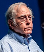 Richard P. Turco合作论文数Department of Atmospheric and Oceanic Sciences, University of California, Los Angeles2William R. Cotton合作论文数Department of Atmospheric Science, Colorado State University2
 Armistead G. Russell合作论文数School of Civil and Environmental Engineering, College of Engineering, Georgia Institute of Technology;Laboratory for Atmospheric Modeling, Diagnostics and Analysis, Georgia Institute of Technology2
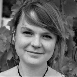 C. L. Winter合作论文数Geoanalysis Group;Los Alamos National Laboratory;Geoanalysis Group, Los Alamos National Laboratory2Howard P. Hanson合作论文数2Elmar R. Reiter合作论文数2Everett P. Springer合作论文数Environmental Sciences Division2Laurie A. McNair合作论文数2
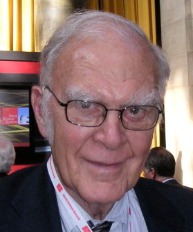 Frank Sherwood Rowland (Sherry) (F. Sherwood Rowland)合作论文数Department of Chemistry, University of California, Irvine2
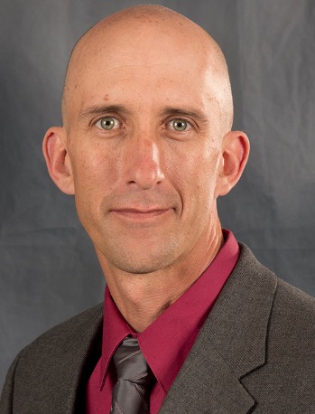 Rod Linn合作论文数Los Alamos National Laboratory;Departmrnt of Scientific Computing, College of Arts and Sciences, Florida State University2Shyh-C. Chen合作论文数2J Ahrens合作论文数1G. Sosa合作论文数1
 Roger Pielke Jr.合作论文数Center for Science and Technology Policy Research, University of Colorado Boulder;American Enterprise Institute;University College London;Risk Frontiers;Institute of Energy Economics1J. C. Doran合作论文数1Cyj Kao合作论文数1J. Archuleta合作论文数1S A Edgerton合作论文数1j l arriaga合作论文数1john a archuleta合作论文数1william earl clements合作论文数1M Ruiz合作论文数1J T Lee合作论文数1We Eichinger合作论文数1Ge Streit合作论文数1J REISNER合作论文数1Na Marley合作论文数1
 Elizabeth Vega合作论文数Col. San Bartolo Atepehuacan, Instituto Mexicano del Petróleo1




