High-altitude mountain areas are very susceptible to the climate evolution at all scales. However little is known about this extreme end member characterized by steep topographies and remoteness. Therefore in-situ observations are scarce and often limited in their temporal and spatial coverage as well as their fidelity. Over the past two decades teams from Italy as well as Switzerland have concentrated multiple interdisciplinary research efforts at and on the slopes of the Matterhorn. This cross-border laboratory today covers a full altitude transect from the valley floor to the summit at 4478 m asl as well as from south to north with a dense network of permanent in-situ observation locations. In addition, several research campaigns have been historically undertaken and add to this unique footprint of observation data as well as insight. Primary data observed are ground-surface temperature as well as permafrost active layer depth, meteorological parameters, surface kinematics using crackmeters as well as GNSS, resistivity, optical imaging, seismic signals as well as personal observations through a regional observer network. In this presentation, we will summarize the activities over the past two decades and discuss insights, key findings as well as data availability.
Warming in the last two decades has caused massive rockfall activity with limited mobility in the range of 101-6 m³. However, only a few highly destructive and mobile rock avalanches above 1 Mio. m³ have been documented. Rock-ice mechanical models explaining high-magnitude rock slope failure in permafrost have been postulated but not validated on real failures. This study combines complementary expert knowledge to decipher the 1 Mio. m³ Fluchthorn rock slope failure that detached on June 12, 2023, from the before 3399 m high summit causing a rock avalanche that additionally eroded ca. 120.000 m³ of ice. InSAR data shows deformation rates in the range 4.1 – 7.1 ± 0.13 cm/a from April 2021 to March 2023, but these are surprisingly linked to a westward deformation of the entire Silvretta nappe (in the range of 3 cm/a) oversteepening the Fluchthorn. Mountain guides have observed singular failures before the event. IR drone flights immediately after the event indicate rock temperatures at the failure planes in the range of 0°C - -2°C and ice-filled fractures. Solid, scarcely fractured pseudotachilitic sequences in the summit regions may have contributed to the massive oversteepening of the Fluchthorn Westface without significant pre-failures. The grain size compositions shows massive material take up of fine-grained material and fragmentation (Pudasaini & Krautblatter 2021). In a seismic analysis we can for the first time exactly reconstruct the temporal and spatial trajectory of a rock-ice avalanche, velocities and energy release during the 120-second rock-ice-avalanche propagation consistent with fragmentation and deposits. High-resolution photogrammetry highlights massive ice erosion and accumulation patterns during the rock avalanche propagation. In addition, we analyse all precursors in the last two years before the failure in detail (Leinauer et al. 2023): These include small prefailure volumes, seismic precursors, kinematic precursors and kinematic precursors detected in UltraCam & LiDAR surveys. In an IRAZU model, capable of nucleation and growth of fractures based on nonlinear fracture mechanics applied stresses act to produce a progressive fracturing path that closely resembles the real failure and we can show the impact of the solid pseudotachilitic roof on the oversteepening. In a discontinuum model (UDEC), we can show the stabilizing effect of permafrost on developing fracturing patterns in a combined rock-ice mechanical approach, including temperature-dependent rock mechanical (Krautblatter et al. 2013, Draebing & Krautblatter 2019, Jia et al. 2017, 2019) and destabilization processes in ice-filled fractures and along rock-ice interfaces (Mamot et al. 2018, 2020, 2021). In summary, we show a unique combination of datasets deciphering pre-failure tectonic and geological controls and forcing, syn-failure permafrost-related mechanics, and second-resolution data on rock avalanche evolution in a cryospheric terrain with massive ice uptake.
Amplification of seismic energy in steep topography is widespread and plays an important role affecting the locations of earthquake-induced damage and the distribution of earthquake-triggered landslides. Mountains, and especially the large freestanding massifs of the European Alps, represent extreme topography and may thus exhibit larger topographic amplification than features with less relief. However, suitable broadband seismic data from these locations are rare, in part due to difficult and often dangerous site access. Here we present ambient seismic data collected on two mountains in the Swiss Alps (the Matterhorn and Grosser Mythen), similar in shape but different in scale. At the Matterhorn, comparing data from seismic stations on the summit and ridge to a nearby local reference showed elevated spectral power on the mountain between 0.4 and 1 Hz, and directional site-to-reference spectral amplitude ratios up to 14, which we attribute in part to topographic resonance. We used ambient vibration modal analysis and numerical eigenfrequency modeling to identify the fundamental mode of the Matterhorn at 0.42 Hz, as well as evidence for a second, mutually-perpendicular mode at a similar frequency. Our data further show high modal damping ratios of ∼20% for these modes, which we ascribe to radiative energy loss. A short campaign measurement at Grosser Mythen, showed similar modal properties with a higher fundamental frequency of 1.8 Hz and peak spectral ratios of 6. At the Matterhorn, we analyzed 13 months of continuous data, showing that spectral peaks are stable over time and that the fundamental frequency of the mountain does not measurably vary. Our results aid estimation of topographic amplification for other mountain features.
Forecasting the time of imminent slope failures is a powerful component in local early warning systems. Different prediction methods have been developed and applied successfully since the 1960s, but the most used and commonly accepted is the inverse velocity method after Fukuzono (1985). Technical developments in real-time and remote monitoring in the last decade offer new possibilities to monitor the displacement of unstable slopes with high accuracy and high frequency. However, state-of-the-art failure time forecasting methods are not yet ready to simply use such data for prospective predictions. The inverse velocity method has not been developed with high-frequency and therefore usually noisy measurement data which require automatism and filtering which in turn influences the outcome of the forecasts. Also, it does not indicate the uncertainty of its forecasts by default. Furthermore, defining the starting point for the calculation of reasonable forecasts (onset of acceleration) in real time remains challenging while many studies in literature used the method retrospectively in post-event analyses. We developed a prospective failure time forecasting model (PFTF model) based on the linear inverse velocity method which can handle high frequency data in real time or simulated real time. The model uses multiple smoothing windows for the input data and the inverse velocity calculation. This minimizes the influence of subjective decisions on the sensitive smoothing process and enables a statistical quantification of uncertainties. The onset of acceleration is detected automatically and in real time by using different quantiles of inverse velocities. The model runs a new calculation with every new available datapoint. The completely open-source code is written in R and will be available online after publication. To perform sensitivity analyses and calibrate the model, we used GNSS and inclinometer observations from before the acceleration phase until failure of a rock block at the Grabengufer (Randa, CH). We also tested the model with data from other historical events characterized by different geological settings, measurement techniques, and sampling rates ranging from 2 minutes to multiple hours. Here, we show the potential of the developed PFTF model as a tool for prospective slope failure time forecasting. Our multiple smoothing approach minimizes subjective decisions, improves forecasting after automatic detection of the onset of acceleration, and enables a statistical evaluation of the forecasts´ uncertainty. The most essential pattern here is the transition from diverging, unreliable and unstable forecasts to converging, reliable and certain forecasts. After further validation with multiple datasets, the model will be applicable to many slope failure processes (slide, topple, fall, flow), different materials (rock, earth, ice, other) and different scales (m³-km³). Reference: Fukuzono, T. (1985): A Method to Predict the Time of Slope Failure Caused by Rainfall Using the Inverse Number of Velocity of Surface Displacement. – Journal of Japan Landslide Society, 22, 2: 8–14.
Slope movements in mountain areas are abundant and diverse phenomena, with an extreme range in size and velocity, and constituted from different materials such as bedrock, debris, and ice. In the past two decades, many studies have observed accelerating trends in the surface velocities of these landforms, often attributed to global warming and its amplified impact on high mountains. Detailed data needed for quantitative analysis and modelling, however, remain scarce due to logistic and technical difficulties. In particular, state-of-the-art monitoring strategies of surface displacement in high-mountains rely either on geodetic terrestrial surveys or on remote sensing techniques. While these methods are beneficial for the establishment of long-term time series and distributed datasets of surface displacements, they lack high temporal resolution and are sensitive to data gaps. These characteristics limit their potential for underpinning detailed process understanding and natural hazard management procedures. By contrast, in-situ permanent instruments allow high temporal resolution without observation gaps, providing unprecedented information w.r.t. the processes at hand. Furthermore, continuous observations with short transmission delays are suitable for applications in real-time, essential for many aspects of natural hazard monitoring and early warning systems.Here, we present a decadal dataset consisting of continuously acquired kinematic data obtained through in-situ global navigation satellite system (GNSS) instruments that have been designed and implemented in a large-scale multi field-site monitoring campaign across the Swiss Alps. The monitored landforms include rock glaciers, high-alpine steep bedrock as well as landslide sites, most of which are situated in permafrost areas. The dataset was acquired at 54 different stations between2304 and 4003 m a.s.l and comprises ~240’000 daily positions derived through double-difference GNSS post-processing. Apart from these, the dataset contains down-sampled and cleaned time series of weather station and inclinometer data as well as the full set of GNSS observables in RINEX format. Furthermore, the dataset is accompanied by tools for processing and data management in order to facilitate reuse, open alternative usage opportunities and support the life-long living data process with updates. To date, this dataset has seen numerous use cases in research as well as natural-hazard mitigation and adaptation measures. Some of those are presented in order to showcase the fidelity and versatility of the monitoring network.
Monitoring of the periglacial environment is relevant for many disciplines including glaciology, natural hazard management, geomorphology, and geodesy. Since October 2022, Rock Glacier Velocity (RGV) is a new Essential Climate Variable (ECV) product within the Global Climate Observing System (GCOS). However, geodetic surveys at high elevation remain very challenging due to environmental and logistical reasons. During the past decades, the introduction of low-cost global navigation satellite system (GNSS) technologies has allowed us to increase the accuracy and frequency of the observations. Today, permanent GNSS instruments enable continuous surface displacement observations at millimetre accuracy with a sub-daily resolution. In this paper, we describe decennial time series of GNSS observables as well as accompanying meteorological data. The observations comprise 54 positions located on different periglacial landforms (rock glaciers, landslides, and steep rock walls) at altitudes ranging from 2304 to 4003 ma.s.l. and spread across the Swiss Alps. The primary data products consist of raw GNSS observables in RINEX format, inclinometers, and weather station data. Additionally, cleaned and aggregated time series of the primary data products are provided, including daily GNSS positions derived through two independent processing tool chains. The observations documented here extend beyond the dataset presented in the paper and are currently continued with the intention of long-term monitoring. An annual update of the dataset, available at https://doi.org/10.1594/PANGAEA.948334 (Beutel et al., 2022), is planned. With its future continuation, the dataset holds potential for advancing fundamental process understanding and for the development of applied methods in support of e.g. natural hazard management.
Monitoring of the periglacial environment is relevant for many disciplines including glaciology, natural hazard management, geomorphology, and geodesy. Since October 2022, Rock Glacier Velocity (RGV) is a new Essential Climate Variable (ECV) product within the Global Climate Observing System (GCOS). However, geodetic surveys at high elevation remain very challenging due to environmental and logistical reasons. During the past decades, the introduction of low-cost global navigation satellite system (GNSS) technologies has allowed us to increase the accuracy and frequency of the observations. Today, permanent GNSS instruments enable continuous surface displacement observations at millimetre accuracy with a sub-daily resolution. In this paper, we describe decennial time series of GNSS observables as well as accompanying meteorological data. The observations comprise 54 positions located on different periglacial landforms (rock glaciers, landslides, and steep rock walls) at altitudes ranging from 2304 to 4003âma.s.l. and spread across the Swiss Alps. The primary data products consist of raw GNSS observables in RINEX format, inclinometers, and weather station data. Additionally, cleaned and aggregated time series of the primary data products are provided, including daily GNSS positions derived through two independent processing tool chains. The observations documented here extend beyond the dataset presented in the paper and are currently continued with the intention of long-term monitoring. An annual update of the dataset, available at https://doi.org/10.1594/PANGAEA.948334 (Beutel et al., 2022),âââââââ is planned. With its future continuation, the dataset holds potential for advancing fundamental process understanding and for the development of applied methods in support of e.g. natural hazard management.
Energy harvesting systems strongly depend on the nondeterministic behavior of the environment. Systematic and thorough evaluation of these systems demands for tools that consistently reproduce these conditions and allow for closely integrating highly dynamic applications. To this end, a testbed is introduced that allows us to precisely and repeatedly force an energy harvesting system under test using thermal and radiative sources in a controlled environment while allowing to sinking arbitrary current profiles. The coordinated control of the boundary conditions on the input and output sides enables detailed evaluation, exploration, and dimensioning of different aspects of energy management and harvesting systems. By reproducing environmental traces at a higher rate than normally occurring in nature, the testbed allows us to substantially shorten the time needed for experimental evaluations. This approach enables fast and consistent evaluation of energy harvesting systems under a wide coverage of operating conditions.
Abstract. Permafrost warming is coinciding with accelerated mass movements, talking place especially in steep, mountainous topography. While this observation is backed up by evidence and analysis of both remote sensing as well as repeat terrestrial surveys undertaken since decades much knowledge is to be gained about the specific details, the variability and the processes governing these mass movements in the mountain cryosphere. This dataset collates data of continuously acquired kinematic observations obtained through in-situ Global Navigation Satellite Systems (GNSS) instruments that have been designed and implemented in a large-scale multi field-site monitoring campaign across the whole Swiss Alps. The landforms covered include rock glaciers, high-alpine steep bedrock bedrock as well as landslide sites, most of which are situated in permafrost areas. The dataset was acquired at 54 different stations situated at locations from 2304 to 4003 m a.s.l and comprises 209’948 daily positions derived through double-differential GNSS post-processing. Apart from these, the dataset contains down-sampled and cleaned time series of weather station and inclinometer data as well as the full set of GNSS observables in RINEX format. Furthermore the dataset is accompanied by tools for processing and data management in order to facilitate reuse, open alternate usage opportunities and support the life-long living data process with updates. To date this dataset has seen numerous use cases in research as well as natural-hazard mitigation and adaptation due to climate change.
In this article, we introduce an energy harvesting system capable of converting bipolar thermal gradients to electrical energy. An active rectification circuit, electrical impedance matching, and commodity thermoelectric generators are used to efficiently extract energy from very small temperature gradients found at the natural ground-to-air boundary. The full harvesting system is modeled in detail from thermal radiation to the electrical load. This end-to-end model enables system dimensioning to meet specific application requirements. A multiyear deployment of the harvesting system supplying a wireless sensor network for environment monitoring demonstrates the applicability of this system in a real application. The case study confirms self-sustainable operation of an application with a 550 $\mu {\rm W}$ power footprint. With a maximum harvested power of up to 27.2 mW during the day and 6.3 mW during the night, a significant improvement in both average and maximum harvested power is demonstrated compared to the state-of-the-art.
The development, evaluation, and comparison of wireless IoT and cyber-physical systems requires testbeds supporting inspection of logical states and accurate observations of physical performance metrics. We present FlockLab 2, a second generation testbed supporting multi-modal, high-accuracy and high-dynamic range measurements of power and logic timing and at the same time in-situ debug and trace infrastructure of modern microcontrollers allowing for reproducible evaluation and benchmarking. We detail the architecture, provide a characterization and demonstrate the interface, the supported services and the tools of the FlockLab 2 testbed. Data Availability Statement. The hardware design and the software for server and observer of the presented testbed architecture and the data for the plots in this paper are openly available at XXX.
Recent studies have highlighted water supply as a driving factor for rock glacier deformation velocities. In parallel, numerous observations of correlating mean annual air- or ground temperatures and rock glacier velocities have been reported. We investigated the connection between rock glacier temperatures and –hydrology and found that there is no contradiction between both hypotheses. We observed that water supply to the shear horizon of rock glaciers is highly correlated to their mean annual temperatures and – even more pronounced – to their temperatures during early winter. The rock glacier temperatures influence the amount of water supplied to the shear horizon to a lesser extent, but strongly determine the duration of the water supply. The main external influencing factor on rock glacier dynamics found next to atmospheric warming was early winter snow cover. Our results are based on deformation- and borehole temperature measurements of four Swiss rock glaciers.
This paper gives an overview of measurement data derived from permafrost study sites in the Kunlun Mountain Pass area of the Qinghai-Tibet Plateau, China.The paper describes the locality with focus on the collocated engineered structures of the Qinghai-Tibet highway, railway and power lines.The paper is a companion to data and C1
Wirelessly interconnected sensors, actuators, and controllers promise greater flexibility, lower installation and maintenance costs, and higher robustness in harsh conditions than wired solutions. However, to facilitate the adoption of wireless communication in cyber-physical systems (CPS), the functional and non-functional properties must be similar to those known from wired architectures. We thus present Time-Triggered Wireless (TTW), a wireless architecture for multi-mode CPS that offers reliable communication with guarantees on end-to-end delays among distributed applications executing on low-cost, low-power embedded devices. We achieve this by exploiting the high reliability and deterministic behavior of a synchronous transmission based communication stack we design, and by coupling the timings of distributed task executions and message exchanges across the wireless network by solving a novel co-scheduling problem. While some of the concepts in TTW have existed for some time and TTW has already been successfully applied for feedback control and coordination of multiple mechanical systems with closed-loop stability guarantees, this paper presents the key algorithmic, scheduling, and networking mechanisms behind TTW, along with their experimental evaluation, which have not been known so far. TTW is open source and ready to use: ttw.ethz.ch
Analog-Mixed Signal (AMS) circuits have become increasingly important for today's SoCs. The Timed Data Flow (TDF) model of computation available in SystemC-AMS offers here a good tradeoff between accuracy and simulation-speed at the system-level. One of the main challenges in system-level verification is the quality of the testbench. In this paper, we present a testbench qualification approach for SystemC-AMS TDF models. Our contribution is twofold: First, we propose specific mutation models for the class of filters implemented as TDF models. This requires to analyze the Laplace transfer function of the filter design. Second, we present the mutation based qualification approach based on the proposed specific mutations as well as standard behavioral mutations. This allows to find serious quality issues in the testbench. Our experimental results for a real-world AMS system demonstrate the applicability and efficacy of our approach. Download Paper (PDF; Only available from the DATE venue WiFi) IP3-2 AN ALGEBRA FOR MODELING CONTINUOUS TIME SYSTEMS Speaker: José Medeiros, University of Brasilia, BR Authors: José E. G. de Medeiros1, George Ungureanu2 and Ingo Sander2 1University of Brasília, BR; 2KTH Royal Institute of Technology, SE Abstract Advancements on analog integrated design have led to new possibilities for complex systems combining both continuous and discrete time modules on a signal processing chain. However, this also increases the complexity any design flow needs to address in order to describe a synergy between the two domains, as the interactions between them should be better understood. We believe that a common language for describing continuous and discrete time computations is beneficial for such a goal and a step towards it is to gain insight and describe more fundamental building blocks. In this work we present an algebra based on the General Purpose Analog Computer, a theoretical model of computation recently updated as a continuous time equivalent of the Turing Machine. Download Paper (PDF; Only available from the DATE venue WiFi)Advancements on analog integrated design have led to new possibilities for complex systems combining both continuous and discrete time modules on a signal processing chain. However, this also increases the complexity any design flow needs to address in order to describe a synergy between the two domains, as the interactions between them should be better understood. We believe that a common language for describing continuous and discrete time computations is beneficial for such a goal and a step towards it is to gain insight and describe more fundamental building blocks. In this work we present an algebra based on the General Purpose Analog Computer, a theoretical model of computation recently updated as a continuous time equivalent of the Turing Machine. Download Paper (PDF; Only available from the DATE venue WiFi) IP3-3 TTW: A TIME-TRIGGERED WIRELESS DESIGN FOR CPS Speaker: Romain Jacob, ETH Zurich, CH Authors: Romain Jacob1, Licong Zhang2, Marco Zimmerling3, Jan Beutel1, Samarjit Chakraborty2 and Lothar Thiele1 1ETH Zurich, CH; 2Technical University of Munich, DE; 3Technische Universität Dresden, DE Abstract Wired fieldbuses have long been proven effective in supporting Cyber-Physical Systems (CPS). However, various domains are now striving for wireless solutions due to ease of deployment or novel functionality requiring the ability to support mobile devices. Low-power wireless protocols have been proposed in response to this need, but requirements of a large class of CPS applications can still not be satisfied. We thus propose Time-Triggered Wireless (TTW), a distributed low-power wireless system design that minimizes communication energy consumption and offers end-to-end timing predictability, runtime adaptability, reliability, and low latency. Evaluation shows a 2x reduction in communication latency and 33-40% lower radio-on time compared with DRP, the closest related work, validating the suitability of TTW for new exciting wireless CPS applications. Download Paper (PDF; Only available from the DATE venue WiFi)Wired fieldbuses have long been proven effective in supporting Cyber-Physical Systems (CPS). However, various domains are now striving for wireless solutions due to ease of deployment or novel functionality requiring the ability to support mobile devices. Low-power wireless protocols have been proposed in response to this need, but requirements of a large class of CPS applications can still not be satisfied. We thus propose Time-Triggered Wireless (TTW), a distributed low-power wireless system design that minimizes communication energy consumption and offers end-to-end timing predictability, runtime adaptability, reliability, and low latency. Evaluation shows a 2x reduction in communication latency and 33-40% lower radio-on time compared with DRP, the closest related work, validating the suitability of TTW for new exciting wireless CPS applications. Download Paper (PDF; Only available from the DATE venue WiFi) IP3-4 PHYLAX: SNAPSHOT-BASED PROFILING OF REAL-TIME EMBEDDED DEVICES VIA JTAG INTERFACE Speaker: Eduardo Chielle, New York University Abu Dhabi, BR Authors: Charalambos Konstantinou1, Eduardo Chielle2 and Michail Maniatakos2 1New York University, US; 2New York University Abu Dhabi, AE Abstract Real-time embedded systems play a significant role in the functionality of critical infrastructure. Legacy microprocessor-based embedded systems, however, have not been developed with security in mind. Applying traditional security mechanisms in such systems is challenging due to computing constraints and/or real-time requirements. Their typical 2030 year lifespan further exacerbates the problem. In this work, we propose PHYLAX, a plug-and-play solution to detect intrusions in already installed embedded devices. PHYLAX is an external monitoring tool which does not require code instrumentation. Also, our tool adapts and prioritizes intrusion detection based on the requirements of the underlying infrastructure (power grid, chemical factory, etc.) as well as the computing capabilities of the target embedded system (CPU model, memory size, etc.). PHYLAX can be employed on any legacy device which incorporates a JTAG interface. As a case study, we present the inclusion of PHYLAX on a power grid recloser controller. Download Paper (PDF; Only available from the DATE venue WiFi)Real-time embedded systems play a significant role in the functionality of critical infrastructure. Legacy microprocessor-based embedded systems, however, have not been developed with security in mind. Applying traditional security mechanisms in such systems is challenging due to computing constraints and/or real-time requirements. Their typical 2030 year lifespan further exacerbates the problem. In this work, we propose PHYLAX, a plug-and-play solution to detect intrusions in already installed embedded devices. PHYLAX is an external monitoring tool which does not require code instrumentation. Also, our tool adapts and prioritizes intrusion detection based on the requirements of the underlying infrastructure (power grid, chemical factory, etc.) as well as the computing capabilities of the target embedded system (CPU model, memory size, etc.). PHYLAX can be employed on any legacy device which incorporates a JTAG interface. As a case study, we present the inclusion of PHYLAX on a power grid recloser controller. Download Paper (PDF; Only available from the DATE venue WiFi) IP3-5 CHARACTERIZING DISPLAY QOS BASED ON FRAME DROPPING FOR POWER MANAGEMENT OF INTERACTIVE APPLICATIONS ON SMARTPHONES Speaker: Chung-Ta King, National Tsing Hua University, TW Authors: Kuan-Ting Ho1, Chung-Ta King1, Bhaskar Das1 and Yung-Ju Chang2 1National Tsing Hua University, TW; 2National Chiao Tung University, TW Abstract User-centric power management in smartphones aims to conserve power without affecting user's perceived quality of experience. Most existing works focus on periodically updated applications such as games and video players and use a fixed frame rate, measured in frame per second (FPS), as the metric to quantify the display quality of service (QoS). The idea is to adjust the CPU/GPU frequency just enough to maintain the frame rate at a user satisfactory level. However, when applied to aperiodically-updated interactive applications, e.g. Facebook or Instagram, that draw the frame buffer at a varying rate in response to user inputs, such a power management strategy becomes too conservative. Based on real user experiments, we observe that users can tolerate a certain percentage of frame drops when running aperiodically updated applications without affecting their perceived display quality. Hence, we introduce a new metric to characterize display quality of service, called the frame drawn ratio (FDR), and propose a new CPU/GPU frequency governor based on the FDR metric. The experiments by real users show that the proposed governor can conserve 17.2% power in average when compared to the default governor, while maintaining the same or even better QoE rating. Download Paper (PDF; Only available from the DATE venue WiFi)User-centric power management in smartphones aims to conserve power without affecting user's perceived quality of experience. Most existing works focus on periodically updated applications such as games and video players and use a fixed frame rate, measured in frame per second (FPS), as the metric to quantify the display quality of service (QoS). The idea is to adjust the CPU/GPU frequency just enough to maintain the frame rate at a user satisfactory level. However, when applied to aperiodically-updated interactive applications, e.g. Facebook or Instagram, that draw the frame buffer at a varying rate in response to user inputs, such a power management strategy becomes too conservative. Based on real user experiments, we observe that users can tolerate a certain percentage of frame drops when running
Ozone and Carbon Monoxide Dataset Collected by the OpenSense Zurich Mobile Sensor Network This dataset contains ozone (O3) and carbon monoxide (CO) concentration measurements collected by the OpenSense (http://www.opensense.ethz.ch) mobile senor network over the course of 4.5 years (2012/02-2016/09). The sensors are mounted on top of 10 streetcars in the city of Zurich, Switzerland.In particular, the dataset contains: Ozone (O3) data: 2012/02 - 2016/09 (19.9 Mio samples) Carbonmonoxide (CO) data: 2014/03 - 2016/09 (49.7Mio samples) Hardware:-------------- Ozone sensor: SGX (former e2V) MiCS-OZ-47 Ozone Sensing Head with Smart Transmitter PCB Carbon monoxide sensor: Alphasense CO-B4 GPS receiver: u-blox EVK-6p Data files format:-------------------------co_data_*: Time of day: yyyy.mm.dd HH:MM Latitude WGS84 Longitude WGS84 HDOP: horizontal dilution of precision, uncertainty of the GPS position Tram ID WE_CHANNEL_SENSOR_1_MV: The voltage [in mV] at the working electrode of the electrochemical sensor (see Alphasense CO-B4 datasheet for more details) o3_data_*: Time of day: yyyy.mm.dd HH:MM Latitude WGS84 Longitude WGS84 HDOP: horizontal dilution of precision, uncertainty of the GPS position Tram ID Ozone [ppb]: On-device calibrated (according to manufacturer) ozone measurement [in parts-per-billion] Temperature [in °C] Relative Humidity [in %] Data quality:------------------The data has NOT been post-processed!In order to achieve high data quality, the data needs to be cleaned (e.g. outlier filtering) and, most importantly, the sensors need to be individually calibrated.Reference data can be obtained from www.ostluft.ch, the official air quality monitoring network in eastern Switzerland, which operates multiple monitoring stations in the city of Zurich. Plot Coverage Map (MATLAB):--------------------------------------------The provided MATLAB script plot_data_coverage.m plots the locations of the collected samples onto the map of Zurich (map_zurich.png). References:-----------------The dataset (and related aspects) has partly been used and is described in more detail in the following publications: Balz Maag et al. SCAN: Multi-Hop Calibration for Mobile Sensor Arrays. In Proceedings of the ACM on Interactive, Mobile, Wearable and Ubiquitous Technologies, Vol.1, No.2 (IMWUT), 2017. Olga Saukh et al. Reducing Multi-Hop Calibration Errors in Mobile Sensor Networks. In IEEE/ACM International Conference on Information Processing in Sensor Networks (IPSN), 2015. Best Paper Award! Olga Saukh et al. Route Selection for Mobile Sensor Nodes on Public Transport Networks. In Journal of Ambient Intelligence and Humanized Computing, 5(3), Springer, 2014. Olga Saukh et al. On Rendezvous in Mobile Sensing Networks. In Proceedings of the 5th Workshop on Real-World Wireless Sensor Networks (RealWSN), 2013. Jason Jingshi Li et al. Sensing the Air we Breathe – The OpenSense Zurich Dataset. In Proceedings of the 26th International Conference on Artificial Intelligence (AAAI), 2012. Olga Saukh et al. Route Selection for Mobile Sensors with Checkpointing Constraints. In Proceedings of the 8th International Workshop on Sensor Networks and Systems for Pervasive Computing (PerSeNS, in conjunction with IEEE PerCom), March 2012. David Hasenfratz et al. On-the-fly Calibration of Low-Cost Gas Sensors. In Proceedings of the 9th European Conference on Wireless Sensor Networks (EWSN), 2012.For further information, visit: http://www.opensense.ethz.ch
 Lothar Thiele合作论文数Computer Engineering and Networks Laboratory, Department of Information Technology and Electrical Engineering, Swiss Federal Institute of Technology Zurich68
 Stephan Gruber合作论文数Geomorphodynamics and Geochronology;Department of Geography;University of Zurich;Department of Geography, University of Zurich36
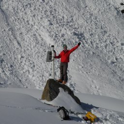 Samuel Weber合作论文数Alpine Environm & Nat Hazards, WSL Inst Snow & Avalanche Res SLF34
 Roman Lim合作论文数Computer Engineering and Networks Lab22
 Andreas Hasler合作论文数Department of Geography, University of Zurich21
 Andreas Vieli合作论文数Department of Geography, Durham University19Tonio Gsell合作论文数17
 Matthias Dyer合作论文数Detecon Schweiz16
 Matthias Keller合作论文数ETH14Matthias Woehrle合作论文数Computer Engineering and Networks Lab14
 Jerome Faillettaz合作论文数Lab Hydraul Hydrol & Glaciol VAW, ETH14Limpach Philippe合作论文数13
 Bernhard Buchli合作论文数Computer Engineering and Networks Laboratory, ETH Zurich13Reto Da Forno合作论文数ETH Zurich12Felix Sutton合作论文数ETH Zurich12
 Matthias Meyer合作论文数11Andreas Meier合作论文数10vanessa wirz合作论文数9Girard Lucas合作论文数9
 Romain Jacob合作论文数Swiss Fed Inst Technol, Zurich, Switzerland8Oliver Kasten合作论文数ETH-Zurich, Swiss Federal Institute of Technology
Department of Computer Science
Distributed Systems Group8
Romain Jacob合作论文数Swiss Fed Inst Technol, Zurich, Switzerland8Oliver Kasten合作论文数ETH-Zurich, Swiss Federal Institute of Technology
Department of Computer Science
Distributed Systems Group8 Marco Zimmerling合作论文数ETH8Mustafa Yuecel合作论文数8
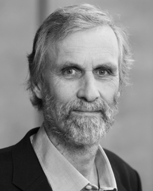 Alain Geiger合作论文数ETH, Zürich Geodesy and Geodynamics Laboratory Switzerland8
 Matthias Ringwald合作论文数BlueKitchen GmbH8
 Alessandro Cicoira合作论文数Dept Geog, Univ Zurich7
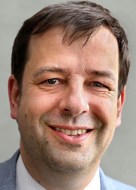 Christian Plessl合作论文数Paderborn Center for Parallel Computing, Universität Paderborn;Faculty for Computer Science, Electrical Engineering and Mathematics, Universität Paderborn7
 Michael Krautblatter合作论文数Department of Civil, Geo and Environmental Engineering, Technische Universität München6Marcia Phillips合作论文数Swiss Federal Institute for Snow and Avalanche Research SLF6Isabelle Gartner-Roer合作论文数5Christian F. Tschudin合作论文数5
 Olga Saukh合作论文数Institute of Technical Informatics, Faculty of Electrical Engineering and Information Technology, Graz University of Technology;Complexity Science Hub Vienna, Graz University of Technology5Igor Talzi合作论文数5Stefanie Gubler合作论文数5Reynald Delaloye合作论文数5
 Christoph Walser合作论文数ETH5Andreas Biri合作论文数Comp Engn & Networks Lab TIK, Swiss Fed Inst Technol4
 Balz Maag合作论文数ETH Zurich4Frank Siegemund合作论文数Distributed Systems Group, Departement of Computer Science, Swiss Federal Institute of Technology4Hugo Raetzo合作论文数4
 Jeannette Noetzli合作论文数Geomorphodynamics and Geochronology;Department of Geography;University of Zurich;Department of Geography, University of Zurich4
 Zimu Zhou (周子慕)合作论文数Department of Data Science, City University of Hong Kong4Raphaël Mayoraz合作论文数3Daniel Vonder Mühll合作论文数3Eric Pointner合作论文数3Lukas Sigrist合作论文数IIS, ETH, Zurich, Switzerland3
 Fiddes J合作论文数3
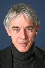 Martin Vetterli合作论文数School of Computer and Communication Sciences, Ecole Polytechnique Federale de Lausanne3
 Marc Brendan Parlange合作论文数Department of Civil Engineering, Faculty of Applied Science, University of British Columbia3




