Accurate and up-to-date information is essential for environmental monitoring, particularly in regions characterized by complex topography and heterogeneous landscapes. This study presents a multisource remote sensing–based approach for forest vegetation classification on La Palma Island (Canary Islands, Spain), which was further used to illustrate its potential for monitoring the temporal dynamics of different forest habitat types. Very high-resolution multispectral data from the WorldView-2/3 satellites were used, complemented by multispectral and LiDAR data acquired by an unmanned aerial vehicle (UAV). Four target forest vegetation types were mapped within a six-class classification scheme that also included “Other vegetation” and “Soil/Others” as non-target/background classes. The performance of ten supervised classification algorithms was evaluated, including Minimum Distance, Mahalanobis Distance, Parallelepiped, Spectral Angle Mapper, Maximum Likelihood, Naïve Bayes, K-Nearest Neighbors, Random Forest, Support Vector Machine, and the transformer-based deep learning model SegFormer. The results indicate that Random Forest achieved the highest overall accuracy, while Support Vector Machine and SegFormer also showed competitive performance, particularly when spectral information was integrated with vegetation indices and topographic variables. The study provides practical evidence on the selection of input data and classifiers for detailed forest vegetation mapping in a large and topographically complex island.
Benthic communities, such as seagrass meadows, play a crucial environmental role in marine ecosystems and provide socio-economic benefits. Satellite remote sensing is currently used for its monitoring, and deep learning (DL) techniques offer improvements in mapping quality compared to traditional machine learning (ML). This study compares conventional ML and convolutional DL models for mapping Cymodocea nodosa meadows in El R & iacute;o, Canary Islands, using WorldView-2 satellite imagery. An in-situ measurement campaign was conducted to generate an open dataset for segmentation. Evaluated models include decision trees, Gaussian Na & iuml;ve Bayes, support vector machines, K-nearest neighbors, Subspace KNN, feedforward neural networks, U-Net, Attention U-Net, and Pix2Pix models. Results show that DL models significantly outperform conventional ML models in detecting Cymodocea nodosa. The best model (U-net) achieved an Intersection over Union (IoU) of 83% overall and 74% for Cymodocea nodosa, while the best ML model (FNN) only reached 62% and 23%, respectively. IoU was highlighted for its sensitivity to minor mapping changes. In addition, a temporal analysis revealed a dramatic 96% reduction in Cymodocea nodosa coverage over 21 years, from 245.32 ha in 2001 to 9.31 ha in 2022. This study not only compares conventional ML and convolutional DL techniques for benthic habitat mapping but also provides a valuable methodology and dataset for future marine ecosystem monitoring research.
Accurate estimation of above-ground biomass (AGB) is essential to understanding carbon stocks and flows, monitoring forest health, assessing biodiversity, and tracking ecological disturbances, which together help to inform climate policies. Imminent global satellite biomass missions (such as ESA's BIOMASS and NASA-ISRO's NISAR satellites) will offer valuable environmental monitoring, but their low spatial resolution limits their application in detailed local assessments. In this study, we present biomass super-resolution for high accuracy prediction (BiomSHARP), a deep learning (DL) model that extends the hierarchical attention Transformer (HAT) architecture, adapting it to enhance coarse-resolution biomass maps by fusing them with high-resolution (HR) multispectral data from sensors such as Sentinel-2 or Landsat. BiomSHARP achieves 25-m biomass predictions-four times the spatial resolution of the input-bridging the gap between global-scale monitoring and local-scale applications. In a first set of experiments, conducted in a local area in Europe, we demonstrate that BiomSHARP outperforms both traditional interpolation methods and state-of-the-art (SOTA) DL interpolation and prediction approaches for HR AGB estimation across all evaluated metrics [mean absolute error (MAE), mean squared error (mse), root mse (RMSE), peak signal-to-noise ratio (PSNR), and structural similarity index measure (SSIM)], while using a comparable/lower number of parameters. Moreover, the model exhibits strong global-scale generalization, as demonstrated by its ability to accurately estimate biomass across diverse climatic regions despite being trained on a limited subset of data. Furthermore, the model presents strong temporal generalization, achieving improved performance in estimating AGB from 2020 data even when trained solely on 2010 data. We also analyze the impact of different combinations of spectral bands on biomass estimation, identifying optimal subsets that reduce redundancy and improve computational efficiency. BiomSHARP represents a promising approach to advance global environmental assessments and support improved climate strategies. The code and models are publicly available at: https://github.com/laiaalbors/biomsharp
The global increase in wildfires due to climate change highlights the need for accurate wildfire mapping. This study performs a proof of concept on the usefulness of SuperDove imagery for wildfire mapping. To address this topic, we present an automatic methodology that combines the use of various vegetation indices with clustering algorithms (bisecting k-means and k-means) to analyze images before and after fires, with the aim of improving the precision of the burned area and severity assessments. The results demonstrate the potential of using this PlanetScope sensor, showing that the methodology effectively delineates burned areas and classifies them by severity level, in comparison with data from the Copernicus Emergency Management Service (CEMS). Thus, the potential of the SuperDove satellite sensor constellation for fire monitoring is highlighted, despite its limitations regarding radiometric distortion and the absence of Short-Wave Infrared (SWIR) bands, suggesting that the methodology could contribute to better fire management strategies.
Forests are crucial for biodiversity, climate regulation, and hydrological cycles, requiring sustainable management due to threats like deforestation and climate change. Traditional forest monitoring methods are labor-intensive and limited, whereas UAV LiDAR offers detailed three-dimensional data on forest structure and extensive coverage. This study primarily assesses individual tree segmentation algorithms in two forest ecosystems with different levels of complexity using high-density LiDAR data captured by the Zenmuse L1 sensor on a DJI Matrice 300RTK platform. The processing methodology for LiDAR data includes preliminary preprocessing steps to create Digital Elevation Models, Digital Surface Models, and Canopy Height Models. A comprehensive evaluation of the most effective techniques for classifying ground points in the LiDAR point cloud and deriving accurate models was performed, concluding that the Triangular Irregular Network method is a suitable choice. Subsequently, the segmentation step is applied to enable the analysis of forests at the individual tree level. Segmentation is crucial for monitoring forest health, estimating biomass, and understanding species composition and diversity. However, the selection of the most appropriate segmentation technique remains a hot research topic with a lack of consensus on the optimal approach and metrics to be employed. Therefore, after the review of the state of the art, a comparative assessment of four common segmentation algorithms (Dalponte2016, Silva2016, Watershed, and Li2012) was conducted. Results demonstrated that the Li2012 algorithm, applied to the normalized 3D point cloud, achieved the best performance with an F1-score of 91% and an IoU of 83%.
Seagrass and seaweed meadows hold a very important role in coastal and marine ecosystems. However, anthropogenic impacts pose risks to these delicate habitats. This paper analyses the multitemporal impact of the construction of the largest industrial port in the Canary Islands, near the Special Area of Conservation Natura 2000, on Cymodocea nodosa seagrass meadows (sebadales) of the South of Tenerife, in the locality of Granadilla (Canary Islands, Spain). Very-high-resolution WorldView-2 multispectral satellite data were used for the analysis. Specifically, three images were selected before, during, and after the construction of the port (2011, 2014, and 2022, correspondingly). Initially, advanced pre-processing of the images was performed, and then seabed maps were obtained using the machine learning K-Nearest Neighbors (KNN) supervised classification model, discriminating 12 different bottom types in Case-2 complex waters. The maps achieved high-quality metrics with Precision values of 85%, 81%, and 80%, recall of 76%, 77%, and 77%, and F1 scores of 80%, 79%, and 77% for 2011, 2014, and 2022, respectively. The results mainly show that the construction directly affected the seagrass and seaweed habitats. In particular, the impact of the port on the meadows of Cymodocea nodosa, Caulerpa prolifera, and maërl was assessed. The total maërl population was reduced by 1.9 km2 throughout the study area. However, the Cymodocea nodosa population was maintained at the cost of colonizing maërl areas. Furthermore, the port sedimented a total of 0.98 km2 of seabed, especially Cymodocea nodosa and maërl. In addition, it was observed that Caulerpa prolifera was established as a meadow at the entrance of the port, replacing part of the Cymodocea nodosa and maërl areas. As additional results, bathymetric maps were generated from satellite imagery with the Sigmoid model, and the presence of a submarine outfall was, as well, presented.
Monitoring dense forest ecosystems, such as the laurel forest in Garajonay National Park, is vital for biodiversity conservation, carbon storage, and ecological balance. This study employs satellite remote sensing technologies to introduce a novel methodology, based on vegetation indices, aiming to assess and protect the health of the forest. Utilizing the Jeffries-Matusita distance and a histogram-based method, optimal indices to map forest degradation, like Wide Dynamic Range Vegetation Index (WDRVI) and Modified Simple Ratio (MSR), were identified among 19 generated indices. The study processed imagery from three satellite sensors (WorldView-2, PlanetScope and Sentinel-2), producing maps distinguishing healthy and degraded areas. The study's practical significance lies in offering a method to assess the suitability of sensors and indices for effectively mapping forest degradation. This approach aids conservation efforts and provides valuable insights for environmental managers and policymakers, facilitating the implementation of targeted strategies to safeguard Garajonay National Park's unique laurel forest ecosystem. Emphasizing the role of remote sensing in practical vegetation protection endeavors, the study contributes to on-the-ground initiatives, ensuring the preservation and sustainability of the park's rich biodiversity.
The shallow Tagoro submarine volcano monitoring represents a unique opportunity not only for improving our sparse understanding of submarine volcanic processes in specific scientific fields as physical and chemical oceanography or marine geology but also its interactions over the marine biology in one of the richest marine ecosystems in Europe. This chapter aims to summarize the most relevant physical–chemical, geological and biological changes that occurred in the marine ecosystem of El Hierro island, at the Marine Reserve Punta de La Restinga—El Mar de Las Calmas, due to the genesis of the new underwater volcano Tagoro (27º37′07″N–017º59′28″W) in October 2011. During the first six months of the eruption, extreme physical–chemical perturbations caused by this event, comprising thermal increase from up to + 18.8 °C, water acidification with a pH decrease of 2.9 units, deoxygenation to anoxic levels and extremely high metal enrichment among others, resulted in significant and dramatic alterations of the marine ecosystem. After March 2012, once the eruptive phase was finished, the new submarine volcano entered an active hydrothermal phase involving the release of heat with smaller but still significant and important thermal anomalies of up to + 2.55 °C around the craters, density decrease of − 1.43 kg m−3, pH decrease of − 1.25 units, and high concentrations of metals and inorganic nutrients similar to upwelling zones. These enrichments are still active up to date, producing clear signs of marine recovery not only in the benthonic strata but also in the whole water column compared with pre-eruptive data. Since its eruption ten years ago, an unprecedented monitoring effort has turned into the longest and most complete multidisciplinary time-series for the study of a shallow submarine volcano, with the realization of 31 oceanographic multidisciplinary expeditions that systematically measure more than 40 different physical–chemical and biological variables. All this information and the results obtained during the evolution of the process could serve as a baseline for better understanding future or similar submarine eruptions worldwide.
The reliable detection of vegetation disease and plant stress are challenges in forest ecosystems. To address this problem, remote sensing existing methods of detection mostly rely on vegetation indices, however, in dense forest, the spectral saturation must be considered to select the most appropriate index. In this work, after a revision of the state of the art, a total of 20 vegetation indices were preliminary selected to perform a thorough statistical analysis with the aim to identify the disease and devitalization phenomena in a complex laurel forest. Multisensor very high resolution imagery, from the same month, with a time difference of a decade have been used. A robust methodology has been implemented to generate accurate vigor maps and to identify the forest areas that have experienced a degradation in plant health after 10 years.
Coastal island ecosystems are unique and fragile environments and very sensitive to climate change and direct anthropogenic impact. The use of remote sensing offers the advantage of monitoring these valuable areas in an accessible and cost-effective manner. The main objective of this research, linked to the sustainable management of littoral areas, is the generation of knowledge that is materialized in the implementation of a robust image processing methodology to generate accurate bathymetry and benthic high-resolution maps in coastal shallow waters using remote sensing satellite multispectral sensors (WorldView-2/3). So, this paper presents a methodology for the monitoring of two protected ecosystems in Canary Islands (Spain): Las Canteras beach (Gran Canaria Island) and the channel of La Graciosa-Lanzarote Island. In addition, a multitemporal study is presented where the usefulness of the technology in the monitoring of marine ecosystems is presented.
Increased tourism in Belize over the last decade and the growth of the local population have led to coastal development and infrastructure expansion. Land use alteration and anthropogenic activity may change the sediment and nutrient loads in coastal systems, which can negatively affect ecosystems via mechanisms such as reducing photosynthetically active radiation fields, smothering sessile habitats, and stimulating eutrophication events. Accurate monitoring and prediction of water quality parameters such as Total Suspended Sediments (TSS), are essential in order to understand the influence of land-based changes, climate, and human activities on the coastal systems and devise strategies to mitigate negative impacts. This study implements machine learning algorithms such as Random Forests (RF), Extreme Gradient Boosting (XGB), and Deep Neural Networks (DNN) to estimate TSS using Sentinel-2 reflectance data in the Belize Coastal Lagoon (BCL) and validates the results using TSS data collected in situ. DNN performed the best and estimated TSS with a testing R2 of 0.89. Time-series analysis was also performed on the BCL’s TSS trends using Bayesian Changepoint Detection (BCD) methods to flag anomalously high TSS spatio-temporally, which may be caused by dredging events. Having such a framework can ease the near-real-time monitoring of water quality in Belize, help track the TSS dynamics for anomalies, and aid in meeting and maintaining the sustainable goals for Belize.
Understanding the causes of global sea level rise is considered as an important goal of climate research on a regional scale, especially around islands, owing to their vulnerability to this phenomenon. In the case of the Canary Islands, these alterations entail an increase in territorial risks. The Canary Islands span the transitional zone linking the Northwest African upwelling system and the open ocean waters of the subtropical gyre. Here, we used satellite altimeter data to perform a detailed statistical analysis of sea level anomaly from 1993 to 2019. A seasonal study was carried out at two different regions and sea level anomaly was compared with temperature variability in the area. A total rise in the sea level of around 7.94 cm was obtained for the last 27 years in both areas. Sea level anomaly was strongly influenced by sea surface temperature, as expected. In addition, we found differences between the annual cycle in the open ocean and the upwelling zone, showing different patterns in both sites. The expected increase in sea level for the year 2050 in the coastal zone of the archipelago was estimated to be 18.10 cm, affecting the coastal economy of the islands, which is strongly based on the use of beaches for tourism.
The production of highly accurate land cover maps is one of the primary challenges in remote sensing, which depends on the spatial resolution of the input images. Sometimes, high-resolution imagery is not available or is too expensive to cover large areas or to perform multitemporal analysis. In this context, we propose a multi-task network to take advantage of the freely available Sentinel-2 imagery to produce a super-resolution image, with a scaling factor of 5, and the corresponding high-resolution land cover map. Our proposal, named SEG-ESRGAN, consists of two branches: the super-resolution branch, that produces Sentinel-2 multispectral images at 2 m resolution, and an encoder–decoder architecture for the semantic segmentation branch, that generates the enhanced land cover map. From the super-resolution branch, several skip connections are retrieved and concatenated with features from the different stages of the encoder part of the segmentation branch, promoting the flow of meaningful information to boost the accuracy in the segmentation task. Our model is trained with a multi-loss approach using a novel dataset to train and test the super-resolution stage, which is developed from Sentinel-2 and WorldView-2 image pairs. In addition, we generated a dataset with ground-truth labels for the segmentation task. To assess the super-resolution improvement, the PSNR, SSIM, ERGAS, and SAM metrics were considered, while to measure the classification performance, we used the IoU, confusion matrix and the F1-score. Experimental results demonstrate that the SEG-ESRGAN model outperforms different full segmentation and dual network models (U-Net, DeepLabV3+, HRNet and Dual_DeepLab), allowing the generation of high-resolution land cover maps in challenging scenarios using Sentinel-2 10 m bands.
Satellite remote sensing is an efficient and economical technique for studying coastal bottoms in clear and shallow waters. Accordingly, the main objective of this study is the generation of benthic maps using high spatial resolution multispectral images from the WorldView-2/3 satellites. In this context, one of the main challenges consists of eliminating the disturbances caused in the signal by the atmosphere, the sea surface, and the water column. Regarding the water column correction, there is controversy about its effectiveness to improve the results achieved. To assess the impact of the water column correction in seagrass mapping, two coastal areas with different characteristics have been selected. Specifically, an analysis has been carried out consisting of the assessment of the Lyzenga and Sagawa water column correction models to identify the algorithm that provides the best mapping precision and, additionally, to seek if this pre-processing stage is helpful when classifying the seabed. The classification models selected for the study were: Gaussian Naïve Bayes (GNB), Support Vector Machine (SVM), K-Nearest Neighbors (KNN), and Subspace KNN (S-KNN). Machine learning techniques have proven to achieve better results and, in particular, SVM and KNN models provide the best overall accuracy. The results after benthic mapping have demonstrated, that image classification without water column corrections provides better accuracy (95.36% and 99.20%) than using Lyzenga (73.49% and 97.80%) or Sagawa (82.04% and 99.10%), for Case 2 and 1 waters, respectively.
Remote spectral imaging of coastal areas can provide valuable information for their sustainable management and conservation of their biodiversity. Unfortunately, such areas are very sensitive to changes due to human activity, natural phenomenon, introduction of non-native species, and climate change. Thus, the main objective of this research is the implementation of a robust image processing methodology to produce accurate bathymetry maps in shallow coastal waters using high-resolution multispectral WorldView-2/3 satellite imagery for the monitoring at the maximum spatial and spectral resolutions. Two different island ecosystems have been selected for the assessment, since they stand out for their richness in endemic species and they are more vulnerable to climate change: Cabrera National Park and Maspalomas Natural Protected area, located in the Balearic and Canary Islands, Spain, respectively. In addition, a third example to show the applicability of the mapping methodology to monitor the construction of a new port in Granadilla (Canary Islands) is presented. Contributions of this work focus on improving the preprocessing methodology and, mainly, on the proposal and assessment of new satellite-derived regression and machine learning bathymetric models, which have been validated and compared with respect to measured reference bathymetry. After a thorough analysis of nine techniques, using visual and quantitative statistical parameters, ensemble learning approaches have demonstrated excellent performance, even in challenging scenarios up to 35-m depth, with mean RMSE values around 2 m.
There is a growing interest in the development of automated data processing workflows that provide reliable, high spatial resolution land cover maps. However, high-resolution remote sensing images are not always affordable. Taking into account the free availability of Sentinel-2 satellite data, in this work we propose a deep learning model to generate high-resolution segmentation maps from low-resolution inputs in a multi-task approach. Our proposal is a dual-network model with two branches: the Single Image Super-Resolution branch, that reconstructs a high-resolution version of the input image, and the Semantic Segmentation Super-Resolution branch, that predicts a high-resolution segmentation map with a scaling factor of 2. We performed several experiments to find the best architecture, training and testing on a subset of the S2GLC 2017 dataset. We based our model on the DeepLabV3+ architecture, enhancing the model and achieving an improvement of 5% on IoU and almost 10% on the recall score. Furthermore, our qualitative results demonstrate the effectiveness and usefulness of the proposed approach.
Sentinel-2 satellites have become one of the main resources for Earth observation images because they are free of charge, have a great spatial coverage and high temporal revisit. Sentinel-2 senses the same location providing different spatial resolutions as well as generating a multi-spectral image with 13 bands of 10, 20, and 60 m/pixel. In this work, we propose a single-image super-resolution model based on convolutional neural networks that enhances the low-resolution bands (20 m and 60 m) to reach the maximal resolution sensed (10 m) at the same time, whereas other approaches provide two independent models for each group of LR bands. Our proposed model, named Sen2-RDSR, is made up of Residual in Residual blocks that produce two final outputs at maximal resolution, one for 20 m/pixel bands and the other for 60 m/pixel bands. The training is done in two stages, first focusing on 20 m bands and then on the 60 m bands. Experimental results using six quality metrics (RMSE, SRE, SAM, PSNR, SSIM, ERGAS) show that our model has superior performance compared to other state-of-the-art approaches, and it is very effective and suitable as a preliminary step for land and coastal applications, as studies involving pixel-based classification for Land-Use-Land-Cover or the generation of vegetation indices.
Coastal areas are key to sustaining biodiversity, but their complexity and variability makes their analysis challenging. On the other hand, mountain ecosystems include a large percentage of the global biodiversity and their monitoring is essential, as they are especially vulnerable to climate change. In this context, remote sensing offers a cost-effective technology for the conservation of both kinds of natural areas. In this work, multispectral and hyperspectral data recorded by sensors, onboard satellites, aircrafts and remotely piloted aircraft systems (RPAS), have been used for the sustainable management of natural resources. Specifically, a multiplatform methodology has been developed to process multisensor high spatial resolution imagery and the main benefits and drawbacks of each technology have been identified. Advanced processing techniques in each stage of the methodology have been selected to provide accurate and validated benthic and vegetation maps. Two challenging ecosystems, located in Cabrera and Teide National Parks, have been selected for this study. They correspond with a coastal and a mountain island ecosystem, respectively. To address the associated challenges, the use of imagery with the maximum spatial and spectral resolution, provided by Sentinel-2, WorldView-2, CASI and Pika-L, has been considered. Results have been validated with in-situ data and by the National Parks’ managers and they have shown the ability of remote sensing to accurately map both Parks when the appropriate imagery and techniques are selected. The best performance was achieved with the Support Vector Machine classifier and, in general, WorldView can be considered the most appropriate platform when factoring in cost, coverage and accuracy.
Many remote sensing applications require high spatial resolution images, but the elevated cost of these images makes some studies unfeasible. Single-image super-resolution algorithms can improve the spatial resolution of a low-resolution image by recovering feature details learned from pairs of low-high resolution images. In this work, several configurations of ESRGAN, a state-of-the-art algorithm for image super-resolution, are tested. We make a comparison between several scenarios, with different modes of upsampling and channels involved. The best results are obtained training a model with RGB-IR channels and using progressive upsampling.
The accurate monitoring of water quality indicators, bathymetry and distribution of benthic habitats in vulnerable ecosystems is key to assessing the effects of climate change, the quality of natural areas and to guide appropriate biodiversity, tourism or fisheries policies. Coastal and inland water ecosystems are very complex but crucial due to their richness and primary production. In this context, remote sensing can be a reliable way to monitor these areas, mainly thanks to satellite sensors' improved spatial and spectral capabilities and airborne or drone instruments. In general, mapping bodies of water is challenging due to low signal-to-noise (SNR) at sensor level, due to the very low reflectance of water surfaces as well as atmospheric effects. Therefore, the main objective of this work is to provide a robust processing framework to estimate water quality parameters in inland shallow waters using multiplatform data. More specifically, we measured chlorophyll concentrations (Chl-a) from multispectral and hyperspectral sensors on board satellites, aircrafts and drones. The Natural Reserve of Maspalomas, Canary Island (Spain), was chosen for the study because of its complexity as well as being an inner lagoon with considerable organic and inorganic matter and chlorophyll concentration. This area can also be considered a well-known coastal-dune ecosystem attracting a large amount of tourists. The water quality parameter estimated by the remote sensing platforms has been validated using co-temporal in situ measurements collected during field campaigns, and quite satisfactory results have been achieved for this complex ecosystem. In particular, for the drone hyperspectral instrument, the root mean square error, computed to quantify the differences between the estimated and in situ chlorophyll-a concentrations, was 3.45 with a bias of 2.96.
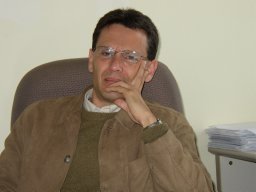 Francisco Eugenio合作论文数Signal and Communications Department, University of Las Palmas of Gran Canaria76
 Ferran Marqués合作论文数Signal Theory and Communications Department, Universitat Politecnica de Catalunya26
 Dionisio Rodriguez-Esparragon合作论文数25
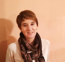 Consuelo Gonzalo-Martín合作论文数24
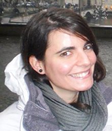 Edurne Ibarrola合作论文数ULPGC, Inst Oceanog & Cambio Global IOCAG, Parque Cient Tecnol Marino de Taliarte S-N, Telde 35214, Las Palmas, Spain17
 Javier Martin Abasolo合作论文数11
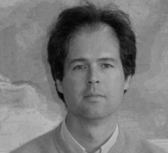 Alonso Hernandez-Guerra合作论文数Faculty of Marine Sciences, University of Las Palmas of Gran Canaria8
 Nerea Marrero Betancort合作论文数Unidad Asociada ULPGC CSIC, Univ Las Palmas Gran Canaria7
 Angel M. Garcia-Pedrero合作论文数Technical University of Madrid7Anabella Medina Machín合作论文数7E. Rovaris合作论文数6
 Luis Salgueiro Romero合作论文数Univ Politecn Cataluna, Signal Theory & Commun Dept, BarcelonaTech, Barcelona 08034, Spain5
 Santiago Hernandez-Leon合作论文数Inst Oceanog & Cambio Global, Univ Las Palmas Gran Canaria5
 Jocelyn Chanussot合作论文数Chinese Academy of Sciences;Grenoble Institute of Technology;Inria5
 Veronica Vilaplana合作论文数UPC),, Technical University of Catalonia5
 Antonio Mederos-Barrera合作论文数4
 Felipe Calderero合作论文数Department of Signal Theory and Communications, Technical University of Catalonia (UPC),4Hernandez, A.合作论文数3
 J. Martin合作论文数3
 Lucas Drumetz合作论文数IMT Atlantique Lab, STICC UBL Brest3
 Pablo Sangra合作论文数Facultad de Ciencias del Mar, Universidad de Las Palmas de Gran Canaria3M. Alfaro合作论文数2Antonio Ignacio Hernandez Cordero合作论文数2
 Gamba Paolo合作论文数University of Pavia2
 Xavier Bosch-Lluis合作论文数2
 Sheila Natali Estrada-Allis合作论文数Departamento de Física, Universidad de Las Palmas de Gran Canaria2
 Jose Luis Martin Esquivel合作论文数Cijisa2
 Eugenio Fraile Nuez合作论文数Instituto Español de Oceanografía2
 Fionn Murtagh合作论文数Centre of Mathematics and Data Science, University of Huddersfield;Goldsmiths, University of London;Royal Holloway, University of London2
 Diandra Barreto合作论文数2
 Isaac Ramos-Perez合作论文数2
 Enric Valencia合作论文数2
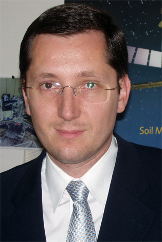 Adriano Camps合作论文数Remote Sensing Laboratory, Universitat Politecnica de Catalunya;Department of Signal Theory and Communications, Universitat Politecnica de Catalunya2N. Rodriguez-Alvarez合作论文数1Guida, R.合作论文数1J. F. Marchan-Hernandez合作论文数1Miguel A. Ferrer合作论文数1E. Fraile‐Nuez合作论文数1ada m medina合作论文数1Olvido Tello合作论文数1
 Ana Sotomayor合作论文数1Marcos Gonzalez-Porto合作论文数1
 Nicole Auil Gomez合作论文数1
 Vanesa Martin-Arias合作论文数1E. Hernández合作论文数1Andria Rosado合作论文数1Megha Rudresh合作论文数1María Luz Fernández de Puelles合作论文数1Samir Rosado合作论文数1




