Sediment-laden meltwater plumes are a common occurrence at the margins of marine-terminating glaciers in Svalbard and are useful proxies for inferring the glacial hydrological system and meltwater runoff. Plumes can influence calving rates, marine biogeochemistry and fjord circulation. However, little is known about how their dynamics will evolve in a warmer, wetter Arctic with increasing melt rates and retreating glacier margins. To determine the temporal magnitude and frequency evolution of sediment-laden meltwater plumes, we manually delineated plume outlines in every available Sentinel-2 image at Blomstrandbreen, Kongsfjorden, Svalbard, between 2016 and 2021. While the frequency of plumes upwelling on the fjord surface remained stable in each melt season, their surface area increased significantly by almost an order of magnitude between the beginning and end of the study period, owing primarily to glacial runoff. This significant change was a result of several large plumes (>2 km2) mapped in 2020 and 2021. The rate of glacier terminus change throughout the study period has little-to-no influence on plume surface area. However, a notable event concerning the terminus retreating into an overdeepening between 2017 and 2018 may have impacted plume magnitude, allowing for larger plume migration across the calving front after 2018. Seasonal supraglacial lakes on Blomstrandbreen are found to be small in both area and volume which have limited influence on plumes surfacing between 2016-2021. Our findings suggest with increased runoff, plumes upwelling at the glacier terminus may increase in size, transporting greater volumes of sediment into the surrounding local marine environment. These changes could be exacerbated by projected increases in glacier mass loss and retreat expected to occur across Svalbard throughout this century and beyond, making the study of plumes and their impacts key to constraining the transport of water and sediment from a terrestrial to a marine environment as demonstrated at Blomstrandbreen.
Sediment-laden meltwater plumes are commonly observed in the fjords and coastal waters of Svalbard. Plumes are present at the margins of marine-terminating glaciers, and the mouths of glacier-fed subaerial rivers. They can influence fjord circulation, are useful proxies for meltwater runoff and can be used to infer a glacier’s hydrological system. Plumes often cover large areas of open water, meaning they are visible in satellite imagery. Passes by satellites provide an insight into what is occurring at a point in time, but satellite timeseries can also provide a longer temporal window than in-situ measurements. To determine how suspended sediment concentration (SSC) varies in plumes at two sites in Kongsfjorden, over three melt seasons (2012, 2019, 2021), we use in-situ and satellite-equivalent techniques. We find that SSC-reflectance relationships in a subaerial river plume are variable across three melt seasons, meaning relationships are not transferable from season-to-season. At a marine-terminating system, we find relationships remain stable across two melt seasons, however a small, non-significant dataset means there is low confidence in extrapolating these results. We also find that plumes from these subaerial and marine-terminating systems are not directly comparable due to differing geology and contrasting methods of meltwater delivery. Our findings suggest more research should be conducted into the relationship between SSC-reflectance at plumes in Svalbard, focussing on a system’s hydrology and lithology, whilst accounting for retreat at marine-terminating glaciers. Furthermore, new methods for interrogating cloud-impacted satellite scenes should be devised, reducing the reliance on short fieldwork windows for understanding plume variability.
The Arctic is warming at a rate of at least twice the global average. This is directly impacting upon the hydrological cycle; changing the balance of rain and snowfall, increasing losses of snow and glacier cover, and subsequently shifting the volumes and timing of meltwater runoff to nearby fjords and oceans. Sediment-laden meltwater plumes which are easily observable using satellite remote sensing, are good proxies for glacier runoff, both from subaerial rivers draining land-terminating glaciers, and subglacial discharge at tidewater glacier systems; they to bridge the gap between infrequent field observations and regular satellite data acquisitions. In-situ surface reflectance and surface water measurements were collected in July 2019, at the terrestrial glacier-fed Bayelva river plume, and the Blomstrandbreen subglacial discharge plume. These in-situ measurements, combined with Moderate Imaging Spectroadiometer (MODIS) satellite data were used to calibrate a relationship between surface reflectance and suspended sediment concentration at the two sediment-laden meltwater plumes. Using these empirical relationships, we determined seasonal sediment flux by establishing the thickness of the plume layer through conductivity, temperature and depth (CTD) profiles. Additionally, we determined plume metrics (area, extent or planform morphology and distribution), by integrating CTD profiles and measurements of meltwater runoff and sediment collected at the Bayelva hydrometric gauge, along with modelled datasets. We find that the sediment-laden meltwater plumes are extremely sensitive to variable inputs of meltwater runoff, with distinct changes in plume morphometry and sediment concentrations occurring at various points throughout the melt season, evidenced clearly during the transition from snow to firn and glacier ice melt, and after episodic rainfall events. Future work will apply these empirical relationships to other satellite datasets (including Planet, Sentinel and Landsat) from the last 20 years to determine long-term changes in the sediment-laden meltwater plume systems, including their wider effects on fjord hydrography, and glaciomarine sedimentary processes in response to climatically-induced changes in the hydrology of the glacier systems.
Autonomous Underwater Vehicles (AUVs) deployed close to the seafloor can acquire high-resolution geophysical data about the topography and shallow stratigraphy of the seabed, yet have had limited application within the fields of glacial geomorphology and ice sheet reconstruction. Here, we present multibeam echo-sounding, side-scan sonar, sub-bottom profiler and High-Resolution Synthetic Aperture Sonar (HISAS) data acquired during three AUV dives on the northeast Antarctic Peninsula continental shelf. These data enable glacial landforms, including mega-scale glacial lineations (MSGLs), grounding-zone wedges (GZWs) and iceberg ploughmarks, to be imaged at a horizontal resolution of a few tens of centimetres, allowing for the identification of subtle morphological features. We map tidal ridges that are interpreted as having been formed 1) along the ice-sheet grounding line by the squeezing up of soft seafloor sediments by vertical motion of the grounding line during tidal cycles, and 2) by the tidally driven motion of grounded or near-grounded icebergs. These data also enable the mapping of small GZWs that show the location of short-term still-stands or re-advances of the ice-sheet grounding zone. No meltwater channels are identified from our data, suggesting that free-flowing meltwater may not be essential for the formation of GZWs or MSGLs. The examples presented here show how high-resolution AUV-derived geophysical data provide a step-change in our ability to image seafloor glacial landforms, enabling new interpretations about past ice dynamics and glacial sedimentation at fine temporal and spatial scales.
Multibeam echo-sounders were deployed from Autonomous Underwater Vehicles (AUVs) flying close to the seafloor of the Weddell Sea shelf in order to investiagte the glacial landforms there with a view to understanding processes and patterns associated with deglaciation from the Last Glacial Maximum on the eastern side of the Antarctic Peninsula. A horizontal resolution of 0.5 m (using conventional mulitbeam systems), and in some cases 0.05 m (using interferometric multibeam equipment), allowed delicate seafloor landforms to be mapped in several areas of the shelf beyond the Larsen C and former Larsen A and B ice shelves. A number of glacial landform assemblages were observed, including suites of delicate ridges associated with grounding-zone wedges and the grounding of icebergs on the shelf. These landforms are probably related to the action of tides moving the ice up and down through a series of tidal cycles. At the highest spatial resolution, individual dropstones derived from rain-out during the melting of floating ice were imaged clearly. Imaging the seafloor at such high resolution allows both very detailed descriptions of submarine landform morphology and also the complexity of such landforms and landform assemblages to be better understood, aiding the interpretation of the glacial and related processes that led to their formation.
Linear to curvilinear depressions interpreted as iceberg ploughmarks are identified on the continental shelf beyond Larsen C Ice Shelf in about 350 m water depth using multibeam echo-sounding at sub-metre horizontal resolution. Detailed imaging of ploughmark morphology demonstrates the presence of irregularly spaced ridges extending across the full ploughmark width. These ridges have an arcuate shape in plan-view, are up to 2 m high, 20-40 m wide, show occasional presence of subdued debris-flow lobes on their distal side and have an asymmetric cross-profile in which the seafloor deepens beyond their slightly steeper side. The ridges are interpreted to have been produced when the iceberg moved backwards under the falling tide, which pushed up a ridge of sediment behind the iceberg keel, before it continued on its original trajectory under the rising tide. Similar features, which we term ‘iceberg tidal ridges’, can be identified at lower resolution on bathymetric and three-dimensional seismic data from the mid-Norwegian margin, suggesting the broader implications of the interpretations presented here. For example, the mapping of delicate ridges preserved within iceberg ploughmarks can be used to reconstruct past oceanic circulation including the former direction and strength of ocean currents.
This research was funded by the Flotilla Foundation and Marine Archaeology Consultants Switzerland.
Abstract Mountain glaciers at the periphery of the Greenland ice sheet are a crucial freshwater and sediment source to the North Atlantic and strongly impact Arctic terrestrial, fjord, and coastal biogeochemical cycles. In this study we mapped the extent of 1,848 mountain glaciers in NE Greenland at the Little Ice Age. We determined area and volume changes for the time periods Little Ice Age to 1980s and 1980s to 2014 and equilibrium line altitudes. There was at least 172.76 ± 34.55‐km3 volume lost between 1910 and 1980s, that is, a rate of 2.61 ± 0.52 km3/year. Between 1980s and 2014 the volume lost was 90.55 ± 18.11 km3, that is, a rate of 3.22 ± 0.64 km3/year, implying an increase of ~23% in the rate of ice volume loss. Overall, at least ~7% of mass loss from Greenland mountain glaciers and ice caps has come from the NE sector.
The Disko Trough-Mouth Fan (TMF) is a major submarine sediment fan located along the central west Greenland continental margin offshore of Disko Trough. The location of the TMF at the mouth of a prominent cross-shelf trough indicates that it is a product of repeated glacigenic sediment delivery from former fast-flowing outlets of the Greenland Ice Sheet, including an ancestral Jakobshavn Isbrae, which expanded to the shelf edge during successive glacial cycles. This study focuses on the uppermost part of the fan stratigraphy and analyses multibeam swath bathymetry and sub-bottom profiler records, supplemented by a series of vibrocores up to 6 m in length. The swath bathymetry data show that the surface of the fan is prominently gullied and channelled with channels extending downslope from a series of shelf-edge incising gullies. Sub-bottom profiles from across- and down-fan show that the fan sediments are often acoustically stratified. Glacigenic-debris flows (GDFs) were recovered in sediment cores from the uppermost slope but they are absent in cores from elsewhere on the fan. Instead, glacimarine lithofacies in the Disko TMF are dominated by turbidites, hemipelagic sediments and IRD. The gullied and channelled surface of the fan implies erosion at the base of dense, sediment-laden, turbidity currents related to the delivery of meltwater and sediment from an ice sheet grounded at the shelf edge. Such meltwater-related fans have been documented previously on mid-latitude, glacier-influenced margins, but they have rarely been described from high-latitude settings. Although GDFs are often regarded as the building blocks of TMFs, the morphology and sedimentary architecture of the uppermost, Late Quaternary part of the Disko TMF indicates that it represents a clear example of a fan in which sediment delivery is strongly influenced by meltwater. This implies that there is a spectrum of TMFs on glaciated continental margins that reflects the relative dominance of meltwater processes vs. GDFs. It highlights the variability in fan morphology and mechanisms of sediment delivery on high-latitude TMFs and shows that the classic Polar North Atlantic model of GDF dominated fans is but one of a number of styles for such large-scale, high-latitude glacimarine sedimentary depocentres.
Glacier and ice sheet retreat exposes freshly deglaciated terrain which often contains small-scale fragile geomorphological features which could provide insight into subglacial or submarginal processes. Subaerial exposure results in potentially rapid landscape modification or even disappearance of the minor-relief landforms as wind, weather, water and vegetation impact on the newly exposed surface. Ongoing retreat of many ice masses means there is a growing opportunity to obtain high resolution geospatial data from glacier forelands to aid in the understanding of recent subglacial and submarginal processes. Here we used an unmanned aerial vehicle to capture close-range aerial photography of the foreland of Isfallsglaciaren, a small polythermal glacier situated in Swedish Lapland. An orthophoto and a digital elevation model with similar to 2cm horizontal resolution were created from this photography using structure from motion software. These geospatial data was used to create a geomorphological map of the foreland, documenting moraines, fans, channels and flutes. The unprecedented resolution of the data enabled us to derive morphological metrics (length, width and relief) of the smallest flutes, which is not possible with other data products normally used for glacial landform metrics mapping. The map and flute metrics compare well with previous studies, highlighting the potential of this technique for rapidly documenting glacier foreland geomorphology at an unprecedented scale and resolution. The vast majority of flutes were found to have an associated stoss-side boulder, with the remainder having a likely explanation for boulder absence (burial or erosion). Furthermore, the size of this boulder was found to strongly correlate with the width and relief of the lee-side flute. This is consistent with the lee-side cavity infill model of flute formation. Whether this model is applicable to all flutes, or multiple mechanisms are required, awaits further study. (c) 2016 The Authors. Earth Surface Processes and Landforms published by John Wiley & Sons Ltd.
Prominent quasi-linear or lobate wedge-shaped depositional sedimentary landforms, termed grounding-zone wedges (GZWs), are distributed widely on polar continental shelves.They are regarded as a product of the deposition of mainly subglacially-transported sediment at the grounding-zone of modern and palaeo ice sheets and ice streams (e.g.Shipp et al. 1999;Ottesen et al. 2005;Horgan et al. 2013).GZWs vary in shape, dimensions and regional distribution across the continental shelf, where they can form single or multiple and widely-or closely-spaced depositional features.The presence of these landforms is used to delimit the maximum and retreat positions of former ice-sheet margins on high-latitude continental shelves (e.g.Shipp et al. 1999;Ottesen et al. 2005).During the Late Glacial transition, retreat of the Antarctic Peninsula Ice Sheet that covered the shelf of the NE Antarctic Peninsula during the Last Glacial Maximum (LGM) produced several distinctive grounding-zone landforms (Evans et al. 2005).
Submarine gullies have been observed widely in swath-bathymetric imagery of the shelf edge and upper slope on high-latitude margins (e.g. Noormets et al. 2009; Gales et al. 2013), but less frequently in fjords. Gullies vary in distribution and dimensions depending on formation mechanisms, including submarine mass wasting, subglacially or proglacially derived turbid underflows and dense bottom-water currents linked to brine rejection during sea-ice formation (e.g. Noormets et al. 2009). Since recession of the Greenland Ice Sheet through Kangerlugssuaq Fjord (68° N) in East Greenland after the Last Glacial Maximum (Dowdeswell et al. 2010), significant seafloor erosion on the flanks of the inner tributary fjords has taken place to produce a series of submarine gullies and an axial channel (Fig. 1a–e). Fig. 1. Multibeam bathymetry and cross-profiles of submarine gullies in Courtauld Fjord, East Greenland. ( a ) Submarine gullies in the outer fjord and subglacial bedforms in the inner fjord. Courtauld Glacier drains into the head of the fjord and several glaciers are also present along the east flank of the fjord. Dashed white line and white arrows mark the lateral moraine on the western fjord wall produced when Courtauld Glacier last advanced to the outer fjord sill during the Little Ice …
The Northeast Greenland continental shelf is only sparsely mapped due to its remoteness and harsh yearround sea-ice conditions.Mapping the distribution of submarine glacial landforms relies mainly on single track lines of multibeam echo sounder bathymetric data with only occasional systematic surveys.Ice streams drain the modern Greenland Ice Sheet [GrIS] to its northeastern margin in several fjords near the head of the Westwind Trough (Fig. 1a).The presence of glacial lineations and recessional moraines in the inner to middle trough indicates that the GrIS extended onto the continental shelf probably during the Last Glacial Maximum (Evans et al.
Antarctic Ice Sheet change during the last glacial cycle is unclear. The timing of moraine development in the Ross basin suggests that the ice sheet reached maximum thickness under the warming temperatures of the last termination.
A new digital bathymetric model (DBM) for the Northeast Greenland (NEG) continental shelf (74 degrees N-81 degrees N) is presented. The DBM has a grid cell size of 250 m x 250 m and incorporates bathymetric data from 30 multibeam cruises, more than 20 single-beam cruises and first reflector depths from industrial seismic lines. The new DBM substantially improves the bathymetry compared to older models. The DBM not only allows a better delineation of previously known seafloor morphology but, in addition, reveals the presence of previously unmapped morphological features including glacially derived troughs, fjords, grounding-zone wedges, and lateral moraines. These submarine landforms are used to infer the past extent and ice-flow dynamics of the Greenland Ice Sheet during the last full-glacial period of the Quaternary and subsequent ice retreat across the continental shelf. The DBM reveals cross-shelf bathymetric troughs that may enable the inflow of warm Atlantic water masses across the shelf, driving enhanced basal melting of the marine-terminating outlet glaciers draining the ice sheet to the coast in Northeast Greenland. Knolls, sinks, and hummocky seafloor on the middle shelf are also suggested to be related to salt diapirism. North-south-orientated elongate depressions are identified that probably relate to ice-marginal processes in combination with erosion caused by the East Greenland Current. A single guyot-like peak has been discovered and is interpreted to have been produced during a volcanic event approximately 55 Ma ago.
This paper compiles and reviews marine and terrestrial data constraining the dimensions and configuration of the Antarctic Peninsula Ice Sheet (APIS) from the Last Glacial Maximum (LGM) through deglaciation to the present day. These data are used to reconstruct grounding-line retreat in 5 ka time-steps from 25 ka BP to present. Glacial landforms and subglacial tills on the eastern and western Antarctic Peninsula (AP) shelf indicate that the APIS was grounded to the outer shelf/shelf edge at the LGM and contained a series of fast-flowing ice streams that drained along cross-shelf bathymetric troughs. The ice sheet was grounded at the shelf edge until ∼20 cal ka BP. Chronological control on retreat is provided by radiocarbon dates on glacimarine sediments from the shelf troughs and on lacustrine and terrestrial organic remains, as well as cosmogenic nuclide dates on erratics and ice moulded bedrock. Retreat in the east was underway by about 18 cal ka BP. The earliest dates on recession in the west are from Bransfield Basin where recession was underway by 17.5 cal ka BP. Ice streams were active during deglaciation at least until the ice sheet had pulled back to the mid-shelf. The timing of initial retreat decreased progressively southwards along the western AP shelf; the large ice stream in Marguerite Trough may have remained grounded at the shelf edge until about 14 cal ka BP, although terrestrial cosmogenic nuclide ages indicate that thinning had commenced by 18 ka BP. Between 15 and 10 cal ka BP the APIS underwent significant recession along the western AP margin, although retreat between individual troughs was asynchronous. Ice in Marguerite Trough may have still been grounded on the mid-shelf at 10 cal ka BP. In the Larsen-A region the transition from grounded to floating ice was established by 10.7–10.6 cal ka BP. The APIS had retreated towards its present configuration in the western AP by the mid-Holocene but on the eastern peninsula may have approached its present configuration several thousand years earlier, by the start of the Holocene. Mid to late-Holocene retreat was diachronous with stillstands, re-advances and changes in ice-shelf configuration being recorded in most places. Subglacial topography exerted a major control on grounding-line retreat with grounding-zone wedges, and thus by inference slow-downs or stillstands in the retreat of the grounding line, occurring in some cases on reverse bed slopes.
Along the West Greenland continental margin adjoining Baffin Bay, bathymetric data show a series of large submarine fans located at the mouths of cross-shelf troughs. Two of these fans, the Uummannaq Fan and the Disko Fan are trough-mouth fans built largely of debris delivered from ice sheet outlets of the Greenland Ice Sheet during past glacial maxima. On the Uummannaq Fan glacigenic debris flow deposits occur on the upper slope and extend to at least 1800 m water depth in front of the trough-mouth. The debris flow deposits are related to the remobilisation of subglacial debris that was delivered onto the upper slope at times when an ice stream was positioned at the shelf edge. In contrast, sedimentary facies from the northern sector of the fan are characterised by hemipelagic and ice-rafted sediments and turbidites; glacigenic debris flows are notably absent in cores from this region. Further south along the …
A robust understanding of Antarctic Ice Sheet deglacial history since the Last Glacial Maximum is important in order to constrain ice sheet and glacial-isostatic adjustment models, and to explore the forcing mechanisms responsible for ice sheet retreat. Such understanding can be derived from a broad range of geological and glaciological datasets and recent decades have seen an upsurge in such data gathering around the continent and Sub-Antarctic islands. Here, we report a new synthesis of those datasets, based on an accompanying series of reviews of the geological data, organised by sector. We present a series of timeslice maps for 20 ka, 15 ka, 10 ka and 5 ka, including grounding line position and ice sheet thickness changes, along with a clear assessment of levels of confidence. The reconstruction shows that the Antarctic Ice sheet did not everywhere reach the continental shelf edge at its maximum, that initial retreat was asynchronous, and that the spatial pattern of deglaciation was highly variable, particularly on the inner shelf. The deglacial reconstruction is consistent with a moderate overall excess ice volume and with a relatively small Antarctic contribution to meltwater pulse la. We discuss key areas of uncertainty both around the continent and by time interval, and we highlight potential priorities for future work. The synthesis is intended to be a resource for the modelling and glacial geological community. (C) 2014 The Authors. Published by Elsevier Ltd.
The North-East Greenland ice stream reaches about 700 km inland and drains a major part of the Greenland ice sheet via marine terminating glaciers at the western edge of the North-East Greenland Continental Shelf (NEGCS). Previous studies suggested that, during full-glacial periods, the ice sheet only extended to the inner shelf and did not reach further to the east. Based on radiocarbon dating data it was hypothesized that the Greenland Ice Sheet reached onto the middle shelf or even the shelf edge. An advance at least to the middle shelf at about 79.5 to 80.5 N was later demonstrated by two studies using new high-resolution swath bathymetric data that showed seafloor features, including mega-scale glacial lineations and retreat moraines, indicating past ice stream activity. These data, however, only provided a fragmented picture of the behaviour of this North-East sector of the Greenland ice sheet, with the …
 Julian A. Dowdeswell合作论文数Scott Polar Research Institute, Department of Geography, University of Cambridge;Jesus College, University of Cambridge41
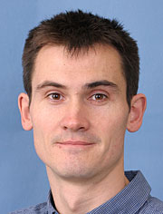 Colm Ó Cofaigh合作论文数Department of Geography, Durham University18
 Ruediger Stein合作论文数Faculty of Geosciences, Universitat Bremen12
 H.-W. Hubberten合作论文数12Frank Niessen合作论文数Alfred Wegner Institute for Polar and Marine Research, PO-Box 120161, 27515 Bremerhaven, Germany12
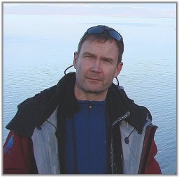 Riko Noormets合作论文数University of Cambridge Scott Polar Research Institute7
 Robert Larter合作论文数British Antarctic Survey;Science Coordination Office, International Thwaites Glacier Collaboration7
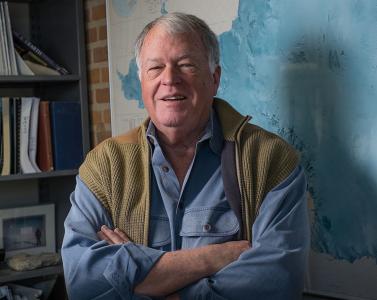 John B. Anderson合作论文数Department of Earth Science, Rice University6
 Claus-Dieter Hillenbrand合作论文数British Antarctic Survey5
 Dag Ottesen合作论文数Exploro AS5
 James A. Smith合作论文数Department of Civil and Environmental Engineering, School of Engineering and Applied Science, University of Virginia5Kelly A. Hogan合作论文数Dept. of Chemical and Biological Sciences, University of Huddersfield4
 Christine Louise Batchelor合作论文数Department of Geography, University of Cambridge4
 Gerhard Kuhn合作论文数Faculty of Geosciences, University of Bremen4
 Guy D. Tallentire合作论文数Geog & Environm, Loughborough Univ3
 Aleksandr Montelli合作论文数Scott Polar Res Inst, Univ Cambridge3
 Emma P. Hocking合作论文数Northumbria Univ, Dept Geog & Environm Sci, Newcastle Upon Tyne, Tyne & Wear, England3
 Jan Erik Arndt合作论文数3Martin Jakobsson合作论文数3
 Dominic A. Hodgson合作论文数British Antarctic Survey, Natural Environment Research Council3
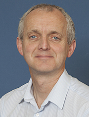 Mike Bentley合作论文数Department of Geography, Durham University3
 Eugene Domack合作论文数3Carol J. Pudsey合作论文数3
 Neil Franklin Glasser合作论文数Department of Geography & Earth Sciences, Faculty of Earth & Life Sciences, Aberystwyth University3
 Alexander R. Simms合作论文数Department of Earth Science, University of California at Santa Barbara3
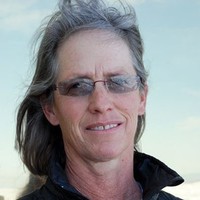 Anne Jennings合作论文数Institute of Arctic and Alpine Research, University of Colorado Boulder3
 Bethan Joan Davies合作论文数Science Laboratories, Durham University3
 Alastair G C Graham合作论文数Coll Life & Environm Sci, Univ Exeter3Joanne S. Johnson合作论文数British Antarctic Survey, Natural Environment Research Council3Stephen Livingstone合作论文数Department of Geography, Faculty of Social Sciences, The University of Sheffield3
 Karsten Gohl合作论文数3
 Evelyn Dowdeswell合作论文数Bristol Glaciology Centre3
 Richard Hodgkins合作论文数Department of Geography, University of London3
 Stephen Juggins (Steve Juggins)合作论文数School of Geography, Politics and Sociology, Newcastle University3
 Miquel Canals Artigas合作论文数Departament de Dinàmica de la Terra i de l'Oceà, Universitat de Barcelona3katherine lilly合作论文数2
 Stewart S R Jamieson合作论文数2travis stolldorf合作论文数2joseph pomeroy合作论文数2
 julia lindow合作论文数2
 William A Dickens合作论文数2alexandra e witus合作论文数Dept Earth Sci, Rice Univ2
 Deborah Verfaillie合作论文数UCLouvain, Earth & Life Inst ELI2
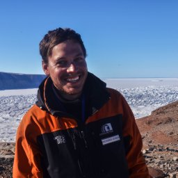 Richard Selwyn Jones合作论文数Securing Antarct Environm Future, Monash Univ2
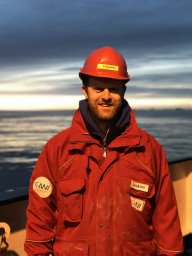 Johann Philipp Klages合作论文数Helmholtz Zentrum Polar & Meeresforsch AWI, Alfred Wegener Inst2
 Andy Hein合作论文数Global Change, School of GeoSciences, The University of Edinburgh2
 Ian Goodwin合作论文数Marine Climate Risk Group and Department of Environment and Geography, Macquarie University2
 David E. Sugden合作论文数University of Edinburgh2
 Matt McGlone合作论文数Long-Term Ecology Laboratory, Landcare Research2




