Organic carbon is a key energy source in marine food-webs, but elevated concentrations can have negative ecological impacts. We used 12 years of marine physiochemical, climate, and near-surface sea and meteorological condition data to investigate broadscale correlates and potential drivers of variability in dissolved and particulate organic carbon (DOC and POC, respectively) concentrations in coastal waters of the Great Barrier Reef (GBR), Australia. DOC concentrations were higher when salinity was lower, when the Southern Oscillation Index was more positive, and at times of greater northward wind speeds. POC concentrations were higher in shallower waters and were positively correlated with total suspended solids and chlorophyll a concentrations. Latitude was important for structuring variation in organic carbon concentrations, likely reflecting terrestrial material from rivers and broader marine processes. We conclude that variability in broadscale patterns of DOC concentrations in GBR coastal waters is likely most sensitive to material discharge from rivers as well as oceanographic and climatic processes and forcing. Variability in broadscale patterns of POC concentrations in coastal waters of the GBR is likely most affected by sediment resuspension and phytoplankton biomass accumulation.
Marine turtles face numerous anthropogenic threats, including that of chemical contaminant exposure. The ecotoxicological impact of toxic metals is a global issue facing Chelonia mydas in coastal sites. Local investigation of C. mydas short-term blood metal profiles is an emerging field, while little research has been conducted on scute metal loads as potential indicators of long-term exposure. The aim of the present study was to investigate and describe C. mydas blood and scute metal profiles in coastal and offshore populations of the Great Barrier Reef. This was achieved by analyzing blood and scute material sampled from local C. mydas populations in five field sites, for a suite of ecologically relevant metals. By applying principal component analysis and comparing coastal sample data with those of reference intervals derived from the control site, insight was gleaned on local metal profiles of each population. Blood metal concentrations in turtles from coastal sites were typically elevated when compared with levels recorded in the offshore control population (Howick Island Group). Scute metal profiles were similar in Cockle Bay, Upstart Bay, and Edgecumbe Bay, all of which were distinct from that of Toolakea. Some elements were reported at similar concentrations in blood and scutes, but most were higher in scute samples, indicative of temporal accumulation. Coastal C. mydas populations may be at risk of toxic effects from metals such as Co, which was consistently found to be at concentrations magnitudes above region-specific reference intervals. Environ Toxicol Chem 2023;42:2375-2388. © 2023 The Authors. Environmental Toxicology and Chemistry published by Wiley Periodicals LLC on behalf of SETAC.
AbstractExcess nutrientsfrom fertiliser application, pollution discharge and water regulations outflow through rivers from lands to oceans, seriously impact coastal ecosystems. Terrestrial runoff of waters polluted with nutrients (primarilynitrogen[N] andphosphorus[P] compounds) from point source/s, such as sewage treatment plant (STP) discharges, and diffuse sourcesvia river discharges, such as fertiliser losses, are having devastating adverse effects in coastal and marine ecosystems globally (Carpenter et al., Ecol Appl 8:559–568, 1998; Halpern et al., Science 319:948–952, 2008; Crain et al., Ecol Lett 11:1304–1315, 2008; Smith and Schindler, Trends Ecol Evol 24:201–207, 2009). The nutrients can be dissolved such as dissolved nitrate and Phosphate typically discharged from STPs or agricultural runoff or in a particulate form, often associated with soil erosion.
Toxic metal exposure is a threat to green sea turtles (Chelonia mydas) inhabiting and foraging in coastal seagrass meadows and are of particular concern in local bays of the Great Barrier Reef (GBR), as numerous sources of metal contaminants are located within the region. Seagrass species tend to bioaccumulate metals at concentrations greater than that detected in the surrounding environment. Little is known regarding ecotoxicological impacts of environmental metal loads on seagrass or Chelonia mydas (C. mydas), and thus this study aimed to investigate and describe seagrass metal loads in three central GBR coastal sites and one offshore site located in the northern GBR. Primary seagrass forage of C. mydas was identified, and samples collected from foraging sites before and after the 2018/2019 wet season, and multivariate differences in metal profiles investigated between sites and sampling events. Most metals investigated were higher at one or more coastal sites, relative to data obtained from the offshore site, and cadmium (Cd), cobalt (Co), iron (Fe) and manganese (Mn) were found to be higher at all coastal sites. Principle Component Analysis (PCA) found that metal profiles in the coastal sites were similar, but all were distinctly different from that of the offshore data. Coastal foraging sites are influenced by land-based contaminants that can enter the coastal zone via river discharge during periods of heavy rainfall, and impact sites closest to sources. Bioavailability of metal elements are determined by complex interactions and processes that are largely unknown, but association between elevated metal loads and turtle disease warrants further investigation to better understand the impact of environmental contaminants on ecologically important seagrass and associated macrograzers.
The quality of water entering the coastal waters of the Great Barrier Reef continues to be of urgent concern for policy makers. Beef grazing and sugarcane cultivation pose special threats at the catchment scale, and past policy approaches and millions in investment have largely proved insufficient to reverse the associated decline in water quality. In this paper, we examine the role of regulation - as one tool of governance - in addressing threats to water quality to the Great Barrier Reef. By adopting a focused study of sugarcane and cattle grazing, and by drawing upon recent developments in regulatory theory, we evaluate the approaches adopted by government, including the recent re-introduction of legislative measures targeting nutrient and sediment loads. Scientific and government consensus appears to be that regulation should form part of a functioning environmental governance system, but it must also be supported by other measures such as economic incentives, education and outreach. Where regulation of land use is required, best practice suggests it should be risk-based, responsive, and cognisant of the regulated industry's attitudinal settings.
Fibropapillomatosis (FP) is a tumor-forming disease which affects all species of marine turtle, but predominantly the green turtle (Chelonia mydas). Expression of this disease is thought to be precipitated by poor environmental conditions and often linked to anthropogenically induced environmental changes. Although FP is a globally distributed disease, targeted studies on the spatial distribution of the disease in Australia are limited. Here, we present the first comprehensive report of FP prevalence in Queensland, Australia. A retrospective analysis of 25,645 capture records for 15 sites along the Queensland coast were used to determine FP prevalence and trends in foraging green turtles. Within this data set, 791 turtles (3.1%) with FP tumors were recorded. Our analysis showed that prevalence varies between sites and years, with juvenile turtles being the most frequently affected by the disease. We found that survey method has a significant influence on the apparent FP prevalence detected at each site. That is, surveys which were explicitly FP-targeted detected higher numbers of individual turtles with FP, and therefore generated higher prevalence rates than comprehensive population surveys. We also report the first attempt at developing water quality indices (WQIs) to compare with FP prevalence data in foraging green turtles. The WQIs were built from metrics published in a range of peer-reviewed papers, reports, and based on expert opinion. Despite utilizing an extensive data set, a relationship between FP prevalence and WQI rankings at each site could not be quantified. The analysis was confounded by a range of limitations, including data gaps, varying temporal scales and data capture methods in the FP prevalence, and water quality data sets. This study has significant implications for management as it highlights the benefits of designing and collecting centralized data that can be integrated and used across multiple projects or programs.
For many years, local communities have expressed concerns that turbid plume waters from the Fly River in Papua New Guinea may potentially deliver mine-derived contaminants to the Torres Strait, an ecologically and culturally unique area north of the Australian mainland. Information on suspended sediment transport and turbidity patterns are needed in this data-limited region to identify and manage downstream ecosystems that may be at risk of exposure from the Fly River runoff. This study used MODIS satellite time series and a colour-classification approach to map optical water types around the data-poor Gulf of Papua and Torres Strait region. The satellite data were supported by field data, including salinity and suspended sediment measurements, and used together in qualitative water quality assessments to evaluate the habitats that are likely exposed to Fly River discharge and/or derived sediments. It showed that the Fly River influence in the Torres Strait region is largely limited to the north-east corner of the Torres Strait. The drivers of turbidity vary between locations, and it is impossible to fully separate direct riverine plume influence from wave and tidally driven sediment resuspension in the satellite maps. However, results indicate that coastal habitats located as far east as Bramble Cay and west to Boigu Island are located in an area that is most likely exposed to the Fly River discharge within the region, directly or through sediment resuspension. The area that is the most likely exposed is a relatively small proportion of the Torres Strait region, but encompasses habitats of high ecological importance, including coral reefs and seagrass meadows. Satellite data showed that the period of highest risk of exposure was during the south-east trade wind season and complemented recent model simulations in the region over larger spatial and temporal frames. This study did not evaluate transboundary pollution or the ecological impact on local marine resources, but other recent studies suggest it is likely to be limited. However, this study did provide long-term, extensive but qualitative, baseline information needed to inform future ecological risk mapping and to support decision making about management priorities in the region. This is important for ensuring the protection of the Torres Strait ecosystems, given their importance to Torres Strait communities and turtle and dugong populations, and the Torres Strait’s connectivity with the Great Barrier Reef Marine Park.
Logging and plantation agriculture are vital to economies and livelihoods in tropical nations, including Papua New Guinea. To meet global demand, hundreds of thousands of ha of diverse natural habitat have been logged, cleared and replaced with monoculture crops. Resulting hydrological changes have increased sediment, nutrient and pesticide runoff, impacting down-stream habitats. Here, case studies from Kimbe Bay (New Britain) and Mullins Harbour (Milne Bay), examine effects on nearshore coral reefs. In both places, logging and oil palm development had destabilized soils and removed or degraded riparian vegetation. Downstream, nearshore reefs had high silt levels, which, coincident with minor coral bleaching and predation by crown-of-thorns starfish, were correlated with high levels of coral mortality and low coral species richness. Sediment and related impacts can be reduced by effective catchment management, such as avoiding steep slopes, expanding stream and coastal buffer zones, minimizing fertilizer and pesticide use, monitoring and reactive management.
Water quality monitoring programs (WQMPs) are crucial for assessment of water quality in river basins where agricultural intensification and development raise concerns in freshwater and marine environments. WQMPs if supported by scientists and local communities, and if based on the knowledge needs of all stakeholders, can provide vital information supporting resource management actions. Our paper focuses on the transdisciplinary development and implementation of a community-led pilot WQMP for the Tully River basin, adjacent to the Great Barrier Reef (GBR). The community-led pilot WQMP was established to fill some knowledge gaps identified during development of the Tully Water Quality Improvement Plan (WQIP) and to provide opportunities for active stakeholder participation in the monitoring. Results indicated some water quality parameters (i.e. nitrates and total phosphorus) had higher than expected values and exceeded state water quality guidelines. Hence, the results provided an evidence base for freshwater quality objective development to conserve, protect and improve water quality conditions in this basin and GBR. Leadership of Indigenous people in the pilot WQMP recognizes their deep desire to improve water resources outcomes and to care for country and people.
Water quality of the Great Barrier Reef (GBR) is determined by a range of natural and anthropogenic drivers that are resolved in the eReefs coupled hydrodynamic - biogeochemical marine model forced by a process-based catchment model, GBR Dynamic SedNet. Model simulations presented here quantify the impact of anthropogenic catchment loads of sediments and nutrients on a range of marine water quality variables. Simulations of 2011-2018 show that reduction of anthropogenic catchment loads results in improved water quality, especially within river plumes. Within the 16 resolved river plumes, anthropogenic loads increased chlorophyll concentration by 0.10 (0.02-0.25) mg Chl m-3. Reductions of anthropogenic loads following proposed Reef 2050 Water Quality Improvement Plan targets reduced chlorophyll concentration in the plumes by 0.04 (0.01-0.10) mg Chl m-3. Our simulations demonstrate the impact of anthropogenic loads on GBR water quality and quantify the benefits of improved catchment management.
Variation in water quality can directly affect the composition of benthic assemblages on coral reefs. Yet, few studies have directly quantified nutrient and suspended particulate matter (SPM) to examine their potential impacts on benthic community structure, especially around high oceanic islands. We assessed the spatiotemporal variation of nutrients and SPM across six sites in American Samoa over a 12-month period and used exploratory path analysis to relate dissolved inorganic nutrients, land use, and natural and anthropogenic drivers to benthic assemblages on adjacent shallow reefs. Multivariate analyses showed clear gradients in nutrient concentrations, sediment accumulation and composition, and benthic structure across watersheds. Instream nutrients and land uses positively influenced reef flat nutrient concentrations, while benthic assemblages were best predicted by wave exposure, runoff, stream phosphate and dissolved inorganic nitrogen loads. Identifying locality-specific drivers of water quality and benthic condition can support targeted management in American Samoa and in other high islands.
We review the literature on the ecology, connectivity, human impacts and management of freshwater and estuarine systems in the Great Barrier Reef catchment (424,000 km2), on the Australian east coast. The catchment has high biodiversity, with substantial endemicity (e.g., lungfish). Freshwater and estuarine ecosystems are closely linked to the land and are affected by human disturbance, including climate change, flow management, land clearing, habitat damage, weed invasion, and excessive sediments, nutrients and pesticides. They require holistic integrated management of impacts, interactions, and land-sea linkages. This requirement is additional to land management aimed at reducing pollutant delivery to reef waters. Despite advances in research and management over recent decades, there are substantial deficiencies that need addressing, including understanding of physical and biological processes and impacts in ground waters, large rivers and estuaries; ecological effects of pesticides; management and mitigation for invasive species and climate change; and explicit protection of nonmarine waters.
Many coastal and marine ecosystems around the world are under increasing threat from a range of anthropogenic influences. The management of these threats continues to present ongoing challenges, with many ecosystems increasingly requiring active restoration to support or re-establish the ecosystem's biological, cultural, social and economic values. The current condition of Australia's Great Barrier Reef (GBR) and its threats, including water quality, climate change and the loss of wetlands, causing the continuing decline in the GBR's ecological condition and function, has received global attention. Activities aimed at halting these declines and system restoration have been underway for over forty years. These activities are challenging to implement, and much has been learnt from their various outcomes. This paper considers the GBR and the associated management activities as a case study for regional scale catchment to reef management. It summarises the management approaches to date, describing the key role that science, policy and community have played in underpinning various investments. Four criteria for success are proposed: the lead role of the community, the need for a systems approach, the need for targeted, cost-effective and sustainable long-term investment, and importantly, building knowledge and maintaining consensus and political commitment.
This study quantified the bioavailable nitrogen contribution from riverine plumes to Great Barrier Reef (GBR) coastal environments. The potential bioavailable nitrogen from two Dry Tropics riverine plumes was considerable [9 -30% added to the end-of-catchment dissolved inorganic nitrogen (DIN) load]. Particulate inorganic nitrogen conversion to DIN was an important process in short timeframes (25% to 100% of the generated load). The remaining load was contributed by microbial mineralisation of organic nitrogen. Flood plume sediment has potential to generate nitrogen once deposited and/or resuspended. Nitrogen generation was insignificant in a few plumes where immobilisation of nitrogen in bacteria biomass occurred. The source of organic matter in the plumes and availability of nitrogen relative to organic matter were important determinants of mineralisation/ immobilisation. This research demonstrates that riverine plumes have potential to be considerable sources of bioavailable nitrogen to coastal environments of the GBR and that organic matter is a key bioavailability driver.
Catchment impacts on downstream ecosystems are difficult to quantify, but important for setting management targets. Here we compared 12 years of monitoring data of seagrass area and biomass in Cleveland Bay, northeast Australia, with discharge and associated sediment loads from nearby rivers. Seagrass biomass and area exhibited different trajectories in response to river inputs. River discharge was a slightly better predictor of seagrass indicators than total suspended solid (TSS) loads, indicating that catchment effects on seagrass are not restricted to sediment. Linear relationships between Burdekin River TSS loads delivered over 1-4 years and seagrass condition in Cleveland Bay generated Ecologically Relevant Targets (ERT) for catchment sediment inputs. Our predicted ERTs were comparable to those previously estimated using mechanistic models. This study highlights the challenges of linking catchment inputs to condition of downstream ecosystems, and the importance of integrating a variety of metrics and approaches to increase confidence in ERTs.
There is a concern that the Fly River plume from Papua New Guinea (PNG) may be delivering mine-derived polluted mud along the southern PNG coast into the northern Torres Strait, which is the northernmost extent of the Great Barrier Reef. To quantify this threat, the mud transport dynamics along the southern PNG coast were studied using the SLIM model. The model was qualitatively verified using historical field data on sediment dynamics and compared with more recent satellite-derived turbidity data. During strong south east winds and spring tides, about 5.4% of the Fly River mud discharge enters the Torres Strait, in agreement with previous field-derived results. The annual net movement of mud is westward, thus polluted Fly River mud progressively intrudes into Torres Strait. This intrusion is slow and may take a century to reach in significant quantities at Saibai Island, the nearest Australian island to the Fly River. Field data are needed to fully validate the model and provide greater confidence in these results.
Land use in the catchments draining to the Great Barrier Reef lagoon has changed considerably since the introduction of livestock grazing, various crops, mining and urban development. Together these changes have resulted in increased pollutant loads and impaired coastal water quality. This study compiled records to produce annual time-series since 1860 of human population, livestock numbers and agricultural areas at the scale of surface drainage river basins, natural resource management regions and the whole Great Barrier Reef catchment area. Cattle and several crops have experienced progressive expansion interspersed by declines associated with droughts and diseases. Land uses which have experienced all time maxima since the year 2000 include cattle numbers and the areas of sugar cane, bananas and cotton. A Burdekin Basin case study shows that sediment loads initially increased with the introduction of livestock and mining, remained elevated with agricultural development, and declined slightly with the Burdekin Falls Dam construction.
Implementing management actions to achieve environmental outcomes requires defining and quantifying ecological targets, but this is a complex challenge, and there are few examples of how to quantitatively set them in complex dynamic marine ecosystems. Here we develop a methodology to devise 'desired state' for tropical seagrasses in Cleveland Bay, northern Australia, in the Great Barrier Reef World Heritage Area. Analysis of diverse species assemblages was used to define seagrass communities as indicators of the region's ecological value. Multivariate regression trees assigned 8000 observations of species presence/absence and habitat characteristics from 2007 to 2017 into seven community types. Generalized Linear Models were used to assess annual variation in above-ground biomass of each seagrass community. Reference subsets of the data expressing high biomass and spatial extent were identified, and desired state was defined as the mean and 95% confidence intervals. This approach rests on the assumption that seagrass resilience and its ecosystem services are met when the diverse seagrass communities reach desired state. This method required a data set that spanned a range in seagrass conditions, but which may have been compromised by a history of pressures. Our method for defining desired state provides evidence-based targets that can be used within an adaptive management framework that prioritises and implements management actions.
The Wet Tropics region of north Queensland contains the highest biological diversity in Australia, has outstanding environmental values, is economically important and located adjacent to the Great Barrier Reef (GBR). Increasing urban development and agricultural intensification in the Wet Tropics has raised serious water quality concerns. To successfully achieve water quality improvement outcomes, the integration of social and biophysical knowledge, in particular clarifying the roles and responsibilities of multiple stakeholders for knowledge integration, has been identified as a key issue and research priority. However, research into the processes supporting knowledge integration and clarifying roles and responsibilities of multiple stakeholders for improving water quality is largely lacking. To fill this gap, we further developed and advanced a social-ecological planning framework to improve our understanding of how multiple-stakeholders can contribute to successful water quality management outcomes. Our conceptual framework, applied in the Tully basin adjacent to the GBR: (1) provides a transdisciplinary approach; (2) enhances the integration of social and biophysical knowledge through tailored methods fitting the local context; (3) shares knowledge and provides recommendations; (4) outlines factors that may promote or inhibit the implementation of freshwater quality objectives; (5) highlights inadequacies of existing government guidelines, policies, and presents co-management opportunities and (6) offers a novel collaborative approach supporting water quality improvement in the Wet Tropics of Australia and beyond.
This paper presents a review around seagrass habitat in Tarawa Lagoon, Kiribati and explores the links between seagrass occurrence and the national priority issues of climate change, urban development, human health, nearshore fisheries, threatened species, ocean policy, research capacity and awareness. The contribution of healthy seagrass habitats to many aspects of these national issues is often overlooked and there is need to establish the knowledge gaps and priority actions that can enable mitigation of issues that impact on valuable seagrass resources and their management. Research data on seagrass habitats in Kiribati, and the wider Pacific Island region, is limited and this hinders informed decisions at local, national and regional levels. We present a comprehensive review on seagrass within a national context to aid prioritisation and uptake of information for resource owners, and wider stakeholders, in Kiribati while acknowledging local expertise. The paper highlights data and knowledge gaps that if addressed, will provide information useful to Kiribati nationals, communities and government stakeholders. Recommendations for actions that fill these gaps and build understanding of seagrass resources in Kiribati are provided.
 Stephen E Lewis合作论文数Sch Phys Sci, Open Univ64
 Zoe Bainbridge合作论文数Centre for Tropical Water and Aquatic Ecosystem Research, James Cook University63
 Jane Waterhouse合作论文数49
 Michelle Devlin合作论文数Catchment to Reef Research Group, James Cook University30
 Frederieke J Kroon合作论文数CSIRO Ecosystem Sciences17
 Katharina Fabricius合作论文数Australian Institute of Marine Science15
 Scott Norman Wilkinson合作论文数CSIRO Land and Water14Aaron M. Davis合作论文数13
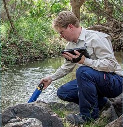 Turner Ryan D R合作论文数Department of Science, Information Technology, Innovation and Arts, The State of Queensland13
 Rebecca Bartley合作论文数CSIRO Land and Water13
 Caroline Petus合作论文数Université de Bordeaux13
 Britta Schaffelke合作论文数Centre for Research on Introduced Marine Pests, CSIRO Marine Research12
 Bob Pressey合作论文数Australian Research Council Centre of Excellence for Coral Reef Studies, James Cook University11
 Catherine J. Collier合作论文数School of Marine and Tropical Biology, James Cook University11
 Jorge G. Alvarez-Romero合作论文数10Mirjam Maughan合作论文数10hugh yorkston合作论文数9J Waterhouse合作论文数9David Haynes合作论文数, P.O. Box 425, South Hobart, TAS, 7004, Australia.9
 Dominique O'Brien合作论文数National Research Centre for Environmental Toxicology (Entox),, The University of Queensland9
 Jochen Mueller合作论文数Faculty of Health and Behavioural Sciences, The University of Queensland9A HENDERSON合作论文数9
 Iris C Bohnet合作论文数Faculty of Environmental Science, Czech University of Life Sciences Prague9Miles J. Furnas合作论文数9Dieter Tracey合作论文数8
 Rachel Eberhard合作论文数Department of Natural Resources and Mines, Animal Research Institute8
 John Faithful合作论文数8
 Michael Alan Rasheed合作论文数Department of Employment, Economic Development and Innovation, Fisheries Queensland8
 Petra M. Kuhnert合作论文数University of Queensland7
 Eduardo Teixeira Da Silva合作论文数Curso de Administração;Faculdade de Estudos Sociais do Paraná;Curso de Administração, Faculdade de Estudos Sociais do Paraná7Alan W. Mitchell合作论文数7Peter S. Valentine合作论文数Consultant, East-West Center7
 Bronwyn Masters合作论文数6Julie Tsatsaros合作论文数6
 Jon C. Day合作论文数Great Barrier Reef Marine Park Authority6
 Eric Wolanski合作论文数Center for Tropical Water and Aquatic Ecosystem Research, James Cook University School of Science and Engineering6
 Scott A. Wooldridge合作论文数Australian Institute of Marine Science6
 Richard Pearson合作论文数Centre for Biodiversity and Environment Research, Department of Genetics, Evolution and Environment, University College London;Division of Biosciences, University College London6Ken Rohde合作论文数5
 alex carter合作论文数Centre for Tropical Water & Aquatic Ecosystem Research (TropWATER),, James Cook University5
 Kate O'Brien合作论文数School of Chemical Engineering, Faculty of Engineering, Architecture and Information Technology, The University of Queensland5
 Henderson Brent合作论文数CSIRO Computational Informatics5
 Colette Rachel Thomas合作论文数James Cook University5
 Ian P Prosser (Ian Prosser)合作论文数Water for a Healthy Country Flagship Program, CSIRO5
 Marcus Sheaves合作论文数College of Science & Engineering, James Cook University;Centre for Tropical Water and Aquatic Ecosystem Research, James Cook University;Centre for Sustainable Tropical Fisheries and Aquaculture, James Cook University;Centre for Tropical Environmental and Sustainability Science, James Cook University5
 Allan Dale合作论文数Cairns Inst, James Cook Univ5
 Mark E. Baird合作论文数School of Mathematics, University of NSW5
 Aaron P. Davis合作论文数Herbarium, Library, Art and Archives, Royal Botanic Gardens5Donna Audas合作论文数5




