Operating autonomous underwater vehicles (AUVs) near shore is challengingheavy shipping traffic and other hazards threaten AUV safety at the surface, and strong ocean currents impede navigation when underwater. Predictive models of ocean currents have been shown to improve navigation accuracy, but these forecasts are typically noisy, making it challenging to use them effectively. Prior work has explored the use of probabilistic planners, such as Markov decision processes (MDPs), for planning in these scenarios, but prior methods have lacked a principled way of modeling the uncertainty in ocean model predictions, which limits applicability to cases in which high fidelity models are available. To overcome this limitation, we propose using Gaussian processes (GPs) augmented with interpolation variance to provide confidence measures on predictions. This paper describes two novel planners that incorporate these confidence measures: (1) a stationary risk-aware GPMDP (for low-variability currents), and (2) a nonstationary risk-aware NS-GPMDP (for faster and high-variability currents). Extensive simulations indicate that the learned confidence measures allow for safe and reliable operation with uncertain ocean current models. Field tests of the planners on Slocum gliders over several weeks in the ocean demonstrate the practical efficacy of our approach.
In this paper we present an architecture for autonomous manipulation. Our approach is based on the belief that contact interactions during manipulation should be exploited to improve dexterity and that optimizing motion plans is useful to create more robust and repeatable manipulation behaviors. We therefore propose an architecture where state of the art force/torque control and optimization-based motion planning are the core components of the system. We give a detailed description of the modules that constitute the complete system and discuss the challenges inherent to creating such a system. We present experimental results for several grasping and manipulation tasks to demonstrate the performance and robustness of our approach.
Precise kinematic forward models are important for robots to successfully perform dexterous grasping and manipulation tasks, especially when visual servoing is rendered infeasible due to occlusions. A lot of research has been conducted to estimate geometric and non-geometric parameters of kinematic chains to minimize reconstruction errors. However, kinematic chains can include non-linearities, e.g. due to cable stretch and motor-side encoders, that result in significantly different errors for different parts of the state space. Previous work either does not consider such non-linearities or proposes to estimate non-geometric parameters of carefully engineered models that are robot specific. We propose a data-driven approach that learns task error models that account for such unmodeled non-linearities. We argue that in the context of grasping and manipulation, it is sufficient to achieve high accuracy in the task relevant state space. We identify this relevant state space using previously executed joint configurations and learn error corrections for those. Therefore, our system is developed to generate subsequent executions that are similar to previous ones. The experiments show that our method successfully captures the non-linearities in the head kinematic chain (due to a counterbalancing spring) and the arm kinematic chains (due to cable stretch) of the considered experimental platform, see Fig. 1. The feasibility of the presented error learning approach has also been evaluated in independent DARPA ARM-S testing contributing to successfully complete 67 out of 72 grasping and manipulation tasks.
We introduce a graph-based informative path planning algorithm for a mobile robot which explicitly handles time. The objective function must be submodular in the samples taken by the robot, and the samples obtained are allowed to depend on the time at which the robot visits each location. Using a submodular objective function allows our algorithm to handle problems with diminishing returns, e.g. the case when taking a sample provides less utility when other nearby points have already been sampled. We give a formal description of this framework wherein an objective function that maps the path of the robot to the set of samples taken is defined. We also show how this framework can handle the case in which the robot takes samples along the edges of the graph. A proof of the approximation guarantee for the algorithm is given. Finally, quantitative results are shown for three problems: one simple example with a known Gaussian process model, one simulated example for an underwater robot planning problem using data from a well-known ocean modeling system, and one field experiment using an autonomous surface vehicle (ASV) measuring wireless signal strength on a lake.
Recent advances in Autonomous Underwater Vehicle (AUV) technology have facilitated the collection of oceanographic data at a fraction of the cost of ship‐based sampling methods. Unlike oceanographic data collection in the deep ocean, operation of AUVs in coastal regions exposes them to the risk of collision with ships and land. Such concerns are particularly prominent for slow‐moving AUVs since ocean current magnitudes are often strong enough to alter the planned path significantly. Prior work using predictive ocean currents relies upon deterministic outcomes, which do not account for the uncertainty in the ocean current predictions themselves. To improve the safety and reliability of AUV operation in coastal regions, we introduce two stochastic planners: (a) a Minimum Expected Risk planner and (b) a risk‐aware Markov Decision Process, both of which have the ability to utilize ocean current predictions probabilistically. We report results from extensive simulation studies in realistic ocean current fields obtained from widely used regional ocean models. Our simulations show that the proposed planners have lower collision risk than state‐of‐the‐art methods. We present additional results from field experiments where ocean current predictions were used to plan the paths of two Slocum gliders. Field trials indicate the practical usefulness of our techniques over long‐term deployments, showing them to be ideal for AUV operations.
Mobile aquatic, aerial, and terrestrial robots open up rich opportunities for environmental monitoring. Sensors mounted on a robot can be moved to take measurements in multiple locations, allowing an effective spatial sampling density much higher than the number of robots. In order to most effectively exploit mobile robots in this manner, path planning methods which consider the usefulness of measurements are needed. This thesis studies and develops discrete planning algorithms for optimal usage of mobile robots in environmental monitoring applications. Specifically, we address cases where a probabilistic model (e.g., a Gaussian process) is used to predict a scalar field. In this context, the usefulness of a set of measurements collected by a robot or team of robots can be quantified as the expected reduction in entropy or mean squared error, providing a well defined objective function for the planner. We present path planning approaches which take advantage of the characteristics of these objective functions to efficiently plan optimal or near optimal paths for one or more robots. This thesis makes the following contributions. First, we present extensions to a submodular orienteering algorithm which increases its usefulness for environmental monitoring applications. Specifically, we show how to handle temporally changing fields, and how to efficiently incorporate sensors which take measurements while the robot is moving. Second, we present a branch and bound algorithm which adapts an upper bound from feature selection literature to efficiently find the optimal solution to an informative path planning problem. Finally, we provide results from tests of the algorithms on real robotic problems, including ocean monitoring using underwater gliders, and lake monitoring using an autonomous surface vehicle.
We present an optimal algorithm for informative path planning (IPP), using a branch and bound method inspired by feature selection algorithms. The algorithm uses the monotonicity of the objective function to give an objective function-dependent speedup versus brute force search. We present results which suggest that when maximizing variance reduction in a Gaussian process model, the speedup is significant.
Long range and high endurance Autonomous Underwater Vehicles such as gliders enable sustained oceanographic sampling at larger time-scales and much lower operational costs compared to traditional ship-based sampling methods. While most path-planning methods for AUVs optimize paths with respect to efficiency, obstacle avoidance, and control they do not explicitly address the issue of finding the safest possible path when considering risks such as shipping traffic and bathymetry. In coastal regions with high shipping traffic, reducing collision risk at the path planning stage, at the expense of efficiency, is a worthwhile trade-off. We propose a method of building risk maps using historical data from the Automated Information System. These are used to plan minimum risk paths between a specified start and goal location, while avoiding obstacles, using an algorithm based on A* search. Our planner incorporates the uncertainty in dead-reckoning without explicitly considering the effect of ocean currents. We compare the relative risk of paths produced by our method when compared to a shortest-path planner which does not take risk into account, and show that our methods performs significantly better, while producing competitive paths lengths.
We present a path planning method for autonomous underwater vehicles in order to maximize mutual information. We adapt a method previously used for surface vehicles, and extend it to deal with the unique characteristics of underwater vehicles. We show how to generate near-optimal paths while ensuring that the vehicle stays out of high-traffic areas during predesignated time intervals. In our objective function we explicitly account for the fact that underwater vehicles typically take measurements while moving, and that they do not have the ability to communicate until they resurface. We present field results from ocean trials on planning paths for a specific AUV, an underwater glider.
We present a method for reconstructing 3D models of tree branch structure from laser range data. Our approach is probabilistic, and uses general knowledge of tree structure to guide an iterative reconstruction process. Our goal is to recover parameters such as branch locations, angles, radii, and lengths, as well as connectivity information between branches. These parameters can then be fed into functional-structural plant models to study the relationships between the structure of a plant, its environment, and its internal biology. In this paper we present an algorithm for finding these parameters, and results on both simulated and real datasets.
Along with steady gains in processing power, commodity laptops are increasingly becoming sensor-rich devices. This trend, driven by consumer demand and enabled by improvements in solid-state sensor technology, offers an ideal opportunity to integrate robotics into K‐12 and undergraduate education. By adding wheels, motors and a motor control board, a modern laptop can be transformed into a capable robot platform, for relatively little additional cost. We propose designing software and curricula around such platforms, leveraging hardware that many students already have in hand. In this paper, we motivate our laptop-centric approach, and demonstrate a proof-of-concept laptop robot based on an Apple MacBook laptop and an iRobot Create mobile base. The MacBook is equipped with a built-in camera and a three-axis accelerometer unit ‐ we use the camera for monocular simultaneous localization and mapping (SLAM), and the accelerometer for 360 degree collision detection. The paper closes with some suggestions for ways in which to foster more work in this direction.
Measuring the biological parameters of trees can be a time consuming process. Currently, there are two main choices: painstakingly count leaves and measure hundreds of branches by hand, or use rough approximations obtained from sensors like hemispherical cameras or airborne laser scans. We hope to find ways of reconstructing models of trees in greater detail, by collecting large amounts of sensor data at relatively close range and fitting a model to this data. Once the model is created, parameters such as branch lengths and approximate leaf areas can be automatically calculated. If we are able to successfully automate data collection and model reconstruction, the process of extracting tree parameters will become considerably easier and more accurate than current methods.
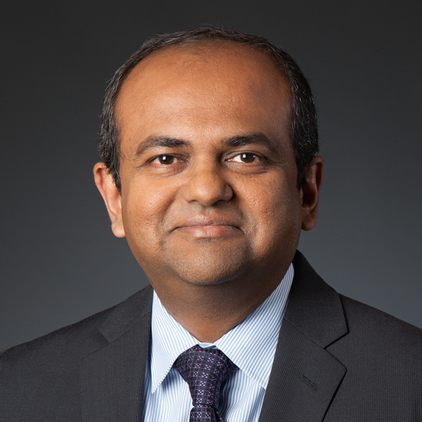 Gaurav Sukhatme合作论文数Thomas Lord Department of Computer Science, Viterbi School of Engineering, University of Southern California;Robotic Embedded Systems Laboratory, University of Southern California;Amazon12
 Arvind Pereira合作论文数Computer Science Department, University of Southern California Los Angeles4
 Jonathan Kelly合作论文数Institute for Aerospace Studies, University of Toronto3
 Ludovic Righetti合作论文数Department of Electrical and Computer Engineering, New York University;Department of Mechanical and Aerospace Engineering, Tandon School of Engineering, New York University;Max-Planck Institute for Intelligent Systems2
 Mrinal Kalakrishnan合作论文数Meta2
 Andreas Krause合作论文数Learning & Adaptive Systems Group, Machine Learning Institute, Department of Computer Science, ETH Zurich;Swiss Data Science Center;Max Planck Institute for Intelligent Systems;AI Center, ETH Zurich;LatticeFlow2
 Stefan Schaal合作论文数Intrinsic;SKS Autonomous Systems2
 Peter Pastor合作论文数Computational Learning and Motor Control Lab, University of Southern California2
 Geoff Hollinger合作论文数Robotic Decision Making Laboratory2
 Randolph Charles Voorhies合作论文数Department of Computer Science, University of Southern California, Los Angeles, California 900891
 Somers Thane合作论文数Collaborat Robot Intelligent Syst CoRIS Inst, Oregon State Univ1
 Burton Jones合作论文数Biological and Environmental Science and Engineering Division, King Abdullah University of Science and Technology;Red Sea Research Center1Matthew Ragan合作论文数1
 Omair Khan合作论文数Department of Computer Science;University of Southern California;Department of Computer Science, University of Southern California1




