This paper takes the form of a dialogue between its main UK based protagonist and three senior geography educationists based in the US. Tasked with debating the current conditions of geography education research and its possible future development, the exchange centers on the efficacy of research in the field and what continuing research efforts can hope to achieve. This is a long standing debate and the article attempts to suggest ways forward, looking outside as well as looking within the field itself.
Geographical thinking is a cornerstone of modern geography education. Despite its universal value, no large-scale international study has systematically examined its integration into diverse curricular documents. This study investigates how geographical thinking is embedded in the curricula of nine countries, focusing on content and procedural dimensions. Using a structured analytical framework, the research reveals significant patterns and gaps, particularly the underrepresentation of place as a central concept, the lack of explicit focus on geographical thinking, and the limited emphasis on its procedural dimension. The findings emphasise the need for stronger interconnections between these dimensions to promote a more comprehensive approach to geographical thinking within different forms of curricula.
Midnight Oil, an Australian rock band active for more than 40 years, is as well-known for their political, social, and environmental stances as they are for their music. These concerns have included Aboriginal rights, nuclear proliferation, and climate change. This paper explores the lyrical content of fifteen albums to explore how the band's lyrics use place names, evocative place description, and Australian vernacular terms - a musical approach by artists that I describe as place lyricism - to create for the listener an understanding of Australia, that though still limited to the experience of the band themselves, is fuller and more complete than portrayed in much popular culture.
Climate change is a wicked problem, defying simple resolution. Education in various forms and at various levels has sought to improve understanding and stimulate climate change action in young people. There exists, however, a certain wickedness in education systems as well that makes climate change education difficult to enact successfully. These include an unsupportive education environment where academic standards related to climate change are missing, the lack of an inquiry-based pedagogy that can be well-suited to investigating topics like climate change with no easy answers, and ill-prepared teachers who do not fully know both the physical science and social aspects of the topic. A review of education standards in the United States and the literature on the latter two issues is used to make the argument that it is the geography classroom that can serve as the best unifying space that is most supportive of holistic and meaningful climate change education. This future is possible should we be successful in amending standards, pedagogy, and teacher preparation.
In many Advanced Placement Human Geography (APHG) classrooms, there is a post-exam period of low activity. For example, in our home state, one school district had 12 class days remaining on the calendar prior to the school year end. In this project, we developed a series of post-exam activities focused on the National Geographic Society’s Out of Eden Walk project. The activities utilize concepts learned in APHG that can serve as a bridge to upcoming material in Advanced Placement World History (APWH), a course many students take the next school year. For example, students may compare city models learned in the APHG Urban unit to contemporary and historic cities visited by journalist Paul Salopek—the Out of Eden walker—and then investigate background information on those cities as a primer for the more in-depth material of focus in APWH. As Advanced Placement (AP) exam dates, and thus the number of post-exam days, vary yearly, our “module” encompasses five class days to provide a week of material. Our primary goals were to (1) maximize post-exam classroom time; (2) reaffirm APHG learning via application; and (3) introduce places, events, and concepts of note for the upcoming APWH course. Given the national nature of AP courses, this module is applicable to students across the United States. As described in this article, the project team met to create an articulation between the two courses to find learning opportunities of best fit; create new Out of Eden Walk materials; pilot the materials; refine materials from feedback; and then share the module with a wider audience here.
What does professionalization mean for a geography teacher? We have invited authors from across the globe to address this question, contributing essays in four relevant areas: (I) the qualification, described in the section “Pathways of professionalization as geography teacher”, (II) the institutions, explained in “Institutionalization, networking, and informal learning”, (III) the various fields in geography education, named in “Special fields and discourses of geography teacher education”, and, finally, (IV) different praxis in a section on “Methods and practices under the lens”.
This book presents contemporary approaches of geography education from different countries, making the international dimension of geography teacher education accessible to various geography educators in different parts of the world. This chapter provides an introduction into this field of research and praxis, summarizing the state of the art concerning teachers' professionalisation and current challenges to geography education. Furthermore, the chapter introduces the book's structure that is constructed along discourses of geography education and geography teacher professionalization that are relevant globally but answered with nationally different strategies. In doing so, each chapter is summarized briefly, providing a comprehensive overview of the book.
In 2019, the State of South Carolina (USA) adopted new social studies standards with an emphasis on disciplinary skills in addition to content throughout the social studies areas of history, geography, civics, and economics. These skills were introduced for all grades, kindergarten through grade 12. Geography courses were added in grades 3 and 7. The standards specify and deconstruct six geography skills to be taught in these classrooms. These skills include Mapping; Models and Representations; Gather Evidence and Communicate Findings; Conditions, Connections, and Regions; Scale; and Distribution and Pattern. Social studies coordinators at the school district level were interviewed on the successes and obstacles teachers are experiencing, and on what future actions were being considered to address these skills in teaching
The National Council for Geographic Education (NCGE) describes itself as “a non-profit organization, chartered in 1915 to enhance the status and quality of geography teaching and learning. NCGE sup...
I am an Ironman. For the uninitiated, this means that I have completed a 140.6-mile triathlon. Mine consisted of a 2.4-mile ocean swim, a 112-mile bike ride, and a 26.2-mile marathon run. As you ca...
After a disaster, there is an urgent need for information on population mobility. Our analysis examines the suitability of Twitter data for measuring post-disaster population mobility using the case of Hurricane Maria in Puerto Rico. Among Twitter users living in Puerto Rico, we show how many were displaced, the timing and destination of their displacement, and whether they returned. Among Twitter users arriving in Puerto Rico after the disaster, we show the timing and destination of their trips. We find that 8.3% of resident sample relocated during the months after Hurricane Maria and nearly 4% of were still displaced 9 months later. Visitors to Puerto Rico fell significantly in the year after Hurricane Maria, especially in tourist areas. While our Twitter data is not representative of the Puerto Rican population, it provides broad evidence of the effect of this disaster on population mobility and suggests further potential use.
AbstractDigital Earth (DE) education provides students with geospatial knowledge and skills to locate, measure, and solve geographic problems on Earth’s surface. The rapid development of geospatial technology has promoted a new vision of DE to embrace data infrastructure, social networks, citizen science, and human processes on Earth. The high demand for a geospatial workforce also calls for an ever-changing, diverse form of learning experiences. Limited efforts, however, have been made regarding DE education to adapt to this changing landscape, with most interventions falling short of expectations. This chapter gives an overview of current teaching and learning structures with DE technologies. Successes and obstacles for K-12 education are explored first, followed by classroom technologies and experiential learning and outreach exercises such as academic certificates and internships in higher education. Taking the geospatial intelligence model from the U.S. Geospatial Intelligence Foundation (USGIF) as an example, recent advancements in DE education for professional careers are described via its geospatial competencies, hierarchical frameworks, and credentials. In alignment with the principles of DE development, future DE education calls for an integrated learning framework of open data, real-world context, and virtual reality for better preparedness of our students in the geospatial world.
Hollywood continues to be both profitable and successful in attracting audiences to witness displays of death and destruction on the silver screen. Tornadoes, earthquakes, tsunami hazards, and climate change are among the most recent hazards portrayed in disaster films. The purpose of our research was to systematically collect and analyze physical, social, and temporal data from twelve disaster films to build upon past studies examining the portrayal of disaster. Our findings indicate a clear shift from those identified in earlier studies, with disaster myths (e.g. the importance of death tolls; technology as the only solution) appearing more than previously. Further, current trends in the disaster film genre indicate a shift toward unpredictable, widespread events and a defenseless humanity.
Games have been used as instructional tools throughout history. Chess, for example, has been used to study battle tactics (Young 2004), and SimCity has simulated urban planning for students for man...
This article explores teacher training in geographic information system (GIS) and hopes to uncover the necessary elements required for long-term and sustained use of GIS in the K-12 classroom. A variety of models have been proposed for successful GIS professional development including long-term teacher training lasting up to a year in length. Our study takes an additional step by following up with teachers over a full year after they have completed training to determine if they are continuing to teach with GIS and if so, how. We find there remains a disconnect between providing GIS teacher professional development and actually seeing long-term classroom implementation. We offer three recommendations for transformation in teacher practice: pre-service teacher geography and GIS intervention, continuous follow-up and coaching, and including GIS in Academic Standards.
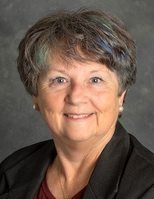 Susan L. Cutter合作论文数Department of Geography, College of Arts and Sciences, University of South Carolina;Hazards Vulnerability & Resilience Institute, College of Arts and Sciences, University of South Carolina25
 Christopher Emrich合作论文数School of Public Administration, College of Community Innovation and Education, University of Central Florida;National Center for Integrated Coastal Research, University of Central Florida14
 Walter W. Piegorsch合作论文数Department of Mathematics and BIO5 Institute, University of Arizona10
 Mark M. Smith合作论文数9Weber Lynn合作论文数Department of Psychology, University of South Carolina9Larianne Collins合作论文数5arleen a hill合作论文数3Deborah S. K. Thomas合作论文数3
 Christopher Burton合作论文数2
 jongwon lee合作论文数Dept Social Studies Educ, Ewha Womans Univ2
 Eyup Artvinli合作论文数EĞİTİM FAKÜLTESİ, ESKİŞEHİR OSMANGAZİ ÜNİVERSİTESİ2Monti Caughman合作论文数2
 Sarah Bednarz合作论文数Dept Geog, Texas A&M Univ2Susan Wise合作论文数2Ginni Melton合作论文数2
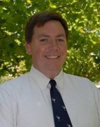 Michael Sean Scott合作论文数Center for Problem-oriented Policing , Inc2
 Inga Gryl合作论文数2
 Melanie Gall合作论文数Management Institute2Kent Mathewson合作论文数1Robin Shudak合作论文数1Carmen P. Brysch合作论文数1Sarah Witham Bednarz合作论文数1Derek H. Alderman合作论文数1dara angelo合作论文数1gregg bowser合作论文数1Sylvia-Linda Kaktins合作论文数1Phillip R. Hare合作论文数1Robert W. D. Perham合作论文数1
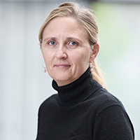 Lene Møller Madsen合作论文数Department of Science Education, Exercise and Sports, Faculty of Science, University of Copenhagen1mark m smith合作论文数1
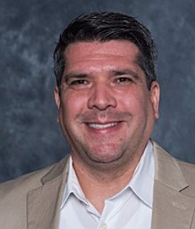 George J. Roy合作论文数Department of Instruction and Teacher Education, University of South Carolina1Brandy Wood合作论文数1Bryan Boruff合作论文数1Camelia Kantor合作论文数Pennsylvania State University1
 Yago Martín合作论文数Departamento de Geografía, Historia y Filosofía, Universidad Pablo de Olavide1william c terry合作论文数Dept Hist & Geog, Clemson Univ1
 Hyun Bang Shin合作论文数Urbanisation, Planning and Development, Department of Geography and Environment, London School of Economics and Political Science1
 Zhenlong Li合作论文数Department of Geography, College of Earth and Mineral Sciences, Pennsylvania State University;Geoinformation and Big Data Research Laboratory, Pennsylvania State University1
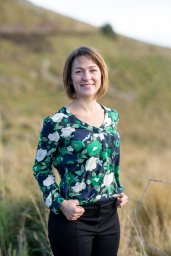 Stevenson Joanne合作论文数1
 Yushan Duan (段玉山)合作论文数School of Geographic Sciences, East China Normal University1Andrew R. Eckhoff合作论文数1
 Gillian Kidman合作论文数School of Curriculum, Teaching and Inclusive Education, Faculty of Education, Monash University1Mathew C. Schmidtlein合作论文数1
 Loretta Lees合作论文数Department of Sociology, College of Arts & Sciences, University of Leicester1Cuizhen Wang合作论文数College of Chemical and Biological Engineering, Shandong University of Science and Technology1
 Lisa Mathis Butler Harrington合作论文数Kansas State University1Sarah Battersby合作论文数1Melanie Baker合作论文数1




