Temperature-index modeling is used to determine the magnitude of temperature depression on the Blanca Massif, Colorado, required to maintain steady-state mass balances of nine reconstructed glaciers at their extent during the Last Glacial Maximum (LGM). The mean temperature depression thus determined is ~8.6 +0.7/−0.9 °C where the uncertainties account for those inherent in the glacier reconstructions, in model parameters (e.g., melt factors), and possible modest changes in LGM precipitation. Associated equilibrium-line altitudes (ELAs) exhibit a statistically significant directional dependency being lower toward the north and east. Under the assumption that regional temperature change was uniform, required changes in precipitation vary systematically—also exhibiting a directional dependency coinciding with that in ELAs—and indicate increases (over modern) occurred on the eastern side of the massif while decreases occurred on the western side. This disparity represents a strengthening of a precipitation asymmetry, particularly winter precipitation, which exists today. The modern precipitation asymmetry may be a consequence of snow being blown over to the eastern side of the massif (advective transport) by southwesterly flow. Intensification of this flow during the LGM would have enhanced advection, and augmented snow accumulation on glaciers, thus explaining the lower ELAs and increased precipitation on that side of the massif.
First posted April 17, 2020 For additional information, contact: Director, Geosciences and Environmental Change Science CenterU.S. Geological SurveyBox 25046, MS-980Denver, CO 80225-0046 The Homestake Reservoir 7.5' quadrangle lies at the northwestern end of the Upper Arkansas Valley, and headwaters of the Arkansas River, and the Roaring Fork, Fryingpan, and Eagle Rivers of the Colorado River system. The quadrangle lies within tectonic provinces of the 1.4 giga-annum (Ga) Picuris orogeny and includes the late Paleozoic Ancestral Rockies, Late Cretaceous-Paleocene Laramide orogeny, Oligocene-to-Miocene and Pliocene? volcanism, and Miocene to the present Rio Grande rift extensional tectonics. In the eastern half of the quadrangle, high-angle, east-dipping, Neogene normal faults displace Proterozoic rocks, and locally Miocene-to-Pliocene? volcanic rocks. Many quartz veins and hydrothermally altered zones are exposed along the eastern flank of the quadrangle, indicative of the multiple tectonic episodes the region has experienced. The main intent of the map is to unravel the structural complexity by partitioning the structures and volcanism within the appropriate geologic interval. This ultimately permits accurate identification of geomorphic features suitable for chronologies related to landscape evolution studies, seismic and other natural hazard identification, ground and surface water modeling, and paleoclimatic studies. Within the western half of the quadrangle, Mesoproterozoic and Paleoproterozoic igneous and metamorphic rocks of 1.4 Ga St. Kevin Granite and 1.8–1.7 Ga Biotite gneiss and schist, respectively, are uplifted along the generally east-dipping, high-angle Sawatch fault system. In the northwest portion of the quadrangle, strands of the Homestake shear zone have been mapped, dated and assigned to the 1.4 Ga Picuris orogeny of northern New Mexico. 10Be and 26Al cosmogenic nuclide ages of the youngest glacial deposits indicate a last glacial maximum age of about 22–21 kilo-annum (ka) and complete deglaciation by about 14 kilo-annum, supported by chronologic studies in adjacent drainages. The Turquoise Lake impounding lateral and terminal moraine complex was deposited during late Pleistocene glacial maximum ~22–21 ka. No late Pleistocene tectonic activity is apparent within the quadrangle.
ABSTRACTNew cosmogenic 10Be surface exposure ages from 17 moraine boulders in the Mosquito Range of Colorado suggest that glaciers were at their late Pleistocene (Pinedale) maximum extent at ∼21–20 ka, and that ice recession commenced before ∼17 ka. These age limits suggest that the Pinedale Glaciation was synchronous within the Colorado Rocky Mountain region. Locally, the previous (Bull Lake) glaciation appears to have occurred no later than 117 ka, possibly ∼130 ka allowing for reasonable rock weathering rates. Temperature‐index modeling is used to determine the magnitude of temperature depression required to maintain steady‐state mass balances of seven reconstructed glaciers at their maximum extent. Assuming no significant differences in precipitation compared to modern values, mean annual temperatures were ∼8.1 and 7.5 °C lower, respectively, on the eastern and western slopes of the range with quantifiable uncertainties of + 0.8/−0.9 °C. If an average temperature depression of 7.8 °C is assumed for the entire range, precipitation differences − that today are 15–30% greater on the eastern slope due to the influence of winter/early spring snowfall − might have been enhanced. The temperature depressions inferred here are consistent with similarly derived values elsewhere in the Colorado Rockies and those inferred from regional‐scale climate modeling.
Temperature-index modeling is used to determine the magnitude of temperature depression in the northern Sawatch Range required to maintain steady-state mass balances of six reconstructed glaciers at their extent during the local Last Glacial Maximum (LLGM), dated at ~21 ka. Assuming no significant differences in precipitation compared to modern values, mean annual temperatures in the region were on average 8.8 + 0.5/– 0.8 °C cooler than they are today. Allowing for modest (± 10 cm) increases or decreases in precipitation, required temperature depressions only differ by ±0.2 °C. Temperature depression in the northern Sawatch Range is consistent, although slightly greater, with those determined in other ranges in Colorado using similar approaches. The estimates presented here are, however, substantially less than those suggested by several downscaled simulations of global Last Glacial Maximum (LGM) climate, that might be due to the need for improved calibration of such downscaled simulations, or the models from which they are derived. Our estimates of LGM temperature depression are considerably greater than that previously determined in the study area and those in two other ranges in Colorado derived using different methodologies, the latter being most likely responsible for the discrepancies.
Fluvial systems of the Rocky Mountain-Colorado Plateau region are a product of temporo-spatial migration of Neogene tectonism and episodic, glacial hydrologic fluxes. Structural geology, sedimentology, paleontology, tephrachronology, geomorphology, geodetics, and historic/paleoseismic inventories indicate: 1) tectonic activity rates have been ~0.1-0.3 mm/yr; and 2) major incision occurred across the region <640 ka (MIS 16), and globally within the northern hemisphere <500 ka (MIS 12?), coeval to appearance of the largest Laurentide and Fennoscandinavian ice sheets. Based on well-constrained evidence from the Rio Grande and Arkansas fluvial systems and existing evidence from the Colorado River system, we present a conceptual model for landscape evolution of major drainages of the Rocky Mountains, providing a testable hypothesis and platform for future work. Herein, Pliocene to early Pleistocene tectonism, volcanism, and climate aridity disconnected basins, fragmented drainages, and parched watersheds. Elevated, broad regions (>3200m asl) provided areas for ice development and runoff during onset of major glacial episodes. Middle Pleistocene (
Cosmogenic Be-10 surface-exposure dating and numerical glacier modeling are used to reconstruct glacial chronology and climate in the Colorado Sangre de Cristo Mountains during the local last glacial maximum (LLGM) and the subsequent deglaciation. Twenty-two surface-exposure ages on moraine boulders and polished-bedrock outcrops in the Willow Creek valley and ten in two adjacent valleys indicate that glaciers were at or near their maxima from similar to 21 ka until 17-16 ka, and then retreated rapidly, nearly deglaciating the Willow Creek valley entirely by similar to 14 ka. Coupled energy/mass-balance and flow modeling of two of the glaciers indicates that, if changing ice extent was driven only by temperature and insolation changes, temperature depressions of 5.0 and 5.1 degrees C from modern conditions, with an uncertainty of approximately +1.5/ 1.0 degrees C, would have sustained the glaciers in mass-balance equilibrium at their LLGM extents. Doubling or halving of modern precipitation during the LLGM would have been associated with 2.7-3.0 degrees C and 6.9-7.0 degrees C temperature depression respectively. Approximately half of the subsequent LLGM to-modern climate change was accomplished by similar to 14 ka. If the rapid main phase of deglaciation between about 16 ka and 14 ka was driven solely by temperature and insolation changes, it would have been associated with a temperature rise of about 2.5 degrees C, at a mean rate of approximately 1.1 degrees C/ky. This new chronology of the last glaciation is generally consistent with others developed recently in the Colorado Rocky Mountains. The numerical modeling, however, suggests a lesser LLGM temperature depression from modern conditions than have most previous studies in Colorado. (C) 2016 Elsevier Ltd. All rights reserved.
This fi eld-trip guide outlines the glacial history of the upper Arkansas River valley, Colorado, and builds on a previous GSA fi eld trip to the area in 2010. The following will be presented: (1) new cosmogenic 10Be exposure ages of moraine boulders from the Pinedale and Bull Lake glaciations (Marine Isotope Stages 2 and 6, respectively) located adjacent to the Twin Lakes Reservoir, (2) numerical modeling of glaciers during the Pinedale glaciation in major tributaries draining into the upper Arkansas River, (3) discharge estimates for glacial-lake outburst fl oods in the upper Arkansas River valley, and (4) 10Be ages on fl ood boulders deposited downvalley from the moraine sequences. This research was stimulated by a new geologic map of the Granite 7.5′ quadrangle, in which the mapping of surfi cial deposits was revised *E-mails: avrielsc@buffalo.edu; jbriner@buffalo.edu; rshroba@usgs.gov; joe.licciardi@unh.edu; eleonard@coloradocollege.edu; bruggeka@morris.umn.edu; cmrussell94@gmail.com. Schweinsberg, A.D., Briner, J.P., Shroba, R.R., Licciardi, J.M., Leonard, E.M., Brugger, K.A., and Russell, C.M., 2016, Pinedale glacial history of the upper Arkansas River valley: New moraine chronologies, modeling results, and geologic mapping, in Keller, S.M., and Morgan, M.L., eds., Unfolding the Geology of the West: Geological Society of America Field Guide 44, p. 335–353, doi:10.1130/2016.0044(14). © 2016 The Geological Society of America. All rights reserved. For permission to copy, contact editing@geosociety.org. 336 Schweinsberg et al.
 Benjamin J.C. Laabs合作论文数Department of Geology and Geophysics, University of Wisconsin7
 Marc William Caffee合作论文数Department of Physics and Astronomy, Purdue University6
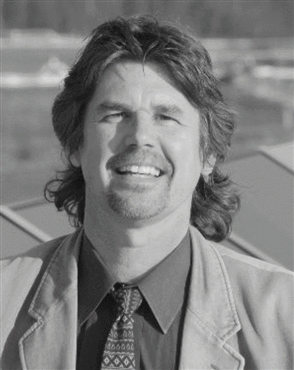 Peter Jansson合作论文数Department of Physical Geography and Quaternary Geology, Stockholm University6
 Kurt A. Refsnider合作论文数6
 Eric M. Leonard合作论文数Department of Geology, Colorado College5
 Cal Ruleman合作论文数4
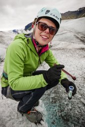 Caroline C. Clason合作论文数Sch Geog Earth & Environm Sci, Univ Plymouth4
 Neal Iverson合作论文数Department of Geological and Atmospheric Sciences, College of Liberal Arts and Sciences, Iowa State University4
 Jerker Jarsjo合作论文数Department of Physical Geography and Quaternary Geology, Stockholm University4
 Gunhild Rosqvist合作论文数4
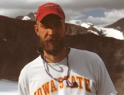 Peter L. Moore合作论文数Department of Geological and Atmospheric Sciences;Iowa State University;Department of Geological and Atmospheric Sciences, Iowa State University4
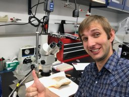 A. Hudson合作论文数3
 T. S. Hooyer合作论文数3barry s goldstein合作论文数2Chester A. Ruleman合作论文数2latysha pankratz合作论文数2caleb barron合作论文数2
 Caroline Coch合作论文数2
 Cohen David合作论文数St Lukes Mid Amer Heart Inst2Brent M. Goehring合作论文数Geochemistry, Lamont-Doherty Earth Observatory2Mitchell A. Plummer合作论文数2Noah Bensen合作论文数1
 Alexander Reimers合作论文数1Jordan Dahle合作论文数1Marc W. Caffee合作论文数1Michael G. Frothingham合作论文数1Matthew Dettinger合作论文数1Peter Dolan合作论文数1
 Sylvia Rose Nicovich合作论文数Bur Reclamat1
 Rachel N. Sortor合作论文数Dept Earth & Environm Sci, Tulane Univ1
 Cody Curtis Mason合作论文数Department of Natural Sciences, University of West Georgia1Avriel D. Schweinsberg合作论文数Geol Dept, Univ Buffalo1
 Kevin T. Uno合作论文数Department of Geology and Geophysics, University of Utah;Department of Geology and Geophysics, University of Utah1
 Mark D Johnson合作论文数1
 James P. McCalpin合作论文数GEO-HAZ Consulting, Inc.1
 Jason Briner合作论文数Department of Geology, College of Arts and Sciences, University at Buffalo1Gerald Holdsworth合作论文数Arctic Institute of North America, University of Calgary1
 Denis Cohen合作论文数Department of Geological and Atmospheric Science, Iowa State University1Philip P. Armstrong合作论文数1Ren A. Thompson合作论文数1
 Tammy Rittenour合作论文数Department of Geology, College of Science, Utah State University1
 Susan L Herron合作论文数Schlumberger-Doll Research1Kenzie J. Turner合作论文数1
 Brian Hanson合作论文数Department of Geology and Geophysics, University of Minnesota1Chester C. Langway合作论文数1
 Colin A. Shaw合作论文数1
 Marith Reheis合作论文数Geosciences and Environmental Change Science Center, U.S. Geological Survey1Theodore R. Brandt合作论文数1
 Roger LeB Hooke合作论文数N.H. Winchell School of Earth & Environmental Sciences, College of Science and Engineering, University of Maine1




