Surface-Surface Intersection (SSI) represents a foundational challenge in Computer-Aided Design (CAD) and numerous engineering disciplines. The lack of topologically consistent surface intersection algorithms stands as a primary factor to the poor reliability of CAD systems. SSI algorithms form the backbone of Boolean operations in CAD modeling, and their numerical inaccuracies as well as topological incorrectness are among the foremost causes of the notorious watertightness issues in CAD models. Such issues directly compromise the integrity of subsequent simulation and manufacturing workflows, underscoring the critical need for robust SSI solutions. In this review, we systematically analyze the challenges and recent breakthroughs in SSI computation. We dissect representative methodologies and evaluate their performance across geometric accuracy, topological consistency, and computational efficiency. We further delve into applications of SSI in Boolean operation, collision detection and physical simulation of Computer-Aided Manufacturing (CAM).
Oblique-view urban remote sensing imagery inevitably exhibits geometric projection displacements between building roofs and footprints, leading to significant distortions in spatial structure. Existing approaches either ignore these deformations or handle them implicitly within segmentation-based frameworks, where progress is dominated by general segmentation advances rather than improvements in geometric correction. In this work, we explicitly define roof-to-footprint offset vector (RFOV) extraction as an independent learning task that decouples geometric alignment from semantic segmentation. To support this task, we introduce the Oblique City dataset (ObliCity), the first large-scale benchmark that integrates high-resolution UAV imagery and globally distributed satellite data, covering diverse city morphologies and camera perspectives. Methodologically, we reformulate DragOSM into DragRoof, an ODE-based framework inspired by human annotation behavior. By simulating the continuous process of dragging roofs toward their footprints, DragRoof learns deterministic, geometry-consistent offset fields and adaptively determines convergence through an end token. Extensive experiments on ObliCity demonstrate that DragRoof achieves state-of-the-art RFOV extraction performance, requiring fewer inference steps while delivering superior directional and length accuracy. Our dataset and model establish a principled foundation for studying projection displacement correction in oblique remote sensing imagery. The source code and dataset will be avaliable at https://github.com/likaiucas/DragRoof.
Accurate cartographic-level polygonal vector extraction from remote sensing images is crucial for land survey and land cover mapping. However, current deep learning-based segmentation models often generate raster outputs with irregular boundaries, making them unsuitable for applications requiring precise vector data. This study presents the Prompt-based Cartographic-level Polygonal (PCP) Vector Extraction framework, which leverages segmentation results as prompts to guide the extraction process and enhance regularity. Built upon the Segment Anything Model (SAM), the PCP extracts the segmentation mask and an additional vertex map. To improve vertex extraction accuracy and enable more regular polygon generation, two key modules are introduced: the Iterative Upscaling Refinement (IUR) module, which addresses challenges related to low-resolution feature maps, and the Shape Rule-Based Vertex Filtering and Connecting (SRVFC) module, which enhances the vertex filtering process by learning from shape features. Experimental results on the Land Survey Vector (LSV), LoveDA and WHU-Mix (Vector) datasets demonstrate that the PCP outperforms existing methods in terms of vertex precision and recall, reflecting geometric accuracy, as well as in complexity-aware Intersection over Union (C-IoU), which balances overall accuracy and simplicity. Thus, the PCP framework provides a promising solution for cartographic-level vector extraction in remote sensing applications. The source code is available at https://github.com/wchh-2000/PCP.
With the continuous enhancement of remote sensing image resolution and the rapid advancement of deep learning techniques, land cover mapping is undergoing a significant transformation from pixel-level segmentation to object-based vector modeling. This shift imposes higher demands on deep learning models, requiring not only precise delineation of object boundaries but also the preservation of topological consistency among geographic elements. However, existing public datasets face three major limitations: limited class annotations, restricted data scale, and the lack of spatial structural information, which severely hinder the development of breakthrough methods in high-resolution remote sensing vectorization. To address these challenges, we present IRSAMap, the first global remote sensing dataset designed for large-scale, high-resolution, multifeature land cover vector mapping. This dataset offers four key advantages. First, a comprehensive element vector annotation system that includes over 1.8 million instances of ten typical natural and man-made objects, such as buildings, roads, rivers, and trees, using a unified vector annotation standard framework that ensures both semantic integrity and spatial structural accuracy. Second, an intelligent annotation workflow incorporating "manual preannotation + AI-based training and inference + manual review and correction," which enhances annotation efficiency while ensuring consistency. Third, a global coverage that spans 79 regions across six continents, representing diverse terrain types, including urban and rural areas, with a total coverage area exceeding 1000 km2. Fourth, multitask adaptability, supporting various tasks such as pixel-level land cover classification, building outline regularization extraction, road centerline extraction, and panoramic segmentation. As a fundamental resource for remote sensing intelligent interpretation, IRSAMap provides a standardized benchmark for the paradigm shift from pixels to objects, which will significantly advance the development of high-precision geographic feature automation, collaborative modeling, and other cutting-edge research directions. The dataset is of great value for applications such as global geographic information updating and digital twin construction. IRSAMap is publicly available at https://github.com/ucas-dlg/IRSAMap
Self-intersections of NURBS surfaces are unavoidable during the CAD modeling process, especially in operations such as offset or sweeping. The existence of self-intersections might cause problems in the subsequent simulation and manufacturing process. Therefore, fast detection of self-intersections of NURBS is highly demanded in industrial applications. Self-intersections are essentially singular points on the surface. Although there is a long history of exploring singular points in mathematics community, the fast and robust determination and computation of self-intersections have been a challenging problem in practice. In this article, we construct an algebraic signature whose non-negativity is proven to be sufficient for excluding the existence of self-intersections from a global perspective. An efficient algorithm for determining the existence of self-intersections is provided by recursively using this signature. Once the self-intersection is detected, if necessary, the self-intersection locus can also be computed via a further recursively cross-use of this signature and the surface-surface intersection function. Various experiments and comparisons with existing methods, as well as geometry kernels, including OCCT and ACIS, validate the robustness and efficiency of our algorithm. We also adapt our algorithm to self-intersection elimination, self-intersection trimming, and applications in mesh generation, Boolean operation, and shelling.
Ellipsoids serve as the most commonly used geometric primitives and bounding volumes in computer-aided design and computer graphics, where an efficient and topologically stable intersection algorithm between two ellipsoids is highly required. Although there has been extensive research on intersections of two general quadrics, ellipsoids have their own specialty in both algebra and geometry which guides to new possibilities to break the bottleneck in intersection computation. In this paper, we use a topology-determination-based strategy in computing the intersection of ellipsoids. Firstly, the topology of the intersection curve is quickly determined using some algebraic discriminants without computing any point on the intersection curve; then an octree strategy is applied to efficiently compute at least one point on each intersection branch; finally, by tracing the branch, we get the complete intersection loci. Plenty of examples show that our algorithm is topologically stable when facing challenging cases including multi-branches, small loops, singular or tangent intersections, and is more efficient compared with existing algorithms.
Moving planes have been widely recognized as a potent algebraic tool in various fundamental problems of geometric modeling, including implicitization, intersection computation, singularity calculation, and point inversion of parametric surfaces. For instance, a matrix representation that inherits the key properties of a parametric surface is constructed from a set of moving planes. In this paper, we present an efficient approach to computing such a set of moving planes that follow the given rational parametric surface. Our method is based on the calculation of Dixon resultant matrices, which allows for the computation of moving planes with simpler coefficients, improved efficiency and superior numerical stability when compared to the direct way of solving a linear system of equations for the same purpose. We also demonstrate the performance of our algorithm through experimental examples when applied to implicitization, surface intersection, singularity computation as well as inversion formula computation.
The surface-surface intersection computation is fundamental to CAD/CAM, since it is crucial to boundary representation, mesh generation, rendering, hidden surface removal and CNC machining. In this paper, we present an efficient algorithm for computing the intersection of two rational parametric surfaces, which is an algebraic technique based on a hybrid of a matrix-representation and a hierarchical lattice method. Given two rational surfaces, the Dixon matrix representation of one surface is first constructed; then the marching squares technique is applied on lattices of the parametric domain of the other surface to extract the intersection points. Extensive experiments have been conducted on various surfaces, including Utah teapot patches and some classic surfaces that have complex self-intersection features. These examples have covered rich intersection curve topology with multiple branches and singular points. All examples show that our algorithm is efficient and numerically stable. (C) 2022 Elsevier Ltd. All rights reserved.
 Xiaohong Jia (贾晓红)合作论文数Key Laboratory of Mathematics Mechanization, Institute of Systems Science, Academy of Mathematics and Systems Science, Chinese Academy of Sciences5
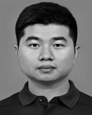 Yupeng Deng合作论文数2
 Diyou Liu合作论文数2
 Qing Chen (陈卿)合作论文数School of Mathematical Sciences, University of Science and Technology of China2
 Jiansheng Chen (陈建生)合作论文数National Astronomical Observatories, Chinese Academy of Sciences;University of Chinese Academy of Sciences2
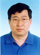 Jingbo Chen (陈景波)合作论文数Institute of Geology and Geophysics, Chinese Academy of Sciences2
 Yu Meng (孟瑜)合作论文数Aerospace Information Research Institute, Chinese Academy of Sciences;University of Chinese Academy of Sciences2
 Haochen Wang合作论文数Center for Research on Intelligent Perception and Computing, State Key Laboratory of Multimodal Artificial Intelligence Systems, Institute of Automation, Chinese Academy of Sciences1
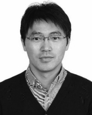 Yue Anzhi合作论文数Chinese Acad Sci, Inst Remote Sensing & Digital Earth, Beijing 100101, Peoples R China1
 Xian Sun (孙显)合作论文数Aerospace Information Research Institute, Chinese Academy of Sciences1
 Jinsan Cheng (程进三)合作论文数University of Chinese Academy of Sciences;Academy of Mathematics and Systems Science, Chinese Academy of Sciences1




