Understanding where blue carbon habitats occur and how they are affected by human activity contributes to effective management of natural carbon sinks. Here, we compiled geographical data for Sweden to map the distribution of coastal vegetated blue carbon (BC) habitats. The mapping effort focused on well-recognised (salt marshes and seagrass meadows) and emergent BC habitats (other rooted submerged macrophytes and forested wetlands). We also estimated the exposure to anthropogenic pressures on coastal BC habitats based on their proximity to land-based human activities, and subsequently, the portion of these BC habitats that were located within protected areas. The total area of BC habitats was estimated to around 1850 km2, corresponding to ca. 35% of the Swedish coast. Seagrass meadows and other rooted submerged macrophytes were dominating, covering about 1500 km2. Around 22% of the mapped BC habitats were expected to be exposed to high pressures from land-based human activities due to their location, while BC habitats within protected areas were often less exposed. This nationwide assessment of coastal vegetated BC habitats accentuates the need for strengthening conservation prioritisation to maximise the carbon storage potential of BC habitats.
Antimicrobial resistance (AMR) is a global major health concern. Spatial analysis is considered an invaluable method in health studies. Therefore, we explored the usage of spatial analysis in Geographic Information Systems (GIS) in studies on AMR in the environment. This systematic review is based on database searches, a content analysis, ranking of the included studies according to the preference ranking organization method for enrichment evaluations (PROMETHEE) and estimation of data points per km2. Initial database searches resulted in 524 records after removal of duplicates. After the last stage of full text screening, 13 greatly heterogeneous articles with diverse study origins, methods and design remained. In the majority of studies, the data density was considerably less than one sampling site per km2 but exceeded 1,000 sites per km2 in one study. The results of the content analysis and ranking showed a variation between studies that primarily used spatial analysis and those that used spatial analysis as a sec ondary method. We identified two distinct groups of GIS methods. The first was focused on sample collection and laboratory testing, with GIS as supporting method. The second group used overlay analysis as the primary method to combine datasets in a map. In one case, both methods were combined. The low number of articles that met our inclusion criteria highlights a research gap. Based on the findings of this study we encourage application of GIS to its full potential in studies of AMR in the environment.
In March 2020, the first known cases of COVID-19 occurred in Europe. Subsequently, the pandemic developed a seasonal pattern. The incidence of COVID-19 comprises spatial heterogeneity and seasonal variations, with lower and/or shorter peaks resulting in lower total incidence and higher and/or longer peaks resulting higher total incidence. The reason behind this phenomena is still unclear. Unraveling factors that explain why certain places have higher versus lower total COVID-19 incidence can help health decision makers understand and plan for future waves of the pandemic. We test whether differences in the total incidence of COVID-19 within five European countries (Norway, Sweden, Germany, Italy, and Spain), correlate with two environmental factors: the Köppen-Geiger climate zones and the Continentality Index, while statistically controlling for crowding. Our results show that during the first 16 months of the pandemic (March 2020 to July 2021), climate zones with larger annual differences in temperature and annually distributed precipitation show a higher total incidence than climate zones with smaller differences in temperature and dry seasons. This coincides with lower continentality values. Total incidence increases with continentality, up to a Continentality Index value of 19, where a peak is reached in the semicontinental zone. Low continentality (high oceanic influence) appears to be a strong suppressing factor for COVID-19 spread. The incidence in our study area is lowest at open low continentality west coast areas.
(1) Stockholm University, Department of Physical Geography, Stockholm, Sweden (arjen.stroeven@natgeo.su.se), (2) Stockholm University, Bolin Centre for Climate Research, Stockholm, Sweden, (3) University of Gothenburg, Department of Earth Sciences, Gothenburg, Sweden, (4) University of California, Los Angeles, Department of Earth, Planetary, and Space Sciences, Los Angeles, USA, (5) Purdue University, Department of Earth, Atmospheric, and Planetary Sciences, West Lafayette, USA, (6) Purdue University, Department of Physics and Astronomy, and Purdue Rare Isotope Measurement Laboratory (PRIME Lab), West Lafayette, USA, (7) Södertörn University, School of Natural Science, Technology and Environmental Studies, Stockholm, Sweden, (8) British Geological Survey, Edinburgh, Scotland, (9) University of Hawaii, Department of Geology and Geophysics, Honolulu, Hawaii, USA, (10) Swedish Nuclear Fuel and Waste Management Company, Stockholm, Sweden, (11) Massachusetts Institute of Technology, Department of Earth, Atmospheric and Planetary Sciences, Cambridge, Massachusetts, USA, (12) Scottish Universities Environmental Research Centre, Glasgow, UK
In this study, we estimate baseline conditions in terms of the current risk of well salinization on the Baltic Sea island of Öland, Sweden, and assess the effects of future sea level rise on the land area, infrastructure and cultural values. We use a multicriterion geographical information systems (GIS) approach. Geomorphological and physical parameters affect the risk of saltwater intrusion into freshwater aquifers, including their hydrology, geomorphology, and climatology; the spatial distribution of the current risk of salinization is mapped in this study. In the event of a future 2 m sea level rise, a total land area of 67 km2 will be inundated on Öland, corresponding to approximately 5% of the island’s land surface. Inundation includes urban areas, nature reserves, and animal protection areas, implying the loss of environmental and socioeconomic values. A future 2 m sea level rise will also cause direct inundation of 3% of all wells on the island. Currently, 17.5% of all wells are at a high risk of becoming saltwater contaminated. More generally, the present results add evidence showing a relatively high vulnerability of major Baltic Sea islands and their infrastructure to future sea level rise. The approach used here and related results, including salinization risk maps, may prove useful for decision-makers in the planning of infrastructure. Drilling of new wells could for instance preferably be done in areas with identified lower risk-index values, which would facilitate an overall higher freshwater withdrawal in the interest of the entire island.
Industrially utilized river basins are frequently exposed to contaminants originating from polluting activities. However, the physical instability and probability of mass movement mobilization of contaminated soil into rivers have only received little attention. In this study, we present a GIS-based method to produce a regional overview of where and how contaminated areas are potentially exposed to slope instability. A landslide susceptibility-index was used to study the degree and distribution of overlap between contaminated sites and unstable ground. A contaminated area instability hazard classification was produced integrating slope instability and contamination risk classification. Our results indicate that mass movement can be tied mainly to a slope gradient ≥16°, a proximity to the river that is <500 m, a distance of <500 m from roads, concave surface curvature, and sand- and silt soils. Forty-six (22%) of all considered contaminated sites are located within areas with a non-negligible slope instability, of which a majority, 30 sites (14%) are situated on ground with a low or moderate instability. Three sites with a class 2 contamination risk (the 2nd highest class) are located on ground with a very high slope instability.
Future sea level rise as a consequence of global warming will affect the world's coastal regions. Even though the pace of sea level rise is not clear, the consequences will be severe and global. Commonly the effects of future sea level rise are investigated for relatively vulnerable development countries; however, a whole range of varying regions needs to be considered in order to improve the understanding of global consequences. In this paper we investigate consequences of future sea level rise along the coast of the Baltic Sea island of Gotland, Sweden, with the aim to fill knowledge gaps regarding comparatively well-suited areas in developed countries. We study both the quantity of the loss of features of infrastructure, cultural, and natural value in the case of a 2 m sea level rise of the Baltic Sea and the effects of climate change on seawater intrusion in coastal aquifers, which indirectly cause saltwater intrusion in wells. We conduct a multi-criteria risk analysis by using lidar data on land elevation and GIS-vulnerability mapping, which gives the application of distance and elevation parameters formerly unimaginable precision. We find that in case of a 2 m sea level rise, 3 % of the land area of Gotland, corresponding to 99 km(2), will be inundated. The features most strongly affected are items of touristic or nature value, including camping places, shore meadows, sea stack areas, and endangered plants and species habitats. In total, 231 out of 7354 wells will be directly inundated, and the number of wells in the high-risk zone for saltwater intrusion in wells will increase considerably. Some valuable features will be irreversibly lost due to, for example, inundation of sea stacks and the passing of tipping points for seawater intrusion into coastal aquifers; others might simply be moved further inland, but this requires considerable economic means and prioritization. With nature tourism being one of the main income sources of Gotland, monitoring and planning are required to meet the changes. Seeing Gotland in a global perspective, this island shows that holistic multi-feature studies of future consequences of sea level rise are required to identify overall consequences for individual regions.
The erosional impacts of former ice sheets on the low-relief bedrock surfaces of Northern Hemisphere shields are not well understood. This paper assesses the variable impacts of glacial erosion on a portion of Baffin Island, eastern Canadian Arctic, between 68° and 72°N and 66° and 80°W. This tilted shield block was covered repeatedly by the Laurentide Ice Sheet during the late Cenozoic. The impact of ice-sheet erosion is examined with GIS analyses using two geomorphic parameters: lake density and terrain ruggedness. The resulting patterns generally conform to published data from other remote sensing studies, geological observations, cosmogenic exposure ages, and the distribution of the chemical index of alteration for tills. Lake density and terrain ruggedness are thereby demonstrated to be useful quantitative indicators of variable ice-sheet erosional impacts across Baffin Island. Ice-sheet erosion was most effective in the lower western parts of the lowlands, in a west–east-oriented band at around 350–400 m a.s.l., and in fjord-onset zones in the uplifted eastern region. Above the 350–400 m a.s.l. band and between the fjord-onset zones, ice-sheet erosion was not sufficient to create extensive ice-roughened or streamlined bedrock surfaces. The exception — where lake density and terrain ruggedness indicate that ice-sheet erosion had a scouring effect all across the study area — was in an area from Foxe Basin to Home Bay with elevations <400 m a.s.l. These morphological contrasts link to former ice-sheet basal thermal regimes during the Pleistocene. The zone of low glacial erosion surrounding the cold-based Barnes Ice Cap probably represents the ice cap’s greater extent during successive Pleistocene cold stages. Inter-fjord plateaus with few ice-sheet bedforms remained cold-based throughout multiple Pleistocene glaciations. In contrast, zones of high lake density and high terrain ruggedness are a result of the repeated development of fast-flowing, erosive ice in warm-based zones beneath the Laurentide Ice Sheet. These zones are linked to greater ice thickness over western lowland Baffin Island. However, adjacent lowland surfaces with similar elevations of non-eroded, weakly eroded, and ice-scoured shield bedrock indicate that—even in areas of high lake density and terrain ruggedness—the total depth of ice sheet erosion did not exceed 50 m.
Much previous work on Late Cenozoic glacial erosion patterns in bedrock has focussed on mountain areas. Here we identify varying impacts of ice sheet erosion on the low-relief bedrock surface of the Fennoscandian shield, and examine the geological, topographical and glaciological controls on these patterns.
Because of the potential value of alumni involvement for student success, for connections to society and as a base for future philanthropy, there is growing interest in developing university alumni relations programmes in countries that do not have a long tradition in this area. This case study of Stockholm University describes the goals, strategies, barriers and successes of building an alumni programme in an environment that lacks a tradition of alumni relations and aims to provide perspectives and ideas that can help other universities worldwide with their work towards building alumni programmes that fit their cultural contexts and goals.
Sea level rise is confirmed to be an upcoming and pressing issue; on a global as well as local scale; and with it comes the necessity to adapt. Using the local case study of the island of Gotland, Sweden, we investigate the effects of future sea level rise on a multitude of features combined and thereby assess the overall impact on the environment and infrastructure of the island. Sea level is expected to rise 1 2 m until 2100 [1]. We analyze what percentage of Gotland’s total land surface will be submerged under the given scenario, using ArcGIS environment using LIDAR elevation data. Through successive overlay analysis of both raster and vector data, we then quantify the loss of infrastructure; including wells, roads, industrial areas and gas stations. Secondly we investigate what percentage of Gotland’s natural and cultural heritage will drown. In this ongoing study we found that about 3% of Gotland’s land area will drown. Future pressures of water extraction will yield increased risk of saltwater intrusion for a considerable part of the population. For southern Gotland, projections show that about 30% of the wells will be associated with high risk of saltwater intrusion. Furthermore, around 90% of the wells would be at medium or high risk of saltwater intrusion in that case. Even a minimum predicted sea level rise will drown the entire shore meadows and the associated breeding places for birds. We expect that current quantifications of the impact of sea level rise on multiple environmental and anthropogenic features can provide a scientifically sound basis for assessment of main consequences and costs of direct losses.
The nature of the regolith that existed on the shields of the Northern Hemisphere at the onset of ice sheet glaciation is poorly constrained. In this paper, we provide the first detailed account of an exceptionally preserved, deeply weathered late Neogene landscape in the ice sheet divide zone in northern Finland. We mine data sets of drilling and pitting records gathered by the Geological Survey of Finland to reconstruct regional preglacial deep weathering patterns within a GIS framework. Using a large geochemical data set, we give standardised descriptions of saprolite geochemistry using a variant of the Weathering Index of Parker (WIP) as a proxy to assess the intensity of weathering. We also focus on mineral prospects and mines with dense pit and borehole data coverage in order to identify links between geology, topography, and weathering.Geology is closely linked to topography on the preglacial shield landscape of northern Finland and both factors influence weathering patterns. Upstanding, resistant granulite, granite, gabbro, metabasalt, and quartzite rocks were associated with fresh rock outcrops, including tors, or with thin (<5 m) grusses. Plains developed across less resistant biotite gneisses, greenstones, and belts of alternating rock types were mainly weathered to thick (10-20 m) grusses with WIPfines values above 3000 and 4000. Beneath valley floors developed along mineralised shear and fracture zones, weathering penetrated locally to depths of >50 m and included intensely weathered kaolinitic clays with WIPfines values below 1000.Late Neogene weathering profiles were varied in character. Tripartite clay-gruss-saprock profiles occur only in limited areas. Bipartite gruss-saprock profiles were widespread, with saprock thicknesses of >10 m. Weathering profiles included two discontinuities in texture, materials and resistance to erosion, between saprolite and saprock and between saprock and rock. Limited core recovery when drilling below the soil base in mixed rocks of the Tana Belt indicates that weathering locally penetrated deep below upper fresh rock layers. Such deep-seated weathered bands in rock represent a third set of discontinuities. Incipient weathering and supergene mineralisation also extended to depths of >100 m in mineralised fracture zones. The thin weathering crusts found extensively beneath till may represent types of early or middle Pleistocene palaeosols.We confirm that glacial erosion has been very limited (<20 m) in northern Finland and has been widely restricted to the partial stripping of saprolith. The Fennoscandian Ice Sheet in this ice-divide zone remained cold-based and unerosive throughout the Pleistocene. The large-scale shield geomorphology developed before glaciation and is a product of differential weathering and erosion acting on diverse rock types and structures through the Neogene. The first ice sheets did not advance across planar, uniformly soft, deeply kaolinised beds as proposed in recent models of the Laurentide ice sheet. Instead, in northern Finland, the shield topography comprised broad plains and valleys with isolated hills and hill masses, with a relative relief of several hundred metres. Weathered rock was restricted in its distribution and thickness and provided diverse bed materials for ice sheets, including rock, broken saprock, permeable gruss, and linear zones of impermeable clay, with multiple discontinuities. Glacial erosion and local glacial transport led to widespread incorporation of this saprolith material into tills. (C) 2015 Elsevier B.V. All rights reserved.
Much previous work on Late Cenozoic glacial erosion patterns in bedrock has focussed on mountain areas. We here identify varying impacts of ice sheet erosion on the low-relief bedrock surface of the Fennoscandian shield, and examine the geological, topographical and glaciological controls on these patterns.We combine GIS-mapping of topographical, hydrological and weathering data with field observations. We identify and investigate areas with similar geology and general low relief that show different degrees of ice sheet erosional impact, despite similar ice cover histories. On two transects with a total area of ~84 000km2 across the northern Fennoscandian shield, we first establish patterns of glacial erosion and then examine why glacially streamlined areas exist adjacent to areas of negligible glacial erosion. The northern transect includes two areas of exceptional glacial preservation, the Parkajoki area in Sweden and the so-called ice divide zone in Finland, each of which preserve tors and deep saprolite covers. The southern transect, overlapping in the northern part with the first transect, includes areas of intense glacial streamlining, with bedrock areas stripped of loose material and barely any weathering remnants.For both areas, we firstly present the indicators we have availabe for ice sheet erosional impact: streamlined and non-streamlined inselbergs; parallel and dendritic/rectangular drainage patterns; the absence and presence of Neogene weathering remnants. This is followed by an investigation of factors that possibly influence ice sheet erosional impact: (pre-glacial) land surface elevation and topography, bedrock type and structure, and the ice cover history.We find that the extreme preservation of pre-glacial relief in certain parts of the study area is likely explained by repeatedly divergent flow and frozen-based conditions, and that the most likely control causing glacial streamlining and strong erosion was acceleration of flow around major obstacles and convergence towards major bed depressions. No direct impact of rock type on glacial erosion patterns was found, but an indirect control appears clear. Bedrock geology and long-term differential weathering and tectonic evolution determined the topography of the pre-glacial landscape, and these topographic differences subsequently influenced ice sheet dynamics and thereby partly controlled ice sheet erosion on the Northern Fennoscandian shield.
Click to increase image sizeClick to decrease image sizeKey Words: granitepre-glacial glacial erosionlandforms Acknowledgements The authors thank Scottish Natural Heritage for commissioning interpretative work on the Cairngorms. A. M. Hall wishes also to acknowledge the support of The Carnegie Trust of the Universities of Scotland for fieldwork in the Cairngorms. M. R. Gillespie and C. W. Thomas publish with permission of the Executive Director, British Geological Survey, NERC. The paper benefitted from the careful reviews of John Gordon and Brice Rea.
We use D/H and 18O/16O ratios to explore the age of kaolins on the Fennoscandian Shield. Sub-Cretaceous kaolins in southern Scandinavia have isotopic compositions indicative of weathering under warm mean annual temperatures (MATs) of >15°C. Deep kaolins on the shield surface in Finland previously also have been regarded as products of humid tropical weathering of Mesoproterozoic to Eocene age. New oxygen and hydrogen isotope ratios indicate, however, weathering by cool groundwater under MATs of 13–15°C. Isotope ratios are also not consistent with deep (>1km) burial by cover rocks, indicating that a very old age for the weathering is unlikely. Palaeotemperatures are below Cretaceous MATs, yet substantially above Plio-Pleistocene MATs. Comparisons with palaeotemperatures in N Europe and around the Arctic Ocean indicate that the Finnish kaolins developed on the shield surface in the Palaeogene or, alternatively, Miocene. Deep weathering was selectively developed in highly fractured shield rocks and took place in response to latest Cretaceous and Palaeogene uplift and after stripping of Palaeozoic cover rocks. The cool kaolins in Finland indicate that previous routine attributions of kaolinitic weathering products in the geological record to humid tropical environments should be closely scrutinised.
 Adrian M. Hall合作论文数Deparment of Geography and Geosciences, University of St Andrews20
 Clas Hättestrand合作论文数11
 Johan Kleman合作论文数Department of Physical Geography, Faculty of Science, Stockholm University;Bolin Centre for Climate Research is based at the Department of Environmental Science, Faculty of Science, Stockholm University9
 Seul Moon合作论文数Department of Earth, Planetary, and Space Sciences, College of Physical Sciences, University of California, Los Angeles4
 Jakob Heyman合作论文数Department of Physical;Geography and Quaternary Geology;Stockholm University;Department of Physical|Geography and Quaternary Geology, Stockholm University4
 Jerker Jarsjo合作论文数Department of Physical Geography and Quaternary Geology, Stockholm University4
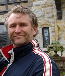 Bradley W. Goodfellow合作论文数Geological and Environmental Sciences, Stanford University4
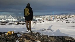 Jens-Ove Naslund合作论文数Department of Physical Geography and Quaternary Geology, Stockholm University4
 Arjen P Stroeven合作论文数Department of Physical;Geography and Quaternary Geology;Stockholm University;Department of Physical|Geography and Quaternary Geology, Stockholm University4goran alm合作论文数4
 Stephen Martel合作论文数Department of Geology and Geophysics;University of Hawaii;Department of Geology and Geophysics, University of Hawaii3Karin Ekstedt合作论文数2
 J. Taylor Perron合作论文数Center for Global Change Science, School of Science, Massachusetts Institute of Technology;Department of Earth, Atmospheric + Planetary Sciences, School of Science, Massachusetts Institute of Technology2
 Marc William Caffee合作论文数Department of Physics and Astronomy, Purdue University2Maarten Krabbendam合作论文数British Geological Survey, Murchison House2Patrik Dinnetz合作论文数Department of Botany;Stockholm University2
 Diego Mas Ivars合作论文数Itasca Geomekanik AB2
 Jon Harbor合作论文数Department of Earth, Atmospheric, and Planetary Sciences, College of Science, Purdue University1Assen Simeonov合作论文数1patrick spets合作论文数1A. Ströberg合作论文数1
 M. R. Gillespie合作论文数1
 Martin Dahl合作论文数Consejo Superior de Investigaciones Cientificas (CEAB-CISC),, Centro de Estudios Avanzados de Blanes1
 Asplund Maria E合作论文数Department of Marine Ecology, University of Gothenburg1
 Anthony Fallick合作论文数School of Geographical & Earth Sciences, University of Glasgow;Scottish Universities Environmental Research Centre, University of Glasgow1Johan Nilsson合作论文数1
 Raymond Munier合作论文数Institute of Geology, Uppsala University1
 Rodrigo Caballero合作论文数Department of Meteorology, Stockholm University1
 Mats Bjork合作论文数Botany Department, Stockholm University1
 H. Albert Gilg合作论文数Lehrstuhl für Ingenieurgeologie, Technische Universität München1
 Jane Kathryn Willenbring合作论文数Department of Earth and Planetary Sciences, Doerr School of Sustainability, Stanford University1
 Atle Nesje合作论文数NORCE Uni Research Climate;Bjerknes Centre for Climate Research, Department of Earth Science, Universitetet i Bergen1Truls Neubeck合作论文数1
 Dag Ottesen合作论文数Exploro AS1Karna Lidmar-Bergstrom合作论文数1Andrew Frampton合作论文数1
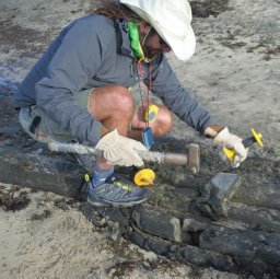 Kevin Norton合作论文数School of Physical Education, Exercise and Sport Studies, University of South Australia1
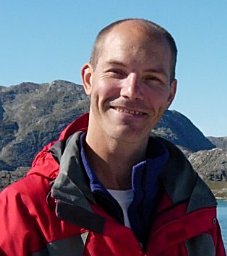 Johan Bonow合作论文数Department of Physical;Geography and Quaternary Geology;Stockholm University;Department of Physical|Geography and Quaternary Geology, Stockholm University1
 Sergio Noce合作论文数Agriconsulting S.p.A1
 Renate Houts合作论文数Department of Psychology & Neuroscience, Trinity College of Arts & Sciences, Duke University1
 Martin Gullström合作论文数Minor Field Study;Committee of Tropical Ecology;Uppsala University;Committee of Tropical Ecology, Uppsala University1
 James L. Fastook合作论文数Climate Change Institute;Department of Computer Science;University of Maine;Climate Change Institute, University of Maine1
 Pertti Sarala合作论文数Department of Geosciences and Astronomy, University of Oulu1
 Fin Stuart合作论文数Scottish Universities Environmental Research Centre1




