This paper explores the problem of planning for visual search without prior map information. We leverage the pixel-wise environment perception problem where one is given wide Field of View 2D scan data and must perform LiDAR segmentation to contextually label points in the surroundings. These pixel classifications provide an informed prior on which to plan next best viewpoints during visual search tasks. We present LIVES: LiDAR Informed Visual Search, a method aimed at finding objects of interest in unknown indoor environments. A robust map-free classifier is trained from expert data collected using a simple cart platform equipped with a map-based classifier. An autonomous exploration planner takes the contextual data from scans and uses that prior to plan viewpoints more likely to yield detection of the search target. We propose a utility function that accounts for traditional metrics like information gain and path cost and for the contextual information. LIVES is baselined against several existing exploration methods in simulation to verify its performance. It is validated in real-world experiments with single and multiple search objects with a Spot robot in two unseen environments. Videos of experiments, implementation details and open source code can be found at https://sites.google.com/view/lives-2024/home.
Navigation strategies that intentionally incorporate contact with humans (i.e. "contact-based" social navigation) in crowded environments are largely unexplored even though collision-free social navigation is a well studied problem. Traditional social navigation frameworks require the robot to stop suddenly or "freeze" whenever a collision is imminent. This paradigm poses two problems: 1) freezing while navigating a crowd may cause people to trip and fall over the robot, resulting in more harm than the collision itself, and 2) in very dense social environments where collisions are unavoidable, such a control scheme would render the robot unable to move and preclude the opportunity to study how humans incorporate robots into these environments. However, if robots are to be meaningfully included in crowded social spaces, such as busy streets, subways, stores, or other densely populated locales, there may not exist trajectories that can guarantee zero collisions. Thus, adoption of robots in these environments requires the development of minimally disruptive navigation plans that can safely plan for and respond to contacts. We propose a learning-based motion planner and control scheme to navigate dense social environments using safe contacts for an omnidirectional mobile robot. The planner is evaluated in simulation over 360 trials with crowd densities varying between 0.0 and 1.6 people per square meter. Our navigation scheme is able to use contact to safely navigate in crowds of higher density than has been previously reported, to our knowledge.
This paper explores the problem of planning for visual search without prior map information. We leverage the pixel-wise environment perception problem where one is given wide Field of View 2D scan data and must perform LiDAR segmentation to contextually label points in the surroundings. These pixel classifications provide an informed prior on which to plan next best viewpoints during visual search tasks. We present LIVES: LiDAR Informed Visual Search, a method aimed at finding objects of interest in unknown indoor environments. A robust map-free classifier is trained from expert data collected using a simple cart platform equipped with a map-based classifier. An autonomous exploration planner takes the contextual data from scans and uses that prior to plan viewpoints more likely to yield detection of the search target. We propose a utility function that accounts for traditional metrics like information gain and path cost and for the contextual information. LIVES is baselined against several existing exploration methods in simulation to verify its performance. It is validated in real-world experiments with single and multiple search objects with a Spot robot in two unseen environments. Videos of experiments, implementation details and open source code can be found at https://sites.google.com/view/lives-2024/home.
This paper introduces LIVE: Lidar Informed Visual Search focused on the problem of multi-robot (MR) planning and execution for robust visual detection of multiple objects. We perform extensive real-world experiments with a two-robot team in an indoor apartment setting. LIVE acts as a perception module that detects unmapped obstacles, or Short Term Features (STFs), in Lidar observations. STFs are filtered, resulting in regions to be visually inspected by modifying plans online. Lidar Coverage Path Planning (CPP) is employed for generating highly efficient global plans for heterogeneous robot teams. Finally, we present a data model and a demonstration dataset, which can be found by visiting our project website https://sites.google.com/view/live-iros2023/home.
Radio interferometry is the current method of choice for deep space astronomy, but in the past few decades optical techniques have become increasingly common. This research seeks to characterize the performance of aperture masking interferometry in the near-infrared at small scales. A mask containing six pairs of apertures at varying diameters and separations was constructed for use with a 24-inch telescope at the MIT Wallace Astrophysical Observatory. Test images of Spica and Jupiter were captured for 28 different telescope configurations, varying aperture separation, aperture diameter, collection wavelength, and exposure time. Lucky imaging was used to account for atmospheric perturbations. Each image was reduced via bias and dark frames to account for sensor noise, and then the full width at half maximum for each image was computed and used as a proxy for maximum angular resolution. The data imply that at small scales aperture size primarily controls the observed maximum angular resolution, but further data are required to substantiate the claim.
 Luis Sentis合作论文数Human Centered Robotics Laboratory, Department of Aerospace Engineering and Engineering Mechanics, Cockrell School of Engineering, The University of Texas at Austin;Apptronik Systems4
 Gupta Ryan合作论文数Mechanics in the University of Texas at Austin,Department of Aerospace Engineering and Engineering3
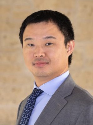 Junfeng Jiao合作论文数Department of Population Health, Dell Medical School, University of Texas at Austin1
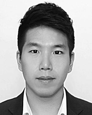 Minkyu Kim合作论文数Interaction & Robot. Res. Center, Korea Inst. of Sci. & Technol.;c;Interaction & Robot. Res. Center, Korea Inst. of Sci. & Technol.1




