Model-based systems engineering (MBSE) represents a move away from the traditional approach to systems engineering. MBSE has the potential to promote consistency, communication, clarity and maintainability within systems engineering projects. MBSE also has the potential to address one of the well-known issues of the systems engineering process—the late discovery of errors or design faults. In this article, the development of the “Spacecraft early analysis model” (SEAM) is detailed and the current version is presented. The SEAM is a model-based framework developed by the authors to define, execute and analyze spacecraft structure and behavior during preliminary design. The SEAM comprises multiple modules (Project, Requirements, Mission, System, Operations) that enable the definition of the spacecraft and its supporting systems, and enables each to be updated independently. The SEAM incorporates a novel behavioral pattern that structures the modes and functions of the spacecraft using state machines and activities. Using this pattern, the behavior itself is not prescribed, as is common in similar model-based representations of spacecraft. The user defines individual functions and modes, and the user then simulates the behavior of the spacecraft in response to a concept of operations (ConOps). In this article, the need for the SEAM, the development approach, the SEAM composition and the limitations of the SEAM are presented and discussed.
This paper investigates using Large Language Models (LLMs) within Model Based Systems Engineering (MBSE) as the basis for generative design tools for spacecraft. This study has developed tooling for automatically generating system architecture, functions, modes, and components from an initial requirement set. Specifically, a Python tool was developed to couple the Capella MBSE tool to an LLM in order to facilitate a rapid generative design process. The approach was tested by application to three system design tasks: a European Space Agency Earth observation mission, a CubeSat payload design, and a masters' degree level group design for an Earth observation spacecraft. For each, generated outputs were evaluated against those produced by technical designers. It was found that the generation of system modes and components was of good quality, providing high traceability and alignment against requirements, and also providing generated architectures that in some areas were more detailed than human-generated equivalents. Further development could provide spacecraft system engineers with an 'AI design assistant', as human input is still at the centre of the process and appears necessary to ensure a high-quality output.
Today’s MBSE tools and environments are highly varied and therefore present a challenge for organizations looking to implement MBSE. Furthermore, while MBSE environments are highly capable of supporting the description of design baselines, the current capabilities within these environments could be further refined for exploring alternative designs. As a result it is important to gain an understanding of the limitations of current MBSE tooling in performing the valuable activity of design space exploration, and identify a set of candidate techniques to combat these. This paper reviews the various options available to MBSE practitioners by comparing some of the most common MBSE languages, tools and methods. The possible issues that can be encountered when exploring different designs have been identified and assigned a severity rating. A set of design space exploration techniques are presented, and where possible these have been sourced from existing literature. A knowledge graph has been constructed to collect all this data into a structured format, containing all the MBSE languages, tools, methods, design space exploration-related issues and techniques, as well as the relationships between each of these. This knowledge graph, implemented as a Neo4j graph database, allowed deeper insights to be drawn from the collected information. By defining a selected MBSE environment, including language, tool and method, the knowledge graph could be used to identify the least troublesome sequence (with minimum number of related issues) to arrive at a desired design artifact, for example a set of optimized system parameters. Beside this, the knowledge graph could be used to display the relationships and clusters of MBSE languages, tools and methods, to assist organizations with selecting suitable MBSE environment elements. Future work will bring greater depth to the analysis available with the knowledge graph, for instance, differentiation between different types of design space exploration issues and techniques.
This paper provides a novel approach for detecting radiation leaks at nuclear facilities with satellite instrumentation through three proxy-based identification techniques; Outgoing longwave radiation, thermal infrared and visual imagery. Several data sources and processing techniques were utilised to identify anomalous thermal behaviour indicative of excessive radioisotope release and nuclear activity, alongside considerations into the structural integrity of indispensable buildings, to draw statistically informed conclusions on the overall state of nuclear power plants and the leak of radioactive material. Verification of the proposed methodology was established for Fukushima Daiichi and Chernobyl nuclear power plants case studies with a predominant focus on the monitoring of evolving situations in Zaporizhzhia, Ukraine. The results demonstrate the importance of the continual monitoring of nuclear facilities and highlight the current limitations of available technology. Consequently applications of the proposed methodology to future applications is considered.
AbstractExtreme space weather events can have serious impacts on critical infrastructure, including Global Navigation Satellite Systems (GNSS). The use of GNSS, particularly as sources of accurate timing signals, is becoming more widespread, with one example being the measurement of electricity grid frequency and phase information to aid grid management and stability. Understanding the likelihood of extreme space weather impacts on GNSS timing signals is therefore becoming vital to maintain national electricity grid resilience. This study determines critical intensity thresholds above which the complete failure of a GNSS based timing system may occur. Solar radio bursts are identified as a simple example to investigate in more detail. The probability of occurrence of an extreme space weather event with an intensity equal to or greater than the critical intensity is estimated. Both a power law and extreme value theory were used to evaluate recurrence probabilities based on historical event frequencies. The probability was estimated to be between 3%–12% per decade to cause the complete failure of any GNSS‐based timing system.
Previous research has indicated that it may be possible to detect chemical warfare agents in the thermal infrared with instruments such as the Infrared Atmospheric Sounding Interferometer (IASI) on the Meteorological Operational (MetOp) satellites. However, the low likelihood of the IASI overpass coinciding with an attack, coupled with the low spatial resolution of such an instrument would make it difficult to observe chemical attacks of a realistic scale. Additionally, these instruments have high size, weight and power needs and are thus less suited to smaller spacecraft. It was decided to investigate detection of Sarin and Sulphur Mustard using a linear variable filter – a filter for which the transmission properties vary along the filter’s length – as the spectral selection apparatus for a spaceborne infrared detector. Linear variable filters offer the advantage of being inexpensive and compact as well as offering multiple spectral bands, allowing for more affordable instruments to be constructed. These chemical agents were chosen for their use in recent conflicts as well as their high spectral absorption in the thermal infrared. First, to produce input spectral data, dispersion modelling was conducted using the "Urban Dispersion Model" producing atmospheric profiles for releases of Sarin and Sulphur Mustard. These profiles were then inputted to the "Oxford Reference Forward Model", along with other parameters such as temperature, emissivity, angle and altitude of satellite, and other atmospheric trace gases, with associated absorption cross-sections and line parameter data. This model calculated the radiative transfer, allowing the relevant bands of absorption to be selected. Commercially available linear variable filters were investigated, along with suitable detector technologies, and the necessary parameters for an appropriate filter and detector were determined from this investigation. Models for the filter and detector responses have been run for three different scenarios produced with the dispersion model. These include a scenario 1 minute after a 100kg release of Sarin, a scenario 1 minute after a 100 kg release of Sulphur Mustard, and a scenario in which neither gas is present, to allow for comparisons to be made and limits of detection to be established, including the necessary signal-to-noise ratio the instrument must achieve. Analysis of each of these scenarios utilised an idealised filter and detector constructed for the purposes of this work, and these were modelled using an optical model described in previous work by the authors. The results from the detector model suggest that the signal-to-noise ratio achieved by the instrument when observing these scenarios is more than sufficient for almost all wavelengths in the bands of interest. This indicates that it is likely that observations of Sarin and Sulphur Mustard releases could be successful under certain circumstances. Further analysis is required to establish a threshold for detectable concentration or the timeframe on which detections are viable, and there are still some technical barriers regarding the detectors to be overcome, but this work demonstrates the potential of using these filters for chemical warfare agent detection.
Model Based Systems Engineering (MBSE) is an interesting alternative to traditional systems engineering methods. Instead of using electronic documents to record system information, MBSE uses a unified and coherent system model. Trade-offs are a major element of a space systems engineer's role in early system design. This can be a particularly challenging process in the domain of spacecraft, as the system designs are often very complex and the constraints can be difficult to characterize. There has been little previous research on the use of MBSE as a design space exploration tool or in support of trade-offs. This paper investigates the potential to use MBSE for design exploration and to understand trade-offs, through the creation of a new toolset including a SysML profile. The tool draws on generative design (allowing automatic guided generation of a multitude of design alternatives) and system optimization to rapidly generate and assess new designs using interactive analysis and visualizations. Techniques such as surrogate modelling, genetic algorithms and robustness measurements will be available in the toolset. The toolset was applied to a design scenario aiming to improve the trade off and design selection process for LEO Earth observation satellites. The upcoming ESA TRUTHS space mission was used as a case study and the design process was recorded and compared to a manual design exploration approach. The toolset was found to reduce the design exploration time by 38% to 96%, allow exploration of more designs in an equivalent time and provide better quantification of the relationships present in the design space, all without drops in selected design quality. For now, the toolset can only perform parameter variation in the design exploration and future work is expected to extend this to higher levels of variability. The study also discusses how the MBSE toolset could be applied to other missions, offering the same advantages to all early phase spacecraft designers.
In the framework of the EU-funded EURO-CARES project, aimed at determining the actions to develop a European facility for curation of extraterrestrial samples returned by space missions, we identified the requirements (mainly in terms of materials selection) of the transportation containment facility which should contain the Sample Return Capsule (SRC), which in turn contains the extraterrestrial material returned to Earth.Transportation box design for restricted (i.e., possibly related to biological life) and unrestricted samples is different. Packaging and transport of restricted samples must guarantee the samples' preservation from the terrestrial environment and the safety of people performing these operations and, hence, must be done according to World Health Organization (WHO) rules. In the case of unrestricted samples, the only requirement is sample preservation.We propose a triple packaging as follows: (1) primary receptacle; (2) secondary package (plastic material), optional for unrestricted samples; (3) rigid, cushioned outer layer. Only for restricted samples, an additional layer is proposed, that is, the overpack.The primary receptacle coincides with the SRC. The plastic material of the secondary package must have a low outgassing rate (i.e., <10(-7) torr/s) and preferably low permeability and cost. Teflon and Neoflon would be the best choices. The outer package must be rigid and resistant to breakage, and our trade-off analysis identified stainless steel and aluminum alloys as best options. The outer should be filled with an inert atmosphere to inhibit oxidation within the sample in case of leak: argon is more inert than nitrogen, but the latter is easily available. The overpack allows the box environment control (e.g., real-time contamination monitoring); ISO containers could be used to this end. Contamination of the environment inside the box can be monitored by different instruments, which should be selected on the basis of mission requirements.There are no mass limitations for box transport by ground or ship, but these solutions imply a long journey duration. Any aircraft might be used for transporting unrestricted samples. Only cargo aircraft may be used for transporting restricted samples, unless the total sample mass is lower than 50 g (WHO guidelines).
Operating satellites at altitudes below 300km in Very Low Earth Orbit has many advantages. However, due to the higher atmospheric density of this region, satellites encounter a higher abundance of Atomic Oxygen in the Very Low Earth Orbit environment. Since some payloads require access to space, they are located within open cavities on the surface of the spacecraft. This may make them more susceptible to the corrosive nature of Atomic Oxygen at these lower altitudes. The work presented aims to analyse the Atomic Oxygen flux within these cavities to eventually be able to estimate the damage. This problem has been approached analytically and these results have been compared with results from Direct Simulation Monte Carlo. Useful relationships and simplifications have been identified. For example, it was shown that the maximum Atomic Oxygen flux inside a simple rectangular cavity or pit was experienced at the rim of the forward-facing panel. This flux was found to be approximately half the flux seen on the front of the satellite. It was shown that the angular distribution of particles through a point in space approximated a normal distribution. This meant that the flux distribution on the forward-facing surface could be approximated by the cumulative frequency distribution of this normal distribution. It is hoped that this work will be useful to those designing the configuration (especially that of the payload) of future Very Low Earth Orbit spacecraft.
This paper presents a volcanic plume simulation and image generation framework, alongside a method for the tomographic reconstruction of volcanic ash plumes. The simulation framework facilitates the generation and processing of imagery analogous to that produced by real-world multi-spectral infrared observations of volcanic emissions. With this required imagery simulated, methods for the tomographic reconstruction of volcanic plumes can be tested. This simulation approach was undertaken due to the lack of suitable real-world multi-spectral and multi-angle imagery, and the difficulties and dangers of arranging multiple ground-based cameras or operating UASs in proximity to an active volcano. The efficacy of the simulation framework is demonstrated through a series of sensitivity analyses, assessing the change in reconstruction accuracy when modifying simulation variables such as the number and distribution of images, spatial resolution, and camera pointing inaccuracy. It is proposed that the results of these analyses can be used to inform the design and optimization of real-world observation campaigns.
Exposure of astronauts to ionising radiation is widely considered to be the biggest threat to sustained Martian habitation. One proposed mitigation is to use Martian regolith (soil) as a shielding material that would not need to be transported from Earth. We consider its effectiveness by estimating the radiation dose from galactic cosmic rays and solar energetic particles below the Martian surface for mission profiles of 30, 458, and 619 days surface stay. The dose from primary particles is estimated from first principles and compared with the European Space Agency's SPENVIS Mars Energetic Radiation Environment Model. Calculations performed using SPENVIS proved inconclusive and improved confidence in the model output could be achieved with a better understanding of the Martian regolith and its simplified representation within the model. Through first principles estimations we find that Martian regolith would be an effective shield against primary radiation, typically reducing the dose of primary particle radiation by 41% at a depth of 1m, for a 30 day surface stay.
Is there a business, service and technology case for flying constellations lower? This study describes work by Thales Alenia Space UK and Thales Alenia Space France and the Satellite Applications Catapult to select an attractive telecommunications application for Very Low Earth Orbit (VLEO) satellites. Through a trade process comparing 8 different applications, mobile 5G internet access was selected as a financially compelling prospect for a VLEO constellation. This work develops a conceptual design of the payload and platform for the satellites in the constellation. A constellation was selected which will provide coverage between latitudes of ± 55° (as these latitudes cover > 95% of the Earth’s population). This consists of 33 planes of 70 satellites each inclined at 55° which will cover many potential users, with extended service in northern highly populated areas. The constellation will be able to provide an average 3.8 Mbps downlink data rate per beam to a conventional mobile phone handset, with each satellite supporting 320 beams. The flexibility of the payload allows this rate to be increased if not all beams are in use.
Previous research has indicated that it is theoretically possible to detect chemical warfare agents, such as sarin and sulphur mustard from space. However, this analysis showed that limitations with spatial resolution mean that the likelihood of realtime detection of chemical warfare agents was low. This leads to this idea for a satellite mission that could achieve this capability. Such a mission would be of value both to the monitoring of chemical releases and to emergency services in responding rapidly to incidents and attacks, especially in remote and inaccessible areas. In this paper, three potential instruments are compared in a trade study, against the Infrared Atmospheric Sounding Interferometer (IASI) instrument on ESA's MetOp satellite as a benchmark. Operational scenarios in which a potential future mission would operate are used to derive requirements on the instruments. First is a Laser Heterodyne Radiometer (LHR), second is the Tropospheric Emission Spectrometer (TES), a spectrometer flown on NASA's AURA mission, and last is the High-resolution Anthropogenic Pollution Imager (HAPI). The instruments' parameters such as spatial, spectral, and temporal resolutions as well as revisit time and instrument needs such as Size, Weight and Power (SWaP) were compared against the mission requirements. It was determined that no single instrument was able to meet all of the operational requirements alone, indicating that combinations of instruments may be necessary to produce a mission that can fulfil the requirements, with two basic concepts suggested for further research.
Volcanic ash presents a challenge for the aviation industry. Volcanic ash is semi-transparent, absorbing in the 8-12 micron window. 3D information is needed to be able to back-calculate dose – this is a key parameter in managing airspace. To recreate the ash cloud, multiangle observations are required – making a nadir-pointing satellite ideal to perform observations for this purpose. Other mission objectives using the same instruments can also be realised, for example, as volcanic ash clouds are the primary target, there is the possibility to map new magma extrusions, lava and pyroclastic flow movements. Thermal infrared data has also previously been used to observe volcanic cycles and better understand their behaviour. There is also the possibility of including forest fires as targets of opportunity. The images required for 3D construction of ash clouds can also be used to create digital elevation models of terrain around volcanos which have application in disaster management and planning. A CubeSat mission - Pointable Radiometer for Observing Volcanic Emissions (PROVE) - is proposed to monitor the ash cloud using both thermal infrared and visual cameras. All requirements and components were determined by students through trade-off studies. Each work package was undertaken by undergraduate and postgraduate students (both as part of research projects and on a voluntary extracurricular basis) supervised by academics. The resulting 1U+ payload consists of a thermal infrared camera (FLIR Tau 2 with a 50mm lens), and 2 visual cameras (a narrow field of view Basler ace ac5472-5gc with a Kowa LM75HC lens, and a 5MP Arducam with a 40 degree lens as a wide field of view instrument). Alongside this, a payload computer to communicate with the cameras and store data was selected (the Beaglebone Black Industrial) with a custom PCB providing connections to the instruments and bus. The software to operate the payload takes the form of a custom scheduler for an imaging pass, sending commands to the camera systems (and to the bus) to take the required multiangle images for ash cloud reconstruction. The payload is currently in the final design and testing stage, with vibration and vacuum testing, as well as FlatSat testing before the final manufacture and integration of the payload. There is the possibility of a UK launch later this year.
The world has become very reliant on satellites. Businesses, Governments and Critical National Infrastructure (CNI) are using space systems at an unprecedented scale. For example, timing signals from GNSS synchronise high speed financial transactions and energy networks, while communications networks rely on satellites for connectivity, broadcast infrastructure and backhauling. However, the dependence of our society on space systems means we are vulnerable to any threats to space infrastructure. Whilst governance is one of the keys to effective space security, protection and planning also play critical roles. This work focusses on planning, by modelling threats to space systems. The aim of this work was to contribute the satellite element to an application or ‘app’ being developed for military and civilian infrastructure managers and business leaders. The app will allow the evaluation of risk to spacecraft and to all the downstream elements of infrastructure and business processes that they service. This app is a software model called ‘SpaceAware Resilience’. Previously it modelled only the downstream impact of degraded services from satellites but did not model the risk to the satellite systems themselves. The objective of this work was to add this element to the model. This included evaluating a variety of threats to satellite systems and establishing some possible threat scenarios for later demonstration purposes. This work was limited to threats to the orbiting satellite itself, as the least understood part of the infrastructure, not to the ground stations or up- or downlinks. Two types of threats were established: unintentional and intentional. Unintentional threats included space debris and space weather radiation effects on satellites and their services, intentional threats included anti-satellite weapons and cyber-attacks. Risk scenarios were selected based on incidents with historical data available. This information will help the next stage of modelling likelihood and impact. It is hoped that this improved threat model will help agencies, companies and government learn more about the key vulnerabilities of space systems, the infrastructure they serve and possible mitigations.
The University of Bristol is developing the PROVE (Pointable Radiometer for Observation of Volcanic Emissions) Pathfinder payload, a part of a 6U CubeSat hoped to launch in the next year. PROVE Pathfinder's aim is to image volcanic ash plumes from several different locations and aspects along its orbital trajectory. These images will be used to gain more knowledge of the ash cloud, useful in protecting civil aviation in the case of large-scale volcanic eruptions with ash associated. As CubeSats have historically suffered from a high failure rate, a thorough understanding of the reliability of the PROVE Pathfinder system is essential to mitigating the mission risk. This paper presents the analysis, results and recommended failure mitigation strategies from a reliability study carried out on the PROVE Pathfinder payload system. Several different analysis approaches were used to study the reliability of the system. These included Failure Mode Effects and Criticality Analysis (FMECA), Fault Tree Analysis (FTA), Monte Carlo simulation and a reliability model of PROVE Pathfinder devised using Model Based Systems Engineering (MBSE). Various estimates of system reliability were produced, with a final figure of 80% reliability. This estimate took account of the numerous mitigation strategies identified during the study, including cold redundancy in payload controllers and aluminum radiation shielding. While some discrepancies in qualitative reliability estimates were found, the insight gained during the study greatly assisted with identifying mitigation strategies and generally improved system reliability. A framework for reliability analysis approaches and mitigation strategy identification for general use on spacecraft systems is proposed, with opportunity for future development.
Model-based systems engineering (MBSE) represents a move away from the traditional approach of document-based systems engineering (DBSE), and is used to promote consistency, communication, clarity, and maintainability within systems engineering projects. MBSE offers approaches that can address issues associated with cost, complexity, and safety. One way that this can be achieved is by performing early functional validation of the high-level spacecraft functional avionics system. The use case discussed in this article focusses on the Biomass model, a systems modeling language-based representation of the Biomass Earth-observation mission. The MBSE approach is used to calculate the required size of the data handling unit onboard the Biomass spacecraft. The functional response of the system in terms of the onboard memory usage throughout the mission is simulated. Traditionally, this level of analysis would not be available at this early stage. The approach aims to replace ad hoc, spreadsheet-based calculations with a formal representation of the system that can be executed, interrogated and quantified. The flexibility of this MBSE approach is demonstrated by applying changes to the Biomass project and assessing the time required to implement these changes in the Biomass model and propagate them through to the results of the simulation. The changes have been made independently of each other and include: changes to the logical architecture, changes to the functional definition, changes to the mission profile, and changes to the requirements. Potential areas for improvement regarding the structure of the Biomass model are highlighted and discussed.
 John Vrublevskis合作论文数12
 Aurore Hutzler合作论文数European Space Agency9
 Caroline Louise Smith合作论文数9
 Sara Russell合作论文数Natural History Museum9
 Monica M. Grady合作论文数9
 Theo Tryfonas合作论文数Department of Civil Engineering, University of Bristol8Allan Bennett合作论文数Department of Biosafety;Health Protection Agency;Centre for Emergency Preparedness and Response;Centre for Emergency Preparedness and Response, Department of Biosafety8
 Andrea Meneghin合作论文数INAF-Astrophysical Observatory of Arcetri7
 Ludovic Ferriere合作论文数Natural History Museum Abu Dhabi;University of Vienna7J.C. Mandeville合作论文数7
 John Robert Brucato合作论文数Arcetri Astrophysical Observatory7
 Andrea Longobardo合作论文数6Frances Westall合作论文数Centre De Biophysique Moléculaire, CNRS-Orléans6
 Ernesto Palomba合作论文数INAF – Osservatorio Astronomico di Capodimonte6Andrew Calway合作论文数Department of Computer Science;University of Bristol6michael guest合作论文数5
 Louis Timperley合作论文数5
 Kieran Wood合作论文数University of Bristol5
 Joe Gregory合作论文数University of Bristol5
 Thomas Pottage合作论文数5
 Matthieu Gounelle合作论文数Laboratoire d'Etude la Matiere Extraterrestre;Museum National d'Histoire Naturelle;Laboratoire d'Etude la Matiere Extraterrestre, Museum National d'Histoire Naturelle5Jerome Aleon合作论文数Centre de Recherches Pétrographiques et Géochimiques5
 Jutta Zipfel合作论文数Naturmuseum und Forschungsinstitut Senckenberg5
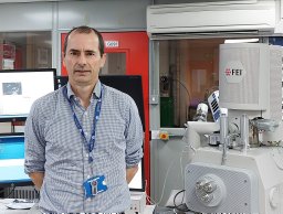 John Bridges合作论文数Space Research Centre;Dept . of Physics & Astronomy University;Dept . Earth;Planetary Sciences;Univ of Hawaii;Dept . of Geology and Geophysics;y University, Univ of Hawaii5
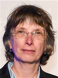 Petra Rettberg合作论文数Radiation Biology Department, Institute of Aerospace Medicine, German Aerospace Center5
 Ian Franchi合作论文数Department of Physical Sciences, The Open University5
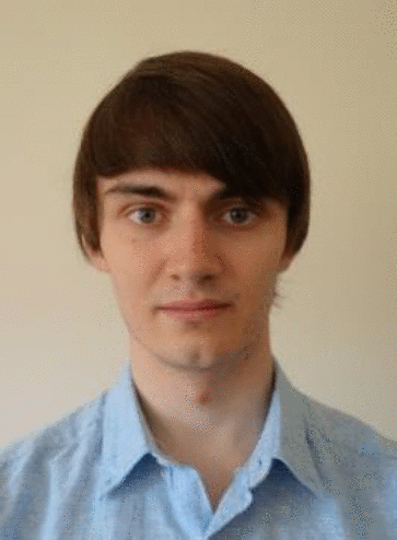 Gary Sutlieff合作论文数4
 Fabrizio Dirri合作论文数4
 Ludovic Faure合作论文数4
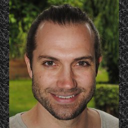 Frederic Foucher合作论文数Centre de Biophysique Moléculaire, CNRS-OSUC4
 Karen Aplin合作论文数School of Civil, Aerospace and Design Engineering, Faculty of Science and Engineering, University of Bristol4
 Andrei Sarua合作论文数School of Physics, University of Bristol4Stefan Leuko合作论文数Australian Centre for Astrobiology, Macquarie University4
 Vinciane Debaille合作论文数Laboratoire G-Time, Université Libre de Bruxelles4l duvet合作论文数3M. J. Cintala合作论文数3Helen Thomas合作论文数3
 Antonio Prezzavento合作论文数3
 Luigi Folco合作论文数Museo Nazionale dell'Antartide, Università di Siena3
 Chris Snider合作论文数School of Electrical, Electronic and Mechanical Engineering, University of Bristol3
 Yves Marrocchi合作论文数Laboratoire de Minéralogie et Cosmochimie du Muséum (LMCM),, Muséum National D'Histoire Naturelle3Matt Watson合作论文数2M. van Winnendael合作论文数2John Holt合作论文数2
 Jonathan Walsh合作论文数2Josh Lucas合作论文数2
 Ben Dryer合作论文数SPS, Open Univ2K Paul合作论文数2
 Nigel P. Bannister合作论文数Space Research Centre, University of Leicester2




