Hello again! My name is Mariko Burgin, and I am the IEEE Geoscience and Remote Sensing Society (GRSS) president. You can reach me at president@grss-ieee.org.
Increasingly more significant portions of the Greenland ice sheet are undergoing seasonal melting-refreeze cycles due to climate warming. The process begins with the arrival of warm temperatures and increased solar radiation in the spring and summer seasons generating meltwater on the ice sheet’s surface. Meltwater percolates to deeper ice layers, either refreezing within the firn, creating longer-term meltwater pockets (firn aquifers), or generating peripheral runoff. Depending on the location and climate, the refreeze duration, the depth of infiltration, and meltwater persistence are temporally and spatially complex. Multi-frequency passive microwave measurements in the 1.4 GHz to 36.5 GHz range can distinguish seasonal meltwater between the immediate surface and the deeper firn layers, as demonstrated at experiment sites on the Greenland ice sheet. Here we explored the multi-frequency melt response at the pan-Greenland scale. We employed 1.4 GHz brightness temperature (TB) measurements from the NASA Soil Moisture Active Passive (SMAP) satellite and 6.9, 10.7, 18.9, and 36.5 GHz TB measurements from the JAXA Global Change Observation Mission-Water Shizuku (GCOM-W) satellite. The results show that the frequency-dependent response was consistent across the ice sheet. The multi-frequency melt indications match with lasting seasonal subsurface meltwater with delayed refreezing compared to the surface. These results suggest persistent seasonal subsurface meltwater occurrences that are spatially and temporally significant but concealed from the high-frequency observations. Similar to the surface melt with significant interannual variations, the results show that the subsurface meltwater cycle exhibits substantial spatial and temporal variations from year to year.
Provides society information that may include news, reviews or technical notes that should be of interest to practitioners and researchers.
Increasingly larger portions of the Greenland ice sheet are undergoing seasonal melting-refreeze cycles due to global climate warming. The cycle begins with the arrival of high temperatures and increased solar radiation in the spring and summer seasons generating meltwater on the ice sheet's surface. Meltwater percolates to deeper ice layers, either refreezing within the firn, creating longer-term meltwater pockets (firn aquifers), or generating peripheral runoff. Depending on the location and climate, the refreeze duration, the depth of infiltration, and meltwater persistence are temporally and spatially complex. Our recent study showed that multi-frequency passive microwave measurements in the 1.4 GHz to 36.5 GHz range effectively distinguished seasonal meltwater between the immediate surface and deeper firn layers at an experiment site in the accumulation zone of the southwestern Greenland ice sheet. Here, we further explored the vertically and horizontally polarized multi-frequency melt response at the pan-Greenland scale. We employed 1.4 GHz brightness temperature (TB) measurements from the NASA Soil Moisture Active Passive (SMAP) satellite and 6.9, 10.7, 18.9, and 36.5 GHz TB measurements from the JAXA Global Change Observation Mission-Water Shizuku (GCOM-W) satellite. The results show that the frequency-dependent response was consistent across the ice sheet. The multi-frequency melt indications match with lasting seasonal subsurface meltwater with delayed refreezing compared to the surface. These results suggest persistent seasonal subsurface meltwater occurrences that are spatially and temporally significant but concealed from the high-frequency observations. Retrieving the meltwater evolution in snow and firn presents a complex problem; this work represents an initial step toward developing an ice-sheet-wide algorithm for more comprehensive retrieval of the meltwater profile.
For understanding englacial hydrology and its impact on ice sheet mass balance, observations of the liquid water content (LWC) within the ice sheets are needed. Earlier studies have shown the complementary nature of multi-frequency microwave radiometer measurements to detect subsurface LWC distribution in addition to surface LWC, which is critical for understanding the seasonal melt dynamics of ice sheets. In this study, we used 1.4 GHz brightness temperature (TB) measurements from the NASA Soil Moisture Active Passive (SMAP) satellite, and 6.9, 10.7, 18.9, and 36.5 GHz TB measurements from the JAXA Global Change Observation Mission-Water Shizuku (GCOM-W) satellite to investigate the multi-frequency response at pan-Greenland scale. The melt indications derived at different frequencies show trends consistent with persistent seasonal subsurface melt water and delayed subsurface refreezing of the seasonal melt water. The result suggests that the seasonal subsurface persistent melt water occurrences that are not captured by the high-frequency retrievals are both temporally and spatially very significant.
For understanding englacial hydrology and its impact on ice sheet mass balance, observations of the liquid water content (LWC) within the ice sheets are needed. We combined 1.4–10.7 GHz passive microwave measurements with traditional 18.7–36.5 GHz measurements to detect subsurface LWC. In situ measurements from the DYE‐2 experiment site in Greenland and a modeled LWC at this site were used to calibrate and validate the method. Our analysis showed sensitivity of the lower microwave frequencies to LWC in surface and subsurface layers down to at least 2 m, enabling detection of seasonal subsurface LWC and its refreezing. A simplified retrieval detected a delayed refreezing of subsurface LWC following surface freezing, while also capturing total seasonal meltwater production. These advancements open the door to detection of subsurface meltwater and refreezing twice a day at pan‐Greenland scale, thereby enabling improved estimates of ice sheet contributions to global sea level rise.
Soil moisture is of great importance to disciplines such as agriculture, hydrology and meteorology. Over the past three decades, passive microwave remote sensing has been demonstrated as a promising tool for global soil moisture estimation and several missions have been launched over the past years. This study focuses on the parametrization of the tau-omega model at L-, C- and X-band for the Yanco site in New South Wales, Australia, and compares the resulting forward-simulated brightness temperatures with two missions: NASA's Soil Moisture Active Passive (SMAP) mission and JAXA's Advanced Microwave Scanning Radiometer 2 (AMSR2) onboard the GCOM-W mission. Preliminary comparison of SMAP and AMSR2 brightness temperatures and forward-simulated brightness temperatures at the Yanco site showed a generally good agreement and higher correlation for the vertical polarization. This is consistent with other studies analyzing the SMAP soil moisture products. Simultaneous calibration of the vegetation parameter b and roughness parameter h was also performed for the L-, C- and X-band data sets, respectively, at both horizontal and vertical polarizations.
The subsurface of Mars has the potential to harbor existing deposits of liquid water, which are of great interest both scientifically (in the search for life) and as resources for future astronauts living on the red planet. However, the depth to a potential subsurface aquifer may be kilometers deep, which is well beyond what current surface or orbital approaches can sur-vey while also confirming the unique signature for liquid water. Inspired by critical technology for exploring deep aquifers on Earth, we are developing the Transient H2O Reconnaissance (TH 2 OR) instrument at NASA's Jet Propulsion Laboratory (JPL). TH2OR operates on the principle of transient electro-magnetics (TEM), which leverages induction and electromotive force to induce a current in a subsurface water body using a loop-shaped antenna that provides both transmit and receive functions when placed on the surface. On Mars, TEM may be even more effective given the relative dryness of the subsurface compared to a more conductive, saline, liquid, water body on Earth. However, to probe deep within the subsurface (below 5 km) a large enclosed antenna is needed - specifically, a 100-m diameter effective loop or a shape with roughly equivalent area that can transmit at low frequencies (kHz-Hz). The deployment of a large-scale structure on the surface is complicated by the fact that the transmit wire must be both lightweight and robust to contact with the surface. Further, TH2OR may be delivered to the surface by a non-mobile vehicle, so it is desired that the deployment can be activated from a static location. This paper provides an overview of the deployment trade study, focusing on our current, favored approach, using a projectile wire launcher. Building on past approaches in the literature, we have developed and fielded an Earth-based, gas-projectile prototype for launching a triangle-shaped antenna onto analogue terrain. Our results compare simulated launch performance to actual field tests conducted under Earth gravity and pressure conditions. We discuss how Earth performance maps to a prospective Mars deployment under reduced gravity and pressure. We also pro-vide lessons learned and next steps towards the development of an integrated TH 2 OR instrument for finding water on Mars.
Abstract The National Aeronautics and Space Administration (NASA) and the European Space Agency (ESA) are studying how samples might be brought back to Earth from Mars safely. Backward planetary protection is key in this complex endeavour, as it is required to prevent potential adverse effects from returning materials to Earth's biosphere. As the question of whether or not life exists on Mars today or whether it ever did in the past is still unanswered, the effort to return samples from Mars is expected to be categorized as a ‘Restricted Earth Return’ mission, for which NASA policy requires the containment of any unsterilized material returned to Earth. NASA is investigating several solutions to contain Mars samples and sterilize any uncontained Martian particles. This effort has significant implications for both NASA's scientific mission, and the Earth's environment; and so special care and vigilance are needed in planning and execution in order to assure acceptance of safety to Earth's biosphere. To generate a technically acceptable sterilization process across a wide array of scientific and other stakeholders, on 30–31 January 2019, 10–11 June 2019 and 19–20 February 2020, NASA informally convened a Sterilization Working Group (SWG) composed of experts from industry, academia and government to assess methods for sterilization and inactivation, to identify future work needed to verify these methods against biological challenges, and to determine their feasibility for implementation on robotic spacecraft in deep space. The goals of the SWG were: (1) Understand what it means to sterilize and/or inactivate Martian materials and how that understanding can be applied to the Mars Sample Return (MSR) mission. (2) Assess methods for sterilization and inactivation, and identify future work needed to verify these methods. (3) Provide an effective plan for communicating with other agencies and the public. This paper provides a summary of the discussions and conclusions of the SWG over these three workshops. It reflects a consensus position based on qualitative discussion of how agencies might approach the problem of sterilization of Mars material. The SWG reached a consensus that sterilization options can be considered on the basis of biology as we know it, and that sterilization modalities that are effective on terrestrial materials and organisms should be part of the MSR planetary protection strategy. Conclusions pointed to several industry standards for sterilization to include heat, chemical, UV radiation and low-heat plasma. Technical trade-offs for each sterilization modality were discussed while simultaneously considering the engineering challenges and limitations for spaceflight. Future work includes more in-depth discussions on technical trade-offs of sterilization modalities, identifying and testing Earth analogue challenge organisms and proteinaceous molecules against chosen modalities, and executing collaborative agreements between NASA and external working group partners to help close data gaps, and to establish strong, scientifically grounded sterilization and inactivation standards for MSR.
NASA Jet Propulsion Laboratory's (JPL's) Architecture Team (A-Team) has nearly a decade of experience in maturing early formulation mission and technology concepts by combining innovative collaborative engineering methods with cutting-edge subject matter expertise and advanced analysis tools in an in-person environment. When COVID-19 forced JPL's workforce to work remotely in March 2020, A-Team had to quickly pivot from an in-person collaborative environment to a remote working environment. Through introspection, careful planning, and considerable practice, A-Team was able to develop new operating procedures to effectively continue early formulation studies in a virtual environment. A-Team has held over 57 remote studies in the 10 months since the start of mandatory telework at JPL in March 2020. In the remote setting, A-Team conducts studies in half-day sessions with clients and subject matter experts (SMEs) via videoconferencing, shared computer screens, and digital collaborative tools. The key lesson is that increased staffing and planning is needed to prepare and successfully run remote A-Team studies. Remote A-Team studies require careful selection of the appropriate tools for security, accessibility, and usability within the NASA/JPL environment. Knowledge capture methods and templates need to be thought out and agreed upon in advance as there is less room for improvising in a remote format. Various communication channels have to be monitored to allow for team coordination while maintaining fruitful participant engagement during a session. In addition, technical backup for all roles within the A-Team have to be identified to allow the study to continue even if a team member's connectivity is temporarily interrupted. Finally, careful thought has to be put into methods and processes to create a collaborative environment in a virtual space such that a group of experts who are only connected via the internet can experience the creative spark and flow of a great collaborative and innovative study.
Lead Team: Vlada Stamenkovic (Jet Propulsion Laboratory, California Institute of Technology), Kennda Lynch (LPI/USRA), Penelope Boston (NASA Ames), and Jesse Tarnas (Brown University).
Charles D. Edwards (Jet Propulsion Laboratory, California Institute of Technology). Co-Authors: 1. Vlada Stamenkovic Jet Propulsion Laboratory, California Institute of Technology; 2. Penelope Boston NASA Ames; 3. Kennda Lynch LPI/USRA … et al.
Presents information on the IEEE M2GARSS conference.
Moving into 2020 marks a number of milestones (if only based on its simplified numerology). The beginning of a new year and a new decade is always a good opportunity for retrospection, especially when progress has been made and is underway. The year 2019 marked both the last year that the IEEE Geoscience and Remote Sensing Society (GRSS) Women in GRSS (WinGRSS) would be a committee on its own and the launch of the Inspire, Develop, Empower, Advance (IDEA) Committee (http://www.grss-ieee.org/community/idea/). WinGRSS has not gone away. Rather, it is now part of IDEA, which represents a broader and stronger mission of diversity and inclusion within the GRSS.
The Airborne Microwave Observatory of Subcanopy and Subsurface (AirMOSS) P-band synthetic aperture radar (SAR) was flown more than 1200 h from August 2012 to September 2015, covering regions of 2500 km2 spread over nine major biomes in North America. The flights, as a part of the NASA AirMOSS Earth Venture Suborbital 1 (EVS-1) mission, collected radar data used to map root-zone soil moisture (RZSM) at 3-arcsec resolution. We previously reported the baseline retrieval algorithm and demonstrated its performance for a semiarid shrubland (Walnut Gulch, AZ, USA); we represented the RZSM profile as a continuous quadratic function and solved a radar scattering nonlinear optimization problem to obtain the unknown polynomial coefficients. In this article, we expand the retrievals to other AirMOSS sites that, in addition to the semiarid shrubland, include grassland and crops (MOISST, OK, USA), woody savanna (Tonzi Ranch, CA, USA), temperate conifer forest (Metolius, OR, USA), and boreal forest (Saskatchewan, Canada). Due to a wide range of land covers, soil types, and soil moisture regimes, we parameterize the forward model and constrain the inverse algorithm for each site separately. We present the full set of retrievals for these sites, validating the results against in situ observations. Error sources and strategies to minimize their effects are discussed. The concept of sensing depth is introduced. We find that the retrieval errors are smallest for the top 25 cm of soil with a root-mean-square error (RMSE) of less than 0.05 m3/m3. The RMSE remains around 0.06 m3/m3 even for depths reaching 45 cm, which is the typical sensing depth for the sites considered. These AirMOSS RZSM products (known as Level-2/3 RZSM, or L2/3-RZSM, products) are the first of their kind in that it is the first time RZSM has been retrieved directly from remote sensing observation.
 Mahta Moghaddam合作论文数Microwave Systems, Sensors, and Imaging Lab, Ming Hsieh Department of Electrical Engineering, University of Southern California22
 Andreas Colliander合作论文数NASA Jet Propulsion Laboratory, California Institute of Technology22
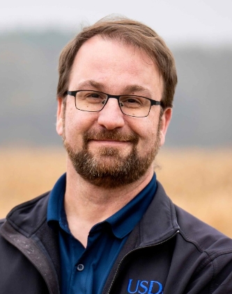 Michael H Cosh合作论文数Hydrology and Remote Sensing Laboratory, Beltsville Agricultural Research Center, Agricultural Research Service, U.S. Department of Agriculture13
 Eni G. Njoku合作论文数Jet Propulsion Laboratory10
 Rajat Bindlish合作论文数Hydrol & Remote Sensing Lab, USDA ARS10
 Alireza Tabatabaeenejad合作论文数University of Michigan;Department of Electrical Engineering and Computer Science;Radiation Laboratory;Radiation Laboratory, University of Michigan10
 Dara Entekhabi合作论文数Department of Civil and Environmental Engineering, School of Engineering, Massachusetts Institute of Technology;Department of Earth, Atmospheric, & Planetary Sciences, School of Science, Massachusetts Institute of Technology9
 Jeffrey Walker合作论文数Department of Civil Engineering, Faculty of Engineering, Monash University9
 Aaron Berg合作论文数Department of Geography, Environment & Geomatics, College of Social and Applied Human Sciences, University of Guelph;Hydrology and Remote Sensing Lab, University of Guelph9
 Todd G. Caldwell合作论文数USGS Nevada Water Science Center9
 Nathan Barba合作论文数8
 Simon Yueh合作论文数Jet Propulsion Laboratory, California Institute of Technology8
 Stamenković Vlada合作论文数Space Biology Institute, ETHZ7
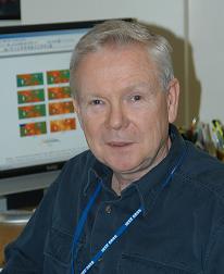 Thomas Jackson合作论文数Hydrology and Remote Sensing Laboratory, Beltsville Agricultural Research Center, Agricultural Research Service, United States Department of Agriculture7
 Wade Crow合作论文数USDA-ARS Hydrology and Remote Sensing Laboratory7
 Jose Martinez-Fernandez合作论文数Department of Geography, University of Salamanca7
 Robert E. Grimm合作论文数Southwest Research Institute7
 Raju Manthena合作论文数6
 Kalind C. Carpenter合作论文数NASA Jet Propulsion Laboratory, Pasadena CA, USA6
 Shawn Carlisle Kefauver合作论文数Department of Land, Air and Water Resources, University of California, Davis6
 Brian H. Wilcox合作论文数Jet Propulsion Laboratory6
 M. Thibeault合作论文数5
 D. Arumugam合作论文数5
 Fan Chen合作论文数5Mark S. Seyfried (Mark Seyfried)合作论文数Northwest Watershed Research Center, United States Department of Agriculture-Agricultural Research Service5
 Xueyang Duan合作论文数5
 Peggy O'Neill合作论文数Hydrological Sciences Laboratory, Goddard Space Flight Center, NASA;Jet Propulsion Laboratory, NASA5
 Emmanuel Philippe Dinnat合作论文数5Heather McNairn合作论文数4Keely Roth合作论文数4Seth Krieger合作论文数4
 Ryan Woolley合作论文数4
 Mohammad Mousavi合作论文数Jet Propulsion Laboratory, California Institute of Technology4Ying Gao合作论文数4
 J. Z. Miller合作论文数4
 Rashmi Shah合作论文数Sch. of Aeronaut. & Astronaut., Purdue Univ.;c;Sch. of Aeronaut. & Astronaut., Purdue Univ.4
 Xiaoling Wu合作论文数Department of Civil Engineering, Faculty of Engineering, Monash University4
 Chunsik Chae合作论文数4
 Zhongbo Su (Bob)合作论文数Department of Water Resources, Faculty of Geo-Information and Earth Observation, University of Twente/ITC Netherlands4
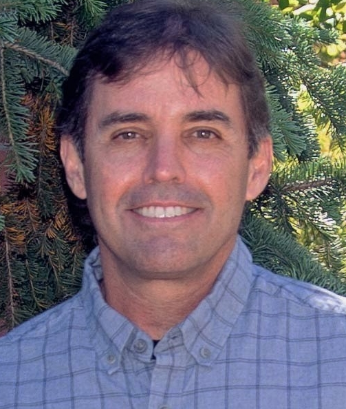 John S. Kimball合作论文数Department of Ecosystem and Conservation Sciences, WA Franke College of Forestry and Conservation, University of Montana4
 Jeffrey R. Piepmeier合作论文数Instrument Systems and Technology Division, NASA’s Goddard Space Flight Center4
 Jakob J. van Zyl合作论文数Jet Propulsion Laboratory, California Institute of Technology4
 Patrick J. Starks合作论文数4
 Yuriy Goykhman合作论文数4
 Charles D. Edwards合作论文数Jet Propulsion Laboratory, California Institute of Technology4
 Ana-Catalina Plesa合作论文数4H McNairn合作论文数4
 Tracy L. Rowlandson合作论文数Department of Agronomy;Iowa State University;of Science and Technology;Department of Agronomy, Iowa State University4
 Yann Kerr合作论文数Center for Hydrology - Hydrological Observatory, HOBE;CESBIO, CNES, CNRS, IRD, INRAE4




