Chondrites are composed of formerly partially molten material, known as chondrules, surrounded by fine-grained matrix. They date from the earliest times in Solar System history. However, their role in the formation of the planets is uncertain because, in part, it is not clear how they were produced. Here, we show a robust pathway for forming meteorite-producing asteroids that contain chondrules through embryo-embryo collisions during the late stages of terrestrial planet formation. Melted material from these impacts cool into chondrules and mix with unmelted material in embryo-centric disks that formed from the ejecta. This material accretes into numerous asteroid-sized satellites. These objects are later ejected onto heliocentric orbits because of gravitational encounters with other embryos, thereby becoming the parent bodies of chondrites. This mechanism provides a pathway to form chondrites in Solar System history at times commensurate with measured chondrule ages, while explaining many of their physical properties.
Polygonal terrain results from thermal contraction, is commonly found in periglacial environments, and serves as a valuable proxy for interpreting subsurface ice distribution and climate history on Earth and Mars. In this study, we investigate the morphology of polygons in Beacon Valley, Antarctica, to assess the relationship between polygon size and ice table depth and to evaluate whether existing models for ice-cemented soils apply to polygons overlying massive ice. Using high-resolution remote sensing imagery and lidar datasets, we mapped over 1500 polygons and compared their sizes to measured ice table depth. Statistical analyses indicate that polygons formed over massive ice are generally smaller than those formed on ice-cemented soils. This observation contradicts current models, which predict larger polygons on massive ice due to a reduction in stress through viscous flow. We propose that sediment within the glacial ice inhibits viscous deformation and lowers tensile strength, thereby reducing the size of the observed polygons. Our statistical analysis also reveals two distinct subpopulations of polygons, for both polygons on ice-cemented soil and massive ice, which we interpret as evidence of polygon time evolution. This observation is supported by a crack propagation model that illustrates how polygon size decreases with time. Our findings challenge prevailing models of polygon formation and evolution and offer a revised conceptual framework with implications for interpreting subsurface ice availability on both Earth and Mars.
Ground-Penetrating Radar (GPR) is widely used for subsurface imaging to support investigations in geology, hydrology, agriculture, engineering, mineral resources, unexploded ordnance, and archaeology. These diverse applications require investigation depths spanning several centimeters to kilometers, with corresponding frequencies of several GHz to a few MHz, respectively. Early GPR development began in the mid-20th century, but the first major application was the Surface Electrical Properties (SEP) experiment on the Apollo 17 lunar landing. We review key previous work in lunar GPR and discuss several approaches to future exploration.
Martian layered ejecta craters are theorized to form by tapping into water ice. The inference that some equatorial layered ejecta craters are Amazonian indicates ice has persisted in the tropics. However, detailed spatial and temporal distribution and evolution of this ice remains unknown; which is critical to constraining Mars’ global water cycle and climate change over eons. Here we estimate absolute model formation ages for layered and radial (ballistic) ejecta craters to constrain the spatial and temporal distribution of equatorial ice. The assumption is radial ejecta form where volatiles are not present in significant quantities. Ages are derived from the density of smaller craters superposed on the ejecta blankets. We examine 73 craters in a 30° x 30° area centered at 15ºS, 355ºE, with 44 layered and 29 radial ejecta. Analysis suggests an increasing proportion of layered ejecta craters with increasing diameter. This trend is amplified when considering younger (<3.4 Ga) craters only andwould be in agreement with deeper tropical subsurface ice and a receding ice table. Conversely, it could indicate “armoring” preserves layered over radial ejecta. Layered and radial ejecta craters are mixed over distances comparable to their diameters, which represents an unreasonably short length scale for ground-ice emplacement. This supports intermittent low-latitude surface ice—from excursions to high obliquity—could be responsible. The combination of increasing proportion of layered ejecta with crater size and random spatial distribution may suggest a hybrid model in which buried ice and intermittent, but extensive, tropical glaciers both contribute to layered ejecta crater formation.
Orbital debris impacts on spacecraft are an emerging threat to space missions due to the exponential increase in the number of satellites orbiting the Earth. Debris characteristics (size, material, velocity, etc.) are not well known for the size range of 10 mm or less that is undetectable using Earth telescopes or radar observation. The objective of this research was to determine wether a concept designed to detect impact of particles in the similar to 1 to 5 mm range, find the location of the impact, and characterize the impacting projectile (velocity, size, angle, density), is feasible. The paper describes the design, fabrication, and tests performed on "witness plates" (the concept) made of two parallel layers of additively manufactured aluminum and instrumented with sixteen gages, eight on each layer. Laboratory experiments have shown that the waves can be recorded and properly interpreted to find location of impact, sound speed in the plate, and to estimate impact velocity. It was shown analytically that the amplitude of the first strain wave that propagates from the impact point is expected to decay as 1/r. This was observed as well in the signals recorded in the experiments. CTH computations were performed during the pre-test design phase and the post-test analysis phase. In fact, the numerical simulations have been key and pervasive in this research effort as they provided invaluable insight for the initial design and the correct interpretation of signal anomalies seen during the tests. Additionally, the computations confirmed the 1/r law derived analytically, i.e. that the assumptions for the derivation were justified. The main conclusions of the research are that, for a normal impact, the 1/r law for front gages can be easily used to determine the diameter of the impactor. It is possible that the back gages could be used to determine the density of the impactor as well. Finally, it was shown that oblique impacts generate an expected assymetry in the signals recorded. Though this aspect should be investigated further, the assymetry is probably uniquely related to the impact angle, which could provide the angle information.
Constraints on the interior of the Moon have been derived from its inductive response, principally as measured by the magnetic transfer function (TF) between the distantly orbiting Explorer 35 satellite and the Apollo 12 surface station. The most successful prior studies used a dataset spanning 0.01-1 mHz, so the lunar response could be modeled as a simple dipole. However, earlier efforts also produced transfer functions up to 40 mHz. The smaller electromagnetic skin depth at higher frequency would better resolve the uppermost mantle-where key information about primitive lunar evolution may still be preserved-but requires a multipole treatment. I compute new profiles of electrical conductivity vs depth using both low- and high-frequency ranges of published Apollo-Explorer TFs. Using the low-frequency data, I derive temperature profiles at depths >400 km (<1 mHz) consistent with conductive heat loss and expectations of the iron (and possibly water) content of the mantle. The near-constant iron fraction (Mg# 81 +/- 10) could imply efficient mixing due to now-defunct convection. Alternatively, incomplete overturn of gravitationally unstable magma-ocean cumulates could have left a heterogeneous distribution of minerals at hundred-km scales that are not resolved by electromagnetic sounding. A third explanation is that the electromagnetically probed region may be the initial equilibrium crystallization in a mantle that did not buoyantly overturn. In contrast, the high-frequency data produced higher conductivities than expected, requiring unrealistically low Mg# or high water content. Either the published transfer functions >> 1 mHz are incorrect, or the TF multipole method at the Moon is unreliable. Future electromagnetic sounding using the magnetotelluric method can operate up to 100s Hz and is largely insensitive to multipole effects, resolving structure to 100 km or less.
The magnetometer of the InSight mission operated on the Martian surface from November 2018 until May 2022. Previously, satellites have provided information on the Martian magnetic field environment from orbit; however, the degree to which external fields penetrate to and interact with the surface could not be studied prior to the InSight landing. Here, we present an overview of the complete surface magnetic field data from InSight sols 14 to 1241 that display different external magnetic field phenomena, transient and periodic. Periodic observations range from short period waves (100–1000s of seconds), diurnal variations, ∼26 sol Carrington rotations, to seasonal fluctuations. Transient events are observed in response to space weather and dust movement. We find that ionospheric variations are the dominant contribution as seen from the surface, while contributions from the undisturbed interplanetary magnetic field are more subtle. We discuss limitations associated with a single point measurement and opportunities that future missions could enable. Including magnetometers on future missions at a variety of locations for long‐duration continuous observations will be of great value in understanding a range of external field phenomena and will enable further investigations in different crustal magnetic field settings.
Early in its evolution, the Moon underwent a magma ocean phase leading to its differentiation into a feldspathic crust, cumulate mantle, and iron core. However, far from the simplest view of a uniform plagioclase flotation crust, the present-day crust of the Moon varies greatly in thickness, composition, and physical properties. Recent significant improvements in both data and analysis techniques have yielded fundamental advances in our understanding of the structure and evolution of the lunar interior. The structure of the crust is revealed by gravity, topography, magnetics, seismic, radar, electromagnetic, and VNIR remote sensing data. The mantle structure of the Moon is revealed primarily by seismic and laser ranging data. Together, this data paints a picture of a Moon that is heterogeneous in all directions and across all scales, whose structure is a result of its unique formation, differentiation, and subsequent evolution. This brief review highlights a small number of recent advances in our understanding of lunar structure.
Operating spacecraft in Earth orbit is an increasingly important element in nearly all business segments of the U.S. and most world economies. It is essential for national defense, communications, and remote monitoring of the Earth and the Universe around us. As our dependency on these assets exponentially grows, many Earth orbits are becoming more populated. Commercial and government entities are deploying proliferated ‘mega-constellations” of hundreds or even thousands of spacecraft. The number of spacecraft, especially in low Earth orbit, has resulted in increased risks from these vehicle's orbital debris or collisions. The unknown, and potentially significant risks posed by space debris are a major concern to both commercial and government spacecraft operators. While agencies track these spacecraft and the larger pieces of debris on a regular basis, it is limited by both the size of the debris and the quantity of objects. Objects <5cm are difficult, if not impossible, to track from Earth. The small size and large volume of such debris requires statistical risk characterization with respect to orbit, rather than tracking the individual objects. Accurate modeling requires accurate in-situ data sampling. The distribution of space debris is anticipated to increase exponentially over time, thereby requiring persistent surveillance to understand and update the magnitude of the danger. Technologies that provide in-situ characterization of the Micrometeoroid and Orbital Debris (MMOD) environment are not currently available. Southwest Research Institute® (SwRI®) is developing technology to detect, localize, and characterize MMOD impacts on spacecraft. The technology employs an array of sensitive sensors mounted to spacecraft structures. On-board processing use signals from these sensors to detect and characterize the impacts. The resulting data supports estimating the size and frequency distribution of impacts in the spacecraft's orbit, monitoring changes in this distribution over time, and even enable a rapid mitigation response to protect the vehicle or alert other vehicles within the constellation. Reliably detect and charactering spacecraft impacts allows the rejection of a vast majority of nominal spacecraft structural “noise,” in order to reduce the computational burden and data demands. The onboard processor derives information about the size of a detected impactor by analyzing the magnitude and spectral content of impact data. It also monitors differences in the arrival time of signals at the spatially distributed sensors, which provide the location of the impact and its velocity. This paper describes SwRI's ongoing efforts to develop the MMOD detection and characterization capability. It addresses the electronics design for sampling and processing sensor signals; developing processing algorithms to detect, localize, and characterize impacts; design considerations for distribution of the sensor network; testing and simulations to develop training data; and system level design considerations for applying this technology.
Abstract SwRI is developing a technology that will enable detection and characterization of micrometeoroid orbital debris (MMOD) while on-orbit. The technology includes an instrumented aluminum panel that can be installed on a satellite and, with the appropriate sensor and software suite, is able to detect and characterize impacts during the mission. The stress waves produced by the impact on the panel will be selected on-board by the software, treated, and sent to the ground for further analysis. The selection process will be directed by an algorithm that will be developed based on the experimental campaign and stress wave theory. CTH computer simulations in 2D and 3D were performed to study the viability and design the technology. Fully instrumented witness panels are being tested (August 2022) under hypervelocity impact using SwRI’s 0.17 in caliber two-stage light-gas gun. The small-scale panels were placed in the target tank to be impacted multiple times at velocities up to 6 km/s by a 3-mm al6061-T6 sphere. As expected, the strain magnitude depends on the distance to the impact point and, in general, decreases with distance.
The Lunar Geophysical Network (LGN) mission is proposed to land on the Moon in 2030 and deploy packages at four locations to enable geophysical measurements for 6–10 yr. Returning to the lunar surface with a long-lived geophysical network is a key next step to advance lunar and planetary science. LGN will greatly expand our primarily Apollo-based knowledge of the deep lunar interior by identifying and characterizing mantle melt layers, as well as core size and state. To meet the mission objectives, the instrument suite provides complementary seismic, geodetic, heat flow, and electromagnetic observations. We discuss the network landing site requirements and provide example sites that meet these requirements. Landing site selection will continue to be optimized throughout the formulation of this mission. Possible sites include the P-5 region within the Procellarum KREEP Terrane (PKT; (lat: 15°; long: −35°), Schickard Basin (lat: −44.°3; long: −55.°1), Crisium Basin (lat: 18.°5; long: 61.°8), and the farside Korolev Basin (lat: −2.°4; long: −159.°3). Network optimization considers the best locations to observe seismic core phases, e.g., ScS and PKP. Ray path density and proximity to young fault scarps are also analyzed to provide increased opportunities for seismic observations. Geodetic constraints require the network to have at least three nearside stations at maximum limb distances. Heat flow and electromagnetic measurements should be obtained away from terrane boundaries and from magnetic anomalies at locations representative of global trends. An in-depth case study is provided for Crisium. In addition, we discuss the consequences for scientific return of less than optimal locations or number of stations.
Dwarf planet Ceres is a compelling target for future exploration because it hosts at least regional brine reservoirs and potentially ongoing geological activity. As the most water-rich body in the inner solar system, it is a representative of a population of planetesimals that were likely a significant source of volatiles and organics to the inner solar system. Here we describe possible medium-class (around $1 billion) mission concepts that would determine both Ceres’ origin and its current habitability potential. Habitability is addressed through a combination of geological, geophysical, and compositional investigations by (i) searching for evidence from orbit of past and ongoing geological activity near landforms interpreted as brine-driven volcanic structures and (ii) probing the brine distribution below one of these regions with electromagnetic sounding (in situ). Two approaches were considered for compositional measurements, which address both habitability and origins: (1) in situ exploration at two sites and (2) sample return from a single site. Both concepts targeted material at Occator crater, which is one of the youngest features on Ceres (∼20 Ma) and a site rich in evaporites evolved from recently erupted brine sourced from a region >35 km deep. We conclude that a sample return architecture from these young evaporite deposits offers greater science return by enabling high-resolution analysis of organic matter (trapped in salt minerals) and isotopes of refractory elements for a similar cost and less science risk than in situ analyses. This manuscript describes the six science objectives and the two implementation concepts considered to achieve those objectives.
The subsurface of Mars has the potential to harbor existing deposits of liquid water, which are of great interest both scientifically (in the search for life) and as resources for future astronauts living on the red planet. However, the depth to a potential subsurface aquifer may be kilometers deep, which is well beyond what current surface or orbital approaches can sur-vey while also confirming the unique signature for liquid water. Inspired by critical technology for exploring deep aquifers on Earth, we are developing the Transient H2O Reconnaissance (TH 2 OR) instrument at NASA's Jet Propulsion Laboratory (JPL). TH2OR operates on the principle of transient electro-magnetics (TEM), which leverages induction and electromotive force to induce a current in a subsurface water body using a loop-shaped antenna that provides both transmit and receive functions when placed on the surface. On Mars, TEM may be even more effective given the relative dryness of the subsurface compared to a more conductive, saline, liquid, water body on Earth. However, to probe deep within the subsurface (below 5 km) a large enclosed antenna is needed - specifically, a 100-m diameter effective loop or a shape with roughly equivalent area that can transmit at low frequencies (kHz-Hz). The deployment of a large-scale structure on the surface is complicated by the fact that the transmit wire must be both lightweight and robust to contact with the surface. Further, TH2OR may be delivered to the surface by a non-mobile vehicle, so it is desired that the deployment can be activated from a static location. This paper provides an overview of the deployment trade study, focusing on our current, favored approach, using a projectile wire launcher. Building on past approaches in the literature, we have developed and fielded an Earth-based, gas-projectile prototype for launching a triangle-shaped antenna onto analogue terrain. Our results compare simulated launch performance to actual field tests conducted under Earth gravity and pressure conditions. We discuss how Earth performance maps to a prospective Mars deployment under reduced gravity and pressure. We also pro-vide lessons learned and next steps towards the development of an integrated TH 2 OR instrument for finding water on Mars.
Electromagnetic sounding of Ceres can be accomplished using the solar wind as a source. The depths to a deep global brine or mud layer and shallow briny intrusions can be assessed simultaneously.
One objective of a lander mission to Jupiter's icy moon Europa is to detect liquid water within 30 km as well as characterizing the subsurface ocean. In order to satisfy this objective, water within the ice shell must also be identified. Inductive electromagnetic (EM) methods are optimal for water detection on Europa because even a small fraction of dissolved salts will make water orders of magnitude more electrically conductive than the ice shell. Compared to induction studies by the Galileo spacecraft, measurements of higher-frequency ambient EM fields are necessary to resolve the shallower depths of intrashell water. Although these fields have been mostly characterized by prior missions, their unknown source structures and plasma properties do not allow EM sounding using a single surface magnetometer or the orbit-to-surface magnetic transfer function, respectively. Instead, broadband EM sounding can be accomplished from a single surface station using the magnetotelluric (MT) method, which measures horizontal electric fields as well as the three-component magnetic field. We have developed a prototype Europa Magnetotelluric Sounder (EMS) to meet the measurement requirements in the relevant thermal, vacuum, and radiation environment. EMS comprises central electronics, a fluxgate magnetometer on a mast, and three ballistically deployed electrodes to measure differences in surface electric potential. In this paper, we describe EMS development and testing as well as providing supporting information on the concept of operations and calculations on water detectability. EMS can uniquely determine the occurrence of intrashell water on Europa, providing important constraints on habitability.
Recurring slope lineae (RSL) are dark narrow features that incrementally lengthen and fade at least once each Mars year. Their origin has remained enigmatic. We report quantitative modeling of three hypotheses related to triggering of over-steepened sand caches that result in dry-grain flow. First, sand could be supplied by either wind blowing upslope from within the crater or by wind blowing into the crater from the outside. Without cementation, grain flows should be directly correlated with temporal variations in potential sediment transport. Second, deliquesced perchlorate salts could increase soil cohesion; with the loss of water this soil cohesion may be reduced. The timing of accumulation versus release can be distinct from each other. Third, seasonal water frost could act in a similar cementation capacity. We assess these hypotheses using atmospheric modeling to determine wind speed, wind direction, temperature, and relative humidity at three craters (Rauna, Krupac, and Palikir) that host confirmed RSL and that cover a large latitudinal range. Overall, we find no convincing support for any of these hypotheses. Deliquescence is predicted to occur only at Rauna crater and its formation does not correlate with RSL activity. The occurrence of frost is inconsistently correlated with RSL activity among the three craters. Upslope winds at Palikir crater transport a significant amount of sediment only when RSL are active. However, the largest sediment flux into the crater is also during periods of RSL activity, thus supporting both internal and external contributions. Sediment transport into Krupac crater to 5- and SW-facing slopes is also maximized when RSL are active, but there is no correlated upslope transport. This supports the hypothesis that RSL formation is dominated by external sediment supply alone. On the other hand, W- and NW-facing Krupac and all RSL at Rauna show no correlations with any directional sediment transport. Nonetheless, we suggest that the mixed success of the external sediment transport model is still quantitatively better than any competitor (including water), and that we simply lack the model and data resolution to treat RSL at the required meter scales. In all of the aeolian models, favorably-directed potential sediment flux greatly exceeds the volume of sand that must be displaced to form RSL. We conclude that RSL may require a particular combination of favorable strong winds, local sediment traps, and a supply of sand grains that easily saltate on Mars (similar to 100 mu m in diameter).
Venus Corona and Tessera Explorer (VeCaTEx) would use an aerobot to descend repeatedly beneath the dense clouds for imaging targeted area of the surface in the near infrared to address six of the prime investigations prioritized by VEXAG. The technologies needed could be matured during the next decade.
 David E. Stillman合作论文数Department of Space Studies, Southwest Research Institute64
 Cynthia Dinwiddie合作论文数24
 Gregory Delory合作论文数UCB19
 Essam Heggy合作论文数Lunar and Planetary Institute18
 Ronald N. Mcginnis合作论文数Geosciences and Engineering Division, Southwest Research Institute® (SwRI®),16
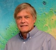 Stephen M. Clifford合作论文数Lunar and Planetary Institute12
 Philippe Lognonné合作论文数Institut de Physique du Globe de Paris, Université Paris Cité10Heidi Fuqua合作论文数9
 Harry Y. McSween合作论文数Department of Earth, Environmental, and Planetary Sciences, College of Arts and Sciences, The University of Tennessee, Knoxville9Roger J. Phillips合作论文数9
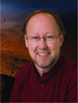 W. Bruce Banerdt合作论文数9
 Robert R. Herrick合作论文数Geophysical Institute, University of Alaska Fairbanks9
 Stamenković Vlada合作论文数Space Biology Institute, ETHZ8
 Catherine L. Johnson合作论文数Department of Earth, Ocean and Atmospheric Sciences, Faculty of Science, The University of British Columbia;Planetary Science Institute8
 Keith Harrison合作论文数Southwest Research Institute8
 Joseph A. Macgregor合作论文数Department of Earth and Space Sciences, University of Washington8
 Nathan Barba合作论文数7
 Clive R. Neal合作论文数Department of Civil and Environmental Engineering and Earth Sciences, College of Engineering, University of Notre Dame7
 Tilman Spohn合作论文数Institut für Planetenforschung, DLR7
 Mariko Sofie Burgin合作论文数7
 Raju Manthena合作论文数6
 Kalind C. Carpenter合作论文数NASA Jet Propulsion Laboratory, Pasadena CA, USA6
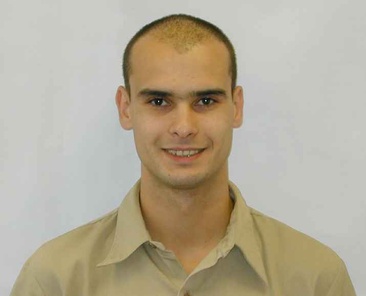 Raphaël F. Garcia合作论文数University Paul Sabatier Toulouse III6
 Sean C. Solomon合作论文数Lamont-Doherty Earth Observatory, Columbia Climate School, Columbia University6
 Kris Zacny合作论文数Honeybee Robotics Spacecraft Mechanisms Corporation6
 Matthias Grott合作论文数6Kevin Bjella合作论文数US Army;Engineer Research and Development Center;Cold Regions Research and Engineering Laboratory;Engineer Research and Development Center, US Army6
 Michelle R. Kirchoff合作论文数6
 Ana-Catalina Plesa合作论文数6
 Kevin Baines合作论文数Jet Propulsion Laboratory, California Institute of Technology;Space Science and Engineering Center, University of Wisconsin-Madison6
 Brian H. Wilcox合作论文数Jet Propulsion Laboratory6
 Sharon Kedar合作论文数5
 Scott Painter合作论文数Watershed Systems Modeling Group, Oak Ridge National Laboratory5
 James W Head合作论文数Department of Earth, Environmental and Planetary Sciences, Brown University5Donald M. Hooper合作论文数5
 James A. Cutts合作论文数5
 William M. Farrell合作论文数Solar System Exploration Division, NASA/Goddard Space Flight Center5Seth Krieger合作论文数4S. E. Smrekar合作论文数4
 Maxim de Jong合作论文数4
 Joseph Michalski合作论文数Planetary Spectroscopy and Mineralogy Laboratory, Department of Earth Sciences, The University of Hong Kong4
 D. Arumugam合作论文数4
 Sushil K. Atreya合作论文数Department of Climate and Space Sciences and Engineering, College of Engineering, University of Michigan-Ann Arbor4
 Bullock Mark A合作论文数Department of Space Studies, Southwest Research Institute4
 Mark A. Wieczorek合作论文数Institut de Physique du Globe de Paris, Centre National de la Recherche Scientifique;Université Paris Cité4
 Jeffery L. Hall合作论文数4
 Barbara Sherwood Lollar合作论文数Department of Earth Sciences, University of Toronto;Institut de Physique du Globe de Paris, Université Paris Cité;Department of Chemical Engineering and Applied Chemistry, University of Toronto4Douglas G. Currie合作论文数University of Maryland4
 M. Darby Dyar合作论文数Department of Astronomy, Mount Holyoke College4




