The challenges and the importance of preserving legacy instrumental records of earthquakes are now well-recognized (e.g., Richards & Hellweg, 2020, https://doi.org/10.1785/0220200053). Seismologists may not be aware of parallel challenges and opportunities with legacy macroseismic data for earthquakes in the United States. For much of the 20th century, macroseismic data were collected by a series of U.S. government agencies using a standard questionnaire distributed on postcards. Published summaries of postcards provide macroseismic data akin to modern Did You Feel It? questionnaire responses. In this paper we focus on the M 6.5 Fickle Hill, California earthquake, on 21 December 1954 (Hellweg et al., 2025) as a proof-of-concept, illustrating the potential of what we dub Did They Feel It? (DTFI) data to improve our understanding of significant 20th century U.S. earthquakes for which instrumental data are sparse. Legacy macroseismic data interpreted following modern conventions can potentially constrain traditional ShakeMaps at a level of detail and accuracy that in some respects rival maps for modern earthquakes. The updated ShakeMap for the 1954 Fickle Hill earthquake, also drawing from recently published media and first-person accounts, supports the location, depth, and stress drop value estimated from available instrumental data (Hellweg et al., 2025).
Many earthquakes occur along the North Coast of California in the vicinity of the Mendocino Triple Junction (MTJ), where the Pacific, Gorda, and North American (NA) plates meet, and on the adjacent plate boundaries. The MTJ marks the nexus of the Mendocino and San Andreas faults with the Cascadia subduction zone (CSZ). Historically, most large earthquakes around the MTJ have been within the offshore Gorda plate and its subducted portion beneath the NA plate. North of the MTJ, active faults mapped in the NA plate are part of the CSZ fold-and-thrust belt. Although some events have been detected in the NA plate, no large historic events have been associated with mapped surface faults. The 21 December 1954 Mw 6.5 earthquake in Humboldt County is one possible exception. Using published data from catalogs and articles, unpublished data from Berkeley's archives, and S-P times interpreted from two U.S. Coast and Geodetic Survey (USCGS) accelerometers, we determine a probability cloud for the earthquake's hypocenter using NonLinLoc. The highest probability location lies beneath Fickle Hill just east of the city of Arcata, California, at 40.87 degrees N, 124.03 degrees W, and similar to 11 km depth. Using P-wave polarities from Berkeley stations and the digitized waveforms from the accelerometers, we find that the focal mechanism most consistent with the data indicates thrust movement with strike, dip, and rake of 350 degrees, 10 degrees, and 90 degrees, respectively, at a depth of 14 km. Given the depth uncertainties of both this event and the megathrust, this implies that the earthquake most likely took place on the subduction interface rather than on the mapped faults in the Mad River fault zone that trend 322 degrees and dip to the northeast. The revisited intensity in the epicentral region also supports a location beneath Fickle Hill to the east of the city of Arcata, California.
On 22 December 2022, a destructive earthquake with a magnitude Mw 6.4 ruptured the oceanic lithosphere emplaced beneath Northern California. This event was a repeat of an earthquake that occurred 47 yr earlier, on 7 June 1975, with a magnitude of MD 5.7. Both earthquakes caused significant damage during 10–16 s of strong shaking, primarily in the town of Rio Dell, with Fortuna and Ferndale also affected. Evidence indicates that the hypocenters of these two ruinous earthquakes occurred along the same fault within the downgoing Gorda plate, with the hypocenters located on opposite ends of the slip patch determined for the 2022 event. This pattern of recurring destructive intraplate earthquakes along inherited weak zones throughout the offshore Gorda basin is likely not unique to this sequence.
Research Article| January 25, 2023 Introduction to the SRL Focus Section on the Hunga Tonga‐Hunga Ha’apai Eruption Margaret Hellweg; Margaret Hellweg * 1Berkeley Seismology Laboratory, University of California Berkeley, Berkeley, California, U.S.A. *Corresponding author: peggy@seismo.berkeley.edu Search for other works by this author on: GSW Google Scholar Stephen Arrowsmith; Stephen Arrowsmith 2Southern Methodist University, Dallas, Texas, U.S.A. https://orcid.org/0000-0002-9150-0363 Search for other works by this author on: GSW Google Scholar Hugo Delgado; Hugo Delgado 3Departamento de Vulcanologia, Instituto de Geofisica, Coyoacan, Mexico https://orcid.org/0000-0001-5263-7968 Search for other works by this author on: GSW Google Scholar James Gridley; James Gridley 4National Tsunami Warning Center, Palmer, Alaska, U.S.A. Search for other works by this author on: GSW Google Scholar Ronan Joseph Le Bras; Ronan Joseph Le Bras 5Comprehensive Test Ban Treaty Organization, Wien, Austria https://orcid.org/0000-0003-2439-6938 Search for other works by this author on: GSW Google Scholar Daniel McNamara; Daniel McNamara 6Ann Arbor, Michigan, U.S.A. Search for other works by this author on: GSW Google Scholar Steven Sherburn Steven Sherburn 7Data Science and Geohazards Monitoring Department, GNS Science, Taupo, New Zealand Search for other works by this author on: GSW Google Scholar Author and Article Information Margaret Hellweg * 1Berkeley Seismology Laboratory, University of California Berkeley, Berkeley, California, U.S.A. Stephen Arrowsmith https://orcid.org/0000-0002-9150-0363 2Southern Methodist University, Dallas, Texas, U.S.A. Hugo Delgado https://orcid.org/0000-0001-5263-7968 3Departamento de Vulcanologia, Instituto de Geofisica, Coyoacan, Mexico James Gridley 4National Tsunami Warning Center, Palmer, Alaska, U.S.A. Ronan Joseph Le Bras https://orcid.org/0000-0003-2439-6938 5Comprehensive Test Ban Treaty Organization, Wien, Austria Daniel McNamara 6Ann Arbor, Michigan, U.S.A. Steven Sherburn 7Data Science and Geohazards Monitoring Department, GNS Science, Taupo, New Zealand *Corresponding author: peggy@seismo.berkeley.edu Publisher: Seismological Society of America First Online: 25 Jan 2023 Online ISSN: 1938-2057 Print ISSN: 0895-0695 © Seismological Society of America Seismological Research Letters (2023) 94 (2A): 564–566. https://doi.org/10.1785/0220230001 Article history First Online: 25 Jan 2023 Cite View This Citation Add to Citation Manager Share Icon Share Facebook Twitter LinkedIn MailTo Tools Icon Tools Get Permissions Search Site Citation Margaret Hellweg, Stephen Arrowsmith, Hugo Delgado, James Gridley, Ronan Joseph Le Bras, Daniel McNamara, Steven Sherburn; Introduction to the SRL Focus Section on the Hunga Tonga‐Hunga Ha’apai Eruption. Seismological Research Letters 2023;; 94 (2A): 564–566. doi: https://doi.org/10.1785/0220230001 Download citation file: Ris (Zotero) Refmanager EasyBib Bookends Mendeley Papers EndNote RefWorks BibTex toolbar search Search Dropdown Menu toolbar search search input Search input auto suggest filter your search All ContentBy SocietySeismological Research Letters Search Advanced Search Similar to the Roman god Janus, natural events often have two faces. For the people in their environment, they can be disasters, sometimes with truly terrible effects. For scientists, often geophysicists who observe the interactions on the planet, they may bring exciting new measurements and insights. The Hunga Tonga‐Hunga Ha’apai (HTHH) eruption was just such an event. It was the largest underwater eruption since 1883, when the Indonesian volcano Krakatoa produced a tsunami that killed more than 20,000 people, and the pressure wave that was heard (or measured) around the world. Similar to Krakatoa, the HTHH eruption was tremendous, with... You do not have access to this content, please speak to your institutional administrator if you feel you should have access.
During 2020, the National Seismological Center (CSN) implemented an earthquake early warning system (EEWS) for northern Chile. From a seismological point of view, this area is considered to be one of the largest seismic gaps in Chile, where an Mw -9:0 earth-quake is expected in a region with a population of more than 1.4 million people. From an economical perspective, this region holds 90% of the copper mining companies in Chile, with more than 15% of the Gross National Product coming from the mining indus-try. Antofagasta Minerals funded an EEWS prototype for this region with the purpose of keeping both the population and the mining industry safe; 25 new seismic stations have been added to the CSN permanent network to develop an EEWS capable of issuing strong shaking alerts, which could potentially save lives and support critical mining operations in the region. During a 20 month period, we successfully detected, located, and calculated the magnitude of 1774 earthquakes (0-300 km depth) using ElarmS-3, an earthquake early warning algorithm from the University of California, Berkeley. The alert time, or the time between when an earthquake alert is issued and the S-wave arrival at the location, is on average-24 s, and 96% of shallow and intermediate depth earthquakes (0-150 km) with M >= 5.0 were alerted. We obtained errors of 0.52 +/- 0.43 in magnitude, 30.4 +/- 42.72 km in location, 43.5 +/- 50.0 km in depth, and 6.6 +/- 10.6 sin origin time.
The Pacific coast of the contiguous United States hosts the highest seismic risk in the country due to the intersection of high-seismic hazard and the high densities of population and infrastructure. The regional seismic networks in Washington, Oregon, Nevada, and California have operated for many years and have collected long catalogs and large amounts of seismic waveform data in a variety of formats, including digital records. These data are available for engineering purposes and research into earthquakes, other natural and man-made seismic sources, and the Earth's structure. The West Coast networks are closely coordinating as they embark on the implementation ofWest Coast ShakeAlert, an earthquake early warning system.
Quantitative seismology is based firmly on the analysis of actual ground motions, and the transition to digital recording in the 1980s enabled sophisticated new capabilities to extract useful results from waveforms. With some effort, these tools can also be applied to analog records. Focusing on assets available within U.S. institutions, we review the necessary steps and the challenges in enabling “data rescue”—that is, preserving the scientific information latent in large analog seismogram archives and making it usable. They include: determining what assets are available (the analog seismogram archives held by various institutions, with associated metadata on instrument responses, station locations, and timing information); developing a consensus on the top level of a triage process (which analog records most definitely should be rescued?); deciding the level of quality needed in copying original seismograms to media suitable for digitizing; assessing the relative merits of scanning and digitizing; and, the need for a community service in distributing scans and digital records, as they accumulate. The necessary level of effort can benefit from practical experience. For example, specific studies have used digitized versions of analog recordings to model earthquake sources and assess seismic hazard. Other studies have used them to gain experience with nuclear explosion signals recorded at regional distances, noting that regional signals enable explosions to be monitored down to levels much lower than those attainable teleseismically. The opportunities presented by large archives of analog seismograms include the insights they present to current and future seismologists studying earthquakes and explosions, into the practical areas of assessing seismic hazard, monitoring for test ban compliance down to low explosion yields—and prompt characterization of actual explosions should they occur, as well the traditional academic pursuit of a better understanding of earthquake physics.
More accurate sensors that track the speed difference between P-waves and S-waves created by fault ruptures have facilitated the development of effective earthquake early warning systems. Japan has been using this technology since the 1960s to stop bullet trains and prevent earthquake-induced derailments. The seismically active Palm Springs, California, area adopted this technology in the 1980s to increase the speed of fire department response. The U.S. Geological Survey, California Institute of Technology at Pasadena, University of California at Berkeley, California Office of Emergency Services, and other agencies and organizations are partnering to create a public warning network for the heavily populated earthquake-prone areas of Los Angeles and San Francisco. Earthquake early warning (EEW) enhances resilience by encouraging investment in retrofitting for seismic strengthening, by developing policies for responding to the warnings, and through public education about the meaning of warnings and appropriate responses to them. Challenges remain, however, in the development of effective public warning within the blind zone near the epicenter of an earthquake where the time difference between the P- and S-waves is so short that no warning can be issued, as was demonstrated in the 2014 Napa Earthquake. Other challenges include the high cost of developing and maintaining public EEW systems. This chapter discusses how these challenges factor into the design of such a system.
Research Article| November 07, 2018 Ten Years of the ‘Seismo Blog’ Horst Rademacher; Horst Rademacher aBerkeley Seismological Laboratory, University of California, Berkeley, Berkeley, California 94720 U.S.A., horst@berkeley.edupeggy@seismo.berkeley.edu Search for other works by this author on: GSW Google Scholar Margaret Hellweg Margaret Hellweg aBerkeley Seismological Laboratory, University of California, Berkeley, Berkeley, California 94720 U.S.A., horst@berkeley.edupeggy@seismo.berkeley.edu Search for other works by this author on: GSW Google Scholar Author and Article Information Horst Rademacher aBerkeley Seismological Laboratory, University of California, Berkeley, Berkeley, California 94720 U.S.A., horst@berkeley.edupeggy@seismo.berkeley.edu Margaret Hellweg aBerkeley Seismological Laboratory, University of California, Berkeley, Berkeley, California 94720 U.S.A., horst@berkeley.edupeggy@seismo.berkeley.edu Publisher: Seismological Society of America First Online: 07 Nov 2018 Online Issn: 1938-2057 Print Issn: 0895-0695 © Seismological Society of America Seismological Research Letters (2019) 90 (1): 376–377. https://doi.org/10.1785/0220180330 Article history First Online: 07 Nov 2018 Cite View This Citation Add to Citation Manager Share Icon Share Facebook Twitter LinkedIn MailTo Tools Icon Tools Get Permissions Search Site Citation Horst Rademacher, Margaret Hellweg; Ten Years of the ‘Seismo Blog’. Seismological Research Letters 2018;; 90 (1): 376–377. doi: https://doi.org/10.1785/0220180330 Download citation file: Ris (Zotero) Refmanager EasyBib Bookends Mendeley Papers EndNote RefWorks BibTex toolbar search Search Dropdown Menu toolbar search search input Search input auto suggest filter your search All ContentBy SocietySeismological Research Letters Search Advanced Search As seismologists we have a public communications dilemma. It manifests itself in at least two ways. The first is captured well in a joke: Why do seismologists hate to go to cocktail parties? The answer: They are sick of having to say “I don’t know.” And what question invariably provokes this response? Well, think of the very first question someone you meet at a party asks you, once you have revealed your profession. When they learn that you study earthquakes, they inevitably ask “When is the next Big One?” And we all know how challenging it is to seriously explain... You do not have access to this content, please speak to your institutional administrator if you feel you should have access.
First posted October 2, 2018 For additional information, contact: Earthquake Science Center-Pasadena Field OfficeU.S. Geological Survey525 South Wilson Ave.Pasadena, CA 91106-3212 The U.S. Geological Survey (USGS), along with partner organizations, has developed an earthquake early warning (EEW) system called ShakeAlert for the highest risk areas of the United States: namely, California, Oregon, and Washington. The purpose of the system is to reduce the impact of earthquakes and save lives and property by providing alerts to institutional users and the public. Using networks of ground-motion sensors and sophisticated computer algorithms, ShakeAlert can detect an earthquake seconds after it begins, calculate its location and magnitude, and estimate the resulting intensity of shaking. Alerts can then be sent to people and systems that may experience damaging shaking, allowing them to take appropriate protective actions. Depending on the user’s distance from the earthquake, alerts may be delivered before, during, or after the arrival of strong shaking.ShakeAlert is built on the foundation of the sensor networks and data processing infrastructure of the USGS-led Advanced National Seismic System. However, these networks were not originally designed for EEW; old equipment needs to be updated and new stations must be added to construct EEW-capable networks. The ShakeAlert data-processing infrastructure includes redundant servers that are geographically distributed at monitoring centers in Seattle, Washington, as well as Menlo Park, Berkeley, and Pasadena in California. Three data-processing layers collect raw ground-motion data from field stations (data layer), analyze these data to estimate the area and intensity of the resulting shaking (production layer), and publish alert products as appropriate for end users (alert layer). The alert layer can support thousands of institutional users and alert redistributors, but the USGS does not have the mission, infrastructure, or expertise to perform public notifications and is therefore recruiting technology enablers from the private sector. Additionally, ShakeAlert will coordinate with both public and private partners to accomplish consistent and ongoing public communication, education, and outreach.The estimated cost of completing the ShakeAlert infrastructure and sensor networks is \$39.4 million and has an estimated annual operation and maintenance cost of \$28.6 million per year. Building a highly reliable data telemetry infrastructure would cost another \$20.5 million and operating this telemetry system would add \$49.8 million per year; however, these costs could be reduced if project partners provide bandwidth on existing systems.
In the present paper we describe the on-land field operations integrated in the TOMO-ETNA experiment carried out in June-November 2014 at Mt. Etna volcano and surrounding areas. This terrestrial campaign consists in the deployment of 90 short-period portable three-component seismic stations, 17 broadband seismometers and the coordination with 133 permanent seismic station belonging to Italy's Istituto Nazionale di Geofisica e Vulcanologia (INGV). This temporary seismic network recorded active and passive seismic sources. Active seismic sources were generated by an array of air-guns mounted in the Spanish oceanographic vessel "Sarmiento de Gamboa" with a power capacity of up to 5200 cubic inches. In total more than 26,000 shots were fired and more than 450 local and regional earthquakes were recorded. We describe the whole technical procedure followed to guarantee the success of this complex seismic experiment. We started with the description of the location of the potential safety places to deploy the portable network and the products derived from this search (a large document including full characterization of the sites, owners and indication of how to arrive to them). A full technical description of the seismometers and seismic sources is presented. We show how the portable seismic network was deployed, maintained and recovered in different stages. The large international collaboration of this experiment is reflected in the participation of more than 75 researchers, technicians and students from different institutions and countries in the on-land activities. The main objectives of the experiment were achieved with great success.
ShakeAlert is the U.S. earthquake early warning system that is now in the process of being rolled out across the U.S. west coast. it uses traditional networks of seismic and geodetic stations to provide seconds to minutes of warning. The newly operational ‘production prototype’ system is now available for pilot projects in which selected users make automated responses and warn personnel of forthcoming shaking. Improved methodologies are also under evaluation for inclusion in the system. New approaches focus on providing better information in the biggest earthquakes by assessing the finite extent of the rupture and updating the warning accordingly. MyShake is a new experimental approach to earthquake early warning that harnesses the accelerometers in personal smartphones to detect the earthquake and assess the hazard. In the first two days of the public release 50,000 people installed the app on their android phones around the world (see map). We will report on the performance of this system and its potential to contribute to early warning in regions with and without traditional seismic networks.
加利福尼亚综合地震台网(CISN)正在为加利福尼亚州开发一种地震预警(EEW)示范系统。在加利福尼亚综合地震台网震动警报(ShakeAlert)项目中,正在检验3种算法,其中之一是基于台网的地震警报系统(ElarmS)的地震预警系统。在过去的3年中,ElarmS算法经历了大量重新评定和解决技术与方法的若干挑战。在新的生产级产品,即ElarmS第2版(简称ElarmS-2或E2)中,对算法的改进扩大到适用当前地震台网的布局,改进了硬件和软件的性能,提高了预警处理速度和警报的准确性。E2设计为模块化的代码,由改进关联器的新事件监测模块组成,可以更迅速地与少数触发关联匹配,同时也增加了几个新的警报过滤检查,从而帮助最大限度地减少虚报。本文概述了这个新的在线实时系统的方法,总结了其性能。从2012年10月2日到2013年2月15日的在线操作性能来看,平均而言,在所有加利福尼亚发生的地震事件中,ElarmS系统在初至P波到达后8.68±3.73s发布预警。这一时间在台站仪器密集地区减少了2s。震级和发震时刻的标准差为0.4级和1.2s,定位误差中值为3.8km。在加利福尼亚发生的29次地震(MANSS>3.5)中,E2成功检测到26次,发布了两次虚报。E2现正传送警报给震动警报系统,由震动警报系统发布给测试用户。
 Douglas Neuhauser合作论文数31
 Richard Allen合作论文数Department of Earth and Planetary Science, University of California, Berkeley;Division of Mathematical and Physical Sciences, College of Letters and Sciences, University of California21
 Egill Hauksson合作论文数Geophysics, Division of Geological and Planetary Sciences, California Institute of Technology14Holly Brown合作论文数12dieter seidl合作论文数11
 Douglas Dreger合作论文数Department of Earth & Planetary Science, University of California, Berkeley;Dreger Consulting Services, LLC11I. H. Henson合作论文数10
 David Oppenheimer合作论文数9D.D. Given合作论文数8o n khainovski合作论文数7
 Paul Spudich合作论文数7
 Angela I. Chung合作论文数Berkeley Seismological Laboratory, University of California, Berkeley7
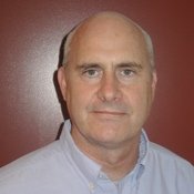 Philip James Maechling合作论文数Earthquake Center;University of Southern California;Earthquake Center, University of Southern California7
 Thomas H. Heaton (Thomas Heaton)合作论文数Division of Geological and Planetary Sciences, California Institute of Technology7K. Solanki合作论文数6
 Tom Jordan合作论文数Department of Earth Sciences, College of Letters, Arts and Sciences, University of Southern California6
 Barbara Romanowicz合作论文数Department of Earth & Planetary Science, University of California, Berkeley;Collège de France6Lawrence M. Baker合作论文数6Maren Boese合作论文数5Peter Lombard合作论文数5
 Horst Rademacher合作论文数4Robert A. Uhrhammer合作论文数4
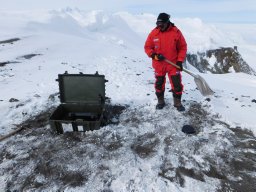 Andrea Cannata合作论文数Istituto Nazionale di Geofisica e Vulcanologia4Stefano Gresta合作论文数4Matteo Vinci合作论文数3l d dietz合作论文数3s zuzlewski合作论文数3
 Masha Liukis合作论文数3siegfried greinwald合作论文数3joe b fletcher合作论文数3Ivan Henson合作论文数3marta lucia calvache合作论文数3
 Diego Gomez Martinez合作论文数GERS, Bogota, Colombia3Jessica R. Murray合作论文数3John Boatwright合作论文数3
 Salvatore Alparone合作论文数Istituto Nazionale di Geofisica e Vulcanologia, Sezione di Catania, Piazza Roma 2, 95123 Catania, Italy3
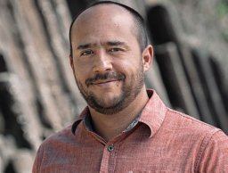 Diego Melgar合作论文数Facultad de Ingeniería, Universidad Nacional Autónoma de México3Jon B Fletcher合作论文数3Placido Montalto合作论文数3
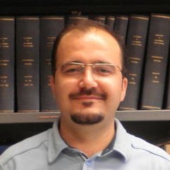 H. Serdar Kuyuk合作论文数Disaster Control Research Center;Tohoku University;Disaster Control Research Center, Tohoku University3Giuseppe Di Grazia合作论文数3J. H. Luetgert合作论文数3Kate Hutton (K.Hutton)合作论文数3o khainovsky合作论文数2j j boatwright合作论文数2j a treiman合作论文数2michael p zeleznik合作论文数2William B. Joyner合作论文数2r a torres c合作论文数2




