In the Mediterranean area, rural abandonment and the rapid urbanisation after the 1950' s led to complex environmental problems, such as the exploitation of natural resources, the environmental pollution, whilst the unstrained urban growth caused excessive pressure on the existing infrastructure, which affects buildings, public transportation, water quality and public health. Various studies demonstrate that the implementation of green roof technology can moderate environmental problems, through the reduction of heat flux and solar reflectivity, the minimisation of buildings' energy consumption, the air pollution removal, the storm water runoff reduction, the air cooling and the effective management of the urban heat island effect.In this framework, the aim of this study is to assess the green roof potential and the quantification of its benefits over Thessaloniki, Greece's second largest city. In order to do so, very high spatial resolution satellite image and natural colour orthoimagery were used along with a geographical object-based image analysis approach. Carbon sequestration potential, rainwater retention and energy conservation were estimated based on coefficients adopted after a comprehensive literature review and actual dynamic energy simulations. (C) 2017 The Authors. Published by Elsevier B.V.
Mazen Abdel-Salam Dimitrios Achillias Wail Adaileh Bolanle Adejumo A. K. Agarwal George Ageridis Brian Agnew Ahmed Al-Salaymeh Ayaz Mohammad Alam Abdulrahman Alamoud Khaled Alqdah Feryal Alsni Dimitris Anastaselos Chris Anastasiou Bjarne Andresen Fahim Ansari Ioannis Sofoklis Antonopoulos Jesús Fraile Ardanuy Birol Arifoglu Hakan Arslan Marc Assael P. Axaopoulos T.P. Ashok Babu Ali Badran Jong-Wha Bai Rangan Banerjee Fotios Barmpas B.K.Behera Hamza Bentrah Jay B Benziger Pat Bodger Natalia Boemi Wojciech Budzianowski Yannis Caouris Albert Castell Daniel Castro Aurnachala Chandaver Yassine Charabi Alexandros Charalambides Arun Kumar Chaudhuri Daniel Chemisana L. Chen Baixin Chen Ayaz Chowdhury Stefan Clarenbach Erdem Cuce Manoj Datta Philip Davies Joop de Kraker Giovanni Di Nicola Harris Doukas Charalambos Doumanides Branislav Dragovic Vassiliki Drosou Gokhan Egilmez Mohamed El Mankibi Nwabueze Emekwuru Jorge Facao Ihab Farag Hubert Fechner Alexandros Flamos Paris Fokaides
Forest ecosystems provide a variety of goods as it is, for example, firewood, technical timber, fruits and roots of plants. They also accord important indirect benefits, as is flood protection and atmospheric pollution reduction. Despite their importance, they face systematically the danger of shrinkage in many parts of the planet. To face this problem, this paper describes all the phases for the development of an Expert System that provides consultation for Forest Management Planning and for the reduction of the Wildfire Destruction Danger. Its implementation makes use of a Fuzzy Logic, for the handling of uncertainty, and a rule-based knowledge base. The software developed has carefully tested and evaluated by three distinct groups of users, including potential end-users, with satisfactory results.
The possibility to extract forest areas according to the criteria included in a legal forest definition was evaluated, in a mountainous area in the Northern-central part of Greece, following an object based image analysis approach. While a lot of studies have focused on the estimation of forest cover at regional scale, no particular emphasis has been given so far to the delineation of forest boundary line at local scale.The study area presents heterogeneity and it is occupied by deciduous and evergreen forest species, shrublands and grasslands. One level of fine scale objects was generated through the Fractal Net Evolution Approach (FNEA) from Quickbird data. Logistic regression statistical analysis was used to predict the existence or not of tree canopy for each image object. The classified objects were subject to a second classification process using class and hierarchy related information to quantify the criteria of the Greek Forest law. In addition, the usefulness of a fusion procedure of the multispectral with the panchromatic component of the Quickbird image was evaluated for the delineation of forest cover maps.Logistic regression classification of the original multispectral image proved to be the best method in terms of absolute accuracy reaching around 85% but the comparison of the accuracy results based on the Z statistic indicated that the difference between the original and the fused image was non-significant. Overall the object based classification approach followed in our study, seems to be promising in order to discriminate in a more operational manner and with decreased subjectivity the extent of forest areas according to forest legal definitions.
The accurate discrimination of forest from natural non-forest areas in Greece presents great interest, since nowadays there is an ongoing effort to develop a Forest Cadastre system. We evaluated the possibility to extract forest areas according to the legislation criteria, in a mountainous area in the Northern-central part of Greece, using an object oriented approach and a very high resolution image. The 240 hectares study area is occupied from deciduous and evergreen forest species, shrublands and grasslands. The segments were classified using two different algorithms, namely Nearest Neighbor, built-in the software eCognition and a logistic regression approach. Furthermore we evaluated for the same task the usefulness of a fused image with the Gram-Schmidt method, classified after the segmentation with the NN algorithm. After the classification of the first level we proceed with a classification based segmentation approach resulting to a second upper level. The later was classified using class and hierarchy related features of the software to quantify the criteria of the Forest law. Logistic regression classification of the original multispectral image proved to be the best method in terms of absolute accuracy reaching around 85% but the comparison of the accuracy results based on the Z statistic indicated that the difference in the results between the three approaches was non-significant. Overall the object oriented approach followed in this work, seems to be promising in order to discriminate in a more operational manner and with decreased subjectivity the extent of the forest areas in Greece.
A composite index is proposed for fire destruction danger assessment. Wildfire incidence and fire severity (FS), in association with the values in threat and the sensitivity of these values to fire, are some of its constituent parameters. The index is computed by use of logic programming within a multi-criteria Decision Support System (DSS). It is applicable to either large or small areas and can be used for short and long-term prediction. The Decision Support System is also described along with the underlying reasoning assumptions. It incorporates mechanisms for the representation and handling of uncertainty and can reason with inexact or incomplete information. The building blocks of its architecture consist of hierarchically-structured rules, a scheme that offers a high degree of transparency. The system design provides a high degree of flexibility, and allows user-induced customisation. It can be used either as stand-alone or as a component of an integral software system, as it is a Fire and Forest Management Decision Support System, by the use of an appropriate interface.
Satellite remote sensing provides new possibilities and challenges to forest managers for monitoring and managing forest ecosystems. The value/use of high-resolution satellite data of Landsat Thematic Mapper (TM) to estimate tree density, basal area, basal volume, and forest biomass was investigated under an operational perspective in a spatially heterogeneous Mediterranean landscape in northern Greece. Digital classification using Fisher's linear discriminant functions produced an overall accuracy of 82
If fuel, weather and topography are considered to be the most important determinants of wildfire occurrence, it is evident that only fuel can be kept under human control and modified to reduce fire potential. In the present study, forest fuel mapping is considered from a remote sensing perspective by the assessment and mapping of general vegetation complexes. The purpose is to delineate forest types which present a particular fire behaviour and to explore the use of Landsat TM data for their mapping. The spectral classes were derived by considering as key elements of the classification scheme the main species that prevail in the overstory layer, as well as meaningful mixtures of them, discriminated by their degree of density as indicated from vegetation indices. The study area, Halkidiki, Greece, which has strong spatial heterogeneity in both the composition and structure of its ecosystems, as well as of their spatial distribution and arrangement, is a characteristic area and representative of the majority of landscape types found across Greece. The overall classification accuracy of the original Landsat TM image (85.30%) was not improved significantly when other synthetic spectral channels or the digital elevation model were integrated with the satellite data, possibly because the detailed classification scheme adopted was determined using the overall spectral discrimination offered by the original satellite data.
Meteorological satellites are appropriate for operational applications related to early warning, monitoring and damage assessment of forest fires. Environmental or resources satellites, with better spatial resolution than meteorological satellites, enable the delineation of the affected areas with a higher degree of accuracy. In this study, the agreement of two datasets, coming from National Oceanic and Atmospheric Administration/Advanced Very High Resolution Radiometer (NOAA/AVHRR) and Landsat TM, for the assessment of the burned area, was investigated. The study area comprises a forested area, burned during the forest fire of 21-24 July 1995 in Penteli, Attiki, Greece. Based on a colour composite image of Landsat TM a reference map of the burned area was produced. The scatterplot of the multitemporal Normalized Difference Vegetation Index (NDVI) images, from both Landsat TM and NOAA/AVHRR sensors, was used to detect the spectral changes due to the removal of vegetation. The extracted burned area was compared to the digitized reference map. The synthesis of the maps was carried out using overlay techniques in a Geographic Information System (GIS). It is illustrated that the NOAA/AVHRR NDVI accuracy is comparable to that from Landsat TM data. As a result NOAA/AVHRR data can, operationally, be used for mapping the extent of the burned areas.
Logistic regression modeling was applied, as an alternative classification procedure, to a single post-fire Landsat-5 Thematic Mapper image for burned land mapping. The nature of the classification problem in this case allowed the structure and application of logistic regression models, since the dependent variable could be expressed in a dichotomous way. The two logistic regression models consisted of the TM 4, TM 7, TM 1 and TM 4, TM 7, TM 2 presented an overall accuracy of 97.37% and 97.30%, respectively and proved to be the most well performing three-channel color composites. The discriminator ability in respect to burned area mapping of each one of the six spectral channels of Thematic Mapper, which was achieved by applying six logistic regression models, agreed with the results taken from the separability indices Jeffries-Matusita and Transformed Divergence.
Several techniques have been developed to detect and map burned areas using Landsat Thematic Mapper data, ranging from simple ones, such as visual analysis, to more complex, such as spectral mixture analysis. However, the Intensity-Hue-Saturation transformation, a method mainly used for merging multiresolution and multispectral data and for contrast-stretching applications, has never been applied. In this study, a method is presented by which transforming the RGB values of a three-channel composite to IHS values, the mapping of areas affected by forest fires can be easily achieved. Specifically, the hue component of two RGB color composites, consisting of TM7-TM4-TM1 and TM4-TM7-TM1, respectively, proved to be very useful in mapping of burned areas.
This study focused on the development of a logistic regression model for burned area mapping using two Landsat-5 Thematic Mapper (TM) images. Logistic regression models were structured using the spectral channels of the two images as explanatory variables. The overall accuracy of the results and other statistical indications denote that logistic regression modelling can be used successfully for burned area mapping. The model that consisted of the spectral channels TM4, TM7 and TM1 and had an overall accuracy of 97.62%, proved to be the most suitable. Moreover, the study concluded that the spectral channel TM4 was the most sensitive to alterations of the spectral response of the burned category pixels, followed by TM7.
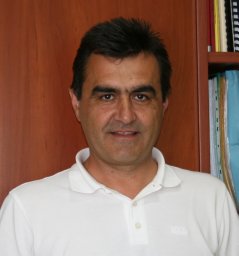 Nikos Koutsias合作论文数Department of Environmental and Natural Resources Management, University of Ioannina6
 Giorgos Mallinis合作论文数School of Forestry and Natural Environment, Aristotle University of Thessaloniki4
 Nikos Lorentzos合作论文数Agricultural University of Athens3
 Christos Domenikiotis合作论文数Department of Agriculture;Animal Production and Aquatic Environment;University of Thessaly;Department of Agriculture, University of Thessaly3
 Nicolas R. Dalezios合作论文数2
 Spiridon Th. Kaloudis合作论文数2Alexander B Sideridis合作论文数2
 Ifigeneia Theodoridou合作论文数2Dimitrios G Karamanolis合作论文数2
 Ioannis Z. Gitas合作论文数Aristotle University of Thessaloniki;Laboratory of Forest Management and Remote;Laboratory of Forest Management and Remote, Aristotle University of Thessaloniki2A. Toka合作论文数1G. Mihalakakou合作论文数1Hubert Fechner合作论文数1
 Paris Fokaides合作论文数1Apostolos Makras合作论文数1
 Arif Saeed Malik合作论文数1
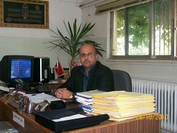 Wail Adaileh合作论文数Dept Mech Engn, Tafila Tech Univ1
 A. Tourlidakis合作论文数University of Western Macedonia1Nikitas Nikitakos合作论文数1agustin lobo合作论文数1George Giannakidis合作论文数1Tocatlidou, A.合作论文数1
 John Paravantis合作论文数1
 D. P. Kothari合作论文数Gaikwad-Patil Group of Institutions1A. Karagiannidis合作论文数1
 Athanasios Loukas合作论文数Department of Civil Engineering, University of Thessaly1
 Haris Doukas合作论文数School of Electrical and Computer Engineering, National Technical University of Athens1
 Vassiliki Drosou合作论文数Centre for Renewable Energy Sources (CRES), 19th km Marathonos Avenue, Pikermi GR-19009, Greece1
 Alexander Sideridis合作论文数Publisher Elsevier Science Publishers B. V. Amsterdam, The Netherlands, The Netherlands
index terms collaborative colleagues1
Alexander Sideridis合作论文数Publisher Elsevier Science Publishers B. V. Amsterdam, The Netherlands, The Netherlands
index terms collaborative colleagues1 Georgios Martinopoulos合作论文数Process Equipment Design Laboratory, AUTh1
 Christos Karkanias合作论文数Merck Sharp and Dohme, U.S.A.1
 Daniel Chemisana Villegas合作论文数Department of Environment and Soil Sciences, University of Lleida1Y.G. Caouris合作论文数1
 Albert Castell合作论文数1
 A. Al-Salaymeh合作论文数Mechanical Engineering Department;, Faculty of Engineering and Technology;University of Jordan;Faculty of Engineering and Technology, University of Jordan1David Redpath合作论文数1Konstantinos Papakostas合作论文数1
 Yiannis Tripanagnostopoulos合作论文数1
 Denia Kolokotsa合作论文数School of Chemical and Environmental Engineering, Technical University of Crete1
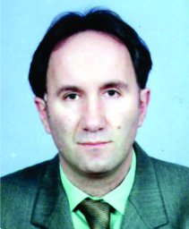 Branislav Dragovic合作论文数1
 Theodosios Theodosiou合作论文数InTeREn Engineering P.C.;Chatzaki Team;Tetraktys Intelligence1
 Dimitrios Anastaselos合作论文数1Nikolas Kyriakis合作论文数1Aris Tsangrassoulis合作论文数Group of Building Environmental Physics, University of Athens1Georgios Savaidis合作论文数1Constantine P. Yialouris合作论文数Informatics Laboratory, Agricultural University of Athens1
 E. Giama合作论文数Aristotle University1
 Theodora Slini合作论文数Aristotle University;Laboratory of Heat Transfer and Environmental Engineering;Laboratory of Heat Transfer and Environmental Engineering, Aristotle University1
 Marina Neophytou合作论文数Department of Civil and Environmental Engineering, School of Engineering, University of Cyprus1




