Measurements of surface-atmosphere carbon dioxide (CO2) and methane (CH4) fluxes have been relatively sparse across the Arctic tundra and boreal biomes, causing significant uncertainties in carbon budget estimates from the region. While the availability of Arctic-boreal carbon flux data has increased substantially over the past decade, the data have remained spread across different repositories, scientific articles, and unpublished sources, making it difficult to leverage. Here we present a new dataset of monthly Arctic-boreal carbon fluxes (ABCFlux v2) across terrestrial (wetlands and uplands) and freshwater (lakes and rivers) ecosystems compiled from previous syntheses including the Arctic-boreal CO2 flux database (ABCFlux v1), the Boreal-Arctic Wetland and Lake Methane Dataset (BAWLD-CH4), and the Global River Methane Database (GRiMeDB). In addition, we consider data from general-purpose (e.g., Zenodo) and flux network repositories, literature, and site principal investigators. The dataset includes surface-atmosphere CO2 fluxes of gross primary production (GPP), ecosystem respiration (Reco), and net ecosystem exchange (NEE), alongside CH4 fluxes. For aquatic ecosystems, we split CH4 fluxes into diffusive and ebullitive flux pathways, and included potential emissions from transient storage in the water column (“storage fluxes”), alongside CO2 and CH4 concentrations dissolved in the surface water. Fluxes are measured through a variety of methods including chamber and eddy covariance techniques alongside bubble traps, ice-surveys, and concentration-based turbulence-driven modelling in aquatic ecosystems. The monthly flux data are reported together with supporting methodological and environmental metadata. The resulting ABCFlux v2 has 23 847 flux site-months, 8182 concentration site-months, and 199 seasonal observations from 1024 sites, and includes 56 139 reported fluxes (i.e. sum of GPP, Reco, NEE, and CH4 fluxes) from the years 1984 to 2024. The majority of monthly observations occurred after 1999. Wetlands had the highest number of site-month observations (8758), followed by boreal forest (6981), lotic ecosystems (6275), lentic ecosystems (3799) and upland tundra (3308). Measurements of CO2 dominated the dataset across most ecosystem types (25 222) except for lentic ecosystems, where CH4 flux site-months (3098) were more frequent than CO2 flux site-months (2915). Overall, ABCFlux v2 includes 160 % more site-months for terrestrial CO2 flux data compared to ABCFlux v1. Integrating and updating BAWLD-CH4 flux data from growing season averages to monthly fluxes resulted in 5671 site-months of chamber CH4 data compared to 762 site-years. This collaborative initiative, involving contributions from over 260 researchers, provides a comprehensive overview of the current state of the Arctic-boreal carbon flux network and its data, and serves as an important step in reducing uncertainties in Arctic-boreal carbon budgets and in enhancing our understanding of climate feedbacks. The data can be accessed at ORNL DAAC at https://doi.org/10.3334/ORNLDAAC/2448 (Virkkala et al., 2026).
Background Across boreal North America, fire is the primary forest disturbance. In recent years, concerns about overwintering fires in boreal forests have been growing. Overwintering fires smolder throughout winter and reappear in early spring in the subsequent fire season. Aims To investigate the spatial and temporal changes in reburned area from overwintering fires with 30 m spatial resolution satellite data. Methods We used long-term Landsat satellite observations to map reburned area from overwintering fires - areas that burned twice, first during the initial fire season, and a second time during the subsequent fire season - between 1986 and 2024 in the Taiga Plains in the Northwest Territories, Canada and Interior Boreal Alaska in Alaska, USA. Key results Our algorithm detected significantly more reburned area from overwintering fires compared to other satellite-based burned area products (P < 0.05). The absolute increase in reburned area from overwintering fires related to the increase in total burned area (around 50% of explained variation), thus the fractional contribution of reburned area from overwintering fires remained around 1% of the annual burned area. Conclusions Our study detected more reburning from overwintering fires at Landsat resolution with no temporal change in the fractional contribution of overwintering fires to the total burned area between 1986 and 2024.Implications Our work provides new insights into when and where emerging overwintering fires occur in boreal North America.
Peatlands store more carbon (C) than any other terrestrial ecosystem and as a C sink they are vital to mitigating climate change. The keystone of many peatland ecosystems is Sphagnum, a bryophyte genus of c. 350 species found on every continent except Antarctica. With climate change, many peatlands face increasing frequency and severity of drought. How Sphagnum responds to and recovers from drought will be key to sustaining peatlands over the coming decades. Here, we synthesise the latest evidence for how interactions of drought with Sphagnum affect peatland functioning. We discuss how Sphagnum traits, from the cellular to the community, control its ecohydrology and what changes occur during drought. We detail the effects of drought on Sphagnum C cycling and biochemistry, including photosynthesis, growth, respiration and methane (CH4) fluxes. We also highlight drought resilience and tipping points for Sphagnum physiology and at the ecosystem level. The implications of Sphagnum drought responses for peatland hydrology, restoration and wildfires are also outlined. Finally, we identify knowledge gaps and propose some urgent questions which should be addressed in future research.
Cross-scale feedbacks between hydrology, vegetation, permafrost thaw, and wildfire will drive Arctic carbon cycle responses including methane emissions to the atmosphere. This presentation will summarize recent findings from several large-scale empirical projects examining interactions between disturbance regimes and their consequences for vegetation and carbon storage and fluxes in interior Alaska and northwestern Canada. A long-term monitoring project at the Alaska Peatland Experiment (APEX) found that early onset of abrupt thaw, driven by active layer thickening with no visible thermokarst, was predicted by changes in the moss community and stimulated CH4 fluxes 5-fold, accounting for 30% of the total annual thaw-driven increase in CH4. Methane emissions at several sites in interior Alaska were sensitive to rainfall and surface moisture conditions, with spring rain events stimulating soil warming and methane fluxes. Finally, new tools have allowed us to identify and examine forests and peatlands that experienced overwintering or zombie fire conditions, with early results showing interesting regional differences in how these novel fire conditions influence fuel combustion and carbon release. Results from recent and ongoing studies will be used to frame forward-looking research questions and approaches urgently needed to better understand the fate of permafrost carbon. In particular, I will discuss several efforts to incorporate abrupt thaw into circumpolar upscaling and modeling studies. Unlike active layer thickening, abrupt thaw impacts meters of soil rapidly, occurs on a fine-scale not easily detected in remote sensing products, and is further destabilized by rainfall, wildfire, and vegetation change.
We review how ‘abrupt thaw’ has been used in published studies, compare these definitions to abrupt processes in other Earth science disciplines, and provide a definitive framework for how abrupt thaw should be used in the context of permafrost science. We address several aspects of permafrost systems necessary for abrupt thaw to occur and propose a framework for classifying permafrost processes as abrupt thaw in the future. Based on a literature review and our collective expertise, we propose that abrupt thaw refers to thaw processes that lead to a substantial persistent environmental change within a few decades. Abrupt thaw typically occurs in ice-rich permafrost but may be initiated in ice-poor permafrost by external factors such as hydrologic change (i.e., increased streamflow, soil moisture fluctuations, altered groundwater recharge) or wildfire. Permafrost thaw alters greenhouse gas emissions, soil and vegetation properties, and hydrologic flow, threatening infrastructure and the cultures and livelihoods of northern communities. The term ‘abrupt thaw’ has emerged in scientific discourse over the past two decades to differentiate processes that rapidly impact large depths of permafrost, such as thermokarst, from more gradual, top-down thaw processes that impact centimeters of near-surface permafrost over years to decades. However, there has been no formal definition for abrupt thaw and its use in the scientific literature has varied considerably. Our standardized definition of abrupt thaw offers a path forward to better understand drivers and patterns of abrupt thaw and its consequences for global greenhouse gas budgets, impacts to infrastructure and land-use, and Arctic policy- and decision-making.
As the northern high-latitude permafrost zone experiences accelerated warming, permafrost has become vulnerable to widespread thaw. Simultaneously, wildfire activity across northern boreal forest and Arctic/subarctic tundra regions impacts permafrost stability through the combustion of insulating organic matter, vegetation, and post-fire changes in albedo. Efforts to synthesis the impacts of wildfire on permafrost are limited and are typically reliant on antecedent pre-fire conditions. To address this, we created the FireALT dataset by soliciting data contributions that included thaw depth measurements, site conditions, and fire event details with paired measurements at environmentally comparable burned and unburned sites. The solicitation resulted in 52 466 thaw depth measurements from 18 contributors across North America and Russia. Because thaw depths were taken at various times throughout the thawing season, we also estimated end-of-season active layer thickness (ALT) for each measurement using a modified version of the Stefan equation. Here, we describe our methods for collecting and quality-checking the data, estimating ALT, the data structure, strengths and limitations, and future research opportunities. The final dataset includes 48 669 ALT estimates with 32 attributes across 9446 plots and 157 burned-unburned pairs spanning Canada, Russia, and the United States. The data span fire events from 1900 to 2022 with measurements collected from 2001 to 2023. The time since fire ranges from 0 to 114 years. The FireALT dataset addresses a key challenge: the ability to assess impacts of wildfire on ALT when measurements are taken at various times throughout the thaw season depending on the time of field campaigns (typically June through August) by estimating ALT at the end-of-season maximum. This dataset can be used to address understudied research areas, particularly algorithm development, calibration, and validation for evolving process-based models as well as extrapolating across space and time, which could elucidate permafrost-wildfire interactions under accelerated warming across the high-northern-latitude permafrost zone.
Climate warming is increasing the prevalence of overwintering 'zombie' fires, which are expected to occur primarily in peatlands, undermining carbon storage through deep burning of organic soils. We visited overwintering fires in Northwest Territories, Canada, and Interior Alaska, United States, and present field measurements of where overwintering fires are burning in the landscape and their impact on combustion severity and forest regeneration. Combustion severity hotspots did not generate overwintering, but peat and woody biomass smouldering both supported overwintering, leading to wintertime smouldering in both treed peatlands and upland forests. These findings create challenges for fire managers and uncertainty about carbon emissions, but forest regeneration was not compromised.
This chapter synthesizes information about the storage and vulnerability of organic matter in permafrost. The permafrost region is rapidly warming, leading to degradation and release of carbon. Permafrost holds a vast amount of organic carbon (∼1460–1600 gigatons (Gt = 109 t = 1012 kg) on land, and in total more than 4300 Gt (including organic carbon in subsea permafrost), making the permafrost domain the Earth's largest terrestrial carbon pool. The thawing of permafrost also affects ecosystem types and greenhouse gas emissions. Projections suggest that by 2100, the Arctic could release between 55 and 232 Gt carbon of CO2-equivalent, highlighting the potential to release carbon in amounts similar to that from a large industrial nation. While the possibility of a sudden release of greenhouse gases is not confirmed yet, permafrost destabilization increases the likelihood of the Arctic becoming a continuous carbon source, crucial to be included in climate mitigation considerations.
Widespread changes to near-surface permafrost in northern ecosystems are occurring through gradual top-down thaw and more abrupt localized thermokarst development. Both thaw types are associated with a loss of ecosystem services, including soil hydrothermal and mechanical stability and long-term carbon storage. Here, we analyzed relationships between the vascular understory, basal moss layer, active layer thickness (ALT), and greenhouse gas fluxes along a thaw gradient from permafrost peat plateau to thaw bog in Interior Alaska. We used ALT to define four distinct stages of thaw: Stable, Early, Intermediate, and Advanced, and we identified key plant taxa that serve as reliable indicators of each stage. Advanced thaw, with a thicker active layer and more developed thermokarst features, was associated with increased abundance of graminoids and Sphagnum mosses but decreased plant species richness and ericoid abundance, as well as a substantial increase in methane emissions. Early thaw, characterized by active layer thickening without thermokarst development, coincided with decreased ericoid cover and plant species richness and an increase in CH4 emissions. Our findings suggest that early stages of thaw, prior to the formation of thermokarst features, are associated with distinct vegetation and soil moisture changes that lead to abrupt increases in methane emissions, which then are perpetuated through ground surface subsidence and collapse scar bog formation. Current modeling of permafrost peatlands will underestimate carbon emissions from thawing permafrost unless these linkages between plant community, nonlinear active layer dynamics, and carbon fluxes of emerging thaw features are integrated into modeling frameworks.
The Arctic-boreal region is warming rapidly, with consequences for northern ecosystems and global climate. Fires across the Arctic-boreal region are a major natural disturbance mechanism that initiate climate warming (positive) and cooling (negative) feedbacks. Understanding the net forcing effect from boreal fire on climate is crucial in managing and mitigating climate change impacts of boreal fires. Here we report radiative forcing estimates from boreal forest fires across Alaska and Western Canada (Arctic Boreal Vulnerability Experiment-domain). Our results integrate the effect of greenhouse gas emissions (warming) and aerosols emission (net cooling) have through direct combustion, post-fire vegetation recovery sequestering carbon (cooling), fire-induced permafrost degradation emitting CO2 and CH4 (warming), and changes in surface albedo (cooling). Alaskan fires are on average climate warming (1.34±2.95 W/m2 per burned area) – uncertainty given as spatial standard deviation, while Canadian fires show on average a climate cooling (‑2.26±2.48 W/m2 per burned area) effect. The emissions from the combustion of organic soils and post-fire permafrost thaw dominate the positive feedback for Alaskan fires, whereas the cooling effect of post-fire changes in surface albedo because of prolonged spring snow cover dominate for the western Canadian fires. Our work demonstrates large-scale spatial variability in the climate feedbacks from North American boreal forest fires. Such fine-scale spatial information on the warming and cooling influences of forest fires could be useful in designing forest management and fire suppression activities informed by climate impacts.
Methane emissions from the boreal-Arctic region are likely to increase due to warming and permafrost thaw, but the magnitude of increase is unconstrained. Here we show that distinguishing several wetland and lake classes improves our understanding of current and future methane emissions. Our estimate of net annual methane emission (1988-2019) was 34 (95% CI: 25-43) Tg CH4 yr(-1), dominated by five wetland (26 Tg CH4 yr(-1)) and seven lake (5.7 Tg CH4 yr(-1)) classes. Our estimate was lower than previous estimates due to explicit characterization of low methane-emitting wetland and lake classes, for example, permafrost bogs, bogs, large lakes and glacial lakes. To reduce uncertainty further, improved wetland maps and further measurements of wetland winter emissions and lake ebullition are needed. Methane emissions were estimated to increase by similar to 31% under a moderate warming scenario (SSP2-4.5 by 2100), driven primarily by warming rather than permafrost thaw.
The North Slope of Alaska is an area susceptible to permafrost thaw, posing significant threats to infrastructure stability. Accurate characterization of soil strength and permafrost active layer depths is crucial for predicting and mitigating these risks. As part of a multi-institution, multi-disciplinary effort, researchers from the US Army Engineer Research and Development Center, the University of Colorado Boulder, and Texas A&M University employed dynamic cone penetrometers (DCP) to investigate the mechanical properties of soils on the North Slope. The tests were conducted in an attempt to identify areas with unstable permafrost and infer potential surface characteristics that may aid in predicting the location of permafrost in the future. Over 200 DCP measurements were collected, with results showing trends along transects running up and down-slope from a small river. The DCP technique offers a cost-effective and rapid method for characterizing soil strength and permafrost stability, making it an attractive tool for future studies and practical applications. This research contributes to our understanding of the complex interactions between geology, terrain dynamics, and infrastructure on the North Slope, ultimately informing strategies to potentially mitigate the impacts of permafrost thawing.
Permafrost-agroecosystems include all cultivation and pastoral activities in areas underlain by permafrost. These systems support local livelihoods and food production and are rarely considered in global agricultural studies but may become more relevant as climate change is increasing opportunities for food production in high latitude and mountainous areas. The exact locations and amount of agricultural production in areas containing permafrost are currently unknown, therefore we provide an overview of countries where both permafrost and agricultural activities are present. We highlight the socioecological diversity and complexities of permafrost-agroecosystems through seven case studies: (1) crop cultivation in Alaska, USA; (2) Indigenous food systems and crop cultivation in the Northwest Territories, Canada; (3) horse and cattle husbandry and Indigenous hay production in the Sakha Republic, Russia; (4) mobile pastoralism and husbandry in Mongolia; (5) yak pastoralism in the Central Himalaya, Nepal; (6) berry picking and reindeer herding in northern Fennoscandia; and (7) reindeer herding in northwest Russia. We discuss regional knowledge gaps associated with permafrost and make recommendations to policy makers and land users for adapting to changing permafrost environments. A better understanding of permafrost-agroecosystems is needed to help sustainably manage and develop these systems considering rapidly changing climate, environments, economies, and industries.
Permafrost-affected ecosystems of the Arctic–boreal zone in northwestern North America are undergoing profound transformation due to rapid climate change. NASA's Arctic Boreal Vulnerability Experiment (ABoVE) is investigating characteristics that make these ecosystems vulnerable or resilient to this change. ABoVE employs airborne synthetic aperture radar (SAR) as a powerful tool to characterize tundra, taiga, peatlands, and fens. Here, we present an annotated guide to the L-band and P-band airborne SAR data acquired during the 2017, 2018, 2019, and 2022 ABoVE airborne campaigns. We summarize the ∼80 SAR flight lines and how they fit into the ABoVE experimental design (Miller et al., 2023; https://doi.org/10.3334/ORNLDAAC/2150). The Supplement provides hyperlinks to extensive maps, tables, and every flight plan as well as individual flight lines. We illustrate the interdisciplinary nature of airborne SAR data with examples of preliminary results from ABoVE studies including boreal forest canopy structure from TomoSAR data over Delta Junction, AK, and the Boreal Ecosystem Research and Monitoring Sites (BERMS) area in northern Saskatchewan and active layer thickness and soil moisture data product validation. This paper is presented as a guide to enable interested readers to fully explore the ABoVE L- and P-band airborne SAR data (https://uavsar.jpl.nasa.gov/cgi-bin/data.pl).
Permafrost degradation in peatlands is altering vegetation and soil properties and impacting net carbon storage. We studied four adjacent sites in Alaska with varied permafrost regimes, including a black spruce forest on a peat plateau with permafrost, two collapse scar bogs of different ages formed following thermokarst, and a rich fen without permafrost. Measurements included year-round eddy covariance estimates of net carbon dioxide (CO2 ), mid-April to October methane (CH4 ) emissions, and environmental variables. From 2011 to 2022, annual rainfall was above the historical average, snow water equivalent increased, and snow-season duration shortened due to later snow return. Seasonally thawed active layer depths also increased. During this period, all ecosystems acted as slight annual sources of CO2 (13-59 g C m-2 year-1 ) and stronger sources of CH4 (11-14 g CH4 m-2 from ~April to October). The interannual variability of net ecosystem exchange was high, approximately ±100 g C m-2 year-1 , or twice what has been previously reported across other boreal sites. Net CO2 release was positively related to increased summer rainfall and winter snow water equivalent and later snow return. Controls over CH4 emissions were related to increased soil moisture and inundation status. The dominant emitter of carbon was the rich fen, which, in addition to being a source of CO2 , was also the largest CH4 emitter. These results suggest that the future carbon-source strength of boreal lowlands in Interior Alaska may be determined by the area occupied by minerotrophic fens, which are expected to become more abundant as permafrost thaw increases hydrologic connectivity. Since our measurements occur within close proximity of each other (≤1 km2 ), this study also has implications for the spatial scale and data used in benchmarking carbon cycle models and emphasizes the necessity of long-term measurements to identify carbon cycle process changes in a warming climate.
Northern peatlands are a globally significant source of methane (CH4), and emissions are projected to increase due to warming and permafrost loss. Understanding the microbial mechanisms behind patterns in CH4 production in peatlands will be key to predicting annual emissions changes, with stable carbon isotopes (delta C-13-CH4) being a powerful tool for characterizing these drivers. Given that delta C-13-CH4 is used in top-down atmospheric inversion models to partition sources, our ability to model CH4 production pathways and associated delta C-13-CH4 values is critical. We sought to characterize the role of environmental conditions, including hydrologic and vegetation patterns associated with permafrost thaw, on delta C-13-CH4 values from high-latitude peatlands. We measured porewater and emitted CH4 stable isotopes, pH, and vegetation composition from five boreal-Arctic peatlands. Porewater delta C-13-CH4 was strongly associated with peatland type, with delta C-13 enriched values obtained from more minerotrophic fens (-61.2 +/- 9.1 parts per thousand) compared to permafrost-free bogs (-74.1 +/- 9.4 parts per thousand) and raised permafrost bogs (-81.6 +/- 11.5 parts per thousand). Variation in porewater delta C-13-CH4 was best explained by sedge cover, CH4 concentration, and the interactive effect of peatland type and pH (r(2) = 0.50, p < 0.001). Emitted delta C-13-CH4 varied greatly but was positively correlated with porewater delta C-13-CH4. We calculated a mixed atmospheric delta C-13-CH4 value for northern peatlands of -65.3 +/- 7 parts per thousand and show that this value is more sensitive to landscape drying than wetting under permafrost thaw scenarios. Our results suggest northern peatland delta C-13-CH4 values are likely to shift in the future which has important implications for source partitioning in atmospheric inversion models. Plain Language Summary Peatlands are abundant across the boreal-Arctic landscape and are important sources of methane, a powerful greenhouse gas. The amount of methane emitted into the atmosphere depends on multiple factors including the organic material being decomposed and the microbial processes ("pathways") that produce methane. The different pathways of methane production leave distinct fingerprints ("stable carbon isotopes") on methane that provide information on how that methane was formed and help to trace methane in the atmosphere back to its ground source. We looked at how stable carbon isotopes change across five northern peatland locations and wanted to know what controls those changes. We found that stable carbon isotopes differ between bogs and fens and are further controlled by soil pH and the abundance of sedge vegetation present. We used this information to test how stable carbon isotopes from northern peatlands might change as the landscape becomes wetter or drier due to the impacts of climate change. We found that peatland stable carbon isotopes are most sensitive to potential landscape drying opposed to wetting which has important implications for improving methane emission models.
Abstract Rapid Arctic warming is thawing carbon-rich permafrost, releasing greenhouse gasses to the atmosphere and accelerating global climate change. Despite the importance of this feedback, permafrost-enabled global-scale models simulate only one mechanism of belowground carbon loss: the gradual, top-down thickening of the seasonally-thawed soil layer. This ignores abrupt permafrost thaw and intensifying fire regimes that result in combustion of soil carbon and fire-induced thaw. Here, we expand a compact Earth system model (OSCAR v3.0) to enable first-order estimates of the impacts of abrupt thaw and wildfire, together with gradual thaw, on remaining carbon budgets consistent with the temperature goals of the Paris Agreement. We find that remaining carbon budgets are reduced by up to 20% for 1.5°C, and up to 22% for 2.0°C. Ensuring that these substantial future emissions are accounted for when developing emissions reductions targets consistent with the Paris agreement presents a timely challenge for scientific and policy communities.
 Jennifer Harden合作论文数Geology, Minerals, Energy, and Geophysics Science Center, U.S. Geological Survey52
 A. Dave McGuire合作论文数Institute of Arctic Biology, University of Alaska Fairbanks51
 Evan S. Kane合作论文数School of Forestry;Michigan Technological University;USDA Forest Service North;School of Forestry, Michigan Technological University51
 Jennifer L Baltzer合作论文数The Forest Ecology Research Group, Wilfrid Laurier University50
 Michelle Cailin Mack合作论文数Center for Ecosystem Science and Society, Northern Arizona University;Department of Biological Sciences, Northern Arizona University49
 Jill F Johnstone合作论文数Department of Biology, University of Saskatchewan42
 Brendan M Rogers合作论文数Earth System Science Department, University of California, Irvine37
 Mark P Waldrop合作论文数Geology, Minerals, Energy, and Geophysics Science Center, U.S. Geological Survey37
 Eugenie Euskirchen合作论文数Department of Biology and Wildlife, College of Natural Science & Mathematics, University of Alaska Fairbanks;Institute of Arctic Biology, University of Alaska Fairbanks;Department of Veterinary Medicine, University of Alaska Fairbanks34
 Walker Xanthe J合作论文数Department of Biology, University of Saskatchewan33
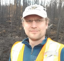 David Olefeldt合作论文数Dept Renewable Resources, Univ Alberta33
 Eric S. Kasischke合作论文数33
 Edward (Ted) Schuur合作论文数Center for Ecosystem Sciences and Society, Department of Biological Sciences, College of the Environment, Forestry, and Natural Sciences, Northern Arizona University;University of Alaska33
 Nicola J Day合作论文数27
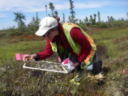 Dieleman Catherine M合作论文数Department of Biology, The University of Western Ontario26
 Kristen L. Manies合作论文数U. S. Geological Survey23
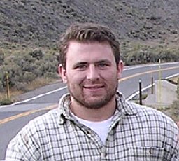 Brian W. Benscoter合作论文数Department of Plant Biology, Michigan State University22
 Sander Veraverbeke合作论文数California Institute of Technology, Ghent University20
 Scott Goetz合作论文数Global Earth Observation & Dynamics of Ecosystems Lab, Northern Arizona University;School of Informatics, Computing, and Cyber Systems, Northern Arizona University19
 Laura Bourgeau-Chavez合作论文数Michigan Tech Research Institute, Michigan Technological University19
 Elizabeth E Hoy合作论文数18
 Gustaf Hugelius合作论文数Department of Physical Geography, Stockholm University18
 Claire Treat合作论文数Department of Agroecology, Center for Landscape Research in Sustainable Agricultural Futures, Aarhus University18
 J. M. Waddington合作论文数School of Geography;McMaster University;School of Geography, McMaster University17
 Susan M. Natali合作论文数Department of Ecology and Evolution, State University of New York at Stony Brook16
 Thomas A. Douglas合作论文数U.S. Army Corps of Engineers- Engineer Research and Development Center Cold Regions Research and Engineering Laboratory16Stefano Potter合作论文数Woodwell Climate Res Ctr15Steven G. Cumming合作论文数Department of Forest Sciences;University of British Columbia;Department of Forest Sciences, University of British Columbia15
 Nancy H. F. French合作论文数Michigan Tech Research Institute, Michigan Technological University15
 Rebecca B. Neumann合作论文数Department of Civil & Environmental Engineering, University of Washington14
 Jonathan A. O'Donnell合作论文数Department of Biology and Wildlife, University of Alaska14
 Christina Schädel合作论文数Department of Botany and Microbiology, University of Oklahoma12
 Guido Grosse合作论文数Permafrost Research Section, Alfred Wegener Institute Helmholtz Centre for Polar and Marine Research;Institute of Geosciences, University of Potsdam12Kevin H. Wyatt合作论文数12Carolyn M. Gibson合作论文数Integrat Biol, Univ Guelph11Miriam C. Jones合作论文数Department of Earth and Environmental Sciences;Lehigh University;Department of Earth and Environmental Sciences, Lehigh University11
 Allison R. Rober合作论文数10Colin W. Edgar合作论文数9
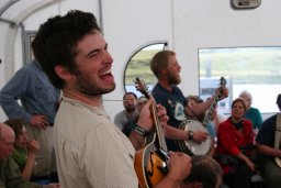 Benjamin W. Abbott合作论文数Brigham Young University9
 Peter Kuhry合作论文数Department of Physical Geography, Faculty of Science, Stockholm University9
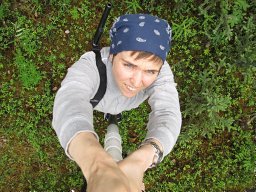 Kirsten Barrett合作论文数9
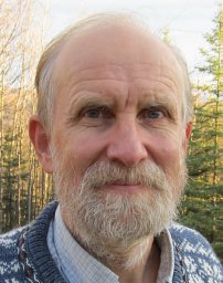 M. Torre Jorgenson合作论文数Alaska Biological Research Inc;Arctic Institute of North America;Alaska Biological Research Inc, Arctic Institute of North America9
 Liza K. Jenkins合作论文数Michigan Tech Research Institute, Michigan Technological University9
 Dan K. Thompson合作论文数8
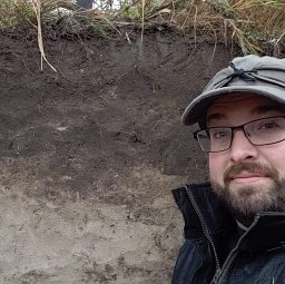 Colby J. Moorberg合作论文数Dep Agron, Kansas State Univ7
 Michael Flannigan合作论文数Department of Renewable Resources, Faculty of Agricultural, Life and Environmental Sci, University of Alberta7
 Ellen Whitman合作论文数School for Resource and Environmental Studies, Dalhousie University7
 Teresa Hollingsworth合作论文数7William J. De Groot合作论文数7




