Forest degradation is typified by reductions in canopy cover and biomass density over time, resulting in decreased capacity and quality of forest ecosystem function and services. It usually occurs in small patches across the forest area, so it is tough to detect using only field data, which is typically collected in widely spaced sampling plots. In this paper, we used multitemporal field measurements of aboveground biomass (AGB) and remote sensing to estimate forest degradation in a tropical dry forest that has been subject to shifting cultivation for many years. First, we obtained field measurements in 2019 and 2022, and then we mapped AGB in these years using random forest regression and Sentinel-1 and Sentinel-2 images. Then, we calculated the difference in AGB between these two dates (Delta AGB = AGB2022-AGB2019) and reclassified the map of Delta AGB into three categories, namely AGB gain, no change, and AGB loss. We performed a rigorous accuracy assessment by randomly distributing 1257 sampling points across those three categories to obtain an unbiased area estimation. Although the average AGB density of the data collected in the field was not statistically different between these two years, there was a slight reduction in canopy cover and canopy height, along with an increase in stem density, which is consistent with a shifting cultivation regime in which coppicing occurs. The RMSE of the 2019 AGB model was 14.5 +/- 4.8 Mg ha-1 and the 2022 model was 14.0 +/- 4.52 Mg ha-1, suggesting that the mapped AGB are comparable between these two years. The accuracy of our estimate for AGB loss exceeded that of AGB gain, and using ground data at two time periods allowed us to achieve a much more accurate estimate than would have been possible with remote sensing alone. AGB loss accounted for 4.3 % of the change in biomass over the total forest area, while AGB gain through natural recuperation represented 1.3 %, and most of the forest area (94.4 %) remained stable. Thus, over the entire study area, a small negative trend in AGB was registered. The study demonstrates the value of integrating time series ground-level data with remote sensing and modeling to obtain much more accurate estimates of biomass loss and gain in forests where degradation and regrowth are the dominant processes, rather than deforestation.
In the Monarch Reserve, four cases were selected for exploratory analysis using the critical list of variables for sustaining the commons and LASSO regression to determine which of these are most influential in the successful maintenance of forest cover over a decade. Forest recovery from degraded to dense forest is found to be inversely related to resource size, consistent with theory. However, in four other categories of forest change, the size of the resource is less influential, though it is still a significant, variable with a positive relationship to forest cover change which is inconsistent with theory. The analysis also showed that less overlap, greater poverty and lower dependence on the resource are associated both with forest gain and with mitigation of forest loss, which is contrary to theory and most research. Also associated with poverty in the LASSO regression are homogeneity of identity and ease of enforcement of rules. These show a negative relation to transitions from non-forest to dense forest, with low coefficients. This is inconsistent with theory. Possible reasons for the divergence from theory are discussed in detail, as is the utility of this approach for assessment and monitoring.
In many cultures, interactions between humans and plants are rooted in what is called “relational values”—values that derive from relationships and entail reciprocity. In Mexico, biocultural diversity is mirrored in the knowledge and use of some 6500 plant species and the domestication of over 250 Mesoamerican native crop species. This research explores how different sets of values are attributed to plants and how these influence management strategies to maintain plant resources in wild and anthropogenic environments. We ran workshops in two communities (one Indigenous, the other non-Indigenous) in a highly biodiverse region in western Mexico, to ascertain the values and management activities related to important plant resources. The relationship between values attributed to plants and management activities was examined through redundancy analysis. A total of 180 plant resources were mentioned during the workshops, with a broad spectrum of values attributed to them, including material, non-material, and regulatory dimensions. We divided plant management strategies into three general categories of increasing intensity and complexity. We found that participants in the Indigenous community value and manage more wild plant resources than people in the non-Indigenous community. We also identified relationships between plant resource values and the type of management performed; for example, more intensive forms of management, such as sowing seeds, were used for seasonal plants that had a food value. By valuing and managing different sets of plant resources from forest, agricultural plots, and home gardens, people enabled multi-functional landscapes to form, illustrating a key feature of relational values in agroecosystems, which promotes both conservation and domestication of plants.
Forest degradation reduces biomass density, contributes to greenhouse gas emissions, and affects biodiversity and natural resources available for local communities. Previous studies have reported that gross emissions from forest degradation might be higher than from deforestation, due to the larger area affected by the first process. The quantification of forest degradation with remote sensing has large uncertainty, mainly because the subtle and gradual changes in forest are challenging to detect, and sometimes these changes happen below the canopy cover which the optical sensors cannot see. The objective of this work is to map the degraded forests and the most relevant biophysical and socio-economic factors contributing to such degradation in the dry tropics. We mapped the degraded forests by modeling forest biophysical parameters with multi-temporal optical data of Landsat-8 and Sentinel-2 and identified the most relevant biophysical and socio-economic factors that can be associated with forest degradation. We included three biophysical variables and 11 socio-economic variables including parceled land and land in ejido property and used multiple linear regression to relate those variables with identified degraded forests. We identified 62,878 ha of tropical dry forest in a degraded state, cover 49.91% of the forest area. The most relevant biophysical factor was distance to settlements and the most relevant socio-economic factor was percentage of parceled land property (private land). Both factors were negatively associated with the mapped degraded forests. Since parceled land and land in ejido property are strongly and positively correlated (Pearson’s r = 0.82, p < 0.001), it suggests that ejido property, as a form of land tenure, plays an important role in preventing forest degradation. This experiment presents a possible way to measure and understand degradation which may help finding solutions to slow down forest degradation and promote forest restoration.
REDD+ refers to the implementation of activities under the UNFCCC in developing tropical countries to reduce emissions from deforestation and forest degradation and to promote the sustainable management of forests and the enhancement and conservation of forest carbon stocks. REDD+ will provide financing based on performance to countries reducing their greenhouse gas emissions from deforestation and forest degradation. A great deal of concern has been raised by civil society about REDD+ regarding questions of equity and whether the benefits of this policy will be ‘pro-poor’. The objective of this study is to evaluate the potential for pro-poor REDD+ benefit sharing in the region known as Yucatan Peninsula (comprising the states of Campeche, Quintana Roo and Yucatan), considering the prevalent drivers of deforestation and forest degradation and the possible alternatives to address them, and assessing the impacts of each of these strategies on different local social groups. The analyses presented here consider the identification of local poorer groups and their prototypical involvement in the main drivers of emissions and potential engagement in REDD+ activities. The information can be used as “cross-reference” tools for the analysis and the design of pro-poor interventions that can be replicated and adapted to specific condition.
The COVID-19 pandemic has accelerated the adoption of surveillance technologies in cities around the world. The new surveillance systems are unfolding at unprecedented speed and scale in response to the fears of COVID-19, yet with little discussion about long-term consequences or implications. The authors approach the drivers and procedures for COVID-19 surveillance, addressing a particular focus to close-circuit television (CCTV) and tracking apps. This paper describes the technologies, how they are used, what they are capable of, the reasons why one should be concerned, and how citizens may respond. No commentary should downplay the seriousness of the current pandemic crisis, but one must consider the immediate and longer-term threats of insinuated enhanced surveillance, and look to how surveillance could be managed in a more cooperative social future.
El objetivo del estudio es realizar una revisión del estado actual de la legalidad en la participación social y propiedad forestal reconocidas en la Estrategia Nacional para la Reducción de Emisiones por Deforestación y Degradación forestal (ENAREDD+), a fin de identificar los principales desafíos jurídicos y políticos que pudieran constituir áreas de oportunidad en el éxito de los principios de REDD+ en México. Se realizó una revisión de la literatura sobre el tema, de la ENAREDD+ y del marco jurídico asociados con la participación social y la propiedad forestal. Los principales hallazgos muestran que existe un reconocimiento distinto de los actores en la participación social y los alcances de la propiedad forestal al interior de la ENAREDD+, así como en el marco jurídico vigente, que pudieran cuestionar la legalidad forestal en México.
While mainstream academic literature over the past ten years has tended to identify commercial and industrialized agriculture as the primary driver of deforestation, national plans for REDD+ (as exemplified by proposals to the Forest Carbon Partnership Facility for funding) focus strongly on 'communities' and local actors. This is partly to ensure that communities are not harmed by the program, and may benefit from it; but the documents show that in most cases they are in fact envisaged as the primary actors in the REDD+ implementation. In concordance with this, most of the national proposals identify small scale local actors as the agents behind deforestation much more often than large scale outside actors. Moreover, most assign more weight to REDD+ activities directed to small scale actors than even their own analysis of drivers would imply, quite apart from global understanding about who is responsible for forest loss. We suggest that this seeming policy inconsistency can be explained through an understanding of problem framing. We show that the 'communities' narrative may implicitly rest on earlier, now largely discredited explanations of the causes of deforestation (shifting cultivation and other traditional practices). However this narrative is attractive today from a variety of other positions, and we suggest that it represents a policy case of a solution looking for a problem. (C) 2020 The Authors. Published by Elsevier Ltd.
Forest degradation affects forest structure, composition and diversity, carbon stocks, functionality and ecosystem processes. It is known to contribute significantly to global carbon emissions, but there is uncertainty about the relative size of these emissions. This is largely because while deforestation, or long-term forest clearance, has been successfully monitored using remote sensing (RS) technology, there are more difficulties in using RS to quantify forest degradation, in which the area remains as forest, but with an altered structure, composition and function. A major challenge in estimating emissions from forest degradation is that in addition to identifying the areas affected, the amount of biomass loss over time in a given area must be estimated. Contributory challenges to mapping, monitoring and quantifying forest degradation include the complexity of the concept of degradation, limitations in the spatial and temporal resolution of RS sensors, and the inherent complexity of detecting degradation caused by different disturbance processes and forest uses. We take the innovative approach of dividing the studies reviewed by the specific type of forest disturbance that is being monitored (selective logging, fires, shifting cultivation and fuelwood extraction etc.), since these different activities will result in different signatures in the canopy and thus may determine the type of RS technology that may best be applied.
The first COVID-19 case in Mexico was confirmed on 26 February 2020 and by May 3 the number of registered cases had risen to 30,927. However the rate of transmission varied greatly from city to city. We used data on temperature, humidity and ultraviolet radiation (UV) from 45 cities all over the country to explore whether there was an association between these variables and rates of transmission and rates of accumulation of COVID-19 ascribed deaths. The advantage of an in-country study of this kind is that many of the variables that can confound international studies are held constant (e.g. public health policies, methods of reporting, cultural, behavioural and genetic factors). Although the official statistics undoubtedly greatly underestimate the situation in Mexico due to lack of testing, they are underestimated in all cities so this should not introduce bias across the sample. We found that temperature and humidity had no discernible association with transmission rates but that UV during the transmission period was negatively correlated with rates of transmission, suggesting a sterilizing effect. UV in the January preceding the epidemic had a slightly higher association with transmission rates than UV during the transmission period itself. We also found negative associations of UV in the transmission period and in January with rate of cumulative deaths, but at lower levels of statistical significance. We conclude that in addition to a sterilizing effect during the transmission period, UV may have a physiological effect in reducing transmission and deaths due to COVID-19, most likely through the medium of vitamin D production in the body. This follows the growing body of medical evidence that vitamin D deficiency is associated with severity of COVID-19. However, we also found a negative correlation between altitude and rates of COVID-19 transmission, distinct and independent of the UV effect, which may indicate that other physiological processes are also present. In a multiple regression, altitude and UV together accounted for 18% of the variation in transmission rates between cities.
The analysis of resource management strategies is considered to be relevant to the conservation and sustainable use of ecosystems. In Mexico, ejidos are the most important of the land tenure institutions that grant access to resources inside communities. Although it is recognized that an ejido’s internal structure creates different social groups, few studies have explored their resource management strategies. The aim of this study was to characterize natural resource management strategies in two ejidos in a highly biodiverse region on the southern coast of Jalisco, Mexico. We sought to identify differences in strategies and the variables that explain these differences. We took the household as the unit of analysis, and conducted 55 structured interviews that tackled different aspects of households’ productive activities and natural resource management. We used cluster and ordination analyses to generate a typology of natural resources management strategies, and linear models to identify the variables that differed among groups. The results show that four different natural resources management strategies were strongly associated with differences in land tenure and the type of ecosystem that a household manages. This information can help us to enhance and diversify strategies for sustaining both ecosystems and community livelihoods.
All over the world, there is increasing demand for wood and other goods from seasonally dry tropical forests; the "Caatinga" forest in northeast Brazil is a case in point. In order to set up sustainable forest management protocols, a comprehensive understanding of the main drivers of forest growth is needed, but few studies have focused on this subject in the Caatinga biome. Traditionally, periodic annual increment (PAI) has been calculated by dividing standing stock by the legally imposed minimum cutting cycle of 15 years, but it is doubtful that this guarantees sustainability. We use data from 20 coupes spread over 10 managed areas and apply both multiple regression and tree regression techniques to correlate PAI with 27 environmental variables including mean annual rainfall and many soil properties. We find that neither the time since harvesting nor the stock before harvest are significantly related to PAI. Instead, using a simple linear regression model, we show that rainfall can explain most (72%) of the variation, while a tree regression model, which captures non-linear relations between rainfall and PAI, explains 96% of the variation. On the other hand, no soil factors contribute significantly to the overall explanation of growth after harvest. We conclude that planning of sustainable management could be greatly improved by use of our regression models and rainfall data which are widely available at local level across the Caatinga. Moreover, this would obviate the need for costly forest inventories.
La investigación compara el grado en que cuatro organizaciones usan evaluaciones para identificar la obtención de resultados y mejorar su práctica. Las organizaciones estudiadas (una organización de la sociedad civil (OSC), una dependencia federal, una universidad pública y una administración municipal) llevan a cabo proyectos de manejo de recursos naturales en una reserva de la biósfera terrestre de México. En el marco de un estudio de casos, se combinó el análisis de documentos institucionales con entrevistas semi-estructuradas para acceder a la información. La OSC tiene el sistema de evaluación más adecuado para identificar el cumplimiento de objetivos de conservación y desarrollo. En contraste, la administración municipal carece por completo de procedimientos evaluativos.
The purpose of this work was to determine which structural variables present statistically significant differences between degraded and conserved tropical dry forest through a statistical study of forest survey data. The forest survey was carried out in a tropical dry forest in the watershed of the River Ayuquila, Jalisco state, Mexico between May and June of 2019, when data were collected in 36 plots of 500 m2. The sample was designed to include tropical dry forests in two conditions: degraded and conserved. In each plot, data collected included diameter at breast height, tree height, number of trees, number of branches, canopy cover, basal area, and aboveground biomass. Using the Wilcoxon signed-rank test, we show that there are significant differences in canopy cover, tree height, basal area, and aboveground biomass between degraded and conserved tropical dry forest. Among these structural variables, canopy cover and mean height separate conserved and degraded forests with the highest accuracy (both at 80.7%). We also tested which variables best correlate with aboveground biomass, with a view to determining how carbon loss in degraded forest can be quantified at a larger scale using remote sensing. We found that canopy cover, tree height, and density of trees all show good correlation with biomass and these variables could be used to estimate changes in biomass stocks in degraded forests. The results of our analysis will help to increase the accuracy in estimating aboveground biomass, contribute to the ongoing work on REDD+, and help to reduce the great uncertainty in estimation of emissions from forest degradation.
This paper presents the results of a statistical study of forest inventory data for tropical dry forest in Ayuquila River Basin, Jalisco state, Mexico. The field inventory was carried out between May-June of 2019 which is at the end of dry season and the beginning of raining season. The field inventory data were collected in 43 plots of 500 m 2 each which were designed in a way to include tropical dry forests in two conditions: degraded and conserved. In each plot, the collected data include DBH, tree height, number of trees per plot, and the density of tree stems. A study was carried out to find out if there are statistically significant differences variables relating to forest structure between degraded and conserved status. The Mann-Whitney test shows that there is significant differences in canopy cover, biomass, tree height, and basal area. This information is important since it helps to understand whether and how forest degradation can be detected using remote sensing data.
El artículo presenta un análisis de la arquitectura de evaluación de la Comisión Nacional de Áreas Naturales Protegidas (CONANP). La finalidad es reconocer factores que promueven e inhiben el uso de evaluaciones para dirigir la toma de decisiones de los guardaparques que administran un Área Natural Protegida (ANP) en el centro de México. Para acceder a la información se utilizaron técnicas de investigación etnográfica, las cuales facilitaron la interacción con el personal de la dependencia para entender el proceso social que influye en la producción y uso de evaluaciones. Se identificó que los guardaparques interactúan con tres tipos de evaluación. Ninguna es utilizada para identificar el impacto de sus acciones. Aun así, su interacción con las evaluaciones les permite identificar aspectos susceptibles de mejora en su manejo del ANP. Algunas barreras a superar se relacionan con el margen de maniobra de los guardaparques para implementar cambios. Por un lado, debido a limitaciones presupuestales que inciden en su capacidad operativa y, por el otro, por las consecuencias negativas de un enfoque evaluativo que exige demostrar resultados cuantificables en el corto plazo.
MODIS-based NDVI time series (2000–2016) was applied to monitor sub-annual forest disturbance in the Mexican state of Michoacán, with an algorithm that decomposes the time-series data into a harmonic function and a trend. To detect change, a moving sum of residuals between the observed and predicted NDVI values was compared with that from the reference period. Magnitude of change was computed by subtracting the predicted NDVI from the observed one. By comparing the detected changes with reference data through visual interpretation, a threshold of |0.05| was established as the magnitude of change for forest disturbance detection. The method detected more forest gain than loss for 2013–2016, a result which is supported by recent findings from the national forest inventory. Forest loss decreases yearly for 2013–2016, and forest gain peaks at 2014 and 2015. We verified the findings with data from the global forest cover change project.
To what extent does consulting with indigenous communities improve the legitimacy of environmental governance? This question was addressed by analysing the consultation process organised within the Reducing Emissions from Deforestation and Forest Degradation (REDD+) readiness phase in Mexico. Criteria to assess governance legitimacy were compiled from scientific literature and compared with those adopted by international indigenous rights agreements. The extent to which these criteria were met and how they were implemented in two indigenous communities in the Yucatan Peninsula was assessed through documents and interviews analyses. Results show that, despite the progress that Mexico's consultation protocol represents, it did not include an intra-community representation criterion; transparency. accountability and deliberation criteria were not completely reached in practice; there was discordance between official and local participants' understanding of consultation objectives; and no agreement or consent were sought from the participants. These findings provide lessons for other governance projects implemented through consultation with local communities both in Mexico and elsewhere.
 Arturo Balderas Torres合作论文数Instituto Tecnológico y de Estudios Superiores de Occidente (ITESO), Tlaquepaque CP 45090, México23
 Michael K. Mccall合作论文数University of Twente19
 Bhaskar Singh Karky合作论文数International Centre for Integrated Mountain Development17
 Yan Gao合作论文数Centro de Investig. en Geografia Ambiental, Univ. Nac. Autonoma de Mexico;c;Centro de Investig. en Geografia Ambiental, Univ. Nac. Autonoma de Mexico15
 Jon C. Lovett合作论文数Environment Department;University of York;Environment Department, University of York14
 Adrian Ghilardi合作论文数Center for Ecosystem Research, National Autonomous University of Mexico12
 armonia borrego合作论文数10
 Martin Herold合作论文数Institute of Environmental Science and Geography, University of Potsdam;GFZ German Research Centre for Geosciences10
 Jaime Paneque-Galvez合作论文数Ctr Invest Geog Ambiental, Univ Nacl Autonoma Mexico8
 E. Trines合作论文数7K. Banskota合作论文数7
 Jean Francois Mas Caussel合作论文数Centro de Investigaciones en Geografia Ambiental, Universidad Nacional Autonoma de Mexico7
 Miguel Angel Salinas-Melgoza合作论文数Escuela Nacional de Estudios Superiores Unidad Morelia, Universidad Nacional Autónoma de México6
 Daniel Murdiyarso合作论文数Center for International;Forestry Research;Center for International|Forestry Research6
 Omar Raúl Masera Cerutti合作论文数Centro de Investigaciones en Ecosistemas, Universidad Nacional Autónoma de México6
 Eliakimu Zahabu合作论文数sokoine university of agriculture5
 Manuel R. Guariguata合作论文数Center for International Forestry Research5Pushkin Phartiyal合作论文数5Isaías Daniel Hinojosa Flores合作论文数4
 Veronique De Sy合作论文数4
 Tuyeni Heita Mwampamba合作论文数4
 Peter R.W. Gerritsen合作论文数South Coast University Centre, University of Guadalajara4
 Patrick E. Van Laake合作论文数4
 Cecilia Luttrell合作论文数School of Environmental Sciences, and Centre for Social and Economic Research on the Global Environment, University of East Anglia4
 Esther Turnhout合作论文数Forest and Nature Conservation Policy Group, Wageningen University4
 Ashish Tewari合作论文数3Sofía Monroy-Sais合作论文数3
 Diana Laura Jimenez合作论文数Ctr Invest Geog Ambiental, Univ Nacl Autonoma Mexico3
 Lucia Morales合作论文数3Alexander Quevedo合作论文数3
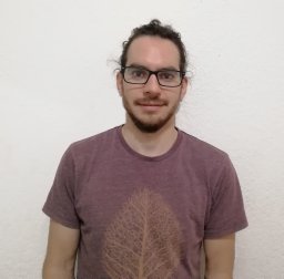 Jonathan V. Solorzano合作论文数Ctr Invest Geog Ambiental, Univ Nacl Autonoma Mexico3
 Francisco Mora合作论文数Inst Invest Ecosistemas & Sustentabilidad, Univ Nacl Autonoma Mexico3
 Thakur Prasad Bhattarai合作论文数3
 Eduardo Garcia Frapolli合作论文数3
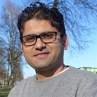 Pratihast Arun Kumar合作论文数Centre for Geo-Information, Wageningen University3Diego Perez-Salicrup合作论文数national autonomous university of mexico3
 Alejandro Casas合作论文数Centro de Investigaciones en Ecosistemas, Universidad Nacional Autónoma de México3
 Douglas Macmillan合作论文数Nottingham Breast Institute, Nottingham City Hospital3
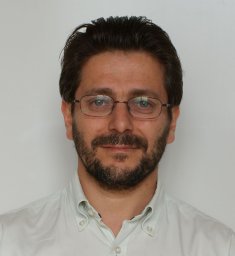 John R. Healey合作论文数School of the Environment and Natural Resources, Bangor University3
 Markku Kanninen合作论文数Department of Forest Sciences, Faculty of Agriculture and Forestry, University of Helsinki3Silvia Solís合作论文数3
 Bocco Gerardo合作论文数Centro de Ecología, UNAM AP 27-H. Santa María Guido3e riegelhaupt合作论文数3P. E. Van Laake合作论文数3P. van Laake合作论文数2john massao合作论文数2Richard Lewis合作论文数2
 Per Moestrup Jensen合作论文数Department of Plant and Environmental Sciences, Faculty of Science, University of Copenhagen2
 Michael Poulsen合作论文数Department of Biology, Faculty of Science, University of Copenhagen2




