The shrimp trawl fishery in northern Peru operates within five nautical miles and presents high bycatch rates. To reduce the impact on marine biodiversity, a new net (MN) was designed and compared against the traditional net (TN) during 27 paired hauls from November 2019 to February 2020 in the area between Los Órganos and Lobitos, Piura. During each haul, two vessels operated simultaneously in the same area, deploying one net each, and total catch, bycatch, and discards were recorded for both nets. The MN showed a reduction of over 35% in bycatch and a 50% decrease in discards compared to the TN. The catch by weight of the target species (Penaeus californiensis) and two other commercially important bycatch species (Diplectrum conceptione and Etropus ectenes) was not significantly affected. Although a decrease in the catch of all taxonomic groups evaluated (fish, crustaceans, mollusks and macroalgae) with the MN was observed, this reduction was not statistically significant for fish. The number of species per taxonomic group (total, fish, crustaceans, mollusks) also decreased with the use of MN, for all taxa evaluated. In summary, the results of this study demonstrate that the implementation of MN, characterized by its different material, exclusion areas and larger mesh sizes compared to TN, allows reduction of the impact of this fishery without affecting the target species catch.
Small-scale fisheries (SSF) represent over three-quarters of all active vessels in the European fleet yet remain largely invisible in marine spatial planning due to the lack of spatial data. This data gap has contributed to the marginalisation of SSF in policy and governance, despite their ecological, economic, and socio-cultural significance. The recent revision of the EU Fisheries Control Regulation (CR 2023/2842), mandating vessel tracking for all fishing vessels-including those under 12 metres by 2029-offers a critical opportunity to integrate SSF into formal spatial and fisheries management processes. This paper synthesises insights from researchers across 24 institutions in Europe to assess the current state of SSF tracking, estimate existing coverage, and identify opportunities and challenges for implementing an EU-wide SSF tracking programme. We estimate that approximately 12% of the SSF fleet is currently tracked, primarily within net, trap, and dredge fisheries. While researchers broadly recognise the value of spatial data for improved spatial planning and ecosystem assessment, several challenges hinder implementation, including high implementation costs, limited institutional capacity, and fragmented or incompatible data infrastructures. We recommend: (i) the development of clear technical requirements and harmonised data protocols, (ii) leveraging tracking data to support participatory and adaptive management, and (iii) ensuring inclusive governance that reflects the socio-cultural dimensions of SSF. As EU Member States move toward full implementation of CR 2023/2842, early decisions will shape not only the technical architecture of tracking systems, but also the broader governance future of European SSF. A more equitable and integrated approach is essential-and achievable.
The movements of aquatic animals affect their exposure to threats and the efficacy of conservation measures, such as Marine Protected Areas (MPAs). However, many species' movements remain poorly understood and difficult to reconstruct from available datasets, hampering conservation efforts. This is especially the case for species that rarely surface, for which data are often limited to observations from acoustic telemetry (detections) and ancillary sensors, such as archival tags. Here, we pioneer the use of state-of-the-art particle algorithms to model animal movement, integrate datasets and assess MPA design, using a case study of the Critically Endangered flapper skate ( Dipturus intermedius ) in Scotland. Our algorithms led to 5-fold improvements in maps of space use and 30-fold improvements in residency estimates (lower mean error) compared to prevailing heuristic methods. By formally integrating tracking datasets, we were uniquely able to examine movements beyond receivers into fished zones, MPA-scale residency and specific habitats beyond protected areas that may warrant protection. This work showcases a probabilistically sound modelling framework that is sufficiently fast, flexible and accessible to meet the demands of modern animal-tracking datasets in acoustic telemetry systems. This represents a marked advance for analyses of animal movements and MPA efficacy worldwide. ### Competing Interest Statement The authors have declared no competing interest.
The Great Atlantic scallop, or King scallop (Pecten maximus), ranks third in value after mackerel and Nephrops in UK fisheries. Its landings have surged over recent decades, making it the UK's fastest-growing fishery. Scallop stock assessments, crucial for sustainable fisheries management, traditionally rely on fisheries surveys, including underwater imaging and dredge sampling. Data on areas that contain scallops but not fishable using dredges is lacking. Dredge sampling is also potentially destructive. Remote data collection using drop down cameras and towed video are used, but there are few tools available to analyse these data automatically. P. maximus are usually recessed in fine sand and gravel habitats making image identification challenging. This study explores the potential of Artificial Intelligence (AI), specifically the NetHarn model from the VIAME toolkit, to identify and count scallops from underwater video transects. The research utilises diverse video footage from NatureScot, captured with custom camera systems (DDV and miniDDV), providing varied habitat, image quality, and camera specifications. Previous AI studies of this species artificially placed scallops on the seabed and are not representative of natural presentation. This research applies the same AI model to survey images featuring scallops in their natural habitat. Results showed moderate performance of the NetHarn model, achieving an F1 score of 0.44 and a mean Average Precision (mAP) of 0.41 when classifying scallops into three categories: king, queen, and dead. Model performance varied across geographic locations, camera platforms, and habitat types, with challenges including blurred images and mislabelling. The study emphasises the need for improved data acquisition, standardised camera systems, and larger annotated datasets to enhance AI model performance. Despite moderate results, this research highlights AI's potential for automating estimation of scallop stock abundance and marine habitat monitoring. Future efforts should focus on addressing image quality issues, increasing sample sizes, and optimising data collection for enhanced marine conservation and fisheries management.
Animal movements affect their exposure to threats and the efficacy of conservation measures, such as marine protected areas (MPAs). However, many species' movements are difficult to reconstruct from available datasets, hampering conservation efforts. This is especially the case for aquatic species that rarely surface, for which data are often limited to observations from acoustic telemetry (detections) and ancillary sensors. Here, we pioneer the use of state-of-the-art particle algorithms to model movements, integrate datasets, and assess MPA design, leveraging a case study of a Critically Endangered elasmobranch. Our algorithms led to 5-fold improvements in space-use maps and 30-fold improvements in residency estimates compared to prevailing methods. By integrating tracking datasets, we were uniquely able to examine movements beyond acoustic receivers, MPA-scale residency, and specific habitats beyond protected areas that warrant protection. This work reveals a modeling framework that enhances the conservation value of acoustic telemetry, supporting analyses of MPA efficacy worldwide.
The Great Atlantic scallop or King scallop, Pecten maximus, holds a prominent position in the UK's fishing industry, ranking third in first sale value after mackerel and Nephrops. Its landings have significantly increased over the past decades, making it the fastest-growing fishery in the UK. Scallop stock assessments are crucial for sustainable fisheries management, typically relying on fisheries-dependent and independent surveys, including underwater imaging and dredge sampling.Traditional stock assessment methods, such as Virtual Population Analysis (VPA), have been supplemented by Time Series Analysis (TSA) approaches. However, these methods are limited to areas targeted for fishing, leaving data gaps in other regions.This research explores the potential of Artificial Intelligence (AI), specifically the NetHarn model provided by the VIAME toolkit, to identify and count king and queen scallops from towed underwater video transects. The study utilizes video footage from NatureScot, captured using custom camera systems (DDV and miniDDV), providing a diverse dataset with variations in habitat, image quality, and camera specifications. Previous studies using AI to count scallops artificially placed king scallops on the seabed. While the results exhibited good precision and recall, the experiment did not represent scallops in their natural state. This limitation was primarily attributed to the fact that the scallops did not have adequate time to fully recess. This study represents the application of the same model to survey images that include scallops in their natural setting. The results achieved using these data showed that the NetHarn model, a Cascade Faster R-CNN, exhibited modest performance, achieving an F1 score of 0.36 and a mean Average Precision (mAP) of 0.32 when classifying scallops into three categories: king, queen, and dead. The study also compared model performance across different geographic locations, camera platforms, and habitat types, revealing variations in accuracy.Error analysis highlighted challenges related to image quality, especially blurred images, and labelling stones or similar objects as scallops. The study emphasized the need for improved data acquisition, standardized camera systems, and larger annotated datasets to enhance AI model performance.Despite the modest results, this research underscores the potential of AI for automating scallop stock assessments and marine habitat monitoring. Future efforts should focus on addressing image quality issues, increasing sample sizes, and optimising data collection to harness the full potential of AI in marine conservation and fisheries management.
Knowledge on the spatial and temporal distribution of the activities carried out in the marine environment is key to manage available space optimally. However, frequently, little or no information is available on the distribution of the largest users of the marine space, namely fishers. Tracking devices are being increasingly used to obtain highly resolved geospatial data of fishing activities, at intervals from seconds to minutes. However, to date no standardized method is used to process and analyse these data, making it difficult to replicate analysis. We develop a workflow to identify individual vessel trips and infer fishing activities from highly resolved geospatial data, which can be applied for large-scale fisheries, but also considers nuances encountered when working with small-scale fisheries. Recognizing the highly variable nature of activities conducted by different fleets, this workflow allows the user to choose a path that best aligns with the particularities in the fishery being analysed. A new method to identify anchoring sites for small-scale fisheries is also presented. The paper provides detailed code used in each step of the workflow both in R and Python language to widen the application of the workflow in the scientific and stakeholder communities and to encourage its improvement and refinement in the future.
Passive acoustic telemetry is widely used to study the movements of aquatic animals. However, a holistic, mechanistic modelling framework that permits the reconstruction of fine‐scale movements and emergent patterns of space use from detections at receivers remains lacking. Here, we introduce an integrative modelling framework that recapitulates the movement and detection processes that generate detections to reconstruct fine‐scale movements and patterns of space use. This framework is supported by a new family of algorithms designed for detection and depth observations and can be flexibly extended to incorporate other data types. Using simulation, we illustrate applications of our framework and evaluate algorithm utility and sensitivity in different settings. As a case study, we analyse movement data collected from the Critically Endangered flapper skate ( Dipturus intermedius ) in Scotland. We show that our methods can be used to reconstruct fine‐scale movement paths, patterns of space use and support habitat preference analyses. For reconstructing patterns of space use, simulations show that the methods are consistently more instructive than the most widely used alternative approach (the mean‐position algorithm), particularly in clustered receiver arrays. For flapper skate, the reconstruction of movements reveals responses to disturbance, fine‐scale spatial partitioning and patterns of space use with significant implications for marine management. We conclude that this framework represents a widely applicable methodological advance with applications to studies of pelagic, demersal and benthic species across multiple spatiotemporal scales.
An artisanal shrimp trawl fishery operating illegally in northern Peru has high levels of bycatch and three main commercial species. Here we provide the first characterisation of the socio-economic contribution of this fishery. Estimates have been generated for the capital values, operational and maintenance costs, as well as net profits at point of landing and across the value chain. This fleet sector in northern Peru is estimated at 105 vessels, generating an annual gross income of U$D 4.8 million with 315 direct jobs. Vessel owners could potentially have a net income of over ∼$12,000 per year, and crew are likely to be earning 45 % above the living wage for similar land-based rural employment, including other fishing activities operating in the same areas. With an appropriate multiplier for the seafood supply chain, the gross economic value of the fishery from landings up to the retail level is estimated at U$D 35 million with 915 jobs. Recommendations for improving the sustainability of the fishery and possible mitigations are discussed to address the gulf between policy and regulatory intent and reality, where enforcement is lacking or absent.
Increasing competition for marine space requires the appropriate development of indicators to best represent the use of marine areas and the value (whether economic, social and/or cultural) derived from such use. Fishers (the largest group of users) are often under-represented in marine spatial planning processes. Highly-resolved vessel tracking data provide opportunities to map the activities of fishing vessels at a level of detail never before available. Most effort mapping methods have focused on active gears such as trawls or dredges in large scale fisheries. For these fisheries, the time spent fishing at sea (hours) is usually a representative indicator of fishing effort, enabling a straightforward mapping of the most important fishing grounds. However, for passive gears generally used in small-scale fisheries, we show that spatial indicators of effort (here, length of vessel track) greatly outperform time-at-sea as an indicator of fishing effort. We further demonstrate and validate a method to estimate gear soak time from vessel tracking data and show how maps of effort that account for soak time can be different from those solely based on time spent fishing at sea. The development of adequate methods to quantify the spatial distribution of passive gear effort is particularly relevant to fisheries management because globally about a fifth of all catches (by weight) are landed by passive gears. Appropriate, fine scale effort maps will provide better tools for spatial planning to support sustainable fishing.
Around 4.2 million tonnes of fish and other species, some of which are of conservation concern, are discarded every year in bottom trawl fisheries. This study focusses on a small-scale shrimp trawl fishery located in northern Peru that operates with high level of discards which causes conflict with other local fishers. Despite trawling being an illegal activity within the 5NM off the coast, this fishery has been operating in these inshore areas for over 40 years because it sustains the well-being of hundreds of fishers. This study aimed to identify the factors that affect the spatio-temporal variation in catches in order to propose recommendations that can be adopted by fishers to minimise their impact on the ecosystem while still providing economic opportunities. The spatial distributions of shrimp, main commercial species and discards were modelled over time using hierarchical generalised additive models. Strong spatio-temporal variation was observed for all catch components and moon phase affected commercial species and discards differently. The results show that, to reduce the environmental impacts of this fishery in the short-term, the fishing area could be divided into north and south and that fishing activities should be limited to the southern area in the autumn. Other recommendations rely on temporal closures during the week of the first quarter of the moon phase. Finally, considering the institutional weaknesses in monitoring, control and surveillance, we suggest that the only realistic approach to reduce the fishery's environmental impacts in the short-term is to foster the willingness of fishers to adopt responsible fishing practices. Yet, long-term solutions will require comprehensive co-management efforts.
Due to global population declines, there is a pressing need for data on the life history traits of many elasmobranch species to support the development of species-specific management plans. A lack of information on the reproductive cycle of the Critically Endangered flapper skate Dipturus intermedius was recently identified as a hindrance to its conservation. To address this data gap, we combined non-lethal ultrasound and hormone analysis to investigate the size at maturity and reproductive cycle of the flapper skate in the Loch Sunart to the Sound of Jura Marine Protected Area off the west coast of Scotland. In-field ultrasound imagery revealed encapsulated eggs in utero and was used to determine the presence and size of ovarian follicles. Combining these images with levels of plasma testosterone, progesterone and oestradiol provided valuable insights into the timing of the reproductive cycle and maturity state of the flapper skate. This preliminary study suggests that male skate start to mature at 165 cm and females at 203 cm total length. Oestradiol appears to be the primary hormone controlling the female reproductive cycle and, along with ultrasound images, indicates that females lay pairs of eggs throughout a winter egg-laying season. Our study further highlights how non-lethal methods can be used to investigate the life history of oviparous elasmobranchs in the field. This information will support the identification of important life history groups and their associated habitats and contribute to the development of management strategies for these species.
About a third of all marine fish in the world are caught in Small-Scale Fisheries (SSF). SSF are increasingly recognised as essential for food security and livelihoods for vulnerable and economically fragile communities globally. Although individual SSF vessels are usually perceived as having little impact on the ecosystem, the cumulative impact of gear type and number of vessels may be substantial. Bottom trawling is a common fishing method that can greatly influence the marine ecosystem by damaging the seafloor and generating high levels of discards. However, appropriate sampling coverage using on-board observer programmes to collect these data from SSF are rare, as they are expensive and pose logistical constraints. A mobile App was used to assess whether self-reporting by fishers could provide reliable fine-scale information on fishing effort and discards over time in an illegal shrimp trawling fishery in northern Peru. Maps depicting the spatial distribution of trawling effort and the proportion of discards from observers and fishers were compared using the Similarity in Means (SIM) Index, which ranges from 0 when spatial patterns differ completely to 1 when spatial patterns are very similar. High levels of agreement between spatio-temporal patterns of effort (SIM Index = 0.81) and discards (0.96) were found between fisher and observer maps. Moreover, far greater spatial coverage was accomplished by fishers, suggesting that self-reporting via an App represents a useful approach to collect reliable fisheries data as an initial step for effective monitoring and management of these fisheries.
Marine Protected Areas (MPAs) are widely used in marine management, but for mobile species understanding the spatio-temporal scale of management measures that is required to deliver conservation benefits depends on a detailed knowledge of species' movements that is often lacking. This is especially the case for species of skate (Rajidae) for which relatively few movement studies have been conducted. In Scotland, the Loch Sunart to the Sound of Jura MPA covering 741 km(2) has been designated for the conservation of the Critically Endangered flapper skate (Dipturus intermedius), but fine-scale movements within this area remain poorly understood. A passive acoustic telemetry study which coupled acoustic tagging of 42 individuals and a static array of 58 receivers was conducted from March 2016 to June 2017. Using acoustic detection time series, angler capture-recapture data and depth time series from archival tags, fine-scale movements of individuals were investigated. Overall, 33 of the 42 tagged individuals were detected. Residency, site fidelity and transiency were documented. Residency around receivers, lasting from 3 to more than 12 months, was documented in 16 acoustically detected individuals (48%) and all life-history categories, but was most noticeable among females. Acoustic detections were associated with depth, salinity and season, but there was no evidence that individuals formed close-knit groups in the areas in which they were detected. Taken together with historical occurrence records of flapper skate, the prevalence and scale of residency documented here suggest that the MPA is sufficiently large to benefit a notable percentage (38 [24-52]%) of skate found in the study area over monthly and seasonal timescales. This result strengthens the case for the use of MPAs to support the conservation of flapper skate and other skate species that display similar movement patterns in areas of high local abundance.
Catch-and-release angling is widespread, but the impacts of this practice for captured individuals are understudied, especially among elasmobranchs. Studies on sub-lethal behavioural impacts are particularly sparse, despite their importance for the interpretation of biologging data and for assessments of species’ tolerance to capture. In this study, the behavioural responses of flapper skate ( Dipturus intermedius ) to catch-and-release angling were described for the first time, using archival observations (depth and temperature) for 21 tag deployment/retrieval events and five recreational angling events that occurred during tagged individuals’ time at liberty from charter vessels off the west coast of Scotland in 2016–17. During capture (8–50 minutes), the changes in depth and temperature experienced by individuals typically exceeded natural variability. Post-release, behavioural change was apparent from visual inspection, regression and functional data analysis of the time series. Immediately following release, movements into deeper water and short periods of low vertical activity (usually 1–2 hours in duration) were common. However, overall average vertical activity was typically around 38% higher in the 12 hours following release than in undisturbed activity. A small number of individuals (n = 3, 14%) exhibited irregular post-release behaviour in the form of rapid, transient re-ascents towards the surface following release. Collectively, the evidence for limited, short-term behavioural changes suggests that flapper skate behaviour is relatively resilient to catch-and-release angling from charter vessels, but irregular post-release behaviour in 14% of individuals is sufficiently notable to indicate that further research is required on the impacts of this practice. This study clearly demonstrates the value of biologging data and behavioural analyses for examining the impacts of disturbance and separating ‘disturbed’ and ‘undisturbed’ behaviours in studies of animal movement.
Large Scale Fisheries (LSF), with Length Over All (LOA) larger than 12 to 15 m are generally subject to national and international regulations that require they carry some form of tracking system that is capable of reporting their position with a prescribed frequency and accuracy. However, Small Scale Fisheries (i.e. LOA < 15 m) although representing similar to 90% of the world's fishers they are generally not subject to such regulation and thus important data related to the location, intensity and type of fishing activity for the majority of SSF is unknown. LSF are tracked using an Automatic Identification System (AIS) and/or Vessel Monitoring System (VMS). The need to develop tracking systems suitable for use in SSF is increasing as regulators and many of those involved in this fishing sector recognize the potential advantages of collecting this data. Funded by Scottish Government, this research represents a structured analysis of track data from a trial of a low cost tracking system being conducted in the Outer Hebrides, Scotland. Approximately similar to 40 creel fishing vessels (LOA < 12 m) have been fitted with the tracking system since November 2020.
Developments in animal electronic tagging and tracking have transformed the field of movement ecology, but interest is also growing in the contributions of tagged animals to oceanography. Animal-borne sensors can address data gaps, improve ocean model skill and support model validation, but previous studies in this area have focused almost exclusively on satellite-telemetered seabirds and seals. Here, for the first time, we develop the use of benthic species as animal oceanographers by combining archival (depth and temperature) data from animal-borne tags, passive acoustic telemetry and citizen-science mark-recapture records from 2016–17 for the Critically Endangered flapper skate ( Dipturus intermedius ) in Scotland. By comparing temperature observations to predictions from the West Scotland Coastal Ocean Modelling System, we quantify model skill and empirically validate an independent model update. The results from bottom-temperature and temperature-depth profile validation (5,324 observations) fill a key data gap in Scotland. For predictions in 2016, we identified a consistent warm bias (mean = 0.53 °C) but a subsequent model update reduced bias by an estimated 109% and improved model skill. This study uniquely demonstrates the use of benthic animal-borne sensors and citizen-science data for ocean model validation, broadening the range of animal oceanographers in aquatic environments.
Approximately 70 % of the Scottish fishing fleet target shellfish using baited creels. Bait is an essential component of catch success, but the economic and environmental implications of bait use are unknown. In this preliminary study, a short survey was circulated to members of the Scottish inshore creeling fleet and analysed alongside spatial data from 8 creel fishing vessels. Bait biomass, input into coastal waters through creeling activity, was calculated along with bait types, motivations surrounding the discarding of used bait and the annual estimated spatial concentration. Findings indicate that preferred bait types differ with geographic location and cost the creeling sector approximately 9.8 pound million annually at the time of the survey, equating to 16.3 % of the nominal 2018 shellfish landing value. Data from this research suggests that approximately 13,492 metric tonnes of bait biomass enters coastal Scottish waters through creeling activities annually. Vessel tracks showed fishers returning to certain fishing grounds repeatedly, indicating that bait biomass input is highly localised. Hotspots of fishing activity were calculated to receive up to 75 kg ha-1 and 47 kg ha-1 of bait biomass per fisher annually when fishing Nephrops and crab/ lobster, respectively. Bait discarding occurs most frequently at the fishing grounds with convenience being the main motivation. This study provides a baseline for future studies and prompts the consideration of bait use in the management of creel fisheries.
Trends in depth and vertical activity reflect the behaviour, habitat use and habitat preferences of marine organisms. However, among elasmobranchs, research has focused heavily on pelagic sharks, while the vertical movements of benthic elasmobranchs, such as skate (Rajidae), remain understudied. In this study, the vertical movements of the Critically Endangered flapper skate (Dipturus intermedius) were investigated using archival depth data collected at 2 min intervals from 21 individuals off the west coast of Scotland (56.5°N, −5.5°W) in 2016–17. Depth records comprised nearly four million observations and included eight time series longer than 1 year, forming one of the most comprehensive datasets collected on the movement of any skate to date. Additive modelling and functional data analysis were used to investigate vertical movements in relation to environmental cycles and individual characteristics. Vertical movements were dominated by individual variation but included prolonged periods of limited activity and more extensive movements that were associated with tidal, diel, lunar and seasonal cycles. Diel patterns were strongest, with irregular but frequent movements into shallower water at night, especially in autumn and winter. This research strengthens the evidence for vertical movements in relation to environmental cycles in benthic species and demonstrates a widely applicable flexible regression framework for movement research that recognises the importance of both individual-specific and group-level variation.
 Sophie Smout合作论文数Sea Mammal Research Unit, University of St. Andrews12
 James Thorburn合作论文数Scottish Oceans Inst, Univ St Andrews10
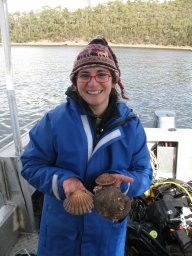 Mendo Tania合作论文数Institute for Marine and Antarctic Studies, University of Tasmania9
 Edward Lavender合作论文数Ctr Res Ecol & Environm Modelling, Univ St Andrews8
 Jane Dodd合作论文数8
 Janine B. Illian合作论文数Department of Mathematical Sciences;University of Abertay;Department of Mathematical Sciences, University of Abertay7t mendo合作论文数6
 Gordon B. Curry合作论文数6
 Peter Wright合作论文数Ecology and Conservation Group, Marine Scotland Science6A. D. Ansell合作论文数6
 Dmitry Aleynik合作论文数Scottish Assoc Marine Sci6Swithun Crowe合作论文数5J. Mendo合作论文数4Paddy McCann合作论文数4I. Gomez合作论文数3
 Anna Mujal-Colilles合作论文数Marine Engineering Laboratory, UPC-Barcelona Tech3
 Lloyd Peck合作论文数British Antarctic Survey, Natural Environment Research Council;Institute for Protein Biochemistry;Wolfson College, Cambridge University3M.C. Rhodes合作论文数3J. Side合作论文数2
 Georgina Cole合作论文数2Ali McKnight合作论文数2Kyla Orr合作论文数2Janneke M Ransijn合作论文数Scottish Oceans Institute, University of St. Andrews2
 Stanisław W. Biber合作论文数Math Inst, Univ Oxford2
 Renato Gozzer-Wuest合作论文数Programs Division, Sustainable Fisheries Partnership2Arne Vögler合作论文数2
 Estanis Mugerza合作论文数IFREMER, STH2
 Esther Lane Jones合作论文数School of Applied Sciences, University of South Wales2
 Sarah Mackay合作论文数2
 Ana Isabel Rodriguez Perez合作论文数Facultade de Medicina e Odontoloxía, University of Santiago de Compostela2
 Lene Friis Møller合作论文数2Carlo Albert合作论文数2
 Andreas Scheidegger合作论文数2
 Alejandro Gallego合作论文数2
 Michael Heath合作论文数Department of Mathematics and Statistics, University of Strathclyde2Alwyn Williams合作论文数2
 Vengatesan Venugopal合作论文数2
 Harshinie Karunarathna合作论文数School of Engineering, University of Glasgow2
 Michael T Burrows合作论文数Scottish Association for Marine Science2
 William Guy Sanderson合作论文数2
 Theodore B. Henry合作论文数University of Plymouth Ecotoxicology and Stress Biology Research Group, School of Biological Sciences Drake Circus Plymouth UK2Josefine Egekvist合作论文数2
 Simon Northridge合作论文数School of Biology, University of St Andrews2D. I. MacKinnon合作论文数1Alexander James Coram合作论文数1Felicity Spoors合作论文数1reddy nemalidinne合作论文数School of Engineering, The University of Edinburgh1Caroline Lynam合作论文数1Simon M Waldman合作论文数1




