An implementation of Meta's 2023 foundation artificial intelligence model, Segment Anything (SAM) is tested and used to assist in mapping changes in the extent of riparian woodland using publicly available archival aerial imagery along three gravel bed, meandering, river reaches in rural settings in the UK. Using visual prompts in interactive mode, this newly applied approach is shown to deliver substantial time savings over manual digitisation techniques and, for the type of imagery and the small-scale deployed, potentially greater accuracy. When applied to high-resolution (25 cm) aerial imagery SAM appears to be a practical and useful method for examining vegetation and landform change in a manner that has previously only been feasible through detailed field studies. The extent of riparian wood increased by 37-46% between 1999 and 2022 along all three reaches with extension occurring in three main situations: lateral expansion of existing woodland patches along stable or near stable banks; localised bankside establishment of trees transplanted under flood conditions; and progressive colonisation of point bars that developed through channel migration. Considering these factors, important conditions for the establishment, survival and expansion of riparian wood are discussed and likely differences in species distribution according to the geomorphic context are highlighted.
Rural and coastal communities in areas of socio-economic deprivation face increasing exposure to compound climate-related hazards, including flooding, erosion and extreme heat. Effective adaptation planning in these contexts requires approaches that integrate physical hazard modelling with measures of social vulnerability in a transparent and reproducible way. This study develops and applies the Adaptive and Resilient Rural-Coastal Communities in Lincolnshire (ARRCC-L) framework, a sequential process combining data collation, two-dimensional hydraulic simulation using LISFLOOD-FP, and composite vulnerability mapping. The framework is versioned and protocolised to support replication, and is applied to Lincolnshire, UK, integrating UKCP18 climate projections, high-resolution flood models, infrastructure accessibility data and deprivation indices to generate multi-scenario flood exposure assessments for 2020–2100. The findings demonstrate how open, reproducible modelling can underpin inclusive stakeholder engagement and inform equitable adaptation strategies. By situating hazard analysis within a socio-economic context, the ARRCC-L framework offers a transferable decision support tool for embedding resilience considerations into regional planning, supporting both local adaptation measures and national risk governance.
The basis for attribution assessments of current extreme weather and climatic events such as droughts and floods is that the record of such events is of sufficient length to be able to compare the occurrence and severity of recent events with those in the past. If this assumption holds, then the magnitude and frequency of extreme hydrological events in the current anthropogenically forced climate can be compared with those in the past under an unforced climate. Attempts to attribute recent floods to anthropogenically-forced climate change have been made, but we argue that such assessments have failed to correctly analyse the true frequency and magnitude of past floods, when anthropogenic Greenhouse Gas (GHG) forcing was low. In this paper we use well-dated, multi-millennial and multi-centennial length records of large floods from multiple sites across Western and Southwestern Europe that demonstrate past floods were occasionally of much higher magnitudes than those of the present-day, and that attribution studies are presently unable to claim that human-created greenhouse gas emissions have increased flood magnitude. We show that flood magnitude was significantly higher before the 20th century, despite there being a negligible greenhouse gas contribution from humans, which means that natural variability might be significantly higher than assumed by climate modellers. This has profound implications for flood planning and climate adaptation policy, as many recent floods cannot be viewed as unprecedented, even in the historical record.
Abstract Tree ring‐based climate reconstructions are fundamental for high‐resolution paleoclimatology, but only a few of them extend back into the mid‐Holocene (8,200–4,200 years BP). Here, we present annually‐resolved tree‐ring stable carbon and oxygen isotopes (δ13C and δ18O) from subfossil yew (Taxus baccata) wood excavated in the Fenland region of eastern England. We develop an eco‐physiological model to reconstruct hydroclimate variability from 5,224 to 4,813 ± 4 and 4,612–4,195 ± 6 cal. years BP. Our findings suggest that a relative sea‐level rise in the North Sea, riverine flooding, and a prolonged negative phase of the North Atlantic Oscillation caused unusually wet conditions around 4,200 years ago when yew woodlands in eastern England disappeared. We expect our study to stimulate high‐resolution stable isotope measurements in relict wood and encourage the integration of terrestrial and marine proxy archives to reconstruct the causes and consequences of large‐scale climate variations around the still debated 4.2 ka event.
The lower Yellow River has experienced enormous floods, levee breaches, and channel avulsions over the last 4000-year history, resulting in the deposition of extensive paleoflood sediments across the North China Plain. However, a comprehensive investigation of paleoflood stratigraphy in alluvial plains is still lacking. Here, representative paleoflood profiles along the abandoned channel areas in the lower Yellow River have been comprehensively and systematically analyzed in terms of sedimentology, stratigraphy, and chronology. Our findings reveal that the subsurface stratigraphy is mainly formed by twelve lithological facies and four facies associations. The facies associations are interpreted to represent lowland, paleosol, overbank and channel environments. Compared with the mutable overbank and channel deposits, lowland and paleosol facies that have been developed during relatively stable periods without flood aggradation can be utilized to refine stratigraphic correlations. By combining stratigraphic evidence and radiometric dating results, four sedimentary units are consistently identified in the study area: Unit I related to the early geomorphic surface before the similar to 8.0 ka, Unit II represents stability period during the middle Holocene, Unit III with different sequences of overbank flood deposits and paleosols suggesting an abrupt environmental change since similar to 4.0 ka, and Unit IV of widely distributed indicating the frequent cycles of flood and interflood since the last millennium. Furthermore, a sedimentary model of paleofloods with a distinct upward-coarsening sequence along the abandoned channel areas is proposed, illustrating the multi-stage deposition of the flooding process. In particular, the thick layer of uniform silt and clay in the lower Yellow River demonstrates distinct features of slack water deposits, which explores the potential of applying the traditional method to more populated and higher-risk areas on floodplains and similar lower rivers.
The Loddon River floodplains, Victoria, southeast Australia, is contaminated with high levels of As (up to 300 mg kg-1) due to re-deposited mine tailings from historical gold mining (1851-1914). Arsenic concentrations often significantly exceed Australia's sediment guidelines (ISQG-high value of 70 ppm). To determine the potential risk associated with As, this study examined the speciation of As and its mineral phase association in sediments along a 60 km stretch of the river, and investigated how As is released under redox cycling conditions. Sequential extraction procedures (SEP) revealed that As is primarily associated with crystalline Feyyoxyhydroxides (up to 40 %) and residual phases (up to 70 %). X-ray absorption spectroscopy (XAS) analyses showed that As was predominantly in its pentavalent state, existing mainly as Feyyoxyhydroxides-sorbed arsenate (Fe-AsO4), with a small amount (up to 18 %) of reduced arsenopyrite (FeAsS) present upstream reaches of the Loddon River. A column experiment simulating flooding-drying cycles was used to assess As mobility. Under reducing conditions, in the presence of a carbon source, As concentrations in the water increased dramatically, reaching up to 1300 mu g L-1, far exceeding the WHO drinking water guideline of 10 mu g L-1. Microbially-mediated reductive dissolution of Feyyyoxyhydroxides and reduction of As from As(V) to As(III), which has lower affinity for Feyyoxyhydroxides, was likely responsible for this As release. These findings highlight the enduring presence of As contamination in floodplains impacted by historical gold mining. Furthermore, this study underlines the potential environmental and health risks posed by As in floodplain sediments, particularly as wetting and drying cycles can increase its mobility. Greater efforts are needed to assess the spatial extent of historical pollution in impacted river catchments and develop comprehensive mitigation strategies to address the widespread contamination of floodplain sediments in affected river systems globally.
Abstract This study focuses on heavy metals distribution and their ecological risk in river water, bed sediment, and suspended particulate matter (SPM) along the Ganga River basin. Overall abundance of the metals followed the sequence, Fe > Al > Mn > Pb > Ni > Cd > Cr > Zn > Co in water, Al > Fe > Mn > Zn > Cr > Cu > Ni > Co > Pb > Cd in bed sediment, while Al > Fe > Mn > Cr > Zn > Ni > Cu > Pb > Co > Cd in SPM. Among the abundant metals, Fe and Mn average concentrations exceeded BIS and WHO limits in river water. Similarly, Fe, Cd, and Zn, and most metals exceeded local background concentrations in bed sediment and SPM, respectively. Major ion chemistry in water signified carbonate weathering dominance during the time of sampling. Generally, Mn, Ni, Cu, Cr, and Co were derived from natural weathering and erosion, while Zn, Cd, and Pb were derived from both natural and anthropogenic sources. Metal index (MI) for river water showed that 27% of the locations were anthropogenically affected, whereas contamination factor and ecological risk assessment indicated highest contamination and risk from Cr and Cd in suspended sediments around urban centers in the middle basin. Furthermore, the confluence of Chambal and Yamuna increased heavy metal load in Yamuna and Ganga, respectively. The study highlighted the role of the water–sediment interaction indicating SPM is acting as a sink for metals followed by bed sediment.
Ballarat's mining history is celebrated, but less known is the environmental damage to local waterways. Ballarat's goldmines were amongst the richest in Australia, and they all sent their waste into the Yarrowee River. An interdisciplinary approach that integrates documentary evidence with insights from archaeology and geomorphology reveals the effects of mine waste on the river during the nineteenth century and how those effects continue to be felt. Deposits of mine tailings remain on the floodplains from Ballarat East downstream to Inverleigh and the junction with the Barwon River. Historical perspectives provide crucial context for understanding lasting changes to the Yarrowee and its catchment and how the effects of goldmining continue to have lasting impacts on heritage, ecosystems, and river health.
The Nile Basin drains about one-tenth of the African continent and contains the longest river channel system in the world. This chapter reviews the evolution of the river – with a particular focus on the Quaternary Period including the present-day hydrology and fluvial geomorphology. Fluctuations in the climate and hydrology of tropical Africa during the Quaternary exerted an important influence on the behaviour of the Nile sediment system. During the cold stages of the Pleistocene, low lake levels reflect a decrease in precipitation as the expanded ice sheets cooled the global oceans and monsoon intensity fell. The marine sedimentary record in the Eastern Mediterranean provides a valuable record of the long-term behaviour of the River Nile because long-term changes in the flux of water and sediment from various parts of the catchment have exerted an important influence on oceanographic and sedimentation dynamics. The chapter examines the contemporary suspended sediment budget of the delta complex.
Climate change puts estuaries at higher risk of flooding from the land, river, and coast by increasing sea levels and extreme weather events such as heavy rainfall. Meanwhile, sediment delivery from catchments and the seas is expected to play a crucial role in estuarine to keep up with sea-level rise (SLR), which will consequently affect estuarine hydrodynamics and flood risks in the future. Nevertheless, the actual impact of fluvial inputs, and specifically, the role of catchment management for the long-term estuarine development, is less known due to a lack of integrated catchment and coastal modelling works. Therefore, this study built a modelling framework that combined catchment hydrological and estuary hydro-morphological processes to understand the impact of catchment management, particularly natural flood management, on long-term estuarine evolution. A cellular automata model (Bentley, 2016) and HEC-HMS were applied for estuary and catchment modelling, respectively. The reforestation scenario with and without SLR (3 mm/year) for 100 years on a hypothetical catchment and estuary were tested. The reforestation effect was captured as the proportionally reduced catchment discharge and sediment delivery at the rainfall events compared to the baseline (non-reforestation) scenario. Preliminary results, however, showed the estuarine morphology is less sensitive to reforestation cases. In both management scenarios, SLR cases resulted in a 50 % increase in sedimentation in the estuary compared to non-SLR. Though due to rapid SLR, that sedimentation was not sufficient to keep tidal prism constant, and it was increased by 13% in 100 years as a result. The above results/sensitivities are based on simulation runs, with no tidal pumping, incorporating this may change these results. Further work such as introducing tidal asymmetry to the estuary model will provide a more comprehensive view of the fluvial impact on estuaries' long-term evolution. Bentley, I. (2016) A novel cellular automata based estuarine morphodynamic model. PhD. University of Glasgow. Available at: http://theses.gla.ac.uk/6821/.
The article examines the effectiveness of GIS-technologies in Kazakhstan for determining and clarifying hydrographic characteristics (e.g. catchment area, river length, location, lakes and reservoirs), the analysis of hydrological processes and phenomena, as well as the creation of a cartographic and attributive database of water bodies. Yesil River, the main waterway of the central and northern part of Kazakhstan, is one of the least hydro- logically studied catchments in the region. To address this research and information gap data was obtained from remote sensing and runoff depth based on the Kazhydromet network for the period 1945 to 2016. A topographic and river network map (1:1,000,000) of the Yesil River basin, including locations of gauging stations as well as depth and runoff coefficient maps were created using ArcGIS software. These maps provide a very useful tool for water resource management and economic policy decision making.
The Aral Sea basin in Central Asia and its major rivers the Amu Darya and Syr Darya were the center of advanced river civilizations, and a principal hub of the Silk Roads trade network. The region’s decline has been traditionally attributed to the Mongol invasion of the early-13th century CE. In this study, we demonstrate the role of changing hydroclimatic conditions on the development of these culturally influential potamic societies that were depending on floodwater farming. Radiometric dating of irrigation canal abandonment and an investigation of regional river channel dynamics at Otrār oasis, a UNESCO World Heritage site located at the confluence of the Syr Darya and Arys rivers in southern Kazakhstan, revealed that major phases of fluvial aggradation occurred between the 7th to early-9th century CE and the mid-14th to mid-16th century CE. These periods coincide with economic flourishing of the oasis, facilitated by NAO-induced wet climatic conditions and higher river flows that favored floodwater farming. Periods of abandonment of the irrigation network and cultural decline primarily correlate with fluvial entrenchment during periods of drought. As the decline of the region seems to have initiated before the arrival of Ghenghis Khan and his armies, climate change has to be considered as a pivotal factor in the region's final demise.
Global plastic demand has led to a growing abundance of microplastics being detected across all environmental compartments. These microplastics pose a long-term health risk to ecosystems through accumulation, ingestion and leaching of chemicals. Knowledge of microplastics in river catchments has been limited due to their complexity, however as microplastics have a terrestrial origin, freshwater systems are considered to be a key pathway to other environments. They can transport microplastics to marine environments, act as temporary and long-term storage and aid degradation of larger plastics into smaller fragments that enter the aquatic system.As microplastics are linked to anthropogenic sources, much of the focus has been placed on urban and industrial areas, but in this study, we aim to assess a rural, agricultural catchment. River Witham catchment in Eastern England covers the area of 3,000km2 with a population of ~400,000. The river provides important drainage for the high-grade agricultural land in the fens and it discharges into the Wash, which is England’s largest nature reserve as well as an important area for shellfish aquaculture.This presentation will address the preliminary findings of this project by detailing the spatial variability of microplastics storage in riverbed sediments in an agricultural catchment. Data suggests that microplastic concentration could be as high in rural areas as it is in urban areas. The findings are expected to help improve the knowledge of microplastic contamination on a catchment level and to act as a basis for regional environmental protection.
The Ganga basin includes some of the most densely populated areas in the world, in a region characterized by extremely high demographic and economic growth rates. Although anthropogenic pressure in this area is increasing, the pollution status of the Ganga is still poorly studied and understood. In the light of this, we have carried out a systematic literature review of the sources, levels and spatiotemporal distribution of organic pollutants in surface water and sediment of the Ganga basin, including for the first time emerging contaminants (ECs). We have identified 61 publications over the past thirty years, with data on a total of 271 organic compounds, including pesticides, industrial chemicals, and by-products, artificial sweeteners, pharmaceuticals, and personal care products (PPCPs). The most studied organic contaminants are pesticides, whereas knowledge of industrial compounds and PPCPs, among which some of the major ECs, is highly fragmentary. Most studies focus on the main channel of the Ganga, the Yamuna, the Gomti, and the deltaic region, while most of the Ganga's major tributaries, and the entire southern part of the catchment, have not been investigated. Hotspots of contamination coincide with major urban agglomerations, including Delhi, Kolkata, Kanpur, Varanasi, and Patna. Pesticides levels have decreased at most of the sites over recent decades, while potentially harmful concentrations of polychlorinated biphenyls (PCBs), organotin compounds (OTCs), and some PPCPs have been detected in the last ten years. Considering the limited geographical coverage of sampling and number of analyzed compounds, this review highlights the need for a more careful selection of locations, compounds and environmental matrices, prioritizing PPCPs and catchment-scale, source-to-sink studies.
One of the most enduring and culturally vibrant potamic societies in the world are the Māori peoples of Aotearoa/New Zealand. The creation of the prints featured in this article have emerged from a long-term and ongoing trans-disciplinary art-science project – Te Awa Rio/the River’s voicen– that has for the first time brought together river scientists, visual artists and the Te Atihaunui- a-Paparangi people or iwi (kin groups) of the Whanganui River of the North Island. Offered, with much humility, these works show how indigenous knowledge, an understanding of deep time human- environment entanglements, and a reconnection with the watery realm, can offer society a way to rethink how best to navigate through and beyond our current planetary crisis. Planetary wellbeing, in the past as well as in the present era of anthropogenic climate weirding, pandemics and environmental breakdown, has often been measured by the health of our rivers and by the partnerships, formal or informal, that communities make with them and the watery realm more generally (Macklin and Lewin, 2020). Water is the lifeblood of humankind, and without water to support vital biological and social functions, people cannot flourish. The early ‘hydraulic’ civilisations of Mesopotamia, the Huang He (Yellow River), Indus and Nile Valleys understood this very well (Macklin and Lewin, 2015) and the fate of these societies was intimately entwined with their stewardship of water resources and their resilience from the impacts of exceptional floods and droughts.
Estimates of climatic suitability for malaria transmission in Africa over the periods 1971-2005, 2011-2040, 2041-2070 and 2071-2100. Seven climate projections using the high concentration scenario (RCP 8.5) were produced with EC-EARTH3-HR v3.1 by the Swedish Meteorological and Hydrological Institute (described in the Excel workbook). These were used to run the Lisflood hydrological model at 0.5 degree resolution and estimate hydro-climatic suitability for malaria transmission based on the Mordecai temperature ranges and Lisflood-predicted surface water availability. For each time period and each of the seven GCMs (i.e. 28 rasters) a 0.5 degree raster layer of the ‘number of suitable months for malaria transmission’ over Africa is presented in the form of a Geotiff. An Excel spreadsheet summarises these files in terms of total area in each 1 month category for the Lisflood estimates and the estimated changes in suitability between time periods. The population estimated to live within areas hydro-climatically suitable for malaria transmission is also presented, incorporating both present day estimates and future predictions. These data are broken down by country and summarised in terms of ‘population months’ for each time period.
The availability of water at the ground surface for vector mosquito larval habitats is a critical environmental control of malaria transmission. While ambient air temperature controls the rate of several components of the malaria transmission cycle, extensive laboratory and field studies mean that suitable temperature ranges are well established. In contrast, estimation of surface water availability from current global datasets remains challenging. Instead, monthly rainfall is typically used as a proxy for habitat availability; a threshold of 80 mm per month has gained traction as a proxy for breeding habitat in continental-scale models of malaria climate suitability in Africa and has been applied across the globe. However, since complex and spatially variable hydrological processes (e.g. infiltration, evaporation, soil moisture storage, transfer through and storage in river networks) are omitted, a wide variety of rainfall thresholds are found in the literature that leads to large differences in environmental suitability estimates. Moreover, irrigated areas have been observed to provide suitable year-round habitat for Anopheles mosquitos but are not included in such models. Here we show that across continental Africa, the estimated geographic range of climatic suitability for malaria transmission is more sensitive to precipitation thresholds than the thermal response curves applied. To address this problem and provide a more physical-basis for larval habitat estimation, we use daily climate predictions from seven downscaled general circulation models to run a continental-scale hydrological model (Lisflood) for a process-based representation of mosquito breeding habitat availability. A more complex pattern of malaria climatic suitability emerges as water is routed through drainage networks and river corridors serve as year-round transmission foci. The area estimated to be hydro-climatically suitable for stable malaria transmission is smaller than previous models suggest; however, more people are found in longer-transmission season areas due to higher-density populations along rivers and in irrigated areas. Hydro-climatic predictions of malaria suitable areas show only a very small increase in state-of-the-art future climate scenarios; however, bigger geographical shifts are observed than with most rainfall threshold models and the pattern of that shift is very different when a hydrological model is used to estimate surface water availability for vector breeding.
(1) University of Exeter, Environment & Sustainability Institute, Camborne School of Mines, Penryn, United Kingdom (k.hudson-edwards@exeter.ac.uk), (2) School of Natural Sciences and Psychology, Liverpool John Moores University, Liverpool, L3 3AF, UK, (3) School of Environment, Natural Resources and Geography, Bangor University, Bangor, Gwynedd, LL57 2UW, UK, (4) Department of Geography and Earth Sciences, Aberystwyth University, Penglais, Aberystwyth, Ceredigion WY23 3FL, UK, (5) School of Earth and Environment, University of Leeds, Leeds LS2 9JT, UK, (6) Department of Geological Sciences and Geological Engineering, Queen’s University, Kingston, Ontario K7L 3N6, Canada, (7) Department of Earth and Planetary Sciences, Birkbeck, University of London, Malet St., London WC1E 7HX, UK, (8) Lincoln Centre for Water and Planetary Health, School of Geography, College of Science, University of Lincoln, Brayford Pool, Lincoln, Lincolnshire LN6 7TS, UK, (9) School of Geographical and Earth Sciences, University of Glasgow, Glasgow G12 8QQ, UK
 Paul Brewer合作论文数Institute of Geography and Earth Sciences, Aberystwyth University57
 John Lewin合作论文数Department of Geography and Earth Sciences, Aberystwyth University31
 Jamie Woodward合作论文数School of Environment, Education and Development, Faculty of Humanities, The University of Manchester28Graham Bird合作论文数21Anna F. Jones合作论文数Institute of Geography and Earth Sciences, Aberystwyth University18
 Andy J. Howard合作论文数School of Geography, University of Leeds15
 Willem Toonen合作论文数Department of Physical Geography, Utrecht University, Utrecht, The Netherlands12
 Karen Hudson-Edwards合作论文数Camborne School of Mines, University of Exeter;Environment and Sustainability Institute, University of Exeter12
 Martin Williams合作论文数Geography, Environment and Population, School of Social Sciences, University of Adelaide10
 Keith Beven合作论文数Lancaster Environment Centre, Lancaster University9
 Geoff Duller合作论文数Department of Geography and Earth Sciences, Aberystwyth University9
 Marc Stutter合作论文数9
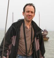 Gerardo Benito合作论文数Museo Nacional de Ciencias Naturales, Consejo Superior de Investigaciones Cientificas9
 Mark Wilkinson合作论文数The James Hutton Institute;School of Civil Engineering and Geosciences, Newcastle University;The James Hutton Institute, Newcastle University8David G. Passmore合作论文数Department of Geography, University of Newcastle upon Tyne8
 Thomas J Coulthard合作论文数Institute of Geography;Earth Sciences;University of Wales;Institute of Geography, University of Wales8
 Eleanor B Mackay合作论文数Ctr Ecol & Hydrol, Lake Ecosyst Grp, Lancaster LA1 4AP, England7
 Clive Bonsall合作论文数School of History, Classics & Archaeology, The University of Edinburgh7Simon A. Foulds合作论文数7
 Jonathan N. Turner合作论文数7Paul Quinn合作论文数Water Resources Systems Research Laboratory, Newcastle University7
 Ian C. Fuller合作论文数School of People, Environment & Planning, Massey University7Andreescu Radian合作论文数National History Museum of Romania6
 Peter Clift合作论文数Department of Geology and Geophysics, College of Science, Louisiana State University6
 Smith Mark W合作论文数Sch Geog, Univ Leeds6
 Kim Mikkel Cohen合作论文数Faculty of Geosciences, Utrecht University6
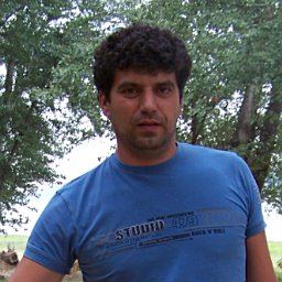 Tsvetan Kotsev合作论文数Institute of Geography, Bulgarian Academy of Sciences6c h swain合作论文数5
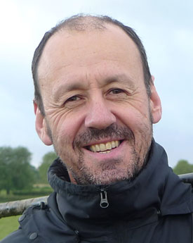 Philip M. Haygarth合作论文数Lancaster Environment Centre, Lancaster University5
 Claudia Vitolo合作论文数5
 Heather Jamieson合作论文数5
 Julie Durcan合作论文数School of Geography and the Environment, University of Oxford5
 Liviu Giosan合作论文数Department of Geology & Geophysics, Woods Hole Oceanographic Institution5
 Mariyana Nikolova合作论文数Institute of Geography, Bulgarian Academy of Sciences5
 Yehia El-Khatib合作论文数Computing Department;Lancaster University;Computing Department, Lancaster University5
 Hywel M. Griffiths合作论文数Department of Geography and Earth Sciences, University of Aberystwyth5Mihail Mollov合作论文数5
 Barbara Percy合作论文数4David Passmore合作论文数Department of Geography, Geomatics and Environment, University of Toronto Mississauga4
 James Grove合作论文数Department of Resource Management and Geography, The University of Melbourne;eWater Cooperative Research Centre;eWater Cooperative Research Centre, The University of Melbourne4
 Stephen Tooth合作论文数Department of Geography and Earth Sciences, Aberystwyth University4
 Ian Rutherfurd合作论文数School of Geography, Earth and Atmospheric Sciences, Faculty of Science, University of Melbourne4
 Ewen Silvester合作论文数Department of Environmental Management and Ecology (DEME),, La Trobe University4
 Anwar Alizai合作论文数4Derek A. Welsby合作论文数4
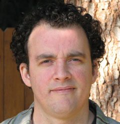 Sam Vanlaningham合作论文数School of Fisheries and Ocean Sciences, University of Alaska Fairbanks4Catherine Helena Swain合作论文数3A. L. Gemmell合作论文数3andrew j hardy合作论文数3




