We explain how to use simple composition rules to drive an automated, mobile photography system. The composition rules are used to determine both the location for a good photograph, and how to frame that photograph. We describe the composition component in the context of a larger application, a robotic photographer. The robot moves around an area with people in it, opportunistically looking for faces and taking photographs. We describe both how to find faces in the world and how to create “good” photographs of those faces.
Detecteur de risque intelligent particulier pouvant lui-meme servir de guide au cours de son processus d'installation dans un emplacement prevu a cet effet. De plus, l'emplacement d'installation du detecteur de risque intelligent particulier peut jouer un role central dans la maniere dont divers reglages du detecteur de risque intelligent sont definis et regles dans le temps.
In this paper we present two real-time methods for estimating surface normals from organized point cloud data. The proposed algorithms use integral images to perform highly efficient border- and depth-dependent smoothing and covariance estimation. We show that this approach makes it possible to obtain robust surface normals from large point clouds at high frame rates and therefore, can be used in real-time computer vision algorithms that make use of Kinect-like data.
We characterize a class of videos consisting of very small but potentially complicated motions. We find that in these scenes, linear appearance variations have a direct relationship to scene motions. We show how to interpret appearance variations captured through a PCA decomposition of the image set as a scene-specific non-parametric motion basis. We propose fast, robust tools for dense flow estimates that are effective in scenes with small motions and potentially large image noise. We show example results in a variety of applications, including motion segmentation and long-term point tracking.
We describe a complete system for quantitatively measuring the optical distortion in aircraft windshields and automatically classifying that distortion as acceptable or not. The system comprises two parts: The first uses digital imaging of a known grid pattern through the windshield of interest to create a distortion map of that windshield; the second uses the distortion maps created for 100 windshields (some acceptable and some not) and automatically learns a decision-tree-based classifier. We show results that highlight the robustness of this system, including a demonstration that the distortion map for a windshield is consistently measured over 3 years, and cross-validation study shows that we can effectively classify windshields based on the distortion maps.
We consider the special case of tracking objects in highly structured scenes. In the context of vehicle tracking in urban environments, we offer a fully automatic, end-to-end system that discovers and parametrizes the lanes along which vehicles drive, then uses just these pixels to simultaneously track dozens of objects. This system includes a novel active contour energy function used to parametrize the lanes of travel based only on the accumulation of spatio-temporal image derivatives, and a tracking algorithm that exploits longer temporal constraints made possible by our compact data representation; we believe both of these may be of independent interest. We offer quantitative results comparing tracking results to ground-truthed data, including thousands of vehicles from the NGSIM Peachtree data set.
The recent deployment of very large-scale camera networks has led to a unique version of the tracking problem whose goal is to detect and track every vehicle within a large urban area. To address this problem we exploit constraints inherent in urban environments (i.e. while there are often many vehicles, they follow relatively consistent paths) to create novel visual processing tools that are highly efficient in detecting cars in a fixed scene and at connecting these detections into partial tracks.We derive extensions to a network flow based probabilistic data association model to connect these tracks between cameras. Our real time system is evaluated on a large set of ground-truthed traffic videos collected by a network of seven cameras in a dense urban scene.
This paper presents an investigation into the effect of amorphous ribbon sensor on the mechanical properties of carbon fibre/epoxy (CF/epoxy) woven laminates. Finite Element (FE) unit cell techniques have been employed in conjunction with Hashin failure criterion to predict the effective elastic constants and failure strengths. The 2/2 twill weave unit cell has been adopted for validating the FE model against the experimental results. Reasonable agreement has been observed between the FE predicted and the experimental results.
City-scale tracking of all objects visible in a camera network or aerial video surveillance is an important tool in surveillance and traffic monitoring. We propose a framework for human guided tracking based on explicitly considering the context surrounding the urban multi-vehicle tracking problem. This framework is based on a standard (but state of the art) probabilistic tracking model. Our contribution is to explicitly detail where human annotation of the scene (e.g. “this is a lane”), a track (e.g. “this track is bad”), or a pair of tracks (e.g. “these two tracks are confused”) can be naturally integrated within the probabilistic tracking framework. For an early prototype system, we offer results and examples from a dense urban traffic camera network tracking, querying data with thousands of vehicles over 30 minutes.
We explain how to use simple composition rules to drive an automated, mobile photography system. The compo- sition rules are used to determine both the location for a good photograph, and how to frame that photograph. We describe the composition component in the context of a larger application, a robotic photographer. The robot moves around an area with people in it, opportunistically looking for faces and taking photographs. We describe both how to find faces in the world and how to create "good" photographs of those faces.
Surveillance and tracking systems often observe the same scene over extended time periods. When object motion is constrained by the scene (for instance, cars on roads, or pedestrians on sidewalks), it is advantageous to characterize and use scene-specific and location-specific priors to aid the tracking algorithm. This paper develops and demonstrates a method for creating priors for tracking that are conditioned on the current location of the object in the scene. These priors can be naturally incorporated in a number of tracking algorithms to make tracking more efficient and more accurate. We present a novel method to sample from these priors and show performance improvements (in both efficiency and accuracy) for two different tracking algorithms in two different problem domains.
We develop a framework to allow generic object detection algorithms to exploit geometric information commonly available to robot vision systems. Robot systems take pictures with calibrated cameras from known positions and may simultaneously capture depth measurements in the scene. This allows known constraints on the 3D size and position of objects to be translated into constraints on potential locations and scales of objects in the image, eliminating potentially expensive image operations for geometrically infeasible object locations. We show this integration to be very natural in the context of face detection and find that the computational effort of the standard Viola Jones face detector (as implemented in OpenCV) can be reduced by 85 percent with three times fewer false positives.
 Robert Pless合作论文数Department of Computer Science, School of Engineering & Applied Science, George Washington University12
 Bill Smart合作论文数Collaborative Robotics and Intelligent Systems Institute, College of Engineering, Oregon State University12
 Nathan Jacobs合作论文数Department of Computer Science and Engineering, McKelvey School of Engineering, Washington University in St. Louis;Multimodal Vision Research Laboratory, Washington University in St. Louis;Division of Computational and Data Sciences, Washington University;AI for Health Institute, Washington University;Taylor Geospatial Institute;Center for the Environment, Washington University;Multidomain Vision Research, LLC6
 Cindy Grimm合作论文数Washington University in St. Louis5
 michael p gleason合作论文数4
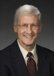 Matthew M. Thomas合作论文数The Boeing Company4Zachary Byers合作论文数3
 Freeman Phillip合作论文数3
 Logan Schneider合作论文数Medical Neurological Branch, National Institute of Neurological Disorders, National Institutes of Health2Anupam Pathak合作论文数Google2
 Robert Glaubius合作论文数Department of Computer Science and Engineering • Lopata 526
Washington University in St. Louis • One Brookings Drive • St. Louis, MO 631302
Robert Glaubius合作论文数Department of Computer Science and Engineering • Lopata 526
Washington University in St. Louis • One Brookings Drive • St. Louis, MO 631302 Yoky Matsuoka (松岡陽子)合作论文数Yohana;PanasonicWELL;YokyWorks Foundation2Frederick Heckel合作论文数2N. Navab合作论文数1K Goodier合作论文数1RB Rusu合作论文数1david sloo合作论文数1allen j minich合作论文数1reena singhal lee合作论文数1
 yash modi合作论文数dept.of Electronics and Communication,Bangalore,India1william d smart合作论文数1
 David Berthelot合作论文数Apple1
 Stefan Holzer合作论文数Fyusion Inc.1
 Austin Abrams合作论文数Washington University in St. Louis1Chris Wilson合作论文数1Joseph Tucek合作论文数HP Labs1Tim Blakely合作论文数1
 Mark Malhotra合作论文数Google1
 Hamid Savoj合作论文数Department of Electrical Engineering and Computer Sciences, University of California at Berkeley1
 Shwetak Patel合作论文数Paul G. Allen School of Computer Science & Engineering, University of Washington1Nik A. Melchior合作论文数Carnegie Mellon University1
 Dongeek Shin合作论文数Elect Res Lab, MIT1Scott Satkin合作论文数The Robotics Institute, Carnegie Mellon University1Suat Gedikli合作论文数1Ashwin Srinivas合作论文数1
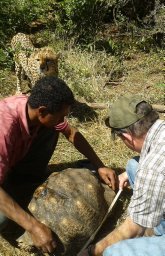 Patrick Baker合作论文数University of Maryland Center for Automation Research1




