Rivers in plateau regions are more vulnerable to human activities and climate change than those in plains due to cold climate and high altitude. Studying the temporal and spatial distribution of phosphorus against the backdrop of climate warming and human activities is of great significance for the protection of the ecological environment of plateau rivers. This study focuses on the Yarlung Zangbo River, one of the highest-altitude rivers in the world, analyzing the different forms of phosphorus and total dissolved organic carbon (TOC) concentration and distribution characteristics in sediments and sediment–water interfaces at different time and spatial scales. The analysis indicators include total phosphorus (TP) and dissolved total phosphorus (DTP) in the water body; ammonium chloride-extractable phosphorus (NH4Cl-P), iron-bound phosphorus (Fe-P), calcium-bound phosphorus (Ca-P), aluminum-bound phosphorus (Al-P), organic phosphorus (OP), and TOC concentration and distribution in sediments. The results showed that the upstream and downstream sections of the Yarlung Zangbo River have relatively good water quality, while the middle stream section, affected by human activities, has higher phosphorus and TOC content in the water body. The phosphorus in the sediments is mainly in the form of Ca-P, indicating that the primary natural phosphorus input is through the disintegration of salts. During the freeze–thaw cycle, the organic matter in the sediments affects the phosphorus content in the water through adsorption and release. Climate warming is expected to increase the phosphorus load in the Yarlung Zangbo River. Comparative studies between plateau rivers and plains rivers have revealed that exogenous particulate phosphorus and endogenous phosphorus converted with the facilitation of organic matter are the main sources of eutrophication risk in plateau rivers. This study unveils the temporal and spatial distribution characteristics of phosphorus and TOC in the Yarlung Zangbo River, and discusses the mechanisms affecting phosphorus concentrations in key plateau river nutrient elements, providing scientific support for the protection of the fragile ecological environment of plateau river ecosystems.
Construction of cascade reservoirs has altered nutrient dynamics and biogeochemical cycles, thereby influencing the composition and productivity of river ecosystems. The Lancang River (LCR), characterized by its cascade reservoir system, presents uncertainties in nitrogen transport and nitrate transformation mechanisms. Herein, we conducted monthly monitoring of hydrochemistry and multiple stable isotopes (δ15N-NO3-, δ18O-NO3-, δ18O-H2O, δD-H2O) throughout 2019 in both the natural river reach (NRR) and cascade reservoirs reach (CRR) of the LCR. Through the monthly detection of nitrogen forms and runoff in the import (M2) and export (M9) section, the average annual retention ratios for Total nitrogen (TN), Nitrate nitrogen (NO3--N), Particulate Nitrogen (PN) and Ammonium Nitrogen (NH4+-N) were about -35%, -53%, 48% and -65%, respectively. The retention rates were positively correlated with hydraulic retention time and negatively correlated with reservoir age, especially in the flood season. Compared to the NRR, the reservoir had significantly affected the nitrogen transport characteristics, especially for the large reservoirs (like Xiaowan and Nuozhadu), which enhanced phytoplankton uptake of NO3--N to form PN capabilities in the lentic environment and subsequently to precipitate or intercept it at the reservoir. This led to the overall decreasing trend of TN and PN concentrations along the CRR. The Bayesian stable isotope model quantified NO3--N sources from the NRR to the CRR. During this transition, soil nitrogen (SN) ratios decreased from 69.3% to 61.8%, while Manure & sewage (M&S) increased from 24.0% to 31.3%. Anthropogenic and natural factors, including urban sewage discharge, population density, and precipitation, were selected as key predictor variables. The eXtreme Gradient Boosting (XGBoost) model exhibited superior predictive performance for NO3--N concentrations, achieving an R2 of 0.70. These findings deepen our understanding of the impact of reservoirs on river ecology.
With the increasing demand for clean energy and water resources, hydropower engineering is gradually expanding worldwide. Revealing the status and toxic risks of riverine pollutants is of considerable theoretical importance for water safety management. However, damming complicates the geochemical behavior of pollutants in river water, especially in large reservoirs with intensive anthropogenic activities. Whether damming amplifies the environmental risks of pollutants needs to be clarified. This study selected heavy metals (HMs) as major pollutants, combining positive matrix factorization (PMF) and Monte Carlo simulation (MCS), identifying the damming impacts on riverine HMs in the Three Gorges Reservoir (TGR). The average concentrations of most HMs increased manyfold than the background, and the HMs loading rates of outflow was increased, suggesting the obvious disturbance by human activities. Through PMF, about 70
Excessive levels of nitrate nitrogen (NO3--N) could lead to ecological issues, particularly in the Yarlung Tsangpo River (YTR) region located on the Qinghai Tibet Plateau. Therefore, it is crucial to understand the fate and sources of nitrogen to facilitate pollution mitigation efforts. Herein, multiple isotopes and source resolution models were applied to analyze key transformation processes and quantify the sources of NO3-. The δ15N-NO3- and δ18O-NO3- isotopic compositions in the YTR varied between 1.23‰-13.64‰ and -7.98‰-11.19‰, respectively. The NO3--N concentrations varied from 0.08-0.86 mg/L in the dry season and 0.20-1.19 mg/L during the wet season. Nitrification remained the primary process for nitrogen transformation in both seasons. However, the wet season had a widespread effect on increasing nitrate levels, while denitrification had a limited ability to reduce nitrate. The elevated nitrate concentrations during the flood season were caused by increased release of NO3- from manure & sewage (M&S) and chemical fertilizers (CF). Future endeavors should prioritize enhancing management strategies to improve the utilization efficiency of CF and hinder the direct entry of untreated sewage into the water system.
The coupling effect of damming and urbanization on nutrient dynamics renders the aquatic environment sensitive and vulnerable, posing a significant global concern. However, the role of damming as a source or sink of nutrients remains uncertain. In this study, river water samples were collected in the Three Gorges Reservoir (TGR), which is recognized as the world's largest hydropower engineering. By integrating solute chemistry and flux budget modeling, the status, source, and transformation of riverine nutrients were revealed, and the interplay between water storage and human inputs on TGR nutrient dynamics was discussed. The concentrations of TDN and DSi were 100.2 +/- 46.1 mu mol/L and 115.7 +/- 14.1 mu mol/L, respectively. NO3--N (77.9 +/- 64.1 mu mol/L) was the main species of TDN, with NH4+-N and dissolved organic nitrogen accounting for only 2.5 and 19.7%, respectively. DSi was attributed to silicate weathering, while riverine NO3--N exhibited a significant influence from anthropogenic inputs. About 71.7% of NH4+-N was retained or converted to NO3--N by nitration along the river. Evidence from the significant correlation (p < 0.05) between NO3--N/NH4+-N and d-excess suggests that the evaporation process accelerated by damming promotes nitrification. Through the anthropogenic net nitrogen input model, atmospheric nitrogen deposition was the primary factor affecting nitrogen flux in TGR river water, highlighting the critical impact of urbanization. The estimated contribution fluxes of stored nitrogen from 1997 to 2020 exhibited a limited contribution ratio and decrease yearly, supporting that water level rise from damming promotes the release of stored nitrogen. This study enhances the comprehension of the anthropogenic impacts on the nutrient biogeochemical cycle in damming rivers, providing enlightenment for environmental health management in large reservoirs.
Complete ammonia oxidation (comammox) bacteria can complete the whole nitrification process independently, which not only challenges the classical two-step nitrification theory but also updates long-held perspective of microbial ecological relationship in nitrification process. Although comammox bacteria have been found in many ecosystems in recent years, there is still a lack of research on the comammox process in rhizosphere of emergent macrophytes in lakeshore zone. Sediment samples were collected in this study from rhizosphere, far-rhizosphere, and non-rhizosphere of emergent macrophytes along the shore of Lake Liangzi, a shallow lake. The diversity of comammox bacteria and amoA gene abundance of comammox bacteria, ammonia-oxidizing archaea (AOA), and ammonia-oxidizing bacteria (AOB) in these samples were measured. The results showed that comammox bacteria widely existed in the rhizosphere of emergent macrophytes and fell into clade A.1, clade A.2, and clade B, and clade A was the predominant community in all sampling sites. The abundance of comammox amoA gene (6.52 × 10 6 –2.45 × 10 8 copies g −1 dry sediment) was higher than that of AOB amoA gene (6.58 × 10 4 –3.58 × 10 6 copies g −1 dry sediment), and four orders of magnitude higher than that of AOA amoA gene (7.24 × 10 2 –6.89 × 10 3 copies g −1 dry sediment), suggesting that the rhizosphere of emergent macrophytes is more favorable for the growth of comammox bacteria than that of AOB and AOA. Our study indicated that the comammox bacteria may play important roles in ammonia-oxidizing processes in all different rhizosphere regions.
Deoxygenation in the deep water of stratified lakes and reservoirs due to climate warming and human activities poses a threat to crucial limnetic ecosystem services. Metalimnetic oxygen minima (MOM) typically occurs during the mid to late stages of limnetic stratification. To investigate the mechanism of MOM during stably stratified periods in the Panjiakou Reservoir, northern China, four years of in-situ monitoring was conducted in parallel with longitudinal-vertical 2D modeling. The model simulated the hydrodynamic, water quality, algal, and DO processes in 2017 and 2020, and was calibrated and verified by the measurements. Three scenarios were designed to test the impact of hydrological processes and the high oxygen-consuming sedimentation zones (HOCSZ). We concluded that the stratification and the corresponding advection generated in the metalimnion are the driving forces of MOM in the reservoir, and the limnetic eutrophication-related benthic HOCSZ are the seedbeds of the metalimnetic hypoxia. This unique spatial setting driving the biogeochemical processing and MOM dynamics required a new generation of modelling, incorporating spatial inhomogeneities of sediment characteristics and a sophisticated resolution of hydrodynamics. Metalimnetic horizontal advection, hypolimnetic upwelling currents, sedimentation hot spots and the formation of high oxygen consumption zones became the major initiation processes leading to MOM. The numerical modeling not only represented the occurrence, development, and extinction of MOM but also comprehensively explained the spatial differences in the vertical morphology of MOM and its inter-annual variations. Our studies help to identify management strategies to mitigate the impacts of MOM on aquatic ecological security and drinking water quality, thus supporting the optimization of reservoir regulations.
Over the past 70 years, the Yangtze River Basin-the third longest river basin in the world-has been under the influence of augmented human activities. Regarding environmental protection and policy design, the total nitrogen and phosphorus (TN and TP, respectively) loads from soil erosion are objectively and quantitatively critical parameters while assessing the spatio-temporal soil erosion changes over the 1901–2010 period. First, soil erosion in our study area was calculated using the Revised Universal Soil Loss Equation (RUSLE) model. Second, the TN and TP loads from soil erosion were assessed using the constructed Nutrient Loss Empirical Model (NLEM). Third, we conducted spatial autocorrelation analysis, Mann-Kendall (M–K) trend tests, and wavelet analysis of the soil erosion, and related TN and TP loads. At Datong Station over the 1901–2010 period, the average annual TN and TP loads from soil erosion were 1.77 and 0.56 million tonnes, respectively. Moran's I values of the average annual soil erosion, and related TN and TP loads from soil erosion indicates the existence of positive correlations, while clustering was the prevailing spatial distribution pattern. High-high (H-H) cluster areas were mainly evident in high-altitude region of the western and southern Yangtze River Basin, conversely, low-low (L-L) cluster areas were scattered primarily in regions with high population density and intense human activities. Soil erosion increased rapidly around 2001; hence, 2001 was a changing point. According to the M–K test, the time intersection of soil erosion, and related TN and TP loads at Datong Station was around 1990; hence, 1990 may have been a changing point, likely due to the operation of Gezhouba Dam during 1981-1986. This Dam trapped large amounts of sediments. If the sediment load data of control hydrological station of 12 sub-basins is available, SDR, sediment load, AN and AP calculation could be more accurate and interpretable.
It is necessary to review changes in the interactions of indicators following the construction of the Three Gorges Dam (TGD) in order to explore the impact of the dam on ecology. Research on changes in interactions among indicators of the comprehensive social–economic–ecology system in the Yangtze River Basin is limited, and the objective of this study was to investigate how this system changed after the operation of the TGD, as well as how the indicators contributed to this change. Here, the correlational network approach using 38 data point indicators from 1949 to 2018 of the Yangtze River Basin was applied to analyze the changes in indicator interactions before and after the TGD operation. The TGD impoundment altered networks of the social–economic–ecological system in the Yangtze River Basin. Indicators are both less positively and less negatively connected. The number of synergy and trade-off networks clusters changed from two (Modularity = 0.33) to -six (Modularity = 0.23) and from two (Modularity = 0.015) to four (Modularity = 0.34) after the TGD operation, indicating that the sustainable development of the Yangtze River Basin might be at a middle level after the TGD operation. Further analysis revealed that the mean annual discharge, downstream fry runoff, and downstream counts of the eggs and larvae of four carp, diatom abundance index, breeding population of Chinese sturgeon, and annual precipitation contributed more to the changes in the networks after 2003.
The construction of the reservoir has changed the nitrogen migration and transformation processes in the river, and a large amount of sediment deposition in the reservoir may also lead to the spatial differentiation of com-plete ammonia oxidation (comammox) bacteria. The study investigated the abundance and diversity of comammox bacteria in the sediments of three cascade reservoirs, namely, Xiaowan, Manwan, and Nuozhadu on the Lancang River in China. In these reservoirs, the average amoA gene abundance of clade A and clade B of comammox bacteria, ammonia-oxidizing archaea (AOA), and ammonia-oxidizing bacteria (AOB) was 4.16 +/- 0.85 x 10⁵, 1.15 +/- 0.33 x 10⁵, 7.39 +/- 2.31 x 10⁴, and 3.28 +/- 0.99 x 10⁵ copies g-1, respectively. The abundance of clade A was higher than that of other ammonia oxidizing microorganisms. The spatial variation of comammox bacteria abundance differed among different reservoirs, but the spatial variation trends of the two clades of comammox bacteria in the same reservoir were similar. At each sampling point, clade A1, clade A2, and clade B coexisted, and clade A2 was usually the dominant species. The connection between comammox bacteria in the pre-dam sediments was looser than that in non-pre-dam sediments, and comammox bacteria in pre-dam sediments exhibited a simpler network structure. The main factor affecting comammox bacteria abundance was NH4+-N, while altitude, temperature, and conductivity of overlying water were the main factors affecting comammox bacteria diversity. Environmental changes caused by differences in the spatial distribution of these cascade reservoirs may be the main driver of the changes of community composition and abundance of comammox bacteria. This study confirms that the construction of cascade reservoirs results in niche spatial differentiation of comammox bacteria.
为阐明深水水库沉积物磷赋存形态的空间分布特征和潜在的释放风险,对澜沧江中下游4座梯级水库(功果桥、小湾、漫湾和糯扎渡)的沉积物和上覆水理化性质进行了研究.结果表明,各水库沉积物总磷(TP)含量变化范围在266.66~842.87mg/kg之间,平均为533.18mg/kg.各水库沉积物有机磷(OP)变化特征表现为功果桥水库沉积物OP以生物可利用OP为主过渡到其他水库以残渣磷为主.各水库沉积物无机磷(IP)分布特征表现为生物可利用IP由上游到下游逐渐增加,环境条件有利于下游水库生物可利用IP的形成.相关性分析表明,有机质和上覆水体环境因子是影响沉积物磷形态分布的重要因素.通过对各水库沉积物-水界面正磷酸盐(PO43--P)浓度分析得知,孔隙水PO43--P浓度范围在0.017~0.258mg/L之间,上覆水PO43--P浓度范围在0.015~0.055mg/L之间,PO43--P均是由孔隙水向上覆水进行扩散,其释放通量范围为0.010~0.116mg/(m2.d).季节性缺氧和区域沉积作用使下游水库存在较大的PO43--P释放风险.
Rivers are important routes for material and energy transport between terrestrial and marine ecosystems. Recent global-scale assessments of carbon (C) have suggested that C emission fluxes to the atmosphere are comparable to the fluvial C fluxes to the ocean. However, many previous studies only collected data from inland rivers in low altitude regions. Therefore, it remains unclear how plateau rivers affect C flux. In this study, 20 monitoring sites were set up along the Yarlung Tsangpo (YT) River on the Tibetan Plateau and detailed observations were carried out in the wet and dry seasons. The riverine CO2 fluxes exhibited significant seasonal patterns which ranged from 597.12 ± 292.63 μatm in the wet season to 368.72 ± 123.50 μatm in the dry season. The CO2 emission flux (FCO2) obtained from floating chamber method, ranging from 8.44 ± 6.94 mmol m−2 d−1 in sunmmer to 3.62 ± 6.32 mmol m−2 d−1 in winter, with an average value of 6.03 mmol m−2 d−1. Generally, the river was a weak carbon source with respect to the atmosphere. However, the pCO2 and FCO2 were much lower than that for other large rivers around the globe, which were obviously restrained by the weak microbial activities due to the low primary productivity and carbonate buffer activities in the carbonate background. Carbon loss via atmosphere exchange in the YT River on the plateau accounted for 2.2% and 10.6% of the riverine dissolved carbon fluxes (67.77 × 10⁹ mol a−1) according to the floating chamber and thin boundary layer methods, respectively. The YT River probably acts as a “pipeline” to transport weathered nutrients from the plateau to downstream areas. Our results demonstrated the characteristics of a “weak outgassing effect and a high transport flux of carbon” for the plateau river, which is different from rivers on plains. Considering the global relevance of Tibetan Plateau, further studies with enhanced spatiotemporal resolution are needed to better understand the important role of plateau rivers on carbon budgets and climate change over both regional and global cycles.
The water environment of large reservoirs is fragility due to effects from hydrological regulation of damming and anthropogenic inputs. As a critical path to quantify the natural chemical weathering and assess environmental risks, solute chemistry of river has been widely focused on. However, the complexed hydrological conditions of large reservoir affect the chemical compositions, and the significance of solute vertical geochemistry as an indicator of chemical weathering and water quality health remains explore. Therefore, the Three Gorges Reservoir (TGR) was selected as a typical study area, which is the world's largest hydropower project and subject to frequent water quality problems. Then, the chemical compositions in stratified water were determined. Ca2+ (52.8 ± 4.3 mg/L) and HCO3- (180.9 ± 8.9 mg/L) were the most abundant ions among cations and anions, respectively. Incremental mean concentration of total major ions followed with the increase of riverine depth and flow direction. An improved inversion model was used to quantify the source contribution, which weathering of dolomite (34%) and calcite (38%) contributed the most to total cations, and the influences of agriculture and sewage discharge were limited. Additional contributions of evaporite and pyrite oxidation were found in analysis of deeper water samples, which also results in 2%-67% difference in estimated CO2 release flux using data from different depth, indicating additional information about sulfuric acid driven weathering was contained. Finally, the water quality of the reservoir was assessed for irrigation and non-carcinogenic risks. Results showed the stratified water of TGR can be used as a good water source of irrigation. However, NO3- (5.1 ± 1.1 mg/L) may have a potential non-carcinogenic risk to children, especially in surface water. To sum up, this study provided an indispensable supplement to the water chemistry archives in the TGR basin, serving as theoretical references for environmental management of large reservoirs.
To explore the diversity of eukaryotic plankton in Nujiang River, water samples were collected from 35 locations in November 2020. The sampling area covers over 1 000 kilometers of Nujiang River. Metabarcoding technology was used to study the spatial distribution of eukaryotic plankton and its response to environmental factors based on 18S rRNA gene. Overall, 1 320 OTUs(Operational Taxonomic Unit) were obtained from the samples. The eukaryotic plankton species detected in these samples cover 34 phyla and 302 genera. According to β diversity, the eukaryotic community can be divided into three groups, namely, high altitude(above 4 000 m), middle altitude(between 1 000 m and 4 000 m), and low altitude(below 1000 m), and the difference among the groups is larger than that within the groups. The Shannon-Wiener index and Simpson index which refelct the diversity of the community, Pielou’s evenness index which indicates the evenness of community, and Chao1 index which characterize the abundance of community, all decrease as altitude increases, meaning a higher altitude will affect the diversity of eukaryotic plankton. To analyze the community composition, we compared the relative abundance of different species at phylum level. The result show that Ciliophora and Chlorophyta are enriched in low altitude area, rising with the decline of altitude; Bacillariophyta, the most abundant species, are enriched in middle altitude area; Arthropoda are enriched in high altitude area, reducing with the decling of altitude. For the environmental impact, the result showed pH value and conductivity decrease as altitude decreases. Water temperature, DO(Dissolved Oxygen), FV(Flow Velocity) and Turb(Turbidity) decrease as altitude increases. Altitude, water temperature and flow velocity are the key environmental factors for the distribution of eukaryotic community in Nujiang River Basin.
河流是连接海陆两大生态系统的主要通道,也是碳循环的主要参与者之一.以雅鲁藏布江流域为研究对象,采用水化学与元素地球化学方法对雅鲁藏布江流域的水化学特征和碳汇过程进行研究.结果显示:①雅鲁藏布江流域河水总溶解固体(TDS)均值为205.3 mg/L,高于世界河流平均水平;河水中阴离子以HCO3-为主,阳离子以Ca2+为主.② 质量平衡模型表明,流域水化学组成以碳酸盐岩风化为主,平均贡献率为56%,硅酸盐岩和蒸发盐岩平均贡献率分别为 23%和 17%;大气降水输入对河水主要离子的贡献仅为 3%.③ 流域内岩石风化速率为42.03 t/(km2·a),约为世界河流平均岩石风化速率的2 倍.受径流流量的影响,丰水期岩石风化速率(72.00 t/(km2·a))远大于枯水期(12.06 t/(km2·a)).④ 流域内岩石风化CO2 消耗速率为 407.13×10³ mol/(km2·a),远高于世界河流平均水平.其中,碳酸盐岩风化CO2 消耗速率平均为232.29×10³ mol/(km2·a),硅酸盐岩风化CO2消耗速率平均为174.84×103 mol/(km2·a).
Comammox Nitrospira can complete nitrification independently, and they are important participants in the nitrogen cycle. In this study, we investigated the comammox Nitrospira in the sediments of Xiaojiang River basin, a tributary of the Three Gorges, and explored the differences in the responses of its different clades to water quality recovery during a cyanobacteria outbreak period and a water quality recovery period. Sediment samples were taken from the two water quality periods of the Yangtze River tributary Xiaojiang, namely, the cyanobacteria outbreak period and the water quality recovery period. The diversity of comammox Nitrospira clade A and comammox Nitrospira clade B, and the abundance of comammox Nitrospira clade A, comammox Nitrospira clade B, ammonia-oxidizing archaea (AOA), and ammonia-oxidizing bacteria (AOB) were measured. The results showed that during the water quality recovery period, the abundance of both comammox clade A amoA (4.32 × 10⁶ ± 1.32 × 10⁶ copies g−1) and comammox clade B amoA (4.06 × 10⁶ ± 2.91 × 10⁶ copies g−1) exhibited an increasing trend. Compared with that in the cyanobacteria outbreak period, the abundance of comammox clade A was increased by 450% during the water quality recovery period, while comammox clade B was increased by 195%. During the water quality recovery period, both comammox Nitrospira species richness (Chao1) and species diversity (Pielou, Shannon, and Simpson) were increased. During the water quality recovery period, comammox clade A amoA exhibited a greater increase in abundance and a quicker response to water quality recovery than comammox clade B. Water quality recovery favored the growth of comammox Nitrospira.
Tangxun Lake is the largest urban lake in China, which is polluted by multiple wastewaters, and now is severely eutrophic. We detected diversity, abundance, and the coexistence of Candidatus Methylomirabilis oxyfera - like and anammox bacteria in different horizontal and vertical directions of the lake sediments through qPCR and clone library. Phylogenetic tree analysis showed that the Ca. Methylomirabilis oxyfera - like and anammox bacteria exhibited high diversity, and they belonged to group B—E and Ca. Brocadia genus, respectively. These two bacteria displayed higher diversity in polluted area than in other areas. Furthermore, they had great spatial variation of abundance both horizontally and vertically. The abundance of anammox bacteria was significantly higher than that of Ca. Methylomirabilis oxyfera - like bacteria. The stronger the human interference were, the higher abundances these two bacteria exhibited horizontally, whereas both their abundances and the ratio of anammox to Ca. Methylomirabilis oxyfera - like bacteria decreased with the increasing depth. Redundancy analysis indicated that nitrate was the most influential environmental factor to the abundance of these two bacteria. Ammonia, nitrite, total nitrogen, and organic matters were in positive correlation with the abundance of these two bacteria. Nitrate was slightly negatively correlated with the abundance of Ca. Methylomirabilis oxyfera - like bacteria, while it was positively correlated with that of anammox bacteria. Our results provided an insight into the effects of environmental factors such as ammonia, nitrite, and nitrate on the diversity and abundances of these two bacteria and theoretical basis for restoration of water.
Since eutrophication occurred frequently in the backwater zone of tributaries in the Three Gorges Reservoir (TGR) during the hydrological management of the dam, biogeochemical processes of dissolved nitrogen and driving factors in the backwater zone are pressed for clarity. In this study, the concentration of dissolved nitrogen species in stratified water sampling from a typical backwater zone of tributary in TGR was determined, and stable isotopes of water were used to quantify the influence of hydrological processes on the dynamics of dissolved nitrogen. Influenced by heavy rainfall before sampling, the average value of total dissolved nitrogen (TDN) in river water was 2.23 +/- 0.48 mg/L, 1.6 times of the seasonal average. Probably due to assimilation and denitrification, the NO3--N concentration was extremely low in stratified water. The dissolved organic nitrogen (DON, 0.84-2.87 mg/L) dominated the composition of dissolved nitrogen species. Combined with H-O isotopes and optimized mathematical models, surface and middle water was recharged by the TGR mainstream within 15 km from the estuary, providing up to 93.5% of the DON concentration, while about 77.3% of DON in bottom water may be contributed from the sediment release. The abnormally increased proportion of DON in TDN may increase the turnover pressure of nitrogen internal circulation and the risk of algal bloom. For another perspective, NH4+-N had high potential health risks to the local residents according to the estimate of hazard quotient. Overall, this study reveals that hydrological processes controlled by the dam have an important impact on the dissolved nitrogen cycle, and long-term monitoring of nitrogen dynamics in this typical river is required.
River water chemistry offers information on watershed weathering and responds to the global carbon cycle. Watershed weathering processes and water chemistry in stratified water are still unclear in Xiaojiang River, as a major tributary of the Three Gorges Reservoir (TGR) which is the largest reservoir in the world. Major ions of river water at different depths were measured to reveal the ionic composition and chemical weathering properties by principal component analysis and stoichiometry in Xiaojiang River. Ca2+−HCO3− dominated the hydrochemical facies of river. Surface river water had the lowest total dissolved solid (146 mg/L) compared to other layers of water. According to principal component analysis, the major ions were divided into two principal components. PC1 was the weathering end-member of rocks, including the main ions except K+ and NO3–N, and PC2 may be the mixed end-member of atmospheric input and anthropogenic input. From stoichiometry, carbonate weathering dominated the cationic composition, with a contribution ratio of 56.7%, whereas atmospheric input (15.2%) and silicates weathering (13.9%) had similar extent of contribution. Compared with other major tributaries of TGR, Xiaojiang had more intense chemical weathering processes. The weathering rates of carbonates and silicates were 19.33 ± 0.68 ton/km2/year and 3.56 ± 0.58 ton/km2/year, respectively. Sulfuric acid as a proton may have participated less in the weathering processes of Xiaojiang River. The CO2 consumption budgets for silicates and carbonates weathering were 0.8 ± 0.2 × 10⁹ mol/year and 2.8 ± 0.2 × 10⁹ mol/year, respectively. These results enrich the watershed weathering information of TGR tributaries and provide data support for understanding the global carbon cycle.
 Yuchun Wang (王雨春)合作论文数51
 Yufei Bao合作论文数27Jie Wen合作论文数15Yongding Liu合作论文数10
 Jinke Liu合作论文数Inst Earth Sci, China Univ Geosci Beijing8
 Jianwei Zhao (赵建伟)合作论文数College of Resources & Environment of Huazhong Agricultural University8
 Hui Zhou (周辉)合作论文数Institute of Rock and Soil Mechanics, Chinese Academy of Sciences;University of Chinese Academy of Sciences8
 Guilin Han (韩贵琳)合作论文数China University of Geosciences, Beijing8Yao Cheng合作论文数7Yanhui Li合作论文数7
 Di Wang合作论文数7
 Chuanqing Zhang (张传庆)合作论文数Institute of Rock and Soil Mechanics, Chinese Academy of Sciences;University of Chinese Academy of Sciences7
 Genbao Li (李根保)合作论文数Institute of Hydrobiology, Chinese Academy of Sciences;University of Chinese Academy of Sciences7
 Yingcai Wang合作论文数7Meng Sun合作论文数6QiWen Wang (王启文)合作论文数6
 Dunhai Li (李敦海)合作论文数Institute of Hydrobiology, Chinese Academy of Sciences;University of Chinese Academy of Sciences6Yin-Wu Shen合作论文数6Jiahui Zhang合作论文数5WU Xinghua (吴兴华)合作论文数5
 Jie Ceng (曾杰)合作论文数School of Geography and Information Engineering, China University of Geosciences5
 Dawei Hu (胡大伟)合作论文数中国科学院武汉岩土力学研究所5Mingzhi Zhou合作论文数4Pengcheng Du合作论文数4YE Zhenya合作论文数4
 Jingjing Lu (卢景景)合作论文数Institute of Rock and Soil Mechanics, Chinese Academy of Sciences4
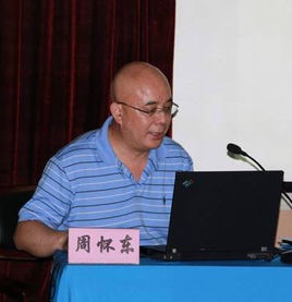 Huaidong Zhou (周怀东)合作论文数中国水利水电科学研究院水环境所所长和中国水环境研究所4
 Zhen Wang (王震)合作论文数College of Environmental Science & Engineering, Beijing Forestry University4
 Xiaoqiang Li (李小强)合作论文数:中国科学院地球环境研究所黄土与第四纪地质国家重点实验室,西安4Aimin Cai合作论文数3Yong Shui合作论文数3Hang Ding合作论文数3Wang Yuchun合作论文数3SHI Feng-ning (施凤宁)合作论文数3gao yang合作论文数3Jiang Rong (蒋蓉)合作论文数3Shun-tian LIANG (梁顺田)合作论文数3
 Su Yuming合作论文数3Gao Yang合作论文数3
 Defu Liu (刘德富)合作论文数湖北省水利学会河湖健康专业委员会3Shanze Li (李姗泽)合作论文数China Institute of Water Resources and Hydropower Research3Shuang Liu合作论文数2
 Dingxue Gao合作论文数2Weiju Wu合作论文数2Xixi Liu合作论文数2
 Gao Xi合作论文数2Fengyi Chang合作论文数2Tu Hongliang合作论文数2Jinkun Wu合作论文数2




