Block-structured meshes are widely used in high-performance computing due to their efficiency in numerical simulations, memory access, and domain partitioning for parallel processing. Medial-axis-based algorithms have been considered as a promising approach for automatically decomposing a domain into quadrilateral blocks while ensuring a minimal number of singular vertices. TopMaker is a notable example, providing a robust decomposition strategy. However, it suffers from limitations such as the capture of curved block boundaries, poor geometric quality, and the presence of non-quadrilateral blocks. In this paper, we propose an improved block decomposition method that enhances TopMaker by integrating integer optimization for subdivision selection and incorporating additional singular nodes to better approximate the domain geometry. Our approach assigns a mesh template to each segment of the medial axis, greatly improving the block quality while ensuring a valid conforming quadrilateral decomposition. We evaluate our approach on a large range of 2D domains and demonstrate its ability to generate high-quality block-structured meshes. The results highlight the robustness, efficiency, and practicality of our method for automated quadrilateral block decomposition. Our method also extends to multi-material models with intricate internal constraints but at the cost of loss of some guarantees of the output mesh.
Extracting a quad mesh from a grid preserving map is straightforward in theory, but typical inputs are not exactly grid preserving maps. Previous works can manage minor deviations from grid preserving maps, but without a clear specification of what is acceptable. This work clarifies how typical inputs differ from a grid preserving map, and shows how the differences with a grid preserving map can be reflected by a sequence of operations acting on a discrete structure. It opens research opportunities for the design of a robust quad extraction algorithm.
In this article, we propose a numerical method to solve semi-discrete optimal transport problems for gigantic pointsets (108 points and more). By pushing the limits by several orders of magnitude, it opens the path to new applications in cosmology, fluid simulation and data science to name but a few. The method is based on a new algorithm that computes (generalized) Voronoi diagrams in parallel and in a distributed way. First we make the simple observation that the cells defined by a subgraph of the Delaunay graph contain the Voronoi cells, and that one can deduce the missing edges from the intersections between those cells. Based on this observation, we introduce the Distributed Voronoi Diagram algorithm (DVD) that can be used on a cluster and that exchanges vertices between the nodes as need be. We also report early experimental results, demonstrating that the DVD algorithm has the potential to solve some giga-scale semi-discrete optimal transport problems encountered in computational cosmology.
Grid preserving maps of triangulated surfaces were introduced for quad meshing because the 2D unit grid in such maps corresponds to a sub‐division of the surface into quad‐shaped charts. These maps can be obtained by solving a mixed integer optimization problem: Real variables define the geometry of the charts and integer variables define the combinatorial structure of the decomposition. To make this optimization problem tractable, a common strategy is to ignore integer constraints at first, then to enforce them in a so‐called quantization step. Actual quantization algorithms exploit the geometric interpretation of integer variables to solve an equivalent problem: They consider that the final quad mesh is a sub‐division of a T‐mesh embedded in the surface, and optimize the number of sub‐divisions for each edge of this T‐mesh. We propose to operate on a decimated version of the original surface instead of the T‐mesh. It is easier to implement and to adapt to constraints such as free boundaries, complex feature curves network etc .
We present a new method for generating pure hexahedral meshes for reservoir simulations. The grid is obtained by extruding a quadrangular mesh, using ideas from the latest advances in computational geometry, specifically the generation of semi-structured quadrangular meshes based on global parameterization. Hexahedral elements are automatically constructed to smoothly honor the geometry of input features (domain boundaries, faults, and horizons), thus making it possible to be used for multiple types of physical simulations on the same mesh. The main contributions are as follows: the introduction of a new semi-structured hexahedral meshing workflow producing high-quality meshes for a wide range of fault systems, and the study and definition of weak verticality on triangulated surface meshes. This allows us to design better and more robust algorithms during the extrusion phase along non-vertical faults. We demonstrate (i) the simplicity of using such hexahedral meshes generated using the proposed method for coupled flow-geomechanics simulations with state-of-the-art simulators for reservoir studies, and (ii) the possibility of using such semi-structured hexahedral meshes in commercial structured flow simulators, offering an alternative gridding approach to handle a wider family of fault networks without recourse to the stair-step fault approximation.
Understanding the location of schools relative to the population they serve is important to contextualise the time, students must travel and to define school catchment areas (SCAs) for planning. We assembled a spatio-temporal database of public primary schools (PPS), population density of school-going children (SGC), and factors affecting travel in 2009 and 2020 in Kenya. We combined the assembled datasets within cost distance and cost allocation algorithms to compute travel time to the nearest PPS and define SCAs. We elucidated travel time and marginalised SGC living outside 24-minutes, government's threshold at sub-county level (decision-making units). Weassembled 2170 PPS in 2009 and 4682 in 2020, an increase of 115.8%, while the average travel time reduced from 28 to 17 minutes between 2009 and 2020. Nationally, 65% of SGC were within 24-minutes' catchment in 2009, which increased to 89% in 2020. Subnationally, 19 and 61 out of 62 sub-counties had over 75% of SGC within the same threshold, in 2009 and 2020, respectively. Findings can be used to target the marginalised SGC, and monitor progress towards attainment of national and Sustainable Development Goals. The framework can be applied in other contexts to assemble geocoded school lists, characterise travel time and model SCA.
Ecological connectivity is a key attribute of landscapes and indicates how landscapes facilitate or impede movement. It is an essential criterion to consider in the design of green infrastructures (GIs) when landscape planners and managers deal with population viability, which in part depends on the movement capacities of organisms. Our goal is to inform about the conservation value of land parcels to maintain or enhance connectivity. For this, we developed a red deer functional connectivity model at a regional scale. We focused our study on this large mammal species inhabiting the Greater Geneva agglomeration between Switzerland and France. Our study site is dominated by forested mountains and lowlands, which are highly fragmented by human infrastructures and agricultural lands. We used GPS location data from 15 red deer to parameterize the habitat resistances with a multivariate analysis. To predict connectivity at the regional scale, we used local expert knowledge to design a graph-based landscape. Then, we used electric circuit theory with Circuitscape software to detect pinch points and map corridors, using the set of resistances parameterized with experimental data and the putative core areas and links identified with the help of expert knowledge. We obtained a map that highlights suitable regional habitat patches and corridors or connectivity pinch points potentially used by red deer between the mountains and the lowlands, ratifying the importance of the transfrontier collaboration while implementing the GI. The obtained results are used to assist landscape managers and planners in their effort to include functional connectivity in the prioritization of the GI across the region.
Given a triangulated surface, a unit length tangent vector field can be used to orient entities located on the surface, such as glyphs or strokes. When these entities are invariant under a \(\pi /2\) rotation (squares, or curvature hatching), the orientation can be represented by a frame field i.e. four orthogonal tangent unit vectors at each point of the surface. The generation of such fields is a key component of recent quad meshing algorithms based on global parameterization as it defines the orientation of the final facets. State-of-the-art methods are able to generate smooth frame fields subject to some hard constraints (direction and topology) or smooth constraints (matching the curvature direction). When we have a surface triangular mesh, and a vector defined on each facet, we cannot directly know if all the vectors are colinear. We first have to define the (so called) parallel transport of every edge to compare the vectors on a common plan.
An important part of recent advances in hexahedral meshing focuses on the deformation of a domain into a polycube; the polycube deformed by the inverse map fills the domain with a hexahedral mesh. These methods are appreciated because they generate highly regular meshes. In this paper we address a robustness issue that systematically occurs when a coarse mesh is desired: algorithms produce deformations that are not one-to-one, leading to collapse of large portions of the model when trying to apply the (undefined) inverse map. The origin of the problem is that the deformation requires to perform a mixed integer optimization, where the difficulty to enforce the integer constraints is directly tied to the expected coarseness. Our solution is to introduce sanity constraints preventing the loss of bijectivity due to the integer constraints.
Background Little is known about strategies for optimising the scale and deployment of community health workers (CHWs) to maximise geographic accessibility of primary healthcare services. Methods We used data from a national georeferenced census of CHWs and other spatial datasets in Sierra Leone to undertake a geospatial analysis exploring optimisation of the scale and deployment of CHWs, with the aim of informing implementation of current CHW policy and future plans of the Ministry of Health and Sanitation. Results The per cent of the population within 30 min walking to the nearest CHW with preservice training increased from 16.1% to 80.4% between 2000 and 2015. Contrary to current national policy, most of this increase occurred in areas within 3 km of a health facility where nearly two-thirds (64.5%) of CHWs were deployed. Ministry of Health and Sanitation-defined ‘easy-to-reach’ and ‘hard-to-reach’ areas, geographic areas that should be targeted for CHW deployment, were less well covered, with 19.2% and 34.6% of the population in 2015 beyond a 30 min walk to a CHW, respectively. Optimised CHW networks in these areas were more efficiently deployed than existing networks by 22.4%–71.9%, depending on targeting metric. Interpretations Our analysis supports the Ministry of Health and Sanitation plan to rightsize and retarget the CHW workforce. Other countries in sub-Saharan Africa interested in optimising the scale and deployment of their CHW workforce in the context of broader human resources for health and health sector planning may look to Sierra Leone as an exemplar model from which to learn.
We propose a method to simultaneously decompose a 3D object into power diagram cells and to integrate given functions in each of the obtained simple regions. We offer a novel, highly parallel algorithm that lends itself to an efficient GPU implementation. It is optimized for algorithms that need to compute many decompositions, for instance, centroidal Voronoi tesselation algorithms and incompressible fluid dynamics simulations. We propose an efficient solution that directly evaluates the integrals over every cell without computing the power diagram explicitly and without intersecting it with a tetrahedralization of the domain. Most computations are performed on the fly, without storing the power diagram. We manipulate a triangulation of the boundary of the domain (instead of tetrahedralizing the domain) to speed up the process. Moreover, the cells are treated independently one from another, making it possible to trivially scale up on a parallel architecture. Despite recent Voronoi diagram generation methods optimized for the GPU, computing integrals over restricted power diagrams still poses significant challenges; the restriction to a complex simulation domain is difficult and likely to be slow. It is not trivial to determine when a cell of a power diagram is completely computed, and the resulting integrals (e.g. the weighted Laplacian operator matrix) do not fit into fast (shared) GPU memory. We address all these issues and boost the performance of the state-of-the-art algorithms by a factor 2 to 3 for (unrestricted) Voronoi diagrams and a x50 speed-up with respect to CPU implementations for restricted power diagrams. An essential ingredient to achieve this is our new scheduling strategy that allows us to treat each Voronoi/power diagram cell with optimal settings and to benefit from the fast memory.
Mapping a triangulated surface to 2D space (or a tetrahedral mesh to 3D space) is an important problem in geometry processing. In computational physics, untangling plays an important role in mesh generation: it takes a mesh as an input, and moves the vertices to get rid of foldovers. In fact, mesh untangling can be considered as a special case of mapping where the geometry of the object is to be defined in the map space and the geometric domain is not explicit, supposing that each element is regular. In this paper, we propose a mapping method inspired by the untangling problem and compare its performance to the state of the art. The main advantage of our method is that the untangling aims at producing locally injective maps, which is the major challenge of mapping. In practice, our method produces locally injective maps in very difficult settings, both in 2D and 3D. We demonstrate it on a large reference database as well as on more difficult stress tests. For a better reproducibility, we publish the code in Python for a basic evaluation, and in C++ for more advanced applications.
Surface reconstruction is an essential step in most processing pipelines involving point clouds. By constructing a surfacic or volumetric model of the cloud, it is possible to infer large-scale semantic and geometric information required for most applications in computer graphics, simulation and virtual reality. Among the different types of point cloud and the variety of possible problems, we are interested in airborne Lidar data and the problem of building reconstruction for urban planning ranging from flood and light exposure simulation to virtual touristic visits. While most existing reconstruction methods are based on characteristic features extraction in point clouds such as planes, ridges, contours and their combination into a more complex model, we instead adopt a template-based approach relying on a library of complex primitives developed in an industrial context. This is formulated as a global fitting problem between a constrained triangulated mesh (our template) and the point cloud. More precisely, we design an energy function that takes into account the distance between both objects while integrating outliers rejection directly in our numerical optimization through the use of an M-estimator. This energy function being smooth everywhere, it can be efficiently minimized by quasi-Newtonian methods like the L-BFGS algorithm. We demonstrate the reliability of our approach on a collection of diverse roof models and several publicly available Lidar datasets, as well as its robustness and limits in function of initialization, point cloud quality and presence of outliers. By only fitting onto relevant points, this method allows a precise fitting as well as a correct outlier segmentation in a unique step, providing a reasonable initialization close to the barycenter of the cloud.
Background: Epidemiologists have testified for a rise of emerging infectious diseases (EID) events in the tropical areas undergoing forest clearance episodes and make the case for their association to forest degradation and loss. In view of this, we developed a workflow of analyses based on open data to model the EID risk in a context of forest degradation, integrating both exposure to hazardous areas and vulnerability to EID. We applied the workflow to mainland Equatorial Guinea to assess population at risk and understand how anthropic activities overlap with hazardous areas.Methods: We first modelled areas associated to spillover risk by conducting a spatio-temporal analysis of deforestation over the 2010–2014 period, and a modelling of ecotones considering forest margins and areas of transitional fragmentation. We modelled the exposure to hazardous areas as the proximity to deforested areas and ecotones. Second, we modelled the lack of accessibility to hospitals to represent the vulnerability to EID. Finally, we produced an index of EID risk combining exposure to hazardous areas and vulnerability to EID. Complementarily, we mapped the interfaces between hazardous areas and anthropic activities by overlaying forest degradation areas with anthropic activities to gain insights about their overlap.Results: Our results highlight the areas where population is particularly exposed to hazardous areas and are vulnerable to the EID risk in light of their remoteness from health facilities. Zonal statistics using high-resolution population distribution revealed that 100% of Equatorial Guinea’s population is located within 15 minutes from the nearest hazardous areas, and that 92.2% stands within 1 hour from the closest hospital. Most of the population is located within the lowest EID risk levels, but 10.7% of the population is exposed to medium and high EID risk, with a set of settlements that could be targeted by health monitoring.Conclusions: Our high-resolution geospatial methodology translates anthropic impact on ecosystems and accessibility to health infrastructures into an EID risk analysis. We demonstrated that it is possible to use open data to that end, providing maps for health and environmental monitoring that can be adapted in other countries to other specific types of hazards and vulnerability.
This course explains least squares optimization, nowadays a simple and well-mastered technology. We show how this simple method can solve a large number of problems that would be difficult to approach in any other way. This course provides a simple, understandable yet powerful tool that most coders can use, in the contrast with other algorithms sharing this paradigm (numerical simulation and deep learning) which are more complex to master.
Quad meshing is a fundamental preprocessing task for many applications (subdivision surfaces, boundary layer simulation). State-of-the-art quad mesh generators proceed in three steps: first a guiding cross field is computed, then a parametrization representing the quads is generated, and finally a mesh is extracted from the parameterization. In this paper we show that in the case of a periodic global parameterization two first steps answer to the same equation and inherently face the same challenges. This new insight allows us to use recent cross field generation algorithms based on Ginzburg-Landau equations to accurately solve the parametrization step. We provide practical evidence that this formulation enables us to overcome common shortcomings in parametrization computation (inaccuracy away from the boundary, singular dipole placement).
Mesh untangling is still a hot topic in applied mathematics. Tangled or folded meshes appear in many applications involving mappings or deformations. Despite the fact that a large number of mesh untangling strategies was proposed during the last decades, this problem still persists. Recently we have proposed a numerical optimization scheme [1] that provably untangles 2d and 3d meshes with inverted elements by partially solving a finite number of unconditional minimization problems. The method is robust for fixed boundary mesh untangling problems, and it can be applied to some extent to free boundary untangling. The problem, however, is that the absence of inverted elements does not guarantee invertibility of the deformation (map). The invertibility is lost if the mesh gets caught in a k-covering trap, i.e. in a local minimum of the deformation energy where all mesh elements are not inverted but total angle around certain vertex is above 2π for 2D and above 4π for 3D. This problem is particularly vexing when partially constrained mesh deformation problems are considered. In this paper we show how to improve the method suggested in [1]. Namely, we show the way to guarantee absence of k-covering folds, and so, the local invertibility is assured. We demonstrate enhanced stability of suggested untangling technique which has a potential to make untangling a routine operation over meshes.
 Dmitry Sokolov合作论文数34
 Bruno Lévy合作论文数Inria33
 Laurent Excoffier合作论文数Division of Population Genetics, Institute of Ecology and Evolution, Department of Biology, Faculty of Science, University of Bern22
 Gregory Giuliani合作论文数Institute for Environmental Sciences, Climatic Change and Climate Impacts, University of Geneva22
 Anthony Lehmann合作论文数Laboratoire d'Ecologie et de Biologie Aquatique, University of Geneva21
 Mathias Currat合作论文数Laboratory of Anthropology, Genetics and Peopling history (AGP),, University of Geneva15
 Bruno Vallet合作论文数Institut Géographique National, Université Paris-Est12
 Etienne Corman合作论文数CNRS11
 Dorian Gorgan合作论文数Computer Science Department, Technical University of Cluj-Napoca11vincent nivoliers合作论文数9
 Laurent Alonso合作论文数INRIA-Lorraine and LORIA, Universite Henri Poincare-Nancy I, BP 239, 54506 Vandoeuvre-les-Nancy, France9Wan-Chiu Li合作论文数9Xavier Cavin合作论文数7Samuel Hornus合作论文数GRAVIR, IMAG-INRIA7
 Sylvain Lefebvre合作论文数INRIA6
 Bruno Jobard合作论文数University of Pau6
 Jeanne Pellerin合作论文数School of Geoloy, Nancy-Université6romain merland合作论文数5David Desobry合作论文数CNRS, Univ Lorraine5
 Francois Protais合作论文数Université de Lorraine, Nancy, France5
 Pierre Lacroix合作论文数5
 Rafael Ruiz de Castañeda合作论文数Institute of Global Health, Faculty of Medicine, University of Geneva5
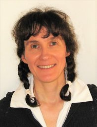 Isabelle Bolon合作论文数Institute of Global Health, Faculty of Medicine, University of Geneva5Rhaleb Zayer合作论文数max planck society5
 Karim C. Abbaspour (Karim Abbaspour)合作论文数Swiss Federal Institute of Aquatic Science and Technology;Department of Biological and Agricultural Engineering, College of Agriculture & Life Sciences, Texas A&M University5
 Miguel Arenas合作论文数Departamento de Bioquímica, Genética e Inmunología, Universidad de Vigo5
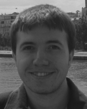 Victor Bacu合作论文数Computer Science Department, Technical University of Cluj-Napoca4
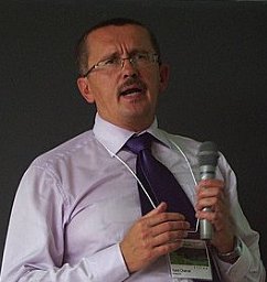 Karel Charvat合作论文数Help Service Remote Sensing4
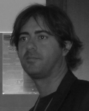 Pierluigi Cau合作论文数4
 Yaniss Guigoz合作论文数SALB Coordination Office;World Health Organisation;SALB Coordination Office, World Health Organisation4
 Carlos Ochoa Pereira合作论文数3Yoann Coudert-Osmont合作论文数CNRS, Univ Lorraine3
 kazi rahman合作论文数enviroSPACE Grp, Univ Geneva3Maxence Reberol合作论文数Université Catholique de Louvain3Justine Basselin合作论文数3
 Mark Beaumont合作论文数Schools of Mathematics and Biology, University of Bristol3Alcoba Gabriel合作论文数3
 Rodrigo Toledo合作论文数3
 Denisa Rodila合作论文数Computer Science Department, Technical University of Cluj-Napoca3S. Babo Martins合作论文数3
 Matthieu Chavent合作论文数Groupe ORPAILLEUR, Nancy Université3
 Andres Ruiz-Linares合作论文数School of Life Sciences, Fudan University;Ministry of Education Key Laboratory of Contemporary Anthropology, Fudan University3Jean-Christophe Ulysse合作论文数3
 Guillaume Caumon合作论文数CREGU, Université de Lorraine-ENSG3
 Franck Ledoux合作论文数CEA-DAM3
 Francois Chappuis合作论文数Institute of Global Health, Faculty of Medicine, University of Geneva3gregory lecot合作论文数2alan r lehmann合作论文数2Luc Buatois合作论文数2




