Wildfires pose an increasing global threat, endangering both human and animal lives. Rapid and coordinated search and rescue (SAR) operations are critical to minimizing casualties in such emergencies. This paper investigates the use of Multi-Agent Reinforcement Learning (MARL) to train autonomous unmanned aerial vehicles (UAVs) capable of cooperative SAR in simulated wildfire environments. The task is modeled as a decentralized partially observable Markov decision process (Dec-POMDP) and trained under a Centralized Training with Decentralized Execution (CTDE) paradigm. Two learning configurations are compared: a single-agent baseline using Proximal Policy Optimization (PPO) and a cooperative multi-agent framework based on Multi-Agent Policy Optimization with Credit Assignment (MA-POCA) incorporating posthumous credit assignment. Training employs a three-stage curriculum to progressively increase environmental complexity and enhance policy generalization. Simulations across one to six UAVs demonstrate that multi-agent coordination significantly improves mission efficiency and consistency. Specifically, teams of four to five UAVs achieved the lowest average completion times while maintaining high stability and reliability across trials. These results confirm that MARL-based cooperative control improves scalability, robustness and overall mission performance in UAV-based SAR operations, especially under optimal team sizing, underscoring the potential of decentralized learning for real-world disaster response scenarios.
The water OH Raman band has been used as an internal standard for remote airborne measurements of fluorescence in water, but the Raman and fluorescence signals of airborne sensors can be perturbed by surface waves that induce a focusing or diverging effect. This lensing effect of waves changes the strength and effective sampling depth of optical signals detected by a remote sensor relative to the flat-water condition. In this work, a small remote optical sensor was used to observe the impact of the lensing effect on Raman scattering of water in a diving pool. This manuscript reports the impact of avalanche multiplication noise on the Raman scattering of flat water; the appearance of bright wave-induced Raman "flashes" analogous to, but stronger than, those observed for sunlight focusing; an approximately logarithmic distribution of signal strengths; and an increase in the average signal strength observed in the presence of waves. A mathematical model of the lensing effect in weak lensing conditions was developed for sinusoidal waves and employed to interpret the observed variability of the Raman signal.
Obstacles on railroads significantly increase the risk of traveling with a lot of train accidents caused by undetected obstacles. The obstacles disturb both the shipments of goods and the transportation of people leading to delays and damage which then result in substantial financial losses. Following natural disasters, manually locating and removing obstacles is not only time-consuming but also hazardous for the personnel involved. To address these challenges, this paper proposes an object detection system that can be implemented on an aerial drone to detect obstacles on the railway. This approach aims to enhance railway safety, reduce costs, and ensure the timely delivery of essential goods such as food and medical supplies during emergencies.
Given the pivotal role of the railroad industry in modern transportation and the potential risks associated with track malfunctions, the inspection and maintenance of railroad tracks emerges as a critical concern. Existing solutions rely on large, expensive, and time-consuming platforms that are very accurate, however, they require the line to be blocked during the inspection. Unmanned Aerial Vehicles (UAVs) can significantly reduce track downtime and cost while maintaining inspection capabilities. However, current solutions focus on the inspection task while UAVs are programmed to follow predefined paths on the network. This paper presents an autonomous, visionbased track following system that was developed, implemented, and tested onboard a UAV. Notably, this system operates independently of external sensors, such as GPS, thanks to its utilization of advanced computer vision techniques. Two approaches were developed utilizing a forward-facing camera and a downward-facing camera. The experimental results of several field trials show the efficiency of the developed system.
Water quality has traditionally been measured via in situ sensors and satellites. The latter has limited applicability for smaller inland water bodies, while the former requires significant logistics, labor, and expense for routine sampling, and reactive/spurious sampling is often not feasible as a result (e.g., sampling pre-/post-storm). Consequently, small uncrewed aircraft system-based (sUAS-based) sampling has emerged as a potential solution to bridge these sampling gaps and challenges. But sampling from an sUAS is complicated by the need to pump water from depth, rather than suspending a sensor from the sUAS, due to concern over sampling sUAS-impacted waters. Here, we measure the water flow below a hovering sUAS in a laboratory by applying the particle image velocimetry flow measurement technique. Observations suggest the development of two counter-rotating vortices under the sUAS, where, in the center of the vortex pair, water is upwelled to the surface, which would, therefore, be a sampling location relatively free of contamination by the sUAS. This location coincides with the still spot on the water surface underneath the sUAS; thus, if one wanted to sample water by suspending a sensor underneath an sUAS, then the optimal sampling location would be within this still spot.
The use of unmanned aerial vehicles (UAVs) has increased rapidly, leading to an effort to accurately and efficiently track UAVs. Many existing approaches utilize YOLO, a state-of-the-art object detection model, in conjunction with object tracking algorithms to detect and follow UAVs in real-time. However, these systems typically focus on a single method, without considering alternative tracking methods. In this paper, we present an experimental comparison of multiple object tracking algorithms integrated with YOLOv8, offering a comprehensive evaluation of their performance in UAV tracking scenarios. First, the model size was optimized to determine the best balance between speed and accuracy. Then, various tracking methods are tested to determine the most effective combination. The YOLOv8 model combined with a Kernelized Correlation Filter outperformed various other trackers in varying environmental scenarios, with a combined success rate and a tracking accuracy of 0.8041. This approach was further implemented in real-time on a Jetson Orion Nano GPU, utilizing a pan-tilt gimbal and an Intel RealSense D435i camera. Running at 20 FPS, the system demonstrated robustness and stability during motion and various environmental scenarios, highlighting its potential for integration into applications such as ground-based UAV surveillance.
The railroad industry is crucial for modern transportation, therefore the need for maintaining the integrity and safety of rail infrastructure is immense. Traditional rail inspection methods, involving manual teams or specialized vehicles, are labor-intensive and costly, causing logistical inconveniences, especially for rapid, large-scale inspection. This paper explores and expands the adaptation of Unmanned Aerial Vehicles (UAVs) and advanced computer vision for rail inspection. While existing literature highlights the benefits and capabilities of UAVs, challenges persist, and a fully integrated, online system has yet to be thoroughly implemented and tested. We seek to create a system that performs the task of track following strictly by visual sensor perception, eliminating any reliance on GPS and ensuring autonomy in environments with limited or degraded GPS availability, such as dense settings, tunnels, etc. The system will perform all processing onboard, providing immediate results without the need for external processing or infrastructure. Our proposed approach divides the problem into track detection, track interpretation, and track following. This work focuses on the first of these steps, track detection. We survey existing approaches, assess their strengths and limitations, and introduce a novel method addressing prior challenges, keeping in mind the goal of a fully integrated, autonomous system for rapid track assessment.
In the recent years, Digital Twins (DTs) have been extensively used in numerous domains. On vehicular applications specifically, most are focused on ground vehicles with proven advantages. But how about the application of DTs in the UAV domain? This paper presents an extensive survey where we aim to address four related research questions, namely if DTs are used in UAVs, which are the applications of DTs in UAVs, if DTs can be applied to any UAV type and, finally, what are the specific tools used for DT implementation in the UAV domain. Using a well-defined research methodology, we collected and reviewed more than 70 publications on the subject. Through different categorizations of the publications under study and an aggregated presentation in tabular format, the reader is able to gain a thorough understanding of recent developments in this area of research.
We describe the control and interfacing of a fluorometer designed for aerial drone-based measurements of chlorophyll-a using an Arduino Nano 33 BLE Sense board. This 64 MHz controller board provided suitable resolution and speed for analog-to-digital (ADC) conversion, processed data, handled communications via the Robot Operating System (ROS) and included a variety of built-in sensors that were used to monitor the fluorometer for vibration, acoustic noise, water leaks and overheating. The fluorometer was integrated into a small Uncrewed Aircraft System (sUAS) for automated water sampling through a Raspberry Pi master computer using the ROS. The average power consumption was 1.1 W. A signal standard deviation of 334 µV was achieved for the fluorescence blank measurement, mainly determined by the input noise equivalent power of the transimpedance amplifier. An ADC precision of 130 µV for 10 Hz chopped measurements was achieved for signals in the input range 0-600 mV.
Multirotor Uncrewed Aircraft Systems (UAS), widely known as aerial drones, are increasingly used in various indoor and outdoor applications. For outdoor field deployments, the plethora of UAS rely on Global Navigation Satellite Systems (GNSS) for their localization. However, dense environments and large structures can obscure the signal, resulting in a GNSS-degraded environment. Moreover, outdoor operations depend on weather conditions, and UAS flights are significantly affected by strong winds and possibly stronger wind gusts. This work presents a nonlinear model predictive position controller that uses a disturbance observer to adapt to changing weather conditions and fiducial markers to augment the system’s localization. The developed framework can be easily configured for use in multiple different rigid multirotor platforms. The effectiveness of the proposed system is shown through rigorous experimental work in both the lab and the field. The experimental results demonstrate consistent performance, regardless of the environmental conditions and platform used.
Uncrewed Aircraft Systems (UAS) are increasingly used in time-consuming and effort-heavy scientific exploration applications. One such application is the inspection of the physical, chemical, and biological properties of water in aquatic ecosystems. This paper presents a novel autonomous UAS capable of sensing water properties and collecting up to three 250 mL water samples from multiple sampling locations. The system features a customized UAS with an in-house built fluorescence sensor and pumping mechanism. The system does in situ fluorescence measurements to map the gradient of fluorescent content across the body of water and determine the best sampling spot for targeted sampling. To ensure safe near-water operation, multiple sensor fusion with an Extended Kalman Filter has been implemented for accurate altitude estimation within 1.5 m from the water surface. To validate the performance of the system, we present experimental results from deployment in two different water ecosystems, namely the Congaree River, SC and Lake Wateree, SC.
We recently described a lightweight, low-power, waterproof filter fluorometer using a 180° backscatter geometry for chlorophyll-a (chl-a) detection. Before it was constructed it was modeled to ensure it would have satisfactory performance. This manuscript repeats the modeling process that allows the calibration slope and detection limit for a fluorescent analyte in water to be estimated from system component performance and conventional spectrofluorometry alone. These values are validated by comparison to the experimental result of calibration from the completed instrument. Our model yields a calibration slope of 8.22 mV-L/µg for dissolved chl-a, consistent with the experimentally measured slope of 8.21 mV-L/µg. The detection limit modeled from this slope and an estimate of the baseline noise of the instrument was 0.15 µg/L chl-a, while the measured detection limit using real blank samples was 0.18 µg/L, in 0.1 s differential measurements.
We describe a waterproof, lightweight (1.3 kg), low-power (∼1.1 W average power) fluorometer operating on 5 V direct current deployed on a small uncrewed aircraft system (sUAS) to measure chlorophyll and used for triggering environmental water sampling by the sUAS. The fluorometer uses a 450 nm laser modulated at 10 Hz for excitation and a standard photodiode and transimpedance amplifier for the detection of fluorescence. Additional detectors are available for measuring laser intensity and light scattering. Control of the fluorometer and communication between the fluorometer and the Raspberry Pi 4B computer controlling the sampler were provided by an Arduino microcontroller using the robot operating system (ROS). Calibrations were based on standards of dissolved chlorophyll extracted from Chlorella powder (a widely available dietary supplement). The detection limit for chlorophyll from these calibrations was found to be 0.2 μg per liter of water for a single 0.1 s differential measurement. The detection limit decreases with the square root of the integration time as expected. Detection limits increase by a factor of two to three when mounted in the sUAS due to electrical noise; sUAS acoustic noise and vibration do not appear to contribute significantly.
Uncrewed Aircraft Systems (UAS) are becoming widely used in the inspection of structures. While in most applications, the UAS are used for remote\contactless inspections, there are cases where the UAS need to contact the structure and do a measurement or deliver a sensor package. In this paper, we work on the autonomous deployment and retrieval of sensor packages to the underside of structures. The accurate positioning and reliable mounting of the package below a structure is a challenging problem. Based on our prior work in the field, we develop a new control and mission framework that takes into account the estimated contact force to ensure that the package is firmly attached during deployment and securely retrieved when the mission ends. The new system has been thoroughly tested in numerous lab experiments that mimic the conditions of an outdoor setting, and experimental results show that the new approach greatly increases the reliability of the system.
Water sensing and sampling is a complex application that can benefit from the use of aerial drones. In the monitoring of an aquatic environment, inspection of its physical, chemical, and biological states are equally important. In most cases, only the physical and chemical properties are investigated due to lack of portable sensor packages capable of in situ measurements of biological indicators. Additionally, biological sample collection for ex situ analysis poses certain challenges which requires specialized sample collection methods. For acquiring a good sample, remote sensing needs to work hand in hand with the sampling mechanism to capture the correct analyte of interest. This work presents the design and development of an aerial drone equipped with a custom-made sensor package and sampling mechanism, for sensing and non-destructive sampling of dissolved organic matter in aquatic environments. The developed system is experimentally validated in an outdoor setting and is shown to be capable for in situ measurements of fluorescent content of water bodies and sensor-triggered sample collection.
The availability of historical flood data is vital in recognizing weather-related trends and outlining necessary precautions for at-risk communities. Flood frequency, magnitude, endurance, and volume are traditionally recorded using established streamgages; however, the material and installation costs allow only a few streamgages in a region, which yield a narrow data selection. In particular, stage, the vertical water height in a water body, is an important parameter in determining flood trends. This work investigates a low-cost, compact, rapidly-deployable alternative to traditional stage sensors that will allow for denser sampling within a watershed and a more detailed record of flood events. The package uses a HC-SR04 ultrasonic sensor to measure stage, onboard memory for recording flood events, and an electropermanet magnet (EPM) to enable Unmanned Aerial Vehicle (UAV) deployments. Optional modules for solar panels and wireless communication can also be added to extend package longevity or allow wireless control of the EPM. The stage sensor package was found to have a range of 0.02 to 4 m with a 6.9 mm accuracy and capable of a 6.4 day long deployment. With the total cost of production at 271.37 USD, it is a cheaper and more flexible alternative to traditional stage sensors that will enable dense sensor networks and rapid response to flooding events.
Mission planning for small uncrewed aerial systems (sUAS) as a platform for remote sensors goes beyond the traditional issues of selecting a sensor, flying altitude/speed, spatial resolution, and the date/time of operation. Unlike purchasing or contracting imagery collections from traditional satellite or manned airborne systems, the sUAS operator must carefully select launching, landing, and flight paths that meet both the needs of the remote sensing collection and the regulatory requirements of federal, state, and local regulations. Mission planning for aerial drones must consider temporal and geographic changes in the environment, such as local weather conditions or changing tidal height. One key aspect of aerial drone missions is the visibility of the aircraft and communication with the aircraft. In this research, a visibility model for low-altitude aerial drone operations was designed using a GIS-based framework supported by high spatial resolution LiDAR data. In the example study, the geographic positions of the visibility of an aerial drone used for water sampling at low altitudes (e.g., 2 m above ground level) were modeled at different levels of tidal height. Using geospatial data for a test-case environment at the Winyah Bay estuarine environment in South Carolina, we demonstrate the utility, challenges, and solutions for determining the visibility of a very low-altitude aerial drone used in water sampling.
The rapid assessment of infrastructure following extreme weather or seismic events is important to ensure the stability of structures before their continued use. This work presents an amplitude compensation technique for accurate acceleration measurements formulated for unmanned aerial vehicle’s (UAV) deliverable sensor packages. These packages are designed for measuring the acceleration of structures, for instance, railroad bridges and power transmission towers. Current technology for structural health monitoring is expensive, stationary, and requires maintenance by certified personnel. These attributes prevent rapid assessment of remote and hard-to-reach structures. Low-cost, UAV-delivered sensor packages are an ideal solution due to their ability to be deployed on a large scale in a timely manner; cutting down on cost and the danger affiliated with structural health monitoring following extreme and hazardous events. One challenge to this approach is that the UAV deployable sensor package consists of several systems, including mounting hardware, embedded electronics, and energy storage that result in a loss of transmissibility between the structure and the package’s accelerometer. This work proposes a frequency response-based filter to isolate the structure’s vibration signature from interference caused by the sensor package itself. Utilizing an input-output relationship between the sensor package and a calibrated reference accelerometer, a model transfer function is constructed. Compensation is performed in the post-processing stage using the inverse transfer function model. This approach is shown to enhance the signal-to-noise ratio by 1.2 dB, an increase of 7.17%. This work investigates algorithm robustness and sensitivity to noise across the sensor package’s bandwidth of 6-20 Hz. A discussion on the limitations of the system is provided.
Visual monitoring operations underwater require both observing the objects of interest in close-proximity, and tracking the few feature-rich areas necessary for state estimation. This paper introduces the first navigation framework, called AquaVis, that produces on-line visibility-aware motion plans that enable Autonomous Underwater Vehicles (AUVs) to track multiple visual objectives with an arbitrary camera configuration in real-time. Using the proposed pipeline, AUVs can efficiently move in 3D, reach their goals while avoiding obstacles safely, and maximizing the visibility of multiple objectives along the path within a specified proximity. The method is sufficiently fast to be executed in real-time and is suitable for single or multiple camera configurations. Experimental results show the significant improvement on tracking multiple automatically-extracted points of interest, with low computational overhead and fast re-planning times.Accompanying short video: https://youtu.be/JKO bbrIZyU
Robust localization is critical for the navigation and control of mobile robots. Global Navigation Satellite Systems (GNSS), Visual-Inertial Odometry (VIO), and Simultaneous Localization and Mapping (SLAM) offer different methods for achieving this goal. In some cases however, these methods may not be available or provide high enough accuracy. In such cases, these methods may be augmented or replaced with fiducial marker pose estimation. Fiducial markers can increase the accuracy and robustness of a localization system by providing an easily recognizable feature with embedded fault detection. This paper presents an overview of fiducial markers developed in the recent years and an experimental comparison of the four markers (ARTag, AprilTag, ArUco, and STag) that represent the state-of-the-art and most widely used packages. These markers are evaluated on their accuracy, detection rate and computational cost in several scenarios that include simulated noise from shadows and motion blur. Different marker configurations, including single markers, planar and non-planar bundles and multi-sized marker bundles are also considered in this work.
 Michail Kalaitzakis合作论文数Univ South Carolina, Dept Mech Engn, Columbia, SC 29208 USA16
 Kimon P. Valavanis合作论文数Department of Electrical & Computer Engineering, Daniel Felix Ritchie School of Engineering & Computer Science, University of Denver10
 Matthew J. Rutherford合作论文数Department of Computer Science, University of Colorado10Michael L. Myrick合作论文数8
 Tammi L. Richardson合作论文数Marine Science Program, University of South Carolina7Zechariah Kitzhaber合作论文数6Caitlyn English合作论文数6
 Kazi Ragib Ishraq Sanim合作论文数Dept Mech Engn, Univ South Carolina6
 Michael E. Hodgson合作论文数Department of Geography, College of Arts and Sciences, University of South Carolina6
 Bhanuprakash Kosaraju合作论文数Department of Mechanical Engineering, University of South Carolina5
 Konstantinos Kanistras合作论文数4
 Brennan Cain合作论文数Univ South Carolina, Dept Comp Sci & Engn, Columbia, SC 29208 USA4
 Dimitris C. Rizos合作论文数Dept Civil & Environm Engn, Univ South Carolina4
 Thrishantha Nanayakkara合作论文数Dyson School of Design Engineering, Faculty of Engineering, Imperial College London4
 Visakha K Nanayakkara合作论文数Graduate School of Science and Engineering, Saga University4Demetrios T Venetsanos合作论文数School of Mechanical Engineering, National Technical University of Athens4
 Ioannis Rekleitis合作论文数Department of Mechanical Engineering, College of Engineering, University of Delaware4
 Mehmet Sahinkaya合作论文数4Sabrina Carroll合作论文数3Joud Satme合作论文数3
 Austin Downey合作论文数Iowa State Univ, Dept Civil Construct & Environm Engn, Ames, IA 50011 USA3
 Nare Karapetyan合作论文数Computer Science and Engineering Department, University of South Carolina3
 Saka, Pranith Chander合作论文数3
 Jessica Alvarenga合作论文数Department of Electrical Engineering, California State University3
 Corinne Smith-Lewis合作论文数2
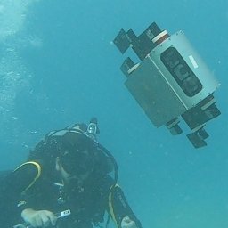 Marios Xanthidis合作论文数Dept Comp Sci Engn, Univ South Carolina2Jason Moulton合作论文数2
 James Johnson合作论文数Department of Horticultural Science;Texas A&M University;Department of Horticultural Science, Texas A&M University2
 Michael Sutton合作论文数Department of Biomedical Engineering, College of Engineering and Computing, University of South Carolina2Bryan Godbolt合作论文数Applied Nonlinear Controls Laboratory, University of Alberta2
 Alberto Quattrini Li合作论文数Computer Science Department, Dartmouth College2
 Nicolás Rojas合作论文数The AI Institute2
 Alan F Lynch合作论文数Applied Nonlinear Controls Laboratory, University of Alberta2Nikhil Krishna合作论文数1Aryan Anand合作论文数1
 Tyler Russo合作论文数Department of Mechanical Engineering, University of South Carolina1
 Bharat Joshi合作论文数Dexterity, Inc.1Alejandro Diaz De Cerio Sanchez合作论文数1Roberto Girardi合作论文数1
 Jacob Martin合作论文数1
 Matthew T Duggan合作论文数1Anand Ambrosi合作论文数1
 Nikolaos Sarantinoudis合作论文数Ind & Digital Innovat Res Grp INDIGO, Tech Univ Crete1Camden Whitehead合作论文数1Sreehari Rajan合作论文数Mechanical Engineering Department, University of South Carolina1Alan Hernandez合作论文数MiraCosta Coll, Comp Sci Dept, Oceanside, CA USA1
 Hasitha Wegiriya合作论文数Department of Informatics, King's College London, London, UK1
 Sharmin Shabnam Rahman合作论文数Computer Science and Engineering Department, University of South Carolina1
 Erin E. Hackett合作论文数Coastal Carolina University;c;Coastal Carolina University1




