Abstract A new gravimetric geoid for Mexico, xGGM23, was determined to update the national official solution used to homogenize GNSS-derived heights. Its resolution of 2.5 arc minutes is consistent with the spatial distribution of terrestrial gravimetry in the country, and its coverage is extended to include the southern US, Belize, Guatemala, El Salvador, Honduras and Nicaragua. We apply the Stokes-Helmert method for geoid modeling to combine the existing land gravimetry with the geopotential model GOCO06s at the reference potential $$ {W}_0^{NA}=\textrm{62,636,856.0}\ {\textrm{m}}^2{\textrm{s}}^{-2} $$ W 0 NA = 62,636,856.0 m 2 s − 2 , which is the standard adopted in North America. A dataset of 182,870 land gravity points in Mexico was combined with DTU21 marine gravity to recover the higher frequencies of the geoid, while the lower frequencies were provided by GOCO06s. Terrain effects were based on the 3 ″ × 3 ″ elevation model DEM2022 from the US National Geodetic Survey. The resulting geoid differs from the leveling datum in Mexico by 13 cm in standard deviation, resulting in a precision two times better than its predecessor model GGM10. We consider this figure as a pessimistic estimate of the real accuracy of the xGGM23, given the lower accuracies of the current leveling datum used in Mexico.
The determination of the shape of the Earth has been one of the fundamental problems geodesy was supposed to solve; it has been and possibly still is the main geodetic problem. It is thus appropriate for geodesists to look at this problem periodically, and this is what the authors of this paper aim to do. About 50 years ago, geodesists started using satellites as a new and very powerful tool. Many problems that were either impossible to solve or that presented almost unsurmountable hurdles to solutions have now been solved relatively simply, so much so that in the eyes of some people, satellites can solve all geodetic problems, and attempts are being made to show that this is indeed the case. We feel that the time has come to show that even satellites have their limitations, the main one being that for them to remain in their orbit, they must fly quite high, typically at several hundred kilometres. The gravitational field of the Earth (and that of any celestial body) smoother as one gets higher and higher. In other words, the gravitational field at the satellite orbit altitude loses detailed information that one can see at the surface of the Earth. In this contribution, we shall try to explain what satellites have contributed to the study of the shape of the Earth and what issues remain to be sorted out.
Este artigo trata do problema clássico do posicionamento do Datum Geodésico Horizontal. Por "problema clássico" entendemos aquele problema que enfrentamos quando o procedimento com o controle usual horizontal da rede, é o oposto a algumas das mais modernas ideias, tal como o uso de coordenadas geocêntricas, ou as ideias de Hotine (1959-1969). Nossa pretensão básica é que um sistema de coordenadas é uma estrutura fixa (isto é, invariável com respeito ao ajustamento da rede, reajustamento ou expansão) para descrever redes geodésicas. Nosso ponto de vista é que um sistema de coordenadas e a rede que ele determina são duas coisas diferentes (este conceito não é universalmente aceito pela comunidade geodésica).
The paper describes the theoretical aspects of the latest University of New Brunswick gravimetric solution of the Canadian geoid. Stokes’s integral convolution approach reformulated for a higher-order reference field, GEM9 in this case, is used. In addition to the theoretical aspects, an example of the actual solution for eastern Canada is shown. Comparisons with Rapp’s 1983 and Wenzel’s GPM1 solutions, SEASAT altimetry and Canadian first-order Doppler points are also described.
The complete theory of topographical effects in the Stokes-Helmert technique for geoid determination is developed. New formulae for direct and indirect topographical effects consider lateral density variations of topographical masses. The formulae are further simplified for computing the topographical effects of water in a lake. Numerical values of the particular topographical terms are given for the lake Superior.
One way to analyse observed data for the presence of systematic effects is to look for the autocorrelation in the data. Since autocorrelation (function) is defined only for a data series, one first has to construct a data series from the observed levelling data. Levelling discrepancies may be thus first plotted as data series with respect to various parameters, such as heights, height differences, azimuths, number of set-ups between benchmarks, etc. Each data series gives an estimate of its autocorrelation function. These functions provide us with a tool to quantify the way errors propagate within the levelling line and thus to qualify systematic errors.
In the paper, the classical as well as the generalized Stokes techniques — in which use is made of a higher-order reference spheroid defined by satellite determined potential coefficients — are compared with Hotine’s technique for geoid determination. While the Stokes techniques use gravity anomalies, Hotine’s technique uses gravity disturbances. Leaving out the complications, we can say that computation of gravity anomalies requires the knowledge of orthometric heights of individual gravity observation points, while gravity disturbances require heights above the reference ellipsoid. The vast majority of the millions of gravity points on land have only the orthometric heights associated with them, thus permitting an evaluation of only gravity anomalies. A systematic use of gravity disturbances on land would require the transformation orthometric heights into heights above the ellipsoid — barring a prohibitively expensive programme of reobservation of the heights at ail the gravity points. Such a transformation would call for the geoid-ellipsoid separation, the geoidal height, to be known. Here lies the seeming self-contradiction of Hotine’s technique as applied on land: the geoid has to be known to be determinable. We show that this seeming paradox does not render Hotine’s approach meaningless. In our investigation, the geoid (assumed known) is replaced by a higher-order reference spheroid. Two approximate variations of Hotine’s technique are then considered, and it is shown that under specific circumstances both of Hotine’s variations give more accurate results than the Stokes techniques.
In this paper, we explore the theoretical properties of Stokes’s solution to the geodetic boundary value problem in Helmert’s modification. We show that the formulation embodied in Helmert’s “second condensation method” should remove the widespread objection to Stokes’s approach – that topographical density has to be known very accurately if an accurate geoid is to ensue - by reducing the effect of topographical masses by several orders of magnitude. The study draws heavily on several papers of ours on partial aspects of the Stokes-Helmert scheme that have been recently published.
In the past, two different methods were proposed to consider the effect of the terrain in Helmert’s 2nd condensation method. In Vaníček and Kleusberg (1987) approach the attraction of the topographical masses is evaluated at a point on the topographical surface. By analogy with the Molodensky’s theory, Wang and Rapp (1990) claim that the free-air anomaly should be reduced by the terrain correction. They also state that the attraction of the topographical masses should be referred to a point on the geoid. This paper shows that key to solve this discrepancy is hidden in the way how the downward continuation of the anomalous gravity is treated in the particular methods. In the Vaníček and Kleusberg approach (1987) the downward continuation of the anomalous gravity from the topographical surface to the geoid is completely neglected, whereas Wang and Rapp (1990) evaluate this term under implicit assumption that there is a linear relationship between free-air gravity anomaly and the elevation of topography. As Moritz (1966) showed such an assumption comes from a simplified view of the compensation of topographical masses; it has not been proved yet that this assumption is acceptable for a precise geoid determination. In other words it means that both methods, Vaníček and Kleusberg (1987) as well as Wang and Rapp (1990), are for different reasons only approximate. We will not be able to decide which method yields more accurate results until a correct procedure of computing downward continuation of anomalous gravity will be employed. Let us emphasize that this paper does not aspire to provide such an accurate procedure.
Strain and its various forms have been used to analyse relative crustal movements in earthquake prone areas for at least some 50 years. The present paper discusses the applications of this technique to study the effects of inconsistent observations and constraints in a horizontal geodetic network. Both simulated and real networks are used. The method of identifying incompatible observations and constraints by using the strain tensor and average differential rotation is given.
The direct topographical effect that arises when the Stokes problem is treated by means of Helmert’s 2nd condensation technique has been a subject of several studies in the recent past. In this paper, we use a spherical rather than planar model of the geoid, to derive more accurate expressions for the effect. Also our expressions are formulated so that the influence of lateral variations of topographical density can be taken into account. As a by-product of our investigation, we show that the integrals figuring in the direct topographical effect are only weakly singular and we proceed to remove the singularities by introducing spherical “Bouguer” shells.
As a result of the Laurentide ice load, covering most of eastern North America ∼ 20 ka BP to 6.5 ka BP, the crust was depressed and is currently undergoing a huge adjustment. The observed present uplift rate at six tide gauge stations were used together with a map of sea level rise rate for the last 2000 years, based on radiocarbon dated shoreline uplift, to estimate the present uplift rate of the crust. The maximum ‘observed uplift’ rate (with respect to sea level) is estimated to be 10.9 ± 1.3 mm/a in southeastern Hudson Bay. A simple viscous flow model is used to estimate the temporal change of the geoid accompanying the observed uplift. This model yields an uplift rate of the geoid of about 10
It has been customary in Geodesy to evaluate the indirect effect that arises from mathematical removal of the topography in solving the geodetic boundary value problem using Stokes approach, by modelling the geoid as a plane. In this contribution, we show that this planar model gives an incorrect result. Adopting a spherical model for the geoid, we derive a new expression for the indirect topographical effect on potential.
Any height system has two constituents: A reference surface upon which all heights are equal to zero, and a prescription for how observed heights and height differences will be related to that surface. That prescription is typically formulated with reference to Earth’s gravity field, but in this contribution, we will use the concept of metric spaces instead. In most height systems, the height of a point can be interpreted as the length of the 3-dimensional path from a point of interest to the reference surface in a particular metric space. The geometry of the path is that of the space associated with the height system. This submission explores the definition of a height system simply as a metric space and a reference surface, applies it to common height systems used in geodesy (geodetic, orthometric, dynamic, normal), and examines their characteristics through that lens.
We estimate the uncertainty of the modelled geoid heights based on the standard deviations of the topographic mass density variation. We model the geoid using the one-step integration method considering mass density variations along with their associated error estimates to calculate the direct and indirect topographic density effects on the geoid heights in the Helmert space. We employ the UNB_TopoDensT_2v01 global lateral density model and its standard deviations and test our algorithms in the Auvergne test area, in central France. Our results show that the topographic mass density variations are currently known well enough to model the geoid with sub-centimetre internal error in topographically mild regions such as Auvergne.
Let us start with defining what we understand by a height system. A height system is a conglomerate of reference surface upon which height H = 0, and a recipe for how heights above that surface are obtained from observations. Two such systems, which we call the classical or Gauss-Stokes’s system and the Molodensky system, are used in practical height measurement. The reference surface used by the classical system is the Geoid and its usage is based on valid physical arguments. Determination of the height above the geoid requires data at the surface of the Earth obtained by levelling, gravimetry, sea level measurements, and topographical density from geological measurements. This system served us well when decimetre height accuracy was required and will continue doing so even now when one or even two orders of magnitude better accuracy is needed. On the other hand, Molodensky’s system uses the quasigeoid as a reference surface; this surface is ill suited for a global height system. This paper argues the case that the standard classical reference surface, the geoid, should be used in practice everywhere.
This paper is written as a progression of the ongoing discussion in geodesy about the merits of the Molodensky height system versus the classical height system. It is a rebuttal of a publication in the Proceedings of the IX Hotine-Marussi Symposium on Mathematical Geodesy by Victor Popadyev titled “On the Advantage of Normal Heights: Once More on the Shape of Quasigeoid.” Even though Popadyev’s paper was not presented at the symposium it was published in the proceedings regardless. It purports to address a presentation from the symposium titled “The shape of the quasigeoid”, that applied a set of criteria to judge the suitability of the quasigeoid as a vertical reference surface, ultimately finding it inferior due to its edges and folds. The proceedings paper acknowledges these irregularities in the quasigeoid, but instead argues that the Molodensky system, apart from any vertical reference surface, should be evaluated on two different and more favorable criteria, and finds it superior on that basis. Herein, we continue the ongoing discussion by clarifying some of the misunderstandings in the Popadyev paper and explaining that even on the favourable criteria proposed the Molodensky system holds no advantages over the classical system.
We present a comprehensive view of the origin, significance and implications of topographic effects in gravimetry. These are gravitational effects of topographic masses that are present in any observable quantity of the earth's gravitational field. In most gravimetric applications and their computational realizations, when topography is not the focus of the study, these effects need to be properly treated as corrections (reductions). Some of them might not be obvious or intuitive, and may remain misunderstood and mistreated. First, we look at topographic effects in geodesy and focus on those that affect the determination of the geoid from terrestrial gravity data. We review the origin and role of both the direct and indirect, the primary and secondary topographic effects. Then, we review the Bouguer concept in geophysical applications. Finally, we take a look at the topographic effect induced by the deformation of the topographic surface and its importance in the interpretation of observed spatiotemporal gravity changes. We illustrate the sizes and shapes (spatial properties) of these effects, discuss their relevance and impacts in the areas of geodesy, geophysical structural studies (exploration and prospection), and in geodynamics with a focus on volcano geodesy.
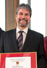 Marcelo C. Santos合作论文数Geodetic Research Laboratory, Department of Geodesy and Geomatics Engineering, University of New Brunswick48
 Robert Kingdon合作论文数Department of Geodesy and Geomatics Engineering, University of New Brunswick33
 Ismael Foroughi合作论文数Dept Sociol, Univ New Brunswick26
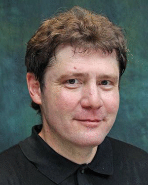 Robert Tenzer合作论文数School of Civil Engineering and Geosciences, Newcastle University24
 Pavel Novak合作论文数Department of Geomatics Engineering, The University of Calgary17
 Zdenek Martinec合作论文数16Artu Ellmann合作论文数Geodesy Group, Royal Institute of Technology13
 Peter Vajda合作论文数Geophysical Institute;Slovak Academy of Sciences;Geophysical Institute, Slovak Academy of Sciences12Michael Sheng合作论文数Dept Geodesy & Geomat Engn, Univ New Brunswick11
 Will Featherstone合作论文数School of Earth and Planetary Sciences, Curtin University8m sheng合作论文数7Juraj Janák合作论文数7marco antonio dos santos合作论文数6
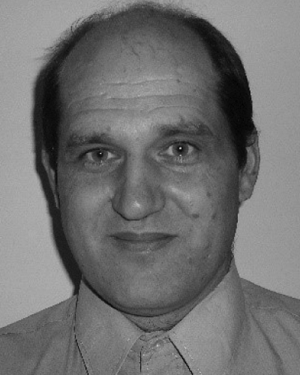 Michael Kuhn合作论文数6Charles L Merry合作论文数6
 Azadeh Koohzare合作论文数6
 Bruno Meurers合作论文数6Richard B. Langley合作论文数6rw kingdon合作论文数5Michael Craymer合作论文数5
 Lars E. Sjöberg (Lars Sjöberg)合作论文数Division of Geodesy and Satellite Positioning, KTH Royal Institute of Technology5
 Spiros Pagiatakis合作论文数Department of Earth and Atmospheric Science;York University;Department of Earth and Atmospheric Science, York University5
 Mehdi Goli合作论文数Fac Civil & Architectural Engn, Shahrood Univ Technol4M. Véronneau合作论文数4Mensur Omerbashich合作论文数4Mustafa Berber合作论文数3d e wells合作论文数3Peter Dare合作论文数3Edward J. Krakiwsky合作论文数3
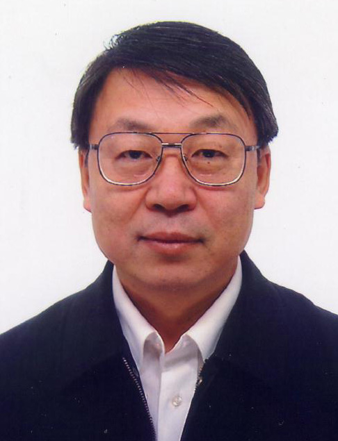 Wenke Sun (孙文科)合作论文数College of Earth and Planetary Sciences, University of Chinese Academy of Sciences3Alfred Kleusberg合作论文数3N Christou合作论文数2Antonio Hernández Navarro合作论文数2antonio hernandez navarro合作论文数2j huang合作论文数2Hou Tianhang合作论文数2Dezsö Nagy合作论文数2peng ong合作论文数2Mónica Santos合作论文数2
 Yosra Afrasteh合作论文数Faculty of Civil Engineering and Geosciences, Delft University of#N#Technology2
 Hakan S. Kutoglu合作论文数Department of Geodesy and Photogrammetry Engineering, Zonguldak Karaelmas University2
 Mehdi Najafi合作论文数Aerospace Engineering Department, Sharif University of Technology2
 Murvet Berber合作论文数Department of Geodesy and Geomatics Engineering, University of New Brunswick2
 Y. Djamour合作论文数National Cartographic Center of Iran (NCC) Azadi Square2
 Andre Mainville合作论文数2
 S. J. Claessens合作论文数Western Australian Centre for Geodesy;Curtin University of Technology;Western Australian Centre for Geodesy, Curtin University of Technology2A. C. O. C. de Matos合作论文数1




