The technique of forgetting in knowledge representation has been shown to be a powerful and useful knowledge engineering tool with widespread application. Yet, very little research has been done on how different policies of forgetting, or use of different forgetting operators, affects the inferential strength of the original theory. The goal of this paper is to define loss functions for measuring changes in inferential strength based on intuitions from model counting and probability theory. Properties of such loss measures are studied and a pragmatic knowledge engineering tool is proposed for computing loss measures using a well-known probabilistic logic programming language ProbLog. This paper includes a working methodology for studying and determining the strength of different forgetting policies, in addition to concrete examples showing how to apply the theoretical results using ProbLog. Although the focus is on forgetting, the results are much more general and should have wider application to other areas.
In the dynamic and challenging maritime domain, Search and Rescue (SAR) operations are critical for ensuring the safety of life at sea. Adverse weather conditions often hinder traditional SAR efforts, leading to significant delays or cancellation of search missions. This paper introduces an autonomous search system utilizing Unmanned Aerial Vehicles. The system combines decision-making techniques for automatic mission generation and a flexible machine-learning framework that allows for easy training and deployment of models to automatically process data gathered during SAR operations. One of the system’s main features is the ease of use in mission planning, where high-level mission goals can be specified via a user interface in the form of data requests. The paper presents the results of the experimental evaluations of the system and showcases its deployment in actual field-test experimentation.
This paper addresses the problem of vision-based object geolocation using Unmanned Aerial Vehicles in Search and Rescue settings. It focuses on the task of automatically and accurately geolocating objects of different classes, focusing on human bodies, to provide a map of the detected objects as salient locations. Such maps can be used by responders to plan rescue operations or by other robotic platforms where geolocation is necessary, such as with delivery of medical supplies. The proposed solution strategy leverages recent developments in the field of Convolutional Neural Networks for vision-based object detection with a method for fusing detections. Occupancy probabilities of locations in the environment containing objects of specific classes, or lack thereof, are also computed. This is achieved by taking advantage of a novel sensor model for fusing vision-based detections using both positive and negative observations. The method is validated in simulation as well as with real field experiments.
Forgetting is an important concept in knowledge representation and automated reasoning with widespread applications across a number of disciplines. A standard forgetting operator, characterized in [26] in terms of model-theoretic semantics and primarily focusing on the propositional case, opened up a new research subarea. In this paper, a new operator called weak forgetting, dual to standard forgetting, is introduced and both together are shown to offer a new more uniform perspective on forgetting operators in general. Both the weak and standard forgetting operators are characterized in terms of entailment and inference, rather than a model theoretic semantics. This naturally leads to a useful algorithmic perspective based on quantifier elimination and the use of Ackermann's Lemma and its fixpoint generalization. The strong formal relationship between standard forgetting and strongest necessary conditions and weak forgetting and weakest sufficient conditions is also characterized quite naturally through the entailment-based, inferential perspective used. The framework used to characterize the dual forgetting operators is also generalized to the first-order case and includes useful algorithms for computing first-order forgetting operators in special cases. Practical examples are also included to show the importance of both weak and standard forgetting in modeling and representation.
This paper focuses on the high-level specification and generation of 3D models for operational environments using the idea of active queries as a basis for specifying and generating multi-agent plans for acquiring such models. Assuming an underlying multi-agent system, an operator can specify a request for a particular type of model from a specific region by specifying an active query. This declarative query is then interpreted and executed by collecting already existing data/information in agent systems or, in the active case, by automatically generating high-level mission plans for agents to retrieve and generate parts of the model that do not already exist. The purpose of an active query is to hide the complexity of multi-agent mission plan generation, data transformations, and distributed collection of data/information in underlying multi-agent systems. A description of an active query system, its integration with an existing multi-agent system and validation of the active query system in field robotics experimentation using Unmanned Aerial Vehicles and simulations are provided.
In the context of collaborative robotics, distributed situation awareness is essential for supporting collective intelligence in teams of robots and human agents, where it can be used for both individual and collective decision support. This is particularly important in applications pertaining to emergency rescue and crisis management. During operational missions, data and knowledge is gathered incrementally and in different ways by heterogeneous robots and humans. This paper aims to describe an RDF Graph Synchronization System called RGS⊕. It is assumed that a dynamic set of agents provide or retrieve knowledge stored in their local RDF Graphs which are continuously synchronized between agents. The RGS⊕ System was designed to handle unreliable communication and does not depend on a static centralized infrastructure.
The problem of reliably detecting and geolocating objects of different classes in soft real-time is essential in many application areas, such as Search and Rescue performed using Unmanned Aerial Vehicles (UAVs). This research addresses the complementary problems of system contextual vision-based detector selection, allocation, and execution, in addition to the fusion of detection results from teams of UAVs for the purpose of accurately and reliably geolocating objects of interest in a timely manner. In an offline step, an application-independent evaluation of vision-based detectors from a system perspective is first performed. Based on this evaluation, the most appropriate algorithms for online object detection for each platform are selected automatically before a mission, taking into account a number of practical system considerations, such as the available communication links, video compression used, and the available computational resources. The detection results are fused using a method for building maps of salient locations which takes advantage of a novel sensor model for vision-based detections for both positive and negative observations. A number of simulated and real flight experiments are also presented, validating the proposed method.
This paper explores the use of LH Interval Calculus, a novel qualitative spatial reasoning formalism, to create a human-readable representation of environments observed by UAVs. The system simplifies data from multiple UAVs collaborating on environment mapping. Real UAV-captured data was used for evaluation. In tests involving two UAVs mapping an outdoor area, LH Calculus proved effective in generating a cohesive high-level description of the environment, contingent on consistent input data.
Reasoning about uncertainty is one of the main cornerstones of Knowledge Representation. More recently, combining logic with probability has been of major interest. Rough set methods have been proposed for modeling incompleteness and imprecision based on indiscernibility and its generalizations and there is a large body of work in this direction. More recently, the classical theory has been generalized to include probabilistic rough set methods of which there are also a great variety of proposals. Pragmatic, easily accessible, and easy to use tools for specification and reasoning with this wide variety of methods is lacking. It is the purpose of this paper to fill in that gap where the focus will be on probabilistic rough set methods. A landscape of (probabilistic) rough set reasoning methods and the variety of choices involved in specifying them is surveyed first. While doing this, an abstract generalization of all the considered approaches is derived which subsumes each of the methods. One then shows how, via this generalization, one can specify and reason about any of these methods using PROBLOG, a popular and widely used probabilistic logic programming language based on PROBLOG. The paper also considers new techniques in this context such as the use of probabilistic target sets when defining rough sets and the use of partially specified base relations that are also probabilistic. Additionally, probabilistic approaches using tolerance spaces are proposed. The paper includes a rich set of examples and provides a framework based on a library of generic PROBLOG relations that make specification of any of these methods, straightforward, efficient and compact. Complete, ready to run PROBLOG code is included in the Appendix for all examples considered. (C) 2021 The Author(s). Published by Elsevier Inc.
The focus of this paper is on base functionalities required for UAV-based rapid deployment of an ad hoc communication infrastructure in the initial phases of rescue operations. The main idea is to use heterogeneous teams of UAVs to deploy communication kits that include routers, and are used in the generation of ad hoc Wireless Mesh Networks (WMN). Several fundamental problems are considered and algorithms are proposed to solve these problems. The Router Node Placement problem (RNP) and a generalization of it that takes into account additional constraints arising in actual field usage is considered first. The RNP problem tries to determine how to optimally place routers in a WMN. A new algorithm, the RRT-WMN algorithm, is proposed to solve this problem. It is based in part on a novel use of the Rapidly Exploring Random Trees (RRT) algorithm used in motion planning. A comparative empirical evaluation between the RRT-WMN algorithm and existing techniques such as the Covariance Matrix Adaptation Evolution Strategy (CMA-ES) and Particle Swarm Optimization (PSO), shows that the RRT-WMN algorithm has far better performance both in amount of time taken and regional coverage as the generalized RNP problem scales to realistic scenarios. The Gateway Node Placement Problem (GNP) tries to determine how to locate a minimal number of gateway nodes in a WMN backbone network while satisfying a number of Quality of Service (QoS) constraints.Two alternatives are proposed for solving the combined RNP-GNP problem. The first approach combines the RRT-WMN algorithm with a preexisting graph clustering algorithm. The second approach, WMNbyAreaDecomposition, proposes a novel divide-and-conquer algorithm that recursively partitions a target deployment area into a set of disjoint regions, thus creating a number of simpler RNP problems that are then solved concurrently. Both algorithms are evaluated on real-world GIS models of different size and complexity. WMNbyAreaDecomposition is shown to outperform existing algorithms using 73% to 92% fewer router nodes while at the same time satisfying all QoS requirements.
In this paper, we consider the problem of partitioning a polygon into a set of connected disjoint sub-polygons, each of which covers an area of a specific size. The work is motivated by terrain covering applications in robotics, where the goal is to find a set of efficient plans for a team of heterogeneous robots to cover a given area. Within this application, solving a polygon partitioning problem is an essential stepping stone. Unlike previous work, the problem formulation proposed in this paper also considers a compactness metric of the generated sub-polygons, in addition to the area size constraints. Maximizing the compactness of sub-polygons directly influences the optimality of any generated motion plans. Consequently, this increases the efficiency with which robotic tasks can be performed within each sub-region. The proposed problem representation is based on grid cell decomposition and a potential field model that allows for the use of standard optimization techniques. A new algorithm, the AreaDecompose algorithm, is proposed to solve this problem. The algorithm includes a number of existing and new optimization techniques combined with two post-processing methods. The approach has been evaluated on a set of randomly generated polygons which are then divided using different criteria and the results have been compared with a state-of-the-art algorithm. Results show that the proposed algorithm can efficiently divide polygon regions maximizing compactness of the resulting partitions, where the sub-polygon regions are on average up to 73% more compact in comparison to existing techniques.
Reasoning about uncertainty is one of the main cornerstones of Knowledge Representation. Formal representations of uncertainty are numerous and highly varied due to different types of uncertainty intended to be modeled such as vagueness, imprecision and incompleteness. There is a rich body of theoretical results that has been generated for many of these approaches. It is often the case though, that pragmatic tools for reasoning with uncertainty lag behind this rich body of theoretical results. Rough set theory is one such approach for modeling incompleteness and imprecision based on indiscernibility and its generalizations. In this paper, we provide a pragmatic tool for constructively reasoning with generalized rough set approximations that is based on the use of Answer Set Programming (Asp). We provide an interpretation of answer sets as (generalized) approximations of crisp sets (when possible) and show how to use Asp solvers as a tool for reasoning about (generalized) rough set approximations situated in realistic knowledge bases. The paper includes generic Asp templates for doing this and also provides a case study showing how these techniques can be used to generate reducts for incomplete information systems. Complete, ready to run clingo Asp code is provided in the Appendix, for all programs considered. These can be executed for validation purposes in the clingo Asp solver.
Recent work in the area of Knowledge Representation and Reasoning has focused on modification and optimization of knowledge bases (KB) through the use of forgetting operators of the form forget ( KB ,R̅) , where R̅ is a set of relations in the language signature used to specify the KB. The result of this operation is a new KB where the relations in R̅ are removed from the KB in a principled manner resulting in a more efficient representation of the KB for different purposes. The forgetting operator is also reflected semantically in terms of the relation between the original models of the KB and the models for the revised KB after forgetting. In this paper, we first develop a rough reasoning framework where our KB’s consist of rough formulas with a semantics based on a generalization of Kleene algebras. Using intuitions from the classical case, we then define a forgetting operator that can be applied to rough KBs removing rough relations. A constructive basis for generating a new KB as the result of applying the forgetting operator to a rough KB is specified using second-order quantifier elimination techniques. We show the application of this technique with some practical examples.
Aerial robots hold great potential for aiding Search and Rescue (SAR) efforts over large areas. Traditional approaches typically searches an area exhaustively, thereby ignoring that the density of victims varies based on predictable factors, such as the terrain, population density and the type of disaster. We present a probabilistic model to automate SAR planning, with explicit minimization of the expected time to discovery. The proposed model is a hierarchical spatial point process with three interacting spatial fields for i) the point patterns of persons in the area, ii) the probability of detecting persons and iii) the probability of injury. This structure allows inclusion of informative priors from e.g. geographic or cell phone traffic data, while falling back to latent Gaussian processes when priors are missing or inaccurate. To solve this problem in real-time, we propose a combination of fast approximate inference using Integrated Nested Laplace Approximation (INLA), and a novel Monte Carlo tree search tailored to the problem. Experiments using data simulated from real world GIS maps show that the framework outperforms traditional search strategies, and finds up to ten times more injured in the crucial first hours.
In this thesis I examine the potential for the self-representation of an Ulster, rural, Catholic childhood in 1950s -70s through the creative practice of writing my own memoir in the first person, present tense and the aging child point of view, in a fractured, non-linear narrative. My memoir uses the child’s language appropriately in accordance with my understanding of child development gained from a lifetime of teaching. My memoir underscores, through personal experience, the revelations of child abuse over the past thirty years as exposed in the Ryan Report in 2009. My narrative strategy of using the first person and child’s point of view demonstrate the impact upon the individual child of a society’s suppression of the silence and violence within the home, school and church. My memoir is accompanied by an exegesis which critically examines my creative writing output and practice. My memoir contributes to the development of a young child’s cognition and its development through to adulthood. It is a contribution to an evolving body of memoir in response to social and familial conditions in mid-twentieth century Ireland.
We consider a general and industrially motivated class of planning problems involving a combination of requirements that can be essential to autonomous robotic systems planning to act in the real world: Support for temporal uncertainty where nature determines the eventual duration of an action, resource consumption with a non-linear relationship to durations, and the need to select appropriate values for control parameters that affect time requirements and resource usage. To this end, an existing planner is extended with support for Simple Temporal Networks with Uncertainty, Timed Initial Literals, and temporal coverage goals. Control parameters are lifted from the main combinatorial planning problem into a constraint satisfaction problem that connects them to resource usage. Constraint processing is then integrated and interleaved with verification of temporal feasibility, using projections for partial temporal awareness in the constraint solver.
This paper presents a software framework which combines reactive collision avoidance control approach with path planning techniques for the purpose of safe navigation of multiple Unmanned Aerial Vehicles (UAVs) operating in unknown environments. The system proposed leverages advantages of using a fast local sense-and-react type control which guarantees real-time execution with computationally demanding path planning algorithms which generate globally optimal plans. A number of probabilistic path planning algorithms based on Probabilistic Roadmaps and Rapidly-Exploring Random Trees have been integrated. Additionally, the system uses a reactive controller based on Optimal Reciprocal Collision Avoidance (ORCA) for path execution and fast sense-and-avoid behavior. During the mission execution a 3D map representation of the environment is build incrementally and used for path planning. A prototype implementation on a small scale quad-rotor platform has been developed. The UAV used in the experiments was equipped with a structured-light depth sensor to obtain information about the environment in form of occupancy grid map. The system has been tested in a number of simulated missions as well as in real flights and the results of the evaluations are presented.
This paper presents the design and development of the LinkBoard, an advanced flight control system for micro Unmanned Aerial Vehicles (UAVs). Both hardware and software architectures are presented. The LinkBoard includes four processing units and a full inertial measurement unit. In the basic configuration, the software architecture includes a fully configurable set of control modes and sensor fusion algorithms for autonomous UAV operation. The system proposed allows for easy integration with new platforms, additional external sensors and a flexibility to trade off computational power, weight and power consumption. Due to the available onboard computational power, it has been used for computationally demanding applications such as the implementation of an autonomous indoor vision-based navigation system with all computations performed onboard. The autopilot has been manufactured and deployed on multiple UAVs. Examples of UAV systems built with the LinkBoard and their applications are presented, as well as an in-flight experimental performance evaluation of a newly developed attitude estimation filter.
Modern optimization-based approaches to control increasingly allow automatic generation of complex behavior from only a model and an objective. Recent years has seen growing interest in fast solvers to also allow real-time operation on robots, but the computational cost of such trajectory optimization remains prohibitive for many applications. In this paper we examine a novel deep neural network approximation and validate it on a safe navigation problem with a real nano-quadcopter. As the risk of costly failures is a major concern with real robots, we propose a risk-aware resampling technique. Contrary to prior work this active learning approach is easy to use with existing solvers for trajectory optimization, as well as deep learning. We demonstrate the efficacy of the approach on a difficult collision avoidance problem with non-cooperative moving obstacles. Our findings indicate that the resulting neural network approximations are least 50 times faster than the trajectory optimizer while still satisfying the safety requirements. We demonstrate the potential of the approach by implementing a synthesized deep neural network policy on the nano-quadcopter microcontroller.
 Andrzej Szalas合作论文数Dept. of Computer and Information Science Linkopings universitet39
 Jonas Kvarnström合作论文数Dept. of Computer and Information Science,Linkopings universitet39Witold Łukaszewicz合作论文数Faculty of Mathematics and Computer Science, University of Warmia and Mazury37
 Fredrik Heintz合作论文数Dept. of Computer and Information Science Linkopings universitet34
 Piotr Rudol合作论文数Department of Computer and Information Science25Mariusz Wzorek合作论文数Dept. of Computer and Information Science, Linkopings universitet25
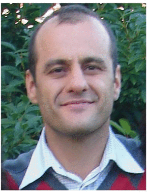 Gianpaolo Conte合作论文数Department of Computer and Information Science;Linkoping University;Department of Computer and Information Science, Linkoping University16
 Andrzej Skowron合作论文数Centrum Cyfrowej Nauki i Technologii, Uniwersytet Kardynała Stefana Wyszyńskiego15
 Martin H. Magnusson合作论文数Lund University7Cyrille Berger合作论文数Dept. of Computer and Information Science, Linkopings universitet7
 Joachim Hertzberg合作论文数Institute of Computer Science, School of Mathematics/Computer Science, University of Osnabrück;Robotics Innovation Center, German Research Center for Artificial Intelligence6
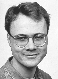 Klas Nordberg合作论文数I am a researcher at the Computer Vision Laboratory.
LinkA¶ping University
Department of Electrical Engineering
Computer Vision Laboratory6Per-Magnus Olsson合作论文数6
Klas Nordberg合作论文数I am a researcher at the Computer Vision Laboratory.
LinkA¶ping University
Department of Electrical Engineering
Computer Vision Laboratory6Per-Magnus Olsson合作论文数6 Georg Dorffner (格奥尔格杜夫纳)合作论文数Institute of Artificial Intelligence, Center for Medical Statistics, Informatics and Intelligent Systems, Medical University of Vienna;The Siesta Group Schlafanalyse GmbH5
 Dimiter Driankov合作论文数Institutionen för Naturvetenskap Och Teknik, Örebro Universitet;Centrum för Tillämpade Autonoma Sensorsystem, Örebro Universitet;School of Science and Technology, Örebro University5
 Johan Wiklund合作论文数Martin J. Whitman School of Management, Syracuse University5
 Erich Rome合作论文数Fraunhofer Institute for Intelligent Analysis and Information Systems IAIS;Fraunhofer Institute Centre Schloss Birlinghoven5
 Olov Andersson合作论文数4
 Mikael Nilsson合作论文数Navigator4
 J.J.C. (John-Jules) Meyer合作论文数Department of Information and Computing Sciences, Utrecht University4
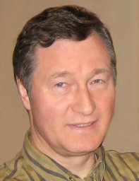 Oleg Burdakov合作论文数Parallel Algorithms Team4E. Skarman合作论文数3
 Elcio Hideiti Shiguemori合作论文数3
 Kaj Holmberg合作论文数LINKOPING INST TECHNOL, DEPT MATH, S-58183 LINKOPING, SWEDEN3
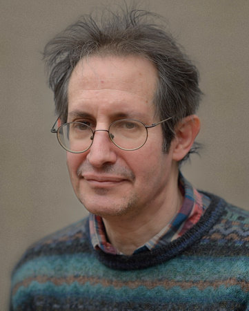 Ernest Davis合作论文数Department of Computer Science, New York University;Courant Institute of Mathematical Sciences, New York University3
 Esra Erdem合作论文数Sabancı University3
 Alexis Tsoukiàs合作论文数Centre National De la Recherche Scientifique, Universite Paris Dauphine3Patrik Haslum合作论文数3
 Erik Sandewall合作论文数Department of Computer and Information Science, Linkoping University3
 Christian Bessiere合作论文数Centre National de La Recherche Scientifique3
 Paolo Frasconi合作论文数Dipartimento di Ingegneria dell'Informazione, Universita degli Studi di Firenze3Ewa Madalinska-Bugaj合作论文数3David Landén合作论文数3Håkan Warnquist合作论文数3
 Joakim Gustafsson合作论文数Division of Speech, Music and Hearing, Department of Intelligent Systems, School of Electrical Engineering and Computer Science, KTH Royal Institute of Technology3B. Wingman合作论文数2T. Persson合作论文数2S. Duranti合作论文数2T. Merz合作论文数2Jose R. G. Braga合作论文数2
 Haroldo Fraga de Campos Velho合作论文数2
 Martin Danelljan合作论文数Apple2
 Pavlos Peppas合作论文数Division of Telecommunications & Information Technology, Department of Electrical and Computer Engineering, University of Patras2
 Michael Felsberg合作论文数Department of Electrical Engineering, Linkoping University2
 John Mylopoulos合作论文数School of Electrical Engineering and Computer Science, Faculty of Engineering, University of Ottawa;Department of Computer Science, University of Toronto2Per Nyblom合作论文数2
 Chris Welty合作论文数Google2Gösta Granlund合作论文数Computer Vision Laboratory, Department of Electrical Engineering, Linkoping University2
 John Mccarthy合作论文数Department of Computer Science, Stanford University2




