We use the spectrally invariant method to study the variability of cloud optical thickness τ and droplet effective radius reff in transition zones (between the cloudy and clear sky columns) observed from Solar Spectral Flux Radiometer (SSFR) and Shortwave Array Spectroradiometer-Zenith (SASZe) during the Marine ARM GPCI Investigation of Clouds (MAGIC) field campaign. The measurements from the SSFR and the SASZe are different, however inter-instrument differences of self-normalized measurements (divided by their own spectra at a fixed time) are small. The spectrally invariant method approximates the spectra in the cloud transition zone as a linear combination of definitely clear and cloudy spectra, where the coefficients, slope and intercept, characterize the spectrally invariant properties of the transition zone. Simulation results from the SBDART (Santa Barbara DISORT Atmospheric Radiative Transfer) model demonstrate that (1) the slope of the visible band is positively correlated with the cloud optical thickness τ while the intercept of the near-infrared band has high negative correlation with the cloud drop effective radius reff even without the exact knowledge of τ; (2) the above relations hold for all Solar Zenith Angle (SZA) and for cloud-contaminated skies. In observations using redundant measurements from SSFR and SASZe, we find that during cloudy-to-clear transitions, (a) the slopes of the visible band decrease, and (b) the intercepts of the near-infrared band remain almost constant near cloud edges. The findings in simulations and observations suggest that, while the optical thickness decreases during the cloudy-to-clear transition, the cloud drop effective radius does not change when cloud edges are approached. These results support the hypothesis that inhomogeneous mixing dominates near cloud edges in the studied cases.
Traveling ionospheric disturbances (TIDs) have been detected using various measurement techniques, including HF sounders, incoherent scatter radars, in situ measurements, and optical techniques. However, observations of TIDs have tended to be sparse and there is a need for additional observations to provide new scientific insight into the geophysical source phenomenology and wave propagation physics. The dense network of GPS receivers around the globe offers a relatively new data source to observe and monitor TIDs. In this paper, we use total electron content (TEC) measurements from similar to 4000 GPS receivers throughout the continental United States to observe TIDs associated with the 11 March 2011 Tohoku tsunami. The tsunami propagated across the Pacific to the U.S. west coast over several hours, and we show that corresponding TIDs were observed in the US. Using this network of GPS receivers we present a 2D imaging of TEC perturbations and calculate various TID parameters, including horizontal wavelength, speed, and period. Well-formed, planar TIDs were detected over the west coast of the U.S. similar to 10h after the earthquake. Fast Fourier transform analysis of the observed waveforms revealed that the period of the wave was 15.1min with a horizontal wavelength of 194.8km, phase velocity of 233.0m/s, and an azimuth of 105.2 degrees (propagating nearly due east in the direction of the tsunami wave). These results are consistent with the TID observations in airglow measurements from Hawaii earlier in the day and with other GPS TEC observations.
The Marine ARM GPCI1 Investigation of Clouds (MAGIC) field campaign was initiated to improve our understanding of low-level marine clouds that have a significant influence on the Earth’s climate. The campaign was conducted using an ARM mobile facility deployed on a commercial ship traveling between Honolulu, Hawaii, and Los Angeles, California, from October 2012 to September 2013. The solar spectral flux radiometer (SSFR) was deployed on July 6, 2013, through the end of the campaign. The SSFR was calibrated and installed by Warren Gore of NASA Ames Research Center, and the data is and will be analyzed by Drs. Alexander Marshak and Weidong Yang of NASA Goddard Space Flight Center, Dr. Samuel LeBlanc of NASA Ames Research Center, Dr. Sebastian Schmidt of the University of Colorado-Boulder, and Dr. Patrick McBride of Atmospheric & Space Technology Research Associates in Boulder, Colorado.
This paper presents an approach using the GEneralized Nonlinear Retrieval Analysis (GENRA) tool and general inverse theory diagnostics including the maximum likelihood solution and the Shannon information content to investigate the performance of a new spectral technique for the retrieval of cloud optical properties from surface based transmittance measurements. The cumulative retrieval information over broad ranges in cloud optical thickness (τ), droplet effective radius (re), and overhead sun angles is quantified under two conditions known to impact transmitted radiation; the variability in land surface albedo and atmospheric water vapor content. Our conclusions are: (1) the retrieved cloud properties are more sensitive to the natural variability in land surface albedo than to water vapor content; (2) the new spectral technique is more accurate (but still imprecise) than a standard approach, in particular for τ between 5 and 60 and re less than approximately 20 μm; and (3) the retrieved cloud properties are dependent on sun angle for clouds of from 5 to 10 and re < 10 μm, with maximum sensitivity obtained for an overhead sun.
A new dual-channel method for determining cloud optical thickness and cloud particle size is presented. The method is applied to both the experimental measurements of cloud transmittance and also to a synthetic data set derived from the numerical solution of the radiative transfer equation. The results of the validation show that the technique can be, indeed, applied to optically thick clouds. The technique is superior with respect to its speed and flexibility and with respect to existing up-to-date cloud retrieval methods based on the measurements of the transmitted solar light.
An algorithm to retrieve cloud optical thickness and effective radius (reff) from spectral transmittance was applied to radiance and irradiance observations of the Solar Spectral Flux Radiometer (SSFR) during the Research at the Nexus of Air Quality and Climate Change Campaign (CalNex). Data from an overcast day, 16 May 2010, was used to validate the algorithm. Retrievals from the SSFR, deployed on the Woods Hole Oceanic Institute R/V Atlantis, were compared to retrievals made from an airborne SSFR, the Geostationary Operations Environmental Satellite (GOES), an Atlantis‐based microwave radiometer, and the Moderate Resolution Imaging Spectroradiometer. In situ observations of reffduring a flight over the Atlantis were compared to the Atlantis SSFR and GOES retrievals. The cloud statistics for the CalNex campaign were compared to previous studies. The agreement between the different retrievals, quantified by determining the number of coincident observations when retrieval uncertainty overlapped, improved as the difference between the field‐of‐views (FOV) of the instruments decreased. It is shown that averaging the 1 Hz SSFR observations to the 15 minute GOES interval cannot fully account for the impact of the different FOVs. The average in situ reff (7.7 μm) fell between the average reffretrieved using the Atlantis‐based SSFR radiance (5.7μm) and irradiance (9.5 μm). The CalNex clouds showed a diurnal pattern observed in previous studies of marine boundary layer clouds in the region. The distribution of cloud optical thickness and liquid water path during CalNex was shown to be a gamma distribution, consistent with previous studies of high cloud fraction marine boundary layer clouds.
The Atmospheric Radiation Measurement (ARM) program (now Atmospheric System Research) was established, in part, to improve radiation models so that they could be used reliably to compute radiation fluxes through the atmosphere, given knowledge of the surface albedo, atmospheric gases, and the aerosol and cloud properties. Despite years of observations, discrepancies still exist between radiative transfer models and observations, particularly in the presence of clouds. Progress has been made at closing discrepancies in the spectral region beyond 3 micron, but the progress lags at shorter wavelengths. Ratios of observed visible and near infrared cloud albedo from aircraft and satellite have shown both localized and global discrepancies between model and observations that are, thus far, unexplained. The capabilities of shortwave surface spectrometry have been improved in recent years at the Southern Great Plains facility (SGP) of the ARM Climate Research Facility through the addition of new instrumentation, the Shortwave Array Spectroradiometer, and upgrades to existing instrumentation, the Shortwave Spectroradiometer and the Rotating Shadowband Spectroradiometer. An airborne-based instrument, the HydroRad Spectroradiometer, was also deployed at the ARM site during the Routine ARM Aerial Facility Clouds with Low Optical Water Depths (CLOWD) Optical Radiative Observations (RACORO) field campaign. Using the new and upgraded spectral observations along with radiative transfer models, cloud scenes at the SGP are presented with the goal of characterizing the instrumentation and the cloud fields themselves.
Abstract. We introduce a new spectral method for the retrieval of optical thickness and effective radius from cloud transmittance that relies on the spectral slope of the normalized transmittance between 1565 nm and 1634 nm, and on cloud transmittance at a visible wavelength. The standard dual-wavelength technique, which is traditionally used in reflectance-based retrievals, is ill-suited for transmittance because it lacks sensitivity to effective radius, especially for optically thin clouds. Using the spectral slope rather than the transmittance itself enhances the sensitivity of transmittance observations with respect to the effective radius. This is demonstrated by applying it to the moderate spectral resolution observations from the Solar Spectral Flux Radiometer (SSFR) and Shortwave Spectroradiometer (SWS), and by examining the retrieval uncertainties of the standard and the spectral method for data from the DOE ARM Southern Great Plains (SGP) site and a NOAA ship cruise (ICEALOT). The liquid water path (LWP) is derived from the retrieved optical thickness and effective radius, based on two different assumptions about the cloud vertical profile, and compared to the simultaneous observations from a microwave radiometer. Optical thickness and effective radius is also compared to MODIS retrievals. In general, the effective radius uncertainties were much larger for the standard retrieval than for the spectral retrieval, particularly for thin clouds. When defining 2 μm as upper limit for the tolerable uncertainty of the effective radius, the standard method returned only very few valid retrievals for clouds with an optical thickness below 25. For the analyzed ICEALOT data (mean optical thickness 23), the spectral method provided valid retrievals for 84 % of the data (24 % for the standard method). For the SGP data (mean optical thickness 44), both methods provided a high return of 90 % for the spectral method and 78 % for the standard method.
The Geoscience Laser Altimeter System (GLAS) aboard ICESat, launched in January 2003, has been designed to detect and monitor changes in the cryosphere. The first objective of this paper is to present high-resolution ice-surface elevation maps derived from GLAS data, using geostatistical analysis. In a regional study of Walgreen Coast and Northern Ellsworth Land, West Antarctica, differences in the representation of geographic and morphologic features in maps based on ERS-1 radar altimeter data and on GLAS data are investigated, with the result that in particular in topographically complex coastal areas and the margin of the ice sheet the improvement in precision and accuracy of the laser altimeter is significant. A second, applied objective is to map elevation changes in Pine Island Glacier, a glacier that plays a key role in the question of stability of the West Antarctic Ice Sheet and has been changing rapidly in recent years. Results of elevation differencing of 2003-GLAS-data and 1995-ERS-1-radar-altimeter-data DEMs (1) show that thinning rates have been increasing and (2) are applied to attribute the observed changes in Pine Island Glacier to internal processes in the glacier, related to dynamic thinning. More generally, this application serves to demonstrate that GLAS data facilitate study of cryospheric change.
Global cloud imagery (GCI) is constructed from multiple satellite platforms that simultaneously monitor the earth. The GCI overcomes sampling limitations that are inherent to measurements from an individual platform, and provides a continuous and high-resolution description of the global convective pattern. However, it must reconcile inconsistencies in the measurements from different platforms. Escaping operational stages of error detection is a spurious brightening (cooling of brightness temperature), which appears sporadically in the composited imagery and must be removed a posteriori. The spurious brightening is shown to follow from a bias between measurements from polar-orbiting platforms and those from geostationary platforms. The bias is related to the zenith angle dependence of geostationary measurements, which enables its efficient removal. GCI is then composited from satellites in which the zenith angle-dependent bias has been removed a priori. The corrected imagery is shown to be virtually free of the systematic error, leaving a more accurate representation of the global convective pattern.
 Peter Pilewskie合作论文数11
 Sebastian Schmidt合作论文数Laboratory for Atmospheric and Space Physics, University of Colorado Boulder;Department of Atmospheric and Oceanic Sciences, University of Colorado Boulder9
 Odele Coddington合作论文数Laboratory for Atmospheric and Space Physics, University of Colorado Boulder;Department of Atmospheric and Oceanic Sciences, College of Arts and Sciences, University of Colorado Boulder6
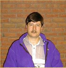 Alexander Marshak合作论文数Michigan Technological University5
 stephan schmidt合作论文数3Peter Thermos合作论文数3Jody Patilla合作论文数3Daniel E Wolfe合作论文数3
 Connor Flynn合作论文数3s lance合作论文数2
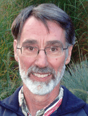 Chris Fairall合作论文数Physical Science Division, Earth Systems Research Laboratory, National Oceanic and Atmospheric Administration;Physical Sciences Laboratory, National Oceanic and Atmospheric Administration2Weidong Yang合作论文数2Edward P. Moser合作论文数2Guoyong Wen合作论文数2
 Bruce C. Kindel合作论文数2
 Andrew Heidinger合作论文数National Oceanic and Atmospheric Administration2
 Jui-Yuan Christine Chiu合作论文数University of Maryland2
 Andi Walther合作论文数Institut für Weltraumwissenschaften, Freie Universität Berlin2
 Warren Wiscombe合作论文数Brookhaven National Laboratory;Goddard Space Flight Center, NASA2
 Kristopher M. Bedka合作论文数CIMSS ), Cooperative Institute for Meteorological Satellite Studies;University of Wisconsin - Madison;Cooperative Institute for Meteorological Satellite Studies ( CIMSS ), University of Wisconsin - Madison2u ch herzfeld合作论文数1konrad sebastian schmidt合作论文数1a s kittelman合作论文数1Scott Kittelman合作论文数1Geoff Crowley合作论文数1Don Hunton合作论文数1adam reynolds合作论文数1
 Samuel E. LeBlanc合作论文数Ames Res Ctr, NASA1
 Jay Zwally合作论文数Earth Sciences Division, National Aeronautics and Space Administration1Lance Steven合作论文数1
 Murry Lewis Salby (Murry Salby)合作论文数Macquarie University1
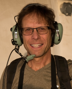 Graham Feingold合作论文数Chemical Sciences Laboratory, National Oceanic and Atmospheric Administration1
 Alexander Kokhanovsky合作论文数Telespazio Belgium1
 Michael R. King合作论文数Department of Bioengineering, George R. Brown School of Engineering and Computing, Rice University1
 Yuri Knyazikhin合作论文数Department of Earth and Environment, College of Art and Sciences, Boston University1Hongli Jiang合作论文数Xi'an Jiaotong Univ, Xi'an Jiaotong Univ.1
 Patrick Minnis合作论文数Analytical Mechanics Associates, Inc.1S. M. I. Azeem合作论文数1
 Edwin W Eloranta合作论文数1
 Douglas E. Wolfe合作论文数Applied Research Laboratory, Penn State University1
 Tamás Várnai合作论文数1Tomislava Vukicevic合作论文数Cooperative Institute for Research in Environmental Sciences;University of Colorado at Boulder;Global Systems Division;Cooperative Institute for Research in Environmental Sciences, University of Colorado at Boulder1
 Andy Vogelmann合作论文数Environmental and Climate Sciences Department, Brookhaven National Laboratory1
 Timothy M. Duly合作论文数1Daniel E. Wolfe合作论文数1
 Ernie Lewis合作论文数Atmospheric Sciences Division;Brookhaven National Laboratory;Atmospheric Sciences Division, Brookhaven National Laboratory1
 Sara Lance合作论文数Sch Earth & Atmospher Sci, Georgia Inst Technol1
 John P. Dimarzio合作论文数1




