Archaeological, ethnohistoric, and ethnographic records all indicate the enduring and far-reaching importance of animate landscapes in Andean South America. In particular, apu—powerful mountains worshipped as spirits that could both protect and also wreak catastrophe—figure significantly in reconstructions of politics, identity, and religion in diverse times and places in the Andes. However, relationships with the landscape are comparatively less integrated into the increasingly robust and scientifically sophisticated scholarship on the acquisition of natural resources for craft production in the pre-Hispanic Andes. This chapter draws on a geochemical database from the Moquegua Valley of southern Peru to explore how choices about clay procurement—an intrusive and extractive intervention into the landscape—were shaped by and contributed to relationships with these sacred places. Identifying significant temporal shifts in resource acquisition over time, this chapter considers when different apus achieved status and suggests that the current ‘map’ of sacred places might have emerged in the Late Intermediate Period (ca. AD 1000–1470s).
During the Middle Horizon (AD 600-1000), obsidian was transported in greater quantities and distances than ever before identified in the Andes, in part by the expansionary Wari state. Two of the three major obsidian sources used in the south-central Andes are located in the modern department of Arequipa, Peru. Arequipa was a region of intense Wari influence and intrusive presence; however, little is known about regional obsidian use. Portable X-ray fluorescence (pXRF) and laser ablation-inductively coupled plasma-mass spectrometry (LA-ICP-MS) were used to analyze 383 obsidian artifacts recovered from 10 archaeological sites in Arequipa. Results highlight diachronic and spatial patterning related to obsidian procurement strategies, state versus bottom-up exchange networks, and local participation within the Wari realm. A wide variety of geological obsidian sources, including nonlocal obsidians originating from Wari's Ayacucho heartland, were used. By the late Middle Horizon, the Wari had consolidated regional resources with the sole use of Alca-1 and Alca-4 bedrock obsidians, the largest-sized and highest-quality sources in the area. We assess related models of obsidian procurement and exchange related to state political economy, long-distance caravan activity, and the role of local ceremonial/waystation centers that facilitated the flow of ideas, goods, and people across Arequipa. Durante el Horizonte Medio (600-1000 dC), la obsidiana fue transportada en cantidades y distancias nunca antes vistas en los Andes Centro Sur, debido en parte, al expansionista estado Wari. Dos de las tres principales fuentes de obsidiana utilizadas estan en Arequipa, Peru, region de intensa influencia Wari. Sin embargo, se sabe poco del uso regional de la obsidiana. Se analizan aqui 383 artefactos de obsidiana recuperados de 10 sitios arqueologicos en Arequipa, utilizando fluorescencia de rayos X portatil (pXRF) y espectrometria de masas con plasma de acoplamiento inductivo por ablacion laser (LA-ICP-MS). Los resultados destacan los patrones diacronicos y espaciales del uso de obsidiana, las redes de intercambio y la participacion local dentro del reino Wari. Tambien indican una amplia variedad de fuentes geologicas de obsidiana, incluyendo algunas no locales, originarias del corazon de Wari en Ayacucho. A fines del Horizonte Medio, Wari habia consolidado el uso exclusivo de obsidianas Alca-1 y Alca-4 (fuentes de mayor tamano y calidad de la zona). Aqui evaluamos modelos de obtencion e intercambio de obsidiana relacionados con la economia politica estatal, la actividad caravanera y el papel de los centros ceremoniales/tambos que facilitaron el flujo de ideas, bienes y personas a traves de Arequipa.
The expansion and impact of the Wari polity across the Andes has been heavily debated by scholars over the past two decades. We use radiocarbon dates, Bayesian statistics, and contextual data from several Andean regions to review the chronology for Wari expansion, political reorganization, and impact on local settlements. We recognize that Wari political and economic influence will vary in space and time and present a model that addresses how influential moments (expansion, reorganization, collapse) in Wari's trajectory may or may not have had broader impacts across the landscapes of its peer polities. Our model, while not completely comprehensive, draws on both Wari's presence in the north highlands and in the south, where scholars have argued for distinct trajectories and character of Wari influence. It also examines data from local communities in these same regions contemporary with identified Wari settlements, but perhaps without outward indicators of Wari hegemony, to evaluate broader patterns in Middle Horizon settlement through the latter half of the first millennium CE.
Between 600 and 1000 AD, the Wari state expanded across the Andes. Wari beer was one of the quintessential ways in which Wari identity was promoted in provincial centers hundreds of kilometers from the Ayacucho heartland. Based on excavations at the far southern provincial Wari brewery at Cerro Baúl, we take a production sequence approach to beer preparation, to evaluate the nature of Wari brewing as state practice. We investigate each step of the brewing process, from ceramic container manufacture through plant processing, mashing, and fermentation, in different spatial venues used at Cerro Baúl in the production of Wari chicha de jora y molle. This method provides us with insights into the practice of Wari state brewing and into the corollary activities being undertaken in the same spaces. In so doing, we establish the nature of craft production of beer-making in Wari state contexts, and how it is differentiated from contemporary and later household contexts of beer production in the region.
• An epistemological framework for understanding regional artistic traditions. • Methods to compare geological clay sources to archaeological and museum samples. • LA-ICP-MS findings that demonstrate continuity in clay procurement in the Inka imperial capital despite changes in the surface decoration and firing technology. • Results that indicate how local differences in technologies such as tempering with fine volcanic materials may affect LA-ICP-MS data and differentiate chemical groups.
The Andean mountains have a mosaic distribution of resources, and no one place has everything a community requires for subsistence, social life and ritual. Therefore, from the very beginning of human habitation there is evidence for short-and long-distance movement and trade. Settled societies in the Andes most commonly used llama caravans that crisscrossed the mountains and highland valleys, although these are hard to identify. Here we present several data sets that inform about southern Lake Titicaca Formative movement of goods and caravans in the build-up to the caravan-driven polity of Middle Horizon Tiwanaku. Plant remains reveal the increasing tempo of goods movement. Olivine basalt results from XRF analyses clarify the extent of goods movement from their sources in the basin. Finally, strontium, carbon and oxygen isotope results from Formative camelid teeth inform us about the extent of long-and short-distance caravan movement emanating out of a shoreline ceremonial center.
The long-distance movement of craft items and ideas about their manufacture contribute to imperial projects; facilitating the dissemination of ideologies, serving as tribute, and acting as media for actors to assert affinity with elites and for elites to reward subjects. We interrogate how pottery production and distribution were influenced and involved in different imperial strategies over approximately 1000 years in one Andean valley. Attractive to colonizing polities for its agricultural potential, the Moquegua Valley was first incorporated into expansive states during the Middle Horizon (500-1000 CE) when both the Wari and Tiwanaku established provincial enclaves there. In the 15th century, the valley was subject to Inka colonization. A century later, it was Spanish imperialism that shaped Moquegua's sociopolitical dynamics. Despite this recurrent pattern of conquest and incorporation, the nature of these incursions likely varied. The elemental data discussed here were generated through LA-ICP-MS on ceramics excavated from archaeological sites that span this millennium of imperialism; they include ceramic material associated with all four political incursions as well as the four centuries long Late Intermediate Period (LIP) when Moquegua was not under the influence of external state authority. Coupled with a robust compositional database of clays that facilitates distinguishing imported ceramics and also the exploitation of different resources within the valley, the data from Moquegua present an opportunity to a) reconstruct a diachronic picture of resource acquisition, the organization of production, and participation in local, regional, and long distance exchange networks and b) interrogate similarities and differences in how craft was implicated in diverse strategies of statecraft. The elemental data suggest that crafting activities were configured in different ways for each of the four expansive polities in Moquegua. As such these data add weight to recent scholarship that argues that crafting activities in contexts of imperialism cannot be reduced to simple models. Additionally, the data from the LIP contribute to comparative dialogue on production and exchange during periods of political localism, and illustrate the ways in which crafting activities participate in intercommunity dynamics during periods of social turmoil.
Between 600 and 1100 CE, the Tiwanaku site emerged as the principal center of an impactful cultural phenomenon in the Andean altiplano. Its influence stretched from the Pacific coast to the Amazonian valleys and south into the Atacama Desert. We examine the results of a series of research projects utilizing LA-ICP-MS on ceramics and clays from a cross-section of Tiwanaku settlements in three of the principal regions of influence: the Cochabamba region of Bolivia, the Bolivian altiplano including the Tiwanaku site, and the Moquegua valley of southern Peru. Our research seeks to synthesize the nature of Tiwanaku ceramic production in its heartland and in the distinctive Tiwanaku settlements on both sides of the Andean continental divide. We use the geochemical data to elucidate the extent of ceramic exchange between regions as well as the diversity of ceramic production within local areas to assess the ways in which ceramic production was enacted in different places. This contribution is part of a special issue synthesizing the results of geochemical analysis of Andean ceramics through time and across space and makes reference to those other comparative studies in the volume.
Con su capital en la sierra de Ayacucho, Perú, el Imperio Wari extendió su influencia por más de 1300 kilómetros, desde Cajamarca en el norte hasta Cuzco y Moquegua en el sur. A lo largo de su periferia sur, la presencia Wari ha sido mejor documentada entre los 1000 y 3000 metros sobre el nivel del mar en valles como Ocoña, Majes, Sihuas, Vitor, Chili y Moquegua, la mayoría de ellos prospectados arqueológicamente. En este artículo, examino las evidencias de un camino Wari sureño y un conjunto de sitios arqueológicos que conectaron el extremo sur del Perú con regiones más septentrionales y, eventualmente, con la capital ayacuchana. Argumento que el nicho ecológico quichua fue el foco principal de los paisajes culturales Wari y dictaminó la ubicación de la red vial principal de esta tradición. Asimismo, examino la organización de los asentamientos localizados a lo largo del camino real propuesto, así como los componentes simbólicos y demográficos de la ruta. Por último, investigo el rol del camino Wari en la promulgación de una economía política imperial en el extremo sur del Perú.
Cerro Baúl, a site perched on a mountain in the Moquegua Valley (Peru), was once the southernmost outpost of the Wari Empire (600-1000 C.E.). Over the last three decades, the Proyecto Arqueológico Cerro Baúl (PACB) has excavated 62 nearly complete decorated ceramics in the central sectors of the site, ranging from tumblers to figurines. This limited but diverse assemblage demonstrates the forms and motifs employed by elite agents during ritual practices and occasions of socio-political engagement at Cerro Baúl. Through a detailed analysis of this corpus, we gain insights into the Wari provincial ceramic tradition, and we highlight the motifs, forms, and styles prioritized by the empire at a site in direct interaction with Tiwanaku.
The expansive Wari state of the Middle Horizon (600-1000 CE) was the first political structure to unify the southcentral and north-central Andes. Simultaneously, Wari's political and cultural influence was not uniform across the diverse populace whom they sought to integrate. In this paper, we propose that a localized view of cosmopolitanism is apt for analyzing heterogenous Wari politics and its impacts on social identities and economies. Rather than assuming cosmopolitan worlds were constituted only in elite contexts, we consider how Wari cosmopolitanism was born out of the everyday and influenced by the localized practices, concerns, and motives of differing groups. We apply this perspective to the study of ceramic production and exchange across disparate Andean regions. Here we integrate new laser ablation inductively coupled plasma mass spectrometry (LA-ICPMS) data with previously published data to assess ceramic compositional variability across three regions: Ancash, Arequipa, and Moquegua (N = 189). This new sample set consists of Wari finewares (e.g., Vin & SIM;aque, Ocros, Chakipampa), Wari-related or emulated materials, local Middle Horizon styles with Wari influenced motifs, and Middle Horizon plainwares. Previous compositional studies suggest that artisans in the Wari heartland of Ayacucho and the Moquegua province crafted imperial ceramic styles for elite consumption within centralized production zones. However, our findings indicate that, in Ancash and Arequipa, the production of Wari emulated pottery drew upon established local knowledge of clay sources. Data suggest that local groups used clays with similar geochemistries to produce both fine and plainwares. Simultaneously, these production strategies were complemented by the influx of Wari finewares from other regions, but the consumption of these prestige goods was not necessarily restricted to elite centers. We thus argue that Wari cosmopolitanism was constituted by local and global processes that were part of everyday life. Moreover, ceramic production and exchange was not necessarily controlled by Wari elites in all contexts nor was it part of an imperial wealth-finance system.
Provenance studies of exotic materials along the frontiers of expansionary states provide invaluable evidence of cultural interactions and systems of exchange. Here we present portable X-ray fluorescence (pXRF) data on obsidian artifacts from the Middle Moquegua Valley of southern Peru. This region is the only known shared border where colonists of both the Tiwanaku and Wari states settled during the Andean Middle Horizon (AD 600–1000). A total of 50 obsidian artifacts housed in the Museo Contisuyu in Moquegua, Peru was analyzed from ten archaeological sites affiliated with Tiwanaku, Wari, and indigenous Huaracane groups across Formative Period and Middle Horizon contexts. The paucity of obsidian recovered from Tiwanaku sites in Moquegua highlights different lithic traditions, material preferences, and access to obsidian sources compared to their Wari counterparts in the valley. Although Tiwanaku settler groups maintained strong social identities tied to their homeland region, pXRF results show that obsidian was one of the few materials that crossed cultural boundaries in Moquegua. We assess how obsidian provenance can be used as a proxy for cross-cultural interaction in borderland regions and to reconstruct economic systems related to state provisioning versus bottom-up processes of regional exchange.
: We review obsidian acquisition and utilization at sites in the Moquegua Valley, Peru from the Formative Period through the Late Horizon (c. 0–1500 CE). We examine sources represented through time, as well as quantities of obsidian recovered from excavation contexts at a variety of sites excavated by the authors (MAS survey, Cerro Baúl, Cerro Mejía, Yahuay Alta, Tumilaca la Chimba, Capanto, Las Peñas, Sabaya, Torata Alta, Camata, and Tacahuay). Our results indicate that the Middle Horizon (600–1000 CE) was the principal period of obsidian use in the region, and that fall-off models indicate that Cerro Baúl served as a centralized distribution center for obsidian from the major sources during this time. Despite the importance of obsidian in other Andean regions during periods outside the Middle Horizon, our data indicate that the Moquegua region participated only tangentially in obsidian procurement in the absence of the Wari state, and that even the Inca Empire did not make obsidian a principal product of exchange during its apogee.
Obsidian artifact and geologic specimen description and parts per million (ppm) elemental concentrations. Online supplementary data.
Double-Wien filter-selection-aperture and hexapole-collision-cell technologies coupled to laser ablation multicollector inductively coupled plasma mass spectrometry (LA-MC-ICP-MS/MS) enables in situ analysis of 87Sr variations produced by 87Rb decay.
This study examines the degree to which potters' local knowledge of clay resources and production technologies contributed to the innovation of the Inka imperial ceramic aesthetic from Cuzco, Peru (ca. 1350-1532 CE). It employs Laser Ablation Inductively Coupled Plasma Mass Spectrometry (LA-ICP-MS) analysis and multivariate statistics to compare the elemental composition of clays from contemporary geological sources in the Cuzco region with pre-Inka (Late Intermediate Period [LIP]) and Inka (Cuzco Inka [CI]) pottery derived from recent excavations in Cuzco and collections at the Field Museum of Natural History. Given marked changes from pre-Inka to Inka times in ceramic decoration and technology, the study hypothesized that potters in the region shifted from using heterogenous clays to select materials as the state imposed a stylistic canon. The results from the LA-ICP-MS analysis, however, reveal no significant change in clay sources from pre-Inka to Inka phases, and some differences in materials used for ceramic production at one workshop during Inka rule. These data indicate continuity in clay materials and suggest the persistence of earlier potting traditions and knowledge of material resources. Though this research is only he first step of a broader project, at present it offers a map of clay geochemistry in the Cuzco region and provides foundational insights for more comprehensive studies of changes in pre-Inka and Inka pottery and their constituent materials. More generally, it contributes to archaeological research on situated learning, which complements a traditional focus on political economy with an understanding of the local forms of knowledge and shared perceptions of materials by which artisans can constitute regional crafting traditions without centralized organization.
While drinking played a key role in Andean society for millennia, it took on new meaning during the Middle Horizon (600-1000 CE), when the Wari empire held sway. We investigate the role of drinking festivals in Wari practice and consider how Wari corn and pepper berry beer was consumed in elite feasting events. We look closely at drinking equipment from the brewery at Cerro Baul, Wari's southernmost center, to examine the roles of institutions and individuals in identity making and structuring relationships. We compare this perspective to drinking paraphernalia found in other regions of Wari influence. In particular we explore the use of sets of identical or nearly identical drinking vessels (kero and cups) to understand their use in distinctive contexts. We also examine post-production engraved marks on vessel bases and their significance in drinking practice in Wari culture.
Williams, P. Ryan, Ana Cristina Londoño, Megan Hart, Donna Nash, Sofia Chacaltana C., & Megan Hente. 2013. Surface Architecture Scanning of Archaeological Sites with Ground Based Lidar in Southern Peru. In Proceedings of the 2013 Digital Heritage International Congress, Volume 2 edited by Alonzo Addison, Livio De Luca, Gabriele Guidi, & Sofia Pescarin, pp.605608. Institute of Electrical and Electronics Engineers, New York.
 Donna J. Nash合作论文数Department of Anthropology (mc 027), University of Illinois-Chicago23
 Mark Golitko合作论文数Dept Anthropol, Field Museum Nat Hist12
 Laure Dussubieux合作论文数Elemental Anal Facil, Field Museum11
 Nicola Sharratt合作论文数11
 David A. Reid合作论文数School of Education, Acadia University8
 Gary Feinman合作论文数Negaunee Integrative Research Center, Field Museum;Shandong University6
 M. Elizabeth Gravalos合作论文数Field Museum Nat Hist5
 Michael E. Moseley合作论文数Department of Anthropology, College of Liberal Arts and Sciences, University of Florida5
 Susan D deFrance合作论文数Department of Anthropology, University of Florida5mario ruales合作论文数4ana miranda合作论文数4
 Robert J. Speakman合作论文数Museum Conservation Institute, Smithsonian Institution4
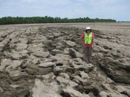 Megan Hart合作论文数Department of Geological Sciences and Engineering, University of Missouri-Rolla4
 James Meierhoff合作论文数3
 Paul Goldstein合作论文数Department of Anthropology, Division of Social Sciences, University of California, San Diego3
 Kurt Rademaker合作论文数Climate Change Institute, University of Maine3
 Michael D. Glascock合作论文数Archaeometry Laboratory, University of Missouri3Ana C. Londono合作论文数3Cyrus Banikazemi合作论文数2
 Kevin J. Vaughn合作论文数2
 Sofia Chacaltana-Cortez合作论文数2
 Steve Kosiba合作论文数Dept Anthropol, Univ Minnesota2
 Veronique Belisle合作论文数Department of Sociology and Anthropology, Millsaps College2
 Kylie Quave合作论文数George Washington Univ2Dean E. Arnold合作论文数Field Museum Nat Hist2
 Kelly Knudson合作论文数School of Human Evolution and Social Change, College of Liberal Arts and Sciences, Arizona State University;Center for Bioarchaeological Research, Arizona State University2
 Benjamin Ralph Vining合作论文数Department of Archaeology, Boston University2
 Tim Denham合作论文数School of Geography and Environmental Science, Monash University2
 John Wayne Janusek合作论文数2
 Nicholas Tripcevich合作论文数University of California-Berkeley2
 Charles Stanish合作论文数Cotsen Institute of Archaeology, University of California, Los Angeles;Department of Anthropology, College of Arts and Sciences, University of South Florida;Institute for the Advanced Study of Culture and the Environment, University of South Florida2
 Ruth Ann Armitage合作论文数2Cecilia Chávez J.合作论文数2
 L. Antonio Curet合作论文数The Field Museum2
 Mark S. Aldenderfer合作论文数Department of Anthropology & Heritage Studies, School of Social Sciences, Humanities and Arts, University of California2T. L. Thurston合作论文数1Alicia Ventresca Miller合作论文数1junno aripekka合作论文数1
 Lucas Stephens合作论文数1giovanni fragala合作论文数1Giuseppe Cacciaguerra合作论文数1Kirk E. Costion合作论文数1Kathleen Forgey合作论文数1
 Joshua Henkin合作论文数1
 Michael Barton合作论文数School of Complex Adaptive Systems, Arizona State University;School of Human Evolution and Social Change, Arizona State University;Center for Social Dynamics and Complexity, Arizona State University1Sofía Chacaltana Cortez合作论文数1Steve Renette合作论文数1Collette Gabler合作论文数1Alexa Thornton合作论文数1




