The Simple Cloud-Resolving E3SM Atmosphere Model (SCREAM) is the newest addition to the family of earth system models capable of explicitly resolving convective systems. SCREAM is a kilometer-scale configuration of the advanced E3SM Atmosphere Model (EAMxx), designed for heterogeneous computing architectures. While the enhanced accuracy of kilometer-scale modeling offers significant benefits, it comes with a substantial computational cost, limiting feasible simulation durations to only a few years to a few decades, even on the fastest supercomputers. Machine learning presents an opportunity for scientists to achieve the high accuracy of storm-resolving models at a significantly reduced cost. Building on the previous success of applying corrective machine learning (ML) to the FV3GFS earth system model, this study explores the effects of implementing corrective-ML in EAMxx-SCREAM. We also address the computational challenges of integrating our implementation of corrective-ML, which is written in Python, with the C++/Kokkos EAMxx driver, as well as potential reasons why this approach has not proved as effective for EAMxx-SCREAM as for FV3GFS.
Mixed-phase clouds modulate the water and energy cycles of high-latitude regions, yet their liquid-ice phase partitioning has long been poorly simulated in climate models. Here, simulations of Arctic mixed-phase clouds by the Simple Cloud-Resolving E3SM Atmosphere Model (SCREAM) are assessed against large-eddy simulations, satellite data, and ground-based observations during the Cold-Air Outbreaks in the Marine Boundary Layer Experiment field campaign. SCREAM simulates nearly completely frozen clouds, which is attributed largely to the unreasonably strong Wegener-Bergeron-Findeisen (WBF) process that converts liquid to ice excessively and partly to the early over-abundant ice production at cold temperatures from a temperature-deterministic deposition ice nucleation scheme. Assuming no subgrid variation for the WBF process in the original formulation particularly conflicts with the instantaneous saturation adjustment assumption in the condensation scheme that assumes subgrid variability, leading to exaggerated WBF process rates. A proposed simple physically-based improvement on the treatment of subgrid cloud overlap substantially increases supercooled liquid water content and notably improves cloud-top phase partitioning, aligning better with observations. Improvement of supercooled liquid water content also converges with increasing horizontal resolution. The deposition ice nucleation scheme is found responsible for a falsely-produced ice cloud aloft that is not observed, biasing the simulated cloud radiative effects and top-of-atmosphere radiative fluxes. This study identifies key deficiencies in cloud parameterizations that continue to challenge convection-permitting models.
Abstract Passive satellite observations provide global coverage of cloud‐top and column‐integrated properties but offer limited direct information about vertical cloud structure. Here, we evaluate the extent to which passive cloud‐top, optical, and microphysical retrievals, together with large‐scale environmental variables, constrain CloudSat radar reflectivity profiles. We first establish a cloud‐type‐based baseline using cloud‐top pressure and cloud optical depth, demonstrating that substantial vertical variability remains within fixed cloud types. We then introduce a probabilistic Mixture Density Network that predicts the full conditional distribution of reflectivity profiles from Moderate Resolution Imaging Spectroradiometer cloud‐top, optical, and microphysical properties and European Center for Medium‐Range Weather Forecasts environmental fields. The model reduces both level‐by‐level and joint structural uncertainty relative to cloud‐type compositing, with test correlations between observed and predicted mean profiles ranging from 0.79 to 0.94 across cloud types and mean continuous ranked probability score reductions ranging from 38.17% in shallow cumulus to 67.07% in deep convective clouds. However, non‐negligible uncertainty persists, reflecting residual ambiguity in mapping top‐of‐atmosphere observations and environmental context to full vertical radar‐observed structure. These results quantify the predictive constraints provided by the selected passive cloud properties and environmental variables, while showing that substantial ambiguity remains when inferring vertical cloud structure from top‐of‐atmosphere observations.
Cloud feedback remains the main source of uncertainty in climate sensitivity estimated by global climate models (GCMs), largely because subgrid cloud responses are parameterized in GCMs due to their coarse resolution. This study examines cloud feedback in the global 3.25-km Simple Cloud-Resolving Energy Exascale Earth System Model (E3SM) Atmosphere Model (SCREAM 3 km) through a pair of 1-yr atmosphere-only simulations with control and 14-K sea surface temperature perturbations. SCREAM 3 km produces a positive cloud feedback that falls within but at the upper end of the range of Coupled Model Intercomparison Project phase 5 (CMIP5) and CMIP phase 6 (CMIP6) models and expert judgment. The positive cloud feedback arises from positive contributions from both high-and low-level clouds, with increases in high-cloud altitude and decreases in low-cloud amount and optical depth playing key roles. The stronger-than-CMIPaverage feedback is mainly attributable to the high-cloud altitude feedback, owing to cloud tops rising nearly isothermally in SCREAM 3 km. The positive low-cloud amount feedback is weaker in SCREAM than in GCMs because estimated inversion strength (EIS) increases more dramatically with warming. A coarser 12-km resolution version of SCREAM exhibits a weaker positive cloud feedback than SCREAM 3 km, mainly because its low-cloud-radiative flux is more sensitive to EIS, leading to a stronger negative low-cloud amount feedback. With this process-level assessment of cloud feedback, this study reveals where SCREAM aligns with and diverges from conventional GCMs and expert assessment, providing insights to inform further model improvement and future expert assessment.
We present a stochastic coupled emulator of E3SM version 3, built on the SamudrACE framework, which couples an atmosphere emulator (ACE2) with a full-depth ocean emulator (Samudra). We replace the deterministic atmosphere emulator with its stochastic counterpart, ACE2S, and fine-tune the coupled system with a probabilistic objective, so that the atmosphere acts as a source of internal variability for the ocean. Trained on 105 years of a pre-industrial control simulation and evaluated on an independent 400 years, the emulator reproduces E3SMv3's mean climate state with biases much smaller than existing model-to-observation differences. Relative to a deterministic baseline, stochastic training maintains internal variability across timescales, most notably in the ENSO power spectrum, eddy-rich SST anomalies, and sea ice variability in the marginal ice zone. The emulator captures daily precipitation accurately up to the 99.99th percentile, but underestimates the rarest tropical extremes. These results show that stochastic coupled emulators can reproduce long-timescale variability with high fidelity, while extrapolation to unseen extremes remains a key challenge.
The Energy Exascale Earth System Model version 3 (E3SMv3) represents the latest advancement in Earth system modeling developed by the U.S. Department of Energy (DOE). Building upon previous versions, E3SMv3 introduces significant updates across its coupled components to enhance capability and improve fidelity. The atmosphere component incorporates advancements in chemistry, aerosol-cloud interactions, convection, and microphysics. The ocean features a new time-stepping scheme and a higher-resolution unstructured mesh with sub-ice-shelf cavities, while the sea ice model integrates advanced snow and ice physics for more realistic cryospheric simulations. The land model introduces prognostic vegetation dynamics and a new sub-grid topographic treatment of solar radiation. A new tri-grid configuration harmonizes the horizontal grids of the land and river components for improved process coupling. It is enabled by a new non-linear remapping between the atmosphere and land. E3SMv3 underwent extensive testing through a comprehensive simulation campaign, including pre-industrial control, idealized experiments, and historical simulations spanning 1850-2024. The model demonstrates significant improvements in simulating the evolution of the historical surface temperature, particularly addressing the "pothole cooling" bias in earlier versions. Reduced aerosol-related forcing contributes to more realistic radiative forcing and better alignment with the observational record. Ocean heat content (OHC) and sea ice trends are also improved as a result.
Accurately simulating clouds remains a key challenge in global climate models, primarily because cloud formation involves sub-grid processes that are parameterized and crudely represented in models. This study examines the performance of DOE's Simple Cloud-Resolving Energy Exascale Earth System (E3SM) Atmosphere Model (SCREAM) in simulating cloud properties and their spatio-temporal distribution by comparing against satellite observations. Two horizontal resolutions of SCREAM (3 and 12 km) are examined, and both depict a realistic spatial structure of mean-state cloud cover but underestimate its global mean magnitude. SCREAM 3 km reasonably reproduces the distribution of mean-state cloud properties across various cloud optical thickness and cloud-top pressure regimes, with performance comparable to CMIP5 and CMIP6 ensemble and marginally outperforming SCREAM 12 km. Still, SCREAM 3 km tends to underpredict low clouds and optically thin clouds, highlighting the need for continued improvement in representing unresolved processes. This study provides a basis for confidence in the representation of clouds in SCREAM, as simulating mean-state clouds is a necessary prerequisite for trusting its cloud responses to changes in aerosols and greenhouse gases.
Abstract This study assesses a 40‐day 3.25‐km global simulation of the Simple Cloud‐Resolving E3SM Model (SCREAMv0) using high‐resolution ground‐based observations from the Atmospheric Radiation Measurement (ARM) Green Ocean Amazon (GoAmazon) field campaign. SCREAMv0 reasonably captures the diurnal timing of boundary layer clouds yet underestimates the boundary layer cloud fraction and mid‐level congestus. SCREAMv0 well replicates the precipitation diurnal cycle, however it exhibits biases in the precipitation cluster size distribution compared to scanning radar observations. Specifically, SCREAMv0 overproduces clusters smaller than 128 km, and does not form enough large clusters. Such biases suggest an inhibition of convective upscale growth, preventing isolated deep convective clusters from evolving into larger mesoscale systems. This model bias is partially attributed to the misrepresentation of land‐atmosphere coupling. This study highlights the potential use of high‐resolution ground‐based observations to diagnose convective processes in global storm resolving model simulations, identify key model deficiencies, and guide future process‐oriented model sensitivity tests and detailed analyses.
Can the current successes of global machine learning-based weather simulators be generalized beyond two-week forecasts to stable and accurate multiyear runs? The recently developed AI2 Climate Emulator (ACE) suggests this is feasible, based upon 10-year simulations trained on a realistic global atmosphere model using a grid spacing of approximately 110~km and forced by a repeating annual cycle of sea-surface temperature. Here we show that ACE, without modification, can be trained to emulate another major atmospheric model, EAMv2, run at a comparable grid spacing for at least ten years with similarly small climate biases. ACE accurately reproduces EAMv2’s frequency distribution of daily-mean precipitation, its time-mean spatial pattern of precipitation, and its space-time structure of tropical precipitation, including the Madden-Julian Oscillation. Moreover, ACE’s climate biases with respect to EAMv2 are substantially smaller than EAMv2’s own biases compared to the observed historical average surface precipitation rate and top-of-atmosphere radiative fluxes.
Abstract The new generation of heterogeneous CPU/GPU computer systems offer much greater computational performance but are not yet widely used for climate modeling. One reason for this is that traditional climate models were written before GPUs were available and would require an extensive overhaul to run on these new machines. In addition, even conventional “high–resolution” simulations don't currently provide enough parallel work to keep GPUs busy, so the benefits of such overhaul would be limited for the types of simulations climate scientists are accustomed to. The vision of the Simple Cloud‐Resolving Energy Exascale Earth System (E3SM) Atmosphere Model (SCREAM) project is to create a global atmospheric model with the architecture to efficiently use GPUs and horizontal resolution sufficient to fully take advantage of GPU parallelism. After 5 years of model development, SCREAM is finally ready for use. In this paper, we describe the design of this new code, its performance on both CPU and heterogeneous machines, and its ability to simulate real‐world climate via a set of four 40 day simulations covering all 4 seasons of the year.
Quantifying the microphysical process contributions to surface precipitation in numerical simulations can be challenging. This is due to the fact that many microphysical processes contribute to the formation and depletion of rain drops and there is almost always a spatial/temporal mismatch between where/when rain is formed and where/when it strikes the surface. In this work, we develop a tracing method that tracks the sources and sinks of raindrop mass and number as they are advected by the Weather Research and Forecasting model. Applying the method to an idealized squall line confirms that convective precipitation is dominated by warm rain processes (autoconversion and accretion) while stratiform precipitation is dominated by the melting of rimed and unrimed ice crystals. Sensitivity experiments in which the prescribed cloud drop number concentration is increased confirm the conventional wisdom that weakened autoconversion increases the fraction of raindrops originating from cold rain processes. The method also reveals that when applied to deep convection the Khairoutdinov and Kogan autoconversion scheme produces an excessive number of raindrops which are subsequently clipped in P3 microphysics to keep the rain size distribution within prescribed limits. This problem can mostly be mitigated by increasing the assumed radius for raindrops created by autoconversion.
Abstract Accounting for the diversity in El Niño Southern Oscillation (ENSO)'s spatial pattern, with the novel ENSO longitudinal index (ELI), we evaluate the simulation of its teleconnections to US winter precipitation extremes by seven global high‐resolution (HR) Earth System Models (ESM). Six (four) HR ESMs simulate the observed increase in precipitation extremes over Southwest US (Southeast US) during ELI‐defined El Niño events better than their low‐resolution counterparts, which are low‐biased. The stronger ENSO‐dependence over the Southwest US and Southeast US in those models is associated with an improved simulation of moisture flux into the regions and/or storm track activity there. HR ESMs, however, generally overestimate the increase in precipitation extremes over the Pacific‐Northwest during La Niña events. Model bias there is associated with bias in moisture transport into the region during La Niña events, which is amplified by the enhanced vertical mass fluxes in HR.
We present an efficient and performance portable implementation of the Simple Cloud Resolving E3SM Atmosphere Model (SCREAM). SCREAM is a full featured atmospheric global circulation model with a nonhydrostatic dynamical core and state-of-the-art parameterizations for microphysics, moist turbulence and radiation. It has been written from scratch in C++ with the Kokkos library used to abstract the on-node execution model for both CPUs and GPUs. SCREAM is one of only a few global atmosphere models to be ported to GPUs. As far as we know, SCREAM is the first such model to run on both AMD GPUs and NVIDIA GPUs, as well as the first to run on nearly an entire Exascale system (Frontier). On Frontier, we obtained a record setting performance of 1.26 simulated years per day for a realistic cloud resolving simulation.
Abstract We develop a doubly periodic version of the Simple Convection‐Permitting E3SM Atmosphere Model (SCREAM) to provide an efficient configuration for this global convection permitting model (GCPM), akin to a single column model often found in conventional general circulation models. The design details are explained, in addition to the extensive case library associated with the doubly periodic SCREAM (DP‐SCREAM) configuration. We demonstrate that doubly periodic cloud resolving models are useful tools to explore the horizontal resolution sensitivity of GCPMs, in addition to replicating biases seen in the global models. Using DP‐SCREAM, we show that SCREAM exhibits behaviors of a scale aware model as it is able to naturally partition between sub‐grid scale (SGS) and resolved vertical transport across the gray zone of turbulence. We show that SCREAM is reasonably scale insensitive when run at resolutions from 1 to 5 km, but can exhibit sensitivity, particularly for the shallow convective regime, when run at resolutions approaching that of large eddy simulations. We conclude that SGS parameterization improvements are likely needed to reduce this scale sensitivity.
Antarctic coastal polynyas produce dense shelf water, a primary source of Antarctic Bottom Water that contributes to the global overturningcirculation. This paper investigates Antarctic dense water formation in the high-resolution version of the Energy Exascale Earth System Model(E3SM-HR). The model is able to reproduce the main Antarctic coastal polynyas, although the polynyas are smaller in area compared toobservations. E3SM-HR also simulates several occurrences of open-ocean polynyas (OOPs) in the Weddell Sea at a higher rate than what the last50 years of the satellite sea ice observational record suggests, but similarly to other high-resolution Earth system model simulations. Furthermore,the densest water masses in the model are formed within the OOPs rather than on the continental shelf as is typically observed. Biases related tothe lack of dense water formation on the continental shelf are associated with overly strong atmospheric polar easterlies, which lead to a strongAntarctic Slope Front and too little exchange between on- and off-continental shelf water masses. Strong polar easterlies also produce excessivesouthward Ekman transport, causing a build-up of sea ice over the continental shelf and enhanced ice melting in the summer season. This, in turn,produces water masses on the continental shelf that are overly fresh and less dense relative to observations. Our results indicate that highresolution alone is insufficient for models to properly reproduce Antarctic dense water; the large-scale polar atmospheric circulation aroundAntarctica must also be accurately simulated.
This paper provides an overview of the United States (US) Department of Energy's (DOE's) Energy Exascale Earth System Model version 2 (E3SMv2) fully coupled regionally refined model (RRM) and documents the overall atmosphere, land, and river results from the Coupled Model Intercomparison Project 6 (CMIP6) DECK (Diagnosis, Evaluation, and Characterization of Klima) and historical simulations - a first-of-its-kind set of climate production simulations using RRM. The North American (NA) RRM (NARRM) is developed as the high-resolution configuration of E3SMv2 with the primary goal of more explicitly addressing DOE's mission needs regarding impacts to the US energy sector facing Earth system changes. The NARRM features finer horizontal resolution grids centered over NA, consisting of 25 -> 100 km atmosphere and land, a 0.125 degrees river-routing model, and 14 -> 60 km ocean and sea ice. By design, the computational cost of NARRM is similar to 3 x of the uniform low-resolution (LR) model at 100 km but only similar to 10 %-20% of a globally uniform high-resolution model at 25 km. A novel hybrid time step strategy for the atmosphere is key for NARRM to achieve improved climate simulation fidelity within the high-resolution patch without sacrificing the overall global performance. The global climate, including climatology, time series, sensitivity, and feedback, is confirmed to be largely identical between NARRM and LR as quantified with typical climate metrics. Over the refined NA area, NARRM is generally superior to LR, including for precipitation and clouds over the contiguous US (CONUS), summertime marine stratocumulus clouds off the coast of California, liquid and ice phase clouds near the North Pole region, extratropical cyclones, and spatial variability in land hydrological processes. The improvements over land are related to the better-resolved topography in NARRM, whereas those over ocean are attributable to the improved air-sea interactions with finer grids for both atmosphere and ocean and sea ice. Some features appear insensitive to the resolution change analyzed here, for instance the diurnal propagation of organized mesoscale convective systems over CONUS and the warm-season land-atmosphere coupling at the southern Great Plains. In summary, our study presents a realistically efficient approach to leverage the fully coupled RRM framework for a standard Earth system model release and high-resolution climate production simulations.
This study evaluates the performance of a global storm-resolving model (GSRM), the Simple Cloud-Resolving E3SM Atmosphere Model (SCREAM). We analyze marine boundary layer clouds in a cold air outbreak over the Norwegian Sea in a 40-day simulation, and compare them to observations from satellite and a field campaign of the Atmospheric Radiation Measurement program (ARM). SCREAM qualitatively captures the cold air outbreak cloud transition in terms of the boundary layer growth, cloud mesoscale structure, and phase partitioning. SCREAM also correctly locates the greatest ice and liquid in the mesoscale updraft. However, the study finds that SCREAM might underestimate cloud supercooled liquid water in the cumulus cloud regime.This study showcases the promise of employing high-resolution and high-frequency observations under similar large-scale conditions for evaluating GSRMs. This approach can help identify model features for future process-level studies before allocating extra resources for a time-matched model intercomparison of a specific case.
Abstract The water cycle is an important component of the earth system and it plays a key role in many facets of society, including energy production, agriculture, and human health and safety. In this study, the Energy Exascale Earth System Model version 1 (E3SMv1) is run with low‐resolution (roughly 110 km) and high‐resolution (roughly 25 km) configurations—as established by the High Resolution Model Intercomparison Project protocol—to evaluate the atmospheric and terrestrial water budgets over the conterminous United States (CONUS) at the large watershed scale. The warm season water cycle slows down in the HR experiment relative to the LR, with decreasing fluxes of precipitation, evapotranspiration, atmospheric moisture convergence, and runoff. The reductions in these terms exacerbate biases for some watersheds, while reducing them in others. For example, precipitation biases are exacerbated at HR over the Eastern and Central CONUS watersheds, while precipitation biases are reduced at HR over the Western CONUS watersheds. The most pronounced changes with resolution to the water cycle come from reductions in precipitation and evapotranspiration. The reduction in evapotranspiration reduces the biases across nearly all of the CONUS. Additional exploratory metrics show improvements to water cycle extremes (both in precipitation and streamflow), fractional contributions of different storm types to total precipitation, and mountain snowpack.
 Stephen A Klein合作论文数Cloud Processes Research Group, Lawrence Livermore National Laboratory16
 Peter A Bogenschutz合作论文数Department of Atmospheric Science, University of Utah15David C. Bader合作论文数14
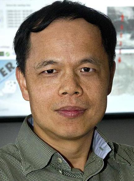 Wuyin Lin合作论文数Environmental and Climate Sciences Department, Brookhaven National Laboratory13
 Jean-Christophe Golaz合作论文数Lawrence Livermore National Laboratory13Taylor Mark A合作论文数Sandia Natl Labs12
 Paul A. Ullrich合作论文数Department of Atmospheric, Oceanic and Space Sciences, Space Research Building, University of Michigan12
 Mark D. Zelinka合作论文数Lawrence Livermore Natl Lab12
 Hassan Beydoun合作论文数11
 Luke Van Roekel合作论文数Department of Atmospheric Science, Colorado State University11
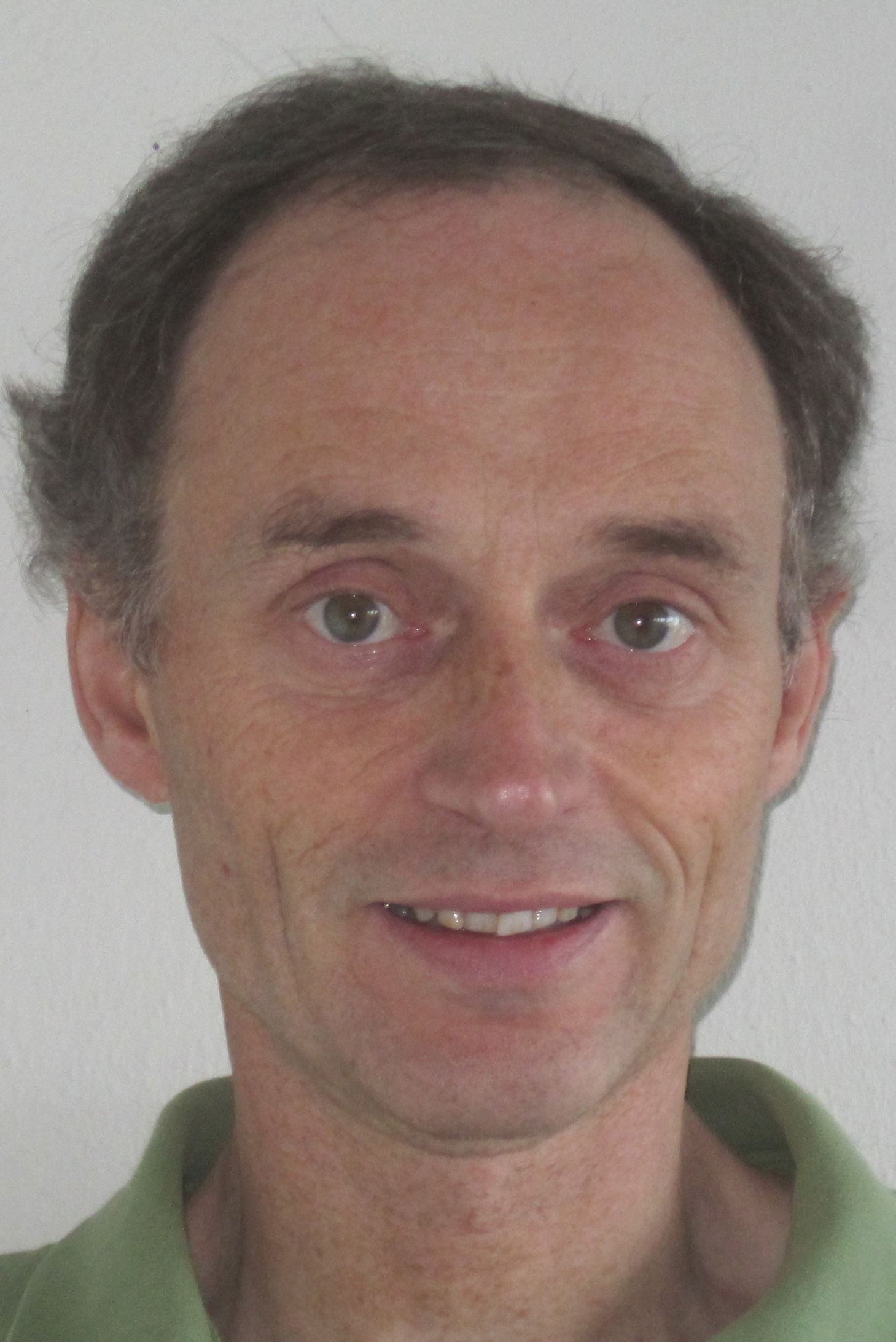 Chris Bretherton合作论文数Department of Atmospheric Sciences, College of the Environment, University of Washington;Department of Applied Mathematics, College of Arts and Sciences, University of Washington;Vulcan Inc11
 Aaron Sheffield Donahue合作论文数Atmospheric, Earth, and Energy Division, Lawrence Livermore National Laboratory10Benjamin R. Hillman合作论文数9Qi Tang合作论文数9
 Christopher R. Terai合作论文数Climate Sci Grp, Lawrence Livermore Natl Lab9
 Lai-Yung Ruby Leung合作论文数Pacific Northwest National Laboratory9
 Shaocheng Xie合作论文数Climate Science Section, Lawrence Livermore National Laboratory9
 Azamat Mametjanov合作论文数University of Nebraska at Omaha9Noel Keen合作论文数7X. Zheng合作论文数Lawrence Livermore National Laboratory7
 Po-Lun Ma合作论文数Pacific Northwest National Laboratory7Balwinder Singh合作论文数6James Foucar合作论文数6Jonathan D. Wolfe合作论文数6Yunyan Zhang合作论文数6Kai Zhang合作论文数6
 Walter M. Hannah合作论文数Lawrence Livermore National Laboratory6
 Bryce E. Harrop合作论文数Pacific Northwest Natl Lab6
 Hailong Wang合作论文数Pacific Northwest National Laboratory6Yuying Zhang合作论文数6
 Hui Wan合作论文数Institute of Atmospheric Physics, Chinese Academy of Sciences6
 Tian Zhou合作论文数Pacific Northwest National Laboratory6
 Karl E. Taylor合作论文数Program for Climate Model Diagnosis and Intercomparison, Lawrence Livermore National Laboratory6
 Robert L. Jacob合作论文数Argonne National Laboratory6Andrew G. Salinger合作论文数Computational Sciences Department;Sandia National Laboratories;Computational Sciences Department, Sandia National Laboratories6
 Sarat Sreepathi合作论文数North Carolina State University6renata mccoy合作论文数5
 Chengzhu Zhang合作论文数5
 Michael S. Pritchard合作论文数Department of Earth System Science, School of Physical Sciences, University of California Irvine5
 Andrew P. Bradley合作论文数University of the Sunshine Coast5
 Yun Qian合作论文数Pacific Northwest National Laboratory5Salil Mahajan合作论文数Department of Atmospheric Sciences;Texas A&M University;Department of Atmospheric Sciences, Texas A&M University5Oksana Guba合作论文数5Hsi-Yen Ma合作论文数4O. Guba合作论文数4
 Jingjing Tian合作论文数Lawrence Livermore Natl Lab4
 Phil Rasch合作论文数Atmospheric Sciences and Global Change Division, Pacific Northwest National Laboratory4
 Karthik Balaguru合作论文数Pac. Northwest National Laboratory, Pacific Northwest Laboratory4
 L. Ruby Leung合作论文数Pacific Northwest National Laboratory4




