We live in a world of constant change, where multiple factors that generate vulnerability coincide, such as pandemics, climate change, and globalization, among other political and societal concerns. This demands the development of approaches capable of dealing with diverse sources of vulnerability and strategies that enable us to plan for and mitigate harm in the face of uncertainty. Our paper shows that the interpretation and conception that one gives to vulnerability in climate change can influence how decision-making solutions and adaptation measures are proposed and adopted. In this context, our approach integrates contextual vulnerability and decision-making planning tools to bolster the capacity to adapt at a local scale. We link our analysis to the evolution of vulnerability in climate change studies and some core articles and decisions on climate change adaptation and capacity building under the United Nations Framework Convention on Climate Change (UNFCCC) and the Conference of Parties throughout this study.
Assigning crisp class boundaries to landscape features can result in the loss of vital information for land evaluation objectives, especially when these boundaries lack clear definitions. This challenge becomes particularly pronounced when land suitability is assessed for implementing agricultural best management practices (BMPs)-conservation measures aimed at reducing the environmental risks of farming activities to aquatic ecosystems while simultaneously achieving water quality and economic objectives. To address the limitations associated with Boolean suitability assessment frameworks, we have introduced an integrated spatial, fuzzy-based land evaluation framework that considers a range of hydrological and economic determinants for BMP placement. By employing data-driven fuzzy membership functions and overlay operators, this framework generates a joint suitability index for BMP placement across agricultural watersheds. The application of the proposed framework to the Thames River Watershed in southwestern Ontario, Canada, produced the first joint suitability index of the watershed. Further analysis of the average farm-level joint suitability scores identified statistically significant clusters of highly suitable and unsuitable lands for BMP placement, with 85% of highly suitable lands being situated in the upper basin areas. The proposed framework is adaptable to various agricultural production geographies, especially in data-limited environments, allowing for strategic BMP placement to mitigate the global impacts of anthropogenic nutrient loadings on aquatic ecosystems. For optimal results, context-specific applications should prioritize research on locally relevant fuzzy membership functions and BMP implementation drivers.
Collaborative forms of governance have a key role in building adaptive capacity in small-scale fishery systems. However, governance systems' structures and features are usually ignored, reducing opportunities to improve collaboration among multiple actors to cope with adverse drivers of change and enlarge trust in decision-making. This study used a social network analysis approach based on descriptive statistics and exponential random graph models (ERGMs) to examine specific network patterns and configurations that may bolster collaboration links and the capacity to adapt in the Galapagos small-scale fishery governance system. To this end, we evaluated the Galapagos small-scale fishery governance system to (1) identify central and bridging organizations, (2) explore the organizational links and link frequencies, and (3) test hypotheses about the governance system structure using a building block approach. Our findings suggest a cross-level and cross-sectoral interaction between various organizations in the Galapagos small-scale fishery system. We identified central and well-positioned actors and network configurations whose interactions might be fundamental to strengthening the small-scale fishing sector's collaboration links and adaptive capacity to face future crises caused by novel pandemics, climate change or other anthropogenic and climate drivers of change.
Addressing the multiple anthropogenic and non-anthropogenic factors affecting small-scale fisheries requires collaboration from diverse regions, geographical scales, and administrative levels in order to prevent a potential misfit between governance systems and the socio-ecological problems they address. While connecting actors and stakeholders is challenging, as they often hold opposing perceptions and goals, unveiling the network configurations of governance systems remains one effective way to explore collaborative alliances in light of the diverse drivers of change present in small-scale fishery systems. This study employed descriptive statistics, exponential random graph models (ERGMs), and qualitative data analysis to explore preferential attachments of new nodes to well-positioned nodes within the Galapagos small-scale fishery governance system network and the propensity of cross-sectoral reciprocity and cross-sectoral open triads formation in the network. Our findings identified significant players and network configurations that might be essential in the collaboration diffusion and robustness of the Galapagos small-scale fishery sector governance system.
In our paper “Coupled Human and Natural Systems” (Liu et al. 2007), we developed a timely, theoretical, and practical foundation for research on Coupled Human And Natural Systems (CHANS). The science of CHANS builds upon, but goes beyond previous research that linked humans and ecosystems (e.g., ecological anthropology, environmental geography, human ecology). CHANS science uses a holistic perspective to integrate patterns and processes that connect human and natural systems, as well as within-scale and cross-scale interactions and feedbacks between human and natural components of such systems (Fig. 1). Such an integrated framework is needed to understand the increased complexity of the Anthropocene and develop innovative solutions to unprecedented global challenges. Open in a separate window Fig. 1 A schematic diagram of a coupled human and natural system. Arrows show interactions and feedbacks. (courtesy of Vanessa Hull.)
Poverty alleviation for smallholders must consider the increasingly varied and intertwined impacts of climate change and globalization. This calls for a resilience perspective that includes eradication of poverty and resilience enhancement under extreme events and shocks. Applying the framework of development resilience, we constructed an agent-based model based on small farming households in the Amazon Delta region in Brazil, and we used it to identify pathways out of poverty and sources for resilience among these households. The model allows us to explore the nonlinearity and heterogeneous nature of the smallholder livelihood systems, including how different household characteristics and livelihood strategies contribute to divergent livelihood outcomes. Using a unique yet simple tracking method, we were able to show the stochastic dynamics of individual household livelihoods in the face of various shocks, and how these households move in and out of different states of poverty over time (i.e., extremely poor, chronic poor, and nonpoor). By comparing traits of households that ended up in different states, we showed the need for targeted interventions for alternative livelihood strategies and key resources improvement. Different from conventional poverty alleviation programs, our findings emphasize empowering smallholders with different livelihood options. This has practical implications in terms of identifying leverage points in smallholder livelihood systems (e.g., livelihood strategy, land resources) that government and other agencies can use to intervene more effectively for households to become prosperous.
Introduction: Roundabouts, as a form of intersection traffic control, are being constructed increasingly because of their promise to improve both efficiency and safety. However, roundabout performance varies from one context to another; and information on their performance during inclement weather is limited. Methods: To evaluate the safety effects of converting signal-controlled intersections to modern roundabouts in a region that historically was unfamiliar with this type of traffic control, an empirical Bayes approach was used to analyze. Second, to examine the potential effects of rainfall on roundabout safety, a matched-pair approach was used to compare risk estimates of collision occurrence at roundabouts and signalized intersections under inclement weather conditions. Results: Roundabout installation is shown as an effective safety intervention for serious collisions since conversion from signalized intersections to roundabouts translates into an overall 20% reduction in the occurrence of injury/fatal collisions. However, roundabouts witnessed more property-damage collisions than what would have been expected had the conversion not occurred. With respect to weather, there is no evidence of a statistically significant increase in crashes on days with rainfall relative to good weather conditions for roundabouts, whereas there is evidence of such an increase in crash risk estimated to be 4% to 22% for signalized intersections. Conclusions: While injury collisions are consistently found to be lower at intersections that have been converted from signalized intersections to roundabouts, the same is not always that case for property-damage collisions, suggesting that drivers need time to adjust. In terms of weather, the evidence in this paper shows that roundabouts show less sensitivity to rainy conditions than signalized intersections. Practical applications: The trade-offs between design, operation, and safety should be considered carefully when planning a new roundabout. More research is required on the specific problems users experience with roundabouts and the effectiveness of public education programs. (C) 2018 National Safety Council and Elsevier Ltd. All rights reserved.
We conducted a large household survey in a region of the Amazon estuary in Brazil to investigate the dependence of small farming households on government cash transfers and to identify the main factors that lead to better livelihood outcomes. The study examined the factors that contribute to heterogeneous household livelihoods and patterns of dependence on cash transfer programs. Multinomial logistic regression was used to evaluate household attributes affecting the level of dependence on cash transfers. Results indicate that households engage in a diversity of livelihood strategies, and vary in dependence on cash transfers. Lower levels of dependency are associated with higher levels of education and income from off-farm activities as well as larger property sizes and holdings in the várzea . Recognition of the causes and potential range of dependence on cash transfer programs adds decision-making capacity for policy makers seeking avenues to reduce dependence and increase program effectiveness.
The need for understanding the factors that trigger human responses to climate change has opened inquiries on the role of indigenous and local ecological knowledge (ILK) in facilitating or constraining social adaptation processes. Answers to the question of how ILK is helping or limiting smallholders to cope with increasing disturbances to the local hydro-climatic regime remain very limited in adaptation and mitigation studies and interventions. Herein, we discuss a case study on ILK as a resource used by expert farmer-fishers (locally known as Caboclos) to cope with the increasing threats on their livelihoods and environments generated by changing flood patterns in the Amazon delta region. While expert farmer-fishers are increasingly exposed to shocks and stresses, their ILK plays a key role in mitigating impacts and in strengthening their adaptive responses that are leading to a process of incremental adaptation (PIA). We argue that ILK is the most valuable resource used by expert farmer-fishers to adapt the spatial configuration and composition of their land-/resource-use systems (agrodiversity) and their produced and managed resources (agrobiodiversity) at landscape, community and household levels. We based our findings on ILK on data recorded for over the last 30 years using detailed ethnographic methodologies and multitemporal landscape mapping. We found that the ILK of expert farmer-fishers and their "tradition of change" have facilitated the PIA to intensify a particular production system to optimize production across a broad range of flood conditions and at the same time to manage or conserve forests to produce resources and services.
The Trent-Severn Waterway in central Ontario, Canada, is a large inland water system. It is managed for a broad range of stakeholders with different needs and expectations, creating a complex management context. Although variations in water levels occur, extreme low water-level events may increase in the future due to climate change, challenging management practices, in addition to requiring adaptation to reduce impacts. A modified policy Delphi was used to generate and evaluate ideas related to historical and future water-level impacts and adaptations. The paper presents the perspectives of three groups—cottagers and homeowners (CH), government (G), and industry and business (IB)—on their experiences with historic low water-levels, as well as their perspectives on future impacts and adaptations using two water-level scenarios: a moderate decrease of 25 cm and a more severe 50 cm decline. Shared impacts and adaptations (individual and collective) were identified along with those that were unique to a group. The likelihood of and consensus on potential impacts and most adaptations increased with the severity of water-level reduction. All groups indicated a higher likelihood of using collective rather than individual adaptations with the severe scenario, and in some cases, their contacts for assistance with adaptation broadened. While the modified policy Delphi requires significant effort by the analyst and respondents, it provides a useful framework for generating and analyzing perceptions and preferences of diverse stakeholders.
Small farm households in the Brazilian Amazon estuary region have been adapting to urbanization and climatic events, by joining in off-farming activities. However, children from well-off families have better chances to receive education resulting in a higher probability of finding an off-farming job. Bolsa Familia program (BF), a conditional cash transfer program, enhances children’s school attendance in poor households. We conducted an agent-based model to interpret the impact of the BF program on eligible households’ livelihood and on income distribution.
Three spatially-explicit wetland models were developed in a geographic information system (GIS) to simulate wetland vegetation response to water-level fluctuations at the Long Point, Ontario wetland complex. They included: a rule-based model that used a series of if-then statements related to pre-existing vegetation, water depth and wetland vegetation community tolerance ranges; a vegetation state probability model based on likelihood of certain wetland vegetation communities occurring at specific water depths; and a vegetation transition probability model based on likelihood of wetland communities changing to another community under declining or rising water level conditions. The accuracy of the models was evaluated by comparing area and spatial distribution of the simulated wetland landscape to digital historical wetland vegetation data from air photo interpretation. The accuracy of the models ranged from over 80% of the cells correctly classified by the vegetation transition probability model and rule-based model to about 55% correctly classified by the vegetation state probability model. The vegetation transition probability model was marginally more accurate than the rule-based model when assessed on a cell-by-cell basis, but the rule-based model replicated the spatial distribution of vegetation communities more accurately and may be more broadly applicable. Recommended improvements include: additional environmental factors (wave exposure and substrate) incorporated in the decision rules and more detailed input data for the digital elevation model (DEM). Spatially-explicit modeling such as the rule-based model can explore management issues related to climate change and water-level regulation impacts on wetlands in the Great Lakes basin and elsewhere.
Agent-based models of land use and cover change (ABMs/LUCC) have traditionally represented land-use and land-cover changes as arising from social, economic and demographic conditions, while spatial ecological models have tended to simulate the environmental impacts of spatially aggregated human decisions. Incorporating a dynamic representation of ecosystem processes into ABMs/LUCC can enable new or counter-intuitive insights to be gained into why certain path-dependent outcomes arise and can also spatially constrain model processes, thereby improving the spatial fit of model output against observational data. A framework is therefore provided to assist in determining an optimal approach for representing ecological processes in an ABM/LUCC according to the research question and desired application of the model. Relevant challenges limiting the integration of complex, dynamic representations of ecosystem processes into ABMs/LUCC are then assessed, with solutions provided from recent examples. ABMs/LUCC that use a dynamic representation of ecological processes may be applied to investigate the complex, long-term responses of the coupled human–natural system to a variety of climatic shifts and ecological disturbances.
In agent-based models of land use/cover change (ABM/LUCC), small changes in micro-level decision-making methods used by agents may significantly affect macro-level outcomes. Yet, the implications of choosing a specific decision making model are seldom explored in ABM/LUCC studies. This paper discusses an ABM/LUCC modelling study of smallholder farming households in the Amazonian varzea in Marajó Island, Brazil. These agents represent the 21 households within the community of Paricatuba. Farmers in this community cultivate acai as a primary source of income, in addition to other farming and economic activities such as offsite employment. In the model, agents make annual decisions to allocate scarce land, capital and labour resources to best provide revenue for the household. Household agents have the same overall goals, resources, information, and feasible actions available to them within the simulation environment. Alternative simulations are developed in which the household agents employ one of two primary decision-making methods, either based on linear programming or decision trees. A comparison of these methods in a Monte Carlo simulation indicates that in certain scenarios, alternative decision-making methods with otherwise common objectives and environments may lead to widely divergent outcomes. The evaluation of multiple decision making methods within a common model can be used to highlight the advantages and limitations of these methods and challenge assumptions.
Research on the determinants of land use change and its relationship to vulnerability (broadly defined), biotic diversity and ecosystem services (e.g. Gullison et al. 2007), health (e.g. Patz et al. 2004) and climate change (e.g. van der Werf et al. 2004) has accelerated. Evidence of this increased interest is demonstrated by several examples. Funding agencies in the US (National Institutes of Health, National Science Foundation, National Aeronautics and Space Administration and National Oceanic and Atmospheric Administration) and around the world have increased their support of land use science. In addition to research papers in disciplinary journals, there have been numerous edited volumes and special issues of journals recently (e.g. Gutman et al. 2004; Environment & Planning B 2005; Environment & Planning A 2006; Lambin and Geist 2006; Kok, Verburg and Veldkamp 2007). And in 2006, the Journal of Land Use Science was launched. Land use science is now at a crucial juncture in its maturation process. Much has been learned, but the array of factors influencing land use change, the diversity of sites chosen for case studies, and the variety of modeling approaches used by the various case study teams have all combined to make two of the hallmarks of science, generalization and validation, difficult within land use science. This introduction and the four papers in this themed issue grew out of two workshops which were part of a US National Institutes of Health (NIH) ‘Roadmap’ project. The general idea behind the NIH Roadmap initiative was to stimulate scientific advances by bringing together diverse disciplines to tackle a common, multi-disciplinary scientific problem. The specific idea behind our Roadmap project was to bring together seven multi-disciplinary case study teams, working in areas that could be broadly classified as inland frontiers, incorporating social, spatial and biophysical sciences, having temporal depth on both the social and biophysical sides, and having had long-term funding. Early in our Roadmap project, the crucial importance of modeling, particularly agent-based modeling, for the next phase of land-use science became apparent and additional modelers not affiliated with any of the seven case studies were brought into the project. Since agent-based simulations attempt to explicitly capture human behavior and interaction, they were of special interest. At the risk of oversimplification, it is worth briefly reviewing selected key insights in land use science in the past two decades to set the stage for the papers in this themed issue. One of the earliest realizations, and perhaps most fundamental, was accepting the crucial role that humans play in transforming the landscape, and concomitantly the distinction drawn between land cover (which can be seen remotely) and land use (which, in most circumstances, requires in situ observation; e.g. Turner, Meyer and Skole 1994). The complexity of factors influencing land use change became apparent and led to a variety of ‘box and arrow’ diagrams as conceptual frameworks, frequently put together by committees rarely agreeing with one another on all details, but agreeing among themselves that there were many components (social and biophysical) whose role needed to be measured and understood. A series of case studies emerged, recognizing the wide array of variables that needed to be incorporated, and typically doing so by assembling a multidisciplinary team (Liverman, Moran, Rindfuss and Stern 1998; Entwisle and Stern 2005). The disciplinary make-up of the team strongly influenced what was measured and how it was measured (see Rindfuss, Walsh, Turner, Fox and Mishra 2004; Overmars and Verburg 2005), with limited, if any, coordination across case studies (see Moran and Ostrom 2005 for an exception). In large part, the focus on case studies reflected the infancy of theory in land use science. Teams combined their own theoretical knowledge of social, spatial and ecological change with an inductive approach to understanding land use change – starting from a kitchen sink of variables and an in-depth knowledge of the site to generate theory on the interrelationships between variables and the importance of contextual effects. This lack of coordination in methods, documentation and theory made it very difficult to conduct meta-analyses of the driving factors of land use change across all the case studies to identify common patterns and processes (Geist and Lambin 2002; Keys and McConnell 2005). Recognizing that important causative factors were affecting the entire site of a case study (such as a new road which opens an entire area) and that experimentation was not feasible, computational, statistical and spatially explicit modeling emerged as powerful tools to understand the forces of land use change at a host of space–time scales (Veldkamp and Lambin 2001; Parker, Manson, Janssen, Hoffmann, and Deadman 2003; Verburg, Schot, Dijst and Veldkamp 2004). Increasingly, in recognition of the crucial role of humans in land use change, modeling approaches that represent those actors as agents have emerged as an important, and perhaps the dominant, modeling approach at local levels (Matthews, Gilbert, Roach, Polhil and Gotts 2007). In this introductory paper we briefly discuss some of the major themes that emerged in the workshops that brought together scientists from anthropology, botany, demography, developmental studies, ecology, economics, environmental science, geography, history, hydrology, meteorology, remote sensing, geographic information science, resource management, and sociology. A central theme was the need to measure and model behavior and interactions among actors, as well as between actors and the environment. Many early agent-based models focused on representing individuals and households (e.g. Deadman 1999), but the importance of other types of actors (e.g. governmental units at various levels, businesses, and NGOs) was a persistent theme. ‘Complexity’ was a term that peppered the conversation, and it was used with multiple meanings. But the dominant topic to emerge was comparison and generalization: with multiple case studies and agent-based models blooming, how do we compare across them and move towards generalization? We return to the generalization issue at the end of this introductory paper after a brief discussion of the other themes.
 Eduardo S. Brondizio合作论文数Department of Anthropology, The College of Arts & Sciences, Indiana University8
 Dawn Cassandra Parker合作论文数Department of Agricultural and Resource Economics;University of California at Davis;Department of Agricultural and Resource Economics, University of California at Davis7
 Emilio F. Moran合作论文数Center for Global Change and Earth Observation, College of Social Science, Michigan State University;Department of Fisheries and Wildlife, College of Social Science, Michigan State University6
 Steven Manson合作论文数Department of Geography, Environment & Society, College of Liberal Arts, University of Minnesota;Institute on the Environment, University of Minnesota6
 Yue Dou合作论文数Dept Nat Resources, Univ Twente5
 Nathan Vogt合作论文数5
 Derek T. Robinson合作论文数School of Natural Resources and Environment, University of Michigan5
 Oriana Trindade De Almeida合作论文数Oriana Trindade de Almeida, Instituto do Homem e Meio Ambiente da Amazônia5
 Miguel Pinedo-Vasquez合作论文数Center for Environmental Research and Conservation, Columbia University5
 a raymond cabrera合作论文数4
 Renato Caceres合作论文数4
 Thomas Dietz合作论文数Department of Sociology, College of Social Science, Michigan State University;Center for Systems Integration and Sustainability, Michigan State University4
 Zhiyun Ouyang (欧阳志云)合作论文数Research Center for Eco-Environmental Sciences, Chinese Academy of Sciences4
 Jane Lubchenco合作论文数Department of Integrative Biology, College of Science, Oregon State University4
 William W. Taylor合作论文数Center for Systems Integration and Sustainability, Michigan State University;College of Social Science, Michigan State University4
 Alice N Pell合作论文数4
 Marco Janssen合作论文数Arizona State University4
 Jeremy Pittman合作论文数First Nations University of Canada4
 Charles L. Redman (Charles Redman)合作论文数School of Sustainability, Arizona State University;School of Human Evolution and Social Change, Arizona State University;School for the Future of Innovation in Society, Arizona State University4
 Leah K. Vanwey合作论文数Department of Sociology, Brown University4Daniel G. Brown合作论文数3William Provencher合作论文数3Steve Schneider合作论文数3
 Matthew Hoffmann合作论文数Department of Political Science, Faculty of Arts and Science, University of Toronto3
 Marina Alberti合作论文数Department of Urban Design and Planning, College of Built Environments, University of Washington3
 Stephen R. Carpenter合作论文数Center for Limnology, College of Letters and Science, University of Wisconsin-Madison3
 Mauricio Castrejon合作论文数3
 Sergio Rivero合作论文数3
 Jianguo "Jack" Liu合作论文数Center for Systems Integration and Sustainability, Michigan State University;Department of Fisheries and Wildlife, College of Agriculture & Natural Resources, Michigan State University;University of Michigan3Timothy K. Kratz合作论文数Center for Limnology;University of Wisconsin-Madison;Center for Limnology, University of Wisconsin-Madison3
 Carl Folke合作论文数Beijer Institute of Ecological Economics, Royal Swedish Academy of Sciences;Stockholm Resilience Centre, Stockholm University3Linda D. Mortsch合作论文数3
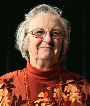 Elinor Ostrom合作论文数Department of Political Science, College of Arts and Sciences, Indiana University Bloomington3b naeslund合作论文数2s maltagliati合作论文数2r hoch合作论文数2cameron s fletcher合作论文数2
 Pelletier Dominique合作论文数Inst Francais Rech Pourl Exploitat Mer IFREMER, Un Halieut Grand Ouest2
 Barbara Entwisle合作论文数Department of Sociology, College of Arts and Sciences, The University of North Carolina at Chapel Hill;Carolina Population Center, The University of North Carolina at Chapel Hill2
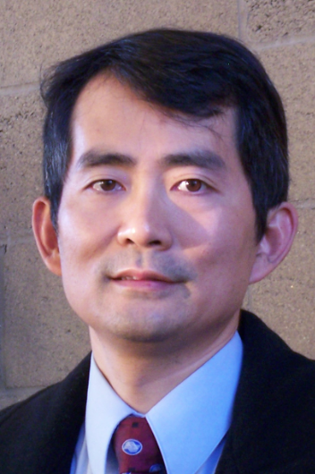 Li An合作论文数College of Forestry, Wildlife, and Environment, Auburn University;Center for Human-Earth System Science, Auburn University2Paul Parker合作论文数2
 George P. Malanson合作论文数Department of Geography, University of Iowa2
 Patrick F. Sullivan合作论文数Sullivan Lab, Department of Genetics, School of Medicine, University of North Carolina at Chapel Hill;Center for Psychiatric Genetics, School of Medicine, University of North Carolina at Chapel Hill;Department of Medical Epidemiology and Biostatistics, Karolinska Institutet2
 Guy R. Larocque合作论文数Natural Resources Canada, Canadian Forest Service, Laurentian Forestry Centre, PO Box 3800, 1055 du P.E.P.S., Stn. Sainte-Foy, Quebec, QC G1V 4C7, Canada2
 J. Gary Polhill合作论文数Macaulay Institute2Douglas Dudycha合作论文数2Marc Linderman合作论文数2Edella Schlager合作论文数2
 Linda Kumblad合作论文数2




