We illustrate that rapid acquisition of audio magnetotellurics (RAMT) is an alternative methodology to construct the impedance tensor.A solenoid is used as the magnetic sensor and a capacitively coupled, long wire antenna (LWA) as the electrical sensor.Recent improvements in data quality, automated processing flows and apparent resistivity to depth transforms resulted in a cost effective and practical alternative for quickly acquiring audio magnetotelluric 1D soundings.Case studies for groundwater, engineering and mining illustrate how the method may be useful for decision making, and hopefully enable more widespread adoption of low cost resistivity measurements.
We present a new rotational vibration isolator with an extremely low resonant frequency of 0.055 ± 0.002 Hz. The isolator consists of two concentric spheres separated by a layer of water and joined by very soft silicone springs. The isolator reduces rotation noise at all frequencies above its resonance which is very important for airborne mineral detection. We show that more than 40 dB of isolation is achieved in a helicopter survey for rotations at frequencies between 2 Hz and 20 Hz. Issues affecting performance such as translation to rotation coupling and temperature are discussed. The isolator contains almost no metal, making it particularly suitable for electromagnetic sensors.
SummaryLaunched onto the Australian market in early 2011, HELITEM is a powerful helicopter time domain electromagnetic system. It was developed by Fugro Airborne Surveys for exploration applications with an emphasis on the detection of deep conductors. Recent innovations have seen an increase in the peak dipole moment and a new receiver platform that have further improved the signal to noise ratio of HELITEM data.To test the performance of the HELITEM system in the Australian environment, a survey was completed over the Forrestania EM test range. A range of modelling techniques were applied to the survey data to extract features in the ground response. Correlations between the modelled results and known target parameters confirmed the ability of the HELITEM system to detect targets in typical Australian conductive overburden conditions.
The potential of obtaining water depths derived from AEM data that are accurate to similar to 0.5 m cannot be fully realised if the variable geometry between transmitter and receiver is neglected. The rigorous approach of monitoring the bird offset in three dimensions is currently too costly. However, neglecting the bird offset variations from the assumed fixed nominal offset is problematic because the measured decay shape is sensitive to the transmitter-receiver geometry. An alternative procedure is to invert both layered earth parameters and geometric parameters using a non-linear least-squares method. This inversion procedure has been tested on 25 Hz GEOTEM data from a survey flown in the Torres Strait. The accuracy of the inverted water depths was appraised using data from laser airborne depth sounding surveys. Good agreement, to within similar to 1 m was obtained between the different methods.
Three time-domain airborne EM surveys were recently flown over a known mineral deposit at Barrow Creek, NT. The Ni/Cu/Ag deposit is located in an area characterised by variable conductive overburden and is considered a difficult exploration target. Data from the three airborne systems and a moving loop ground EM survey were processed and analysed to compare the relative abilities of the systems to locate the target. It was found that the fixed-wing systems (TEMPEST and GEOTEM) produced clear responses to the known mineralisation that were consistent with the model developed from the ground EM responses. The EM responses measured with the helicopter system (HoistEM) did not indicate the target.
We interpret airborne EM response data recorded by the GEOTEM 12.5 and 25 Hz systems flown over shallow seawater, using conductivity-depth imaging (CDI) to estimate sea depths to 65 m. We observed non-monotonic decay in the vertical component of the 25 Hz data recorded at survey altitude. Non-monotonic decay had an adverse effect on the CDI results when the processing was run with positivity constraints. The removal of positivity constraints resulted in significant improvements in the quality of CDIs for interpreting water depth. Layered-earth modelling further showed that this non-monotonic decay in the 25 Hz data was due to variations in the transmitter-receiver geometry over the highly conductive seawater. Currently, 12.5 Hz airborne EM is unsuitable for bathymetric mapping unless late-time system noise can be reduced. CDIs from dB(x)/dt component data at 25 Hz provide the most accurate interpreted sea depths. For this dataset, the use of B-field responses computed from dB/dt observations does not offer any clear advantage over dB/dt data for interpreting sea depths from CDIs.
Airborne electromagnetic (AEM) data were collected offshore Busselton, Western Australia, using GEOTEMTM operating at both 12.5 Hz and 25 Hz over the same survey area. The survey covered a region in shallow water up to 35 m depth, and two overlapping tie lines skirting Cape Naturaliste extending into deeper water. The objectives were to compare 12.5 Hz (8 ms pulse) and 25 Hz (4 ms pulse) AEM data in an area of high conductance using conductivity depth sections to map water depth and seafloor resistivity, and to compare B-field and dB/dt responses. CDI processing of the data with EMFlow software showed that for this dataset, CDIs based on the B-field are better suited for high-conductance targets than CDIs based on the dB/dt data. Water depth was best resolved using 25 Hz B-field data. Sub-sea material and deeper water depths below 45 m was best resolved with 12.5 Hz Bz field data. The 25 Hz dBz/dt data gave the poorest results, due to changes in the bird position not being accounted for in the CDI algorithm.
Airborne electromagnetic (AEM) data are presently inverted with one-dimensional (1D) models, either as Conductivity Depth Images (CDI) or with full non-linear inversion, to build model sections from concatenated 1D models. If lateral conductivity changes are small, 1D models are justified. However, AEM investigations are often carried out specifically to find localized conductors, and in this case, 1D inversion is inadequate and will often produce artefacts in the model section. We have developed an approximate two-dimensional (2D) inversion method that deals with laterally inhomogeneous sections. The method is based on the adaptive Born approximation previously applied by one of the authors (NBC) to the interpretation of central-loop ground EM profiles. The technique produces synthetic models with moderate conductivity contrasts and with some improvement over CDI sections. The computing speed is comparable to that of stitched 1D inversions. An example of processing field data with the approximate 2D inversion method over a massive nickel sulphide deposit shows results that are promising for its routine application on large AEM data sets.
D-37 EXAMPLES OF NICKEL SULPHIDE DETECTION WITH AIRBORNE EM INTRODUCTION Minerals explorers are interested in understanding how a particular technology will address a given exploration problem. Our intention is to address this question in the specific case of predicting how effective present-day airborne electromagnetic (AEM) technology will be in discovering new deposits of nickel sulphide. 1 PETER WOLFGRAM 1 and HOWARD GOLDEN 2 1 Fugro Airborne Surveys Pty Ltd Locked Bag 6 Wembley WA 6014 Australia Traditionally efficacy studies tend to be either case studies that focus on the results of a particular exploration program or modelling studies that focus
Exploration for nickel sulphides has often involved the application of airborne electromagnetic data. Some of the early successes of the technique were in Canada in the 1950s, detecting shallow massive sulphides in highly resistive host stratigraphies. As exploration for deeper deposits under cover proliferates, a comparison of different systems and an analysis of the depth of penetration of these systems is required.An examination of field data from three known nickel sulphide deposits shows that the target anomalies are all above the noise level except where shielded by a flat-lying conductor. Using the geological models for each deposit, forward modelling was applied to determine that the ore bodies chosen for this study could be buried deeper before the system used would cease to be an effective exploration tool. Forward modelling also shows that all methods examined are able to identify the target. Systems with lower base frequency and wider transmitter pulse give the best results.
Orebodies, mineralised zones, faults, folds, contacts, etc. may represent localised electrical conductors that create airborne electromagnetic (AEM) responses of interest to explorationists. However, typical AEM datasets in conductive regimes exhibit numerous features besides those of interest and it is left to the interpreter to identify the ones that are of significance to the interpretation task at hand.Synthetic data can be used to illustrate typical effects of host medium and conductive overburden on target responses, and how these might be identified in the presence of noise such as variations in aircraft ground clearance. Although an understanding of the complex anomaly features is possible, analysing large data sets will require rapid methods of pinpointing anomalous areas and allowing the user to employ visual correlation over a map to aid in the interpretation.Different transformations of the data can enhance different features of interest to the explorationist. The conductivity depth transform (CDT) maps broad conductive zones and their depths - it is less suitable for detecting localised conductors. The stationary current image (SCI™) on the other hand indicates areas where electric currents become trapped in localised conductive features such as isolated bodies, faults, folds, etc. The SCI emphasises structural features because it is optimised for lateral contrasts in electrical conductivity.
Explorationists are increasingly concerned with finding more difficult targets such as those under cover. Significant developments in Airborne Electromagnetic (AEM) technology are now providing advanced tools for exploration in these scenarios. Recovering the magnetic field B rather than dB/dt from a towed sensor boosts the response from a high-conductance target, as is readily shown with model calculations. The advantage of B-field data in the presence of noise is illustrated with a GEOTEMDEEP™ field example over a known conductive body that is covered by a thick conductive sequence and is difficult to detect from dB/dt data alone.
A conductivity-depth transform (CDT) of airborne transient electromagnetic (EM) data generates approximate sections and maps of the subsurface electrical conductivity variations. The resulting products have instrumentation parameters such as the transmitter waveform removed and can be directly integrated with other information from the survey area. Although approximate, the conductivity depth transform has a number of advantages over an exact inversion method. These are illustrated with two examples: a groundwater salinity study in Australia and a survey over the Bushman mineral deposit in Botswana.
"Discussion on: Conductivity-depth transform of GEOTEM data." Exploration Geophysics, 26(4), p. 549
Hydrocarbon exploration with electromagnetic methods is mainly done in areas where seismics do not give satisfactory results, for example in areas with volcanic cover. Most commonly a horizontally layered earth is used for interpretation, because in many sedimentary basins 1-D models are a reasonable description of the true earth, or they give starting models for 2-D or 3-D interpretation. Moreover, for transient EM the numerical modeling for 2-D or 3-D structures is extremely time consuming. Even though the progress in 3-D modeling during the last few years has been enormous, the improvement of 1-D interpretation is still important.
Borehole gravity meter (BHGM) surveys are mainly used in sedimentary environments. Only a limited number of case histories for crystalline rocks is known (Richter 1989). The pilot well of the Continental Deep Drilling Project (KTB) of the FRG has penetrated amphibolites of densities 2.81 to 2.95 g/cm³ embedded within gneisses of lower density (2.12 to 2.74 g/cm³). The apparent densities calculated from the BHGM data are combined with independent information from other sources for the interpretation of dipping structures. The result is an interpretation procedure which is also valid for the sedimentary environment of hydrocarbon exploration.
In the past few years the activities of TEM measurements in oil exploration have significantly increased. One reason why these methods could not yet reach a breakthrough is that the interpretation is usually based on layered earth models. However, many cases which are interesting for hydrocarbon exploration include 3D structures, such as overthrusts or anticlines.
 Kurt Strack合作论文数6
 Daniel Sattel合作论文数3
 Julian Vrbancich合作论文数3K. Vozoff合作论文数3G. Karlik合作论文数2
 Howard Golden合作论文数2
 R. N. Edwards合作论文数Dept Phys, Univ Toronto2Andreas Hördt合作论文数Institut für Geophysik und Extraterrestrische Physik, TU Braunschweig2A. Hoerdt合作论文数1howard golden合作论文数1T. Hanstein合作论文数1Ray Lockwood合作论文数1LK LAW合作论文数1xu chen合作论文数1Torres Francis合作论文数1
 David Blair合作论文数School of Physics, Maths and Computing, The University of Western Australia1
 Li Ju (鞠莉)合作论文数Department of Physics, University of Western Australia1
 James Macnae合作论文数Sch Appl Sci, RMIT Univ1K. Lebrocq合作论文数1Andrew Sunderland合作论文数1Alan Judge合作论文数Trinity College, University of Dublin1D. Moss合作论文数1Barrett Cameron合作论文数1
 Niels B. Christensen合作论文数Department of Earth Sciences, Aarhus University1
 Enrique Gomez-Trevino合作论文数Departamento de Matematicas1
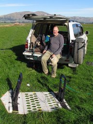 David C. Nobes合作论文数Department of Geological Sciences, University of Canterbury1




