Despite the reliability concerns that are associated with the I2C bus, it is still one of the most popular on-board data busses to be used in nanosatellite missions. This paper provides a detailed fault analysis for the I2C bus in the context of nanosatellite missions, and consequently investigates and proposes potential mitigation techniques. The failure of the I2C bus is a risk that most CubeSat missions has to deal with, as the related bus failures can cause some catastrophic failures. Therefore, this study analyzes the I2C bus characteristics, the hardware and software requirements, and the key factors leading to I2C bus failure. By conducting experimental testing using the appropriate hardware and software to construct a comprehensive list of I2C bus requirements, characteristics, and failures. Based on the experimental testing possible mitigation approaches are proposed and finally a qualitative risk analysis is delivered to measure the impact of the methods on the overall mission success. The study shows high influence of the I2C bus on the CubeSat health and mission success, thus emphasizing on the importance of design considerations to reduce missions' risk level, as well as counting for runtime failures that can occur during mission operation.
Change detection in high-resolution satellite images is essential to understanding the land surface (e.g. agriculture and urban change) or maritime surface (e.g. oil spilling). Many deep-learning-based change detection methods have been proposed to enhance the performance of the classical techniques. However, the massive amount of satellite images and missing ground-truth images are still challenging concerns. In this paper, we propose a supervised deep network for change detection in bi-temporal remote sensing images. We feed multi-level features from convolutional networks of two images (feature-extraction) into one architecture (feature-difference) to have better shape and texture properties using a dual attention module We also utilize a multi-scale dice coefficient error function to decrease overlapping between changed and background pixel. The network is applied to public datasets (ACD, SYSU-CD and OSCD). We compare the proposed architecture with various attention modules and loss functions to verfiy the performance of the proposed method. We also compare the proposed method with the stateof-the-art methods in terms of three metrics: precision, recall and F1-score. The experimental outcomes confirm that the proposed method has good performance compared to benchmark methods.
AlainSat-1 is an educational and scientific nanosatellite project that was initiated in late 2019 by the IEEE Geoscience and Remote Sensing Society (GRSS) along with National Space Science and Technology Center (NSSTC) of UAE University in the frame of the 2nd Student Grand Challenge [1]. The project involves close collaboration between four international universities to design, build, test and launch a remote sensing CubeSat.The spacecraft is a 3U CubeSat that has a mass of around 4 Kgs. The spacecraft has an active 3-axis control system capable of attitude determination and control to less than one degree. Two communications systems will be used on-board: a UHF System and an S-Band System. The project has passed the Critical Design Review (CDR) stage and is currently in the assembly and integration phase. The satellite is currently planned for launch to a sun-synchronous orbit on-board a Falcon 9 rocket in the second quarter of 2024.
Hyperspectral imaging (HSI) is a non-destructive analytical tool that can be used for sensing multiple quality attributes for fresh commodities, but is usually constrained by complex data processing. Here, we report the development of HSI based simple kinetic models to assess quality deterioration in A. bisporus mushrooms. The commercially available fresh mushroom packages kept at constant refrigeration temperature (4 degrees C) were selected for HSI analysis in the visible and near infrared (VNIR) wavelengths (400-1000 nm) for a postharvest storage of 11 d. The observed HSI reflectance patterns clearly showed two sensitive wavelength regions: i) 450-700 nm and ii) 800-900 nm, which were termed as HSI index-I and HSI index-II, respectively. Alongside this, physicochemical and microbiological characterization of mushrooms were carried out and were related to HSI quality indices. The kinetic analysis showed that the HSI index-I is a useful quality indicator for the assessment of storage time for A. bisporus mushrooms. Furthermore, the physical quality attributes such as color and texture, which were changed significantly (p < 0.05) during the storage were linked to HSI index-I through linear regression models. The data processing approach presented in this study is quite useful that will facilitate the application of HSI in quality assessments of fresh commodities.
In this paper, we propose a machine learning system for the estimation of atmospheric particulate matter (PM) concentration, specifically, particles with a maximum diameter of $2.5{\mu }\text{m}$ . These very fine particles, also known as PM 2.5 particles, are very dangerous to the human body as they are small enough to penetrate deep areas of the vital organs. The proposed system uses a combination of features from both polarimetric and spectral imaging modalities in training and developing a machine learning model that provides high accuracy PM 2.5 estimates. Furthermore, acquisition of the polarimetric images is done near the ground surface with a horizontal field of view aiming at standard targets which enables higher accuracy at the surface level. The accuracy of the approach was verified through a study conducted during the summer months of the United Arab Emirates (UAE). The proposed system employs different machine learning techniques such as Support Vector Regression (SVR), Gaussian Process Regression (GPR), and Bagging Ensemble Trees (BET), to provide high accuracy PM 2.5 estimates. Our proposed system achieves the best performance within the red wavelength with accuracy up to 93.8627% and an R 2 score up to 0.9420.
Initially intended as student-led projects at universities and research institutions, the CubeSats now represent a unique opportunity to access space quickly and in a cost-effective fashion. CubeSats are standard and miniaturized satellites consisting of multiple identical units with dimensions of about 10×10×10cm3 and very limited power consumption (usually less than a few W). To date, several hundreds of CubeSats have been already launched targeting scientific, educational, technological, and commercial needs. Compact and highly efficient particle detectors suitable for payloads of miniaturized space missions can be a game changer for astronomy and astroparticle physics. For example, the origin of catastrophic astronomical events can be pinpointed with unprecedented resolution by measuring the gamma-ray coincidence signals in CubeSats flying in formations, and possibly used as early warning system for multi messenger searches. In this paper, we will discuss and analyze the main features of a CubeSat mission targeting intense and short bursts of gamma-rays.
The extraction of man-made structures from high-resolution images plays a vital role in various urban applications. This task is regularly complicated due to the heterogeneous appearance of the objects in the satellite images. In this work, we propose a multi-scale Generative Adversarial network to classify high-resolution images into urban classes (surface, building, tree, low-vegetation, car). We use uNet with EfficientNet B3 architecture as a generator and we use ResNet 18 architecture as a discriminator. We use a conditional generative loss based on the Dice coefficient and softmax functions. Experiments on the Vaihingen and Potsdam datasets were conducted to demonstrate the performance and we compare the results with other architectures. The results demonstrate the validity and higher performance of the proposed multi-scale network for extracting classes in urban areas with average F1-score 89.0% and 88.8%, and average accuracy 89.9% and 91.8% for Vaihingen and Potsdam datasets, respectively.
Modeling wind speed and direction are crucial in several applications such as the estimation of wind energy potential and the study of the long-term effects on engineering structures. While there have been several studies on modeling wind speed, studies on modeling wind direction are limited. In this work, we use a mixture of von Mises distributions to model wind direction. Finite mixtures of von Mises (FMVM) distributions are used to model wind directions at two sites in the United Arab Emirates. The parameters of the FMVM distribution are estimated using the least square method. The results of the research show that the FMVM is the best suited distribution model to fit wind direction at these two sites, compared to other distributions commonly used to model wind direction.
The standardization of the physical aspects of nanosatellites (also known as CubeSats) and their wide adoption in academia and industry has made the mass production and availability of off-the-shelf components possible. While this has led to a significant reduction in satellite development time, the fact remains that a considerable amount of mission development time and effort continues to be spent on flight software development. The CubeSat’s agile development environment makes it challenging to utilize the advantages of existing software frameworks. Such an adoption is not straightforward due to the added complexity characterized by a steep learning curve. A well-designed flight software architecture mitigates possible sources of failure and increases mission success rate while maintaining moderate complexity. This paper presents a novel approach to a flight software framework developed specifically for nanosatellites. The software framework is characterized by simplicity, reliability, modularity, portability, and real-time capability. The main features of the proposed framework include providing a standardized and explicit skeleton for each module to simplify their construction, offering standardized interfaces for all modules to simplify communication, and providing a collection of ready-to-use common services open for further enhancement by CubeSat software developers. The framework efficiency was demonstrated through a software developed for the MeznSat mission that was successfully launched into Low Earth Orbit in September 2020. The proposed software framework proved to simplify software development for the application developer while significantly enhancing software modularity.
Coronal mass ejection (CME) is a highly energetic solar phenomenon. It has a significant impact on the space weather in the near-Earth environment. With the accumulation of CME observations, it becomes more challenging to handle them manually. Therefore, we need an automatic method for identifying CMEs. We propose an unsupervised method for classifying and detecting changes in CMEs. The method consists of four main steps: (i) feature extraction: features derived from difference-image and features derived from pretrained convolutional neural networks (CNN), (ii) dimensional reduction using Principal Component Analysis (PCA), (iii) unsupervised classification using K-mean clustering based on PCA components and (iv) morphological post-processing to improve the clustering output. We compare the results with manual catalog (e.g., coordinated data analysis workshops (CDWA) data center) and automatic detection catalogs (e.g., solar eruption detection system (SEEDS), computer-aided CME tracking (CACTus) and coronal image processing (CORIMP)). The comparison is based on CME characteristics (e.g., time of first appearance, position angle, angular width and velocity). We demonstrate the benefit of this unsupervised method, which produces comparable results to classical methods.
The acquisition of satellite images over a wide area is often carried out across seasons because of satellite orbits and atmospheric conditions (e.g., cloud cover, dust, etc.). This results in spectral mismatch between adjacent scenes as the sun angle and the atmospheric conditions will be different for different acquisitions. In this work, we developed an approach to generate seamless mosaics using Scale-Invariant Features Transformation (SIFT). In this process, we make use of the overlapping areas between two adjacent scenes and then map spectral values of one imagery scene to another based on the filtered points detected by SIFT features to create a seamless mosaic. We make use of the Random Sample Consensus (RANSAC) method successively to filter out obtained SIFT points across adjacent tiles and to remove spectral outliers across each band of an image. Several high resolution satellite images acquired with WorldView-2 and Dubaisat-2 satellites, and medium resolution Sentinel-2 satellite imagery are used for experimentation. The experimental results show that the proposed approach can generate good seamless mosaics. Furthermore, Sentinel-2's level 2A (L2A) product surface reflectance data is used to adjust the spectral values for color consistency.
A generation of detailed classification maps requires high-resolution satellite images classified into numerous classes depending upon the region of interest. This paper addresses the challenges encountered towards generating such classification maps at a large scale. While using a high-resolution satellite image at a large scale, one could face challenges during the pre-processing phase, starting with mosaicking satellite images, dealing with sample collection, projection issues, or even using classification algorithms to develop classification maps. Hence, this article provides details on such tasks performed at a larger scale. A CNN-based supervised method is used to train the model for the classification from the approximately equal size of samples of the interested land cover land use (LCLU) classes. In addition, few land-use classes such as parks and airports are used from Volunteered Geographic Information (VGI) sources.
Farhang Aliyari Thierry Bouwmans Ying Cao Yushi Chen Aswani Kumar Cherukuri Srinivasa Rao Dammavalam Vaidehi Deshmukh Songlin Du Alp Erturk Shu Ting Goh Qing Guo Marcus Hammer Zhaozheng Hu Jincai Huang Shuying Huang Maryam Imani Agnieszka Jenerowicz Binghao Jia Wolfgang Kainz Singara Singh Kasana Jafar Keighobadi M. F. Abdul Khanan Beibei Li Dong Li Zengke Li Huimin Liu Meng Liu Qingjie Liu Ran Liu Shengheng Liu Zhengyi Liu David Lizcano Dengsheng Lu INTERNATIONAL JOURNAL OF IMAGE AND DATA FUSION 2021, VOL. 12, NO. 1, i–ii https://doi.org/10.1080/19479832.2021.1874635
This paper describes the data processing workflow and the retrieval process for data acquired using MeznSat, a 3U CubeSat for greenhouse gases monitoring. MeznSat has 2 main payloads: an Argus 2000 spectrometer operating in Short-Wave Infra-Red (SWIR) range of 1000 - 1650 nm as a primary payload, and a RGB camera as secondary payload. The processing workflow for this mission is responsible for acquiring tangible information, regarding the atmospheric concentrations of green house gases above the UAE, by processing the data from the Argus 2000 spectrometer. With the aim of monitoring the specific cases of Carbon Dioxide and Methane, this paper explains how the spectral radiation measurements taken from the spectrometer are used to produce an estimate of the gas mix ratios along with other atmospheric parameters. The retrieval method uses a lookup table produced by a radiative transfer forward model that generates synthetic instrumental counts. These counts are used in a comparison model with the observations to produce a match for the atmospheric and surface state.
In many cities that have experienced rapid growth like Abu Dhabi, urban microclimate scenarios evolve rapidly as well and it is important to study the urban thermal dynamics continuously. The Local Climate Zone (LCZ) classification considers factors related to the physical properties like surface cover and surface structure of the city which allow to analyze urban heat flows. Abu Dhabi city is rapidly expanding and is characterized by highly heterogeneous types of built forms that comprise mainly of old mid-rise and modern high-rise buildings with varied degrees of vegetation cover in different parts of the city. The fact that it is a coastal city in a desert environment makes it quite unique. This paper presents an approach of studying urban heat flows in such heterogeneous setup. First, the city is classified into local climate zones using images acquired by Landsat Satellite. Numerical simulations are performed in the designated LCZs using a computational fluid dynamics software, Envi-met. The results of Envi-met are calibrated and validated using in-situ measurements across all four seasons. The calibrated models are then applied to study entire Abu Dhabi island across different seasons. The results indicate a clear presence of urban heat island (UHI) effect when averaged over the full day which is varying in different zones. The zones with high vegetation do not show large average UHI effect whereas the effect is significant in densely built zones. The study also validates previous observations on the inversion of UHI effect during the day and in terms of diurnal response.
Like coral reefs around the world, the reefs of the United Arab Emirates (UAE) are facing global climate change and associated threats. The coasts and islands that flank Abu Dhabi host an important number of corals that should be the focus of conservation actions. Well-designed conservation and management plans require efficient monitoring systems that include understanding coral reef patterns. To understand some of these patterns; coral cover data, satellite-derived and in-situ water quality parameters from nine key reef environments in the UAE from 2011 to 2014 to model coral patterns were used. The objectives were to model coral patterns and realistically predict coral damage intensity with changing environmental variables. Coral damage cover models were defined and estimated for the coral damage cover. Effects of environmental factors were estimated, and predictions of coral damage intensity were presented with changing factors. Main findings, based on the studied data, showed that nutrient enrichment, a proxy for anthropogenic pressure, and salinity are the most influential factors to induce coral damage in UAE waters. Furthermore, results demonstrated that the probability of severe damage increases with decreasing water oxygenation and with increasing temperature, light, salinity, acidity and nutrient levels. The defined and estimated predictions accounted for corals' behavioural aspects, across individual reefs and over time. This approach is more appropriate than estimation predictions that just account for historic trends. Nevertheless, there are, probably, many components within the model framework that can be expanded and/or improved as more information become available. An extended dataset will enable a means to independently validate the defined models and test other modelling approaches. Continually increasing the insitu and remote sensing data sizes, spatially and temporally, defines a long-term priority.
Water availability is the central limiting factor for vegetation carbon allocation in semi-arid forests. However, the sensitivity of this relationship likely varies as a function of total tree cover and tree diversity. In the present study, a set of re-measured semiarid forest plots in India were analysed to test how sensitive biomass, productivity and soil organic carbon (SOC) accumulation were to variability in precipitation from plot-level and remote sensing solar-induced fluorescence (SIF) measurements. Variability in mean precipitation at zones I and II impacted tree density, recorded as 150 and 400 trees ha(-1) respectively. Results show that low tree cover plots had lower woody biomass NPP (NPPwood) and lower SIF sensitivity to inter-annual variation of precipitation. Increment in NPPwood over a five-year period was significantly smaller (P < 0.05) in zone I (0.21 Mg ha(-1)year(-1), CI95, 0.14-0.28) than at zone II (2.44 Mg ha year(-1), CI95, 1.43-3.45). Mean annual SOC increment at 0-5 cm depth varied between 0.13 and 0.75 Mg ha year(-1) across the study area. Results highlight the importance of tree cover diversity in modulating the response of semi-arid forests to carbon storage across a precipitation gradient.
With the advent of satellite imaging with the use of nanosatellites, there is also huge potential to create a large volume of remote sensing images acquired over the same region in different periods of time by different satellites. Usually, remote sensing image datasets are geo-referenced. However, slight displacement is often seen with images from different sensors, or even within the same sensor due to pointing inaccuracies because of problems in attitude control systems. Here, we demonstrate a deep learning framework to solve such problems relating to identifying the location of satellite images by maintaining a separate repository of images from known reference satellites. Our idea is to detect the geographical location of remote sensing images using deep convolutional neural networks (CNN). We trained the VGGNet-16 model using Fully-Connected2 (FC2) features based on a reference Worldview-2 dataset to predict the geographical location based on the closest match found; in addition, it can be used to perform image registration. Performance evaluation of our proposed model is performed on different satellite images using a reference WorldView-2 satellite acquired in 2014, along with DubaiSat-2, image tiles from Google Earth, images from Sentinel-2 and Landsat-8 images acquired over an area of Abu Dhabi, United Arab Emirates (UAE).
 Hosni Ghedira合作论文数Res Ctr Renewable Energy Mapping & Assessment, Masdar Inst23
 Taha Ouarda合作论文数Eau Terre Environnement Research Centre, Institut national de la recherche scientifique21
 Jón Atli Benediktsson合作论文数Faculty of Electrical and Computer Engineering, University of Iceland19
 Prajowal Manandhar合作论文数15
 Irmgard Niemeyer合作论文数Institute for Mine-Surveying and Geodesy, Freiberg University of Mining and Technology11
 Richard Gloaguen合作论文数Institute of Geology, Freiberg University of Mining and Technology10
 Annalisa Molini合作论文数Duke University, Duke University10
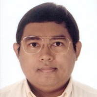 Zeyar Aung合作论文数Department of Electrical Engineering and Computer Science, Khalifa University9
 Antonio Plaza合作论文数Hyperspectral Computing Laboratory, Department of Technology of Computers and Communications, Escuela Politécnica de Cáceres, University of Extremadura;School of Artificial Intelligence, Xidian University8
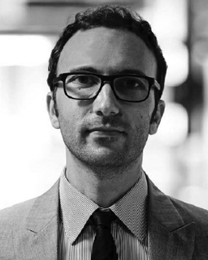 Michele Lazzarini合作论文数8
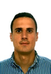 Mauro Dalla Mura合作论文数Tokyo Institute of Technology8
 Rasha Alshehhi合作论文数New York Univ Abu Dhabi7
 Abdul-Halim Jallad合作论文数7
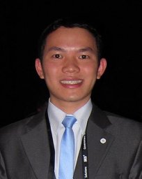 thu vu trong合作论文数Khalifa Univ Sci & Technol6
 Mattia Pedergnana合作论文数6
 Yehia Eissa合作论文数6
 Alex Tsoupos合作论文数5
 Haïfa Ben-Romdhane合作论文数5
 Chiesa Matteo合作论文数Lab Energy & Nanosci, Masdar Inst Sci & Technol5
 Lorenzo Bruzzone合作论文数Remote Sensing Laboratory, Department of Information Engineering and Computer Science, University of Trento5
 Arief Wijaya合作论文数Sensing Group, Remote;Institute for Geology;Remote Sensing Group|Institute for Geology5Hamzeh Issa合作论文数Yahsat Space Lab, Khalifa Univ4
 Lindita Bande合作论文数Department of Architectural Engineering, United Arab Emirates University4
 Philip Koshy Panicker合作论文数Sustainably U Podcast4
 Laura Manenti合作论文数New York University Abu Dhabi/UCL4
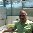 Afshin Afshari合作论文数Masdar Institute of Science and Technology4
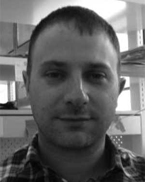 Christian Charron合作论文数4
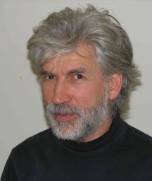 Peter Armstrong合作论文数Altas Corporation4F. Arneodo合作论文数Laboratori Nazionali del Gran Sasso, INFN4
 N.S.R. KRISHNAYYA合作论文数3
 Mohammad H. Alobaidi合作论文数3
 Amina Albalooshi合作论文数3Mukesh Jha合作论文数3Lolowa Alkindi合作论文数3Abdulla Al Marar合作论文数3A. Di Giovanni合作论文数3
 Abdulla Almesmari合作论文数Dept Mech Engn, Abu Dhabi, U Arab Emirates3V. Conicella合作论文数3Fatima Al Aydaroos合作论文数3
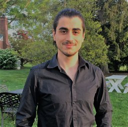 Saverio Perri合作论文数Khalifa Univ Sci & Technol, Masdar Inst, Abu Dhabi, U Arab Emirates3
 Sohmyung Ha合作论文数Department of Biomedical Engineering, Tandon School of Engineering, New York University3
 Gamba Paolo合作论文数University of Pavia3
 Jun Li (李军)合作论文数China University of Geosciences (Wuhan)3
 Nicola Falco合作论文数3
 José Bioucas-Dias合作论文数Instituto de Telecomunicações, Instituto Superior Técnico, Universidade de Lisboa;Department of Electrical and Computer Engineering, Instituto Superior Técnico, Universidade de Lisboa3
 Sergio Bernabe合作论文数3
 Fateh Chebana合作论文数L.;Université Paris;Université Paris3
 Firas S. Jarrar合作论文数3
 Basha Ghouse合作论文数National Atmospheric Research Laboratory (NARL), Gadanki, India3




