Hyperspectral video data provide complementary contextual cues across spectral, spatial, and temporal dimensions for modeling object dynamics under challenging conditions. Many existing hyperspectral video object tracking (HVOT) approaches organize spatial-spectral and temporal modeling in successive stages, leaving room for closer interaction among video-level contextual cues. To address this, we propose HucrTrack, a unified contextual reasoning framework for HVOT trained by parameter-efficient fine-tuning (PEFT). HucrTrack forms synchronized hyperspectral and false-color representations from each hyperspectral cube and enhances spatial-spectral features through a weight-shared dual-representation backbone with unified contextual cue modeling. To effectively leverage contextual dynamics, we design a unified contextual reasoning module (UCRM) composed of three key components: memory dynamics unit (MDU), contextual injection unit (CIU), and selective retrieval unit (SRU). Specifically, MDU maintains a frame-wise dynamic memory via Mamba's hidden states; CIU hierarchically integrates this memory into the spectral-spatial backbone features; and SRU selectively retrieves relevant contextual information to reinforce the tracking representation. In contrast to representative stepwise designs, HucrTrack enables concurrent, unified reasoning over all three dimensions within one recurrent process. Extensive experiments on ten benchmarks demonstrate that HucrTrack compares favorably with existing trackers in both robustness and generalization.
Precise quantification of gross primary productivity (GPP) at fine resolution is crucial for regional carbon cycle analysis. However, existing GPP products frequently fail to capture fine-scale variability due to an inherent trade-off between satellite spatiotemporal resolution and the coarse-scale design of most existing GPP models. To address this issue, a machine learning-based downscaling and correction framework was designed to generate high-accuracy monthly GPP at 30-m resolution (DS-FC-GPP) through fusing multiple remote sensing model-based products along with eddy covariance (EC) data. Moderate resolution imaging spectroradiometer (MODIS) and global land surface satellite (GLASS) GPP products were simultaneously downscaled from 500 m to 30 m resolution using a fine-resolution vegetation index time series. Subsequently, a unified fusion and correction framework was established based on EC data. The analysis revealed that DS-FC-GPP exhibited enhanced spatial patterns with finer details and maintained consistency with the original products when aggregated back to coarse resolution. In the spatial validation, the leave-one-site-out validation achieved a coefficient of determination (R-2) of 0.828 with a mean absolute error (MAE) of 39.497 gC.m(-2)& centerdot;month(-1), while the leave-one-region-out scheme yielded a comparable performance with an R-2 of 0.812 and an MAE of 42.506 gC.m(-2)& centerdot;month(-1). The consistently strong performance across both validation strategies demonstrates the robustness of the proposed framework. Moreover, DS-FC-GPP better captured intra-annual peaks and valleys, maintaining stable accuracy throughout the year. The transfer experiment over China indicated that the DS-FC-GPP framework exhibits robust generalization and transferability. The present work highlights the potential of multisource data fusion and downscaling to promote fine-resolution GPP estimation, offering valuable insights into terrestrial carbon cycle processes.
Accurately estimating optically active water quality indicators (WQIs) from remote sensing reflectance ( Rrs ) in inland waters remains challenging due to their complex optical properties. The multispectral signals are influenced by overlapping absorption and scattering effects from multiple dissolved and suspended constituents, making it difficult to isolate individual WQI contributions. To this end, we propose a novel hierarchical machine learning framework for the simultaneous retrieval of chlorophyll-a (Chla), total suspended solid (TSS), and colored dissolved organic matter (CDOM) in inland waters. The core idea of the proposed method is a conditional probability-constrained multitask learning framework that models the joint distribution of WQIs. Specifically, the model employs a mixture density network (MDN) to learn the initial probability distributions of multiple WQIs and obtains the target output via a multitask learning module. The proposed model is trained and tested with Sentinel-2 images and the GLObal Reflectance community dataset for Imaging and optical sensing of Aquatic environments (GLORIA) dataset over the globe. Two mechanism-informed strategies were designed for robust global modeling: 1) optical water type (OWT) classification via R-rs curve clustering, and 2) missing value construction using the multiple imputation by chained equations (MICEs) algorithm based on the synergistic distribution of WQIs for different OWTs. The improved overall accuracies (i.e., RMSEChla=9.86 mg/m(3),RMSETSS=14.75g/m(3) , and RMSEaCDOM(440)=0.41m(-1 )) verify that the proposed multitask MDN (MT-MDN) model achieves reliable estimation results. This suggests that the accuracy has improved from 29.37% to 50.75% compared to representative machine learning methods [e.g., MDN, random forest (RF), extreme gradient boosting (XGBoost), and categorical boosting (CB)], and has seen an improvement of up to 56.51% compared to traditional semi-empirical methods.
Aboveground biomass (AGB), a key biophysical variable characterizing terrestrial carbon stocks and carboncycle processes, is of critical importance for refined carbon accounting, ecological assessment, and ecosystem monitoring. High resolution AGB estimation relying on a single remote-sensing data source often fails to simultaneously capture spectral responses and structural differences of vegetation, and is susceptible to saturation effects and variations in observation conditions, thereby limiting cross-region robustness and generalization. Moreover, for high resolution AGB estimation using multi-source remote-sensing data fusion, existing models still suffer from three prominent limitations: a lack of adaptive identification and reweighting of heterogeneous input channels, insufficient multi-scale feature interaction and detail reconstruction, and limited capability to explicitly model strong spatial heterogeneity with effective spatial focusing. To address these issues, we propose an improved multi-scale dual-attention network, termed MSDA-SwinUNet, built upon SwinUNet. Specifically, a multi-scale nested decoder is introduced to strengthen cross-scale semantic interaction and reconstruction, while a channel reweighting attention (CRA) module and a grouped spatial reweighting attention (GSRA) module are embedded in the encoder-coupling and decoder-reconstruction stages, respectively, to enable effective multisource feature selection and enhanced representation of spatial heterogeneity. Experimental results show that MSDA-SwinUNet achieves the best overall performance on the test set, with an R² of 0.63, an MAE of 35.58 Mg/ha, and an RMSE of 46.65 Mg/ha, indicating that it provides an effective deep-learning solution for high-resolution aboveground biomass estimation using multi-source data and supports biomass mapping and carbon-monitoring applications.
True Digital Orthophoto Maps (TDOMs) are essential products for digital twins and Geographic Information Systems (GIS). Traditionally, TDOM generation involves a complex photogrammetric pipeline, which may deteriorate due to various challenges, including inaccurate Digital Surface Model (DSM), unreliable occlusion detections, and visual artifacts in weakly textured regions and reflective surfaces, etc. To address these challenges, we introduce Tortho-Gaussian, a novel method inspired by 3D Gaussian Splatting (3DGS) that generates TDOMs through orthogonal splatting of optimized anisotropic Gaussian kernels. More specifically, we first simplify the orthophoto generation by orthogonally splatting the Gaussian kernels onto 2D image planes, formulating a geometrically elegant solution that eliminates the need for an explicit DSM and occlusion detection. Second, to produce TDOM of large-scale area, a divide-and-conquer strategy is adopted to optimize memory usage and time efficiency of both training and rendering for 3DGS. Lastly, we design a fully anisotropic Gaussian kernel that adapts to the varying characteristics of different regions, particularly improving the rendering quality of reflective surfaces and slender structures. Extensive experimental evaluations demonstrate that our method outperforms existing commercial software in several aspects, including the accuracy of building boundaries and visual quality in low-texture regions and on building facades. These results underscore the potential of our approach for large-scale urban scene reconstruction, offering a robust alternative for enhancing TDOM quality and scalability. Project Web: https://github.com/xwangSGG/Tortho_Gaussian.
Optical remote sensing imagery is indispensable for Earth observation, yet persistent cloud occlusion limits its downstream utility. Most cloud removal (CR) methods are optimized for low-level fidelity and can over-smooth textures and boundaries that are critical for analysis-ready data (ARD), leading to a mismatch between visually plausible restoration and semantic utility. To bridge this gap, we propose TDP-CR, a task-driven multimodal framework that jointly performs cloud removal and land-cover segmentation. Central to our approach is a Prompt-Guided Fusion (PGF) mechanism, which utilizes a learnable degradation prompt to encode cloud thickness and spatial uncertainty. By combining global channel context with local prompt-conditioned spatial bias, PGF adaptively integrates Synthetic Aperture Radar (SAR) information only where optical data is corrupted. We further introduce a parameter-efficient two-phase training strategy that decouples reconstruction and semantic representation learning. Experiments on the LuojiaSET-OSFCR dataset demonstrate the superiority of our framework: TDP-CR surpasses heavy state-of-the-art baselines by 0.18 dB in PSNR while using only 15% of the parameters, and achieves a 1.4% improvement in mIoU consistently against multi-task competitors, effectively delivering analysis-ready data.
Unmanned Aerial Vehicle (UAV) multispectral video object tracking is critical for real-world applications. While multispectral imaging offers complementary spectral cues beyond the visible range, tracking in aerial scenarios remains challenging due to data scarcity, suboptimal spectral-spatial modulation, and discrete sequential temporal modeling. To this end, we propose CASS, a context-aware memory framework with spectral-spatial modulation, which integrates spectral, spatial, and temporal cues for UAV multispectral tracking. CASS introduces two lightweight modules: (i) the efficient spectral-spatial modulation (ESSM) module, which modulates spatial representations through spectral-guided fusion, and (ii) the context state space reasoning (CSSR) module, which leverages evolving state space memory to retain long-term temporal cues and mitigate error propagation during cross-frame reasoning. By integrating these components in a parameter-efficient fine-tuning fashion, CASS achieves both efficient modulation and context-aware tracking. Evaluations on UAV multispectral benchmark (MUST) and ground-based hyperspectral benchmarks (NIR, RedNIR, VIS, MSSOT, MSVT) demonstrate CASS’s superior performance for both general hyperspectral tracking and specific UAV perception.
Remote sensing images acquired by unmanned aerial vehicles (UAVs) and satellites are often degraded by adverse weather, illumination variation, and imaging artifacts, which may co-occur and jointly induce global distribution shifts and local structural corruption. Although All-in-One image restoration offers an appealing unified alternative to task-specific pipelines, existing methods still suffer from weak or implicit degradation cues and parameter redundancy caused by full-rank multi-expert designs with overlapping restoration behaviors. We propose CoRE-UIR (Common and Residual Experts for Universal Image Restoration), a prior-guided global–local framework centered on the Common-and-Residual Expert Block (CoRE). CoRE explicitly decomposes restoration capacity into a common dense expert for degradation-invariant restoration and low-rank residual experts for degradation-specific compensation, enabling adaptive specialization without redundant expert replication. Built on this design, Degradation Prior Embedding (DPE) adapts frozen CLIP features into an explicit restoration-oriented prior, while Global Feature Modulation (GFM) aligns global feature statistics before local residual compensation. We also construct MDVD-108K (Multi-Degradation VisDrone), a large-scale UAV restoration dataset covering both single and compound degradations, together with a real-world test set. Extensive experiments on multiple datasets show that CoRE-UIR improves the overall average PSNR by 1.05 dB while running 11.83× faster and reducing peak memory by 85.3% relative to the strongest baseline, BaryIR, thereby maintaining a favorable quality-efficiency trade-off.Evaluations on downstream tasks and unseen degradation also validate the generalizability of CoRE-UIR. The code and dataset will be released at https://github.com/zzaiyan/CoRE-UIR.
Real-time seabed sediment classification (SSC) is crucial for underwater navigation, operations, and habitat assessment. Conventional methods relying on post-mission multibeam-echosounder (MBES) data processing impede in situ decision-making. We propose a novel, real-time SSC method deployable on both shipborne and Autonomous Underwater Vehicle (AUV) platforms, integrating three core components. Primarily, an efficient preprocessing pipeline comprising georeferencing, radiometric normalization, noise suppression, and incidence-angle correction enables rapid conversion of raw MBES backscatter into geometry-consistent tiles, supporting real-time operation with sub-second responsiveness. Afterwards, the system extracts multi-modal descriptors by combining entropy-regularised angular-response fitting for acoustic backscatter, object-level texture analysis using adaptive graph segmentation, and curvature-aware terrain metrics derived from quadratic surface fitting under entropy constraints by considering the physical responses and spatial distribution of MBES images and point clouds. Finally, a Dynamic Optimal Random Forest with Entropy-Adaptive Subnetwork Selection (DORF-EASNet) dynamically selects between a global classifier and lightweight domain-specific sub-models to match local acoustic complexity, achieving a balance between inference efficiency and physical interpretability. Field experiments conducted in Jiaozhou Bay and the South China Sea demonstrate the proposed framework’s robustness across platforms and sensing configurations, achieving macro-F1 scores of 0.881 and 0.913, respectively, while maintaining real-time processing capability exceeding that of conventional offline methods.
Multi-source remote sensing data can highlight different types of information based on user needs, resulting in large volumes of data and significant challenges. Hardware and environmental constraints create mutual dependencies between information types, particularly between spatial data and other types, limiting the development of high-precision applications. Traditional methods are task-specific, leading to many algorithms without a unified solution, which greatly increases the computational and deployment costs of image fusion. In this paper, we summarize four remote sensing fusion tasks, including pan-sharpening, hyperspectral-multispectral fusion, spatio-temporal fusion, and polarimetric SAR fusion. By defining the spectral, temporal, and polarimetric information, as X, we propose the concept of generalized spatial-channel fusion, referred to as Spatial-X fusion. Then, we design an end-to-end network SpaXFus, a generalized spatial-channel fusion framework through a model-driven unfolding approach that exploits spatial-X intrinsic interactions to capture internal dependencies and self-interactions. Comprehensive experimental results demonstrate the superiority of SpaXFus, e.g., SpaXFus can achieve four remote sensing image fusion tasks with superior performance (across all fusion tasks, spectral distortion decreases by 25.48 %, while spatial details improve by 7.5 %) and shows huge improvements across multiple types of downstream applications, including vegetation index generation, fine-grained image classification, change detection, and SAR vegetation extraction.
As a crucial part of the Intelligent Transportation Systems (ITS), traffic sign detection is of vital significance for the construction of high-precision maps, the automation of traffic rule monitoring and the development of auxiliary autonomous driving technologies. However, it faces two critical challenges: 1) limited pixel information for long-distance traffic signs. 2) insufficient deep feature representation in general detectors. To this end, this paper proposes SR-YOLOv8s, an end-to-end framework that incorporates super-resolution (SR) reconstruction and traffic sign detection within a unified multi-task learning paradigm. Specifically, an auxiliary SR branch is introduced alongside the detection head to collaboratively guide the shared backbone in extracting high-resolution and high-quality features, complemented by optimized backbone depth to preserve informative representations. The integration of multi-level features followed by SR-based supervision enables the recovery of fine-grained spatial details, thereby improving the detector’s sensitivity to small targets in complex road scenarios. Moreover, the SR branch is designed to be discarded during inference, incurring no additional computational cost. Comprehensive experiments on CCTSDB, DFG, and TT100k demonstrate that SR-YOLOv8s achieves significant improvements of 11.57, 11.75, and 13.18 in mAP50:95 over the baseline YOLOv8s, with only negligible increases in parameters and inference time, offering a highly cost-effective improvement in accuracy and generalization. The code and results will be accessible at https://github.com/zhaowenlv5-cmyk/SR-YOLOv8
Vehicle emissions are an important source of urban air pollution. As the world’s largest market for new energy vehicles (NEVs), China has rapidly expanded NEV adoption to support green development. However, the environmental and health benefits of this transition remain unclear. Here, using high-resolution satellite-retrieved data and interpretable machine learning techniques, this study quantified the impact of NEVs on atmospheric pollution, specifically particulate matter particles with an aerodynamic diameter of 2.5 μm or less (PM2.5), nitrogen dioxide, carbon monoxide and particles with an aerodynamic diameter of 10 μm or less, and evaluates the corresponding health benefits. By 2023, NEVs led to reductions of 23.80% in particles with a diameter of 2.5 μm or less (8.97 µg m−3) and 30.67% in carbon monoxide (0.26 mg m−3), resulting in the prevention of approximately 262,000 non-accidental deaths and 75,000 all-cause deaths, respectively. Benefits were concentrated in economically developed cities, and reductions in coarse particles and nitrogen dioxide (1.81 µg m−3) were low. These findings highlight pollutant-specific disparities and socio-economic inequalities in NEV-related benefits, suggesting a need to accelerate heavy-duty diesel vehicle electrification and enhance NEV deployment in less-developed regions. Using satellite data and interpretable machine learning, the widespread adoption of new energy vehicles was shown to reduce particulate matter particles with a diameter of 2.5 μm or less and carbon monoxide in Chinese cities, preventing 262,000 non-accidental deaths and 75,000 all-cause deaths.
Methods based on deep learning have achieved remarkable success in hyperspectral image change detection (HSI-CD). However, the high dependence on massive labeled data and the computational complexity of state-of-the-art models pose significant challenges, particularly in scenarios with extreme label scarcity. To address these issues, a Multi-Scale Self-Distillation Change Detection (MSDistillCD) framework is proposed. In the proposed framework, two core modules are designed to extract robust features and enforce consistency under limited supervision. First, a Multi-Scale Feature Extraction Module (MSFEM) constructs sub-patches aligned at the center from a fixed maximum patch and generates inputs with explicit difference information. A shared CNN backbone with dual global aggregation is then employed to capture embeddings that remain robust across scales. Subsequently, a Self-Distillation Classification Module (SDCM) is utilized to facilitate knowledge transfer within the network. Unlike conventional distillation settings, the smallest-scale branch is treated as the primary branch and guides the larger-scale auxiliary branches through temperature-scaled self-distillation, providing additional regularization during training while allowing efficient inference with a single branch. Experimental results on benchmark HSI datasets demonstrate that MSDistillCD achieves the best OA, κ × 100, and F1 across all three datasets, while maintaining robust performance even with extremely limited training samples (e.g., 0.1%). The source code of the proposed MSDistillCD will be released at https://github.com/zhangyuan1698-sketch/MSDistillCD.
Atmospheric methane column concentration (XCH$_{4}$) quantification plays a critical role in global methane monitoring, but existing satellite retrievals face limitations in spatial coverage and computational efficiency. This study innovatively proposes a two-stage physical constrained machine learning model (PCML) that integrates multi-source observational data. By incorporating physical knowledge constraints and spatiotemporal geocoding techniques, the model achieves high-precision global XCH$_{4}$ retrieval. Validation results demonstrate that our XCH$_{4}$ retrieval exhibits strong consistency with ground-based TCCON methane observations, yielding a coefficient of determination of approximately 0.68, a root mean square error of 19.85 ppb, and a mean absolute error of about 15.36 ppb. Intercomparison with existing products demonstrates the superiority of the proposed retrieval framework in capturing spatiotemporal methane distributions. Our PCML XCH$_{4}$ performs well in seasonal assessments and uncertainty analyses based on different regions as well as different land cover types, providing accurate seasonal variations in CH$_{4}$. Overall, the proposed framework achieves reliable global XCH$_{4}$ retrievals, highlighting the great potential of combining physical knowledge with data-driven models for further global carbon budget and accounting studies.
Remote sensing imagery is essential for global environmental monitoring, but frequent cloud cover severely limits the utility of optical images. Fusing cloud-prone optical images with cloud-penetrating Synthetic Aperture Radar (SAR) data offers a path to all-weather Earth observation. However, this task faces a dual challenge: the escalating computational cost of state-of-the-art methods and the inherent ill-posedness of the reconstruction under information loss, which complicates the learning process. To tackle this, we propose ECRformer (Efficient Cloud Removal Transformer). ECRformer pairs an efficient architecture with a principled learning paradigm to address both challenges through: (1) a suite of efficient attention mechanisms, including Cross-Covariance Attention (XCA) for computationally-aware multimodal feature fusion and Multi-Dilation Window Attention (MDWA) for capturing multi-scale spatial context with linear complexity; and (2) the Semantic-Decoupled Feature Learning (SDFL) paradigm, a novel training strategy that decomposes the ill-posed reconstruction task into two well-defined sub-problems: structure recovery and texture rendering. By applying asymmetric supervision (structural loss on the encoder, texture loss on the decoder), SDFL provides a more principled learning process. These improvements enhance reconstruction quality, training stability, and reliability, culminating in new state-of-the-art (SOTA) performance on both the SEN12MS-CR and LuojiaSET-OSFCR large-scale optical-SAR cloud removal datasets. Notably, ECRformer surpasses previous SOTA methods by 1.23/0.90 dB in PSNR, while requiring only 28.9% of the parameters and 24.5% of the FLOPs, providing a powerful, efficient, and reliable solution for multimodal cloud removal. The code is available at https://github.com/zzaiyan/ECRformer.
Long-term observations of lake water clarity are essential for understanding global freshwater dynamics, yet consistent global assessments remain limited. We developed an XGBoost-based model using Landsat 7 top-of-atmosphere reflectance to map outlet-associated Secchi disk depth (SDD) for 16,676 inland lakes (>10 km2) worldwide from 2000 to 2022. The model achieved robust performance (R2 = 0.70), demonstrating reliable generalization across diverse lake environments. Globally, transparency at hydrologically representative outlet locations was dominated by low values (SDD < 2 m), with only 5.38% of lakes exhibiting high transparency (SDD > 4 m). Clear spatial gradients were observed, with North America exhibiting the highest clarity (2.21 ± 1.25 m), followed by Europe (1.61 ± 1.07 m), whereas Africa and Oceania showed lower values (∼0.95 m). A pronounced latitudinal pattern was identified, with higher clarity at mid-to high latitudes. Additionally, larger lakes (>500 km2) generally exhibited higher clarity. Despite pronounced spatial heterogeneity, transparency at hydrologically representative outlet locations remained relatively stable over the 23-year period, with 9.16% of lakes showing significant increases and 6.35% declines. Notably, regional variability was observed, with sustained increases in outlet-associated SDD across the Qinghai–Tibet Plateau and the Yangtze Plain, contrasted by declines in European Russia. Short-term fluctuations were linked to episodic disturbances, including wildfires and volcanic activity along eastern Australia. This study provides a globally consistent, long-term dataset of outlet-associated SDD, offering new insights into spatiotemporal dynamics and highlighting the importance of multi-scale processes for water resource management under SDG 6.3.
Remote sensing (RS) plays a critical role in Earth observation (EO), providing indispensable data for a broad range of downstream applications. Propelled by advances in sensor technology and machine learning, RS field is evolving from task-specific analyses to more generalized modeling frameworks. This article examines the emergence of large RS models (LRSMs), tracing their progress from conventional deep learning (DL) approaches to sophisticated multimodal foundation models with the potential for Earth-scale intelligence (ESI). We outline four pivotal developments shaping this trajectory: 1) from DL to large models: transitioning from specialized DL methods to general-purpose pretrained frameworks, with emphasis on innovative paradigms such as self-supervised contrastive learning (CL) and masked image modeling (MIM) to establish powerful, versatile representations; 2) from vision to multimodality, by combining RS imagery with natural language, LRSMs have expanded from visual analysis to support interactive, user-driven interpretation; 3) from data-driven to physics-informed, incorporating physical mechanisms and principles into LRSMs has led to improved robustness, interpretability, and physically consistent outcomes, significantly enhancing their performance in tasks such as Earth system parameter inversion and spatiotemporal forecasting; and 4) from closed-set to open-world evaluation, evaluation methodologies have evolved from traditional closed-set datasets toward comprehensive, hierarchical, and open-world benchmarks. This shift ensures that assessments reflect real-world complexities more accurately, promoting the development of LRSMs with greater scalability and adaptability. By systematically reviewing these developments and identifying the ongoing challenges and research frontiers, this article aims to guide future innovations, accelerating the practical deployment and societal impact of LRSMs.
Abstract China has become a global hotspot of ozone (O 3 ) pollution, and understanding O 3 formation regime is crucial for air quality management. Satellite‐observed formaldehyde‐to‐nitrogen‐dioxide ratio (HCHO/NO 2 , FNR) has long been demonstrated as an efficient way to infer O 3 formation regime. However, reported FNR thresholds that divide O 3 formation regimes into VOC‐limited, transitional, and NO x ‐limited regimes uncover considerable differences. Using data from the world's first geostationary air quality monitoring instrument Geostationary Environment Monitoring Spectrometer, we report the spatiotemporal variations, particularly diurnal features, of O 3 ‐FNR relationships and O 3 formation regimes in China. We find that O 3 ‐FNR relationships fluctuate significantly over time and across locations, with coefficients of variation (CVs) of 0.22 and 0.27, respectively. We identified the amount of HCHO as a key factor. Given the strong correlation between NO 2 and LRO x /LNO x (chemical loss of HO 2 +RO 2 (LRO x ) to chemical loss of NO x (LNO x )), we demonstrate that O 3 formation regime thresholds alter minimally when column NO 2 is used as the indicator in China, with the CVs reduced to around 0.1. This finding highlights its potential to provide a more reliable diagnosis for large‐scale, space‐based O 3 formation sensitivity, offering promising insights for advancing O 3 pollution management in China.
 Liangpei Zhang (张良培)合作论文数State Key Laboratory of Information Engineering in Surveying, Mapping and Remote Sensing, Wuhan University162
 Huanfeng Shen (沈焕锋)合作论文数SENsed Data Intelligent-analytics, Merging and Applications in GEoscience, Wuhan University;School of Resource and Environmental Sciences, Wuhan University136
 Jie Li (李杰)合作论文数School of Geodesy and Geomatics, Wuhan University88
 Tongwen Li (李同文)合作论文数School of Geospatial Engineering and Science, Sun Yat-sen University50
 Linwei Yue (岳林蔚)合作论文数School of Geography and Information Engineering, China University of Geosciences36
 Jiang He合作论文数34Qianqian Yang (杨倩倩)合作论文数北京邮电大学28
 Qiang Zhang合作论文数17
 Liupeng Lin合作论文数School of Resource and Environmental Sciences, Wuhan University16
 Yuan Wang (王元)合作论文数School of Atmospheric Sciences, Nanjing University16
 Xinxin Liu (刘欣鑫)合作论文数College of Electrical and Information Engineering, Hunan University13
 Huifang Li (李慧芳)合作论文数School of Resource and Environmental Sciences, Wuhan University13
 Yuqi Tang (汤玉奇)合作论文数School of Geosciences and Info-physics, Central South University12
 Yuzeng Chen (陈豫增)合作论文数School of Materials Science and Engineering, Northwestern Polytechnical University10
 Liye Zhu (朱丽叶)合作论文数School of Atmospheric Sciences, Sun Yat-sen University9
 Menghui Jiang合作论文数Wuhan Univ, Sch Resource & Environm Sci, Wuhan 430079, Peoples R China8
 Li Zheng (郑莉)合作论文数School of Geodesy and Geomatics, Wuhan University8
 Xianyu Jin合作论文数7
 Denghong Liu合作论文数7
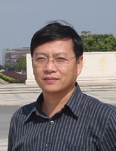 Yi Xiao (肖奕)合作论文数School of Physics, Huazhong University of Science and Technology;Biomolecular Physics and Modeling Group, Department of Physics, Huazhong University of Science and Technology7
 Kui Jiang (江奎)合作论文数School of Computer Science and Technology, Harbin Institute of Technology7Siqin Zhou合作论文数6
 Shuheng Zhao合作论文数6Fujun Sun合作论文数6
 Hongzhang Xu合作论文数6Jianhao Gao合作论文数Wuhan University6Shuwen Li合作论文数6
 Xiangchao Meng (孟祥超)合作论文数6
 Li Yan (闫利)合作论文数School of Geodesy and Geomatics, Wuhan University6
 Meng Gao (高蒙)合作论文数Department of Geography, Faculty of Social Sciences, Hong Kong Baptist University6
 Xin Su (苏新)合作论文数College of Information Science and Engineering, Hohai University6Caiyi Jin合作论文数5
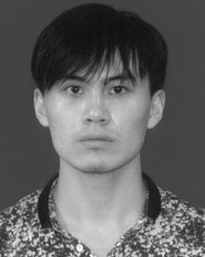 Yancong Wei合作论文数State Key Lab Informat Engn Surveying Mapping & R, Wuhan Univ5
 Jiajun Xiao合作论文数Wuhan Univ, Sch Geodesy & Geomat, Wuhan 430079, Peoples R China5Jiwen Wang合作论文数5
 张强合作论文数School of Materials Science and Engineering, Wuhan University of Technology5
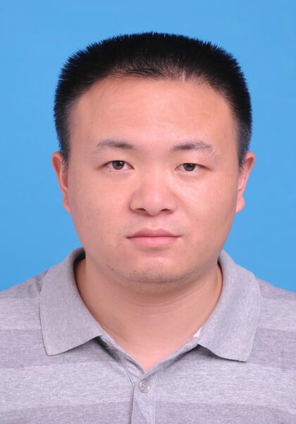 Xinghua Li (李星华)合作论文数School of Remote Sensing Information Engineering, Wuhan University5
 Jing Sun (孙晶)合作论文数School of Resource and Environmental Sciences, Wuhan University5
 Chia-Wen Lin (林嘉文)合作论文数Department of Electrical Engineering, National Tsing Hua University5
 Chao Zeng (曾超)合作论文数School of Resource and Environmental Sciences, Wuhan University5
 Hongyan Zhang (张洪艳)合作论文数School of Computer Science, China University of Geosciences (Wuhan);State Key Laboratory of Information Engineering in Surveying, Mapping and Remote Sensing, Wuhan University5Tingting Liu合作论文数5Zhenghao Li合作论文数4Siyu Tan合作论文数4xia lan合作论文数4




