The presence of subglacial sediments is important in enabling streaming ice flow and may be a critical controlling factor in determining the onset regions of ice streams. Improving our knowledge of the location of sedimentary basins underlying large ice sheets will improve our understanding of how the substrate influences the ice streams. Advancing our understanding of the interaction between subglacial sediments and ice flow is critical for predictions of ice sheet behavior and the consequences on future climate change. To date, no comprehensive distribution of onshore and offshore sedimentary basins over Antarctica has been developed. The goal of this project is to use a combination of large-scale datasets to characterize known basins and identify new sedimentary basins to produce a continent-wide mapping of sedimentary basins and provide improved basal parametrizations conditions that have the potential to support more realistic ice sheet models. The proposed work is divided into three main steps. In the first step, the Random Forest (RF), a supervised machine learning algorithm, is used to identify sedimentary basins in Antarctica. In the second step, a regression analyses between aerogravity data and topography is done to evaluate the gravity signal related to superficial heterogeneities (i.e. sediments) and compare the results to the depth of magnetic sources using the Werner deconvolution method. Last, the correlation between sedimentary basins and ice streams is investigated. Here, we will present the preliminary results from Step 1. The Random Forest uses ensemble learning method for classification and regression. The classification rules for this present work are based on the geophysical parameters of major known sedimentary basins. First we classify the known basins with all available geophysical compilations including topography, gravity and magnetic anomalies, sedimentary thickness, crustal thickness, geothermal heat flux, information on the geology, rocky type and bedrock geochemistry, and then use the Random Forest machine learning algorithm to classify the geology underneath the ice into consolidated rock and sediments based on these parameters.
Sickle cell disease is a multisystem disease characterised by chronic haemolytic anaemia, painful vaso-occlusive crises and acute and chronic end-organ damage. It is one of the most common serious inherited single gene conditions worldwide and has a major impact on the health of affected individuals. Peri-operative complications are higher in patients with sickle cell disease compared with the general population and may be sickle or non-sickle-related. Complications may be reduced by meticulous peri-operative care and transfusion, but unnecessary transfusion should be avoided, particularly to reduce the risk of allo-immunisation. Planned surgery and anaesthesia for patients with sickle cell disease should ideally be undertaken in centres with experience in caring for these patients. In an emergency, advice should be sought from specialists with experience in sickle cell disease through the haemoglobinopathy network arrangements. Emerging data suggest that patients with sickle cell disease are at increased risk of COVID-19 infection but may have a relatively mild clinical course. Outcomes are determined by pre-existing comorbidities, as for the general population.
In a warming world, increased meltwater will form on Antarctica’s ice shelves. The fate of this meltwater will be critical to future ice-shelf and ice-sheet stability. Two main observations define the current theoretical framework for understanding the influence of surface hydrology on ice-shelf stability. The first is the collapse West Antarctica’s Larsen B Ice Shelf that was triggered by the formation of thousands of surface ponds atop the ice shelf. The second is the observation of a waterfall on the Nansen Ice Shelf, in East Antarctica, that is hypothesized to protect the ice shelf from hydrofracture by removing meltwater from the ice-shelf surface. We present a third process that couples ice-shelf hydrology to atmospheric and ocean forcing: the development of an ice-shelf estuary on the Petermann Ice Shelf in northwest Greenland. High-resolution imagery and digital elevation models (DEMs) shows that channelized surface meltwater on the Petermann Ice Shelf in northwest Greenland incises into underlying ice to form an estuary that propagates fractures along the ice shelf. The estuary at the front of the Petermann Ice Shelf is indicated by the convergence of sea ice at the river mouth, the upstream transport of sea ice in the channel as far as 460 m from the calving front, and the persistence of water in the channel following the end of seasonal surface melt. Between 2013 and 2018, the estuarine reach of the river tripled in width and a 1.5 km longitudinal crack propagated along the bottom of the channel. The Petermann Ice Shelf Estuary forms on top of a basal channel, where basal melting has led to ice-shelf thinning, and the creation of the linear surface depression in which the estuary forms. The Petermann Estuary may be the first of several ice-shelf estuaries to develop in a warming climate. Widespread surface melting on ice shelves in Greenland and Antarctica increases the urgency to determine the influence of surface hydrology on ice-shelf stability. We hypothesize that surface rivers may initially buffer ice shelves from collapse by terminating in waterfalls and preventing the formation of damaging lakes. However, with increased meltwater transport across ice shelves, channels can incise to sea level and establish estuaries. Once an estuary is established, estuarine weakening can lead to fracture propagation and enhanced calving, destabilizing ice-shelves, and increased ice-sheet mass loss.
Ocean melting has thinned Antarctica’s ice shelves at an increasing rate over the past two decades, leading to loss of grounded ice. The Ross Ice Shelf is currently close to steady state but geological records indicate that it can disintegrate rapidly, which would accelerate grounded ice loss from catchments equivalent to 11.6 m of global sea level rise. Here, we use data from the ROSETTA-Ice airborne survey and ocean simulations to identify the principal threats to Ross Ice Shelf stability. We locate the tectonic boundary between East and West Antarctica from magnetic anomalies and use gravity data to generate a new high-resolution map of sub-ice-shelf bathymetry. The tectonic imprint on the bathymetry constrains sub-ice-shelf ocean circulation, protecting the ice shelf grounding line from moderate changes in global ocean heat content. In contrast, local, seasonal production of warm upper-ocean water near the ice front drives rapid ice shelf melting east of Ross Island, where thinning would lead to faster grounded ice loss from both the East and West Antarctic ice sheets. We confirm high modelled melt rates in this region using ROSETTA-Ice radar data. Our findings highlight the significance of both the tectonic framework and local ocean–atmosphere exchange processes near the ice front in determining the future of the Antarctic Ice Sheet.
The AGU Ethics and Equity Center is a new hub for resources and tools to support all members of the Earth and space science community and encourage workplace excellence.
The basal thermal regime of ice sheets exerts a strong control on ice‐sheet stability and the onset of rapidly streaming flow. However, the nature of this thermal transition where sliding initiates is largely unconstrained by geophysical observations. In the Greenland Ice Sheet, topographic troughs or elevated geothermal heat fluxes typically define the onset of outlet glaciers. In contrast, Petermann Glacier in Northern Greenland does not have any distinct bed troughs or localized geothermal heating associated with its onset, making it an ideal site to investigate the basal thermal state and examine its role in the onset of Petermann Glacier. Here we use radar bed reflectivity and an ice‐sheet thermomechanical model to examine the basal thermal regime beneath Petermann Glacier. Our results reveal a complex thermal transition near the onset of Petermann Glacier. As the bed shifts from largely frozen to largely thawed with increasing distances from the ice divide, our results show that this thermal transition happens through alternating bands of frozen and thawed bands. The complex thermal state across the onset region suggests that lateral meltwater injection and local meltwater production determine the location of Petermann Glacier. Given the lack of topographic pinning at the onset location, the upstream margin of Petermann is vulnerable to migrate depending on a combination of advective cooling and meltwater supply from the interior of the ice sheet.
Constraining how much and how fast the West Antarctic Ice Sheet (WAIS) will change in the coming decades has recently been identified as the highest priority in Antarctic research (National Academies, 2015). Here we review recent research on WAIS and outline further scientific objectives for the area now identified as the most likely to undergo near-term significant change: Thwaites Glacier and the adjacent Amundsen Sea. Multiple lines of evidence point to an ongoing rapid loss of ice in this region in response to changing atmospheric and oceanic conditions. Models of the ice sheet's dynamic behavior indicate a potential for greatly accelerated ice loss as ocean-driven melting at the Thwaites Glacier grounding zone and nearby areas leads to thinning, faster flow, and retreat. A complete retreat of the Thwaites Glacier basin would raise global sea level by more than three meters by entraining ice from adjacent catchments. This scenario could occur over the next few centuries, and faster ice loss could occur through processes omitted from most ice flow models such as hydrofracture and ice cliff failure, which have been observed in recent rapid ice retreats elsewhere. Increased basal melt at the grounding zone and increased potential for hydrofracture due to enhanced surface melt could initiate a more rapid collapse of Thwaites Glacier within the next few decades.
 Michael Studinger合作论文数Lamont-Doherty Earth Observatory;Columbia University;Lamont-Doherty Earth Observatory, Columbia University43
 Kirsty J. Tinto合作论文数Lamont-Doherty Earth Observatory, Earth Institute at Columbia University26
 Fausto Ferraccioli合作论文数British Antarctic Survey22
 James R. Cochran合作论文数Lamont-Doherty Earth Observatory, Columbia Climate School, Columbia University15
 Timothy T. Creyts合作论文数Lamont Doherty Earth Observ, Columbia Univ14
 Stephanie Pfirman合作论文数School of Ocean Futures, Arizona State University;Global Institute of Sustainability and Innovation, Arizona State University;Department of Environmental Science, Barnard College, Columbia University13
 David F. Porter合作论文数12
 Donald D. Blankenship合作论文数Institute for Geophysics, Jackson School of Geosciences, University of Texas11Detlef Damaske合作论文数11
 N. Frearson合作论文数10Wolovick Michael合作论文数10
 Tom Jordan合作论文数British Antarctic Survey, Natural Environment Research Council10
 Suzanne M. Carbotte合作论文数Lamont-Doherty Earth Observatory, Columbia University;Columbia Climate School, Columbia University10
 Carol A Finn合作论文数9a boghosian合作论文数Lamont Doherty Earth Observ, Columbia Univ9
 Helen Amanda Fricker合作论文数Scripps Institution of Oceanography, University of California, San Diego;Institute of Geophysics and Planetary Physics, University of California, San Diego9
 Das Indrani合作论文数9
 David Braaten合作论文数Center for Remote Sensing of Ice Sheets, University of Kansas Lawrence9
 Anahita Tikku合作论文数Laboratory for Satellite Altimetry, National Oceanic and Atmospheric Administration9
 Frank O. Nitsche合作论文数Lamont-Doherty Earth Observatory, Columbia University8
 William B. F. Ryan合作论文数Lamont-Doherty Earth Observatory, Columbia Climate School, Columbia University in the City of New York8Hugh Corr合作论文数British Antarctic Survey8s elieff合作论文数7
 Margie Turrin合作论文数7
 Stuart Henrys合作论文数GNS Science7Kathryn C. Rose合作论文数6A. E. Block合作论文数5theresa anne jordan合作论文数5
 Siegfried Matthew合作论文数Inst Geophys & Planetary Phys, Univ Calif San Diego5Scott R. Springer合作论文数College of Oceanic and Atmospheric Sciences, Oregon State University5
 Beata Csatho合作论文数Byrd Polar Research Center;Ohio State University;Byrd Polar Research Center, Ohio State University5
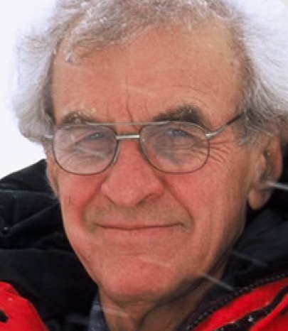 John Behrendt合作论文数Institute of Arctic and Alpine Research, University of Colorado Boulder;U.S. Geological Survey5
 Cecilia M. McHugh合作论文数Queens College;Lamont-Doherty Earth Observatory5
 Patricia J. Culligan合作论文数College of Engineering, University of Notre Dame;Columbia University5
 Christine S Siddoway合作论文数Department of Geology, Colorado College5
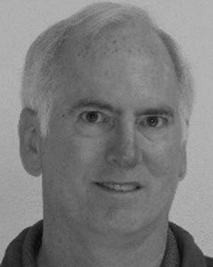 Laurie Padman合作论文数5C. Bertinato合作论文数4eduard sarukhanian合作论文数4arthur block合作论文数4david h barker合作论文数4
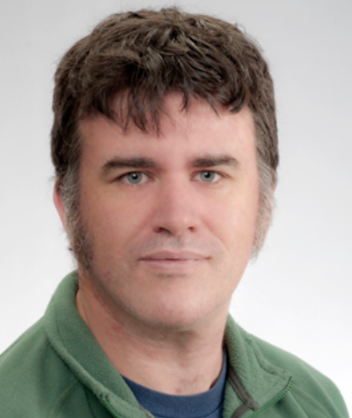 Duncan A. Young合作论文数Institute for Geophysics, Jackson School of Geosciences, University of Texas at Austin4
 David Vaughan合作论文数British Antarctic Survey4
 Jennifer D. Laird合作论文数4
 Igor Krupnik合作论文数Department of Anthropology, Smithsonian Institution4
 Ian Allison合作论文数Institute for Marine and Antarctic Studies, University of Tasmania4
 Abdulhakim M. Abdi合作论文数4Roger D. Flood合作论文数Marine Sciences Research Center, State University of New York4
 Mark Fahnestock合作论文数Institute for the Study of Earth, Oceans and Space, University of New Hampshire4




