When large urban agglomerations are located in wildfire prone regions, adapting to the demographic changes while limiting wildfire vulnerability of communities is a challenge for urban planners and policy-makers [...]
Background: A 140 page illustrated document developed to support a state-wide effort in mitigating catastrophic impacts from bushfires, and to provide additional assistance in developing resilient communities throughout Queensland. The publication describes methods of defining the bushfire related risks that houses are exposed to and outlines the architectural and landscape design feature to mitigate against those risks. Significance: The report was commissioned by the State Government of Queensland and the principle content was provided by the CSIRO Land & Water Division. The document is unique in an international context because it 1. It defines and clarifies key terminology which was hitherto ambiguous and misunderstood, 2. sets out a novel means of defining bushfire risk in the housing context, which is unique in that landscape and site related vulnerabilities are defined for the first time, and 3.it then provides - by way of explicit illustrations and case study documentation - an extremently comprehesive guidance on how to mitigate against those risks. Impact: The document has been widely disseminated to peak governing bodies, emergency authorities, industry organisations and the general public. It will become the template for future publications in the other states and territories in Australia.
Presentacions del Workshop celebrat com una part del 11th Asia-Oceania Symposium on Fire Science and Technology (AOSFST) a Taipei, Taiwan.
Presentacions del Workshop celebrat com una part del 11th Asia-Oceania Symposium on Fire Science and Technology (AOSFST) a Taipei, Taiwan.
Presentacions del Workshop celebrat com una part del 11th Asia-Oceania Symposium on Fire Science and Technology (AOSFST) a Taipei, Taiwan.
Accurate predictions for radiant heat flux are necessary for determining exposure levels to personnel and infrastructure in the event of wildfires. However, detailed physics-based calculations of radiant heat flux are complex and current modelling practice involves significant simplifications in order to make these calculations tractable. We detail current practice for the calculation of radiant heat flux from wildfires and investigate modelling improvements that could benefit practical usage. Furthermore, we demonstrate that current limitations can be circumvented by more advanced physical models using newer generations of computational hardware. Such physical models could allow highly detailed and accurate calculations of radiant heat flux leading to improved risk assessments and planning in regions affected by wildfire.
Bushfires represent an increasing risk for people and properties in exposed urban areas. The integration of bushfire risk management considerations into urban planning is one of the approaches used to address this challenge. This paper summarises the key changes in urban planning and building regulations that were introduced in Victoria over time to minimise the effects of bushfire on settlements. These have generally occurred within four main eras, being the independent origins of planning and bushfire risk management, the progressive emergence of bushfire risk management into urban planning between the late 1970s and the early 1990s, the formalisation of bushfire risk management via urban planning with the Wildfire Management Overlay in 1997 and the 2011 reforms associated with the Bushfire Management Overlay and its following adjustments. Advancements in urban planning regulation have usually occurred after bushfire events that inflicted significant losses on communities. These changes represent an ongoing trend towards the integration of bushfire risk reduction measures into urban planning mechanisms.
Certain commercial entities, equipment, or materials may be identified in this document in order to describe an experimental procedure or concept adequately.Such identification is
T h is p u b lic a io n is a v a ila b le re e o f c h a rg e ro m : h tp s //d o .o rg /1 0 .6 0 2 8 /N IS T .S P .1 2 4 1 A workshop of the permanent working group, sponsored by the International Association for Fire Safety Science (IAFSS), entitled Large Outdoor Fires and the Built Environment (LOF&BE) was held from 2:00 pm to 4:00 pm on Sunday June 30, 2019. The workshop was held as a part of the 2019 Interflam Conference in Egham, United Kingdom. The working group is co-led by Sara McAllister of the U.S. Forest Service, Sayaka Suzuki of the National Research Institute of Fire and Disaster, and Samuel L. Manzello of NIST’s Engineering Laboratory. The IAFSS permanent working group consists of three subgroups, with subleaders appointed by Manzello, McAllister, and Suzuki, and these are prioritized into the following topics: Ignition Resistant Communities (IRC – led by Elsa Pastor, UPC), Emergency Management and Evacuation (EME, led by Enrico Ronchi, Lund University), and Large Outdoor Firefighting (LOFF, led by Raphaele Blanchi, CSIRO, unable to travel to UK). The IRC subgroup is focused on developing the scientific basis for new standard testing methodologies indicative of large outdoor fire exposures, including the development of necessary testing methodologies to characterize wildland fuel treatments adjacent to communities. The EME subgroup is focused on developing the scientific basis for effective emergency management strategies for communities exposed to large outdoor fires. The LOFF subgroup is providing a review of various tactics that are used, as well as the various personal protective equipment (PPE), and suggests pathways for research community engagement, including environmental issues in suppressing these fires. At the workshop, detailed progress was presented regarding activities of all the subgroups. An extended session was held for open discussion so that participants could provide feedback on current progress and offer suggestions for the upcoming LOF&BE workshop being organized as part of IAFSS 2020.
This paper describes the methods used to profile the risk posed by forest fire to schools across the state of Victoria, Australia. The methods are principally spatially data driven with augmentation from local assessments and surveys. Schools are assessed in terms of their likelihood of loss from a range of fire arrival severity scenarios and their capacity to effectively provide shelter for school occupants during these events. This is achieved by considering the potential loss of school buildings. The methods also includes an estimate of the radiant heat exposure at assembly areas and egress routes. As this is now a operational system, the paper describes both the theoretical process and the practical implementation. To address these risk asessements, the schools can implement various risk management processes such as prioritised infrastructure upgrades, vegetation management programs, pre-emptive temporary relocation, targeted education and training. These risk management strategies are considered and developed according to the risk profile of the individual school.
Large outdoor fires present a risk to the built environment. Wildfires that spread into communities, referred to as Wildland-Urban Interface (WUI) fires, have destroyed communities throughout the world, and are an emerging problem in fire safety science. Other examples are large urban fires including those that have occurred after earthquakes. Research into large outdoor fires, and how to potentially mitigate the loss of structures in such fires, lags other areas of fire safety science research. At the same time, common characteristics between fire spread in WUI fires and urban fires have not been fully exploited. In this paper, an overview of the large outdoor fire risk to the built environment from each region is presented. Critical research needs for this problem in the context of fire safety science are provided. The present paper seeks to develop the foundation for an international research needs roadmap to reduce the risk of large outdoor fires to the built environment.
The decision of whether to leave or stay and defend is a well communicated public safety policy for those at risk from bushfire in Australia. Advice relating to sheltering practices during bushfire is less developed. This paper presents findings from a study of sheltering practices during the 2009 Black Saturday bushfires. The study examined the circumstances and challenges experienced by residents when sheltering and/or exiting houses, sheds, and personal bunkers. The analysis considered a number of factors including human behaviour and decision making, house design and construction, the surrounding landscape and fire behaviour. The results show the need for contingency planning and the need for active sheltering, involving regular monitoring of conditions inside and outside the shelter and actions to protect the shelter and its occupants. Also discussed is the tenability and location of the shelters and key questions around how bushfire-related building controls can improve the predictability of shelter failure, reduce the rate of shelter tenability loss and facilitate egress. This research highlights the need for enhanced community engagement and education to encourage residents to plan and prepare for active sheltering.
Risk evaluation in wildfire prone areas requires the determination of the radiant heat incident on structures and other elements.The radiant heat flux profile can be used to determine the likelihood of failure of various ele-ments through ignition of thermal degradation.The radiant heat flux incident at a particular point is, however, challenging to calculate as it requires evaluation of all possible lines of sight from an emitting (hot) surface to the point with possible obstruction and attenuation through smoke and vegetation.This is compounded by the behaviour of wildfires, which dynamically change over short time scales creating complex spatially and temporally varying emitting surfaces.In this study we implemented a digital differential analyser (DDA) ray casting algorithm for calculation of radiant heat flux view factors on graphics processing units (GPUs).GPUs are a new generation of processing architecture that allow for massively parallel calculations on commonly available computer hardware.We show that implementation of a ray casting DDA algorithm on GPUs allows radiant heat fluxes to be calculated orders of magnitude faster than CPU-based implementations.The method can also handle factors such as obstructions and variable transmission coefficients.
 Justin Leonard合作论文数29
 Kimberley Opie合作论文数14
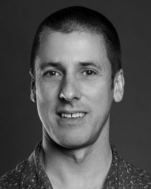 Glenn Newnham合作论文数CSIRO Sustainable Ecosystems11
 Samuel L. Manzello合作论文数Global Collaborative Research and Education Center for Integrated Flow Science, Institute of Fluid Science, Tohoku University;Reax Engineering8
 Sara Mcallister合作论文数university of california berkeley8
 Sayaka Suzuki合作论文数8
 Elsa Pastor合作论文数Centre d'Estudis de Risc Tecnològic (CERTEC),, Universitat Politècnica de Catalunya8
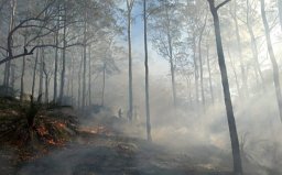 Katharine Haynes合作论文数School of Environmental Sciences, University of East Anglia8
 Anders Siggins合作论文数6
 Enrico Ronchi合作论文数lund university4Felix Lipkin合作论文数3d x viegas合作论文数2
 William Swedosh合作论文数Data61, CSIRO2melissa james合作论文数CSIRO Ecosyst Sci, Highett, Vic 3190, Australia2C. Rucinski合作论文数2Cheryl Mcnamara合作论文数2Joshua Whittaker合作论文数2R. H. Leicester合作论文数2Marielle Jappiot合作论文数2
 Fanny Boulaire合作论文数Queensland University of Technology2P. A. Bowditch合作论文数2
 James Hilton合作论文数2
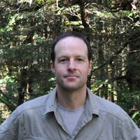 Darius Culvenor合作论文数Environmental Sensing Systems2d alexandrian合作论文数2T. D. Penman合作论文数1
 Chris Lucas合作论文数1
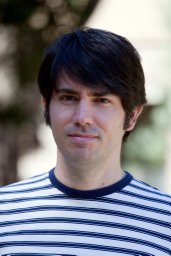 felipe dimer de oliveira合作论文数Risk Frontiers, Macquarie University1
 Daniel J. Gorham合作论文数Insurance Inst Business Home Safety1
 Constanza Gonzalez-Mathiesen合作论文数Facultad de arquitectura y arte, Universidad del Desarrollo1Mark Holland合作论文数1Gavriil Xanthopoulos合作论文数1
 Lynn M. Johnston合作论文数Nat Resources Canada, Canadian Forest Serv1
 Gang-Jun Liu (刘刚军)合作论文数Geospatial Sci, RMIT Univ1
 Domingos X. Viegas合作论文数1
 Alan March合作论文数Melbourne School of Design, The University of Melbourne1
 Michael Gollner合作论文数Department of Mechanical Engineering , University of California, Berkeley1
 Jim Mclennan合作论文数Psychology Department, Swinburne University of Technology1
 Short Karen合作论文数Fire Sciences Laboratory, Rocky Mountain Research Station1
 England Jacqueline R合作论文数School of Botany, University of Melbourne1
 John Handmer合作论文数School of Science, RMIT University1J. Black合作论文数1
 M. Pilar Martín合作论文数Facultad de Ciencias Químicas, Universidad de Castilla La Mancha1
 Fabienne Reisen合作论文数Marine and Atmospheric Research Commonwealth Scientific and Industrial Research Organisation1
 Eulalia Planas合作论文数Centre d’Estudis del Risc Tecnològic (CERTEC),, Universitat Politècnica de Catalunya1
 Britta Allgower合作论文数1
 Alessio Arena合作论文数1A. Malcolm Gill合作论文数Fenner School of Environment & Society, Australian National University1
 John Mashford合作论文数Division of Science, The University of Melbourne1




