The three-dimensional extension of the SAND ( Spatial and Nonspatial Data ) spatial database system is described as is its use for data found in scientific visualization applications. The focus is on surface data. Some of the principal operations supported by SAND involve locating spatial objects in the order of their distance from other spatial objects in an incremental manner so that the number of objects that are needed is not known a priori. These techniques are shown to be useful in enabling users to visualize the results of certain proximity queries without having to execute algorithms to completion as is the case when performing a nearest-neighbor query where a Voronoi diagram (i.e., Thiessen polygon) would be computed as a preprocessing step before any attempt to respond to the query could be made. This is achieved by making use of operations such as the spatial join and the distance semijoin. Examples of the utility of such operations is demonstrated in the context of posing meteorological queries to a spatial database with a visualization component.
Data structure issues that arise in Bézier-based modelling are surveyed. Both low and high level implementation details are discussed. The low level issues deal with the interaction between the representation of the individual patches and the representation of the collection of patches. The high level discussion consists of two parts. The first deals with how to maintain the topological integrity of the objects being modelled. This includes an outline of a technique for adapting Euler operators to Bézier primitives. The second is concerned with increasing the efficiency of certain operations by using hierarchical spatial data structures. Such representations facilitate the execution of operations that depend on spatial proximity (i.e., which patch is closest to another patch.)
This paper demonstrates that merging common subtrees in binary quadtrees results in significant compression savings. Empirical results on maps from a cartographic database are provided, and theoretical bounds on the amount of compression for certain classes of images are derived.
For pt.I see ibid., vol.8, no.3, p.48-68, May (1988). Advanced applications for preliminary display methods are focused on, with emphasis on the octree. Topics include use of the quadtree as a basis for hidden-surface algorithms, parallel and perspective projection methods to display a collection of objects represented by an octree, and the use of octrees to facilitate such image-rendering techniques as ray tracing and radiosity.
A central problem in the field of geometric algorithms is to compare algorithms that process vector-type data specified in the continuous plane with algorithms that process raster-type data specified in the digitized plane. A set of criteria is proposed that a digitization of a collection of line segments should satisfy in order to be said to represent the same structure as their continuous plane counterpart. These criteria insure that the digitized collection has the same number of distinct features as the original data. In particular, attention is focussed on the correspondence of the precision with which the locations of endpoints on a continuous plane are specified to the number of grid cells in the appropriate digitized plane. It is shown that these criteria cannot be satisfied by grid cells of uniform size. The result leads to a reformulation of the digitization process that corresponds closely to a quadtree decomposition.
An adaptation of the quadtree data structure that represents polygonal maps (i.e., collections of polygons, possibly containing holes) is described ina manner that is also useful for the manipulation of arbitrary collections of straight line segments. The gol is to store these maps without the loss of information that results from digitization, and to obtain a worst-case execution time that is not overly sensitive to the positioning of the map. A regular decomposition variant of the region quadtree is used to organize the vertices and edges of the maps. A number of related data organizations are proposed in an iterative manner until a method is obtained that meets the stated goals. The result is termed a PM (polygonal map) quadtree and is based on a regular decomposition point space quadtree (PR quadtree) that stores additional information about the edges at its terminal nodes. Algorithms are given for inserting and deleting line segments from a PM quadtree. Use of the PM quadtree to perform point location, dynamic line insertion, and map overlay is discussed. The PM quadtree is compared conceptually to the K-structure and the layered dag with respect to typical cartographic data. An empirical comparison of the PM quadtree with other quadtree-based representations for polygonal maps is also provided.
We describe the current status of an ongoing research effort to develop a geographic information system based on quadtrees. Quadtree encodings were constructed for area, point and line features for a small area in Northern California. The encoding used was a variant of the linear quadtree. The implementation used a B-tree to organize the list of leaves and allow management of trees too large to fit in core memory. Several database query functions have been implemented, including set operations, region property computations, map editing functions and map subset and windowing functions. A user of the system may access the database via an English-like query language.
Results of a study are summarized in which quadtrees were used to encode the regions in three map overlays representing a small area in northern California. Programs were then written to perform various analysis and manipulation tasks on the quadtree-encoded regions. Data is provided on the compactness of the encodings and the efficiency of the programs.
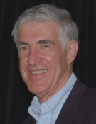 Hanan Samet合作论文数Institute for Advanced Computer Studies, University of Maryland;Center for Automation Research, University of Maryland;Department of Computer Science, University of Maryland8
 Clifford A. Shaffer合作论文数Virginia Tech;Department of Computer Science4
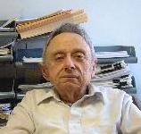 Azriel Rosenfeld合作论文数Center for Automation Research, University of Maryland, College Park;College of Computer, Mathematical and Physical Sciences, University of Maryland in College Park2
 Michael B. Dillencourt合作论文数Department of Computer Science, University of California, Irvine1




