Remote rural areas are facing strong demographic and socioeconomic challenges as being far from a city can limit social and economic interaction opportunities. This study analyses the EU remote rural areas based on a set of selected indicators related to demographic, economic, accessibility, connectivity, biodiversity, land use and geographical context. Spatial cluster techniques revealed that half of the remote rural areas are in a disadvantaged situation because they performed poorly on most of the analysed indicators. Despite being remote, a few rural areas presented socioeconomic favourable conditions and high natural assets. This finding motivated our investigation to identify statistical differences between remote and non-remote areas by applying multivariate regression models. Our results showed that remote rural areas face major challenges in relation to transport infrastructures, internet speed, access to essential services, household income, population decline and ageing. On the contrary, their natural landscape and ecosystems, as well as agriculture and forestry can offer new opportunities to remote rural areas while contribute to the goals of the EU Green Deal.
From the start of the COVID-19 pandemic in Europe, tourism was one of the first and most severely affected sectors. With the gradual imposition of related containment measures in a number of EU countries, various hypotheses were put forward at European, national and regional level concerning whether, what and how the tourism sector was impacted. The goal of this Policy Insights brief is to provide a detailed spatial analysis of tourism expenditure in EU Regions before the COVID-19 crisis (assumed baseline year: 2018). This characterisation can thus be used in economical impact assessment to evaluate the pandemic severity and delineate relevant policy scenarios.
The Joint Research Centre of the European Commission has implemented the LUISA Territorial Modelling Platform for ex ante evaluation of European policies, measures and initiatives that might have a direct or indirect territorial impact. LUISA is based on the concept of ‘land function’ for cross-sector integration and for the representation of complex system dynamics. Beyond a traditional land use model, LUISA adopts a new approach towards activity-based modelling based upon the endogenous dynamic allocation of population, services and activities. The LUISA Platform consists of set of connected modules. A regional module is employed to regionalise (downscale) exogenous socio-economic projections and produce scenarios of regional development according to defined options of growth. An advanced module for the local distribution and allocation of Land Functions is based upon the dynamic interaction between population distribution, accessibility potential and the utility-based allocation of services. Feedbacks and spillover effects are included within and between the local and regional modules. LUISA outputs are represented in terms of ‘territorial indicators’ covering a wide range of themes, from economy to demography, to accessibility and transport to resource efficiency. The territorial indicators are routinely updated and distributed by online tool Urban Data Platform Plus of the Knowledge Centre for Territorial Policies.
This report is an initiative of the Joint Research Centre (JRC), the science and knowledge service of the European Commission (EC), and supported by the Commission's Directorate-General for Regional and Urban Policy (DG REGIO). It highlights drivers shaping the urban future, identifying both the key challenges cities will have to address and the strengths they can capitalise on to proactively build their desired futures. The main aim of this report is to raise open questions and steer discussions on what the future of cities can, and should be, both within the science and policymaker communities. While addressing mainly European cities, examples from other world regions are also given since many challenges and solutions have a global relevance. The report is particularly novel in two ways. First, it was developed in an inclusive manner – close collaboration with the EC’s Community of Practice on Cities (CoP-CITIES) provided insights from the broader research community and city networks, including individual municipalities, as well as Commission services and international organisations. It was also extensively reviewed by an Editorial Board. Secondly, the report is supported by an online ‘living’ platform which will host future updates, including additional analyses, discussions, case studies, comments and interactive maps that go beyond the scope of the current version of the report. Steered by the JRC, the platform will offer a permanent virtual space to the research, practice and policymaking community for sharing and accumulating knowledge on the future of cities. This report is produced in the framework of the EC Knowledge Centre for Territorial Policies and is part of a wider series of flagship Science for Policy reports by the JRC, investigating future perspectives concerning Artificial Intelligence, the Future of Road Transport, Resilience, Cybersecurity and Fairness Interactive online platform: https://urban.jrc.ec.europa.eu/thefutureofcities
Available statistics on tourism from official European sources are limited in terms of both the spatial and temporal resolutions, curbing potential analyses and applications relevant for tourism management and policy. In this study, we produced a novel, complete and consistent dataset describing tourist density at high spatial resolution with monthly breakdown for the whole of the European Union. This is achieved thanks to the integration of data from conventional statistical sources with big data from emerging sources, namely two major online booking services containing the precise location and capacity of tourism accommodation establishments. The produced dataset allowed us to uncover key spatiotemporal patterns of tourism in Europe at unprecedented detail, showcasing the usefulness of complementing official statistical data with emerging big data sources. (C) 2018 The Authors. Published by Elsevier Ltd.
As urban population grow, commercial activities play a fundamental role in providing goods, services and are part of cities fabric. Policy makers and urban planners need new tools to study these areas. This paper describes how machine learning can be applied to predict the density of commercial activities in cities. A supervised machine learning method called Gradient Boosting was applied to a group of spatial data sets. These were used to fit a model, allowing to analyse their combined interactions and predict commercial activities in London at 1 km grid level for 2010 and 2030. The spatial resolution allowed comparing current and future trends. This type of activity is expected to lower closest to the city centre while increasing in further distant areas. Machine Learning has a great potential as a planning tool and the methodology presented in this paper could be further expanded to other cities.
This report analyses a set of European territorial trends at continental and sub-national scale, looking at patterns and determinants of regional growth, while considering pan-European and national characteristics. Past and prospective demographic and economic trends are analysed to provide a picture of ‘what, where and when’ things happen in European cities and regions. Specific emphasis is placed on urban areas since they are acknowledged sources of both opportunities and challenges. The indicators used in the analysis herein presented are freely and openly accessible in the Territorial Dashboard at: https://ec.europa.eu/jrc/en/territorial-policies/t-board
Scenarios for potential shale gas development were modelled for the Baltic Basin in Northern Poland for the period 2015–2030 using the land allocation model EUCS100. The main aims were to assess the associated land use requirements, conflicts with existing land use, and the influence of legislation on the environmental impact. The factors involved in estimating the suitability for placement of shale gas well pads were analysed, as well as the potential land and water requirements to define 2 technology-based scenarios, representing the highest and lowest potential environmental impact. 2 different legislative frameworks (current and restrictive) were also assessed, to give 4 combined scenarios altogether. Land consumption and allocation patterns of well pads varied substantially according to the modelled scenario. Potential landscape fragmentation and conflicts with other land users depended mainly on development rate, well pad density, existing land-use patterns, and geology. Highly complex landscapes presented numerous barriers to drilling activities, restricting the potential development patterns. The land used for shale gas development could represent a significant percentage of overall land take within the shale play. The adoption of appropriate legislation, especially the protection of natural areas and water resources, is therefore essential to minimise the related environmental impact.
.............................................................................................................. 4
The MOLAND (MOnitoring LANd use/cover Dynamics) and the Urban Atlas (UA) are two well-known, detailed data sets of land use/cover information focused on European cities. The MOLAND data set contains a unique time series of land use/cover changes for more than thirty urban areas covering a wide temporal window (1950 to late 1990s). The UA is a more recent project that mapped land use/cover formore than 300 cities for the year 2006. In this paper we discuss the integration of both data sets in order to produce a single geo-database covering an extended time series spanning from 1950 to 2006. The different cartographic specifications of the two input data sets, particularly in terms of spatial and thematic resolution, impeded a straightforward integration. A methodology was therefore set up to harmonize the two data sets and merge them into a consistent and comparable geo-database that can be easily queried and used for both visual and analytical purposes. The usefulness of the newly integrated geo-database was demonstrated by some exploratory analyses of the urban dynamics that occurred during the time span of the combined geo-database. We further discuss the role of time series of land use/cover data and draw recommendations and directions for future work and research.
Related resources: Data access UI Annual Land Take (FUA) The compressed zip file contains the projected total land take, expressed in square kilometers, for Functional Urban Areas (FUAs), from 2010 to 2030, from 2030 to 2050 and from 2010 to 2050. The data is stored in csv format. https://cidportal.jrc.ec.europa.eu/ftp/jrc-opendata/LUISA/SecondaryOutput_Indicators/Europe/REF-2014/FUA/UI-ann-lan d-take-ref-2014-FUA.zip
 Carlo Lavalle合作论文数16
 Filipe Batista e Silva合作论文数16Ine Vandecasteele合作论文数11
 Carolina Perpina Castillo合作论文数10
 Claudia Baranzelli合作论文数Institute for Environment and Sustainability, Joint Research Centre10marin herrera mario alberto合作论文数Joint Res Ctr, European Commiss7Mert Kompil合作论文数European Commission Joint Research Centre ‐ Territorial development unit Ispra Italy7
 Jean-Philippe Aurambout合作论文数Parkville Centre Department of Primary Industries Victoria Australia7Grazia Zulian合作论文数6Marí Rivero Inés合作论文数6
 Ana Luisa Barbosa合作论文数5Sara Vallecillo合作论文数Joint Res Ctr JRC, European Commiss5
 Joachim Maes合作论文数Joint Research Centre, European Commission5Boyan Kavalov合作论文数3
 Andrius Kucas合作论文数Nat Res Ctr, Akad 2, LT-08412 Vilnius, Lithuania3
 Chiara Polce合作论文数3Marco Trombetti合作论文数3Konštantín Rosina合作论文数Slovak Acad Sci, Inst Geog, Bratislava, Slovakia2
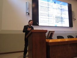 Chris Jacobs-Crisioni合作论文数Joint Res Ctr JRC, European Commiss2
 Nathan Pelletier合作论文数Faculty of Management, The University of British Columbia2
 Marcello Schiavina合作论文数Dipartimento di Bioscienze, Università degli Studi di Parma2Eva Ivits合作论文数2d e roo arie合作论文数1Pilar Vizcaino合作论文数1Nadja Vetters合作论文数1
 Carlotta Fioretti合作论文数Dept Architecture, Roma Tre Univ1
 Alice Siragusa合作论文数Terr Dev Unit, Joint Res Ctr1
 Paola Proietti合作论文数Dept Urban Studies & Reg Sci, Gran Sasso Sci Inst1
 Riccardo Curtale合作论文数Urban Planning & Transportat Grp, Eindhoven Univ Technol1
 Valentina Montalto合作论文数Joint Research Centre1Alessandra Bianchi合作论文数1Aris Christodoulou合作论文数1Carolina Serpieri合作论文数Dept Econ & Law, Sapienza Univ Rome1
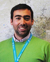 Michele Melchiorri合作论文数European Commission, Joint Research Centre1
 Eda Ustaoglu合作论文数Dept Geomat Engn, Gebze Tech Univ1
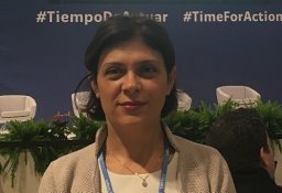 Albana Kona合作论文数European Commission –Joint Research Centre-Ispra1Pascual Pérez Ballesta合作论文数1
 Panayotis Christidis合作论文数European Commission, Joint Research Centre1
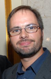 Sérgio Freire合作论文数European Commission, Joint Research Centre1
 Peter Andreas Burek合作论文数Institute for Environment and Sustainability (IES-JRC), Ispra, Italy.1
 Robert Field合作论文数Department of Atmospheric Sciences, College of Engineering and Applied Science, University of Wyoming1Roland Hiederer合作论文数1
 Enrico Pisoni合作论文数Department of Information Engineering, University of Brescia1
 Vasco Diogo合作论文数1
 Okke Batelaan合作论文数Department of Hydrology and Hydraulic Engineering;Universiteit Brussel;Department of Hydrology and Hydraulic Engineering, Universiteit Brussel1
 Serenella Sala合作论文数Land Resources and Supply Chain Assessments Unit, Joint Research Centre, European Commission1
 Paolo Bertoldi合作论文数Joint Research Centre;Institute for Environment and Sustainability;Joint Research Centre, Institute for Environment and Sustainability1
 Nicola Pontarollo合作论文数Department of Economics, University of Verona1




