While climate mitigation is essential for maintaining global mean temperature within 1.5 °C above pre-industrial levels, climate adaptation is necessary both now and in the coming decades. Ecosystems provide a wide array of services, including those that can reduce the negative impacts of climate change. Actions that solve problems using ecosystem services, called Nature-based Solutions (NbS), include ecosystem conservation, restoration, or improved land management. We computed the vulnerability of the global human population to eight climate change impacts – coastal flooding, food insecurity, heat waves, landslides, river flooding, vector-borne diseases, water stress, and wildfires – and identified areas where ecosystem conservation, restoration, or improved land management could potentially reduce people’s vulnerability to climate impacts. Our results indicate that 7.5 billion people are projected to be vulnerable to at least one climate impact by 2030, and NbS can reduce the vulnerability of up to 5.1 billion. We estimate that ecosystem conservation could potentially reduce climate vulnerability of over two billion people; ecosystem restoration could do so for almost sixty million people; and sustainable land management practices for about four billion people. While we do not quantify the effect of NbS on reducing climate impacts, i.e., we did not conduct a quantitative evaluation of the role of nature for climate adaptation, This study is a key first step in identifying areas where nature could possibly help people adapt to climate change, where such effects could be further explored, and where synergies with biodiversity conservation, climate mitigation, and other benefits to people could be found.
Urban forests are critical for climate adaptation and liveability, but effective irrigation management-key to their sustainability-remains poorly documented at the global scale. This study addresses this critical knowledge gap by analysing urban forest irrigation practices across 109 cities in 21 countries, offering one of the first global assessments of irrigation approaches, challenges, and opportunities. Using survey data, we examined water sources, irrigation frequency, constraints, and enabling conditions. Our results show that weather conditions were the leading factor influencing irrigation scheduling in 44 % of cities, while 56 % reported no formal water restrictions. Despite the importance of water conservation, 55 % of respondents reported having no water usage monitoring systems, and 73 % lacked financial incentives to promote water-efficient irrigation. A large majority (80 %) did not use recycled wastewater, and 58 % did not conduct water quality testing. Only 15 % of cities regularly used water-efficient irrigation technologies, and 47 % had no plans to implement smart systems. Over half (56 %) rated their current irrigation practices as only moderately successful. Budget constraints and infrastructure limitations were the most frequently reported challenges, followed by climate change-related concerns. While environmental variables such as mean annual temperature and irrigation need influenced specific practices, local governance and institutional actions had stronger effects. Cities in the Global South reported distinct strategies and constraints compared to those in the Global North. Our findings provide actionable insights for climate-resilient urban water strategies and underscore the need for targeted policies, capacity-building, and efficient technologies to enhance urban forest sustainability worldwide.
BackgroundAs the world becomes increasingly urbanised, there is recognition that public and planetary health relies upon a ubiquitous transition to sustainable cities. Disentanglement of the complex pathways of urban design, environmental exposures, and health, and the magnitude of these associations, remains a challenge. A state-of-the-art account of large-scale urban health studies is required to shape future research priorities and equity- and evidence-informed policies.ObjectivesThe purpose of this review was to synthesise evidence from large-scale urban studies focused on the interaction between urban form, transport, environmental exposures, and health. This review sought to determine common methodologies applied, limitations, and future opportunities for improved research practice.MethodsBased on a literature search, 2958 articles were reviewed that covered three themes of: urban form; urban environmental health; and urban indicators. Studies were prioritised for inclusion that analysed at least 90 cities to ensure broad geographic representation and generalisability. Of the initially identified studies, following expert consultation and exclusion criteria, 66 were included.ResultsThe complexity of the urban ecosystem on health was evidenced from the context dependent effects of urban form variables on environmental exposures and health. Compact city designs were generally advantageous for reducing harmful environmental exposure and promoting health, with some exceptions. Methodological heterogeneity was indicative of key urban research challenges; notable limitations included exposure and health data at varied spatial scales and resolutions, limited availability of local-level sociodemographic data, and the lack of consensus on robust methodologies that encompass best research practice.ConclusionFuture urban environmental health research for evidence-informed urban planning and policies requires a multi-faceted approach. Advances in geospatial and AI-driven techniques and urban indicators offer promising developments; however, there remains a wider call for increased data availability at local-levels, transparent and robust methodologies of large-scale urban studies, and greater exploration of urban health vulnerabilities and inequities.
Excessive heat is a major and growing risk for urban residents. Here, we estimate the inequality in summertime heat-related mortality, morbidity, and electricity consumption across 5723 US municipalities and other places, housing 180 million people during the 2020 census. On average, trees in majority non-Hispanic white neighborhoods cool the air by 0.19 ± 0.05 °C more than in POC neighborhoods, leading annually to trees in white neighborhoods helping prevent 190 ± 139 more deaths, 30,131 ± 10,406 more doctors’ visits, and 1.4 ± 0.5 terawatt-hours (TWhr) more electricity consumption than in POC neighborhoods. We estimate that an ambitious reforestation program would require 1.2 billion trees and reduce population-weighted average summer temperatures by an additional 0.38 ± 0.01 °C. This temperature reduction would reduce annual heat-related mortality by an additional 464 ± 89 people, annual heat-related morbidity by 80,785 ± 6110 cases, and annual electricity consumption by 4.3 ± 0.2 TWhr, while increasing annual carbon sequestration in trees by 23.7 ± 1.2 MtCO2e yr−1 and decreasing annual electricity-related GHG emissions by 2.1 ± 0.2 MtCO2e yr−1. The total economic value of these benefits, including the value of carbon sequestration and avoided emissions, would be USD 9.6 ± 0.5 billion, although in many neighborhoods the cost of planting and maintaining trees to achieve this increased tree cover would exceed these benefits. The exception is areas that currently have less tree cover, often the majority POC, which tend to have a relatively high return on investment from tree planting.
Nature-based solutions (NBS) can deliver many benefits to human wellbeing, including some crucial to climate adaptation. We quantitatively assess the global potential of NBS strategies of protection, restoration, and agroforestry by modeling global climate change mitigation and local ecosystem services (water availability, sediment retention, runoff, pollination, nitrogen retention, green water storage, and coastal protection). The strategies with the most potential to help people do not necessarily deliver the most climate change mitigation: per area of conservation action, agroforestry provides substantial benefits (>20% increase in at least one local ecosystem service) to three times more people on average than reforestation while providing less than one tenth the carbon sequestration per unit area. Each strategy delivers a different suite of ecosystem service benefits; for instance, avoided forest conversion provides a strong increase in nitrogen retention (100% increase to 72 million people if fully implemented globally) while agroforestry increases pollination services (100% increase to 3.0 billion people if fully implemented globally). One common disservice shared by all the NBS strategies modeled here is that increased woody biomass increases transpiration, reducing annual runoff and in some watersheds negatively impacting local water availability. In addition, the places with the greatest potential for climate change mitigation are not necessarily the ones with the most people. For instance, reforestation in Latin America has the greatest climate change mitigation potential, but the greatest ecosystem service benefits are in Africa. Focusing on nations with high climate mitigation potential as well as high local ecosystem service potential, such as Nigeria in the case of reforestation, India for agroforestry, and the Republic of Congo for avoided forest conversion, can help identify win-win sites for implementation. We find that concentrating implementation of these three conservation strategies in critical places, covering 5.8 million km2, could benefit 2.0 billion people with increased local ecosystem services provision. These critical places cover only 35% of the possible area of implementation but would provide 80% of the benefits that are possible globally for the selected set of ecosystem services under the NBS scenarios examined here. We conclude that targeting these critical places for protection, restoration, and agroforestry interventions will be key to achieving adaptation and human wellbeing goals while also increasing nature-based carbon mitigation.
Recent advances in data science and urban environmental health research utilise large-scale databases (100s-1000s of cities) to explore the complex interplay of urban characteristics such as city form and size, climate, mobility, exposure, and environmental health impacts. Cities are still hotspots of air pollution and noise, suffer urban heat island effects and lack of green space, which leads to disease and mortality burdens preventable with better knowledge. Better understanding through harmonising and analysing data in large numbers of cities is essential to identifying the most effective means of disease prevention and understanding context dependencies important for policy.
Forests play a crucial role in regulating the global climate. Yet, forests also influence the local climate conditions through biophysical processes that directly impact human wellbeing. With growing policy emphasis on these climate adaptation effects, we review the scale dependent impacts of forests on climate conditions and their implications for human wellbeing. Generally, existing forests buffer local temperatures, with warming effects in cold regions and cooling effects in hot regions. At a global scale, trees are more conducive to cooling in regions where dense forests would naturally exist. Additionally, forests generally reduce water runoff, which can reduce flooding in wet areas, but it can also limit water availability downstream, especially in drier regions. Together, these findings suggest that climate positive tree effects tend to be most frequent in regions where forests naturally occur, and highlight the growing consensus around the importance of natural forests for climate adaptation.
Abstract Green spaces in urban areas—like remnant habitat, parks, constructed wetlands, and street trees—supply multiple benefits. Many studies show green spaces in and near urban areas play important roles harbouring biodiversity and promoting human well‐being. On the other hand, evidence suggests that greater human population density enables compact, low‐carbon cities that spare habitat conversion at the fringes of expanding urban areas, while also allowing more walkable and livable cities. How then can urban areas have abundant green spaces as well as density? In this paper, we review the empirical evidence for the relationships between urban density, nature, and sustainability. We also present a quantitative analysis of data on urban tree canopy cover and open space for United States large urbanized areas, as well as an analysis of non‐US Functional Urban Areas in OECD countries. We found that there is a negative correlation between population density and these green spaces. For Functional Urban Areas in the OECD, a 10% increase in density is associated with a 2.9% decline in tree cover. We argue that there are competing trade‐offs between the benefits of density for sustainability and the benefits of nature for human well‐being. Planners must decide an appropriate density by choosing where to be on this trade‐off curve, taking into account city‐specific urban planning goals and context. However, while the negative correlation between population density and tree cover is modest at the level of US urbanized areas (R2 = 0.22), it is weak at the US Census block level (R2 = 0.05), showing that there are significant brightspots, neighbourhoods that manage to have more tree canopy than would be expected based upon their level of density. We then describe techniques for how urban planners and designers can create more brightspots, identifying a typology of urban forms and listing green interventions appropriate for each form. We also analyse policies that enable these green interventions illustrating them with the case studies of Curitiba and Singapore. We conclude that while there are tensions between density and urban green spaces, an urban world that is both green and dense is possible, if society chooses to take advantage of the available green interventions and create it. Read the free Plain Language Summary for this article on the Journal blog.
A review of ecological, social, engineering, and integrative approaches to define and apply resilience thinking is presented and comparatively discussed in the context of watershed management. Knowledge gaps are identified through an assessment of this literature and compilation of a set of research questions through stakeholder engagement activities. We derive a proposed research agenda describing key areas of inquiry such as watershed resilience variables and their interactions; leveraging watershed natural properties, processes, and dynamics to facilitate and enable resilience; analytical methods and tools including monitoring, modeling, metrics, and scenario planning, and their applications to watersheds at different spatial and temporal scales, and infusing resilience concepts as core values in watershed adaptive management.
Land-use land-cover (LULC) changes are occurring rapidly in Southeast Asia (SEA), generally associated with population growth, economic development and competing demands for land. Land cover change is one of the vital factors affecting carbon dynamics and emissions. SEA is an important region to study urban-caused LULC emissions and the potential for nature-based solutions (NBS) and nature climate solutions (NCS), as it is home to nearly 15% of the world’s tropical forests and has some of the world’s fastest rates of urban growth. We present a fine-scale urban cluster level assessment for SEA of current (2015) and future (2050) scenarios for carbon sequestration service and climate mitigation potential. We identified 956 urban clusters distributed across 11 countries of SEA. Considering the urban expansion projected and decline in forests, this region could see a carbon loss of up to 0.11 Gigatonnes (Scenario SSP4 RCP 3.4). Comparing carbon change values to urban emissions, we found that the average offset value ranging from −2% (Scenario SSP1 RCP 2.6) to −21%. We also found that a few medium and large urban clusters could add to more than double the existing carbon emissions in 2050 in the SSP3 and SSP4 RCP 3.4 scenarios, while a minority of clusters could offset their emissions under SSP1. Our study confirms that NCS, and particularly reforestation, are in many cases able to offset the direct emissions from land cover conversion from SEA urban clusters. Hence, documenting the plausible LULC transitions and the associated impacts gains significance in the SEA region as the results can be useful for informing policy and sustainable land management.
Coastal ecosystems have the potential to contribute to disaster risk reduction and adaptation to climate change. While previous studies have estimated the value of current coastal ecosystems for reducing coastal risk, there have been relatively few studies that look at changes in ecosystem service provision, in the past and under climate change. We employ the probabilistic, event-based CLImate ADAptation platform (CLIMADA) to quantify the protection from tropical cyclones (TCs) provided by coastal ecosystems, modeling the number of beneficiaries in the past and under future climate change. We also investigate the potential of nature-based solutions (NbS), such as mangrove restoration. We find that currently, one in five (21%) of all people impacted annually by TCs in the global low-elevation coastal zone is within the protection distance of coastal ecosystems. Over the last 30 years, the share of protected people has decreased by approximately 2%, due to ecosystem loss. With climate change, the average annual number of people impacted will increase by 40%. Simultaneously, the proportion of people protected by coastal ecosystems with climate change decreases due to changes in TC distribution (−1%). The importance of current coastal protection, and the potential for increasing protection by NbS, varies widely between countries. While the number of people protected globally only increases slightly with mangrove restoration, the share of people protected in individual countries can increase by up to 39%. Our findings provide a basis for NbS planning and adaptation policy, by highlighting areas which will be crucial for coastal protection services in a world altered by climate change.
Abstract Excessive heat is a major and growing risk for urban residents. Urban trees can significantly reduce summer peak temperatures, thus reducing heat-related mortality, morbidity, as well as cooling energy demand. However, urban tree canopy is inequitably distributed in US cities, which has been shown to contribute to higher summer temperatures in people-of-color (POC) neighborhoods. Here, we utilize a unique dataset of high-resolution tree canopy cover to estimate the inequality in summertime heat-related mortality, morbidity, and electricity consumption across a sample of 5,723 US municipalities and other places, housing 180 million people during the 2020 census (50.6% in majority non-Hispanic white neighborhoods, 49.4% in majority people-of-color, POC, neighborhoods). We also model the potential to increase tree cover in these municipalities in 5% increments up to a realistic maximum, the 90th percentile of tree cover observed in each municipality for each impervious surface class. On average, trees in non-Hispanic white neighborhoods cool the air by 0.19 ± 0.05⁰C more than in POC neighborhoods, leading annually to trees in white neighborhoods helping prevent 190 ± 139 more deaths, 30,131 ± 10,406 more doctors’ visits, and 1.4 ± 0.5 terawatt-hours (TWhr) more electricity consumption than in POC neighborhoods. The greatest inequality in the protective value of trees occurs in the Northeastern US. We estimate that for these 5,723 municipalities, the maximal feasible urban reforestation program in residential neighborhoods could add 1.2 billion trees, reducing population-weighted average summer temperatures by an additional 0.38 ± 0.01⁰C. Relative to the current status quo, this increase in the cooling benefits of trees would reduce annual heat-related mortality by an additional 464 ± 89 people, annual heat-related morbidity by 80,785 ± 6110 cases, and annual electricity consumption by 4.3 ± 0.2 TWhr, while increasing annual carbon sequestration in trees by 23.7 ± 1.2 MtCO2e and decreasing annual electricity-related GHG emissions by 2.1 ± 0.2 MtCO2e. The total economic value of these benefits, including the value of carbon sequestration and avoided emissions, would be USD 9.6 ± 0.5 billion, although in many neighborhoods the cost of increased tree cover exceeds these benefits. The exception is neighborhoods that currently have lower tree cover, especially those that are majority POC, as these neighborhoods have a much higher return-on-investment from tree planting.
There is an emerging consensus that the health of the planet depends on the coexistence between rapidly growing cities and the natural world. One strategy for guiding cities towards sustainability is to facilitate a planning process based on positive visions for urban systems among actors and stakeholders. This paper presents the Urban Nature Futures Framework (UNFF), a framework for scenario building for cities that is based on three Nature Futures perspectives: Nature for Nature, Nature for Society, and Nature as Culture. Our framework engages stakeholders with envisioning the three Nature Futures perspectives through four components using participatory methods and quantitative models: identification of the socio-ecological feedbacks in cities, assessment of indirect impacts of cities on biodiversity, development of multi-scale indicators, and development of scenarios. Stakeholders in cities may use this framework to explore different options for integrating nature in its various manifestations within urban areas and to assess how different community preferences result in various cityscapes and distribution of associated benefits from nature among urban dwellers across multiple scales.
Green stormwater infrastructure (GSI), which includes features like rain gardens, constructed wetlands, or urban tree canopy, is now widely recognized as a means to reduce urban runoff impacts and meet municipal water quality permit requirements. Many co-benefits of GSI are related to increased vegetative cover, which can be measured with satellite imagery via spectral indices such as the Normalized Difference Vegetation Index (NDVI). In urban landscapes, there remain critical gaps in understanding how urban greenness and GSI influence hydrology. Here, we quantify these relationships to assess the feasibility of tracking the effectiveness of urban greening for improving downstream hydrologic conditions. We combined hydrologic data from the United States Geological Survey (USGS) gauges with an NDVI time series (1985-2019) derived from Landsat satellite imagery, and synthesis of GSI implementation data from a set of 372 urbanized watersheds across the United States. We used a multivariate panel modeling approach to account for spatial and time varying factors (rainfall, temperature, urban cover expansion) in an effort to isolate the relationships of interest. After accounting for expansion of urban boundaries, only 32 watersheds (9%) showed significant greenness trends, a majority of which were reductions. Urban greenness had significant influences on downstream flow responses, so that on average, a 10% greenness increase showed a corresponding reduction of total flow (-3.8%), flow variance (-7.7%), peak flows (-4.7%), high flows (-7.6%), flashiness (-2.2%), and high flow frequency (-1.5%); and a corresponding increase in baseflow (4.3%). For a subset of these watersheds for which GSI data were available (n = 48), the level of GSI implementation showed a significant, but weak influence on urban greenness with a 20% increase in BMP density corresponding to a greenness increase of 0.9%. The study results may support valuation and verification of GSI co-benefits in urbanized landscapes at the watershed scale.
Significance Understanding the impacts of urbanization and the associated urban land expansion on species is vital for informed urban planning that minimizes biodiversity loss. Predicting habitat that will be lost to urban land expansion for over 30,000 species under three different future scenarios, we find that up to 855 species are directly threatened due to unmitigated urbanization. Our projections pinpoint rapidly urbanizing regions of sub-Saharan Africa, South America, Mesoamerica, and Southeast Asia where, without careful planning, urbanization is expected to cause particularly large biodiversity loss. Our findings highlight the urgent need for an increased focus on urban land in global conservation strategies and identify high-priority areas for this engagement.
Urban nature—such as greenness and parks—can alleviate distress and provide space for safe recreation during the COVID-19 pandemic. However, nature is often less available in low-income populations and communities of colour—the same communities hardest hit by COVID-19. In analyses of two datasets, we quantified inequity in greenness and park proximity across all urbanized areas in the United States and linked greenness and park access to COVID-19 case rates for ZIP codes in 17 states. Areas with majority persons of colour had both higher case rates and less greenness. Furthermore, when controlling for sociodemographic variables, an increase of 0.1 in the Normalized Difference Vegetation Index was associated with a 4.1% decrease in COVID-19 incidence rates (95% confidence interval: 0.9–6.8%). Across the United States, block groups with lower income and majority persons of colour are less green and have fewer parks. Our results demonstrate that the communities most impacted by COVID-19 also have the least nature nearby. Given that urban nature is associated with both human health and biodiversity, these results have far-reaching implications both during and beyond the pandemic. Access to green space has been a critical, and contentious, issue for neighbourhood inequality and health outcomes. This Analysis looks at how the COVID-19 pandemic interacts with availability of nature for urban residents.
Urban tree cover provides benefits to human health and well-being, but previous studies suggest that tree cover is often inequitably distributed. Here, we use National Agriculture Imagery Program digital ortho photographs to survey the tree cover inequality for Census blocks in US large urbanized areas, home to 167 million people across 5,723 municipalities and other Census-designated places. We compared tree cover to summer land surface temperature, as measured using Landsat imagery. In 92% of the urbanized areas surveyed, low-income blocks have less tree cover than high-income blocks. On average, low-income blocks have 15.2% less tree cover and are 1.5⁰C hotter than high-income blocks. The greatest difference between low- and high-income blocks was found in urbanized areas in the Northeast of the United States, where low-income blocks in some urbanized areas have 30% less tree cover and are 4.0⁰C hotter. Even after controlling for population density and built-up intensity, the positive association between income and tree cover is significant, as is the positive association between proportion non-Hispanic white and tree cover. We estimate, after controlling for population density, that low-income blocks have 62 million fewer trees than high-income blocks, equal to a compensatory value of $56 billion ($1,349/person). An investment in tree planting and natural regeneration of $17.6 billion would be needed to close the tree cover disparity, benefitting 42 million people in low-income blocks.
Non-technical summary We summarize some of the past year's most important findings within climate change-related research. New research has improved our understanding of Earth's sensitivity to carbon dioxide, finds that permafrost thaw could release more carbon emissions than expected and that the uptake of carbon in tropical ecosystems is weakening. Adverse impacts on human society include increasing water shortages and impacts on mental health. Options for solutions emerge from rethinking economic models, rights-based litigation, strengthened governance systems and a new social contract. The disruption caused by COVID-19 could be seized as an opportunity for positive change, directing economic stimulus towards sustainable investments. Technical summary A synthesis is made of ten fields within climate science where there have been significant advances since mid-2019, through an expert elicitation process with broad disciplinary scope. Findings include: (1) a better understanding of equilibrium climate sensitivity; (2) abrupt thaw as an accelerator of carbon release from permafrost; (3) changes to global and regional land carbon sinks; (4) impacts of climate change on water crises, including equity perspectives; (5) adverse effects on mental health from climate change; (6) immediate effects on climate of the COVID-19 pandemic and requirements for recovery packages to deliver on the Paris Agreement; (7) suggested long-term changes to governance and a social contract to address climate change, learning from the current pandemic, (8) updated positive cost–benefit ratio and new perspectives on the potential for green growth in the short- and long-term perspective; (9) urban electrification as a strategy to move towards low-carbon energy systems and (10) rights-based litigation as an increasingly important method to address climate change, with recent clarifications on the legal standing and representation of future generations. Social media summary Stronger permafrost thaw, COVID-19 effects and growing mental health impacts among highlights of latest climate science.
 Timothy M. Boucher合作论文数Worldwide Office, The Nature Conservancy10
 Dean L. Urban (Dean Urban)合作论文数Nicholas School of the Environment, Duke University9
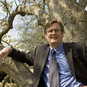 Tim Beatley合作论文数8
 Karen C. Seto (凯伦·司徒)合作论文数Hixon Center for Urban Sustainability, Yale School of The Environment, Yale University;Yale School of Architecture, Yale University7
 Joseph Edward Fargione (Joe Fargione)合作论文数North America Region, The Nature Conservancy7
 Burak Güneralp合作论文数Department of Geography, College of Arts & Sciences, Texas A&M University7
 Peter J. Marcotullio合作论文数Institute of Advanced Studies, United Nations University7
 Thomas Elmqvist合作论文数Stockholm Resilience Centre, Stockholm University5
 Perrine Hamel合作论文数Asian School of the Environment, Nanyang Technological University;Earth Observatory of Singapore5
 Peter Kareiva合作论文数Institute of the Environment and Sustainability, University of California, Los Angeles5
 Deborah Balk合作论文数Center for International Earth Science;Columbia University;Center for International Earth Science, Columbia University5
 Timm Kroeger合作论文数Conservation Economics Program5
 Martina Flörke合作论文数Ingenieurhydrologie und Wasserwirtschaft, Fakultät für Bau- und Umweltingenieurwissenschaften, Ruhr-Universität Bochum4
 Erica N. Spotswood合作论文数San Francisco Estuary Inst4
 Susan C Cook-Patton合作论文数Nature Conservancy, Arlington, VA 22203 USA4
 William M. Miller合作论文数International Institute for Nanotechnology, Weinberg College of Arts and Sciences, Northwestern University4
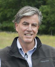 David R. Foster合作论文数Center for the Environment, Harvard University;Department of Organismic & Evolutionary Biology, Faculty of Arts and Sciences, Harvard University4
 Evan H. Girvetz合作论文数Department of Environmental Design;University of California , Davis;Department of Environmental Design, University of California , Davis4
 Lauren Stoneburner合作论文数3
 Andressa Vianna Mansur合作论文数German Centre for Integrative Biodiversity Research (iDiv) Halle-Jena-Leipzig3
 Julie Goodness合作论文数3daniel shemie合作论文数3
 Pierre Masselot合作论文数Department of Public Health, Environments and Society, London School of Hygiene & Tropical Medicine3
 Maike Hamann合作论文数Centre for Sustainability Transitions, Stellenbosch University3
 Manuel Esperón-Rodríguez合作论文数Univ Nacl Autonoma Mexico, Inst Ciencias Mar & Limnol, Mexico City 04510, DF, Mexico3
 Rebecca Chaplin-Kramer合作论文数Woods Institute for the Environment, Stanford University;Woods Institute for the Environment, Stanford University3
 Masuda Yuta J合作论文数Evans Sch Publ Affairs, Univ Washington3
 Joe Kiesecker合作论文数The Nature Conservancy3
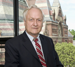 Richard T.T. Forman合作论文数Graduate School of Design, Harvard University3
 Hannes Taubenböck合作论文数German Aerospace Center3
 Tanushree Biswas合作论文数Indian Institute of Chemical Biology3
 Timon Mcphearson合作论文数Environmental Studies Department, College of Arts & Science, New York University;Climasens;Stockholm Resilience Centre3Carmen Revenga合作论文数Worldwide Office, The Nature Conservancy3
 Erin Beller合作论文数San Francisco Estuary Institute3
 Sean M. Watts合作论文数3
 Pamela A. Green合作论文数Water Systems Analysis Group;Institute for the Study of Earth;University of New Hampshire;Department of Earth Sciences;Universitede Paris;University of New Hampshire, Universitede Paris3Jennifer Molnar合作论文数3Glenn Motzkin合作论文数Harvard University3
 Michail Fragkias合作论文数International Project Office, Arizona State University3
 Rohan Simkin合作论文数3Federica Montana合作论文数2Ming Kuo合作论文数2Brenna Walsh合作论文数2johnathan l dimuro合作论文数2Denise Lopez合作论文数2Matthew Benjamin合作论文数2Jimmie Powell合作论文数2Kari Vigerstol合作论文数2M'Lisa Lee Colbert合作论文数2




