Residential development is one of the most intensive and widespread land uses in the United States, with substantial environmental impacts, including changes in forest cover. However, the relationships between forest cover and residential development are complex. Contemporary forest cover reflects multiple factors, including housing density, time since development, historical land cover, and land management since development. We investigated how forest cover varies with housing density, housing age, and household income over a range of development intensities, in six ecoregions within New York State, Wisconsin, and Colorado. We find areas with residential development do retain important forest resources: across landscapes they are typically more forested than areas that remain undeveloped. However, forest cover consistently had a negative, inverse relationship with housing density, across study areas. Relationships between forest cover and housing age and household income were less common and often restricted to only portions of a given region, according to geographically weighted regression analyses. A better understanding of how forest cover varies with residential development, outside of the typically studied urban areas, will be essential to maintaining ecosystem function and services in residential landscapes.
Public lands are typically established in recognition of their unique ecological value, yet both ecological and social values of public lands change over time, along with human distribution and land use. These transformations are evident even in developed countries with long histories of public land management, such as the United States. The 20th Century saw dramatic changes in the American population, in distribution and in racial and ethnic diversity, leading to new challenges and new roles for public lands. Our goal with this paper is to review changing demographics and implications for terrestrial protected areas in the U.S. We overview the fundamentals of population change and data, review past trends in population change and housing growth and their impacts on public lands, and then analyze the most recent decade of demographic change (2000–2010) relative to public lands. Discussions of demographic change and public lands commonly focus on the rural West, but we show that the South is also experiencing substantial change in rural areas with public lands, including Hispanic population growth. We identify those places, rural and urban, where demographic change (2000–2010), including diversification and housing growth, coincide with public lands. Understanding the current trends and long-term demographic context for recent changes in populations can help land managers and conservation scientists mitigate the effects of residential development near public lands, serve a more diverse population, and anticipate future population changes.
Following the loss of homes to wildfire, when risk has been made apparent, homeowners must decide whether to rebuild, and choose materials and vegetation, while local governments guide recovery and rebuilding. As wildfires are smaller and more localised than other disasters, it is unclear if recovery after wildfire results in policy change and adaptation, decreasing assets at risk, or if recovery encourages reinvestment in hazard-prone areas. We studied three wildfires on the Colorado Front Range from 2010 to 2012 that each destroyed over 150 homes, describing policy response and characterising the built environment after wildfire. In each location, we found some adaptation, through better-mitigated homes and stronger building and vegetation mitigation standards, but also extensive reinvestment in hazard-prone environments, with governmental support. Despite suggestions that disaster can lead to substantial policy change and elevate the role of land-use planning, we saw only modest reforms: local governments did not revise land-use regulations; a statewide task force considered but did not require standards for building and vegetation mitigation; and only one jurisdiction strengthened its building and vegetation mitigation standards. Experiences in Colorado suggest that time after wildfire either does not provide extensive opportunities for adaptation in the built environment, or that these opportunities are easily missed.
Detailed model results by ecoregion.
The hazards-of-place model posits that vulnerability to environmental hazards depends on both biophysical and social factors. Biophysical factors determine where wildfire potential is elevated, whereas social factors determine where and how people are affected by wildfire. We evaluated place vulnerability to wildfire hazards in the coterminous US. We developed a social vulnerability index using principal component analysis and evaluated it against existing measures of wildfire potential and wildland–urban interface designations. We created maps showing the coincidence of social vulnerability and wildfire potential to identify places according to their vulnerability to wildfire. We found that places with high wildfire potential have, on average, lower social vulnerability than other places, but nearly 10% of all housing in places with high wildfire potential also exhibits high social vulnerability. We summarised our data by states to evaluate trends at a subnational level. Although some regions, such as the South-east, had more housing in places with high wildfire vulnerability, other regions, such as the upper Midwest, exhibited higher rates of vulnerability than expected. Our results can help to inform wildfire prevention, mitigation and recovery planning, as well as reduce wildfire hazards affecting vulnerable places and populations.
The number of wildland-urban interface communities affected by wildfire is increasing, and both wildfire suppression and losses are costly. However, little is known about post-wildfire response by homeowners and communities after buildings are lost. Our goal was to characterise rebuilding and new development after wildfires across the conterminous United States. We analysed all wildfires in the conterminous USA from 2000 to 2005. We mapped 42 724 buildings, of which 34 836 were present before the fire and survived, 3604 were burned, 2403 were post-fire new development, and 1881 were burned and rebuilt. Before the fires, 38 440 buildings were present within fire perimeters (surviving plus burned). Within 5 years post-fire, there were 39 120 buildings (surviving, rebuilt and new development). Nationally, only 25% of burned homes were rebuilt within 5 years, though rates were higher in the west, the south and Kansas. New development rates inside versus outside fire perimeters were similar. That the number of buildings inside fire perimeters within 5 years post-fire was greater than pre-fire indicated that homeowners are either willing to face wildfire risks or are unaware of them; or that economic incentives to rebuild in the same place outweigh perceived risks.
Wildfire management now emphasizes fire-adapted communities that coexist with wildfires, although it is unclear how communities will progress to this goal. Hazards research suggests that response to wildfire—specifically, rebuilding after fire—may be a crucial opportunity for homeowner and community adaptation. We explore rebuilding after the 2010 Fourmile Canyon Fire from Boulder, CO, that destroyed 165 homes, to better understand individual and community adaptation after wildfire. We examined changes in perception of fire risk and structural characteristics and vegetation mitigation of rebuilt homes, to examine how homes, homeowners, and communities changed after fire. We found evidence that adaptation is occurring, as well as evidence that it is not. Overall, rebuilding was slow. More than 3½ years after the fire, only 30% of those who had lost homes had rebuilt. Postfire rebuilding will only change a fraction of homes, but it is a critical process to understand.
Fire-prone landscapes are not well studied as coupled human and natural systems (CHANS) and present many challenges for understanding and promoting adaptive behaviors and institutions. Here, we explore how heterogeneity, feedbacks, and external drivers in this type of natural hazard system can lead to complexity and can limit the development of more adaptive approaches to policy and management. Institutions and social networks can counter these limitations and promote adaptation. We also develop a conceptual model that includes a robust characterization of social subsystems for a fire-prone landscape in Oregon and describe how we are building an agent-based model to promote understanding of this social-ecological system. Our agent-based model, which incorporates existing ecological models of vegetation and fire and is based on empirical studies of landowner decision-making, will be used to explore alternative management and fire scenarios with land managers and various public entities. We expect that the development of CHANS frameworks and the application of a simulation model in a collaborative setting will facilitate the development of more effective policies and practices for fire-prone landscapes.
As people encroach increasingly on natural areas, one question is how this affects avian biodiversity. The answer to this is partly scale-dependent. At broad scales, human populations and biodiversity concentrate in the same areas and are positively associated, but at local scales people and biodiversity are negatively associated with biodiversity. We investigated whether there is also a systematic temporal trend in the relationship between bird biodiversity and housing development. We used linear regression to examine associations between forest bird species richness and housing growth in the conterminous United States over 30 years. Our data sources were the North American Breeding Bird Survey and the 2000 decennial U.S. Census. In the 9 largest forested ecoregions, housing density increased continually over time. Across the conterminous United States, the association between bird species richness and housing density was positive for virtually all guilds except ground nesting birds. We found a systematic trajectory of declining bird species richness as housing increased through time. In more recently developed ecoregions, where housing density was still low, the association with bird species richness was neutral or positive. In ecoregions that were developed earlier and where housing density was highest, the association of housing density with bird species richness for most guilds was negative and grew stronger with advancing decades. We propose that in general the relationship between human settlement and biodiversity over time unfolds as a 2-phase process. The first phase is apparently innocuous; associations are positive due to coincidence of low-density housing with high biodiversity. The second phase is highly detrimental to biodiversity, and increases in housing density are associated with biodiversity losses. The long-term effect on biodiversity depends on the final housing density. This general pattern can help unify our understanding of the relationship of human encroachment and biodiversity response.
Numerous measures of human influence on the environment exist, but one that is of particular importance is houses as they can impact the environment from species through the landscape level. Furthermore, because the addition of houses represents an important component of landscape change, housing information could be used to assess ecological responses (e.g., decline in wildlife habitat) to that change. Recently developed housing density data represents a potential source of information to assess landscape and habitat change over long periods of time and at broad spatial extents, which is critically needed for conservation and management. Considering the potential value of housing data, our goal was to demonstrate how changes in the number of houses leads to changes in the amount of habitat across the landscape, and in-turn, how these habitat changes are likely to influence the distribution and abundance for a species of conservation concern, the Ovenbird (Seiurus aurocapillus). Using a relationship between Ovenbird abundance and housing density, we predict suitable habitat in the forests of Massachusetts (USA) from 1970 to 2030. Over this 60-year period, the number of houses was projected to increase from 1.84 to 3.32 million. This magnitude of housing growth translates into a 57 % decline in Ovenbird habitat (6,002 km2 to 2,616 km2), a minimum decline of ~850,000 (48 %) Ovenbirds, and an increase in the number of subpopulations across the landscape. Overall, housing data provide important information to robustly measure landscape and habitat change, and hence predict population change of a species. We suggest that time series of housing data linked to ecological responses (e.g., Ovenbird abundance) offers a novel and underutilized approach to estimating long-term and spatially broad predictions of ecosystem response to landscape change, which in turn can inform conservation and management.
Over the past 60 years, housing growth has outpaced population growth in the United States. Conservationists are concerned about the far-reaching environmental impacts of housing development, particularly in rural areas. We use clustering analysis to examine the pattern and distribution of housing development since 1940 in and around the Northern Forest, a heavily forested region with high amenity and recreation use in the Northeastern United States. We find that both proximity to urban areas and an abundance of natural amenities are associated with housing growth at the neighborhood level in this region. In the 1970s, counterurbanization led to higher rates of growth across rural areas. The Northern Forest now has extensive interface between forest vegetation and residential development, which has the potential to profoundly alter the ecological and social benefits of these forests.
In this article the authors examine the impact of recent immigration on rates of serious property crime across communities in Austin, Texas. The greater Austin foreign-born population has increased by more than 580 percent since 1980, and Austin is considered a "preemerging" immigrant gateway city to the United States. The changing population dynamics in Austin provide an excellent opportunity to study the effect of recent immigration on crime in a target destination for recent immigrants. Although interest in the relationship between violent crime and immigration to new locales is evidenced by recent studies that show less favorable outcomes for Latinos in new destinations, little attention has been directed to the relationship of recent immigration with serious property crime in new destinations. Negative binomial regression models with corrections for spatial autocorrelation indicate that recent immigration is not associated with an increased rate of burglary, larceny, or motor vehicle theft once important structural predictors of crime are controlled for.
National-scale analyses of fire occurrence are needed to prioritize fire policy and management activities across the United States. However, the drivers of national-scale patterns of fire occurrence are not well understood, and how the relative importance of human or biophysical factors varies across the country is unclear. Our research goal was to model the drivers of fire occurrence within ecoregions across the conterminous United States. We used generalized linear models to compare the relative influence of human, vegetation, climate, and topographic variables on fire occurrence in the United States, as measured by MODIS active fire detections collected between 2000 and 2006. We constructed models for all fires and for large fires only and generated predictive maps to quantify fire occurrence probabilities. Areas with high fire occurrence probabilities were widespread in the Southeast, and localized in the Mountain West, particularly in southern California, Arizona, and New Mexico. Probabilities for large-fire occurrence were generally lower, but hot spots existed in the western and south-central United States The probability of fire occurrence is a critical component of fire risk assessments, in addition to vegetation type, fire behavior, and the values at risk. Many of the hot spots we identified have extensive development in the wildland--urban interface and are near large metropolitan areas. Our results demonstrated that human variables were important predictors of both all fires and large fires and frequently exhibited nonlinear relationships. However, vegetation, climate, and topography were also significant variables in most ecoregions. If recent housing growth trends and fire occurrence patterns continue, these areas will continue to challenge policies and management efforts seeking to balance the risks generated by wildfires with the ecological benefits of fire.
US forestlands are increasingly subject to disturbances including wildfire, insects and disease, and urban and exurban development. Devising strategies for addressing these "forest threats" depends on anticipating where individual disturbances are most likely and where they might occur in combination. However, many spatial data sets describing forest threats are produced at fine scales but are intended only for coarse-scale planning and policy purposes. We demonstrate one way to combine and display forest threat data at their appropriate spatial scales, using spatial data characterizing wildfire, insects and disease, and urban and exurban development in the northwestern United States. We use a novel 25-km radius neighborhood analysis to highlight locations where threats may be more concentrated relative to others and to identify where multiple threats intersect. Such neighborhood analyses and overlays can help policymakers and managers to anticipate and weigh the implications of potential threats and their intersections in regional- and national-level assessments.
The wildland urban interface (WUI) delineates the areas where wildland fire hazard most directly impacts human communities and threatens lives and property, and where houses exert the strongest influence on the natural environment. Housing data are a major problem for WUI mapping. When housing data are zonal, the concept of a WUI neighborhood can be captured easily in a density measure, but variations in zone (census block) size and shape introduce bias. Other housing data are points, so zonal issues are avoided, but the neighborhood character of the WUI is lost if houses are evaluated individually. Our goal was to develop a consistent method to map the WUI that is able to determine where neighborhoods (or clusters of houses) exist, using just housing location and wildland fuel data. We used structure and vegetation maps and a moving window analysis, with various window sizes representing neighborhood sizes, to calculate the neighborhood density of both houses and wildland vegetation. Mapping four distinct areas (in WI, MI, CA and CO) the method resulted in amounts of WUI comparable to those of zonal mapping, but with greater precision. We conclude that this hybrid method is a useful alternative to zonal mapping from the neighborhood to the landscape scale, and results in maps that are better suited to operational fire management (e.g., fuels reduction) needs, while maintaining consistency with conceptual and U.S. policy-specific WUI definitions.
Planning links human and natural systems in the urban-rural interface by engaging people in consideration of the future of natural resources. We review evolving ideas about what planning entails, who it involves, and what its outcomes should be. Sense of place, collaboration, emergent planning, and other new developments in planning are discussed. Smaller plans, shorter time horizons, and broader, more local involvement in planning processes are trends in resource management planning with potential for the dynamic landscapes of the urban-rural interface.
Rural populations both influence and are influenced by the environment. As a result, understanding the linkages between population and the environment has been a rich area of theory and research among both demographers and natural scientists for centuries. Today, this understanding is critical for advancing our knowledge and guiding decision making, policy, natural resource management, and conservation. Here we address these needs by considering how ecologists and demographers view the environment and how populations can influence the environment. To highlight the interrelationships between rural populations and the environment we present a case study demonstrating how housing growth serves as a proxy for demographic change and affects a species of conservation concern. Specifically, we detail the effects of housing growth in Massachusetts, USA from 1970 to 2030 and how it negatively affects Ovenbird populations in the rural forested landscapes of the state. While our results demonstrate important linkages between ecology and demography, it is also important to note that many challenges remain, such as climate change and a growing human population.
Most drivers underlying wildfire are dynamic, but at different spatial and temporal scales. We quantified temporal and spatial trends in wildfire patterns over two spatial extents in northern Wisconsin to identify drivers and their change through time. We used spatial point pattern analysis to quantify the spatial pattern of wildfire occurrences, and linear regression to quantify the influence of drought and temporal trends in annual number and mean size of wildfires. Analyses confirmed drought as an important driver of both occurrences and fire size. When both drought and time were incorporated in linear regression models, the number of wildfires showed a declining trend across the full study area, despite housing density increasing in magnitude and spatial extent. Fires caused by campfires and debris-burning did not show any temporal trends. Comparison of spatial models representing biophysical, anthropogenic and combined factors demonstrated human influences on wildfire occurrences, especially human activity, infrastructure and property values. We also identified a non-linear relationship between housing density and wildfire occurrence. Large wildfire occurrence was predicted by similar variables to all occurrences, except the direction of influence changed. Understanding these spatial and temporal drivers of wildfire occurrence has implications for land-use planning, wildfire suppression strategies and ecological goals.
 Volker Radeloff合作论文数Russell Labs, Department of Forest and Wildlife Ecology, College of Agricultural & Life Sciences, University of Wisconsin-Madison44
 Susan I. Stewart合作论文数US Forest Service North Central Research Station31
 Miranda H. Mockrin合作论文数Rocky Mountain Research Station, US Forest Service12
 Paul R. Voss合作论文数12
 Todd J. Hawbaker合作论文数Department of Forest Ecology and Management;University of Wisconsin;Department of Forest Ecology and Management, University of Wisconsin11Murray K. Clayton合作论文数7
 Christopher A. Lepczyk合作论文数7
 Anna Pidgeon合作论文数Department of Forest and Wildlife Ecology, College of Agricultural and Life Sciences, University of Wisconsin-Madison6
 Curtis H. Flather合作论文数Rocky Mountain Research Station, Forest Service, U.S. Department of Agriculture6
 Kenneth M. Johnson合作论文数Department of Pharmacology and Toxicology, UTMB5
 Richelle L. Winkler合作论文数Rural Sociology;University of Wisconsin;Sociology, University of Wisconsin4Pr Voss合作论文数3Robert S. Potts合作论文数3Jeffrey D. Kline合作论文数3
 David P Helmers合作论文数SILVIS Laboratory, University of Wisconsin–Madison3
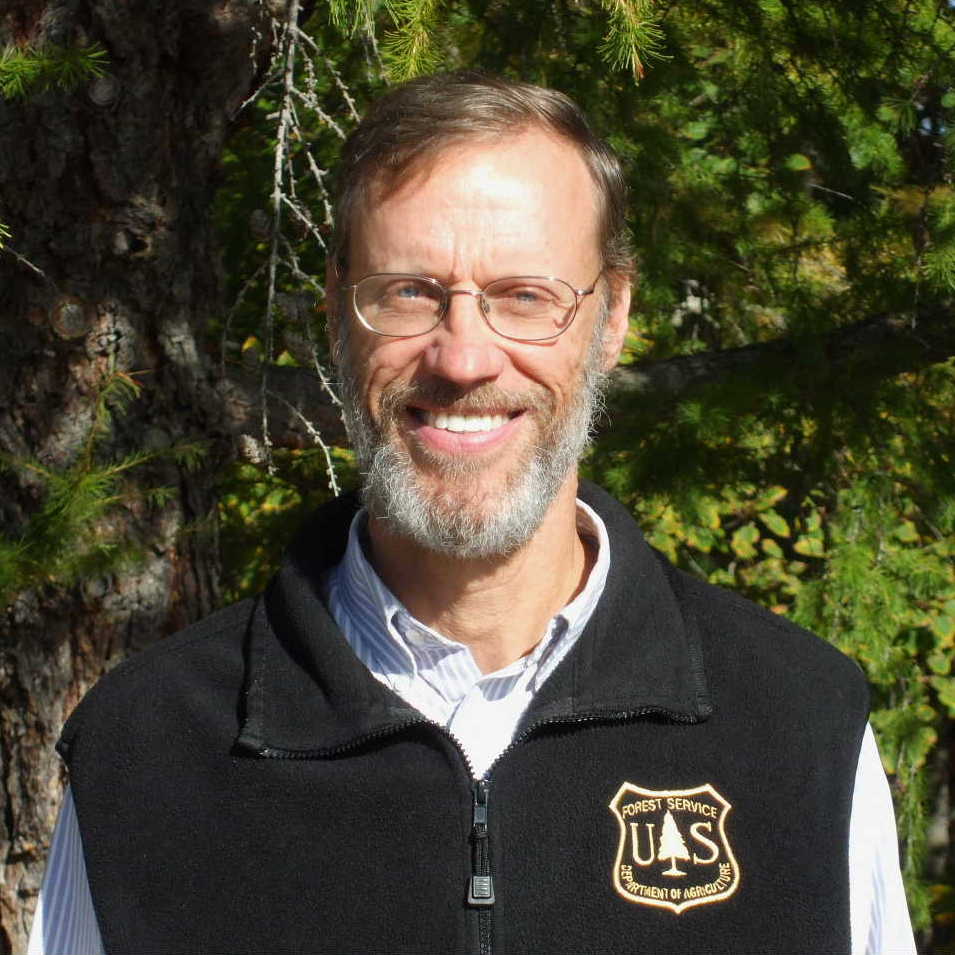 Eric Gustafson合作论文数Institute for Applied Ecosystem Studies, United States Forest Service Forest Service3
 Jeremy S Fried合作论文数PNW Research Station, USDA Forest Service3
 Charlotte E. Gonzalez-Abraham合作论文数Department of Forest Ecology & Management, University of Wisconsin – Madison3
 Brian R. Sturtevant合作论文数Northern Research Station, Forest Service, U.S. Department of Agriculture3Nicholas S. Keuler合作论文数3Daniel G. Brown合作论文数2Dr Field合作论文数2
 Katherine Curtis合作论文数Department of Community and Environmental Sociology, College of Agricultural and Life Sciences, University of Wisconsin-Madison2
 Patricia Malico Alexandre合作论文数2
 Scott Akins合作论文数2
 Kathleen Bergen合作论文数School for Environment and Sustainability, University of Michigan-Ann Arbor2
 Rubén G. Rumbaut合作论文数Department of Sociology, School of Social Sciences, University of California2Stansfield Richard合作论文数Department of Sociology and Criminal Justice, University of Delaware2
 John R. Sauer合作论文数U.S. Geological Survey2
 Frank R. Thompson合作论文数Forest Service, USDA2David D. Long合作论文数2
 David N. Bengston合作论文数USDA Forest Service;North Central Research Station;USDA Forest Service, North Central Research Station2
 Glenn V Fuguitt合作论文数2
 Alexandra D. Syphard合作论文数Department of Geography, San Diego State University2Sebastian Martinuzzi合作论文数Geospatial Laboratory for Environmental Dynamics, University of Idaho2Shaun A. Golding合作论文数1Paul R. Vossa合作论文数1Emily Platt合作论文数1David T. Cleland合作论文数1TK Kuczenski合作论文数1Chin H Wu合作论文数1
 Katherine D. McMahon合作论文数Department of Bacteriology, University of Wisconsin-Madison1
 Derric Jacobs合作论文数Portland State University1gabriel a wigtil合作论文数1
 Bruce Shindler合作论文数Department of Forest Ecosystems & Society, College of Forestry, Oregon State University1
 Alexandra Paige Fischer合作论文数School for Environment and Sustainability, University of Michigan-Ann Arbor1
 Jake Vander Zanden合作论文数Department of Integrative Biology, College of Letters and Science, University of Wisconsin-Madison1
 Pieter Johnson合作论文数College of Arts and Sciences, University of Colorado Boulder1
 Jon Keeley合作论文数Western Ecological Research Center, United States Geological Survey1




