While soil threats and soil health are two interrelated, sometimes confused, concepts, we demonstrated here that a clear separation between these two concepts associated to a mapping of both soil threats and soil health is necessary. Soil threats are commonly defined as processes that may degrade the soil properties, functions or services, while soil health describes the state of the soil at a given moment in time. As a consequence, an unhealthy soil is a soil which is degraded compared to a reference. Mapping soil threats or soil health results then in different but complementary views of the situation. Mapping soil threats informs actions to prevent soil degradation, while mapping soil health indicates the capacity of soils to provide functions and places where remediation is needed. In this study, we demonstrated the differences between these concepts by comparing projection maps for 2050 of soil threats and soil health by considering soil compaction and loss of soil organic carbon (SOC) as soil threats and bulk density and SOC stock as basic soil properties to evaluate both soil threat and soil health in terms of the above-mentioned two soil descriptors. These maps were produced by digital soil mapping, taking into account changes in climate and land use in the European Union (EU). Soil threats were mapped using soil property change between 1980 and 2050 as indicators, that is, a decrease in SOC stocks for SOC loss and increase in soil bulk density for compaction. For soil health assessment, as references are needed, we defined soil areas that could be considered as homogeneous by combining soil, climate and land use information and defined for each area a threshold for soil health based on a quantiles approach. As a result, the obtained soil threat and health maps were very different, as healthy soils can be under threat but not have crossed the threshold yet, while unhealthy soils may not be under threat anymore if no more degradation occurs. These results demonstrate that reading a map requires a good prior understanding of the meaning of the indicators used in order to be able to interpret it in terms of threat or health and to be able to select appropriate metrics, which will not be the same in both cases. Indeed, while soil health maps identify degraded areas where the soil lost part or all its capacity to provide functions and that need remediation, soil threat maps offer vital information about potential vulnerabilities and areas requiring intervention or management strategies.
European soils are exposed to multiple interacting soil threats (STs), challenging the European Commission's objective of restoring healthy soils by 2050. This study provides the first integrated EU-scale projection of four major soil threats-soil compaction, soil organic carbon loss, soil erosion and soil sealing-under two IPCC climate scenarios (SSP1-2.6 and SSP5-8.5), while accounting for land-use change. Unlike previous assessments that examined threats separately, this research analyzes their co-occurrence through the concept of "soil threat bundles". Using digital soil mapping and a k-means clustering approach, the study identified 20 ST bundles and their spatial variation across Europe by 2050. Results show that around 40% of EU soils will not face significant threats, while approximately one-third will experience only one major threat. 22% of soils will be exposed to two simultaneous threats, and between less than 1% (SSP1-2.6) and more than 5% (SSP5-8.5) will experience three interacting threats. Overall, nearly 60% of EU soils could be affected by at least one threat by 2050, a proportion comparable to current estimates of unhealthy soils in Europe. The findings highlight strong differences between climate scenarios. Under SSP1-2.6, land-use change is the second main driver of soil threat distribution. In contrast, under SSP5-8.5, climate change becomes the second main driver, intensifying soil compaction, SOC loss, and erosion, particularly in Central Europe, western England, and the Pyrenees. The study emphasizes the importance of integrated assessments to design targeted soil protection policies within the EU Green Deal and Soil Strategy for 2050.
The assessment of soil health needs to consider the context of soil-forming factors and land use history when identifying reference soils, and set thresholds and management targets specific to different soil types. In the Basque Country (N Spain), rural landscapes and forests have been subjected to anthropogenic transformations and uses since Antiquity, with a profound expansion of intensive forestry plantations during the 20th century. Hence, the establishment of reference soil health status is challenging but essential for guiding sustainable forest management. The aims of this study are: 1) to apply digital soil mapping for the delineation of soil monitoring units in the Basque Country, 2) set up thresholds and targets for soil indicators for managed forest soils, and 3) map the soil health condition of forest plantations. We established a framework for assessing the condition of forest plantations using three indicators suggested by the EU Soil Monitoring and Resilience Law proposal (soil organic carbon (SOC): clay, pH, and bulk density) using data from Basonet, the permanent network for forest monitoring in the Basque Country. The soil units were created applying unsupervised classification to a set of environmental covariates, proxies of the soil-forming factors (pedogenon mapping). Semi-natural native forests were used as reference for setting unit-specific thresholds for soil indicators (i.e., reference approach), and we tested the influence of the selected threshold on the soil health assessment. 61% of plots were in poor condition at the interval 0-20 cm and 90% at 20-40 cm for loss of SOC according to the EU level threshold of SOC:clay
In Europe, rural landscapes and forests have been subjected to intensive anthropogenic transformations and uses since Antiquity. Since the early 20th century, many traditionally managed forests and mountain pastures were transformed into intensive forestry plantations. Hence, it is important to assess the effects of forest plantations on soil health. The European Soil Monitoring Law (SML) proposes the establishment of soil units for monitoring soil health and soil degradation processes using time-series of several indicators: SOC:clay for soil organic carbon (SOC) loss, pH for acidification and bulk density for compaction, among others. Thresholds that may be local must be defined for these different indicators. We propose an approach in which: (1) we delineate soil units applying unsupervised classification to a set of environmental covariates, proxies of the soil-forming factors (pedogenon mapping) and (2) use semi-natural native forests (i.e., secondary forests of native species with lesser human interventions compared to past decades) as references for setting unit-specific thresholds for soil indicators (reference approach) and (3) assessing and mapping the condition of forest plantations (intensively managed forests). We apply this approach to the Basque Country using soil data from the forest monitoring network Basonet. When considering the threshold suggested by the SML for SOC:clay (< 1/13), 61% of plots at 0-20 cm layer and 90% at 20-40 cm layer of plantations were in poor condition (unhealthy), while 37% of plots at 0-20 cm and 79% at 20-40 cm of semi-natural forests would be considered unhealthy. When considering semi-natural forest as references the proportion of plantation plots in poor condition for SOC:clay ranged between 14%-50% depending on the percentile used to set thresholds (5th and 25th percentiles). Forest plantations had lower soil pH compared to semi-natural forests, with 15%-60% of plantation plots with pH lower than the unit-specific thresholds (poor condition). Only 3% of topsoils and 2% of subsoils under plantations were considered unhealthy with a fixed pH threshold of 4.2. All plantation plots were in good condition (healthy) in terms of bulk density with the EU criteria, but 9.6% of semi-natural plots had greater bulk density than the suggested thresholds. Our approach demonstrates the need of considering the context of soil-forming factors when identifying thresholds for soil health indicators.
Soils are under multiple threats, with varying levels of intensity and nature across different areas. It is therefore important to assess the soil threat level. To do so, scientific indicators have been developed, but their implementation at the country level can be challenging. As stakeholders have good knowledge of soil conditions, stakeholders' perceptions on soil threats could be used as a complementary indicator. The objective of this paper is to explore this possibility focusing on the five soil threats considered by stakeholders as the most important at the European level: erosion, artificialisation, compaction, soil organic carbon (SOC) loss and contamination. A participatory stakeholder consultation conducted in France in 2021 yielded 1444 responses. We elaborated stakeholders' perception maps at the departmental scale, which we compared with scientific indicator maps per soil threat. Our findings indicate that stakeholders consider artificialisation the most important soil threat in France. The spatial distribution of soil threats based on stakeholders' perceptions and scientific indicators matches in 43% of the departments for SOC loss, and in over half of the departments for erosion (50%), compaction (51%), artificialisation (63%) and contamination (74%). The differences can be attributed to higher stakeholders' perception compared to scientific indicators for erosion, SOC loss and contamination. Conversely, for artificialisation and compaction, these differences can be attributed to lower stakeholders' perception than the scientific indicators. Moreover, certain scientific indicators assess the threat only partially, whereas stakeholders may perceive the threat differently or as a whole. When biases in the scientific assessment, stakeholders' perception or comparison are taken into consideration, stakeholders' perceptions can be used as a tool to complement existing scientific indicators.
Enchytraeids (Annelida Oligochaeta), small burrowing organisms found worldwide, are known to influence soil structure, though their specific effects on pore space are not well quantified. In this study, we evaluated how the burrowing activities of Enchytraeus albidus and Enchytraeus crypticus affected the X-ray imaged porosity of soil over a 40- day period using two different soils (loamy and silty-clay-loamy soil) sieved to 2 mm and packed at two bulk densities (0.8 and 1 g cm-3). Our findings revealed that while enchytraeids had minimal impact on Xray imaged porosity, they played a key role in reshaping the soil's internal structure, increasing pore connectivity and homogenizing pore size distribution. This was evident through a reduction in the number of smaller pores and a shift toward larger pore sizes. The overall pore structure became more uniform, with enchytraeids promoting a shift in the dominant pore sizes. These structural changes were particularly pronounced in loosely compacted soils, where enchytraeids contributed to greater network complexity, as well as in the soil with a higher clay content, which is more conducive to aggregation. This suggests that enchytraeids have a significant role in modifying soil physical properties, especially in conditions where the soil is loosely compacted. X-ray microtomography is a promising tool for studying at the mesopore scale, and further studies are needed to better characterize the bioturbation activity of enchytraeids.
Most process-based models of soil development with explicit water transfer are based on an assumption of constant soil volume over time. Nevertheless, the consequences of this simplification on model outputs are not negligible when used on a several decades to a century time scale since, over such a time scale, soils experience strain due to multiple processes, which results in significant change in soil volume over depth and time. We propose in this paper a new approach to considering volume change in a process-based model of soil evolution over short to medium time scales (10 to 70 years). The model takes into account the feedbacks among processes responsible for soil evolution including soil organic carbon dynamics as well as transfer of water, heat and gas while considering the impacts of climate change as well as human activities on soil. To replace the constant volume hypothesis, we introduce in the model an estimation, by a pedotransfer function, of the bulk density that was then used to estimate soil volume in the model. The feasibility of this approach was demonstrated using a simple bulk density pedotransfer function based on soil organic carbon content for three long-term experiment sites with different scenarios of land use or tillage practices on Haplic Luvisols in the north of France. Both versions of the model (constant and changing volume) were tested. Soil dilation was predicted over the top soil (<15 cm) when the tillage practices were reduced. Conversion from agriculture to pasture induced an expansion of all layers of the soil profile. Hydraulic properties of the soil were also impacted by the volume change. Over longer time scales, other pedotransfer functions accounting for the impact of various pedological processes on bulk density should be implemented along with the inclusion of other processes responsible for volume change in order to accurately represent the retroactions between the soil volume and the processes affecting its development.
In Europe, 60%–70% of soils are considered degraded, underscoring the urgent need for consistent monitoring to prevent further degradation and support evidence-based policies for sustainable soil management. Many countries in Europe have implemented one or more soil monitoring systems (SMSs), often established long before the EU-wide “Land Use/Cover Area frame statistical Survey Soil”, LUCAS Soil program. As a result, their sampling strategies and analytical methodologies vary significantly. The proposed EU Directive on Soil Monitoring and Resilience (Soil Monitoring Law, SML) aims to address these differences by establishing a unified framework for systematic soil health monitoring across the EU. This paper assesses the compatibility of the 25 identified SMSs from countries participating in the EJP SOIL Program with the anticipated requirements of the SML. The analysis focuses on critical aspects, including sampling strategies, analytical methods, and data accessibility. Results show significant variability in SMS approaches, including sampling depth, monitored land uses, and analytical methods, which limit cross-system comparability. Despite challenges, opportunities for harmonization include aligning SMSs with the LUCAS Soil methodology, developing transfer functions, and adopting scoring systems for soil health evaluation. Enhanced collaboration and data accessibility are also emphasized as critical for achieving the SML's objectives. This research provides actionable recommendations to harmonise SMSs with the SML framework, promoting coordinated soil monitoring efforts across Europe to support the EU's goal of achieving healthy soils by 2050.
Implementing sustainable soil management practices to enhance soil health is a priority in research and policymaking across Europe. There is a need to identify the main soil challenges faced by different European stakeholders and the critical threats limiting the adoption of sustainable management of agricultural soils. The present study analyses stakeholders' perspectives on key soil challenges, knowledge gaps, and priorities for agricultural soil research across partner countries that participated in the European Joint Programme on Soil (EJP SOIL) 2020-2025. Two complementary stakeholder activities-a survey and a workshop-were conducted across 24 partner countries (divided into four regions: Central, Northern, Southern, and Western Europe) of the EJP SOIL consortium in 2024. Among 10 pre-identified soil challenges, the findings highlight that maintaining or increasing soil organic carbon, avoiding soil sealing, and avoiding soil erosion are the top three priorities across Europe. However, the perceived prioritisation of soil challenges differed both between and within regions, reflecting each country's specific soil health context. Divergences in perceptions between practitioners and other stakeholder groups underscore the need to develop actions aimed at better understanding the rationale behind such discrepancies and how to overcome them. In addition, other key challenges for achieving sustainable soil management across Europe include limited funding, policy incoherencies, poor knowledge dissemination and co-creation, and insufficient soil monitoring. Environmental factors influencing soil health, including climate change, together with governance and economic models, were perceived to be critical limitations to the adoption of sustainable management of agricultural soils. This study also emphasises the need for a diversity of engagement methods, policies, and system approaches to support a transition towards sustainable soil management. These findings underscore the need for future research agendas that focus on integrated knowledge and participatory approaches, and strategies involving societal awareness and policy alignment-key elements that have also informed broader strategies involving societal awareness and engagement towards sustainable soil management in Europe.
Soil is a major terrestrial carbon reservoir, and enhancing its carbon stock is a central strategy to mitigate climate change. Earth system models project a net soil carbon sink by 2100, the magnitude of which is still under debate, differing significantly between approaches. Radiocarbon-based studies often suggest a limited soil carbon accumulation capacity, but these estimates are biased by the presence of ancient, radiocarbon-free, organic carbon (aOC). This carbon no longer contributes to soil carbon dynamics and increases the average 14C age of soil carbon because it is radiocarbon-depleted. This known radiocarbon caveat can be overcome with a better understanding of the aOC (ancient radiocarbon-free OC) distribution in the world's soils. Here we apply a mixing linear equation to 313 soils worldwide from radiocarbon databases to estimate the aOC contained in soils. The aOC contained in soils has different origins, from rock-derived to old biospheric C strongly associated with mineral particles during pedogenesis. Our findings show a mean aOC content of 2.4 mg/g ±3.2 SD with an aOC contribution up to 11% of the soil organic carbon in topsoils (0-30 cm depth), reaching 25% in subsoils (30-100 cm depth) and more than half in deep soil (> 100 cm depth). We demonstrate that the aOC content is particularly high in Andosols and Cryosols. We subtracted the aOC contributions to calculate a global mean corrected age of non-aOC carbon to 1 m depth of 290 years, contrasting sharply with previously reported values of 3100 to 4830 years. This corrected estimate aligns more closely with independent isotopic proxies (13C and 36Cl) of soil carbon dynamics. These results also reconcile empirical data with the parameterization of Earth system models.
The scientific concepts of soil threats (STs) and soil-related ecosystem services (SESs) are gaining importance and are fueling the debate on natural resources management and decision-making within the EU. The literature reports numerous assessments of individual STs and SESs at the European scale. However, a comprehensive overview of the patterns emerging from the relationships between STs and SESs is still lacking, which restricts the ability to limit soil degradation and its impact on SESs. In this article, we provide an in-depth analysis of existing European maps for three STs (soil organic carbon loss, erosion, and compaction) and four SESs (climate regulation and carbon sequestration, hydrological control, biomass production, and erosion control) and the feasibility of combining them to study their relationships. At the EU-level, 37 maps for these STs and 17 for these SESs were encountered. With the notable exception of erosion, these maps differ considerably in their conceptualization of STs and SESs, and in the indicators, methods, and databases used to assess them. In the current situation, the combination of individual maps of STs and SESs to study their relationships is rarely possible. Besides these limitations, we identify possible combinations and provide recommendations aimed at improving the compatibility between different STs/SESs maps. We conclude that there is a need for a more robust framework for conceptualizing STs/SESs and for systematically and precisely specifying the chosen indicators.
Enchytraeids (Annelida Oligochaeta) are burrowing soil organisms that are found worldwide, but their specific effects on pore space have not been quantified. The aim of this study was to assess the combined burrowing activities of Enchytraeus albidus and Enchytraeus crypticus in disturbed soil columns (3.3 cm in diameter, 2.5 cm high) using two different soils (loamy and silty-clay-loamy soil) sieved to 2 mm and packed at two bulk densities (0.8 and 1 g cm-3). The pore space geometry was measured on 3D images of the soil columns obtained by X-ray microtomography at the experiment start and 40 days after the introduction or not (control) of enchytraeids. Total porosity was not modified by enchytraeids, except in the silty-clay-loamy soil at a bulk density of 0.8 g cm⁻³ where it decreased by 11% in the top 8 mm. The peak porosity loss of -70% at the depth of 3 mm might be due to food addition. Conversely, enchytraeids significantly increased burrow networks, as indicated by the Euler number increase by 93% and 86% at 0.8 g cm⁻³ in loamy and silty-clay-loamy soils, respectively, and by 60% at 1 g cm⁻³ in loamy soil. Enchytraeids homogenized pore distribution, evidenced by the significant decrease by 42.8% and 37.3% in voxel number at 0.8 g cm⁻³ in loamy and silty-clay-loamy soil, respectively, and by the dominant pore size shift to larger ranges (loamy soil: from 200-250 µm to 350-400 µm; silty-clay-loamy soil: from 350-400 µm to 450-500 µm). In loamy soil at 0.8 g cm⁻³, homogenization also resulted in the skewness coefficient decrease. These effects were almost absent in both soils at the bulk density of 1 g cm⁻³. These pore network changes induced by enchytraeids were more pronounced at soil bulk density 0.8 g cm-3 and in the silty-clay-loamy soil, which has a higher clay content and therefore, is more subject to aggregation. These porosity changes near the soil surface, where enchytraeids predominantly reside, could significantly influence water infiltration and retention, particularly for plant uptake.
Soils are the foundation of agricultural production, ecosystem functioning and human well-being. Bridging soil knowledge gaps and improving the knowledge system is crucial to meet the growing EU soil policy ambitions in the face of climate change and the ongoing trend in soil degradation. The objective of this article is to assess the current state of knowledge, knowledge use and knowledge gaps concerning sustainable soil management in Europe. This study is based on interviews with 791 stakeholders and 254 researchers and on a comprehensive review of >1800 documents carried out under the European Joint Programme on agricultural soils. Despite differences in stakeholder groups, the conclusions are rather consistent and complementary. We identified major knowledge gaps with respect to (1) soil carbon stocks, (2) soil degradation and fertility and (3) strategies for improved soil management. Transcending these three areas, particularly the loss of soil organic carbon, peatland degradation and soil compaction, are most critical, thus, we stress the urgency of developing more models and monitoring programmes on soils. Stakeholders further report that insufficient transfer of existing soil research findings to practitioners is a hindrance to the adoption of sustainable soil management practices. In addition to knowledge production, soil knowledge gaps may be addressed by considering seven recommendations from the stakeholders: (1) raising awareness, (2) strengthening knowledge brokers, (3) improving relevance of research activities and resource allocation for land users, (4) peer-to-peer communication, (5) targeting advice and information, (6) improving knowledge access, and (7) providing incentives. We argue that filling and bridging knowledge gaps should be a priority for policymakers and the insights provided in the article may help prioritise research and dissemination needs enabling a transition to more sustainable soil management in Europe.
Current soil- and land degradation seriously challenge our societies; it contributes to climate change, loss of biodiversity and loss of agricultural productions. Yet, soils are also seen as a major part of the solution, if maintained or restored to provide ecosystem services. Climate-smart sustainable management of soils can provide options for soil health maintenance and restoration. In the European Union, the resource management and sustainability challenge are addressed in the Green Deal that, among other goals, aspires towards a healthy climate-resilient agricultural sector that will produce sufficient products without damaging ecosystems and contribute to better biodiversity and mitigate climate change. The European Joint Programme (EJP) SOIL was set up to contribute to these goals by developing knowledge, tools and an integrated research community to foster climate-smart sustainable agricultural soil management that provides a diversity of ecosystem service, such as adapting to and mitigating climate change, allowing sustainable food production, and sustaining soil biodiversity. This paper provides an overview of the potential of climate-smart sustainable soil management research to the targets of the Green Deal that are related to soils most directly. The EJP SOIL EU-wide consultation (interviews and questionnaires) and literature analysis (national and international reports and papers) done in the first year (2020-2021) generated a wealth of data. This data showed that there are specific manners to do research that are essential for it to be effective and efficient and that can actively contribute to the Green Deal targets. We concluded that research needs to be: (i) interdisciplinary, (ii) long-term, (iii) multi-scaled, from plot to landscape, (iv) evaluating trade-offs of selected management options for ecosystem services and (v) co-constructed with key stakeholders. Research on climate-smart sustainable soil management should be developed (1) on plot scale when mobilizing soil processes and on landscape scale when addressing sediment and water connectivity and biodiversity management; and (2) address the enabling conditions through good governance, social acceptance and viable economic conditions. A guideline to European agricultural soil management: three layers for sustainable soil management: the biosphere: healthy soils and (bio)diverse landscapes (green bar); solutions: based on functioning of the natural system (yellow bar); enabling conditions: finding the social and economic enable conditions (blue bar).image
Land degradation resulting from increased continental surface erosion is a worldwide and systemic phenomenon due to human activities. Already fragile, the intertropical zone is likely to be further affected by climate change and increased aridity, an aggravating factor of soil erosion and land degradation. A major challenge is thus to provide the necessary knowledge to not only deepen our understanding of the Earth system and its critical thresholds but also to help achieving sustainable development goals. Understanding the factors that control the properties and processes of the critical zone, and especially what will be its responses to ongoing climate and land use changes, requires multidisciplinary efforts to tackle time scales that are compatible with morphogenesis and soil development as well as environmental disturbances of anthropogenic origin. Due to its prominent ecological importance, the Brazilian Cerrado biome is an ideal natural laboratory were to gauge the consequences of recent and strong human activities on continental surface erosion. We focused on the region of Brasília where our approach allows confronting the temporal scales of long-lived and stable cosmogenic nuclides with that of short-lived radioactive isotopes, through a comparison of natural and anthropogenically disturbed land surfaces. Our results indicate that long-term, background denudation rates are lower than 10 mm kyr-1whereas recent erosion rates due to human activities may reach rates at least 160 times higher, exceeding by far the sustainability rates of the soil resource.
Soil organic carbon is one of the largest surface pools of carbon that humans can manage in order to partially mitigate annual anthropogenic CO2 emissions. A significant element to assess soil sequestration potential is the carbon age, which is evaluated by modelling or experimentally using carbon isotopes. Results, however, are not consistent. The 14C derived approach seems to overestimate by a factor of 6–10 the average carbon age in soils estimated by modeling and 13C approaches and thus the sequestration potential. A fully independent method is needed. The cosmogenic chlorine nuclide, 36Cl, is a potential alternative. 36Cl is a naturally occurring cosmogenic radionuclide with a production that increased by three orders of magnitude during nuclear bomb tests. Part of this production is retained by soil organic matter in organochloride form and hence acts as a tracer of the fate of soil organic carbon. We here quantify the fraction and the duration of 36Cl retained in the soil and we show that retention time increases with depth from 20 to 322 years, in agreement with both modelling and 13C-derived estimates. This work demonstrates that 36Cl retention duration can be a proxy for the age of soil organic carbon.
Climate-smart sustainable management of agricultural soil is critical to improve soil health, enhance food and water security, contribute to climate change mitigation and adaptation, biodiversity preservation, and improve human health and wellbeing. The European Joint Programme for Soil (EJP SOIL) started in 2020 with the aim to significantly improve soil management knowledge and create a sustainable and integrated European soil research system. EJP SOIL involves more than 350 scientists across 24 Countries and has been addressing multiple aspects associated with soil management across different European agroecosystems. This study summarizes the key findings of stakeholder consultations conducted at the national level across 20 countries with the aim to identify important barriers and challenges currently affecting soil knowledge but also assess opportunities to overcome these obstacles. Our findings demonstrate that there is significant room for improvement in terms of knowledge production, dissemination and adoption. Among the most important barriers identified by consulted stakeholders are technical, political, social and economic obstacles, which strongly limit the development and full exploitation of the outcomes of soil research. The main soil challenge across consulted member states remains to improve soil organic matter and peat soil conservation while soil water storage capacity is a key challenge in Southern Europe. Findings from this study clearly suggest that going forward climate-smart sustainable soil management will benefit from (1) increases in research funding, (2) the maintenance and valorisation of long-term (field) experiments, (3) the creation of knowledge sharing networks and interlinked national and European infrastructures, and (4) the development of regionally-tailored soil management strategies. All the above-mentioned interventions can contribute to the creation of healthy, resilient and sustainable soil ecosystems across Europe.
 David Montagne合作论文数33Isabelle Cousin合作论文数Unité de Science du Sol24Anatja Samouelian合作论文数14
 Christine Hatté合作论文数Laboratoire des Sciences du Climat et de lEnvironnement;Silesian University of Technology14
 Isabelle Lamy合作论文数UR 251 Unité PESSAC, INRA11
 Isabelle Basile-Doelsch合作论文数LSTUR, IRD-Réunion10S. Salvador-Blanes合作论文数Unité de Science du Sol, INRA Orléans10
 Jérôme Balesdent合作论文数Centre Européen de Recherche et d'Enseignement des Géosciences de l'Environnement/Aix Marseille Université10
 Yves Lucas合作论文数Laboratory PROTEE (PROcessus de Transferts et d’Echanges dans l’Environnement),, University of Toulon9
 Nicolas P. A. Saby合作论文数Unité InfoSol, INRA9
 Hocine Bourennane合作论文数8
 Denis Baize合作论文数8Joel Chadoeuf合作论文数8C. Laveuf合作论文数7
 Lydie Le Forestier合作论文数7Folkert van Oort合作论文数7
 J.D. Meunier合作论文数7Michel Hardy合作论文数Institut Jules Bordet Department of Intensive Care and Thoracic Oncology Brussels Belgium Brussels Belgium7
 Peter Finke合作论文数Department of Geology and Soil Science, Ghent University7christelle dere合作论文数6
 Olivier Evrard合作论文数6
 Zuzana Fekiacova合作论文数6Daniel Borschneck合作论文数6
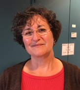 Claire Chenu合作论文数INRA AgroParisTech6Blandine Clozel合作论文数6
 Delphine Derrien合作论文数POLYINTELL, Pharmaparc II6
 Didier L Bourles合作论文数5Annie Guerin合作论文数5
 Catherine Keller合作论文数Centre Européen de Recherche et d’Enseignement des Géosciences de l’Environnement, Aix-Marseille Université5
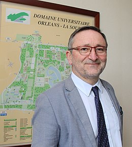 Ary Bruand合作论文数universite d'Orleans5Olivier Josière合作论文数5
 Chiara Piccini合作论文数5
 Marie-Liesse Vermeire合作论文数Earth and Life Institute, Université catholique de Louvain5David King合作论文数5Farid Juillot合作论文数Université Paris Diderot, Université Pierre et Marie Curie5
 Bertrand Guenet合作论文数Laboratoire de Géologie, Geosciences Department, Ecole Normale Supérieure;Centre National de la Recherche Scientifique5
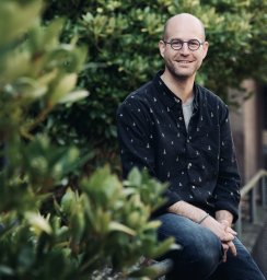 Jean-Thomas Cornelis合作论文数Earth and Life Institute - Environmental Sciences, Université catholique de Louvain5
 Luboš Borůvka合作论文数Faculty of Agrobiology, Food and Natural Resources, Czech University of Life Sciences Prague5Eloise Mason合作论文数4Romain van den Bogaert合作论文数4Adrien Duvivier合作论文数4
 martin h thorsoe合作论文数Department of Agroecology, Aarhus University4J Balesdent合作论文数4
 Beatrice Bechet合作论文数4
 Cecile Delolme合作论文数Université de Lyon;ENTPE;Laboratoire des Sciences de l'Environnement, Vaulx en Velin, F-69518, France;Laboratoire des Sciences de l'Environnement, Université de Lyon4
 Bruno Delvaux合作论文数Unité des Sciences du Sol, Université catholique de Louvain4Ann Saada合作论文数4
 S D (Saskia) Keesstra合作论文数University of Newcastle;Wageningen University and Research4




