AbstractThe machine learning revolution presents geoscientists with exciting new opportunities for research, but is constrained by the need for large, high quality training data sets. Simultaneously, undergraduate and graduate program admissions have become increasingly competitive, pressuring high school and undergraduate students to differentiate themselves through involvement in research at earlier stages. Aligning these two interests provides mutually beneficial opportunities for both geoscientists and early‐stage students. We describe our experiences working with 20 early‐stage students to build a large training data set digitized from satellite images of meltwater drainage patterns on ice sheets. The intent of this Perspective is to share our experience and lessons learned with other machine learning researchers who, like us, may have minimal experience mentoring young volunteer researchers but may seek such partnerships for the first time in response to their machine learning training data set needs. These partnerships enabled creation of a powerful new machine learning model that would have otherwise been infeasible. Student benefits varied with their commitment and proactiveness, ranging from exposure to geoscience research and a resume line item to strong letters of recommendation and ongoing connections with geoscience researchers at an elite university lab. Many students were attracted to the project solely out of interest in machine learning, so the opportunity reached students who would not otherwise have conducted research in geoscience. Still, without incentives for researchers to engage less‐privileged students, our experience suggests that mutually beneficial partnerships between researchers and early‐stage students may exacerbate issues of inequality and lack of diversity within the geosciences.
Ambient nitrogen dioxide (NO2) is derived from tailpipe vehicle emission and is linked with various of health outcomes. Personal exposure monitoring is crucial for accurate assessment of the associated disease risks. This study aimed to evaluate the utility of a wearable air pollutant sampler in determining the personal NO2 exposure of school children for comparison with a model-based personal exposure assessment. We employed cost-effective, wearable passive samplers to directly measure personal exposure of 25 children (aged 12-13 years) in Springfield, MA to NO2 over a five-day period in winter 2018. NO2 levels were additionally measured at 40 outdoor sites in the same region using stationary passive samplers. A land use regression (LUR) model was developed based on the ambient NO2 measures, with a good prediction performance (R2 = 0.72) using road lengths, distance to highway, and institutional land area as predictor variables. Time-weighted averages (TWA), which incorporated the time-activity patterns of participants and LUR-derived estimates in children's primary microenvironments (homes, the school and commute paths), were calculated as an indirect measure of personal NO2 exposure. Results indicated that the conventional residence based exposure estimate approach, often used in epidemiological studies, differed from the direct personal exposure and could overestimate the personal exposure by up to 109 %. TWA improved personal NO2 exposure estimates by accounting for the time activity patterns of individuals, a difference of 5.4 % & PLUSMN; 34.2 % was found for exposures compared to wristband measurements. Nevertheless, the personal wristband measurements exhibited a large variabilitydue to the potential contributions from indoor and in-vehicle NO2 sources. The findings suggest that exposure to NO2 can be highly personalized based on individual activities and contact with pollutants in specific microenvironments, reaffirming the importance of measuring personal exposure.
Public health officials conduct water quality monitoring at marine beaches to reduce the risk of gastrointestinal illness. Climate change causes increased frequency of heavy rainfall events associated with pathogen-laden runoff, necessitating review of beach closure policies to ensure they are adequate to protect public health. Specifically, the lag of approximately 24-48 hr between collecting the water sample and reporting of assay results represents a period when the potentially contaminated beach remains open. Preemptive beach closure-the shutdown of beaches following a rainfall event of predetermined size-could serve as a solution. We surveyed 15 health departments of Connecticut towns along Long Island Sound and found that only 3 sampled after heavy rainfall events and only 6 practiced preemptive beach closure. We then used historical meteorological and water sampling data in logistic models to develop rainfall thresholds for preemptive closure for four Connecticut coastal towns and identified 2-day precipitation as the primary predictor of enterococci levels. Because preemptive beach closures can cause daily life and economic disruptions and are not widely popular, we engaged with stakeholders, town officials, and the public at each stage of the project. Through collaboration and transparency with communities, preemptive beach closure policies were implemented in two towns.
Meltwater runoff from the Greenland ice sheet (GrIS) is an important contributor to global sea level rise, but substantial uncertainty exists in its measurement and prediction. Common approaches for estimating ice sheet runoff are in situ gauging of proglacial rivers draining the ice sheet and surface mass balance (SMB) modeling. To obtain hydrological and meteorological data sets suitable for both runoff stage characterization and, pending the establishment of stage–discharge curves, SMB model evaluation, we established an automated weather station (AWS) and a cluster of traditional and experimental river stage sensors on the Minturn River, the largest proglacial river draining Inglefield Land, NW Greenland. Secondary installations measuring river stage were installed in the Fox Canyon River and North River at Pituffik Space Base, NW Greenland. Proglacial runoff at these sites is dominated by supraglacial processes only, uniquely advantaging them for SMB studies. The three installations provide rare hydrological time series and an opportunity to evaluate experimental measurements of river stage from a harsh, little-studied polar region. The installed instruments include submerged vented and non-vented pressure transducers, a bubbler sensor, experimental bank-mounted laser rangefinders, and time-lapse cameras. The first 3 years of observations (2019 to 2021) from these stations indicate (a) a meltwater runoff season from late June to late August/early September that is roughly synchronous throughout the region; (b) the early onset (∼ 23 June to 8 July) of a strong diurnal runoff signal in 2019 and 2020, suggesting minimal meltwater storage in snow and/or firn; (c) 1 d lagged air temperature that displays the strongest correlation with river stage; (d) river stage that correlates more strongly with ablation zone albedo than with net radiation; and (e) the late-summer rain-on-ice events appear to trigger the region's sharpest and largest floods. The new gauging stations provide valuable in situ hydrological observations that are freely available through the PROMICE network (https://promice.org/weather-stations/, last access: 14 September 2023).
Abstract. Meltwater runoff from the Greenland Ice Sheet (GrIS) is an important contributor to global sea level rise, but substantial uncertainty exists in its measurement and prediction. Common approaches for estimating ice sheet runoff are in situ gauging of proglacial rivers draining the ice sheet, and surface mass balance (SMB) modeling. To obtain hydrological and meteorological datasets suitable for both runoff characterization and SMB model validation, we established an automated weather station (AWS) and cluster of traditional and experimental river stage sensors on the Minturn River, the largest proglacial river draining Inglefield Land, NW Greenland. Secondary installations measuring river stage were installed in the Fox Canyon River and North River at Thule Air Base, NW Greenland. Proglacial runoff at these sites is dominated by supraglacial processes only, uniquely advantaging them for SMB studies. The three installations provide rare hydrological time-series and an opportunity to evaluate experimental measurements of river stage from a harsh, little-studied polar region. The installed instruments include submerged vented and non-vented pressure transducers, a bubbler sensor, experimental bank-mounted laser rangefinders, and time-lapse cameras. The first three years of observations (2019 to 2021) from these stations indicate a) a meltwater runoff season from late June to late August/early September, roughly synchronous throughout the region; b) early onset (~ June 23 to July 8) of a strong diurnal runoff signal in 2019 and 2020, suggesting minimal meltwater storage in snow/firn; c) one-day lagged air temperature displays the strongest correlation with river stage; d) river stage correlates more strongly with ablation zone albedo than with net radiation; and e) late-summer rain-on-ice events appear to trigger the region’s sharpest and largest floods. The new gauging stations provide valuable in situ hydrological observations from a little-studied, rapidly changing area and are freely available through the PROMICE network (https://promice.org/weather-stations/).
The Greenland Ice Sheet is a leading source of global sea level rise, due to surface meltwater runoff and glacier calving. However, given a scarcity of proglacial river gauge measurements, ice sheet runoff remains poorly quantified. This lack of in situ observations is particularly acute in Northwest Greenland, a remote area releasing significant runoff and where traditional river gauging is exceptionally challenging. Here, we demonstrate that georectified time-lapse camera images accurately retrieve stage fluctuations of the proglacial Minturn River, Inglefield Land, over a 3 year study period. Camera images discern the river’s wetted shoreline position, and a terrestrial LiDAR scanner (TLS) scan of riverbank microtopography enables georectification of these positions to vertical estimates of river stage. This non-contact approach captures seasonal, diurnal, and episodic runoff draining a large (∼2,800 km 2 ) lobe of grounded ice at Inglefield Land with good accuracy relative to traditional in situ bubble-gauge measurements ( r 2 = 0.81, Root Mean Square Error (RMSE) ±0.185 m for image collection at 3-h frequency; r 2 = 0.92, RMSE ±0.109 m for resampled average daily frequency). Furthermore, camera images effectively supplement other instrument data gaps during icy and/or low flow conditions, which challenge bubble-gauges and other contact-based instruments. This benefit alone extends the effective seasonal hydrological monitoring period by ∼2–4 weeks each year for the Minturn River. We conclude that low-cost, non-contact time-lapse camera methods offer good promise for monitoring proglacial meltwater runoff from the Greenland Ice Sheet and other harsh polar environments.
Mass loss from the Greenland Ice Sheet (GrIS) is a primary contributor to sea level rise, but substantial uncertainty exists in estimates of future ice sheet losses. Surface mass balance (SMB) models, the current leading approach to sea level rise projection, anticipate continued dominance of runoff as a mass loss pathway. Despite their preeminence, SMB models in vulnerable northern environments lack adequate field validation, particularly for error-sensitive runoff estimates. We have installed a cluster of high quality field instruments at the Minturn Elv, a proglacial river site in Inglefield Land, NW Greenland to provide discharge and weather datasets for the validation and refinement of climate/SMB runoff models. The instrument cluster has meteorological, hydrological, and time lapse camera instrumentation, including a vented water level stage recorder, single shot and scanning lidars, time lapse cameras, and in situ ADCP discharge and terrestrial scanning lidar measurements. The instrument suite provides novel flow and weather datasets with the opportunity to evaluate experimental approaches to stage measurement in adverse, high-latitude areas. Inglefield is a uniquely advantaged location because proglacial runoff is dominated by SMB processes operating on the ice surface without interference from subglacial hydrology. Overall, our hydrometeorological instrument cluster at Inglefield Land will provide one of the few validation datasets for regional climate models outside of Southwest Greenland.
We initiated a collaboration between local government, academia, and citizen scientists to investigate high frequencies of elevated Escherichia coli bacteria levels in the coastal Short Beach neighborhood of Branford, Connecticut. Citizen scientist involvement enabled collection of short-duration postprecipitation outfall flow water samples (mean E. coli level = 4930 most probable number per 100 mL) and yielded insights into scientific collaboration with local residents. A records review and sanitary questionnaire identified aging properties with septic systems (3.3%) and holding tanks (0.6%) as potential sources of the E. coli contamination.
Transportation projects can affect health through multiple pathways—for example, by degrading air quality or encouraging active transportation. There is a need to incorporate health considerations in transportation decision-making to achieve health-related community goals. This paper presents highway project scoring criteria that allow for capturing the impact of transportation projects on health. These scoring criteria are organized into five groups—air quality, accessibility, equity, physical activity, and safety—to capture the multiple pathways that transportation interacts with health. The focus of this study was on updating the Massachusetts Department of Transportation Highway Division project scoresheet to incorporate health-related criteria. Evidence base, standards, and data needs based on which each criterion is assessed, as well as limitations, are summarized for each of the proposed criteria. The paper concludes with a discussion on the outcomes of the proposed changes as well as the transferability potential of the proposed criteria.
Evaluation of cumulative exposure to air pollutant mixtures has been challenging with traditional techniques due to the weight, limited battery life, and cost of the instrument. The performance of a novel wearable air pollutant sampler, the Fresh Air wristband, to passively concentrate nitrogen dioxide (NO2), volatile organic compounds (VOCs), and polycyclic aromatic hydrocarbons (PAHs) was investigated. The Fresh Air wristband consisted of a commercially available triethanolamine-coated pad to collect NO2 and a polydimethylsiloxane (PDMS) sorbent bar to sample VOCs and PAHs. Concentrations were measured off-line following the assessment period. The repeatability and rate of uptake of VOCs and PAHs by the PDMS sorbent bar were evaluated, and the Fresh Air wristband was tested as an exposure tool. The PDMS sorbent bar achieved reproducible uptake from ambient air with uptake rates varying from 2 to 5 days across compounds. Higher-molecular weight compounds (>180 g/mol) were retained well in the PDMS sorbent bar over multiday periods. The Fresh Air wristband was demonstrated as a personal exposure tool; exposures of school-aged children were found to differ by sex, asthma status, home kitchen characteristics, and mode of travel to school. The lightweight, wearable Fresh Air wristband will enable future longitudinal air pollutant exposure assessment in vulnerable populations.
Transportation can impact health through exposure to air pollution, noise, and traffic injuries as well as influence physical activity levels by encouraging or discouraging active transportation. In addition, transportation can affect access to opportunities and mitigate or worsen equities related to all of these exposures. It is therefore critical to recognize and assess health impacts of transportation projects, plans, and policies and develop prioritization frameworks in order to make transportation decisions that support health communities. Health impacts have been accounted for in transportation decision-making in the United States primarily through two approaches: (1) health impact assessments (HIAs) and (2) project scoring and prioritization frameworks. This chapter describes these two approaches, their applications, as well as the documented impact they have had on actual transportation decisions. While HIAs in transportation have not commonly been successful in influencing decision-making, they have initiated collaborations between the health and transportation sectors and improved the awareness of transportation impacts on health. On the other hand, it is common for departments of transportation and metropolitan planning organizations to develop project scoring criteria and prioritization frameworks to assist them in their decision-making. While most of these frameworks have not been developed with a health focus, they do account for health considerations through inclusion of criteria related to accessibility, air quality, equity, physical activity, and safety. Documented impacts of health-focused scoring frameworks indicate their success in increasing funding for active transportation projects. Overall, there is a growing interest in incorporating health in transportation decision-making and adjusting project scoring criteria is seen as a cost-effective way to achieve this.
While measurements and models of ambient air pollutants are often used to determine the health risks and disease burdens of exposures, the cumbersome nature of exposure measurements have limited the exploration of the relationship between ambient pollutant concentrations and personal exposure. The development of the Fresh Air wristband, a wristband housing a passive NO2 sampler, allows the personal exposure of vulnerable populations to be assessed directly to evaluate exposure ambient air pollutant concentrations. The objective of this study was to compare various methods for assessing personal exposure to NO2 across a cohort of children in Springfield, MA. A sampling campaign was conduct during a winter season at 40 sites characterized by differing built environments and land uses. Nitrogen dioxide was measured at each site over a five-day period using a stationary Ogawa passive sampler. NO2 exposure was estimated for 40 children (aged 12-13 years) using concentrations predicted using a land use regression model and measured directly using wearable samplers. The land use regression model was developed for the city of Springfield, MA (85 km2 city area), and a validation of the land use regression model will be presented. Personal NO2 was measured using Ogawa samplers that were housed in a Teflon chamber mounted in a wristband, worn by the children over a five-day period (Monday to Friday). A comparison of ambient NO2 concentrations predicted using the land use regression model with wristband results will be discussed in relation to demographic characteristics and mode of transport to school.
Traditional personal air pollutant monitoring systems include backpacks containing hand-held air monitors and filters/pumps which are worn for several days. Given the size, weight and cost of these sampling systems, use with vulnerable populations (i.e. pregnant women, infants) is not feasible. There has been limited development of analytical techniques to capture the cumulative exposure of an individuals to multiple air pollutants. New exposure assessment tools are required to better study longitudinal environmental exposures. We have developed the Fresh Air wristband to profile personal organic air pollutant exposures using a non-selective passive sampling technique. Pollutants are collected onto a sorbent bar housed within a silicone wristband. The sorbent bar is coated with a thin-film polymer substrate which accumulates non-polar air pollutants with a log Kow ranging between 4 and 8. The wristband is worn by an individual for a multi-day period and then analysed using high resolution gas chromatography time-of-flight mass spectrometry with thermal desorption. With this personal exposure assessment tool, we can quantify the time-weighted averages of exposure to a panel of volatile and semi-volatile organic compounds during typical daily activities without impairing motion. We will present data on the functionality of the Fresh Air wristband as a non-selective passive air pollutant sampler. Application of this new personal exposure assessment tool in a cohort of 60 school-aged children residing in Springfield, MA will further be discussed. Improved assessment of exposure using the Fresh Air wristband across life stages (pregnancy, infancy, childhood) has the potential to produce a more comprehensive understanding of the air pollutants that mediate adverse health.
 Seth Goldstein合作论文数4adam l lewinter合作论文数4
 Lincoln H. Pitcher合作论文数Earth Science and Observation Center (ESOC), Cooperative Institute for Research in Environmental Sciences (CIRES), University of Colorado Boulder4
 Krystal Godri Pollitt合作论文数4
 Laurence C. Smith (Laurence Smith)合作论文数Institute at Brown for Environment and Society, Brown University;Department of Earth, Environmental and Planetary Sciences, Brown University4
 Brandon T. Overstreet合作论文数Department of Geology and Geophysics, University of Wyoming4Cuyler Onclin合作论文数3Fareeha Irfan合作论文数3Elizabeth Z Lin合作论文数Department of Environmental Health Sciences, Yale School of Public Health3J C Ryan合作论文数Brown University3Krystal J. Godri Pollitt合作论文数2Michael Pascucilla合作论文数Yale University, Yale University2
 Massimiliano Mascelloni合作论文数Dept Environm Hlth Sci, Univ Massachusetts2
 Robert Dubrow合作论文数Environmental Health Science, Yale School of Public Health, Yale School of Medicine, Yale University2
 Eleni Christofa合作论文数Institute of Transportation Studies, University of California, Berkeley2LeeAnn Munk合作论文数1David Finnegan合作论文数1Sebastian Munoz合作论文数1Aikaterini Deliali合作论文数1Sarita Hudson合作论文数1
 J. Jenckes合作论文数Dept Geol Sci, Univ Alaska Anchorage1
 Evan J. Ramos合作论文数Dept Geol Sci, Univ Texas Austin1
 Gavin Piccione合作论文数Earth & Planetary Sci, Univ Calif Santa Cruz1
 Ethan D. Kyzivat合作论文数Dept Earth Environm & Planetary Sci, Brown Univ1
 Laura Minet合作论文数Department of Civil Engineering, Faculty of Engineering and Computer Science, University of Victoria;Clean Air Lab, University of Victoria1Aine Lehane合作论文数1
 Penelope How合作论文数Department of Glaciology and Climate Geological Survey of Denmark and Greenland1
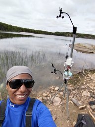 Jessica Fayne合作论文数Dept Earth & Environm Sci, Univ Michigan1
 Daniel Enrique Ibarra合作论文数Institute at Brown for Environment and Society and the Department of Earth, Environmental and Planetary Science, Brown University1
 Marianne Hatzopoulou合作论文数Department of Civil & Mineral Engineering, Faculty of Applied Science and Engineering, University of Toronto1Lemon Stephenie C合作论文数1
 Christine Foley Frisard合作论文数1
 Dong Gao (高栋)合作论文数Center for Excellence in Molecular Cell Science, Chinese Academy of Sciences;University of Chinese Academy of Sciences1
 Brian Leaderer合作论文数Department of Environmental Health Sciences, Yale School of Medicine1Karin Valentine Goins合作论文数1




