This study proposes, for the first time, an approach to remove thermal noise from the wave coherency matrix, $\mathrm {C_{2}}$ , estimated from single-look complex dual-polarization Interferometric Wide Swath mode Sentinel-1 synthetic aperture radar data. The approach is straightforward; it exploits the ThermalNoiseRemoval module, provided by the European Space Agency (ESA) in its Sentinel Application Platform (SNAP) software, to remove thermal noise from the channel intensities. Then, noise correction on the complex data is applied, in order to estimate the noise-free $\mathrm {C_{2}}$ matrix. As a further novelty, the proposed approach can be implemented in SNAP, through the use of a processing graph that is here provided. The method is applied on a dense time series of Sentinel-1 data, collected on an agricultural area located near Seville, Spain. The impact of thermal noise on the estimation of the eigendecomposition parameters of $\mathrm {C_{2}}$ , i.e., entropy ( $H_{2}$ ), average alpha angle ( $\overline {\alpha _{2}}$ ), and anisotropy ( $A_{2}$ ), is assessed for different land-cover types, namely river, rice, forest, and urban areas. Monte Carlo simulations are implemented to assess the performance of the proposed approach in estimating $H_{2}$ , $\overline {\alpha _{2}}$ , and $A_{2}$ . Results show that the proposed noise removal method improves the estimation of these parameters for the considered land-cover classes.
In this letter, we present a new approach to the analysis of polarimetric radar time series, when interest centers on the changes in the full $n \times n$ coherency matrix of the scene rather than a scalar backscatter coefficient. The key to the new idea is to form matrix differences over time, but always constrained so that the remainder is a physical coherency matrix, that is, formed by some combination of physical scattering mechanisms in the scene. We first detail the algorithm and compare it with other published approaches before illustrating its application to the L-band POLSAR data from the NASA-Jet Propulsion Laboratory (JPL) uninhabited aerial vehicle SAR (UAVSAR) system for study of agricultural changes around Saskatoon, Canada, over a two-year baseline.
In this study, we advance a new family of modelbased decompositions adapted for dual-pol synthetic aperture radar data.These are formulated using the Stokes vector formalism, coupled to mappings from full quad-pol decomposition theory.A generalized model-based decomposition is developed, which allows separation of an arbitrary Stokes vector into partially polarized and polarized wave components.We employ the widely used random dipole cloud as a volume model but, in general, non-dipole options can be used.The cross-polarized phase δ, and the α angle, which is a function of the ratio between wave components, measure the transformation of polarization state on reflection.We apply the decomposition to dual-pol data provided by Sentinel-1 covering different scenarios, such as agricultural, forest, urban and glacial land-ice.We show that the polarized term of received polarization state is not usually the same as the transmitted one, and can therefore be used for key applications, e.g., classification and geo-physical parameter estimation.We show that, for vegetated terrain, depolarization is not the only influencing factor to Sentinel-1 backscattered intensities and, in the case of vertical crops (e.g., rice), this allows the crop orientation effects to be decoupled from volume scattering in the canopy.We demonstrate that coherent dualpol systems show strong phase signatures over glaciers, where the polarized contribution significantly affects the backscattered state, resulting in elliptical polarization on receive.This is a key result for Sentinel-1, for which dual-pol phase analysis coupled to dense time series offer great opportunities for land-ice monitoring.
In this paper we develop a new approach to the calibration of polarimetric radar data based on two key ideas. The first is the use of in-scene trihedral corner reflectors not only for radiometric and geometric calibration but also to completely remove any receiver distortion components. Secondly, we then show that the remaining transmitter distortion acts as a similarity transformation of the true scattering matrix. This leads us to employ a change of base to the Pauli matrix components. We show that in this basis calibration and the effects of Faraday rotation become much simplified and for example by using reciprocity alone we can then solve for copolar channel imbalance. Finally by using an uncalibrated symmetric point target of opportunity we can estimate cross-talks and hence fully solve the calibration problem without the need for using clutter averaging or symmetry assumptions in the covariance matrix as used in many other algorithms.
In this paper we outline a new approach to the analysis of polarimetric synthetic aperture (POLSAR) data. Here we exploit target orthogonality as a multi-dimensional extension of wave orthogonality, familiar on the Poincaré sphere. We first show how to formulate a general basis for a complex orthogonal scattering space using a generalization of the Poincaré formulation, and then show how to optimize the backscattered signal in this space for both monostatic and bistatic radar systems. We illustrate application of the new approach, first to ship detection, using data collected off the north-west of Scotland and then land-use applications in a mixed scene around Glasgow, Scotland, both using L-band ALOS-2 POLSAR data.
In this paper, we consider a new method for forest canopy height estimation using TanDEM-X single-pass radar interferometry. We exploit available information from sample-based, space-borne LiDAR systems, such as the Global Ecosystem Dynamics Investigation (GEDI) sensor, which offers high-resolution vertical profiling of forest canopies. To respond to this, we have developed a new extended Fourier-Legendre series approach for fusing high-resolution (but sparsely spatially sampled) GEDI LiDAR waveforms with TanDEM-X radar interferometric data to improve wide-area and wall-to-wall estimation of forest canopy height. Our key methodological development is a fusion of the standard uniform assumption for the vertical structure function (the SINC function) with LiDAR vertical profiles using a Fourier-Legendre approach, which produces a convergent series of approximations of the LiDAR profiles matched to the interferometric baseline. Our results showed that in our test site, the Petawawa Research Forest, the SINC function is more accurate in areas with shorter canopy heights (<~27 m). In taller forests, the SINC approach underestimates forest canopy height, whereas the Legendre approach avails upon simulated GEDI forest structural vertical profiles to overcome SINC underestimation issues. Overall, the SINC + Legendre approach improved canopy height estimates (RMSE = 1.29 m) compared to the SINC approach (RMSE = 4.1 m).
The application of polarimetric Synthetic Aperture Radar (SAR) to forest observation for mapping, classification and parameter estimation (especially biomass) has a relatively long history. The radar penetration through forest volume, and hence the multi-layer nature of scattering models, make fully polarimetric data the observation space enabling a robust and full inversion of such models. A critical advance came with the introduction of polarimetric SAR interferometry, where polarimetry provides the parameter diversity, while the interferometric baseline proves a user-defined entropy control as well as spatial separation of scattering components, together with their location in the third dimension (height). Finally, the availability of multiple baselines leads to the full 3-D imaging of forest volumes through TomoSAR, the quality of which is again greatly enhanced by the inclusion of polarimetry. The objective of this Chapter is to review applications of SAR polarimetry, polarimetric interferometry and tomography to forest mapping and classification, height estimation, 3-D structure characterization and biomass estimation. This review includes not only models and algorithms, but it also contains a large number of experimental results in different test sites and forest types, and from airborne and space borne SAR data at different frequencies.
In this letter, we present a new algorithm for the polarimetric calibration of spaceborne imaging radar systems. The technique combines two features: first, a new method for estimation of distortion matrices without the need for assumptions of small coupling or reciprocity; and second, it employs a factorized polar decomposition, which allows separate estimation of Faraday rotation from system distortion matrices in low-frequency spaceborne systems. We highlight a source of residual error in the procedure called hidden rotators, but show how to mitigate such errors to obtain fully calibrated data for arbitrary Faraday rotation. We illustrate using simulated data from the L-band ALOS-2 satellite.
Based on experimental results, this chapter describes applications of SAR polarimetry to extract relevant information on agriculture and wetland scenarios by exploiting differences in the polarimetric signature of different scatterers, crop types and their development stage depending on their physical properties. Concerning agriculture, crop type mapping, soil moisture estimation and phenology estimation are reviewed, as they are ones with a clear benefit of full polarimetry over dual or single polarimetry. For crop type mapping, supervised or partially unsupervised classification schemes are used. Phenology estimation is treated as a classification problem as well, by regarding the different stages as different classes. Soil moisture estimation makes intensive use of scattering models, in order to separate soil and vegetation scattering and to invert for soil moisture from the isolated ground component. Then, applications of SAR polarimetry to wetland monitoring are considered that include the delineation of their extent and their characterisation by means of polarimetric decompositions. In the last section of the chapter, the use of a SAR polarimetric decomposition is shown for the assessment of the damages consequential to earthquakes and tsunamis.
In this letter, we present a new algorithm for the detection of objects embedded in unwanted background signal. We employ systems in radar and optics capable of measuring the full polarimetric response via either the Mueller matrix or the complex scattering matrix. We first solve an optimization problem to find the maximum signal in the null subspace of the unwanted background. We then detail two levels of algorithm: the first restricted to backscatter systems (such as radar) when the dimensionality of the problem reduces, and also for the full bistatic general case suitable for optical analyses. We present examples to illustrate the application in radar ship detection and aerosol particle discrimination in optics.
In our previous studies, we demonstrated the usefulness of TanDEM-X interferometric bistatic mode with single polarization to obtain forest heights for the purposes of large area mapping. A key feature of our approach has been the use of a simplified Random Volume Over Ground (RVOG) model that locally estimates forest height. The model takes TanDEM-X interferometric coherence amplitude as an input and uses an external Digital Surface Model (DSM) to account for local slope variations due to terrain topography in order to achieve accurate forest height estimation. The selection of DSM for use as a local slope reference is essential, as an inaccurate DSM will result in less accurate terrain-correction and forest height estimation. In this paper, we assessed TanDEM-X height estimates associated with scale variations in different DSMs used in the model over a remote sensing supersite in Petawawa, Canada. The DSMs used for assessments and comparisons included ASTER GDEM, ALOS GDSM, airborne DRAPE DSM, Canadian DSM and TanDEM-X DSM. Airborne Laser Scanning (ALS) data were used as reference for terrain slope and forest height comparisons. The results showed that, with the exception of the ASTER GDEM, all DSMs were sufficiently accurate for the simplified RVOG model to provide a satisfactory estimate of stand-level forest height. When compared to the ALS 95th height percentile, the modeled forest heights had R2 values greater than 80% and Root-Mean-Square Errors (RMSE) less than 2 m. For a close similarity in slope estimation with the ALS reference, coverage across Canada and open data access, the 0.75 arc-second (20 m) resolution Canadian DSM was selected as a preferred choice for the simplified RVOG model to provide TanDEM-X height estimation in Canada.
We advance what we believe is a novel eigenvalue-based method for calibrating Mueller matrix polarimeters employing a single calibration optical component: a polarizer. The method is potentially advantageous in high numerical aperture imaging or wide spectral range spectroscopic polarimetric configurations restricting or even prohibiting the standard use of a retarder as a second calibration component.
Compact polarimetry (CP) offers a tradeoff with fully polarimetric modes in terms of swath width, power budget, and polarimetric information content. In this letter, a classification comparison is made among real CP, simulated CP (SCP), and quad polarimetric (QP) data acquired from the L-band SAR system onboard the ALOS-2 satellite. The Wishart supervised classification scheme is used to compare data modes over two regions of a mixed test site in India. The quantitative classification assessment indicates that the QP data have higher classification accuracy than any other polarimetric combinations for both regions. The comparative classification accuracy of real versus SCP data is different for the two regions. The overall accuracy of the real CP data is slightly higher ~1% than SCP for region 1, which is dominated by urban and rice classes, whereas it is lower by ~9% for the agricultural crop dominated region 2.
In this paper, we demonstrate the feasibility of using TanDEM-X (TX) interferometric coherence data for mapping forest height with 25-m pixels across a study area near Fort Simpson, Northwest Territories (NWT), Canada. Our simplified RVOG model locally estimates forest height by combining an optimized estimation of TX interferometric coherence amplitude with the 20-m resolution Canadian Digital Elevation Model (CDEM) accounting for local slope variations. The initial map of TX height estimates provided R2 values of 0.78 and 0.88, mean errors (ME) of 1.66 m and 1.90 m, and root-mean-square errors (RMSE) of 2.7 m and 2.9 m when compared to independent height estimates derived from field plots and airborne LiDAR, respectively. We corrected the bias of TX height estimates using two variants of a LiDAR-based linear model. An application of three cover-specific linear adjustments provided the final TX height map with absolute ME ≤0.05 m and RMSE ≤2.09 m. The approach was tailored to poorly inventoried northern boreal regions through the use of archived TX data, the CDEM, a land cover map and airborne LiDAR transects. Our encouraging results support the perspective of wall-to-wall mapping of forest height across northern boreal forests in the NWT and beyond.
In this letter, we present a new matrix formulation of range and azimuth ambiguities in polarimetric synthetic aperture radar. We consider the general hybrid case, where the scattering matrix is measured by transmitting a general orthogonal elliptical pair as interlaced pulse trains with simultaneous linear H and V receive. Earlier papers have shown some potential advantages for ambiguity suppression in this mode, and here, we confirm and expand these and show two key new ideas: first that successful suppression of range ambiguities is strongly phase dependent and second that suppression can be achieved for a set of elliptical polarizations along a great circle of the Poincaré sphere
In this paper, we consider the problem of radar estimation of forest canopy height in regions with dense forests and severe topography. We combine a reference digital elevation model with multiple satellite baselines from ascending and descending orbits to develop a merging algorithm relating single pass interferometric coherence to forest canopy height. We first describe the algorithm and processing steps used for height estimation and then apply the technique to a mountainous study site in British Columbia, Canada, using data from the Tandem-X satellite pair. We devise a new masking scheme to isolate potential problem areas in sloped terrain and apply the new merging algorithm by using multiple Tandem-X tracks to overcome the gaps left due to the masking procedure. The radar height products are validated by using a network of ground forest measurement sites and supporting lidar. The regression statistics show an r2 of 0.70 and rmse of 4.1 m between the radar and the field measured heights. By examining height errors, we implement a new test for the presence of canopy extinction, or subcanopy surface scattering, and demonstrate that in the dense and mountainous forests of British Columbia, there are significant canopy extinction effects in X-band imagery.
In this paper, we consider the problem of true transmitter polarization state estimation for circular compact SAR modes. We employ two methods-the first using point targets such as trihedral reflectors, and the second, a new method, based on the Pauli phase observed over distributed targets like forest canopy. We first show how compact modes allow estimation of the Pauli phase for reflection symmetric scatterers. We show that this phase remains remarkably constant over forest canopies, depending primarily on the dielectric constant of constituent volume particles. We show that small imperfections in the transmit polarization state then lead to large errors in this phase estimate. These errors can then be used as the basis for a calibration strategy that allows estimation of a set of candidate true transmitter states. These can then be compared with the trihedral estimates for validation. We illustrate using L-band compact data from the JAXA ALOS-2 satellite and C-band data from the ISRO RISAT-1 satellite.
Forest height is a key measurement for determining aboveground carbon in forests and forest biomass. DLR's TANDEM-X mission provides paired scenes that can be used for forest height measurement. We have demonstrated this in [1,2,3] for scenes with some moderate topography. This paper discusses issues for estimating forest canopy heights in mountainous terrain. Multiple dates and baselines of TanDEM-X data were obtained for a study site with much more severe topography and taller trees in BC, Canada. The results of analysis of large-slope induced errors and mitigation of some of these effects are discussed below.
In this paper we describe remote sensing methods with optical and radar sources to monitor aboveground carbon in forests. We move from forest/non-forest mapping, through forest type mapping (conifer, deciduous and mixed) to major species mapping. Biomass combined with species is required to compute the aboveground carbon. Biomass for forests needs accurate height measurements and allometric equations relating height, species and biomass. LIDAR data and TanDEM-X data were used for height measurement. We close with a discussion of accuracies and sources of error in making carbon maps with remote sensing and allometric models.
 Irena Hajnsek合作论文数Institute of Environmental Engineering, Department of Civil, Environmental and Geomatic Engineering, Eidgenössische Technische Hochschule Zürich35
 Kostas Papathanassiou合作论文数German Aerospace Center30
 Eric Pottier合作论文数University of Rennes 129
 Kp Papathanassiou合作论文数25Wolfgang-Martin Boerner合作论文数20
 Alberto Moreira合作论文数Microwaves and Radar Institute, German Aerospace Center;Institute of Radio Frequency Engineering and Electronics, Karlsruhe Institute of Technology20
 Hao Chen合作论文数16
 Iain Woodhouse合作论文数School of Geosciences, The University of Edinburgh16
 Juan M. Lopez-Sanchez合作论文数University of Alicante15
 Andreas Reigber合作论文数Microwave and Radar Institute, German Aerospace Center;Department of SAR Technology, German Aerospace Center14
 David G. Goodenough合作论文数Department of Computer Science, University of Victoria13
 Laurent Ferro-Famil合作论文数IETR, Univ Rennes 112
 Armando Marino合作论文数Univ Stirling, Fac Nat Sci, Stirling FK9 4LA, Scotland9
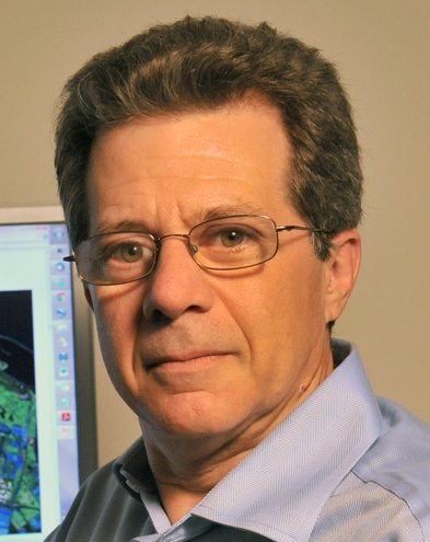 Thomas L. Ainsworth合作论文数Physics Department, Kent State University8
 D. L. Schuler合作论文数7
 J. David Ballester-Berman合作论文数7A. Milne合作论文数6
 Mark L. Williams合作论文数Oak Ridge National Laboratory5
 Rolf Scheiber合作论文数German Aerospace Center5Yves-Louis Desnos合作论文数5martin hellmann合作论文数4Js Lee合作论文数4g wright合作论文数4
 Wen Hong (洪文)合作论文数Aerospace Information Research Institute, Chinese Academy of Sciences;University of Chinese Academy of Sciences4
 David A Hill合作论文数4
 Fernando Vicente-Guijalba合作论文数4
 Jørgen Dall合作论文数DTU Space, Technical University of Denmark4Andrea Minchella合作论文数4
 Sophie Allain合作论文数IETR Laboratory;University of Rennes4Tobias Mette合作论文数Chair of Forest Yield Science, Technical University of Munich4M. Hellmann合作论文数3
 Hans Pretzsch合作论文数School of Life Sciences, Technische Universitat Munchen3Corr, D.G.合作论文数3
 Erxue Chen (陈尔学)合作论文数Institute of Forest Resource Information Techniques, Chinese Academy of Forestry3C. Thornhill合作论文数3
 Andreas Danklmayer合作论文数German Aerospace Center3Mitchell R Grunes合作论文数3
 Jong-Sen Lee (李仲森)合作论文数Department of Geomatics, National Central University3
 Andy Tyrrell合作论文数Intelligent Systems and Nano-Science Group, School of Physics, Engineering and Technology, University of York3E. Lüneburg合作论文数3P. Lumsdon合作论文数3d m parkes合作论文数3Aj Sieber合作论文数2Ya-Ping Wang合作论文数2
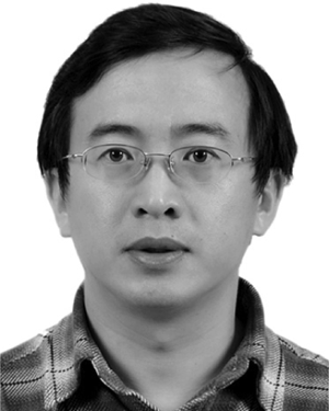 Shiming Li合作论文数2
 Zengyuan Li (李增元)合作论文数Institute of Forest Resource Information Techniques, Chinese Academy of Forestry2a ulbricht合作论文数2Fortuny, J.合作论文数2




