Global heatwaves have made the heat exposure risk (HER) assessment key for sustainable urban development. Although numerous studies have explored heat exposure, integrating the shading effectiveness of the built environment with residents’ travel behavior within the 15-minute city framework remains largely unexplored. This study uses navigation maps to first simulate the travel trajectories of different groups across various time periods within the 15-minute living circle, then integrates the shading effects of buildings and tree canopies along these trajectories to evaluate HER. Haizhu District of Guangzhou, a high-density urban area located in Southern China, was used as a case study, and results showed that: (1) The 15-minute living circle framework enables spatiotemporal dynamic coupling between residents’ daily travel behavior and built-environment shading, capturing a different dimension of heat exposure that complements conventional assessments. (2) Integrating trip probabilities with navigation-based routing effectively simulates travel paths from buildings to surrounding facilities, circumventing the challenges of large-scale individual trajectory data collection and offering a generalizable method for routine heat exposure risk assessment. (3) Simultaneously incorporating three-dimensional modeling of buildings and tree canopies, together with a unified energy conversion index integrating air temperature and solar radiation, provides a consistent computational framework for quantifying heat exposure along pedestrian routes. These findings provide new insights into heat exposure in 15-minute cities, thus contributing to the human-oriented governance of heat exposure risks.
The development of urban ventilation corridors is a viable strategy to alleviate thermal environmental stress. Accurately identifying critical zones for urban ventilation and formulating spatial planning strategies to improve ventilation performance are essential for sustainable urban development. In this study, Guangzhou, as a city with high-density construction and a typical area for urban renewal, is taken as a case study. Based on the “wind direction-resistance surface-corridor” framework, urban ventilation corridors are proposed, and key zones are identified by incorporating urban inefficient land. Furthermore, optimal pathways for urban ventilation corridors are explored in the context of urban renewal by floor area ratio (FAR)-based scenario modeling. The results show that: (1) The spatial distribution of ventilation corridors in Guangzhou is uneven, mainly concentrated in low to medium-density building areas and along rivers, green spaces, and the like. (2) Approximately 10.43% of Guangzhou’s inefficient land intersects with urban ventilation corridors, with Yuexiu and Liwan districts having the highest proportion (over 40%). Redeveloping these inefficient areas could significantly enhance ventilation. (3) FAR is not a critical factor affecting the wind environment, and the impact of different ranges of FAR on ventilation effects varies. Even with an increased FAR, a favorable wind environment can be maintained through adjustments in building height and orientation. The urban planning policies proposed in this study can provide references for the redevelopment of inefficient land to maximize ventilation effects.
With the continuous advancement of urban shading plans and compact development modes, a growing number of residents are experiencing sunlight deprivation. However, most previous studies have approached shading from the perspective of urban heat island mitigation, focusing primarily on cooling benefits, while the issue of sunlight deprivation in high-density residential communities at the macro scale remains largely overlooked. Moving beyond this cooling-oriented view, this study focuses on the combined effects of buildings and canopy shadow on sunlight deprivation. Specifically, taking the core residential communities in Guangzhou as a case study, this study quantifies theextent of sunlight deprivation on the winter solstice across communities built in different eras (1990s-2010s) using a geometric shadow simulation algorithm, and further estimates the size ofthe atfected population. The results show that, although building-induced shadows decrease by approximately 12% in the communities built in the 2010s, buildings remain the primary source of shadowing. In contrast, communities built in the 1990s and 2000s suffer the most severe shading. Despite marked improvements in the 2010s, overall shadow intensity remains predominantly medium to high, indicating that the situation is still serious. The overall scale of sunlight deprivation is severe, affecting over 50% of the population, with 2/3 of the communities experiencing serious sunlight deprivation. These findings will help stimulate a re-examination of the overemphasis on urban shading plans in current planning practice, thereby providing new pathways for optimizing sustainable urban development.
Urban morphology exerts significant influences on land surface temperature (LST), yet prior research has predominantly emphasized local morphological features within individual zones, with insufficient attention to spatial interactions across urban zones. This limitation restricts a comprehensive understanding of the mechanisms driving urban thermal patterns. Our study addresses this by developing a geographically weighted XGBoost model to quantify the spatially varying impacts of urban morphology on LST in the central area of Guangzhou. The modeling framework integrates a comprehensive set of indicators encompassing landscape configuration, building morphology, surface biophysical properties, and spatial contextual factors. While reaffirming the effects of impervious surfaces and vegetation, the analysis reveals the critical role of neighborhood-scale spatial interactions. The proposed spatial contextual indicators, which capture the functional composition of surrounding zones across multiple adjacency levels, exhibit strong explanatory capacity. SHapley Additive exPlanations (SHAP) analysis shows that these indicators account for 26.3% of the total thermal contribution among the top 15 predictors-comparable to building morphology metrics and, in some cases, surpassing direct vegetation indices such as NDVI. Additionally, a reinforcement learning approach based on Soft Actor-Critic algorithm was employed to identify optimal spatial configurations for minimizing average LST. Simulation outcomes suggest that strategically increasing neighborhood green spaces, reducing industrial land proportions, and adjusting spatial arrangements of residential, commercial, and public zones can effectively mitigate urban warming. These findings highlight dual mechanisms-internal morphological characteristics and external spatial interactions-through which urban morphology modulates the thermal environments, underscoring the necessity of integrated spatial planning for climate-responsive urban development.
The green infrastructure network (GIN) is an effective spatial scheme to balance urban development and ecological conservation. However, current frameworks for GIN identification fail to account for dynamic land cover changes during urban expansion. This study introduces a novel framework for re-identifying GIN through dynamic temporal trade-offs across historical (2000), present (2020) and future (2050) periods of urban expansion in Guangzhou, China. Land cover changes were observed and predicted using remote sensing and cellular automata, capturing urban growth from 826.59 km2 to 2586.27 km2. Ecological corridors were identified using the minimum cumulative resistance model, with total corridor lengths decreasing from 3308 km in 2000 to 2437 km in 2050. These corridors were then integrated and optimized cross-temporally using Spatial Design Network Analysis (sDNA). Compared to the static approach, our framework identified 627.26 km of corridors lost between 2000 and 2020 and 211.49 km of potential alternative corridors to address urban encroachments by 2050. It also improved network indices (alpha: +111.71 %, beta: +20.18 %, gamma: +20.10 %) and enhanced resident-related benefits by up to 49.31 %. The framework effectively addresses past deficiencies, meets present needs, and anticipates future challenges. This research advances methodology for adaptive GIN planning and offers insights for ecological conservation and restoration.
Promoting regional development with overall arrangement is an important topic for high-quality development of urbanization in the new era. However, few research has paid attention to the optimal land use pattern in different stages from the perspective of cross-regional cooperation. In this study, we used the northern part of Guangzhou as an example and simulated its land use changes using the patch-generating land use simulation (PLUS) model under multiple development scenarios. A trade-off framework was subsequently proposed to explore the optimal land use patterns in 2030, 2040, and 2050 b y referring to the indicators of the Sustainable Development Goals (SDGs). Results showed that: (1) Setting up an ecological network for joint regional protection as a constraint in land use simulation can not only help reduce conflicts of land use but also contribute to achieving ecologically-oriented development (EOD). (2) The optimal mode of cross-regional coordination typically evolves from a monocentric to a bicentric configuration, followed by a point-axis arrangement, and ultimately culminates in a polycentric structure. (3) The development of land use, infrastructure, and ecological elements is a gradual process towards enhancing cross-regional cooperation. These findings can provide planning references for local governments to promote the cross-regional cooperation.
The use of cellular automata (CA) is essential for exploring future urban growth scenarios in spatial planning. However, modeling polycentric urbanization processes with CA is still challenging due to the presence of spatial spillover effects arising from spatial interactions between different regions. This study proposes a hybrid framework that addresses the spatial spillover effect that emerges from multi-centers by coupling a radiation model (RM) and Markov chain (MC) with CA to simulate polycentric urbanization processes. The simulation capabilities of the RM-MC-CA framework were evaluated and validated by simulating Guangzhou's actual urban growth from 2000 to 2020, and the future urban growth scenarios of 2035 and 2050 were simulated with this coupled model. Results showed this framework provides a spatio-temporal diffusion process consistent with the cooperative mechanism of urbanization from monocentric to polycentric. In terms of simulation accuracy, the proposed RM-MC-CA framework demonstrated the most promising performance compared to MC-CA, GM-MC-CA, and PLUS. Compared to classical MC-CA, the framework improved the Kappa, FOM, and Precision metrics by 0.54%, 3.93%, and 2.38%, respectively. These results indicated that incorporating spatial spillover processes into a CA model can enhance its ability to simulate polycentric patterns that promote high-quality urban development.
The functional structure of territorial space is an important factor for analyzing the interaction between humans and nature. However, the classification of remote sensing images struggles to distinguish between multiple functions provided by the same land use type. Therefore, we propose a framework to combine multi-source data for the recognition of dominant functions at the block level. Taking the Guangdong–Hong Kong–Macau Greater Bay Area (GBA) as a case study, its block-level ‘production–living–ecology’ functions were interpreted. The whole GBA was first divided into different blocks and its total, average, and proportional functional intensities were then calculated. Each block was labeled as a functional type considering the attributes of human activity and social information. The results show that the combination of land use/cover data, point of interest identification, and open street maps can efficiently separate the multiple and mixed functions of the same land use types. There is a great difference in the dominant functions of the cities in the GBA, and the spatial heterogeneity of their mixed functions is closely related to the development of their land resources and socio-economy. This provides a new perspective for recognizing the spatial structure of territorial space and can give important data for regulating and optimizing landscape patterns during sustainable development.
Simulating land use/cover change (LUCC) caused by urbanization is always one of the most important aspects in city’s sustainable development. Previous research mainly simulated urban growth ignoring the periodical characteristics of urbanization cycle, which cannot well meet the needs of optimizing the relationship between urban, agriculture and ecological space. We developed a framework to explore the stable pattern in the terminal urbanization stage including the following parts: bottom-up conversion probability was mainly estimated from inertial driving factors, subregional top-down expansion trends were discovered from spatial development strategy and urbanization cycle represented as the constrained S-curves, and the above transformation rules were integrated into EasyCA to obtain urban growth pattern. To verify the model’s practicality, Guangdong-Hong Kong-Macao Greater Bay Area (GBA) was selected as a case study. Results demonstrate that (1) Planning strategy can greatly reshape the growth pattern particularly in large areas; (2) Subregional constrained S-curves can predict urban quantity reasonably considering the characteristics of urbanization cycle; (3) The coupled model can obtain referable simulation pattern of urban agglomeration in the terminal urbanization stage. It can provide an innovative tool for making decision and has great significance in city’s sustainable development.
Carbon neutrality is becoming an important development goal for regions and countries around the world. Land-use cover/change (LUCC), especially urban growth, as a major source of carbon emissions, has been extensively studied to support carbon-neutral planning. However, studies have typically used methods of small-scale urban growth simulation to model urban agglomeration growth to assist in carbon-neutral planning, ignoring the significant characteristics of the process to achieve carbon neutrality: large-scale and long-term. This paper proposes a framework to model large-scale and long-term urban growth, which couples a quantity module and a spatial module to model the quantity and spatial allocation of urban land, respectively. This framework integrates the inertia of historical land-use change, the driving effects of the urbanization law (S-curve), and the traction of the urban agglomeration network to model the long-term quantity change of urban land. Moreover, it couples a partitioned modeling framework, spatially heterogeneous rules derived by geographically weighted regression (GWR), and quantified land-use planning orientations to build a cellular automata (CA) model to accurately allocate the urbanized cells in a large-scale spatial domain. Taking the Guangdong–Hong Kong–Macao Greater Bay Area (GHMGBA) as an example, the proposed framework is calibrated by the urban growth from 2000 to 2010 and validated by that from 2010 to 2020. The figure of merit (FoM) of the results simulated by the framework is 0.2926, and the simulated results are also assessed by some evidence, which both confirm the good performance of the framework to model large-scale and long-term urban growth. Coupling with the coefficients proposed by the Intergovernmental Panel on Climate Change (IPCC), this framework is used to project the carbon emissions caused by urban growth in the GHMGBA from 2020 to 2050. The results indicate that Guangzhou, Foshan, Huizhou, and Jiangmen are under great pressure to achieve the carbon-neutral targets in the future, while Hong Kong, Macao, Shenzhen, and Zhuhai are relatively easy to bring up to the standard. This research contributes to the ability of land-use models to simulate large-scale and long-term urban growth to predict carbon emissions and to support the carbon-neutral planning of the GHMGBA.
自然资源资产价值实现是自然资源管理部门"统一行使全民所有自然资源资产所有者职责"的关键所在.文章通过分析自然资源资产价值实现困境以及自然资源资产管理现状,创新性地提出了以自然资源资产联动交易为基础的自然资源资产包交易机制.研究旨在构建以市场交易为主体、公私合作的经营体系,建立公益性自然资源资产和经营性自然资源资产价值实现的联动机制,为推动全民所有自然资产全要素价值实现机制提供发展新思路.
Ensuring equitable access to urban parks is crucial for promoting the sustainable development of cities. In the post-COVID era, the concept of the 15-minute city has gained significant attention, emphasizing human-scale urban design and fine-grained governance. This study introduces an improved two-step floating catchment area (2SFCA) method to accurately assess park accessibility and spatial equity in Guangzhou, considering the 15minute city perspective. Firstly, a more effective framework is proposed to identify multiple park entrances that serve as supply points. Secondly, the population distribution is estimated using building areas and locationbased data through a random forest model. Furthermore, the supply capability index is estimated by considering the area of each park and its attractiveness index, derived from multiple geographic data sources. The results reveal unequal park accessibility in Guangzhou, with low-access areas mainly distributed on the fringe of study area in both walking and cycling scenarios due to the limited park supply or high-density population. With the influences of park entrances and the park attractiveness index, the spatial inequity of park accessibility may be more severe than previously estimated in other studies. This work enhances the understanding of park accessibility and facilitate effective planning for sustainable development and reducing environmental injustice.
The planning of natural resource assets protection and utilization as well as territorial space planning is an essential tool to realize the "two unified" functions of natural resources management. In contrast to territorial space planning, there is a lack of basic research on planning for the protection and utilization of natural resource assets, and there is an urgent need to implement objectives, theoretical foundations, and basic framework issues. Firstly, the dialectical relationship between natural resource asset protection and utilization planning and territorial space planning and other related plans have been discussed according to the requirements of "two unified" functions. Secondly, the inner scientific logic of natural resources assets protection and utilization planning was proposed according to the perspective of "trinity" integrated management of resources, assets, and capital. Finally,with the fundamental goal of preserving and increasing the value of natural resource assets, the technical framework for planning for the protection and utilization of natural resource assets is built around the three essential links of development, circulation,and distribution for the sustainable realization of natural resource assets. The study aims to provide relevant ideas and model references for natural resources management agencies to prepare their plans.
The main stream of the Tarim River in China is typical of ecologically sensitive areas that have been heavily disturbed by human activities; as such, the monitoring of the quality of its eco-environment constitutes an important task for researchers. By using GlobeLand30 data and applying the disturbance degree model and revised ecosystem service value (ESV) model, the study presented in this paper undertook a quantitative estimation of the effects of the disturbance impacts of human activities on the eco-environment of this area in the period of 2000 to 2020. The main conclusions are as follows: (1) disturbance index values, which reflect disturbance to the local ecosystem by human activities, increased over the study period. Further, cultivated land experienced the largest increase, which, in turn, brought about the most significant disturbance to the eco-environment. High disturbance index values presented a patchy distribution in the west of the main stream of the Tarim River and formed bands and dots in the east; the area of land characterized by high and moderate disturbance index values increased, with growth areas taking on a scattered distribution of patches, bands, and dots without significant spatial continuity. (2) The total ESV increased, indicating the quality of the eco-environment improved. The increase of cultivated land offset the increase in ESV, which counteracted the effects of ecological governance measures. Areas with high ESV values were mainly located in the western and central parts of the study area, while low values were found in the middle east and east. Areas with higher increases in ESV were mainly located in the western and the western part of the middle reaches and took on a zonal distribution, while areas of decrease followed a scattered distribution, presenting as dots or patches. Using the quantitative analysis methods and high-resolution remote sensing data to evaluate the changes in the eco-environment was considered as the innovation of this study, and the findings are useful in exploring the influence of human activities on ecosystems and evaluating the eco-environment in the minor watershed of an arid area. This piece of quantitative research contributes to the task of monitoring eco-environmental changes using remote sensing techniques in ecologically sensitive areas.
As the largest carbon emitter in the world, China is facing increasing challenge to reduce CO2 emissions. Given this issue, exploring the influencing factors is of great significance for scientific low-carbon emission policymaking. Although previous literature has explored the effects of urbanization on CO2 emissions, the impact of the space of flow on urban carbon emissions have been less explored. Due to the increasing connection between cities, its impact on urban carbon emissions cannot be ignored. Thus, this paper takes the space of flows into account as an aspect of urbanization to supplement the existing literature and empirically examines the multiple effects of urbanization on CO2 emissions in the Pearl River Delta (PRD) urban agglomeration. By using a STIRPAT model, statistical data, and web crawler data, we examined impacts of different types of urbanization on CO2 emissions. Our empirical results show that: (1) Within the PRD urban agglomeration, urban linkage intensity is strongly connected to urban socioeconomic growth, establishing a geographical structure with Guangzhou and Shenzhen as the double core. (2) Our results show that urbanization exerts two opposite effects on CO2 emissions: positively connects carbon emissions with population urbanization, integrated urban linkage flow, and energy intensity, whereas economic urbanization and social urbanization are shown to be negatively correlated. However, spatial urbanization has no significant positive effect on urban CO2 emissions. (3) It is worth noting that urban linkage flows are the second most important factor affecting urban carbon emissions after economic urbanization. Our study could formulate effective planning suggestions for future CO2 emission reduction paths and development modes in the PRD.
It is critical to predict urban growth for understanding of urbanization process. Traditional urban CA mainly focused on discovery of conversion rules from a series of biophysical and social-economic factors. Many varying factors are generally treated as constant, and the simulation result is none of great reference value for decision-making. In order to eliminate these limitations, an Easy Cellular Automata (EasyCA) was proposed with integration of seed searching and clone stamp growth strategy, it aims to provide feasible scenario analysis for decision-making. Only four steady variables namely distance to current urban patches, difficulty coefficient of land conversion, density of urban land and topographic conditions were applied to estimate urban suitability. Policy intervention was further considered for adjustment of urban suitability, and patch growth templates were collected as clone stamps for updating the status of cells during iteration. This EasyCA was then tested with example area of Guangzhou City located in the Pearl River Delta of China. Accuracy indices of averaged fuzzy kappa (FuzzyK) and figure of merit (FOM) were calculated with the values of 0.8419 and 0.2874, respectively, and both of them were higher than those from cell growth-based CA, indicating that EasyCA is efficient in utility and reliability. Comparison analysis verified that few steady variables can obtain reliable result of urban suitability, and it is greatly necessary to integrate policy intervention into estimation of urban growth probability. And the simulation pattern in 2035 is maximally close to actual status compared with the planning layout, it shows that EasyCA is potentially applicable and effective for planning practices in metropolitan areas.
Many countries, including China, have implemented the spatial government policy widely known as urban growth boundary (UGB) for managing future urban growth. However, few studies have asked why we need UGB, especially pre-evaluating the utility of UGB for reshaping the future spatial patterns of cities. In this research, we proposed a constrained urban growth simulation model (CUGSM) which coupled Markov chain (MC), random forest (RF), and patch growth based cellular automata (Patch-CA) to simulate urban growth. The regulatory effect of UGB was coupled with CUGSM based on a random probability game method. Guangzhou city, a metropolitan area located in the Peral River Delta of China, was taken as a case study. Historical urban growth from 1995 to 2005 and random forests were used to calibrate the conversion rules of Patch-CA, and the urban patterns simulated and observed in 2015 were used to identify the simulation accuracy. The results showed that the Kappa and figure of merit (FOM) indices of the unconstrained Patch-CA were just 0.7914 and 0.1930, respectively, which indicated that the actual urban growth was reshaped by some force beyond what Patch-CA has learned. We further compared the simulation scenarios in 2035 with and without considering the UGB constraint, and the difference between them is as high as 21.14%, which demonstrates that UGB plays an important role in the spatial reshaping of future urban growth. Specifically, the newly added urban land outside the UGB has decreased from 25.13% to 16.86% after considering the UGB constraint; particularly, the occupation of agricultural space and ecological space has been dramatically reduced. This research has demonstrated that the utility of UGB for reshaping future urban growth is pronounced, and it is necessary for the Chinese government to further strengthen UGB policy to promote sustainable urban growth.
Urban agglomeration is an important carrier that promotes urbanization into an advanced stage, addressing its unbalanced development is an important task for the newly established territorial spatial planning in China. This research proposed a collaborative optimal allocation of urban land (COAUL) model which provides a simulation tool both for the quantity and spatial structure optimization of urban agglomeration. COAUL first optimizes the quantity structures of every city according to the current situation, potential development capacity and spatial policy. And then the optimized quantity structure is assigned into geo-space with land use spatial optimization model. COAUL has been applied to Guangdong-Hong Kong-Macao Greater Bay Area (GBA), a fast-developing urban agglomeration located in Southern China, and three main findings are obtained: (1) COAUL model can optimize the quantity and spatial structure of urban agglomeration for the goal of balanced development, which could provide scientific reference scenario for the delimitation of the urban agglomerations growth boundaries (UAGB). (2) As cities in urban agglomeration have strong connections with each other, collaborative optimal allocation of urban land could considerably relieve the pressures of developed central cities and also promote the growth of undeveloped edge cities. (3) COAUL can unlimitedly reduce the imbalanced development tendency of urban agglomeration, which is performance better than traditional land use planning models. This research demonstrated that delimiting the UAGB with COAUL model is an important government measure for promoting the balanced development of urban agglomeration areas.
目的 观察品管圈在降低硬式内镜器械损坏发生率的应用效果.方法 通过品管圈活动方式,分析其对降低硬式内镜器械损坏中的应用效果.结果 品管圈活动后,硬式内镜器械损坏的发生率由开展前的0.51%下降到开展后的0.12%,活动前后比较,差异有统计学意义(P<0.05).影响因素主要有圈员在工作责任感、积极性、解决问题的能力、团队凝聚力、沟通协调、操作手法方面的能力显著提高.结论 开展品管圈活动有利于降低硬式内镜器械损坏发生率.
Optimal allocation of newly-added urban land is significant to delimit the urban growth boundary (UGB) for territorial spatial planning, and it is also the basic guarantee to promote the sustainable development of cities. Exploring a model to generate optimal allocation pattern has become one of the key technologies in UGB delineation. In this study, a fast land-use assignment model (FLAM) was proposed adopting Pareto front degradation searching strategy. In this model, urban lands to be allocated were defined as agents, and a heuristic landscape indicator was creatively induced for assigning agents to optimal positions. They first selected positions with the highest urban growth suitability, then some of them with lower suitability gradually moved from original positions to those around urban patches with maximum compactness, which was measured with the area of urban patch and the number of grids allowed for urban growth within the corresponding minimal outer rectangle. Optimal solution could be obtained until all the agents were assigned under the condition of maximum utility both in suitability and compactness. This searching and updating strategy actually can make optimal solutions always along the Pareto front. Taking Guangzhou metropolitan area in China as an example, FLAM was performed and validated with the following aspects: the sensitivity of model's parameters, response to planning demands, and optimization efficiency. Compared with cellular automata (CA) and ant colony optimization (ACO), FLAM has better performance on urban land allocation. Results show that FLAM can obtain reasonable scenarios with the advantages of few model parameters, fasting evolution speed and strong scalability, which can be well applied to support UGB delimitation.
 Yabo Zhao (赵亚博)合作论文数School of Architecture and Urban Planning, Guangdong University of Technology16
 PeiHao Nian (念沛豪)合作论文数13
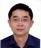 Yunnan Cai (蔡云楠)合作论文数School of Architecture and Urban Planning, Guangdong University of Technology12YuMei Cai (蔡玉梅)合作论文数10
 Bin Ai (艾彬)合作论文数School of Marine Sciences, Sun Yat-Sen University10DiXiang Xie (谢涤湘)合作论文数9Zhang Xiwen合作论文数8Haiyan Jiang合作论文数5Ting Zhang (张婷)合作论文数5
 Xia Li (黎夏)合作论文数School of Geographic Sciences, East China Normal University;Sun Yat-sen University5Zhou Xing-ru (周星汝)合作论文数4Li Zhuang (庄立)合作论文数4
 Shaoying Li合作论文数4
 Peng Zang合作论文数3Tao Huang (黄韬)合作论文数3
 Xiaoping Liu (刘小平)合作论文数School of Geography and Planning, Sun Yat-sen University3
 Jianhong Fan (范建红)合作论文数广东工业大学建筑与城市规划学院3Chunhua Lao合作论文数3Xuemin OUYANG (欧阳雪敏)合作论文数2Ruiyang Chen合作论文数2Fei Xian合作论文数2Huang Liu-qian (黄柳倩)合作论文数2
 Hualong Qiu合作论文数2Hongyuan HUANG (黄宏源)合作论文数2Mei MA (马梅)合作论文数2KeFei Zhao (赵克飞)合作论文数2KaiZhao Wu (吴楷钊)合作论文数2HaiYan Jiang (江海燕)合作论文数2
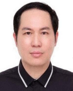 Zhifeng Wu合作论文数2
 Feng Liu (刘峰)合作论文数School of Computer Science, Wuhan University;Artificial Intelligence Institute of Wuhan University, School of Computer Science, Wuhan University2
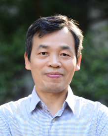 Wenxin Zhang (张文新)合作论文数Faculty of Geographical Science, Beijing Normal University2
 Jianhua He (何建华)合作论文数School of Resource and Environmental Sciences, Wuhan University2
 Weiwei Zhang合作论文数1Yuanjun Zhong合作论文数1
 Xiaohong Tan合作论文数1Fei Su合作论文数1
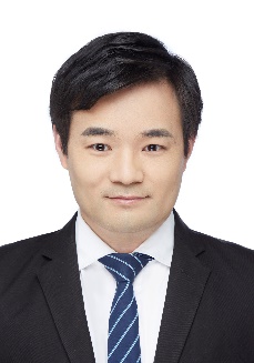 Guangdong Li (李广东)合作论文数Institute of Geographic Sciences and Natural Resources Research, Chinese Academy of Sciences;University of Chinese Academy of Sciences1Junming Bai合作论文数1Tong Sun合作论文数1Feng GAO (高峰)合作论文数1HU Die (胡蝶)合作论文数1LIU Xin (刘鑫)合作论文数1liang guo (郭亮)合作论文数1
 Haoming Zhuang合作论文数Guangdong Key Lab Urbanizat & Geosimulat, Sun Yat Sen Univ1
 Junliang Qiu合作论文数Dept Land Environm Agr & Forestry, Univ Padua1
 Qiqi Jia合作论文数1Xiaoqiong MO (莫晓琼)合作论文数1Tongli CHEN (陈通利)合作论文数1yanhong zhao (赵艳红)合作论文数1




