On sedimentary coasts, waves drive morphological change from storm to decadal timescales, making wave time series central to shoreline change modelling. However, continuous wave observations are costly and scarce, leading monitoring programmes to rely on combinations of in-situ data, hindcasts, and nearshore wave transformation models. The implications of using different wave datasets for shoreline change model performance remain poorly understood, and dataset selection is often constrained by availability rather than suitability.This study evaluates how wave time series from multiple sources affect cross-shore shoreline change model skill at Porsmilin, a macrotidal embayed beach, over the period 2003–2020. The site is partially sheltered by headlands and influenced by complex offshore wave transformations. Wave forcing was derived from a global reanalysis, a high-resolution regional hindcast, and a nearshore simulation, with extraction points spanning ~2–60 m water depth and a range of exposure to incident wave conditions. Linear wave theory was also applied to propagate waves to the breaking point. Shoreline displacement was hindcast using two equilibrium shoreline models and an average-wave correlation approach, enabling assessment of sensitivity to wave forcing relative to shoreline change model choice.Model skill was strongly dependent on the selected wave time series, with differences often exceeding those caused by changing the model itself. No wave dataset consistently outperformed others, and neither wave propagation to breaking nor nearshore simulations systematically improved results. These findings suggest that appropriately selected nodes from global wave models may suffice for shoreline change modelling on cross-shore sediment transport dominated beaches. Nonetheless, careful wave dataset selection and sensitivity testing are essential to improve prediction reliability and enable robust comparison across sites.
The aim of this work is to test an artificial neural network (ANN) with basic hydrodynamic and morphological variables, in order to assess the effectiveness of such methods in modelling complex beach dynamics. A simple feedforward neural network (FFN) is used to evaluate the impact of selected variables on the prediction of the dynamics of specific shoreline proxies extracted from beach profiles, and to build a predictive model to simulate their positions. The model was trained on datasets from two sites from the French coastal monitoring program DYNALIT, Porsmilin and Vougot covering nearly 20 years. These two sites were selected due to differences in their morphology and hydrodynamics, to assess the performance of FFN over a larger variety of situations. A range of temporalities encompassing 3 days, 7 days, 14 days, and 30 days of selected hydrodynamic and morphological variables were used to study the impact time scales can have on modelled shoreline positions. The shoreline proxies used for Porsmilin and Vougot beaches correspond respectively to the average position of the berm isocontour and the dune vegetation limit isocontour. The FFN included 1 hidden layer and 5 nodes, and was ran 50 times in order to assess the models’ performance. The models were generally successful, with a blind shoreline prediction R of 0.88 for Porsmilin and 0.72 for Vougot. This FFN approach showed all-around better performance than previous beach equilibrium models, which is very encouraging regarding the prediction of future beach morphodynamics and the use of ANN therein.
Coastal boulder deposits, observed worldwide, provide geomorphological evidence of extreme wave events such as storms, hurricanes and tsunamis. Theoretical formulations have been developed for determining hydrodynamic conditions responsible for boulder emplacement on the shore, which increasingly make use of boulder geometry and associated site geomorphology. Nevertheless, information on extreme events responsible for the emplacement of coastal boulders is rarely available, meaning there has been limited opportunity to test existing formulations in the light of real hydrodynamic and geomorphic data. In this study, we take advantage of the important record of coastal boulder deposits on Cuba Island to compare the hydrodynamic parameters (minimum flow velocity) deduced from the boulders' morphology and emplacement characteristics, with hydrodynamic conditions (maximum wave height and orbital velocity) that occurred during the tropical cyclones responsible for the boulders' actual emplacement. We selected four sites where three hurricanes have emplaced five boulders on low-lying coral reef terraces over the last 50 years. Using terrestrial Structure-from-Motion photogrammetry, we determined with precision the boulders' shape and volume, which in combination with density, mode of emplacement and distance from the shore, were used to calculate the minimum flow velocity responsible for dislocation of the coral reef terrace and inland transport. To serve as comparisons, available modelled data of wave height and period were used to estimate the maximum orbital velocity that possibly occurred during the weather event using linear wave theory. Our results show that for all boulders studied except one, there is a good agreement between the values of minimum flow and maximal orbital velocities, with minimum flow velocities for boulder emplacement consistently smaller than the maximum wave orbital velocity during the weather event. The difference observed for one boulder is attributed to specific site effects, highlighting in this case the limitation of using distant hydrometeorological data for characterizing wave processes responsible for coastal boulder deposits. Helped by detailed data collected on boulders with large differences in morphology including size, and mode of emplacement, this study confirms the pertinence of using formulations relating boulder morphology and site characteristics to the minimum flow velocity that detached and transported the boulder. It further emphasizes the importance of obtaining adequate boulder and geomorphic setting characterizations to link geomorphological proxies and extreme wave events.
Coral reefs play a crucial role in tropical coastal ecosystems, even though these environments are difficult to monitor due to their diversity and morphological complexity and due to their shallowness in some cases. This study used two approaches for acquiring very-high-resolution bathymetric data: underwater structure-from-motion (SfM) photogrammetry collected from a low-cost platform and unmanned/uncrewed aerial vehicle (UAV)-based SfM photogrammetry. While underwater photogrammetry avoids the distortions caused by refraction at air/water interface, it remains limited in spatial coverage (about 0.04 ha in 1 h of survey). In contrast, UAV photogrammetry allows for covering extensive areas (more than 20 ha/h) but requires applying refraction correction in order to accurately compute bathymetry and roughness values. An analytical approach based on Snell laws and an empirical approach based on linear regression (calibrated using a batch of points whose depths are representative of the depth range of the surveyed areas) are tested to correct the apparent depth on the raw UAV digital elevation model (DEM). Comparison to underwater photogrammetry shows that correcting refraction reduces the root mean square error (RMSE) by more than 50% (up to 62%) on bathymetric models, with RMSE lower than 0.13 m for the analytical approach and down to 0.09 m for the regression method. The linear-regression-based refraction correction proved most effective in restoring accurate seabed roughness, with a mean error on roughness lower than 17% (vs. 30% for analytical refraction correction and 48% for apparent bathymetry).
To assess coastal hazard where Coastal boulder deposits (CBDs) are found, it is crucial to constrain the forces governing their emplacement: from either storms/tropical cyclones or tsunamis. Here we focus on the CBDs on the island of Cuba and the extreme climatic events responsible for their formation. Four sites are being studied to identify the CBDs produced during known hurricanes over the last fifty years.The selected CBDs are located on a low-lying coral reef terrace on the Cuban shore, emplaced by the Cuban hurricane of 1935, Lili hurricane of 1996 and Matthew hurricane of 2016. These meteorological events associated with reported geomorphological objects are analyzed to quantify the hydrodynamic parameters of such extreme events (maximum orbital velocity). Furthermore, the quantification of CBDs volume by stereophotogrammetry (using Agisoft Metashape Professional version 1.7.2) and CBDs density by water immersion method on samples allow us to use deterministic and theoretical approaches ( hydrodynamics equations of Nandasena et al., 2013, 2022 ) to assess the assumed associated hydrodynamic parameters (minimum flow velocity) responsible for the dislocation of the coral reef terraces and transport of the resulted boulders. Finally, we compare these velocities with ones calculated from the meteorological events to discuss the reliability of these approaches to determine the climatic or tsunamigenic origin of the past extreme waves from geomorphological analyses of CBDs.
Measuring nearshore waves remains technically challenging despite wave properties are being used in a variety of applications. With the promise of high-resolution and remotely-sensed measurements of water surfaces in four dimensions (spatially and temporally), stereo-photogrammetry applied to video imagery has grown as a viable solution over the last ten years. However, past deployments have essentially used costly cameras and optics, requiring fixed deployment platforms and hindering the applicability of the method in the field.Focusing on close-range measurements of nearshore waves at break point, this paper presents a detailed evaluation of a field-oriented and cost-effective stereo-video system composed of two GoProTM (Hero 7) cameras capable of collecting 12-megapixel imagery at 24 frames per second. The so-called ‘Stereo-GoPro’ system was deployed in the surf zone during energetic conditions at a macrotidal field site using a custom-assembled mobile tower. Deployed concurrently with stereo-video, a 16-beam LiDAR (Light Detection and Ranging) and two pressure sensors provided independent data to assess stereo-GoPro performance. All three methods were compared with respect to the evolution of the free-surface elevation over 25 min of recording at high tide and the wave parameters derived from spectral analysis. We show that stereo-GoPro allows producing digital elevation models (DEMs) of the water surface over large areas (250 m2) at high spatial resolution (0.2 m grid size), which was unsurpassed by the LiDAR. From instrument inter-comparisons at the location of the pressure transducers, free-surface elevation root-mean square errors of 0.11 m and 0.18 m were obtained respectively for LiDAR and stereo-GoPro. This translated into a maximum relative error of 3.9% and 12.5% on spectral wave parameters for LiDAR and stereo-GoPro, respectively. Optical distortion in imagery, which could not be completely corrected with calibration, was the main source of error. Whilst stereo-video processing workflow remains complex, cost-effective stereo-photogrammetry already opens new opportunities for deriving wave parameters in coastal regions, as well as for various other practical applications. Further tests should try to address specifically challenges associated to variable ambient conditions and acquisition configurations, affecting measurement performance, to guarantee a larger uptake of the technique.
The anatomical differences between the retinas of humans and most animal models pose a challenge for testing novel therapies. Nonhuman primate (NHP) retina is anatomically closest to the human retina. However, there is a lack of relevant NHP models of retinal degeneration (RD) suitable for preclinical studies. To address this unmet need, we generated three distinct inducible cynomolgus macaque models of RD. We developed two genetically targeted strategies using optogenetics and CRISPR-Cas9 to ablate rods and mimic rod-cone dystrophy. In addition, we created an acute model by physical separation of the photoreceptors and retinal pigment epithelium using a polymer patch. Among the three models, the CRISPR-Cas9-based approach was the most advantageous model in view of recapitulating disease-specific features and its ease of implementation. The acute model, however, resulted in the fastest degeneration, making it the most relevant model for testing end-stage vision restoration therapies such as stem cell transplantation.
Coastal boulder deposits (CBDs), named huracanolitos in Cuba, found along rocky shores, result from storms, tropical cyclones or tsunamis. Despite being important indicators for coastal hazard assessment, determining the mode of emplacement of CBDs (storm/hurricane or tsunami) is not easy. We present, for the first time in English, data about CBDs along the shores of the Cuban Archipelago. More specifically, we focused on a CBD, that is, to our knowledge, the largest one ever described on Cuba Island. Located on a low-lying coral reef terrace on the SE shore of the island, the reefal limestone CBD is emplaced seaward of the ruins of the Bucanero resort. The resort was built in 1989, endured hurricanes Ivan (2004) and Dennis (2005) and, in October 2012, was destroyed by Hurricane Sandy. As observed on Corona and Landsat satellite images since 1962, the CBD was not moved, neither by hurricane Flora (1963) nor Sandy (2012), both associated with important storm surges and powerful swells. We determined the CBD volume with open-source structure from motion photogrammetry as 82.6 m(3). Then, we estimated from a sample its density as 2550 kg/m(3). Finally we calculated its weight as 210.6 tons. We calculated the minimum flow velocity responsible for the emplacement of the CBD 33 +/- 2 m inland-6.83 +/- 0.54 m/s and 7.26 +/- 0.51 m/s. Such flow velocities are compatible with those of both tsunamis and hurricanes. Because of the greater frequency of hurricanes than tsunamis in the area, we propose that a tropical cyclone generated the extreme surge and wave that emplaced the Bucanero CBD. Such CBDs demonstrate that on Cuba's south coast, we can expect marine flooding exceeding the flooding during the major hurricanes of recent decades.
Objective:To describe adaptive optics flood illumination ophthalmoscopy (AO-FIO) of the photoreceptor layer in normal nonhuman primates (NHPs) and in the case of a short-term induced retinal detachment (RD). Design:Longitudinal fundamental research study. Subjects:Four NHPs were used to image normal retinae with AO-FIO (in comparison with 4 healthy humans); 2 NHPs were used to assess the effects of RD. Intervention:The photoreceptor layer (cone mosaic metrics, including cone density, cone spacing, and cone regularity) was followed with AO-FIO imaging (rtx1, Imagine Eyes) during a surgically induced RD in 2 NHPs using a vehicle solution containing dimethyl sulfoxide, classically used as a chemical solvent. We also performed functional testing of the retina (full-field and multifocal electroretinogram [ERG]). Main Outcome Measures:Correlation of cone mosaic metrics (cone density, spacing, and regularity) between normal retinae of NHPs and humans, and cone metrics, power spectrum, and ERG wave amplitudes after RD. Results:Imaging features were very similar in terms of cone reflectivity, cell density, regularity, and spacing values, showing strong positive correlations between NHPs and humans. After RD, AO-FIO revealed several alterations of the cone mosaic slowly recovering during the 3 months after the reattachment, which were not detected functionally by ERG. Conclusions:These results demonstrate by in vivo AO-FIO imaging the transient structural changes of photoreceptors after an RD in the primate retina. They also provide an interesting illustration of the AO-FIO potential for investigating photoreceptor toxicity during preclinical studies in NHPs with a high translatability to human studies. Financial Disclosures:Proprietary or commercial disclosure may be found after the references.
Advances in image-based remote sensing using unmanned aerial vehicles (UAV) and structure-from-motion (SfM) photogrammetry continue to improve our ability to monitor complex landforms over representative spatial and temporal scales. As with other water-worked environments, coastal sediments respond to shaping processes through the formation of multi-scale topographic roughness. Although this topographic complexity can be an important marker of hydrodynamic forces and sediment transport, it is seldom characterized in typical beach surveys due to environmental and technical constraints. In this study, we explore the feasibility of using SfM photogrammetry augmented with an RTK quadcopter for monitoring the coastal topographic complexity at the beach-scale in a macrotidal environment. The method had to respond to resolution and time constraints for a realistic representation of the topo-morphological features from submeter dimensions and survey completion in two hours around low tide to fully cover the intertidal zone. Different tests were performed at two coastal field sites with varied dimensions and morphologies to assess the photogrammetric performance and eventual means for optimization. Our results show that, with precise image positioning, the addition of a single ground control point (GCP) enabled a global precision (RMSE) equivalent to that of traditional GCP-based photogrammetry using numerous and well-distributed GCPs. The optimal model quality that minimized vertical bias and random errors was achieved from 5 GCPs, with a two-fold reduction in RMSE. The image resolution for tie point detection was found to be an important control on the measurement quality, with the best results obtained using images at their original scale. Using these findings enabled designing an efficient and effective workflow for monitoring coastal topographic complexity at a large scale.
Remotely sensed digital elevation models (DEMs) and uncertainty-based geomorphic change detection have become very practical tools for geoscientists, including for coastal research. Through the analysis of DEMs of differences (DoDs) and the provision of DEM quality, it allows monitoring complex landforms and confidently relating the changes observed to environmental forcing conditions. With continuing remote sensing advances, and as some monitoring programmes are reaching several decades of repeated data collection, it is timely to consider approaches that enable the reconciliation of DEMs of variable and potentially unknown quality before their subsequent geomorphic analyses. In this paper, we present an original workflow whereby composite data formed by fusing available measurements over invariant features serve as multi-temporal ground truths for assessing repeated DEMs. Results of the evaluation enable identification of DEMs of lower quality (bias and precision) and correction of registration error (horizontal and vertical bias), and thus offer the in-built capacity for estimating and improving change detection levels afforded by the data. The workflow was applied to a freely accessible multi-sensor: RTK-GNSS, terrestrial laser-scanning, drone photogrammetry and multibeam echo-sounding dataset of high-resolution topographic and nearshore bathymetric DEMs collected at the macrotidal pocket beach of Porsmilin (France) over the period 2003-2019. Our results show that consistently high DEM precision can be achieved in a long-term multi-sensor dataset, but registration errors may be present and can be minimized through co-registration with the purpose-built ground truths. Although the study focuses primarily on measuring height discrepancies, which is directly relevant for DoD analysis, we show that the methods can also be used for dealing with horizontal error when high-resolution imagery is available. Finally, the detailed DEM evaluations presented, in application to a rare dataset documenting beach and shoreface change for nearly two decades, provide original insights on the performance of usual topo-bathymetric surveying techniques.
Positive clinical outcomes in adeno-associated virus (AAV)-mediated retinal gene therapy have often been attributed to the low immunogenicity of AAVs and immune privilege of the eye. However, several recent studies have shown potential for inflammatory responses. The current understanding of the factors contributing to inflammation, such as the pre-existence of serum antibodies against AAVs and their contribution to increases in antibody levels post-injection, is incomplete. The parameters that regulate the generation of new antibodies in response to the AAV capsid or transgene after intraocular injections are also insufficiently described. This study is a retrospective analysis of the pre-existing serum antibodies in correlation with changes in antibody levels after intraocular injections of AAV in non-human primates (NHPs) of the species Macaca fascicularis. In NHP serums, we analyzed the binding antibody (BAB) levels and a subset of these called neutralizing antibodies (NABs) that impede AAV transduction. We observed significantly higher pre-existing serum BABs against AAV8 compared with other serotypes and a dose-dependent increase in BABs and NABs in the serums collected post-injection, irrespective of the serotype or the mode of injection. Lastly, we were able to demonstrate a correlation between the serum BAB levels with clinical grading of inflammation and levels of transgene expression.
Background and Objectives: Secondary ocular localizations of hematological malignancies are blinding conditions with a poor prognosis, and often result in a delay in the diagnosis. Materials and Methods: We describe a series of rare cases of ocular involvement in six patients with hematological malignancies, reportedly in remission, who presented secondary ocular localizations, challenging to diagnose. Two patients had an acute lymphoblastic leukemia (ALL) and developed either a posterior scleritis or a pseudo-panuveitis with ciliary process infiltration. One patient had iris plasmacytoma and developed an anterior uveitis as a secondary presentation. Two patients had a current systemic diffuse large B-cell lymphoma (DLBCL) and were referred either for intermediate uveitis or for papilledema and vitritis with secondary retinitis. Finally, one patient with an acute myeloid leukemia (AML) presented a conjunctival localization of a myeloid sarcoma. We herein summarize the current knowledge of ophthalmologic manifestations of extramedullary hematopathies. Results: Inflammatory signs were associated with symptomatic infiltrative lesions well displayed in either the iris, the retina, the choroid, or the cavernous sinus, from the admission of the patients in the ophthalmological department. These findings suggest that patients with ALL, AML, systemic DLBCL, and myeloma can present with ophthalmic involvement, even after having been reported as in remission following an effective systemic treatment and/or allograft. Conclusions: Early detection of hidden recurrence in the eyes may permit effective treatment. Furthermore, oncologists and ophthalmologists should be aware of those rare ocular malignant locations when monitoring patient’s progression after initial treatment, and close ophthalmologic examinations should be recommended when detecting patient’s ocular symptoms after treatment.
La forme des vagues, et de façon plus générale, le comportement de la surface d'eau en relation avec la morphologie littorale, restent difficiles à mesurer alors que ce sont des facteurs déterminants, agissant sur les processus hydro-sédimentaires.Pour observer le champ de vagues en quatre dimensions (spatialement et temporellement), les méthodes de stéréophotogrammétrie à partir de vidéos connaissent un intérêt grandissant depuis une dizaine d'années.Nous présentons les différentes étapes du développement d'un système stéréo-vidéo économique et modulable composé de deux GoPro TM Hero 7. Dans cette étude, une attention particulière est portée au dimensionnement du système permettant de répondre au besoin en termes de résolution spatiale et de précision, ainsi qu'à la calibration des capteurs optiques, qui est effectuée à l'aide d'un damier et dont les erreurs sont contrôlées afin de limiter le risque de propagation dans les modèles numériques des élévations.Le succès de la mesure requiert également une bonne synchronisation des capteurs.Avec le mode de déploiement proposé, une évaluation sur une zone test aux dimensions connues montre une précision de reconstruction de 3,5%.Le système a ensuite été déployé sur la plage du Minou (Bretagne) à l'aide d'une tourelle légère et spécialement aménagée.La reconstruction de vagues au déferlement est opérationnelle même dans des conditions de levé suboptimales (transparence de l'eau, réflexions solaires, etc.).
 Heide Friedrich合作论文数Department of Civil and Environmental Engineering, Faculty of Engineering, The University of Auckland19
 José-Alain Sahel合作论文数Department of Ophthalmology, School of Medicine, University of Pittsburgh13
 Elena Brazhnikova合作论文数11
 Patrice Delmas合作论文数School of Computer Science, Faculty of Science, The University of Auckland11
 Marion Jaud合作论文数10
 France Floc'h合作论文数9Jaillard Céline合作论文数9
 Deniz Dalkara合作论文数CR1-INSERM;Biotherapeutics Department, Institut de la Vision8
 Emmanuel Augereau合作论文数6
 Serge Picaud合作论文数Institut De La Vision, Centre National De La Recherche Scientifique;Paris Vision Institute6
 Olivier Goureau合作论文数Endocrinologie et Regulations Cellulaires, Université Paris Sud6
 Christophe Delacourt合作论文数5Claire-Maelle Fovet合作论文数CRC MIRCen, INSERM/CEA,Fontenay-aux-Roses,France5
 Jane Groom合作论文数5
 Georgy Gimel'farb合作论文数Department of Computer Science, The University of Auckland5Michel Paques合作论文数4Céline Nouvel-Jaillard合作论文数4
 Jarraya Mohamed合作论文数1 Department of Radiology, Boston University School of Medicine4Alexandra Plancheron合作论文数4Ben M'Barek Karim合作论文数Institut Curie, CNRS UMR 33064
 Walter Habeler合作论文数4
 Jens Duebel合作论文数Friedrich Miescher Institute for Biomedical Research4
 Christelle Monville合作论文数4Marc Peschanski合作论文数4Noémie FRITSCH合作论文数3Ángel Raúl Rodríguez‐Valdés合作论文数3Pedro de Jesus Benitez Frometa合作论文数3Ana Bejanariu合作论文数3Joanna Demilly合作论文数3
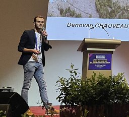 Denovan Chauveau合作论文数CNRS, Univ Brest3
 Julius Jara-Munoz合作论文数Univ Potsdam, Inst Geosci, Potsdam, Germany3Desrosiers Mélissa合作论文数3Edwin Chan合作论文数3
 Xavier Bertin合作论文数National Civil Engineering Laboratory, Estuaries and Coastal Zones Division, Av. do Brasil 101, 1700-066 Lisbon, Portugal3Kevin Pedoja合作论文数Département des Sciences de la Terre, Université de Caen Normandie3
 Christine Authemayou合作论文数Technopôle de Brest Iroise Plouzané, Université de Bretagne Occidentale3Valérie Forster合作论文数3Gregory Gauvain合作论文数2Christophe Prunier合作论文数2
 Pedro Luis Dunan-Avila合作论文数2A Dentel合作论文数2
 Mina A. Khoei合作论文数Inst Vis, Sorbonne Univ2
 Pauline Letortu合作论文数2
 Himanshu Akolkar合作论文数iCub Facility, Istituto Italiano di Tecnologia2
 Ail Divya合作论文数2
 R.B Benosman合作论文数Meta2
 Rui Gong合作论文数The University of Auckland2
 Jerome Ammann合作论文数2
 Antoine Chaffiol合作论文数Laboratoire de Physiologie Cérébrale, l’université Paris-Descartes2




