Development of algorithms for remote sensing applications can be facilitated with accurate scene simulations, where terrain reflectance and topography as well as all atmospheric and illumination conditions are controlled by the investigator. One such scene simulation model is MCScene. The MCScene model is based on a Direct Simulation Monte Carlo approach for modeling 3D atmospheric radiative transport, as well as spatially inhomogeneous surfaces including surface BRDF effects. The model includes treatment of land and ocean surfaces, 3D terrain, 3D surface objects, and effects of finite clouds with surface shadowing. Simulations can be performed from the UV through the LWIR. In this paper, we illustrate the use of MCScene as a tool in remote sensing algorithm development by simulating a partly cloudy scene and using this scene to test and evaluate a spectral cloud masking algorithm.
Ice blinks and water skies are brightness variations on the undersides of overcasts that allow ground-based observers to judge the nature of distant surfaces such as water (dark) or ice (bright). The clear sky should also scatter light from distant surfaces that might be visually detectable. We demonstrate that clear sky blinks do occur, can be visually discerned, and can be successfully photographed. We also model them theoretically using Monte Carlo simulations. The presence of atmospheric aerosols significantly enhances clear sky blinks.
Spectral imagers which collect optical data from the visible to the longwave infrared (LWIR) may collect data under partly cloudy sky scenarios. To fully exploit this data, a better understanding of the influence of cloudy conditions on the collected data is required. Here we examine the influence of broken cloud fields on collected data by simulating a partly cloudy scene as observed by hyperspectral sensors which are collecting data both above and below the cloud deck. To perform these simulations, we have used the MCScene code, a high-fidelity model for full optical spectrum (UV to LWIR) image simulation. The MCScene simulation is based on a Direct Simulation Monte Carlo approach for modeling 3D atmospheric radiative transport, as well as spatially inhomogeneous surfaces including surface BRDF effects. The model includes treatment of land and ocean surfaces, 3D terrain, 3D surface objects, and effects of finite clouds with surface shadowing.
Time-lapse videos, still photos, visual observations, and theoretical studies were used to investigate the antitwilight, i.e., twilight opposite the Sun. Colors, brightnesses, and antitwilight features as a function of solar altitude were measured. Four roughly horizontal bands were identified and explained physically in terms of atmospheric geometry, the observer’s line-of-sight, optical depth, refraction, and multiple scattering. Particular emphasis is placed on (1) the origin of the dark segment, (2) the rapid rising of the Belt of Venus with solar altitude, and (3) ray tracing light through the low atmosphere to understand refractive effects. New names are suggested for three of the four bands, and the new terminology is reconciled with earlier papers.
For this paper, we employ the Monte Carlo scene (MCScene) radiative transfer code to elucidate the underlying physics giving rise to the structure and colors of the antitwilight, i.e., twilight opposite the Sun. MCScene calculations successfully reproduce colors and spatial features observed in videos and still photos of the antitwilight taken under clear, aerosol-free sky conditions. Through simulations, we examine the effects of solar elevation angle, Rayleigh scattering, molecular absorption, aerosol scattering, multiple scattering, and surface reflectance on the appearance of the antitwilight. We also compare MCScene calculations with predictions made by the MODTRAN radiative transfer code for a solar elevation angle of +1°.
A validated, polarimetric 3-dimensional simulation capability, P-MCScene, is being developed by generalizing Spectral Sciences' Monte Carlo-based synthetic scene simulation model, MCScene, to include calculation of all 4 Stokes components. P-MCScene polarimetric optical databases will be generated by a new version (MODTRAN7) of the government-standard MODTRAN radiative transfer algorithm. The conversion of MODTRAN6 to a polarimetric model is being accomplished by (1) introducing polarimetric data, by (2) vectorizing the MODTRAN radiation calculations and by (3) integrating the newly revised and validated vector discrete ordinate model VDISORT3. Early results, presented here, demonstrate a clear pathway to the long-term goal of fully validated polarimetric models.
Hyperspectral imagery was taken of four vehicles from a roof at the Rochester Institute of Technology (RIT) at various vehicle orientations in illumination conditions dominated by direct solar radiation in order to explore and model the in-scene bidirectional reflectance distribution functions (BRDFs) of 3D objects. The four vehicles were rotated and imaged through the span of six hours resulting in many combinations of vehicle orientation, source azimuth, and source zenith. In addition to the general sampling of vehicle BRDFs, three experiments were designed and executed in order to understand the contributions of vehicle shape, vehicle color, and background on the observed in-scene BRDFs.
This paper will discuss recent improvements made to the Monte Carlo Scene (MCScene) code to enable limb-viewing scenarios and situations where the sun is below the horizon. MCScene is a high-fidelity model for full optical spectrum (UV through LWIR) hyperspectral image (HSI) simulation. MCScene generates HSI scenes for algorithm validation, utilizing a Direct Simulation Monte Carlo (DSMC) approach for modeling 3D atmospheric radiative transfer (RT). MCScene includes treatment of molecular absorption, Rayleigh scattering, aerosol absorption and scattering, multiple scattering and adjacency effects, as well as scattering off spatially inhomogeneous surfaces described by bidirectional reflectance distribution functions (BRDFs). The algorithm models land and ocean surfaces, 3D terrain, 3D surface objects, and effects of realistic finite clouds with shadowing. This paper will provide a brief overview of RT elements incorporated into the Monte Carlo engine and the recent addition of a polygonal earth cross-section (PEX) method for modeling.
We present progress being made in the passive optical remote detection of ground surface vibration. With proper design, minute seismic surface waves may be captured using remote visible imagery. The utility of subband steerable filters to the detection of surface vibrations in the absence of inherent image contrast is demonstrated. Detections with the filters are shown with laboratory data and compared to Fourier transform results over a range of surface vibrational amplitudes. We present an analysis of the optical measurements of ground surfaces performed during the passing of nearby trains with discussion of the hardware, software, and detection clutter sources. Results from optical remote sensing are interpreted using additional accelerometer measurements and image processing.
Under an International Cooperative Research and Development agreement, the U.S. Air Force Research Laboratory (AFRL) and Spectral Sciences, Inc. (SSI) are collaborating with the Australian Defence Science and Technology Organisation (DSTO) to use their respective scene simulation codes in order to generate synthetic imagery as viewed from space and covering visible through long wave infrared wavelengths. AFRL uses MCScene, which is SSI's hyperspectral scene simulation code incorporating first-principles 3-D radiative transport (RT) through a world that includes measured terrain and atmosphere/cloud data into the simulations. DSTO uses the code CameoSim to generate hyperspectral imagery over a similar wavelength regime. This joint effort will share and evaluate results from the two codes simulated for a common scene with available ground truth data, with an overall goal of enhancing the scene modeling capabilities of all three organizations. This paper shows preliminary results from each method.
This paper will discuss the effects of broken cloud fields on solar illumination reaching the ground. Broken cloud fields pose a problem for many atmospheric compensation algorithms which retrieve reflectance and/or aerosol properties from measured spectral imagery. In the reflective domain (visible to the SWIR), the application of atmospheric compensation algorithms in the vicinity of broken clouds leads to inaccuracies because of the enhanced number of photons scattered from the clouds into the clear sunlit areas. These illumination effects are simulated for simple slab clouds and complex broken cloud fields using the MCScene code, a high fidelity model for full optical spectrum (UV through LWIR) hyperspectral image simulation. MCScene provides an accurate, robust, and efficient means to generate spectral scenes for algorithm validation. MCScene utilizes a Direct Simulation Monte Carlo approach for modeling 3D atmospheric radiative transfer including full treatment of molecular absorption and Rayleigh scattering, aerosol absorption and scattering, and multiple scattering and adjacency effects, as well as scattering from spatially inhomogeneous surfaces. The model includes treatment of land and ocean surfaces, 3D terrain, 3D surface objects, and effects of finite clouds with surface shadowing.
This paper discusses the influence of broken cloud fields on the retrieval of surface reflectance from spectral data collected by aircraft or space-based sensors. Spectral remote sensing is a valuable means of identifying surface targets and materials via their inherent, unique spectral signatures. Currently, reflectance retrieval codes are optimized for uniform atmospheric and surface illumination conditions, which is not the case when clouds are present. Under partially cloudy conditions there are two main cloud-induced effects: shadows which results in diminished ground illumination, and illumination enhancement of sunlit areas due to the photons scattered from the clouds into these areas. The work presented here will focus on the sunlit areas. The cloud illumination enhancement effects on surface reflectance retrieval are examined for a two hyperspectral scenes; one with an optically opaque slab-cloud placed at the top of the scene and vertical stripes of material reflectance used for a flat terrain, and the second based on the Rochester Institute of Technology Target Detection Self-Test scene where an optically opaque cloud has been added to the scene. The scenes are simulated using MCScene, a high fidelity model for full optical spectrum hyperspectral image simulation. The retrieved reflectance values for the simulated scenes are compared to truth reflectance as a function of distance from the cloud. The cloud scattered photons change both the magnitude and shape of the retrieved reflectance values up to several km away from the cloud. We also present preliminary target detection results which show degraded performance when clouds are present.
Striping effects, i.e., artifacts that vary systematically with the image column or row, may arise in hyperspectral or multispectral imagery from a variety of sources. One potential source of striping is a physical effect inherent in the measurement, such as a variation in viewing geometry or illumination across the image. More common sources are instrumental artifacts, such as a variation in spectral resolution, wavelength calibration or radiometric calibration, which can result from imperfect corrections for spectral "smile" or detector array nonuniformity. This paper describes a general method of suppressing striping effects in spectral imagery by referencing the image to a spectrally low-dimensional model. The destriping transform for a given column or row is taken to be affine, i.e., specified by a gain and offset. The image cube model is derived from a subset of spectral bands or principal components thereof. The general approach is effective for all types of striping, including broad or narrow, sharp or graduated, and is applicable to radiance data at all optical wavelengths and to reflectance data in the solar (visible through short-wave infrared) wavelength region. Some specific implementations are described, including a method for suppressing effects of viewing angle variation in VNIR-SWIR imagery.
: We report the results of observations made at Magdalena Ridge Observatory using the prototype Wide Area Space Surveillance System (WASSS) camera, which has a 4 x 60 deg field-of-view, 0.05 deg resolution, a 2.8 cm(expn 2) aperture, and the ability to view within 4 deg of the sun. A single camera pointed at the GEO belt provided a continuous nightlong record of the intensity and location of more than 50 GEO objects detected within the camera s 60 deg field-of-view, with a detection sensitivity similar to the camera s shot noise limit of m(sub v)=13.7. Performance is anticipated to scale with aperture area, allowing the detection of dimmer objects with larger-aperture cameras. The sensitivity of the system depends on multi-frame averaging and a Principal Component Analysis based image processing algorithm that filters out space objects based on their different angular velocities from those of celestial objects. Results are presented for a full night of viewing on October 16, 2012. Close to 100 space objects were detected, of which 85 were identified.
This paper discusses the effects of broken cloud fields on solar illumination reaching the ground. Application of aerosol retrieval techniques in the vicinity of broken clouds leads to significant over prediction of aerosol optical depth because of the enhancement of visible illumination due to scattering of photons from clouds into clear patches. These illumination enhancement effects are simulated for a variety of broken cloud fields using the MCScene code, a high fidelity model for full optical spectrum (UV through LWIR) spectral image simulation. MCScene provides an accurate, robust, and efficient means to generate spectral scenes for algorithm validation. MCScene utilizes a Direct Simulation Monte Carlo approach for modeling 3D atmospheric radiative transfer (RT), including full treatment of molecular absorption and Rayleigh scattering, aerosol absorption and scattering, and multiple scattering and adjacency effects, as well as scattering from spatially inhomogeneous surfaces.
A calculation method has been developed for rapidly synthesizing radiometrically accurate ultraviolet through long-wavelength infrared spectral imagery of the Earth for arbitrary locations and cloud fields. The method combines cloud-free surface reflectance imagery with cloud radiance images calculated from a first-principles 3-D radiation transport model. The MCScene Monte Carlo code [1-4] is used to build a cloud image library; a data fusion method is incorporated to speed convergence. The surface and cloud images are combined with an upper atmospheric description with the aid of solar and thermal radiation transport equations that account for atmospheric inhomogeneity. The method enables a wide variety of sensor and sun locations, cloud fields, and surfaces to be combined on-the-fly, and provides hyperspectral wavelength resolution with minimal computational effort. The simulations agree very well with much more time-consuming direct Monte Carlo calculations of the same scene.
The MCScene code, a high fidelity model for full optical spectrum (UV to LWIR) spectral image simulation, will be discussed and its features illustrated with sample calculations. The MCScene simulation is based on a Direct Simulation Monte Carlo approach for modeling 3D atmospheric radiative transport, as well as spatially inhomogeneous surfaces including surface BRDF effects. The model includes treatment of land and ocean surfaces, 3D terrain, 3D surface objects, and effects of finite clouds with surface shadowing. This paper will review the more recent upgrades to the model including the development of an approach for incorporating direct and scattered thermal emission predictions into the MCScene simulations. Sample calculations presented in the paper include a full optical spectrum simulation from the visible to the LWIR for a desert scene under a broken cloud field. This scene was derived from an AVIRIS visible to SWIR spectral imaging data collect over the Virgin Mountains in Nevada. The data has been extrapolated to the thermal IR. Other calculations include complex 3D clouds over urban and rural terrain.
: The ultimate goal of this project was to develop a device for encoding and sending modulated high frequency optical signals utilizing a novel combination of chemical oscillators, chemiluminescent reactions and microfluidic technology. Our research team consisted of scientists and engineers from Brandeis University, Spectral Sciences, Inc., the Air Force Research Laboratory, Hanscom AFB, and RainDance Technologies, Inc.. We have made significant progress toward this goal and have discovered several potentially significant new phenomena in the course of our investigations. In particular, we have been able to increase the frequency of the Belousov-Zhabotinsky chemical oscillator by three to four orders of magnitude and have constructed microfluidic circuits to produce one- and two -dimensional arrays of coupled oscillators, which give rise to a variety of patterns that can be used to build communications and computational devices. We have tested two novel approaches for encoding chemical signals, developed a programmable simulator to mimic the signals, and carried out field tests to analyze problems of distinguishing the signal from the background. Mathematical models have been developed and successfully employed to simulate the experimental phenomena. Nonetheless, there remains significant work to be done in order to produce an operable device.
This paper will discuss recent improvements made to the Monte Carlo Scene (MCScene) code, a high fidelity model for full optical spectrum (UV through LWIR) hyperspectral image (HSI) simulation. MCScene provides an accurate, robust, and efficient means to generate HSI scenes for algorithm validation. MCScene utilizes a Direct Simulation Monte Carlo (DSMC) approach for modeling 3D atmospheric radiative transfer (RT) including full treatment of molecular absorption and Rayleigh scattering, aerosol absorption and scattering, and multiple scattering and adjacency effects, as well as scattering from spatially inhomogeneous surfaces, including surface bidirectional reflectance distribution function (BRDF) effects. The model includes treatment of land and ocean surfaces, 3D terrain, 3D surface objects, and effects of finite clouds with surface shadowing. This paper will provide an overview of how RT elements are incorporated into the Monte Carlo engine and both spectral and spatial properties of simulations of 3-dimensional cloud fields will also be presented.
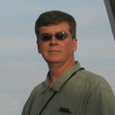 Robert Sundberg合作论文数15
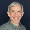 Steven Adler-Golden合作论文数13
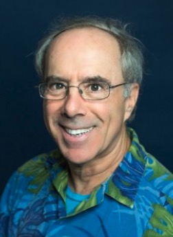 Lawrence Bernstein合作论文数Spectral Sciences, Inc10
 michael e gersh合作论文数9N. Goldstein合作论文数8
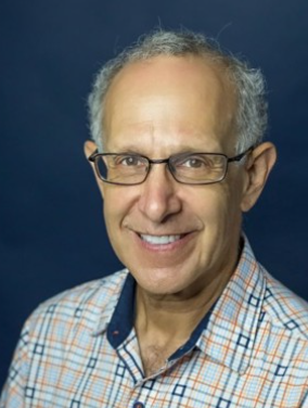 Alexander Berk合作论文数Spectral Sciences, Inc8Fritz Bien合作论文数8
 Michael W. Matthew合作论文数7r p domingue合作论文数5Jamine Lee合作论文数5prabhat k acharya合作论文数3Alexander Singer-Berk合作论文数3David K. Lynch合作论文数3
 Robert M. Shroll合作论文数3Gerald W. Felde合作论文数3Gail P. Anderson合作论文数3wai k cheng合作论文数2Raymond Haren合作论文数2
 David S. P. Dearborn合作论文数2John Gruninger合作论文数2Robert Y. Levine合作论文数2Frank O Clark合作论文数2Anthony J. Ratkowski合作论文数2Michael L. Hoke合作论文数2Marsha J. Fox合作论文数1Wellesley E. Pereira合作论文数1ken groff合作论文数1Bridget Tannian合作论文数1Hhk Burke合作论文数1wellesley pereira合作论文数1Timothy Perkins合作论文数1Sergey Kharabash合作论文数1daniel fulcoly合作论文数1
 Elijah Jensen合作论文数1garth monlux合作论文数1Patrick F Conforti合作论文数1j a gardner合作论文数1Haren, R.合作论文数1
 Irving R. Epstein合作论文数Department of Chemistry, Brandeis University1Laila S Jeong合作论文数1Brian Pukall合作论文数1
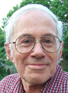 Anatol Markovich Zhabotinsky合作论文数Department of Chemistry, Brandeis University1
 Yanwei Jia (賈艷偉)合作论文数University of Macau,AMSV1
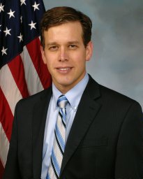 Jeremy Murray-Krezan合作论文数1David P. Miller合作论文数1
 Rainer Dressler合作论文数Spectral Sciences, Inc.1Frederick T. Hawes合作论文数1
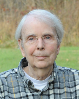 John F. Kielkopf合作论文数Department of Physics and Astronomy, University of Louisville;College of Arts and Sciences, University of Louisville;Centre for Astrophysics, University of Southern Queensland1
 Dan Gould合作论文数Department of Kinesiology, College of Education, Michigan State University1




