Rapid and accurate estimation of earthquake moment magnitude is crucial for early warning systems, for alerting coastal populations vulnerable to tsunamigenic hazards. Most seismic-based estimation approaches introduce time delays that limit applicability near the source, while geodetic approaches have been limited to empirical scaling relationships. We extend a physics-based approach for seismogeodetic moment magnitude (M wg) estimation initially developed for thrust earthquakes to also include strike-slip and normal fault mechanisms by examining 17 M w 7.0 to 9.1 earthquakes. We find that considering S-wave propagation is critical for accurately estimating the magnitude of strike-slip events. Radiation pattern (RP) corrections offer substantial benefits for normal fault events but are difficult to compute in real-time. However, RP corrections can be neglected for strike-slip events, while thrust and normal earthquakes are more reliably handled using the previously established seismogeodetic approach, allowing accurate M wg estimates within about 2-3 min of earthquake initiation in early warning scenarios. We further broaden the seismogeodetic approach by interpolating coseismic windows from collocated GNSS and/or accelerometer stations to stand-alone GNSS stations, thereby increasing the size and geometry of the available network. We present an integrated workflow for rapid M wg estimation that leverages tectonic information from subduction-zone geometry to inform focal mechanism selection, rather than relying on uncertain hypocentral depths. Our extended approach provides rapid earthquake magnitudes (similar to 2-3 min after earthquake initiation) for moderate to large events (M w >= 7) with an M wg accuracy of 0.2 magnitude units. Our approach is useful for operational environments where timely magnitude estimates are essential.
We estimate a seismogeodetic earthquake moment magnitude using unclipped, broadband velocity and displacement waveforms from collocated Global Navigation Satellite Systems and seismic stations located within 800 km epicentral distance for nine 7.2 < M-w < 9.1 earthquakes. We consider the vertical component of seismogeodetic displacement as an approximate source time function and integrate the associated time series to obtain the seismic moment. By continuing to integrate vertical displacement beyond the initial P-waves, we obtain rapid estimates of M-w that are within 0.2 magnitude units for 8 thrust faulting events and within 0.3 units for the single normal faulting event. Because our estimates of the seismic moment are based on the maximum value of integrated displacement, no regression against other source parameters, or distance, is necessary. Our new method shows promise for integration into earthquake and local tsunami early warning systems, including tsunami earthquakes characterized by relatively slow moment release over a longer rupture time, and earthquakes with complex source time functions.
The Joint Task Force, Science Monitoring And Reliable Telecommunications (JTF SMART) Subsea Cables are working to integrate environmental sensors (temperature, pressure, seismic acceleration) into submarine telecommunications cables. This will support climate and ocean observation, sea level monitoring, observations of Earth structure, tsunami and earthquake early warning and disaster risk reduction. Recent advances include regional SMART pilot systems that are the initial steps to trans-ocean and global implementation. Building on the OceanObs'19 conference and community white paper (doi:10.3389/fmars.2019.00424), this paper presents an overview of the initiative and a description of ongoing projects including: InSea wet demonstration project off Sicily; Vanuatu and New Caledonia; Indonesia; CAM-2 triangle system connecting Lisbon, Azores and Madeira; New Zealand; and Antarctica. In addition to the diverse scientific and societal benefits, the telecommunications industry mission of societal connectivity will also benefit because environmental awareness improves both individual cable system integrity and the resilience of the overall global communications network.
We present results from a series of exploratory numerical experiments based on ocean bottom pressure and seismic data from a simulated linear array of SMART cable stations off the trench in the Sumatra-Java region. We use six rupture scenarios to calculate tsunami propagation using hydrodynamic simulations. Through these experiments we show that such an addition would result in up to several hours of improvement in the detection of earthquakes and tsunamis compared to the existing (minimal) DART systems in the northern and southern Indian Ocean. By simulating tsunamis from 58 submarine landslide scenarios in the region, we show that the SMART system can provide invaluable information in early warning against landslide tsunamis. We also calculate seismic phase arrival times from six source scenarios at existing seismic stations and our proposed SMART cables. Statistical analysis of our results shows that inclusion of such a SMART array can improve the important network parameters for the detection, evaluation and locating of seismic events.
The Joint Task Force, Science Monitoring And Reliable Telecommunications (JTF SMART) Subsea Cables, is working to integrate environmental sensors for ocean bottom temperature, pressure, and seismic acceleration into submarine telecommunications cables. The purpose of SMART Cables is to support climate and ocean observation, sea level monitoring, observations of Earth structure, and tsunami and earthquake early warning and disaster risk reduction, including hazard quantification. Recent advances include regional SMART pilot systems that are the first steps to trans -ocean and global implementation. Examples of pilots include: InSEA wet demonstration project off Sicily at the European Multidisciplinary Seafloor and water column Observatory Western Ionian Facility; New Caledonia and Vanuatu; French Polynesia Natitua South system connecting Tahiti to Tubaui to the south; Indonesia starting with short pilot systems working toward systems for the Sumatra-Java megathrust zone; and the CAM-2 ring system connecting Lisbon, Azores, and Madeira. This paper describes observing system simulations for these and other regions. Funding reflects a blend of government, development bank, philanthropic foundation, and commercial contributions. In addition to notable scientific and societal benefits, the telecommunications enterprise’s mission of global connectivity will benefit directly, as environmental awareness improves both the integrity of individual cable systems as well as the resilience of the overall global communications network. SMART cables support the outcomes of a predicted, safe, and transparent ocean as envisioned by the UN Decade of Ocean Science for Sustainable Development and the Blue Economy. As a continuation of the OceanObs’19 conference and community white paper ( Howe et al., 2019 , doi: 10.3389/fmars.2019.00424 ), an overview of the SMART programme and a description of the status of ongoing projects are given.
The Pacific Tsunami Warning Center's (PTWC's) core mission consists in saving lives and minimizing property damage through the issuance of timely, effective tsunami warnings and threat messages. For this purpose, the center relies primarily not only on the analysis of near-real-time seismic data streams provided by established networks such as the Global Seismic Network (GSN), but also by an increasing number of stations contributed by regional seismic networks (RSNs) from around the world. We used theoretical computations of the detection time of the first arriving P wave as a proxy to highlight the areas where RSN contributions have the greatest operational impact. To this goal, the P-wave detection times computed for the GSN provided a baseline to isolate the contribution of the RSN in the form of spatially distributed detection time gains. Inspection of the resulting global maps reveals detection time gains of more than 3 m for Hawaii, Alaska, the east and west coasts of the United States, South America, New Zealand, the southwest Pacific, Australia, and the Sunda arc. Despite higher density of GSN baseline stations across the U.S. west coast and the eastern Caribbean, contributions from RSNs result in detection time gains of more than 2 m. These gains in earthquake detection speed correlate well with the continuous increase in the number of stations ingested into the PTWC system and the gradual reduction of the operational median response time to under 6 m from origin during the last 5 yr. These results allow us to conclude that fulfillment of the PTWC's international and domestic tsunami warning responsibilities critically depends on the support of the RSNs contributing data to PTWC's daily operations.
Abstract. In September 2017, hurricanes Irma and Maria wreaked havoc across the Caribbean region. While obliterating the infrastructure in the Caribbean nations found along their path, both hurricanes gradually destroyed the existing seismic networks. We quantified the impact of the hurricanes on the PTWC tsunami warning capability for the Caribbean region relying on the computation of theoretical earthquake detection and response times after accounting for hurricane-related station outages. The results show that the hurricanes rendered inoperative 38 % of the 146 stations available in the Caribbean. Within the eastern Caribbean region monitored by PTWC the hurricanes exacerbated outages to an astonishing 82 % of the available 76 seismic stations. Puerto Rico, the Virgin Islands, and the Lesser Antilles suffered the brunt of both hurricanes, and their seismic networks nearly disappeared. The double punch delivered by two successive category 5 hurricanes added up to 02:43 and 04:33 minutes to the earthquake detection and response times, effectively knocking out PTWCu0027s local tsunami warning capabilities in the region. Emergency adjustments, including the temporary reduction of the number of stations required for earthquake detection and ML magnitude release, enabled a faster response to earthquakes in the region than otherwise possible in the aftermath of hurricanes Irma and Maria.
The ocean is key to understanding societal threats including climate change, sea level rise, ocean warming, tsunamis, and earthquakes. Because the ocean is difficult and costly to monitor, we lack fundamental data needed to adequately model, understand, and address these threats. One solution is to integrate sensors into future undersea telecommunications cables. This is the mission of the SMART subsea cables initiative (Science Monitoring And Reliable Telecommunications). SMART sensors would “piggyback” on the power and communications infrastructure of a million kilometers of undersea fiber optic cable and thousands of repeaters, creating the potential for seafloor-based global ocean observing at a modest incremental cost. Initial sensors would measure temperature, pressure, and seismic acceleration. The resulting data would address two critical scientific and societal issues: the long-term need for sustained climate-quality data from the under-sampled ocean (e.g., deep ocean temperature, sea level, and circulation), and the near-term need for improvements to global tsunami warning networks. A Joint Task Force (JTF) led by three UN agencies (ITU/WMO/UNESCO-IOC) is working to bring this initiative to fruition. This paper explores the ocean science and early warning improvements available from SMART cable data, and the societal, technological, and financial elements of realizing such a global network. Simulations show that deep ocean temperature and pressure measurements can improve estimates of ocean circulation and heat content, and cable-based pressure and seismic-acceleration sensors can improve tsunami warning times and earthquake parameters. The technology of integrating these sensors into fiber optic cables is discussed, addressing sea and land-based elements plus delivery of real-time open data products to end users. The science and business case for SMART cables is evaluated. SMART cables have been endorsed by major ocean science organizations, and JTF is working with cable suppliers and sponsors, multilateral development banks and end users to incorporate SMART capabilities into future cable projects. By investing now, we can build up a global ocean network of long-lived SMART cable sensors, creating a transformative addition to the Global Ocean Observing System.
In September 2017, hurricanes Irma and Maria wreaked havoc across the Caribbean region. While obliterating the infrastructure in the Caribbean nations found along their path, both hurricanes gradually destroyed the existing seismic networks. We quantified the impact of the hurricanes on the Pacific Tsunami Warning Center (PTWC) initial tsunami warning capability for the Caribbean region relying on the computation of theoretical earthquake detection and response times after accounting for hurricane-related station outages. The results show that the hurricanes rendered 38 % of the 146 stations available in the Caribbean inoperative. Within the eastern Caribbean region monitored by PTWC the hurricanes exacerbated outages to an astonishing 82 % of the available 76 seismic stations. Puerto Rico, the Virgin Islands, and the Lesser Antilles suffered the brunt of both hurricanes, and their seismic networks nearly disappeared. The double punch delivered by two successive category 5 hurricanes added up to 02:43 and 04:33 min to the earthquake detection and response times, effectively knocking out PTWC's local tsunami warning capabilities in the region. Emergency adjustments, including the temporary reduction of the number of stations required for earthquake detection and ML magnitude release, enabled a faster response to earthquakes in the region than otherwise possible in the aftermath of hurricanes Irma and Maria.
We evaluate the Pacific Tsunami Warning Center's (PTWC) performance for the Caribbean relying on the compilation of 298 messages issued for this region between 2003 and July 2017. Matching the earthquake parameters included in these messages with the corresponding solutions published in later more authoritative catalogs allowed us to calculate essential statistics for quality indicators such as response time, epicentral offset, magnitude residual, and their spatial and temporal distributions. Analysis of these statistics reveals that the PTWC has gradually reduced the response times for the Caribbean from a median of 11 min before 2006 to just under 3 min in 2017. The PTWC has also kept the magnitude residuals at 0.2 magnitude unit and the epicentral offsets at or under the historical margin of error despite processing an increasingly larger number of events since 2013. The quality of the preliminary earthquake source parameters issued by the PTWC, combined with the speed of its messages for this region, validates the PTWC data processing system for the Caribbean as capable of handling events in the vicinity of Puerto Rico and the Virgin Islands (PRVI) with the speed and accuracy required to provide them with local tsunami warning products. Notwithstanding, despite fast issuance of tsunami messages from the PTWC, given the potential generation of tsunamis with very short travel times of even less than 5 min, PRVI must continue to educate the population to self evacuate in the event of strong or long ground shaking instead of waiting for official tsunami messages.
We assess the Pacific Tsunami Warning Center's (PTWC) capabilities as the local tsunami warning center for Puerto Rico and the Virgin Islands (PRVI), relying on the computation of theoretically optimum detection and response times. We computed theoretical P- and S-wave detection times for both the Caribbean and a subregion encompassing PRVI. In these computations, we considered not only the topology of the seismic network, but also the data latency of its stations. To account for both factors as realistically as possible, we used a snapshot of the latencies of the data streams coming into the PTWC system on 29 August 2017. The resulting maps show a significant reduction of the area where we could detect earthquakes within 60 s in the Caribbean region from 28% to 6.6% of the total area. Likewise, in the eastern Caribbean, both station outages and long data latencies at 68% of the seismic network nullify the potential gains in response time otherwise possible by taking advantage of the shortest detection times in areas with the highest density of stations, such as the island of Puerto Rico. Notwithstanding, faster release of automatic solutions combined with the reduction of data latencies can shorten tsunami bulletin release times by about one minute, albeit with fewer M-L magnitude computations. In the future, the PTWC hopes to release most events in the densely instrumented parts of the eastern Caribbean within two minutes of origin time.
As part of its daily operations the Pacific Tsunami Warning Center (PTWC) in Honolulu, Hawaii, routinely analyses most earthquakes with a 5.5 or larger magnitude occurring around the globe. Although not officially required, the PTWC scientists on duty will usually issue an observatory (obs) message that contains the first set of preliminary source parameters for these events. If the magnitude of the earthquake under analysis crosses the 6.5 magnitude threshold, however, the protocol requires the issuance of at least a tsunami information bulletin. For many years, scientists at the PTWC assumed that the ubiquitous central limit theorem guaranteed that the inclusion of a larger number of seismic stations in the initial analyses would automatically improve the quality of the source parameters, particularly a more accurate hypocenter location and Mwp magnitude estimate. In this study we assess the validity of these assumptions and their impact on the message delays based on the actual messages’ data and statistics. We matched 577 observatory messages issued by the PTWC between 2003 and 2016 with the corresponding official tsunami message products that followed them. We then computed the corresponding epicentral offsets, magnitude residuals, and message latencies against the source parameters listed in the International Seismological Centre (ISCGEM), the Global Centroid Moment Tensor (GCMT) Project, and the National Earthquake Information Center (NEIC) online catalogs. Analysis of these statistics reveals that 53% of the reported magnitudes did not change despite up to 20 additional minutes of processing time since issuing the observatory message. Paradoxically, for 17% of the dataset the median magnitude residual increases from zero in the obs messages to 0.2 magnitude units in the matching bulletins that followed. In the remaining 30% of the events the initial magnitude estimates see a reduction of the median magnitude residual from 0.3 in the obs messages to 0.1 magnitude units in the corresponding bulletins. These results indicate that for the majority (70%) of the earthquakes analyzed by the PTWC during the last 12 years the quality of the preliminary earthquake parameters does not benefit from the additional message delays. Moreover, the data statistics reveal that from 2003 to 2016 in most cases the initial source parameters included in the obs messages had an accuracy matching or exceeding those included in the initial tsunami messages that followed them. Such results suggest that within this context the central limit theorem has a limited operational applicability. This appears to stem from the rather short analysis times and limited data availability typical for most initial earthquake source characterizations conducted by the PTWC scientists for tsunami warning purposes. Notwithstanding, additional message delays seem justified when dealing with earthquakes characterized by either a complex rupture or large magnitudes. For the majority of the earthquakes processed at the PTWC, however, the results do not justify additional time delays to add more seismic stations in the initial hypocenter location analyses, or to manually review individual magnitude estimates before issuing the first official message product. Moreover, we can conclude that as often as not additional processing times turn into a waste of otherwise precious warning time, something particularly important in the near field.
 Nathan C. Becker合作论文数21
 Charles S. Mccreery合作论文数Richard H. Hagemeyer Pacific Tsunami Warning Center, NOAA13V. Sardina合作论文数11B. F. Hirshorn合作论文数10Kanoa Koyanagi合作论文数10barry hirshorn合作论文数6Christa von Hillebrandt-Andrade合作论文数6
 Walsh David A合作论文数Department of Biology, Concordia University5
 Paul Lundgren合作论文数Department of Geological Sciences, Northwestern University5
 Bruce M. Howe合作论文数Department of Ocean and Resources Engineering, School of Ocean and Earth Science and Technology, University of Hawai‘i at Mānoa5r k cessaro合作论文数4Laura S. L. Kong合作论文数4Uday S. Kari合作论文数4
 Gerard Fryer合作论文数4Nigel Bayliff合作论文数3
 Amir Salaree合作论文数Dept Earth & Environm Sci, Univ Michigan3David Walsh合作论文数3Charles DeMets合作论文数3Jerome Aucan合作论文数LOCEAN (UMR 7159), IRD3
 Richard G. Gordon合作论文数Department of Earth, Environmental, and Planetary Sciences, Wiess School of Natural Sciences, Rice University3Douglas S. Luther合作论文数3
 Seth Stein合作论文数Department of Earth and Planetary Sciences, Weinberg College of Arts & Sciences, Northwestern University;Institute for Policy Research, Northwestern University3Gavin P. Hayes合作论文数Geologic Hazards Science Center, Synergetics Inc.3
 Andi Eka Sakya合作论文数Department of Aeronautical Engineering, Nagoya University3Dale F. Woods合作论文数3
 Charlotte A. Rowe合作论文数Michigan State University3
 Yehuda Bock合作论文数Scripps Orbit and Permanent Array Center, University of California, San Diego;Institute of Geophysics and Planetary Physics, Scripps Institution of Oceanography, University of California, San Diego3
 Carol A. Stein合作论文数Department of Earth and Environmental Sciences, University of Illinois at Chicago3
 John F. Marra合作论文数Brooklyn College, The City University of New York3J. C. Ferris合作论文数2Victor Sardina合作论文数2B. Shiro合作论文数2Don Argus合作论文数2Anthony Jamelot合作论文数2Jose Barros合作论文数2
 S. Tsuboi合作论文数2Wiens Douglas Alvin合作论文数2Quible Daniel合作论文数2
 Dorian Golriz合作论文数2
 Giuditta Marinaro合作论文数2
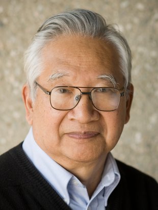 Hiroo Kanamori合作论文数Division of Geological and Planetary Sciences, California Institute of Technology2Luis Rivera合作论文数2
 Paul M Whitmore合作论文数2
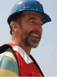 Steve Lentz合作论文数Department of Physical Oceanography, Woods Hole Oceanographic Institution2
 L. Matias合作论文数CGUL, University of Lisbon2Vindell Hsu合作论文数2
 Zacharie Duputel合作论文数Institut de Physique du Globe de Strasbourg2
 Frederik Tilmann合作论文数Deutsches GeoForschungsZentrum GFZ2
 Matthew J. Fouch合作论文数Department of Geological Sciences;Arizona State University;Department of Geological Sciences, Arizona State University2




