We develop a test method to evaluate the vertical moving performance of a multicopter system in a narrow environment, specifically performance for ascending through a narrow aperture. This research aims to boost the multicopter industry by pushing for the expansion of multicopter use in various places and situations. Multicopter users should know whether the multicopter system performance is enough to achieve their objectives and what multicopter suits them. However, discussing what/how much multicopter systems can do is complex, especially in a place or situation affecting some multicopter system functions. Thus, the test method provides an easy-to-understand evaluation of multicopter system performance for mobility to access a destination in a narrow environment, even for multicopter users without technical knowledge. To develop an acceptable test method for the multicopter industry, we repeatedly held demonstrations and discussions with multicopter manufacturers and users to incorporate their opinions from the early stages of this research. In addition, the experiments show that the test method appropriately indicates the difference in multicopter system performance. This paper describes the approach of multicopter system performance evaluation to promote the multicopter industry, the development along with multicopter users' opinions, and the results of the experiments to compare the types of multicopters and considerations.
This paper describes the development of the user-interface for intuitively maneuvering remotely operated robots. When maneuvering the robots is difficult, it causes some troubles in remote operation, and it will affect safe task execution. To easily maneuvering the robots, we focused on the operator's directional awareness, and we proposed user-interface.
This paper introduces the development of test methods for capability evaluation of Unmanned Aircraft Systems (UASs) in Global Navigation Satellite System (GNSS)-denied environments. The purpose of this development is to facilitate growth in the UAS industry. We discuss the test method's approach and what UAS's capability evaluation is essential for UAS use in GNSS-denied environments. As a result, we decided to adopt an approach that a test method evaluates a capability to perform a single simple task. In addition, these test methods should be along with the requirement of UAS manufacturers and users. Thus, first, we develop test methods to assess mobility in narrow spaces with obstacles shielding GNSS radio. We repeatedly have demonstrations and discussions of our test method with UAS manufacturers and users from the early stage of this development and collect their opinions for improvement to proceed with the development while building consensus with them. In addition, we evaluate several UASs by the test methods and examine whether our test method makes it possible to show the difference in UAS capability. This paper describes the approach of the test methods, the test methods for mobility in a GNSS-denied environment, the demonstrations and discussions with UAS manufacturers and users, and the results of the UAS's performance evaluation by the test methods.
This paper introduces a development of evaluation methods for flight performance of small unmanned aircraft system (UAS) restricted environments.
This paper introduces the development of the 3D information representation method overlaying on a camera image to help a remote-controlled robot operator. This development purpose is for an operator to make it easy to understand the environment where the robot is deployed. At the same time, this method should not increase the operator’s strain, such as changing the viewpoint. Therefore, this method represents 3D information overlaying on a camera image. A camera image is most popular for remote operation’s environmental information representation, and this method aims for the operator to refer to camera images with 3D information as augmented reality. This paper describes the approach of this method, the implementation of this method for mobile robot remote operation, and the .
In emergency response and decommissioning at Fukushima Daiichi Nuclear Power Station (FDNPS), remote controlled robot is required to work in harmful places instead of human workers. However, remote robot operation is not easy. In order to achieve a mission by remotely robot operation, the robot operator should understand what and how much he/she is capable to do by remote operation with the robot. Thus, a method for evaluation of robot capability is needed. Many of the missions by remote robot operation in FDNPS accomplish main objectives, while, few problems occurred in some missions. The experience from such problems in FDNPS have significant value for practical remote robot operation. The aim of this research is to develop a robot testing method based on cases of FDNPS remote operations with arm mounted robots. We survey FDNPS remote operations with arm mounted robots, and decide to develop a testing method to evaluate the robot capability for approaching a target object over an obstacle by a robot arm. We develop a test field for evaluation the capability and the test procedure to measure the metric to describe the capability using the test field. Moreover, we conduct actual tests and discussions with a team engaged in nuclear emergency response robot maintenance and training to make it more practical.
This paper describes a system for realizing simultaneous and synchronized collection of air dose rates and measurement locations for efficient dosimetry survey and spatio-temporal dosimetry data logging in nuclear facilities. The prototype system, which is currently under development, mainly consists of a 3D LiDAR-SLAM unit and a dosimeter integrated in a ROS framework. In this paper, we present the configuration of the prototype and the preliminary experimental results of dosimeter position estimation using it.
To work in a place where human access is restricted, using remotely controlled robots as alternative of human is one of the ideal solution, and it is particularly of significant value for harmful places. In Fukushima Daiichi Nuclear Power Station(FDNPS) of Tokyo Electric Power Company holdings(TEPCO), many remotely controlled robots are used for its decommissioning. However, remote operation using robots is not easy, and there were some problems in remote robot operations. Robot testing method considering the tasks of remote robot operation in FDNPS is important for development in robotics and training for operators. Then, we survey about these problems on remote robot operation at FDNPS, and develop robot testing methods to quantitatively evaluate robot capabilities for remote operation based on this survey. This paper introduces this survey and the robot testing methods.
In Fukushima Daiichi Nuclear Power Station (1F), access to some area in reactor building is strictly constrainted by something harmful, for example, high radiation, toxic gas and combustible gas. Therefore, understanding of the state of the site is important to work safety and efficiently for 1F decommissioning. Mapping using remotly control robot called SLAM is one of the ideal solution for understanding of the site where access is constrained by something harmful. There are technical problems to solve for applying SLAM to 1F environments. However, we have very limited or no chance for testing SLAM on the actual 1F site, and this presents a barrier to apply SLAM for 1F. The poupose of this research is to develop a dataset for testing SLAM for 1F environment using a mockup-field instaed of the actual 1F site. This paper introduces a senario for an investigation the inside of primary containment vessel(PCV) and the development of the mockup-field of PCV.
Simultaneous localization and mapping (SLAM) is not only a key technology for robot to move automatically, but also is a useful technology for humans to understand the state of places. Especially for a site where access is constrained by something harmful, such as Fukushima Daiichi Nuclear Power Plant (1F), understanding of the state of the site is important. In addition, mapping using remotely control robots is one of the ideal solution for investigation such sites. However, there are technical problems to solve for applying SLAM to extreme environments, for example, how to obtain landmarks under severe environmental condition. Furthermore, for extreme environments, we have very limited or no chance for testing SLAM on the actual site, and this makes it difficult to research applying SLAM. For this reason, an evaluation method without testing on the actual 1F site is needed to promote research of SLAM for 1F. This paper introduces the development of a dataset for SLAM evaluation with the mockup field instead of the actual site, specifically the dataset of the mockup field of Primary Containment Vessel (PCV) platform under dark illumination condition.
This paper describes the development of some test methods for the robots utilized for nuclear disaster response and decommissioning tasks. From the experiences in the disaster response at Fukushima Daiichi Nuclear Power Station(FDNPS), we have learned the importances of the development of the robots and the improvement of the operation capability. In this paper, we describe the test methods for running performances of the robots that are fundamental functions for the tasks in the nuclear disaster response. As the typical examples, we describe the tests for the performance of running through the narrow passage, climbing up and down the stairs and running with dragging the cable.
This paper proposed test methods for the robots for nuclear emergency response. Our motivation is to enhance the development of the robots and the improvement of the operator proficiency for decommissioning of Fukushima Daiichi Nuclear Power Station. We describe some proposals of developed test method for nuclear disaster response ground robots. Subject of the robots’ performance to be evaluated and required conditions are described. Practical example courses and testing procedure utilizing the mockup facility and developed test field are also introduced.
This paper introduces a laser-scanner measurement model using the statistic of laser-scanner data collected in advance for a mobile robot localization. In autonomous navigation, robots usually run based on self position on a map, and laser-scanners are useful sensors for localization. However, in human living environments like urban areas and parks, laser-scanner data is unstable due to moving objects and natural objects, and it is difficult to obtain landmarks like fixed objects. Therefore, our method make a map using statistics of laser-scanner data and calculates the laser-scanner measurement model based on statistics. Our method is applied to Monte Carlo localization/particle filter. Because the map makes possible to use the frequency and distribution of laser-scanner data for localization, our method allows a robust localization for unstable laser scanner data. In extensive experiments, our method presented an accurate localization and a robot using our method ran stably in actual sidewalks.
To meet the demands of an aging society, research on intelligent/robotic wheelchairs have been receiving a lot of attention. In elderly care facilities, care workers are required to communicate with the elderly in order to maintain both their mental and physical health. While this is regarded as important, having a conversation with someone on a wheelchair while pushing it from behind in a traditional setting would interfere with their smooth and natural conversation. So we are developing a robotic wheelchair system which allows companions and wheelchair users to move in a natural formation. This paper reports on an investigation to learn the patterns of human behavior when the wheelchair users and their companions communicate while walking together. The ethnographic observation reveals a natural formation of positioning for both companions and wheelchair users. Based on this investigation, we propose a multiple robotic wheelchair system which can maintain desirable formations for communication between wheelchairs.
To meet the demands of an aging society, researches for intelligent/robotic wheelchairs have been receiving a lot of attention. In elderly care facilities, care workers are required to have a communication with the elderly in order to maintain their both mental and physical health. While this is regarded as important, a conversation with someone on a wheelchair while pushing it from his/her behind in a traditional setting would interfere with their smooth and natural conversation. Based on these concerns we are developing a robotic wheelchair which allows companions and wheelchair users move in a natural formation. This paper reports on an investigation how human behaves when the wheelchair users and their companions communicate while moving together.
In this work, we propose a system to search for specific person utilizing a mobile robot. The system recognizes specific person using point cloud obtained by range a sensor and camera. Overview of our method will be presented. Tsukuba Challenge 2014 will be testing ground of the system.
 Kuniaki Kawabata合作论文数Naraha Center for Remote Control Technology Development, Japan Atomic Energy Agency;Collaborative Laboratries for Advanced Decommissioning Sciences, Japan Atomic Energy Agency;Center for Engineering, The University of Tokyo;Kagawa University;Keio University15
 Akihisa Ohya合作论文数Intelligent Robot Laboratory;University of Tsukuba;University of Tsukuba, University of Tsukuba8
 Hiroyuki Abe合作论文数5Norihito Shirasaki合作论文数4yosuke tsurumi合作论文数4fusako kiyono合作论文数4
 Akira Matsumoto合作论文数4satoshi shigezaki合作论文数3akihiro iizuka合作论文数3Kimimochi OKAMURA合作论文数3Rintaro Ito合作论文数3Takuya Ishida合作论文数3
 Yoshinori Kobayashi合作论文数Graduate School of Science & Engineering, Saitama University3Ryota Suzuki合作论文数Saitama University3
 Yoshinori Kuno (久野義徳)合作论文数Department of Information and Computer Sciences , Faculty of Engineering, Saitama University;Division of Mathematics, Electronics and Informatics, Graduate School of Science and Engineering, Saitama University3Hiroki ISHIYAMA合作论文数2UENO YOSHINARI合作论文数2Soichiro Suzuki合作论文数2
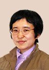 Akiko Yamazaki合作论文数Nursing School, Douai Hospital2
 Keiichi Yamazaki合作论文数Saitama University2hideyuki akagi合作论文数1
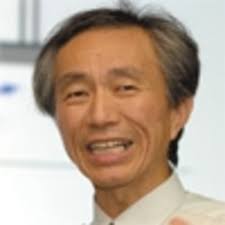 Shinichi Yuta合作论文数Institute of Engineering Mechanics and Systems, University of Tsukuba1makoto sakanobe合作论文数1fumiaki mera合作论文数1hirotaka matsuoka合作论文数1Yuta Tanifuji合作论文数1Takeru Ito合作论文数1Fumiaki Mori合作论文数1Jun Nakamura合作论文数1KUTSUWADA TOMOKI合作论文数1yutaka agawa合作论文数1Toshihide Hanari合作论文数1Takashi Imabuchi合作论文数1Kenta Suzuki合作论文数1
 Wanayuth Sanngoen合作论文数1
 Tatsuo Torii合作论文数1Akiko Natori合作论文数1Masahiro Takagi合作论文数1Akira Ohya合作论文数1Yoshihisa Sato合作论文数1
 Takashi Tsubouchi合作论文数Graduate School of Systems and Information Engineering
Department of Intelligent Interaction Technologies
University of Tsukuba1Masaya Arai合作论文数1
Takashi Tsubouchi合作论文数Graduate School of Systems and Information Engineering
Department of Intelligent Interaction Technologies
University of Tsukuba1Masaya Arai合作论文数1 Shinji Kawatsuma合作论文数1Hyuga Masu合作论文数1




