A geophylogeny is a phylogenetic tree where each leaf (biological taxon) has an associated geographic location (site). To clearly visualize a geophylogeny, the tree is typically represented as a crossing-free drawing next to a map. The correspondence between the taxa and the sites is either shown with matching labels on the map (internal labeling) or with leaders that connect each site to the corresponding leaf of the tree (external labeling). In both cases, a good order of the leaves is paramount for understanding the association between sites and taxa. We define several quality measures for internal labeling and give an efficient algorithm for optimizing them. In contrast, minimizing the number of leader crossings in an external labeling is NP-hard. We show nonetheless that optimal solutions can be found in a matter of seconds on realistic instances using integer linear programming. Finally, we provide several efficient heuristic algorithms and experimentally show them to be near optimal on real-world and synthetic instances.
Metro maps are one of the main ways for users of the public transport system to orient themselves and plan trips. Designing good metro maps is a complex task, the automation of which has been widely studied. Despite this, human-designed maps are still of distinctly higher quality than those created automatically. This is because it is hard to formalise what a good map is in general, but also because there are usually portions of the map where deviations from a supposedly "optimal" solution - according to the general measure - are preferable and creativity is needed. This paper describes the design of systems that tackle this with algorithmically-assisted user interaction. Starting from a fast metro map drawing algorithm by Bast, Brosi and Storandt, we describe a variety of ways a designer may want to interact with the automatically generated map. We discuss design considerations for such a system, the limitations of our current prototype, challenges for making this into a production system, and the promise of algorithmically-assisted user interaction.
We propose Exceptional Gestalt Mining (EGM), a variant of Exceptional Model Mining that seeks subgroups of the dataset where a coalition becomes more than the sum of its parts. Suppose a dataset of games in which several roles exist within a team; the team can combine forces from any subset of roles, to achieve a common goal. EGM seeks subgroups for which games played employing a large role set have a higher win rate than games played employing any strict subset of that role set. We illustrate the knowledge EGM can uncover by deploying it on a dataset detailing Magic: The Gathering games: we find combinations of cards that jointly work better in multicolor decks than in decks employing fewer colors. We argue that EGM can be deployed on datasets from sports where several roles exist that directly interact in play, such as ice hockey.
We consider the problem of matching trajectories to a road map, giving particular consideration to trajectories that do not exclusively follow the underlying network. Such trajectories arise, for example, when a person walks through the inner part of a city, crossing market squares or parking lots. We call such trajectories semi-restricted. Sensible map matching of semi-restricted trajectories requires the ability to differentiate between restricted and unrestricted movement. We develop in this paper an approach that efficiently and reliably computes concise representations of such trajectories that maintain their semantic characteristics. Our approach utilizes OpenStreetMap data to not only extract the network but also areas that allow for free movement (as e.g. parks) as well as obstacles (as e.g. buildings). We discuss in detail how to incorporate this information in the map matching process, and demonstrate the applicability of our method in an experimental evaluation on real pedestrian and bicycle trajectories.
Raw crowdsourced data is often of questionable quality. The typical solution to this is redundancy: ask multiple independent participants the same question and take some form of majority answer. However, this can be wasteful in terms of human effort. In this paper we show that algorithmic analysis of the data is able to get higher quality results out of a given amount of crowd effort (or alternatively, that less crowd effort would have sufficed for the same level of quality). Our case study is based on a publicly available crowdsourced data set by the New York Public Library, featuring building footprints in historical insurance atlases. Besides evaluating the quality improvement achieved by our methods, we provide both a command line interface for batch-mode processing and an interactive web interface; both work with standard data formats and are available as open source software.
We consider the problem of accurately representing geographic networks at reduced coordinate precision. We require that vertices are placed on a grid and the network topology is retained, that is, we are not allowed to introduce intersections or collapse faces. Minimizing the "rounding error" in this setting is known to be NP-hard and no practical methods, even heuristic, are known. We demonstrate a two-stage simulated annealing algorithm that focuses on finding a feasible solution first, then switches to optimizing the rounding error; a straightforward annealing approach without stage one has difficulty finding any feasible solution at all. We discuss various feasibility procedures and evaluate their applicability on geographic networks. Datasets and an implementation in C++ are available at: https://github.com/tcvdijk/armstrong.
An effective way to reduce clutter in a graph drawing that has (many) crossings is to group edges that travel in parallel into bundles. Each edge can participate in many such bundles. Any crossing in this bundled graph occurs between two bundles, i.e., as a bundled crossing. We consider the problem of bundled crossing minimization: A graph is given and the goal is to find a bundled drawing with at most k bundled crossings. We show that the problem is NP-hard when we require a simple drawing. Our main result is an FPT algorithm (in k) when we require a simple circular layout. These results make use of the connection between bundled crossings and graph genus.
In this paper we propose a novel method for quality assessment of crowdsourced data. It computes user reputation scores without requiring ground truth; instead, it is based on the consistency among users. In this pilot study, we perform some explorative data analysis on two real crowdsourcing projects by the New York Public Library: extracting building footprints as polygons from historical insurance atlases, and geolocating historical photographs. We show that the computed reputation scores are plausible and furthermore provide insight into user behavior.
We introduce an efficient algorithm for drawing spatially-informative linear cartograms: transforming a geometric network such that given edge lengths are realised, while distorting edge directions as little as possible. Our algorithm is based on carefully linearised least squares optimisation, forgoing the need for an iterative solver. This is fast and ensures a well-defined result. The classic application of linear cartograms is drawing travel-time maps; we also discuss drawing schematised metro maps.
Storyline visualizations show the structure of a story, by depicting the interactions of the characters over time. Each character is represented by an x-monotone curve from left to right, and a meeting is represented by having the curves of the participating characters run close together for some time. There have been various approaches to drawing storyline visualizations in an automated way. In order to keep the visual complexity low, rather than minimizing pairwise crossings of curves, we count block crossings, that is, pairs of intersecting bundles of lines. Partly inspired by the ILP-based approach of Gronemann et al. [GD 2016] for minimizing the number of pairwise crossings, we model the problem as a satisfiability problem (since the straightforward ILP formulation becomes more complicated and harder to solve). Having restricted ourselves to a decision problem, we can apply powerful SAT solvers to find optimal drawings in reasonable time. We compare this SAT-based approach with two exact algorithms for block crossing minimization, using both the benchmark instances of Gronemann et al. and random instances. We show that the SAT approach is suitable for real-world instances and identify cases where the other algorithms are preferable.
This short paper describes Wüpstream, an efficient code for enumerating upstream features in undirected graphs. It uses a linear-time algorithm based on block-cut trees. We describe this algorithm and discuss some performance considerations in the C++ implementation. Code is available at: https://github.com/tcvdijk/wupstream.
We initiate the study of the following natural geometric optimization problem. The input is a set of axis-aligned rectangles in the plane. The objective is to find a set of horizontal line segments of minimum total length so that every rectangle is stabbed by some line segment. A line segment stabs a rectangle if it intersects its left and its right boundary. The problem, which we call Stabbing, can be motivated by a resource allocation problem and has applications in geometric network design. To the best of our knowledge, only special cases of this problem have been considered so far. Stabbing is a weighted geometric set cover problem, which we show to be NP-hard. A constrained variant of Stabbing turns out to be even APX-hard. While for general set cover the best possible approximation ratio is Θ(log n), it is an important field in geometric approximation algorithms to obtain better ratios for geometric set cover problems. Chan et al. [SODA'12] generalize earlier results by Varadarajan [STOC'10] to obtain sub-logarithmic performances for a broad class of weighted geometric set cover instances that are characterized by having low shallow-cell complexity. The shallow-cell complexity of Stabbing instances, however, can be high so that a direct application of the framework of Chan et al. gives only logarithmic bounds. We still achieve a constant-factor approximation by decomposing general instances into what we call laminar instances that have low enough complexity. Our decomposition technique yields constant-factor approximations also for the variant where rectangles can be stabbed by horizontal and vertical segments and for two further geometric set cover problems.
There are many practical problems in GIS that currently cannot be solved automatically, not because our algorithms are too slow but because we have no satisfactory algorithm at all. This can occur when semantics are involved, such as when extracting information or designing visualizations. A computer currently cannot be expected to solve such problems in a completely unsupervised manner. To achieve high productivity anyway, we explicitly consider human effort as a resource. Clearly the algorithm should do as much of the work as is possible, at high quality -- but crucially the algorithm should also be smart enough to see where it needs help, what it should ask the user to do, and how it takes those answers into account. This concept relates to emerging fields such as human(-based) computation and active learning, but we put the focus on the proper design and analysis of algorithms, and on the resulting dialogue between algorithm and human, which we call algorithmically-guided user interaction. As a showcase, we argue that this approach should be applied to information extraction from historical maps.
We study the following geometric representation problem: Given a graph whose vertices correspond to axis-aligned rectangles with fixed dimensions, arrange the rectangles without overlaps in the plane such that two rectangles touch if the graph contains an edge between them. This problem is called Contact Representation of Word Networks (Crown) since it formalizes the geometric problem behind drawing word clouds in which semantically related words are close to each other. Crown is known to be NP-hard, and there are approximation algorithms for certain graph classes for the optimization version, Max-Crown, in which realizing each desired adjacency yields a certain profit. We present the first O(1)-approximation algorithm for the general case, when the input is a complete weighted graph, and for the bipartite case. Since the subgraph of realized adjacencies is necessarily planar, we also consider several planar graph classes (namely stars, trees, outerplanar, and planar graphs), improving upon the known results. For some graph classes, we also describe improvements in the unweighted case, where each adjacency yields the same profit. Finally, we show that the problem is APX-complete on bipartite graphs of bounded maximum degree.
Historical spatiotemporal datasets are important for a variety of studies such as cancer and environmental epidemiology, urbanization, and landscape ecology. However, existing data sources typically contain only contemporary datasets. Historical maps hold a great deal of detailed geographic information at various times in the past. Yet, finding relevant maps is difficult and the map content are not machine readable. I envision a map processing, modeling, linking, and publishing framework that allows querying historical map collections as a unified and structured spatiotemporal source in which individual geographic phenomena (extracted from maps) are modeled with semantic descriptions and linked to other data sources (e.g., DBpedia). This framework will make it possible to efficiently study historical spatiotemporal datasets on a large scale. Realizing such a framework poses significant research challenges in multiple fields in computer science including digital map processing, data integration, and the Semantic Web technologies, and other disciplines such as spatial, earth, social, and health sciences. Tackling these challenges will not only advance research in computer science but also present a unique opportunity for interdisciplinary research. About the author: Yao-Yi Chiang is Assistant Professor of Spatial Sciences in the Spatial Sciences Institute, University of Southern California (USC). His general area of research is artificial intelligence and data science, with a focus on information integration and spatial data analytics. He develops computer algorithms and applications that discover, collect, fuse, and analyze data from heterogeneous sources to solve real world problems. He teaches data mining, spatial databases, and mobile GIS. Prior to USC, Chiang worked as a research scientist for Geosemble Technologies (now TerraGo Technologies), which was founded based on a patent of which he was a co-inventor on geospatial-data fusion techniques. 6 Exploring Old Maps (EOM) 2017
Over the course of three years, the New York Public Library has run a crowdsourcing project to extract polygonal representation of the building footprints from insurance atlases of the 19th and early-20th century. As is common in crowd-sourcing projects, the overall problem was decomposed into small user tasks and each task was given to multiple users. In the case of polygons representing building footprints, it is unclear how best to integrate the answers into a majority vote: given a set of polygons ostensibly describing the same footprint, what is the consensus? We discuss desirable properties of such a "consensus polygon" and arrive at an efficient algorithm. We have manually evaluated the algorithm on approximately 3,000 polygons corresponding to 200 footprints and observe that our algorithmic consensus polygons are correct for 96% of the footprints whereas only 85% of the (input) crowd polygons are correct.
Given two planar graphs that are defined on the same set of vertices, a RAC simultaneous drawing is a drawing of the two graphs where each graph is drawn planar, no two edges overlap, and edges of one graph can cross edges of the other graph only at right angles. In the geometric version of the problem, vertices are drawn as points and edges as straight-line segments. It is known, however, that even pairs of very simple classes of planar graphs (such as wheels and matchings) do not always admit a geometric RAC simultaneous drawing.
In this article, we present an algorithmic system for determining the proper correspondence between place markers and their labels in historical maps. We assume that the locations of place markers (usually pictographs) and labels (pieces of text) have already been determined -- either algorithmically or by hand -- and we want to match the labels to the markers. This time-consuming step in the digitization process of historical maps is nontrivial even for humans but provides valuable metadata (e.g., when subsequently georeferencing the map). To speed up this process, we model the problem in terms of combinatorial optimization, solve that problem efficiently, and show how user interaction can be used to improve the quality of the results. We also consider a version of the model where we are given label fragments and additionally have to decide which fragments go together. We show that this problem is NP-hard. However, we give a polynomial-time algorithm for a restricted version of this fragment assignment problem. We have implemented the algorithm for the main problem and tested it on a manually extracted ground truth for eight historical maps with a combined total of more than 12,800 markers and labels. On average, the algorithm correctly matches 96% of the labels and is robust against noisy input. It furthermore performs a sensitivity analysis and in this way computes a measure of confidence for each of the matches. We use this as the basis for an interactive system where the user’s effort is directed to checking those parts of the map where the algorithm is unsure; any corrections the user makes are propagated by the algorithm. We discuss a prototype of this system and statistically confirm that it successfully locates those areas on the map where the algorithm needs help.
While off-the-shelf OCR systems work well on many modern documents, the heterogeneity of early prints provides a significant challenge. To achieve good recognition quality, existing software must be “trained” specifically to each particular corpus. This is a tedious process that involves significant user effort. In this paper we demonstrate a system that generically replaces a common part of the training pipeline with a more efficient workflow: Given a set of scanned pages of a historical document, our system uses an efficient user interaction to semi-automatically extract large numbers of occurrences of glyphs indicated by the user. In a preliminary case study, we evaluate the effectiveness of our approach by embedding our system into the workflow at the University Library Würzburg.
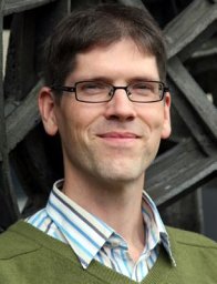 Alexander Wolff合作论文数Faculteit Wiskunde en Informatica, TU Eindhoven12
 Benedikt Budig合作论文数8
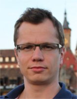 Joachim Spoerhase合作论文数Computer Science I, University of Würzburg4
 Andre Löffler合作论文数Univ Wurzburg, Lehrstuhl Informat 1, Wurzburg, Germany3Martin Fink合作论文数3
 Michael A. Bekos合作论文数Department of Mathematics, University of Ioannina3
 Jan-Henrik Haunert合作论文数Universität Würzburg3
 Hans L. Bodlaender合作论文数Department of Information and Computing Sciences, Utrecht University3
 Philipp Kindermann合作论文数Universität Trier3Peter Markfelder合作论文数2Krzysztof Fleszar合作论文数2Johannes Schamel合作论文数2Felix Klesen合作论文数Universität Würzburg2
 Bettina Speckmann合作论文数Applied Geometric Algorithms Group, Department of Mathematics and Computer Science, Eindhoven University of Technology2Fabian Lipp合作论文数Julius-Maximilians-Universität Würzburg2
 Wouter Meulemans合作论文数Department of Mathematics and Computer Science, Eindhoven University of Technology2
 Arthur Van Goethem合作论文数ASML2
 Sergey Pupyrev合作论文数Ural State University2
 Christoph Schommer合作论文数Department of Computer Science, Faculty of Science, Technology and Medicine, Université du Luxembourg2
 Johan Van Rooij合作论文数Department of Information and Computing Sciences, Utrecht University2
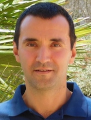 Stephen G. Kobourov合作论文数Department of Computer Science, University of Arizona;Department of Computer Science, School of Computation, Information and Technology, Technical University Munich2
 Richard B. Tan合作论文数2
 Alex Ravsky合作论文数2
 Jesper Nederlof合作论文数Utrecht University2Sabine Storandt合作论文数Department of Computer and Information Science, University of Konstanz1Felix Kirchner合作论文数1Mauricio Giraldo Arteaga合作论文数1Tobias Greiner合作论文数1Timon Behr合作论文数1Nadja Henning合作论文数1Judith Stoef合作论文数1Alexander Zaft合作论文数1Fabian Feitsch合作论文数1
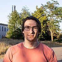 Myroslav Kryven合作论文数University of Arizona1
 Axel Forsch合作论文数Inst Geodesy & Geoinformat, Univ Bonn1Ji-won Park合作论文数KAIST1Johannes Oehrlein合作论文数Univ Bonn, Inst Geodesy & Geoinformat, Bonn, Germany1
 Jonathan Klawitter合作论文数Universität Würzburg1
 Björn Barz合作论文数University of Jena1
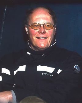 Han Hoogeveen合作论文数Department of Information and Computing Sciences,Universiteit Utrecht1
 Timothy M. Chan合作论文数Siebel School of Computing and Data Science, The Grainger College of Engineering, University of Illinois at Urbana-Champaign1
 J.M. Van den Akker合作论文数Department for Information and Computing Sciences, Utrecht University1
 Markus Chimani合作论文数Department of Computer Science, University of Dortmund1
 Joachim Denzler合作论文数Institute for Computer Science, Friedrich Schiller University Jena1Wouter Slob合作论文数1
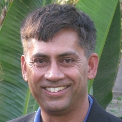 Subhash Suri合作论文数Department of Computer Science, Robert Mehrabian College of Engineering, University of California, Santa Barbara1
 J. van Leeuwen合作论文数Algorithms and Complexity Group, Division of Algorithms, Department of Information and Computing Sciences, Faculty of Science, Utrecht University1
 Steven Chaplick合作论文数Department of Physics and Computer Science, Wilfrid Laurier University1




