Insular species are disproportionately vulnerable to extinction due to small population sizes, geographic isolation, and high susceptibility to stochastic and anthropogenic pressures. The endemic Réunion Harrier ( Circus maillardi ), the last breeding raptor on La Réunion (Indian Ocean), is currently listed as “endangered” (EN) on the IUCN Red List. Concerns have recently emerged regarding the demographic impacts of secondary poisoning from anticoagulant rodenticides used for rat control in agricultural landscapes, in addition to other threats such as habitat loss and fragmentation, and reduced genetic diversity. Here, we analysed data from three standardized island-wide breeding censuses (1998–2000, 2009–2010, 2017–2019), encompassing 355 sampling points and totalising > 1,500 h of observations, to quantify overall population trends and spatial variation within those. Using generalized additive mixed models accounting for spatial variation in the different census designs, we estimated a significant decrease of -46% (95% CI: -61% to -28%) in the relative abundance of breeding pairs at the island scale over 21 years (equivalent to three generations), which supports its current endangered (EN) status. Decline was more pronounced in the eastern part of the island (-56%, 95% CI: -69% to -40%) compared to the western part (-29%, 95% CI: -52% to +0.3%). Combined with previous work on inbreeding and mutational load, exposure to anticoagulant rodenticides and ongoing threats (habitat changes), these results suggest this harrier population is undergoing an extinction vortex that requires immediate and targeted, spatially explicit, conservation actions. We also recommend that population size continues to be monitored and that knowledge of demographic parameters be improved to guide adaptive management for the species. ### Competing Interest Statement The authors have declared no competing interest. European Union, https://ror.org/019w4f821, RE0005162 European Fund
Temperate heathlands and blanket bogs are globally rare and face growing wildfire threats. Ecosystem impacts differ between low and high severity fires, where severity reflects immediate fuel consumption. This study assessed factors influencing fire severity in Scottish heathlands and blanket bogs, including the efficacy of the Canadian Fire Weather Index System (CFWIS). Using remote sensing, we measured the differenced Normalised Burn Ratio at 92 wildfire sites from 2015 to 2021. We used Generalised Additive Mixed Models to investigate the impact of topography, habitat wetness, CFWIS components and 30-day weather on severity. Dry heath exhibited higher severity than wet heath and blanket bog, and slope, elevation and south facing aspect were positively correlated to severity. Weather effects were less clear due to data scale differences, yet still indicated weather's significant role in severity. Rainfall had an increasingly negative effect from approximately 15 days before the fire, whilst temperature had an increasingly positive effect. Vapour Pressure Deficit (VPD) was the weather variable with highest explanatory value, and predicted severity better than any CFWIS component. The best-explained fire severity model (R2 = 0.25) incorporated topography, habitat wetness wind and VPD on the day of the fire. The Drought Code (DC), predicting organic matter flammability at ≥10 cm soil depth, was the CFWIS component with the highest predictive effect across habitats. Our findings suggest that wildfires in wet heath and blanket bogs are typically characterised by low severity, but that warmer, drier weather may increase the risk of severe, smouldering fires which threaten peatland carbon stores.
Temperate upland habitats like heathlands and blanket bogs are globally rare and face growing wildfire threats. Ecosystem impacts differ between low and high severity fires, where severity reflects immediate fuel consumption. This study assesses factors influencing fire severity in Scottish uplands, including the efficacy of the Canadian Fire Weather Index System (CFWIS). Using remote sensing, we measured the differenced Normalised Burn Ratio at 92 wildfire sites from 2015 to 2021. We used Generalised Additive Mixed Models to investigate the impact of topography, habitat wetness, CFWIS components and 30-day weather on severity. Dry heath exhibited higher severity than wet heath and blanket bog, and slope, elevation and South facing aspect were positively correlated to severity. Weather effects were less clear due to data scale differences, yet still indicated weather's significant role in severity. Rainfall had an increasingly negative effect from approximately 15 days before the fire, while temperature had an increasingly positive effect. The best-explained fire severity model (R2 = 0.25) incorporated topography, habitat wetness, wind on the day of fire, and Vapour Pressure Deficit on the day of the fire. The Drought Code (DC), predicting organic matter flammability at ≥ 10 cm soil depth, was the CFWIS component with the highest predictive effect across habitats. Our findings indicate that wet upland habitats such as blanket bogs are resistant to high fire severity, but that warmer, drier weather may increase the risk of severe, smouldering fires which threaten peatland carbon stores.
Primary production dynamics are strongly associated with vertical density profiles in shelf waters. Variations in the vertical structure of the pycnocline in stratified shelf waters are likely to affect nutrient fluxes and hence the vertical distribution and production rate of phytoplankton. To understand the effects of physical changes on primary production, identifying the linkage between water column density and Chlorophyll a (Chl a ) profiles is essential. Here, the vertical distributions of density features describing three different portions of the pycnocline (the top, centre, and bottom) were compared to the vertical distribution of Chl a to provide auxiliary variables to estimate Chl a in shelf waters. The proximity of density features with deep Chl a maximum (DCM) was tested using the Spearman correlation, linear regression, and a major axis regression over 15 years in a shelf sea region (the northern North Sea) that exhibits stratified water columns. Out of 1237 observations, 78 % reported DCM above the bottom mixed layer depth (BMLD: depth between the bottom of the pycnocline and the mixed layer underneath) with an average distance of 2.74 +/- 5.21 m from each other. BMLD acts as a vertical boundary above which subsurface Chl a maxima are mostly found in shelf seas (depth <= 115 m). Overall, DCMs were correlated with the halfway pycnocline depth (HPD) ( rho S = 0.56) which, combined with BMLD, were better predictors of the locations of DCMs than surface mixed layer indicators and the maximum squared buoyancy frequency. These results suggest a significant contribution of deep mixing processes in defining the vertical distribution of subsurface production in stratified waters and indicate BMLD as a potential indicator of the Chl a spatiotemporal variability in shelf seas. An analytical approach integrating the threshold and the maximum angle method is proposed to extrapolate BMLD, the surface mixed layer, and DCM from in situ vertical samples.
Imaging sonars are increasingly being utilised in fish surveys in conjunction with or as substitutes for optical instruments. To justify the use of imaging sonars, we must first describe their application, limitations, and ef-ficacy compared to optics. This study compared quantitative data of fish assemblages obtained using imaging sonars operating at four frequencies (0.75, 1.2, 2.1, and 3 MHz) with simultaneous optical camera footage at two artificial reefs. Fish densities were on average three times higher for sonar than optics. Greater detection by the sonar was attributed to site-attached fishes that were camouflaged against the artificial reefs or the adjacent seabed, which could be discriminated by imaging sonar, but not using optics. This suggests that differences in habitat and fish assemblage composition could influence the relative performance and density estimates of imaging sonar versus optics. Several limitations of imaging sonar were identified that need to be accounted for in future survey designs, including: discriminating fishes from benthic growth; an inability to detect fishes within complex habitat structures; and seabed and side-lobe interferences that truncate survey volume. Overall, this study demonstrates the value of imaging sonar for quantifying fish communities and describes limitations and recommendations for their deployment in future surveys.
Greenhouse gas (GHG) modelling tools or the Intergovernmental Panel on Climate Change (IPCC) inventory methods are often used to identify suitable mitigation strategies for GHG emissions from rice, since measuring them in field is challenging and costly. Here we report an up-to-date quantitative review on methane (CH4) emission from rice paddies using information obtained from peer-review articles. Statistical analysis was conducted on the factors controlling CH4 emissions and a generalised additive model (GAM) was developed to estimate emission factors (EFs). Results showed that emissions were strongly linked to water regime, soil texture and organic amendment practices. Fields that were rainfed during the dry season or saturated emitted 70% and 56% that of continuously flooded fields, while applying straw off-season instead of within-season could decrease emissions by 48%. An independent dataset was used to evaluate the new model performance against existing models with the new model showing R2 values of 0.47 (n: 169), compared to 0.01–0.09 (n: 169) for the existing models. New baseline EFs was estimated at global, regional, and Country scale with result showing that using different pre-season water management when calculating baseline EFs at country level is vital in order to reflect the variation between tropical and temperate rice regions accurately. Our findings shows that the new model is more sensitive in capturing differences in management practices between tropical and temperate rice, and their impacts on CH4 emissions with baseline EF calculations accounting for these differences providing sound mitigation strategies.
Fat content indicates individual condition and fuels annual reproductive cycles in many fish species. These cycles, coupled with ecosystem changes, can result in large intra- and inter-annual fluctuations in fat content. However, quantifying this variability is challenging when scientific sampling does not cover the full reproductive cycle. Scottish and Dutch fish processors routinely measure muscle fat content of North Sea autumn-spawning herring (Clupea harengus) throughout fishing seasons. We validated these high temporal resolution data by estimating a strong intra-annual signal in fat content, which matched herring reproductive status. Fat content increased from 4.5% 95% CI [0.03, 0.06] to 16.1% 95% CI [0.15, 0.17] during May and June before plateauing and decreasing to 9.1% 95% CI [0.08, 0.10] in September, which coincided with the onset of spawning. We also examined inter-annual variability in the seasonal pattern and the timing and magnitude of peak fat content from 2006 to 2020. Inter-annually, fat content differed from the mean pattern during the feeding or spawning periods in years 2013, 2015-2017, 2019, and 2020. There was no difference in the timing and magnitude of peak fat content between years. Our study validates the scientific use of routinely collected fat content data from pelagic fish processors.
Abstract. Primary production dynamics are strongly associated with vertical density profiles, which dictate the depth of stratification and mixed layers. Climate change and artificial structures (e.g. windfarms) are likely to modify the strength of stratification and vertical distribution of nutrient fluxes, especially in shelf seas where fine scale processes are important drivers, affecting the vertical distribution of phytoplankton. To understand the effect of physical changes on primary production, identifying the linkage between density and phytoplankton profiles is essential. Here, the ecological relevance of eight density layers (DLs) obtained by multiple methods that define three different portions of the pycnocline (above, centre, below) was evaluated to identify a valuable proxy for subsurface Chlorophyll-a (Chl-a mg m-3) concentrations. The associations of subsurface Chl-a with surface and deep mixing were investigated by hypothesizing the occurrence at the same depth of any DL and the maximum Chl-a layer (DMC) using Spearman correlation, linear regression, and a Major Axis analysis. Out of 1237 observations of the water column exhibiting a pycnocline, 78 % reported DMCs above the bottom mixed layer depth (BMLD). This suggests that the BMLD is a boundary trapping Chl-a in shallow waters (≤ 120 m). BMLD constantly described Chl-a vertical distribution despite surface mixing indicators, suggesting a significant contribution of deep mixing processes in supporting subsurface production under specific conditions (e.g. prolonged stratification, tidal cycle, and bathymetry). Using BMLD for defining subsurface Chl-a could be a valuable tool for understanding the spatiotemporal variability of Chl-a in shelf seas, representing a potential variable for ecological assessments.
Driven by the necessity to decarbonize energy sources, many countries are targeting tidal stream environments for power generation. However, these areas can act as foraging hotspots for marine top predators, such as seabirds. Thus, it is important to understand the ecological interactions influencing predator behavior and distribution in these areas, to determine the potential ecological implications of marine renewable devices. This study used concurrent observations of foraging seabirds, physical hydrodynamics, and prey presence across a tidal stream environment, before and after the installation of a commercial turbine array close to the island of Stroma, Scotland. There were three main findings: First, benthic foraging seabirds showed a clear preference for certain sections around Stroma where sandeels were detected, while pelagic foraging seabirds were seen all around Stroma. Second, there was a positive effect of water velocity on the number of pelagic foragers and common guillemots. Third, there was a positive effect of the presence of fish schools on the number of pelagic seabirds and common guillemots, in both the same and the previous transects. Thus, it is possible that seabirds target areas of predictable food sources during periods where prey might be easily accessed (e.g., periods of fast flows). Given the difference in the distribution between seabird categories, it is likely that marine renewable devices will impact each category differently. We conclude that any impact on sandbank locations, sandeels preferred habitat, due to the presence of tidal turbines is likely to alter the distribution of benthic foraging seabirds. For pelagic foraging seabirds and common guillemot, changes in prey presence and accessibility (depth and level of aggregation/disaggregation) will have a stronger effect on seabird presence. This study highlights the need to include concurrent physical and biological data when assessing the ecological impacts of tidal turbines.
Les programmes en sciences participatives dans le domaine de l’écologie se sont amplement développés depuis les années 2000 en France. La diversité de compétences des participants à de tels programmes peut toutefois constituer un frein dans la conception de protocoles complexes. Le programme FEDER pour la conservation du Busard de Maillard Circus maillardi J. Verreaux, 1862 sur l’île de la Réunion avait pour ambition de répondre à plusieurs questions scientifiques, dont certaines nécessitaient l’utilisation de méthodologies avancées, notamment pour corriger les problèmes de biais de détection. Nous avons alors conçu un protocole en plusieurs étapes à destination de bénévoles, de professionnels et d’étudiants aux compétences en ornithologie variées. Parmi 150 personnes initialement inscrites à ce programme, 103 ont effectivement collecté des données en mai et juin 2017 sur 330 « postes d’observation » déployés sur toute l’île. Elles avaient été préalablement formées en salle puis sur le terrain afin d’homogénéiser leurs compétences en ornithologie et de s’assurer auprès d’elles de la bonne compréhension des objectifs et du protocole de collecte de données. À l’issue de l’opération de collecte des données sur le terrain, un questionnaire a été soumis aux observateurs afin de recueillir leurs impressions sur les aspects positifs de la démarche et les difficultés rencontrées. 71 participants y ont répondu. Nous détaillons ici les différentes étapes qui ont permis de concevoir puis de déployer ce protocole et nous analysons ses forces et faiblesses, en termes de constitution et de fidélisation d’un réseau de participants. Cette analyse est à l’usage des concepteurs d’autres programmes de sciences participatives. Nous insistons en particulier sur le rôle de l’animation pour garantir le succès d’un tel programme.
Model-based prediction of fish distribution at fine resolutions in space and time has the potential to inform area-based and dynamic forms of management, such as permanent marine protected areas or real-time temporary closures. A major limitation to the spatial and temporal mapping resolution that is achievable is the amount of high quality, standardised data that can be utilized for fitting statistical models. To achieve an adequate spatio-temporal resolution from sparse data, one option is pooling information from several sources, such as scientific surveys and fisheries data. Because surveys and fisheries data usually use different sampling methods, pooling information from different sources requires cross-calibration of catch rates values across multiple gears. However, the individual gear efficiency and selectivity curves (the ratio between catch and availability at a given length) for all fishing gears and species are typically unknown. Using cod (Gadus morhua) in the northern North Sea as a case study, we developed a new formulation of spatio-temporal generalised additive models (GAM) of relative abundance of fish, combining catch data from multiple sources. Differences in gear efficiency and selectivity were internally calibrated within the model by the estimation of the local spatio-temporal variation in abundance. We show that pooling data sources enables the prediction of multi-annual and seasonal spatial variation in cod relative abundance-at-size, at spatio-temporal resolutions that are relevant for informing fishing strategies, e.g., reducing bycatch in real-time, or management objectives, e.g., real-time closed areas. We also show that GAM models fit to catch and effort data can reveal the relative efficiency and selectivity of different survey and commercial gears. The selectivity curve estimates that emerged as a by-product of our analysis are consistent with expert knowledge of the performance of the gears employed for cod. Our analytical approach can therefore serve two useful purposes: to estimate spatio-temporal variation in relative abundance of fish and to estimate relative gear efficiency and selectivity.
Scotland is continuing to afforest land in order to combat climate change, but the long-term capacity for carbon sequestration in forest soils is still uncertain. Here we present measurements that provide comparative estimates of soil organic carbon in grassland and forestry sites at steady state. We develop a new approach to interpret these values based on simulation of organic carbon turnover in soils that are accumulating carbon and use this to determine losses due to management operations associated with afforestation of grassland and deforestation/reforestation of forest stands. Soil organic carbon stock changes were studied in a >120 year-old Scots pine chronosequence and adjacent grassland sites on podzolic soils. Significant carbon accumulation was measured in the top organic soil horizons with forest age, while no changes were noted in the deeper mineral soil horizons. The simulations with the RothC-26.3 model revealed that pine forests on sandy soils could lose a significant amount of soil organic carbon through management operations. The lowest modeled stocks of soil organic carbon were not in the young sites (0–25 years old), but at 43 years since reforestation. Using measured data from our study site, the simulations of grassland afforestation suggested that accumulation of organic carbon under forest occurs mainly in the organic horizons, while the deeper sandy mineral soil horizons are likely to become depleted in organic carbon compared to grasslands. Our simulations suggest that afforestation of grasslands would increase overall soil carbon stocks but may deplete the more stable carbon pools in the deeper mineral horizons of the podzols.
On large inhabited islands where complete eradication of alien invasive rodents through the use of poison delivery is often not practical or acceptable, mechanical trapping may represent the only viable option to reduce their impact in areas of high biodiversity value. However, the feasibility of sustained rodent control by trapping remains uncertain under realistic operational constraints. This study aimed to assess the effectiveness of non-toxic rat control strategies through a combination of lethal and live-trapping experiments, and scenario modelling, using the example of a remote montane rainforest of New Caledonia. Rat densities, estimated with spatially-explicit capture-recapture models, fluctuated seasonally (9.5–33.6 ind.ha-1). Capture probability (.01–.25) and home range sizes (HR95, .23–.75 ha) varied greatly according to trapping session, age class, sex and species. Controlling rats through the use of lethal trapping allowed maintaining rat densities at ca. 8 ind.ha-1 over a seven-month period in a 5.5-ha montane forest. Simulation models based on field parameter estimates over a 200-ha pilot management area indicated that without any financial and social constraints, trapping grids with the finest mesh sizes achieved cumulative capture probabilities > .90 after 15 trapping days, but were difficult to implement and sustain with the local workforce. We evaluated the costs and effectiveness of alternative trapping strategies taking into account the prevailing set of local constraints, and identified those that were likely to be successful. Scenario modelling, informed by trapping experiments, is a flexible tool for informing the design of sustainable control programs of island-invasive rodent populations, under idiosyncratic local circumstances.
Invasive Alien Species (IAS) threaten biodiversity, ecosystem functions and services, modify landscapes and impose costs to national economies. Management efforts are underway globally to reduce these impacts, but little attention has been paid to optimising the use of the scarce available resources when IAS are impossible to eradicate, and therefore population reduction and containment of their advance are the only feasible solutions.CONTAIN, a three-year multinational project involving partners from Argentina, Brazil, Chile and the UK, started in 2019. It develops and tests, via case study examples, a decision-making toolbox for managing different problematic IAS over large spatial extents. Given that vast areas are invaded, spatial prioritisation of management is necessary, often based on sparse data. In turn, these characteristics imply the need to make the best decisions possible under likely heavy uncertainty.Our decision-support toolbox will integrate the following components:(i) the relevant environmental, social, cultural, and economic impacts, including their spatial distribution;(ii) the spatio-temporal dynamics of the target IAS (focusing on dispersal and population recovery);(iii) the relationship between the abundance of the IAS and its impacts;(iv) economic methods to estimate both benefits and costs to inform the spatial prioritisation of cost-effective interventions.To ensure that our approach is relevant for different contexts in Latin America, we are working with model species having contrasting modes of dispersal, which have large environmental and/or economic impacts, and for which data already exist (invasive pines, privet, wasps, and American mink). We will also model plausible scenarios for data-poor pine and grass species, which impact local people in Argentina, Brazil and Chile.We seek the most effective strategic management actions supported by empirical data on the species’ population dynamics and dispersal that underpin reinvasion, and on intervention costs in a spatial context. Our toolbox serves to identify key uncertainties driving the systems, and especially to highlight gaps where new data would most effectively reduce uncertainty on the best course of action. The problems we are tackling are complex, and we are embedding them in a process of co-operative adaptive management, so that both researchers and managers continually improve their effectiveness by confronting different models to data. Our project is also building research capacity in Latin America by sharing knowledge/information between countries and disciplines (i.e., biological, social and economic), by training early-career researchers through research visits, through our continuous collaboration with other researchers and by training and engaging stakeholders via workshops. Finally, all these activities will establish an international network of researchers, managers and decision-makers. We expect that our lessons learned will be of use in other regions of the world where complex and inherently context-specific realities shape how societies deal with IAS.
Southeast Asian peatlands have undergone recent land use change with an increase in industrial agricultural plantations, including oil palm. Cultivating peatlands requires creating drainage ditches and other surface microforms (i.e., harvest paths, frond piles, cover plants, and next to the palm). However, it is currently unclear how these management actions affect rates of carbon losses from the peat. Here we report carbon fluxes from each of the different surface microforms measured monthly (soil CO2 [total soil respiration-R-tot] and stem CH4) and bimonthly (soil CH4, drain CO2 and drain CH4). We calculated annual carbon fluxes and partitioned heterotrophic (R-h) and root-rhizosphere respiration by sampling rhizosphere and root-free soil. Linear mixed effect models were used to determine which environmental factors best-predicted carbon fluxes, and to develop recommendations for management solutions that could reduce carbon losses. Carbon fluxes varied significantly between the different microforms; the greatest CO2 fluxes were measured next to the palm and the greatest CH4 fluxes were measured from the drainage ditches. Annual estimates of R-tot, R-h and drain CO2 were 22.08 +/- 0.50, 17.75 +/- 1.54, and 1.5 +/- 0.10Mg CO2-C ha(-1) yr(-1), respectively. R-h varied between the two plantations: Sebungan averaged 11.43 +/- 1.37Mg CO2-C ha(-1) yr(-1) and Sabaju averaged 24.08 +/- 1.42Mg CO2-C ha(-1) yr(-1). Net ecosystem CH4 fluxes averaged 61.02 +/- 17.78 kg CH4-C ha(-1) yr(-1)-similar to unmanaged swamp forests. The two plantations did not vary in overall CH4 flux, but did vary in transport pathway. CH4 fluxes from the soil, drains and stems followed a ratio of 50:50:0 from Sabaju (water table depth [WTD]: -0.49 +/- 0.004m) and 11:98:0 from Sebungan (WTD: -0.77 +/- 0.007m). Rh dominated the peat carbon losses. WTD controlled variation in R-h from Sebungan where the WTD was deeper. Air and soil temperature controlled variation in Sabaju, with greater fluxes from the harvest path, attributed to the absence of shade. These results suggest that shading the soil (e.g., through addition of frond piles) and raising the water table may be the most effective ways to reduce peat carbon loss from drained peat soils.
The potential ranges of many species are shifting due to changing ecological conditions. Where populations become patchy towards the range edge, the realised distribution emerges from colonisation–persistence dynamics. Therefore, a greater understanding of the drivers of these processes, and the spatial scales over which they operate, presents an opportunity to improve predictions of species range expansion under environmental change.Species reintroductions offer an ideal opportunity to investigate the drivers and spatial scale of colonisation dynamics at the range edge. To this effect, we performed and monitored experimental translocations of water voles to quantify how colonisation and local persistence were influenced by habitat quality and occupancy. We used a novel statistical method to simultaneously consider effects across a range of spatial scales.Densely occupied neighbourhoods were highly persistent and frequently colonised. Persistence was more likely in high quality habitat, whereas the influence of habitat quality on colonisation was less clear. Colonisation of suitable habitat in distant, sparsely occupied areas was much less frequent than expected from the well documented high dispersal ability of the species. Persistence of these distant populations was also low, which we attribute to the absence of a rescue effect in sparsely populated neighbourhoods.Our results illustrate a mismatch between the spatial scales of colonisation dynamics in the core and edge of a species’ range, suggesting that recolonisation dynamics in established populations may be a poor predictor of colonisation dynamics at the range edge.Such a mismatch leads to predictions of long lags between the emergence and colonisation of new habitat, with detrimental consequences for a species’ realised distribution, conservation status and contribution to ecosystem function. Conservation translocations that also reinforce existing populations at the range edge might stimulate the rescue effect and mitigate lags in expansion.
Abstract Pelagic seabirds breeding at high latitudes generally split their annual cycle between reproduction, migration, and wintering. During the breeding season, they are constrained in their foraging range due to reproduction while during winter months, and they often undertake long‐distance migrations. Black‐browed albatrosses (Thalassarche melanophris) nesting in the Falkland archipelago remain within 700 km from their breeding colonies all year‐round and can therefore be considered as resident. Accordingly, at‐sea activity patterns are expected to be adjusted to the absence of migration. Likewise, breeding performance is expected to affect foraging, flying, and floating activities, as failed individuals are relieved from reproduction earlier than successful ones. Using geolocators coupled with a saltwater immersion sensor, we detailed the spatial distribution and temporal dynamics of at‐sea activity budgets of successful and failed breeding black‐browed albatrosses nesting in New Island, Falklands archipelago, over the breeding and subsequent nonbreeding season. The 90% monthly kernel distribution of failed and successful breeders suggested no spatial segregation. Both groups followed the same dynamics of foraging effort both during daylight and darkness all year, except during chick‐rearing, when successful breeders foraged more intensively. Failed and successful breeders started decreasing flying activities during daylight at the same time, 2–3 weeks after hatching period, but failed breeders reached their maximum floating activity during late chick‐rearing, 2 months before successful breeders. Moon cycle had a significant effect on activity budgets during darkness, with individuals generally more active during full moon. Our results highlight that successful breeders buffer potential reproductive costs during the nonbreeding season, and this provides a better understanding of how individuals adjust their spatial distribution and activity budgets according to their breeding performance in absence of migration.
BACKGROUND Geographic variations in case volume have important implications for trauma system configuration and have been recognized for some time. However, temporal trends in these distributions have received relatively little attention. The aim of this study was to propose a model to facilitate the spatiotemporal surveillance of injuries, using Scotland as a case study. METHODS Retrospective analysis of 5 years (2009–2013) of trauma incident location data. We analyzed the study population as a whole, as well as predefined subgroups, such as those with abnormal physiologic signs. To leverage sufficient statistical power to detect temporal trends in rare events over short time periods and small spatial units, we used a geographically weighted regression model. RESULTS There were 509,725 incidents. There were increases in case volume in Glasgow, the central southern part of the country, the northern parts of the Highlands, the Northeast, and the Orkney and Shetland Islands. Statistically significant changes were mostly restricted to major cities. Decreases in the number of incidents were seen in the Hebrides, Western Scotland, Fife and Lothian, and the Borders. Statistically significant changes were seen mostly in Fife and Lothian, the West, some areas of the Borders, and in the Peterhead area. Subgroup analyses showed markedly different spatiotemporal patterns. CONCLUSIONS This project has demonstrated the feasibility of population-based spatiotemporal injury surveillance. Even over a relatively short period, the geographic distribution of where injuries occur may change, and different injuries present different spatiotemporal patterns. These findings have implications for health policy and service delivery. LEVEL OF EVIDENCE Epidemiologic study, level V.
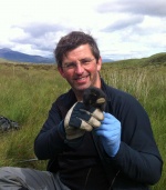 Xavier Lambin合作论文数The School of Biological Sciences, University of Aberdeen12
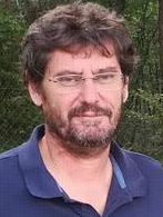 Vincent Bretagnolle合作论文数Centre d'Etudes Biologiques de Chizé, French National Centre for Scientific Research;University La Rochelle10
 Beth E. Scott合作论文数School of Biological Sciences (Zoology),, University of Aberdeen7
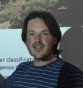 Justin Travis合作论文数Institute of Biological and Environmental Sciences, University of Aberdeen;School of Biological Sciences, University of Aberdeen5
 Beatriz Arroyo合作论文数Instituto de Investigación en Recursos Cinegéticos (IREC, CSIC-UCLM-JCCM)4Ian M. Davies合作论文数3
 Arianna Zampollo合作论文数Gaia Res Inst Onlus3
 Rory B O'Hara Murray合作论文数Scottish Govt, Marine Scotland Sci3
 Villers Alexandre合作论文数Department of Biology, University of Turku;Centre d'Etudes Biologiques de Chizé UMR 7372, CNRS;Université de La Rochelle;University of Turku, CNRS & Université de La Rochelle3
 Tara Marshall合作论文数3
 Ursula Witte合作论文数SFB 313 Olshausenstrasse 40 D-24118 Kiel Germany3David A. Elston合作论文数3
 Jacqueline F. Tweddle合作论文数3Evangelia Gontikaki合作论文数2Aurélien Besnard合作论文数2Edouard Bourguet合作论文数2
 Noemi Naszarkowski合作论文数2Quiterie Duron合作论文数2Lloyd D. Potts合作论文数Sch Engn, Univ Aberdeen2Luis J. Perez Calderon合作论文数2
 Matthew Oliver合作论文数School of Economics, Ivan Allen College of Liberal Arts, Georgia Institute of Technology2
 Rob Robinson合作论文数British Trust for Ornithology2
 Tim Benton合作论文数School of Biology, Faculty of Biological Sciences, University of Leeds2Douglas Alex合作论文数Inst Biol & Environm Sci, Univ Aberdeen2
 Peter Smith合作论文数Institute of Biological and Environmental Sciences, School of Biological Sciences, University of Aberdeen2
 Alejandro Gallego合作论文数2
 Mark Bolton合作论文数Centre for Conservation Science, Royal Society for the Protection of Birds2
 Marianna Chimienti合作论文数School of Biological Sciences, University of Aberdeen2
 James Bullock合作论文数UK Centre for Ecology & Hydrology2
 David Johnson合作论文数Department of Earth and Environmental Sciences, School of Natural Sciences, Faculty of Science and Engineering, The University of Manchester2Lise Ruffino合作论文数Department of Biology, University of Turku2
 Eric Vidal合作论文数Inst Mediterraneen Biodiversite & Ecol Marine & C, Aix Marseille Univ2
 Paul Fernandes合作论文数Institute of Marine Research;Fisheries Research Services;Marine Laboratory Aberdeen;Marine Laboratory Aberdeen, Institute of Marine Research2
 Louise Ross合作论文数Neurosciences Institute, University of Dundee2
 Robin Pakeman合作论文数School of Biological Science, University of Liverpool;The James Hutton Institute2
 Alexandre Millon合作论文数Institut Méditerranéen de Biodiversité et d’Ecologie Marine et Continentale (IMBE)2Stephen C. F. Palmer合作论文数2
 Renaud De Stephanis合作论文数CIRCE, Conservation Information and Research on Cetaceans, C/Cabeza de Manzaneda 3, Algeciras-Pelayo, 11390 Cadiz, Spain2
 William H. Morgan合作论文数Centre for Ophthalmology and Visual Science, The University of Western Australia2
 Noelle Beckman合作论文数Department of Biology;Lee University;Department of Biology, Lee University2Alison J. Hester合作论文数2
 David Burslem合作论文数Interdisciplinary Centre for Environment and Biodiversity, University of Aberdeen;School of Biological sciences, University of Aberdeen2
 Fabrizio Albanito合作论文数2
 Rodrigo Wiff合作论文数Departamento de Oceanografía2
 Ellie Owen合作论文数2Sarah J Woodin合作论文数University of Aberdeen School of Biological Sciences2Bogumila Jedrzejewska合作论文数Mammal Research Institute;Polish Academy of Sciences;Mammal Research Institute, Polish Academy of Sciences2S. J. Petty合作论文数Woodland Ecology2Pablo Inchausti合作论文数2




