First JEDI Space Weather Data Assimilation Workshop What: The workshop gathered 52 participants from 17 affiliations, including government agencies, research centers, and universities, to review current modeling and data assimilation (DA) capabilities in the United States and to discuss requirements for a unified space weather DA system. When: 28-29 August 2024 Where: Boulder, Colorado
AbstractThe “Space Weather Observations throughout Latinoamerica: Filling the Southern gaps” Workshop took place in Ushuaia, Argentina, from 2 to 4 October 2023. This event was exclusively dedicated to Space Weather (SWx), gathering leading international academic and governmental agencies focused on the subject. The meeting addressed the field of SWx from three perspectives: driving phenomena occurring in the solar atmosphere, evolution in the interplanetary environment, and interaction with the Earth. In addition, emphasis was placed on identifying key research directions in solar and space physics that warrant development in Argentina and across the region in the forthcoming years. The workshop also focused on the current observational infrastructure that supports SWx studies, and how to improve and develop it through strategic international partnerships, stressing on the need for real‐time data. The conference fostered discussion among different partners involved in SWx studies, that is, researchers and potential space weather service providers, and the need to include in this debate potential users of space weather services.
Accurate estimation of thermospheric density is critical for precise modeling of satellite drag forces in low Earth orbit (LEO). Improving this estimation is crucial to tasks such as state estimation, collision avoidance, and re-entry calculations. The largest source of uncertainty in determining thermospheric density is modeling the effects of space weather driven by solar and geomagnetic activity. Current operational models rely on ground-based proxy indices which imperfectly correlate with the complexity of solar outputs and geomagnetic responses. In this work, we directly incorporate NASA's Solar Dynamics Observatory (SDO) extreme ultraviolet (EUV) spectral images into a neural thermospheric density model to determine whether the predictive performance of the model is increased by using space-based EUV imagery data instead of, or in addition to, the ground-based proxy indices. We demonstrate that EUV imagery can enable predictions with much higher temporal resolution and replace ground-based proxies while significantly increasing performance relative to current operational models. Our method paves the way for assimilating EUV image data into operational thermospheric density forecasting models for use in LEO satellite navigation processes.
In preparation for the approaching Heliophysics Decadal Survey, a group of space weather experts and enthusiasts took on an effort to coordinate community-wide action on space weather white paper preparations.
Context. Machine-learning methods for predicting solar flares typically employ physics-based features that have been carefully chosen by experts in order to capture the salient features of the photospheric magnetic fields of the Sun. Aims. Though the sophistication and complexity of these models have grown over time, there has been little evolution in the choice of feature sets, or any systematic study of whether the additional model complexity leads to higher predictive skill. Methods. This study compares the relative prediction performance of four different machine-learning based flare prediction models with increasing degrees of complexity. It evaluates three different feature sets as input to each model: a “traditional” physics-based feature set, a novel “shape-based” feature set derived from topological data analysis (TDA) of the solar magnetic field, and a combination of these two sets. A systematic hyperparameter tuning framework is employed in order to assure fair comparisons of the models across different feature sets. Finally, principal component analysis is used to study the effects of dimensionality reduction on these feature sets. Results. It is shown that simpler models with fewer free parameters perform better than the more complicated models on the canonical 24-h flare forecasting problem. In other words, more complex machine-learning architectures do not necessarily guarantee better prediction performance. In addition, it is found that shape-based feature sets contain just as much useful information as physics-based feature sets for the purpose of flare prediction, and that the dimension of these feature sets – particularly the shape-based one – can be greatly reduced without impacting predictive accuracy.
The conceptual design, scientific rationale and relevance, and technology and programmatic needs of a neutral atmosphere density monitoring system are explored.This system could monitor atmospheric density in low Earth orbit (LEO) which varies in response to changes in solar activity and Earth's geomagnetic conditions.The overarching science goal of this monitoring system is to improve physics-based, data assimilative, upper atmospheric models and to ultimately reduce uncertainties in neutral density forecasts for orbital operations.
Solar and stellar ultraviolet occultations provide a capability essential for advancing our understanding of the thermosphere and its coupling with the ionosphere and lower atmosphere.Advances over the past decade have demonstrated the power of occultations for measuring gravity waves and tides over large altitude ranges and across atmospheric domains.Additionally, occultation instruments measure neutral density in the thermosphere directly using technology that is readily miniaturized, making them ideal candidates for space weather monitoring sensors.Future missions for studying the thermosphere should include instruments specifically designed for occultations to maximize the quality of science measurements.Future technology development efforts should focus on EUV stellar occultations and active remote sensing at FUV and EUV wavelengths.
Earth and Space Science Open Archive posterOpen AccessYou are viewing the latest version by default [v1]Solving the Space Weather Problem: A 15+ Year Roadmap to Revolutionize Space Weather Research, Protect NASA Space Assets, and Enable Robust OperationsAuthorsAngelosVourlidasiDJustinLikariDViacheslavMerkiniDRominaNikoukariDLarryPaxtoniDThomasSotirelisDrewTurnerAleksandrUkhorskiyYongliangZhangSee all authors Angelos VourlidasiDCorresponding Author• Submitting AuthorJohns Hopkins University Applied Physics LaboratoryiDhttps://orcid.org/0000-0002-8164-5948view email addressThe email was not providedcopy email addressJustin LikariDJohns Hopkins University Applied PHysics LaboratoryiDhttps://orcid.org/0000-0002-1390-8849view email addressThe email was not providedcopy email addressViacheslav MerkiniDJohns Hopkins University Applied Physics LaborstoryiDhttps://orcid.org/0000-0003-4344-5424view email addressThe email was not providedcopy email addressRomina NikoukariDJohns Hopkins University Applied Physics LaboratoryiDhttps://orcid.org/0000-0002-8608-2822view email addressThe email was not providedcopy email addressLarry PaxtoniDJohns Hopkins University Applied Physics LaboratoryiDhttps://orcid.org/0000-0002-2597-347Xview email addressThe email was not providedcopy email addressThomas SotirelisJohns Hopkins University Applied Physics Laboratoryview email addressThe email was not providedcopy email addressDrew TurnerJohns Hopkins University Applied Physics Laboratoryview email addressThe email was not providedcopy email addressAleksandr UkhorskiyJohns Hopkins University Applied Physics Laboratoryview email addressThe email was not providedcopy email addressYongliang ZhangJohns Hopkins University Applied Physics Laboratoryview email addressThe email was not providedcopy email address
This White Paper argues for the urgent need for the multi-vantage/multi-point observations of the Sun and the heliosphere in the framework of six ( 6) key science objectives.We further emphasize the critical importance of 5D-"space": three spatial, one temporal and the magnetic field components.The importance of such observations cannot be overstated both for scientific research and the operational space weather forecast.
The purpose of this white paper is to put together a coherent vision for the role of helioseismic monitoring of magnetic activity in the Sun's far hemisphere that will contribute to improving space weather forecasting as well as fundamental research in the coming decade. Our goal fits into the broader context of helioseismology in solar research for any number of endeavors when helioseismic monitors may be the sole synoptic view of the Sun's far hemisphere. It is intended to foster a growing understanding of solar activity, as realistically monitored in both hemispheres, and its relationship to all known aspects of the near-Earth and terrestrial environment. Some of the questions and goals that can be fruitfully pursued through seismic monitoring of farside solar activity in the coming decade include: What is the relationship between helioseismic signatures and their associated magnetic configurations, and how is this relationship connected to the solar EUV irradiance over the period of a solar rotation?; How can helioseismic monitoring contribute to data-driven global magnetic-field models for precise space weather forecasting?; What can helioseismic monitors tell us about prospects of a flare, CME or high-speed stream that impacts the terrestrial environment over the period of a solar rotation?; How does the inclusion of farside information contribute to forecasts of interplanetary space weather and the environments to be encountered by human crews in interplanetary space? Thus, it is crucial for the development of farside monitoring of the Sun be continued into the next decade either through ground-based or space-borne observations.
On 03 February 2022, SpaceX launched 49 Starlink satellites, 38 of which re-entered the atmosphere on or about 07 February 2022 due to unexpectedly high atmospheric drag. We use empirical model (NRLMSIS, JB08, and HASDM) outputs as well as solar extreme ultraviolet occultation and high-fidelity accelerometer data to show that thermospheric density was at least 20%-30% higher at 210 km relative to the 9 days prior to the launch due to consecutive geomagnetic storms related to solar eruptions from NOAA AR12936 on 29 January 2022. We model the orbital altitude and in-track position of a Starlink-like satellite in a low-drag configuration at 200 km during minor (G1) and extreme (G5) geomagnetic storms to show that an extreme storm would have at least a factor of two higher impact, with cumulative in-track errors on the order of 10,000 km after a 5-day duration extreme storm. Comparison of the JB08 and NRL MSIS models relative to the HASDM model during modeled historical minor and extreme geomagnetic storms shows that in-track errors on the order of 100 km per day at 250 km, decreasing to cumulative errors on the order of 1 km per day at 550 km during geomagnetic storms. We conclude that full-physics, data assimilative, coupled models of the magnetosphere and upper atmosphere, as well as new operational satellite missions providing "nowcasting" data to launch controllers, space traffic coordinators, and satellite operators, are needed to prevent similar-or worse-orbital system impacts during future geomagnetic storms.
An expanded budget is needed for the newly-formed NASA Heliophysics Space Weather Program, at a level of $100-200M per
Space weather affects all space systems, both natural and artificial.There is a rapid growth of awareness in past decades of this reality and a critical need for space weather prediction due to technology advances.Above all, space weather science and its history are outstanding vehicles for teaching science, technology, engineering, and mathematics (STEM) topics.As a white paper group, we recommend that the Decadal Survey builds space weather literacy within K-14 classrooms and the general public, covering all areas of studies in heliophysics through sustained engagement beyond celestial and spacecraft events.
et à la diffusion de documents scientifiques de niveau recherche, publiés ou non, émanant des établissements d'enseignement et de recherche français ou étrangers, des laboratoires publics ou privés.
Supervised Machine Learning (ML) models for solar flare prediction rely on accurate labels for a given input data set, commonly obtained from the GOES/XRS X-ray flare catalog. With increasing interest in utilizing ultraviolet (UV) and extreme ultraviolet (EUV) image data as input to these models, we seek to understand if flaring activity can be defined and quantified using EUV data alone. This would allow us to move away from the GOES single pixel measurement definition of flares and use the same data we use for flare prediction for label creation. In this work, we present a Solar Dynamics Observatory (SDO) Atmospheric Imaging Assembly (AIA)-based flare catalog covering flare of GOES X-ray magnitudes C, M and X from 2010 to 2017. We use active region (AR) cutouts of full disk AIA images to match the corresponding SDO/Helioseismic and Magnetic Imager (HMI) SHARPS (Space weather HMI Active Region Patches) that have been extensively used in ML flare prediction studies, thus allowing for labeling of AR number as well as flare magnitude and timing. Flare start, peak, and end times are defined using a peak-finding algorithm on AIA time series data obtained by summing the intensity across the AIA cutouts. An extremely randomized trees (ERT) regression model is used to map SDO/AIA flare magnitudes to GOES X-ray magnitude, achieving a low-variance regression. We find an accurate overlap on 85% of M/X flares between our resulting AIA catalog and the GOES flare catalog. However, we also discover a number of large flares unrecorded or mislabeled in the GOES catalog.
A hybrid two-stage machine learning architecture that addresses the problem of excessive false positives (false alarms) in solar flare prediction systems is investigated. The first stage is a convolutional neural network (CNN) model based on the VGG-16 architecture that extracts features from a temporal stack of consecutive Solar Dynamics Observatory (SDO) Helioseismic and Magnetic Imager (HMI) magnetogram images to produce a flaring probability. The probability of flaring is added to a feature vector derived from the magnetograms to train an extremely randomized trees (ERT) model in the second stage to produce a binary deterministic prediction (flare/no flare) in a 12-hour forecast window. To tune the hyperparameters of the architecture a new evaluation metric is introduced, the scaled True Skill Statistic. It specifically addresses the large discrepancy between the true positive rate and the false positive rate in the highly unbalanced solar flare event training datasets. Through hyperparameter tuning to maximize this new metric, our two-stage architecture drastically reduces false positives by $\approx$ $48\%$ without significantly affecting the true positives (reduction by $\approx$ $12\%$), when compared with predictions from the first stage CNN alone. This, in turn, improves various traditional binary classification metrics sensitive to false positives such as the precision, F1 and the Heidke Skill Score. The end result is a more robust 12-hour flare prediction system that could be combined with current operational flare forecasting methods. Additionally, using the ERT-based feature ranking mechanism, we show that the CNN output probability is highly ranked in terms of flare prediction relevance.
Recently, there has been growing interest in the use of machine-learning methods for predicting solar flares. Initial efforts along these lines employed comparatively simple models, correlating features extracted from observations of sunspot active regions with known instances of flaring. Typically, these models have used physics-inspired features that have been carefully chosen by experts in order to capture the salient features of such magnetic field structures. Over time, the sophistication and complexity of the models involved has grown. However, there has been little evolution in the choice of feature sets, nor any systematic study of whether the additional model complexity is truly useful. Our goal is to address these issues. To that end, we compare the relative prediction performance of machine-learning-based, flare-forecasting models with varying degrees of complexity. We also revisit the feature set design, using topological data analysis to extract shape-based features from magnetic field images of the active regions. Using hyperparameter training for fair comparison of different machinelearning models across different feature sets, we show that simpler models with fewer free parameters generally perform better than more-complicated models, ie., powerful machinery does not necessarily guarantee better prediction performance. Secondly, we find that abstract, shape-based features contain just as much useful information, for the purposes of flare prediction, as the set of hand-crafted features developed by the solar-physics community over the years. Finally, we study the effects of dimensionality reduction, using principal component analysis, to show that streamlined feature sets, overall, perform just as well as the corresponding full-dimensional versions.
One of the critical models in space weather forecasting is the Enlil solar wind prediction model that can inform space weather forecasters the direction and speed of coronal mass ejections CMEs. The Enlil code calculates the propagation of the solar wind throughout the 3D heliosphere, but current visualization capabilities in the forecasting offices are restricted to 2D planes intersecting Earth. This limits forecasters to only be able to view CME properties that are traveling directly in the plane of the Earth. Here, we present an update on a new visualization capability being developed to take advantage of the full Enlil 3D data volume and interactively visualize the CME expansion out of the plane of the Earth. We have been collaborating closely with researchers and forecasters at the Met Office in the UK and the Space Weather Prediction Center (SWPC) in the USA to develop a tool to enable full view of the heliosphere in a manner that can be tailored to these different types of users. To accomplish this, we are deploying the Enlil solar wind model into a scalable Cloud-based model staging platform computing environment, which will allow the full 3D Enlil output to reside in-situ with the visualization engine. We will discuss our progress in deploying and running the Enlil model in the Cloud-based testbed environment, the process of interacting directly with space weather forecasters to design a new interactive 3D visualization tool that meets their needs, and will demonstrate use of the actual visualization tool, which is deployed and running in the Amazon Web Services (AWS) Cloud environment.
 Ted Tarbell合作论文数37
 Bruce Lites合作论文数High Altitude Observatory, National Center for Atmospheric Research32
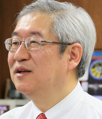 Saku Tsuneta (常田佐久)合作论文数Institute of Space and Astronautical Science, Japan Aerospace Exploration Agency30
 Toshifumi Shimizu合作论文数26
 Z. Frank合作论文数26
 Kiyoshi Ichimoto合作论文数21
 Alan M. Title合作论文数Space Technology Advanced R&D Labs, Lockheed Martin20Richard A. Shine合作论文数19Yukio Katsukawa合作论文数18
 Wei Liu合作论文数Stanford University17Yoshinori Suematsu合作论文数17Alan M Title合作论文数16
 Margarita Ryutova合作论文数15Theodore D. Tarbell合作论文数14Takenori J. Okamoto合作论文数12Masahito Kubo合作论文数11
 Kazunari Shibata (柴田一成)合作论文数Kwasan Observatory, Kyoto University;Department of Environmental Systems Science, School of Science and Engineering, Doshisha University11
 Bart De Pontieu合作论文数Lockheed Martin Solar & Astrophysics Lab;NASA11Andrew Hillier合作论文数College of Veterinary Medicine, The Ohio State University10
 Göran Scharmer合作论文数Department of Astronomy, Stockholm University;Institute for Solar Physics, Stockholm University;Royal Swedish Academy of Sciences10JM Malherbe合作论文数9Karel Schrijver合作论文数Lockheed Martin Advanced Technology Center9
 Michel Rieutord合作论文数Laboratoire d'Astrophysique de Toulouse9
 Boon Chye Low合作论文数NCAR9Eric K. Sutton合作论文数Air Force Research Laboratory, Hanscom AFB9
 Mats Löfdahl合作论文数Institutet för solfysik, Astronomi, Stockholms Universitet9R. A. Shine合作论文数8Y. Katsukawa合作论文数8
 Chris K. Pankratz合作论文数8Shin'Ichi Nagata合作论文数8
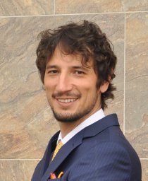 Patrick Antolin合作论文数Kwasan Observatory;Kyoto University;Kwasan Observatory, Kyoto University8
 Hector Socas-Navarro合作论文数High Altitude Observatory8A. Title合作论文数8Marcin Pilinski合作论文数7Hiroaki Isobe合作论文数Department of Earth and Planetary Science;University of Tokyo;Department of Earth and Planetary Science, University of Tokyo7L. Rouppe Van Der Voort合作论文数7
 Neal Hurlburt合作论文数Lockheed Martin Advanced Technology Center;Lockheed-Martin Solar & Astrophysics Laboratory7
 Jeffrey P. Thayer合作论文数Department of Aerospace Engineering Sciences, University of Colorado7T. Roudier合作论文数6
 Varad Deshmukh合作论文数Univ Colorado, Dept Comp Sci, Boulder, CO 80309 USA6
 Xudong Sun合作论文数Stanford University, Stanford Univ6
 Roberto Casini合作论文数High Altitude Observatory;National Center for Atmospheric Research;High Altitude Observatory, National Center for Atmospheric Research6
 Mats Carlsson合作论文数Rosseland Centre for Solar Physics, Institute of Theoretical Astrophysics, The Faculty of Mathematics and Natural Sciences, University of Oslo6M. Kubo合作论文数5James A. Craft合作论文数5S. Nagata合作论文数5
 Thomas Chen合作论文数Columbia Univ5




